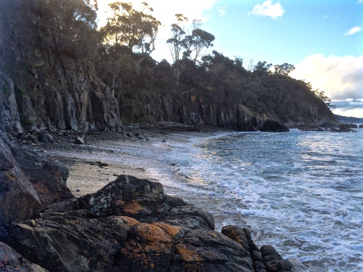
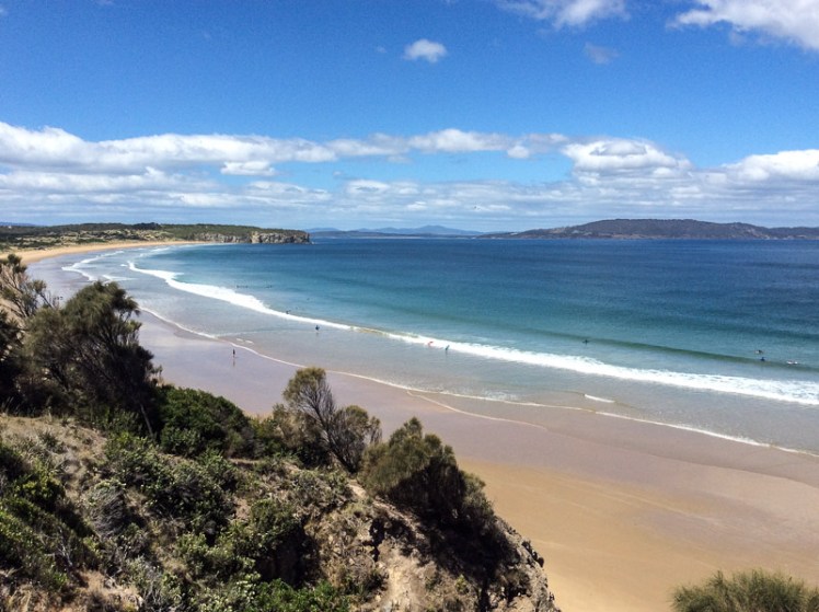
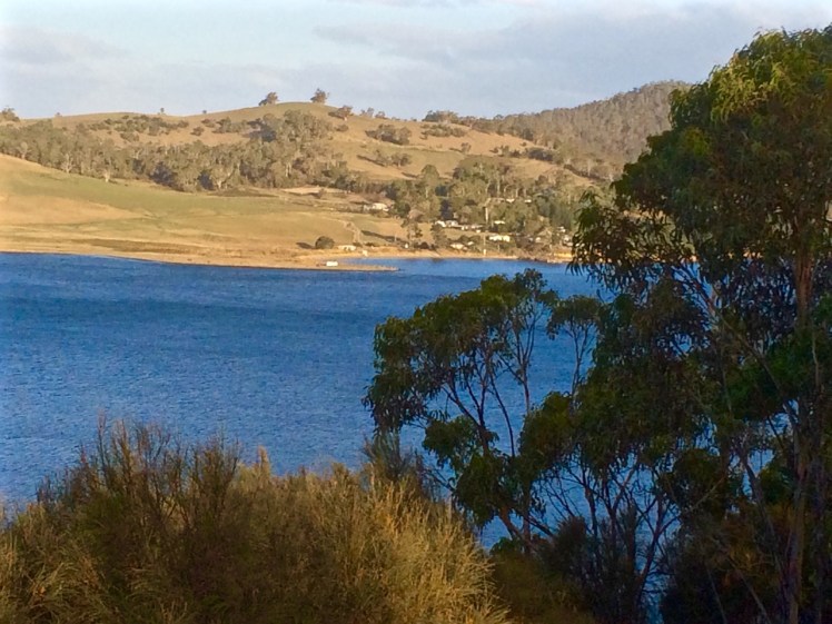
After slithering down off Cape Contrariety we took off our shoes, Cathy and I, and walked barefoot along the swash, quickly leaving behind the small groups of swimmers and surfers taking advantage of sunny weather. Soon we had the whole beach to ourselves and forgot completely about the existence of the low lying houses between the beach and Pipe Clay Lagoon, except for when we paused to study the sand dunes, their shape steeply altered by marram grass, their mass being gnawed away at by the sea. The dunes extend about 300m inland and reach a height of about 20 m (Short, 2006) and amongst the native bush growing on their backs is Acacia longifolia and the threatened species Cynoglossum australe. These Cape Deslacs/Clifton Beach dune fields are a geoconservation site of state significance, and Clifton’s Frederick Henry Bay beach alignment is also considered significant.
Especially along some parts of Bicheno Street the houses here are regarded as being at early risk from sea level rise (Sharples, 2009) and sea level rise will of course impact coastal values too and destroy the dune habitat the Clifton Beach community is currently working to preserve.
We studied the ripple marks and read the southerly swell, counting numerous rips and we observed that apart from a lone juvenile Pacific Gull studying our progress this popular beach, facing south- southeast into Frederick Henry and towards Storm Bay was that day devoid of birds.
When we reached the end we lingered and with a little assistance from Memory Maps pointed out to each other the landmarks we were observing to the south and then we turned our attention to the cliffs at the base of Cape Deslacs taking stabs in the dark about the pale rock, before guessing at sandstone. Later I read that there have been numerous drownings at this northern area of the beach, so it’s a wise swimmer who stays within the flags down the southern end.
Our efforts at amateur geology ending in uncertainty, we walked back down the beach contemplating a stroll around the lagoon on a future low tide and pondering the difficulties Cape Deslacs might pose for our exploring.
Further Reading:
Sharples, C. 2009. Climate change impacts on Clarence coastal areas. Clarence City Council, Clarence.
Short, Andrew. 2006. Beaches of the Tasmanian coast & islands: a guide to their nature, characteristics, surf and safety. Sydney University Press, Sydney.
Tasflora. 2012. Clifton Beach Coastal Reserve: reserve activity plan 2012-2016, draft (revision 3): advice prepared by Tasflora for Clarence City Council. Unpublished report.
When you fly into Hobart’s airport, peninsulas of land and bodies of water spread out below. One of these watery stretches is the large, relatively shallow estuary/lagoon that forms Pitt Water Nature Reserve and Orielton Lagoon (east, and just off this map). The Coal River, Penna and Iron Creek pour freshwater into it.
This striking body of water is crossed by McGees Bridge and the Sorell causeway, both tethered to a suburbanised headland in the middle of the lagoon called Midway Point. It enters the sea between Seven Mile Beach spit and Lewisham.
I love the view coming in to land, love crossing the causeways, the seagulls hanging in the sky, the salt spray… but it’s not an area that I’ve ever explored. I last flew over it a few weeks ago, returning from a postponed yacht delivery in Queensland. This time I went to the map to find out more about it. The names of the places surrounding Pitt Water intrigued me – Shark Point Road, Penna and Frogmore Creek. It was clearly time to go adventuring in the lands of the Oyster Bay and Big River tribes. The Moomairremener band in particular, spent a lot of time around Pitt Water. Their presence is there in the middens and quarries they left behind.
At Midway Point we turned right along Penna Road and quickly found ourselves in countryside with the water to our left. Then we turned left along Shark Point Road.
This road runs along the northern shore. There’s a row of houses, some beautiful, others not, but if you don’t mind the sight of traffic crossing the causeway in the distance, then the northern shore is a secret gem. The dirt road takes a corner and heads north, up into farmland, home to Highland cattle.
Shark Point Road, it turns out, gets its name because this estuary is much loved by sharks, including the gummy shark. They come here to forage and to breed. It’s the nursery for their babies and while they’re unlikely to nibble a kayak I may put on hold indefinitely my plan to paddle its perimetre. In recognition of its importance to the sharks it was declared their refuge and no-take area in 1995. There has to be something in this for people, right? These sharks are fished commercially.
We turned around and sought out Penna Beach on this northern shore and found that it’s in a part reserve, part dog exercise zone. We walked down to it through tussocks and an astonishing diversity of weeds, including box thorn and boneseed.
White shells clad much of the beach and they’re there again in the soil profile behind the beach, along with a thin trail of pebbles denoting an earlier landscape. We figured this is the same shell layer that is visible at Ralph’s Bay, that beautiful embayment on the Derwent River. Strolling along its full, extremely skinny extent we also noticed that the rising sea had nibbled into the soils behind the beach so that only the roots of the tussocks and a depth of about about 10 cm of loam defended the land from the fluid invader gaining might millimeter by millimetre.
As we walked along we discovered some lovely little salt marshes and wetlands behind the beach, although some had an algal infestation. We didn’t see the little blue butterfly that forages here but we heard some brief birdsong emerging from the tussocks. I thought the area could have provided a wonderful habitat for nesting birds but I suspect there’s far too much human disturbance for them to make a go of it. It was only later that I discovered that this area is renowned for its salt marsh diversity and rare plant species.
With an oyster farm tucked into a corner of Pitt Water at Barilla Bay, as well as at Woody Island and Shark Point, along with other human encroachment, such as homes and causeways, water quality has taken a battering. At least forty different types of fish, including eels, seahorses, pipefish, sharks and rays have been known to glide beneath the surface, some enjoying the seagrass once prolific in the quiet shallows.
There’s a man who, between 1975 and 1995, came to know this area, it’s plants and animals well. Geoff Prestige watched as the banded stingaree, southern conger eel, shot-headed eel, rock ling, pipefish, soldier fish, rock flathead, king barracouta, weedfish and smooth toadfish, once prolific, became rare or vanished completely. He also observed snails and worms and molluscs, along with other invertebrates quietly vanish.
Once at least seven types of migratory birds flew here from Alaska to enjoy Tasmania’s summer. This estuary, since 1982, has been a RAMSAR site – in fact, the southernmost site on the East Australasian Flyway but given our interconnected world and development across both hemispheres, this hasn’t stopped numbers plummeting like a distressed stockmarket.
One little known fact about Pitt Water is that it is the home of a tiny, rare orange seastar (Parvulastra vivipara), one of very few anywhere that gives birth to live young.
People like to fish on the seaward side of McGees Bridge and they like to bird watch at Sorell Causeway and the Waterview Sanctuary. Levees have messed with the tides that supported Pittwater although there’s a bit more flushing happening these days. Farmers have spread fertiliser on their fields, fostering algal growth in the lagoons. Dams on the Coal River have stymied freshwater flow. Seagrass has withered.
This area really symbolises the way we are hammering the lovely world but here’s a small plus. On all the slender extent of Penna Beach I only found two pieces of plastic litter, and I thought that a small solace.
I once had a friend who died far too young of breast cancer and sailed away to where the starfish are always pointing. Here’s to you, Vicky, the first woman I knew to buy her own yacht. Groundbreaking is difficult work to do.
As for me, I walked down the mountain one day last year, following the course of a small rivulet that not many Hobartians seem to know much about and wandered south down the western shore of the Derwent and around the corner into the D’Entrecasteaux Channel. It may seem a sequential endeavour but it hasn’t been, because over this period I’ve also walked north along the river and across it and explored the eastern shore, reached Fort Direction and gone out along the ocean beaches of South Arm Peninsula. I’ve gone alone, with friends, family and my dogs. I’ve spent a lot of time, thanks to my baggy old sails and the masthead fly, looking up at sky and clouds and birds, and at stars at night in quiet anchorages. I’ve also spent a lot of time looking down from Samos at water, it’s ripples and waves and bioluminescence, from cliffs to rocky platforms, from mud and sand into the earth’s crevices, at leaves and moss and lichen and under rocks, and in the pools where the communities of starfish live, their tiny pointers creating a lattice of directions.
I’ve strolled some North West Tasmanian beaches and responded loyally to the magnetic lure of the Bay of Fires and on the way back home I’ve reconnoitred the East Coast, pondering logistical difficulties for coastal exploring that’s still to happen.
Then just the other day I met a man who has nearly finished walking all the beaches between the Tamar River and the Freycinet Peninsula and I’ve heard of another who has walked the entire Tasmanian coastline thinking hard about birds and their diminishing habitat.
That’s inspirational!
It seems to me an empty exercise to tick off beaches although each time I find one that hasn’t been noted by Andrew Short* I experience a small thrill. Actually, whether it’s kayaking, sailing, walking or cycling I particularly enjoy it when it provides an opportunity to listen to the land and the water, learning to read them, losing myself in them, enjoying the whole unfolding of the coastline, the patterns that repeat, the intrusions, the formations that mystify, the dropstones, colours and hues.
Without exception I’ve returned home from every small local exploration seeking answers to a new question or mulling over a new observation. I’ve often gone back to some part of the coastline again and again, because I felt its call, or because I wanted to clarify something, or because I was seeking replenishment.
A beach is a shapeshifter. The beach you visit one day is never the same the next. All you can ever be reasonably certain of is it’s location and that is sometimes shockingly transitory too. That’s why a top 10 beaches is meaningless to me. Ultimately each one has it’s charm but the best is the one you know the most deeply; it’s moods, the way it changes through the seasons and the years, the way the elements combine to recreate it and the beauty that coastal wanderers leave behind them – adornments like shells patterned into something new and strange, zen cairns and the tipis made of sticks, so easy to miss inside the coastal forest. Sometimes they’re the abandoned shell of some small being or the delicate bones and feathers of a bird. That beach you know best is usually the beach that most changes you, and you it.
Before I record more D’Entrecasteaux meanderings I’m pausing to cover some of the other coastlines I’ve been exploring.
First to a beach on the Forestier Peninsula.
And that on account of the birds.
* Short, A.D. 2006. Beaches of the Tasmanian coast and islands. Sydney University Press, Sydney.
It’s a little known fact but upstream of Dennes Point, just across the water from Pierson’s Point, there’s a shark refuge and the men in grey suits and the freezing water in which they undertake business were on my mind as I climbed into my kayak to paddle the Tinderbox coastline. I would have liked company but I had no takers and so I’d decided to go alone.
On a fine day.
With the water like a mirror.
And on a low tide.
‘We’ve kayaked it before,’ the geo had said. ‘You don’t need to do it again.’
I could not remember kayaking the whole length of Tinderbox, and if we had done so it was back when I thought of Tinderbox as one long stretch of formidable coastline with no discerning features other than cliff face and rocks. Now I knew better and had reached the conclusion that the best way to get to know the peninsula was by kayak, right up close to the rocks, in part because I didn’t want to be that kayaker who made the headlines through being snaffled in the Derwent. After all, Hobart is full of sea kayakers who paddle this stretch and think nothing of it.
But I wasn’t one of them. I simply had a little goal to achieve and a mystery to solve: where was the door to the underground tunnel behind the cliffs?
‘Sailing is all about anticipation,’ my friend M, used to remind me and it’s perhaps more so with kayaking. I checked the Bureau of Meteorology site and chose my day – swell beneath 0.5 m and north westerly winds below 10 knots turning variable later in the day. It sounded perfect.
A small wave splashed over my map as the geo pushed me off and even before I’d made it out to Flowerpot Point, kayaking through the moored yachts in the southern corner of Blackmans Bay, I could tell the river was intent on being a trickster. Because the water was in fact lumpy, and so another fear assailed me. If I fell out, it would be mere moments before I died of the cold and much as I love the river I did not want its bed to be my last one. As I rounded Flowerpot Point I felt threatened by swell coming at me from all directions, no doubt lingering from previous bad weather. The surf breaking on Soldier’s Rocks a couple of hundred metres away looked downright intimidating.
I stopped. ‘Too rough… poor visibility,’ I advised myself and I wobbled into the little cobbled bay (T468) that I thought I had befriended on one of my earlier walks only to find it fractious and lumpy, the water disconcertingly black. I began to reach for my mobile (geo, come back!) but I didn’t feel steady enough to use it.
‘You miserable little coward,’ admonished the chorus in my head. I could already see Passage Point and North Bruny Island and they didn’t actually look that far away. We’d figured it would take me three hours (based on my dawdling on previous paddles) and certainly sailing along here sometimes takes a goodly length of time. And so I pointed my kayak south again, put my head down and paddled briskly towards my first waypoint, Soldiers Rocks, adrenalin ratcheting up my heartbeats. My seat wasn’t properly adjusted; my legs were already going numb. This was affecting my balance. No ways was I going to reach for my camera.
I burned passed Soldiers Rocks, keeping a distance between us because of the toothy break and reflective swell, and my compromised ability to use the pedals I could no longer feel. The Lucas Point Sewage Plant now seemed more friend than foe. I could see how in this little bay the beaches from the water seemed a single beach rather than two or three, but I was not game to reach for my iPhone.
There was no going back now.
Because of the slop I couldn’t get near the shoreline and so I had to put a big fat cross through the image I’d had of myself, drifting along a feet or two from the cliffs, trailing my hand along rocks from time to time (hello, rocks! hey, sea anemone!) imprinting the geography in my head, scrutinising the cliffs for the hidden doorway.
My next waypoint was Fossil Cove and I could see the arch ahead of me. The geo and the dogs were going to walk through it to the part of the beach on the northern side and I’d said I might see them here but little did I know, they were way behind me. (And little did they know I was ahead. They waited here a long, long time.) Ahead, closer to the eastern shore, was a ship at anchor. There is often a ship at anchor, presumably waiting to proceed upriver but they are like ghost ships. Sailing past, you never see crew. Back when Sandy Bay was barely populated, the ships at anchor often had clandestine grog on board that was collected by smugglers under cover of darkness.
A smaller ship came around the Bruny Island coastline and headed down the D’Entrecasteaux just as a boat came roaring out of it, headed my way. Fishers, I thought, but no. They began to reverse their boat into an extremely narrow gulch on the southern side of Fossil Cove. Neat! And what a clue! They’d been invited to lunch!
To keep my mind off sharks I contemplated the cliff top with its magnificent view, far more alluring IMHO, than an underground dining room but I guess diversity is the spice of life.
Lucas Point came and went. Before I knew it I was past Passage Point where, in the wind shadow, the water lay down. The tide was more resistant here but I was quickly through the gap between Dennes Point on North Bruny and Piersons Point on the Tasmanian mainland and in the channel flat water with a quiet lattice of ripples welcomed me. Beneath me, arrow squid, australian salmon, barracuda, pike, flathead, whiting and silver trivially glided, but I was unaware of them. Beneath the cliffs a seal lolled in the water, one flipper up. I paddled past the two little cobbled beaches, the tiny gulches and the sea cave and made it on to the beach before the geo and dogs arrived to give me a lift home. I hadn’t managed to explore the beaches but, chased ever onwards by imaginary sharks snapping at my stern, I did do this leg in 1 hour flat!
Cobbled beach, Pierson’s Point and quieter water
Cliffs at the start of the D’Entrecasteaux Channel
Moorings off Tinderbox Beach. Bruny Island (left).
Piersons Point with the Tasman Peninsula in the distance and Bruny Island just across the water
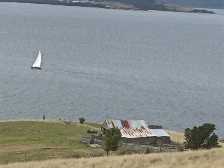
Just because you’re a long way from an empire’s capital, with limitless miles between your island home and battlefields and just because a feud can begin and end in the space of time it takes to receive a letter doesn’t mean that you’re not going to get the jitters hanging out at the end of the world. So when GovernorLachlan Macquarie visited the Hobart Town settlement in 1811, his mind turned to the enemies that could arrive unannounced up the Derwent River – the French, for example, not that long ago defeated in the Napoleonic Wars. His perspective was military; the place clearly needed fortification, and so a network of batteries, some interlinked by means of tunnels, took shape along both the eastern and western shores of the river. I had long ago passed Alexandra Battery, which sits above Blinking Billy Point. The battery at Piersons Point is significant because along with Fort Direction on the far side of the river, it protected the river mouth (although it was a late comer to the system as it was actually only constructed and used during WWII). Prior to that time there was a pilot station here, at the junction between bay, river and channel and on fine days the family based at the Iron Pot lighthouse sometimes rowed across for a bit of conviviality.
When we’d arrived after our wander along this stretch of shoreline, there were some Sudanese children playing tennis on the court that seems as oddly placed here as the idea of a battery is now. Bruny Island is a short hop across the water, the river was to my left, the D’Entrecasteaux Channel flowing into it from my right, and Storm Bay spread south. I could look back down the long stretch of coast I had explored and across the river to Cape Direction and the Iron Pot light.
It had taken a bit of research but I now knew that the river was not only a drowned river valley but also a rift valley. I knew there was a bar beneath some 15m of water just north of Pierson’s Point and I knew that there was likewise a bar running from Piersons to Dennes Point on Bruny Island, because the depth instrument on Samos registers this as we sail over it. But the geo had also put me straight about the the river, the channel and their geological inter-relationship and his take is attached at the bottom of this entry.
It was ages since I had set out to explore beaches, yet here I was still in the Derwent. I had discovered parts of the shoreline I hadn’t really known existed. I had discovered it’s vague and sketchy nomenclature and I had discovered that it wasn’t supporting nearly as many birds as I had anticipated. I now knew these beaches were pocket beaches and that it’s pointless walking beaches without giving equal weight to the coastline in between and I had discovered that the means of travel impacts greatly on the experience. My most profound realisation had been that I was not nearly as hefted to the land as I had once thought I was.
I’d walked along Tinderbox’s spine but the road is narrow and while picturesque it can occasionally be at an unrewarding distance from the river. I knew I would cycle it one sunny day, but that’s more about a ribbon of bitumen than it is about the river and its beaches. I sail this coastline frequently, but then my attention is more on the boat’s interaction with wind and water. That being so, I felt I wouldn’t have done it to my liking unless I kayaked it too. I thought that in my kayak I could really acquaint myself with its rocky shore. And besides, hidden among those cliffs was, bizarrely, a secret door and I was keen to find it.
We set out the teapot and cups, then sat down and enjoyed a little tea ceremony to honour the Derwent. There were cumulus clouds in a blue sky. On such a stunning day, watching the ferry crossing the channel further south between Kettering on the Tasmanian mainland and Roberts Point on Bruny Island those old geographic anxieties seemed peculiar indeed. My geographical anxieties were of a far smaller scale than the governor’s. They were focussed on how I was going to co-ordinate my blog with the places I was intent on exploring. How to proceed, I was wondering. South down the Channel, and if so by what means? Or north from Sandy Bay through Battery Point and if so, how far up river? And if I mixed it up how would I keep a sense of continuity going in both my brain and on my blog?
Looking across at Dennes Point, Bruny Island from Piersons Point.
Lacking the grace of an old lighthouse and looking more like something from outer space. Automated light at Piersons Point with the Iron Pot lighthousein the distance.
With a Dark and Stormy in one Hand and a Pencil in the Other
PASSAGE POINT
Passage Point is a notable promontary at the mouth of the Derwent Estuary and is both lovely from the water and green and pleasant from the road – a rolling hillside, a rustic shed, an abrupt cliff line carved by the waters of the Derwent, the D’Entrecasteaux and Storm Bay.
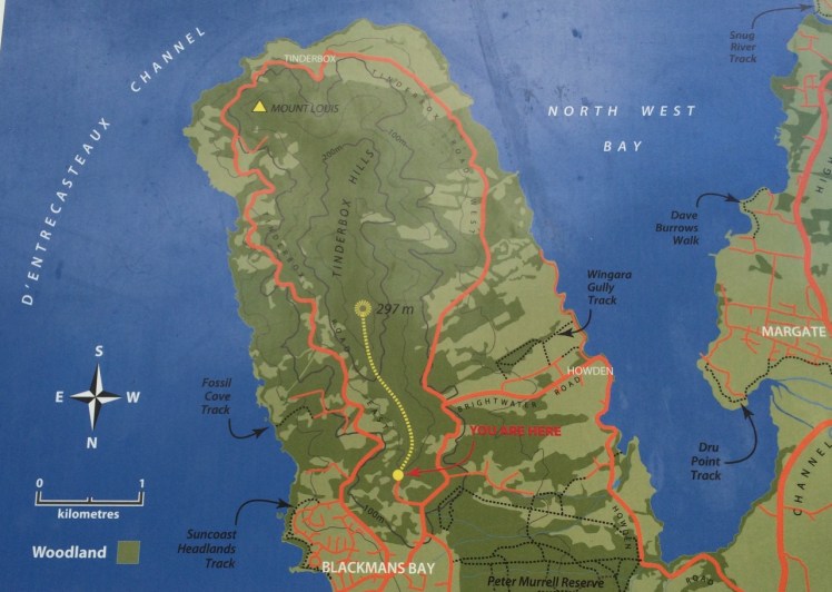
Map from the Kingborough Council Signage at the start of the Tinderbox Hills track: nomenclature is thinly used. Passage Point, Piersons Point and Tinderbox Beach, all important landmarks, are not noted. (Passage Point is to the left of Mount Louis.)
Having finally decided that ‘not the real Fishermans Haul’ was in fact the real Fishermans Haul (see last blog post), we went to Passage Point to see if there was some way we could access the little cobbled beach I’d noticed. There wasn’t. We had to make do with expansive views but as these were superlative and so vast in scope we could hardly complain. Mount Louis, Tinderbox’s highest point and forested in eucalypts rose behind us.
Birngana off Passage Point
My guess on how Passage Point got its name was all tied up with waypoints, landmarks and the ocean because if you’re heading off in your yacht on a trip of any distance, it pays to sit down and plan your passage. With a ‘dark and stormy’* in one hand, and a pencil in the other, take a careful note of the tides, currents and potential hazards. Become familiar with the landmarks you’ll pass, navigational signs you’ll encounter, channels or reefs you may need to negotiate and choose your waypoints. Make Meteye your new best friend and despite being in love with your chartplotter, tuck the paper version into your nav table too because it’s less likely to let you down. Departing the Derwent at this point to head out across Storm Bay is always a bit of a passage into the unknown because the bay is notorious for conjuring tempests up out of the most benign conditions.
Because this familiar promontary is just there where the waters of Storm Bay, the Derwent and the D’Entrecasteaux merge, it’s symbolic of passages about to begin and passages almost completed. So it goes without saying that this is how it got its name, right?
Wrong.
I checked Placenames Tasmania and found some unverified information. A boat called the Fancy was one of ‘the few remaining trading boats called passage boats.’ Back in slower more leisurely days these boats used to ply the Derwent and the Channel. In doing so, they had to round Passage Point and in so doing, they gave the point its name.
This information in the database comes from a boating article in the Saturday Mercury, Jan 2002 where it’s also noted that ‘most features on coasts were named by mariners and seeking reasons for names means looking at it [sic] from a mariner’s point of view. Thus Passage Point was a marker for south-bound boats of the entrance of ‘the passage’ or the Channel.’
Exploring the sweep of shoreline from Sandy Bay to Tinderbox had triggered my curiosity about the way places were named but I had not considered that mariners had a big hand in the names of the places I was exploring. This was an unforgiveable oversight because it’s obvious that many major features first got their names from the early voyages of discovery. My impression of the western shoreline of the Derwent was that places were usually named after the early landowner’s or overlooked in the naming process altogether but I could see that in a tiny colony at the end of the world there’d be a sense of familiarity and homeliness for locals who plied these waterways in naming the places they were passing by the names of the people they knew. On dark and stormy nights in particular, the ability to recognise familiar landmarks and tick off waypoints is comforting and engenders hope when you’re toughing out rugged conditions.
We paused here to savour the view. Passage Point felt extremely evocative for me: I had walked out one wintery morning and followed the Sandy Bay Rivulet down to its mouth. I had turned right and wandered the shoreline from there to here, a distance of some 35 kilometres, give or take a few and although I had done this as an urban explorer, little bit by little bit, it had been fun, it had changed the way I related to the coast as well as dramatically expanding my knowledge of the city I live in.
Beaches T 471 (Fisherman’s Haul) & T472 Fisherman’s Haul South
Having scrutinised more maps I began to doubt that the Lucas Point Sewage Plant was actually at Lucas Point. It’s the landmark that helps identify Fisherman’s Haul and as conversations with locals had helped me fix it in my mind that it lay just south of Flowerpot Hill I started to think that the problem was one of language – ‘just’ is a stretchy kind of word for a start, and may not have been used by anyone I’d spoken to. It may simply have been a supposition I’d made from what had been said to me.
Our modus operandi was to drive along the Tinderbox road slowly (not difficult – there were quite a few cyclists out and about) and check for detours down the slope. The geo noticed a sizeable piece of green land with car tracks on it, somewhat sheltered from the road by a partial row of caesurinas. We did a u-turn and went back to investigate.
Close by a man was burning off. He ambled over to talk to me and I asked him if this was Lucas Point.
‘Some people think it is, but it isn’t really.’
‘Is it back where the sewerage plant is?’
‘Nope. Some people think that’s Lucas Point too, but it isn’t really.’
‘So where is the real Lucas Point?’
He pointed vaguely over his shoulder. ‘Back there a bit.’
‘Okay… And so I’m wondering, if Lucas Point is back there, then is this Fishermans Haul?’
‘Some people say it is but it isn’t really the real Fishermans Haul.’
‘Is there a beach down there?’
‘Nope.’
‘Is there a path down?’
‘Maybe. You should be okay if you’ve got your balancing shoes on.’
‘Well, thanks, I might go and explore.’
The geo was down at the bottom of the slope reading a sign. It stated ‘Lucas Point’. A thin band of caesurinas lined the vertical cliff top so we put the dogs on leads and slithered down a very steep path of sorts beside a short deep gully carved by another youthful rivulet, at that time dwelling soley in a few remnant pools. An old rusty cable lay beside the track but we couldn’t identify a use for it unless haulage came into it. It didn’t take at all long before we came to the end of the path. It stopped for me at a rather cracked and fragile looking rock arch left over from a previous coastline. It might have been fine to walk over it onto the high rocky platform but I didn’t like the look of the cracks in the unconsolidated cliff face to which it was attached. The geo and the dogs stopped a bit further back because it really wasn’t a place for the dogs to be at all – it was all rather precipitous.
The rocks at the real Lucas Point; climbers’ secret
It goes without saying that the long views were superlative. Down this end of the river we were getting closer views of the Iron Pot, the lighthouse at the entry to the Derwent River and in the southern curve of Lucas Point (the cliff I was presumably standing on) was a very beautiful and quiet cobbled beach and just to the north of where I was standing was another cobbled beach. Looking directly south at the cliffs that work around to Passage Point I saw a third. And looking directly down was a tiny narrow gulch.
Fisherman’s HaulLooking south from Lucas Point, the beach below Passage Point just visible.
Andrew Short notes a Fishermans Haul (S) and a Fishermans Haul. Here’s his description of Fisherman’s Haul:
‘Fishermans Haul is a small curving cobble beach (T 471) located to the lee of 40 m high Lucas Point. Steep vegetated bluffs rise to 50 m behind the small beach, which is partly sheltered by the point and rock reefs resulting in low waves at the shore. The road runs along the top of the bluff 100 m west of the beach with access via a steep descent. ‘(Short, 2006)
And here’s his description of Fishermans Haul South:
‘Beach T 472 commences 100 m south of the Haul, and is a 200 m long east- to northeast-facing narrow high tide cobble beach located at the base of 50 m high cliffs, with a steep gully descending to the centre of the beach.’ (Short, 2006)
New discoveries! Seen so often from the water but not really properly seen at all. I was happy to believe the sign and this time, added to the slippery geography I’ve been doing battle with, was that local’s wicked sense of humour and the entertainment he got from causing confusion.
This coastline may seem impossible to access on foot but later I discovered that it’s loved for being a climbing area rich in deepwater solos, that method of climbing that evolved in SW England.Nick Hancock makes it clear that for this you need a kayak you can tie up while you climb up dolerite boulders or columns at this point and you need to be confident that the water is deep and safe enough to splash down into. Don’t even think about trying this unless you have plenty of experience, not just about deepwater solos but weather conditions and the sea state too because Tinderbox is unforgiving. And if you think the name makes it promising for fishing, pack your tackle and take your rod further afield. Too many fish have been hauled and this area is now protected within the bounds of the Tinderbox Marine Reserve – no fishing allowed.
View across the river to South Arm from the real Lucas Point. The Iron Pot is that tiny dot to the right.
Beneath the Lucas Point Sewage Plant there’s a bay and in that bay there’s a thin cobbled beach divided by boulders from another stretch of tide constricted beach. (Possibly Andrew Short’s beaches T469 & T470, but I could well be wrong.)
We’d started the day with brunch at MONA, Hobart’s incredible Museum of Old and New Art, way upriver and I only mention this because I’d spent an inordinately long time at the Marina Abramovic exhibition, engrossed in watching her meditatively regard a donkey and the donkey’s long considered response to her. The immaculate stillness of it all; the way the observer is absorbed into the dynamic of the interaction and how, in paying attention, new details about the donkey, or Marina, or even the pared down environment emerge into focus long after you think you’ve observed everything there is to see alerts you to the fact that perception is fickle and attention is a skill that needs honing.
It made me wonder how long I should spend regarding a beach and how you express gratitude to such a multi-diminsional part of this planet.
Later we packed a rucksack and headed down to the Tinderbox Peninsula. The off the leash exercise area behind the Lucas Point Sewage station was vibrant with canine energy but we detoured up Flowerpot Hill’s southern slope. A blue sky, and a light sea breeze …we reached the place I’d stopped before and paused to consider the various blossoms in flower along the edge of the cliff line.
This beautiful eucalyptus is not indigenous to this area.
I quizzed each local I met about beaches. I was particularly after information about a beach called Fisherman’s Haul but no one could enlighten me.
We snooped around the sewage plant and debated taking a tangled path then elected instead to descend to the shore via another steep path that followed the edge of the short deep gorge carved by the rivulet that inhabits this valley. There’s no sign to identify it but it reaches the Derwent via a cobbled beach and there, that day, it stopped behind the pebbles heaped up on the steeply sloping little beach that was being pounded by business minded waves. Occasionally we’d hear the sound of those cobbles making music as the waves retreated.
The tide was high and I had to calculate the time between waves in order to reach a spot at the northern end from where I could peer over boulders into the Lucas Point Sewage Plant’s beach (if indeed it really was a separate beach).
Lucas Point Sewage Plant’s beach just north of the Flowerpot Coastal Reserve beach.
The tide had left only one small, dry patch at the southern end and so I didn’t think it was wise to gamble with the waves. There was graffiti on its cliffs and above that I could see the sewage plant. Both detracted from its original beauty, one of austere rock and wild water. I could see Soldiers Rocks and just this side of them a lone man fishing. It seemed somewhat too close to the sewage plant to be a palatable past time.
Meanwhile, the geo had brewed the tea given to us by a friend who’d departed in his yacht to sail home to NZ. We sat back and contemplated the beach and the little rivulet, the cliffs to our south and the kayaker who surfed one of the breaking waves before heading on north with no break to his momentum.
Lone kayaking along a rugged shore ~ Soldiers Rocks in the distance
In that beautiful setting the tea tasted divine and lent a meditative quality to the attention I was lavishing on the shoreline. Then I performed a tea ceremony to honour the beach. A little liquid connection. A means of feeling my way towards how one says thank you to a beach for its existence.
Gratitude to all things beach and water
Afterwards I walked the small bushland path beyond the dog exercise ground by myself, wondering where it would take me. Like a lot of my coastal explorations, I ended up walking a circle. What beach we’d found I did not know but I did find out it wasn’t Fishermans Haul – the map said no. So for want of knowing the local name, I’m calling it Flowerpot Coastal Reserve beach and if you’re idling in this area it’s worth seeking it out. Because it exists, and it’s hidden away, and it’s very Tinderbox.
Several years ago I went on a weekend course to learn to sail. There were four teachers: the skipper, the yacht, the wind and the river. I made some good friends and the wind, which until then I’d abhorred, was one of them. ‘Learn to feel it on your face,’ the skipper said and I realised that the wind was really a stranger to me, in part because I struggled to tell west from south and north from east. The wind also presented a very different personality depending on what quarter it emerged from.
If it blew from one direction it blew consistently, right? But no. Focus on it against your face and you’ll see how much it flickers around, how much its strength can vary. A prevailing wind is not a single tone; there are plenty of other notes in there too and there’s no better guide than the windvane (aka masthead fly). When you sail you spend a lot of time looking up because the wind on your face and the wind at the top of the mast might well be behaving differently.
I learned that what the wind is doing above the Tasman Bridge might be different from what’s happening further down the estuary. It messes with the northerlies rampaging down (and vice versa the southerlies heading up). Betsy Island, the South Arm Peninsula and the Eastern Shore contrive to block the south easterly but wind spills in through the valleys. I learned from the geo that landforms can bend and twist the wind, spread it, funnel it (North West Bay is notorious) spin it, like in Sullivans Cove, deflect it, like at Sandy Point, block it as does Pierson’s Point so that suddenly the sails flap and you’re pooling around in a wind shadow.
There are the winds caused by the big weather systems, like the prevailing westerlies that cycle eastwards in these middle latitudes and then there are more local winds like the sea breeze that arrives in the afternoon on those summer days when the island has warmed enough, and it sometimes arrives gently but often it barges in with its muscles flexed. It may stall for a while at the entrance to the Derwent – you watch that dark blue line of indecision, and then the wind rushing across the water towards you, it’s speed and power influenced by the ‘fetch’ as it begins to fill in and in so doing it might ‘knock’ you inconveniently or give you a ‘lift’ to where you are headed. One thing is for sure, on the Derwent the wind takes a different guise diurnally, a different speed depending on where it happens to be (stronger in the wider zones, milder in sheltered bays) and it differs depending on the season. Katabatic winds prevail, blowing in from the NW and the temperature inversion that takes place as wintery cold air sinks to the valley floor gives rise to the Bridgewater Jerry that moves magnificently south down the river, a beautiful white snake of a cloud, its belly down low on the water and awfully cold to be stuck in.
You and your yacht become that pivot point between the wind and the water, their dance made manifest. You learn to read the wind in the water. It might be barely perceptible where you are, about Force 4 on the Beaufort scale for instance, but further away those yachts all heeled over to starboard? The wind is coming your way and it means business. And so you reef because two of the arts of sailing are observational skills and, as my partner on Birngana’s big mainsail used to say ‘Anticipation’.
There are other skills to be learned by the wind out on the Derwent. There’s patience when it deserts you and there’s staying grounded when it thrashes you, so that you’re all heeled over, hanging on and staring directly down into the water, the boom dragging through it, the headsail ripped, the person on the winch knee deep in the river coming over the coaming.
True wind is the wind au naturel. Apparent wind is when the wind made by motion combines with true wind to change its angle and speed. The more you speed up, the more the apparent wind slips ahead of you, streaming through the ‘slot’ between your mainsail and your headsail and powers you along. In effect, it’s your yacht’s most local wind.
When you’re close hauled and the wind is strong, the sails in tight, it’s a bouncy ride, sometimes tense, maybe exhilarating and then when you come about and the wind slips behind you, you can spread your sails out wide, kick back and relax, and the breeze that seemed to have it in for you when you were up against it, becomes a friendly zephyr following behind you. Yet it’s the same breeze and the way you experience it depends on the way you approach it – much like life.
By the same token, it’s easy to let your defences down and wonder why others have their life jackets on when you’re reaching for your bikini because its glassy out there and your boat is going nowhere. But it could be into a vacuum like this that the south westerly roars, attempting to break its own speed record, taking you and the Met Bureau unawares.
Glassy conditions on the Derwent: barely a breeze
The wind lifts sand from dunes and spreads it along beaches. It might take from one beach and deposit elsewhere. It may work with a high tide to push waves harder and higher up dunes and cliffs, or it may lose its territorial battle and be shoved aside by an opposing, more powerful wind from another quarter.
The interplay is dynamic and affects you whether you’re walking, kayaking, cycling or sailing and the Derwent is a brilliant playground to learn all about it’s subtle idiosyncrasies and its full and merciless fury. While conscious of the wind that fills the sail there are other breezes far higher in the atmosphere that pass overhead unregistered. Aeolian drift in the highest reaches carries tiny beings – small spiders, for instance – as well as seeds over vast intercontinental and oceanic distances, making a mockery of quarantine services. And out on the ocean birds, like sailors, yearn for a favourable wind to support their trip or exhausted from flying head on into stormy conditions, might hitch a ride on a yacht, trying to regain the strength to carry on.
On the river in the bleakest of weathers, the world becomes magical, the rain in one’s face exhilarating, the shoreline intoxicating as powered by that beach making and breaking wind we make our way.
Last October I was at Eumarrah, Hobart’s oldest wholefoods shop, when I bumped into an acquaintance I hadn’t seen in quite a while. It so happens that we are both interested in the environment, and birds in particular have been a long and avid interest of his.
I was keen to find out his take on my observation of low bird numbers around the Derwent’s shores, be they on the western or eastern side or in Ralphs Bay, that beautiful low energy embayment near the mouth of the Derwent, these being some of my current stomping grounds. I had also walked ocean beaches with this concern uppermost in my mind and actually, it was while writing this now in my little mountain study, that it dawned on me that there used to be a flock of seagulls that flew over our ridge en route from North West Bay (we used to assume) to the tip in South Hobart. ‘ When had this stopped?’ I asked the geo. ‘The sight and sound of them used to be part of the daily rhythm up here.’
‘I reckon they stopped flying over about two years ago,’ he said.
Two years for us to notice a pretty obvious change in our environment. That’s sobering. The only large flock I’ve seen since I started my walks has been at the dirty little mouth of New Town rivulet but perhaps I have not been focussing on gulls sufficiently because today, sailing Samos into Sullivans Cove just as the cold front arrived with a blast, I noticed a fair number perched on the roof of the new Institute of Marine and Antarctic Studies building and there was also a small flock at the Wrest Point casino.
It’s easy to assume that these birds, long considered the rats of the sea, are safe from our abuse of the environment… but what if something sinister is going on right under our noses that we are not aware of? And what if the seagulls are not as robust as we once thought? Of course, there could be some perfectly simple explanation. Down at the tip they might have introduced a management practice to stop scavenging seagulls from spreading toxic debris along the shorelines. Certainly, some councils have waged war on them (see links below).
Gulls and cormorants are also regarded with trepidation by those sailors who have boats on moorings. I have a couple of friends who have been most unhappy to discover a seagull after party mess on their yachts. Some people resort to nautical scarecrows, profiles of eagles, plastic bags and webbing. Take your eye off your yacht and this is what happens.
Seagull central: it’s our palace now
Anyway, this man so knowledgeable about all things avian, was kind enough to let me record our talk and so here are some of the points he made during the course of our long conversation.
Shorebirds are in decline. Some natural causes include high tides washing away nests. When you think about the more volatile oceans and weather we’re getting with climate change and the way dunes are being hammered by sea level rise, this would be headline news if birds like little penguins and short tailed shearwaters produced newspapers. Native fauna like quolls prey on birds too.
I could add my own examples: go out to Chappel Island in the Furneaux Group off Tasmania’s north eastern coastline and you can barely put one careful foot in front of the other without stepping on the snakes that prey on the short tailed shearwaters that have their southern summer burrows there.
He cited more examples and based on what he had to say I suggest we all go and peer at ourselves in the mirror because the main cause is our lack of restraint in the way we behave around beaches. Some locals walk straight through the plastic fences that councils erect on dunes to safeguard both nesting birds and eroding dunes. People camp on beaches, dunes, or just behind them. Radios blare, kids race about on quad bikes and dirt bikes. Adults in four wheel drive vehicles mistake dunes for playthings, crush nests and mess with the role of dunes as a barricade against the sea.
‘When this sort of thing is happening on remote ocean beaches,’ he said. ‘You know there’s no haven.’ And he mentioned a researcher dissecting a bird on Lord Howe Island, (a tiny speck in the ocean 600 km off the Australian coastline) and finding it chock full of plastics.
‘ And over fishing, acidification of the oceans, the warming seas,’ I said.
‘Dogs,’ he said. ‘Horses on beaches.’
‘Seven Mile Beach,’ I said.
‘Marion Bay Narrows,’ he added.
He had begun talking about birds, like oyster catchers and the endangered hooded plover that choose to nest in the tiny scrapes they make in soft sand. Instead of limiting themselves to the hard sand close to the watermark, people and their dogs trample all over the beaches. It’s possible to stamp on a nest oblivious to what you are doing. ‘You may think your dog is doing no damage, but these nests are hard to see.’ And dogs, he emphasised, run all over the beaches. ‘It’s bad enough when they’re leashed. They still scare birds away.’
He told me about the annual gull count that is run over the June long weekend and includes the Derwent River. On Bellerive Beach, for example, ‘there’s a veritable passeggiato of dogs and their owners and so there’s no chance for a bird to make use of it’, he said.
I began to feel uneasy. I have two beautiful canine companions, fellow adventurers where their presence is allowed. I thought of all our lovely beach walks. It seems to me that even people walking quietly and carefully down a beach with no dog at all disturb birds and even scientists monitoring or researching bird behaviour and lifestyles have that same effect no matter how careful they try to be. Birds nestled over their eggs leave their nests, for instance, when they see that most dangerous of all mammals (us) looming, albeit with a scientific title. But mostly I was thinking about the consequences for me in raising my awareness about this issue. My dogs! The beach! Were they two incompatible loves? And what was more important? Shorebirds, or the delight of seeing my happy dogs enjoying the surf?
‘And boats too,’ I said with a heavy heart.
‘Yes,’ he said. And he told me about a particular reserve on the Derwent River, a little one, just a handful of hectares. He’d recently gone there to do a survey and he explained how its done. You spend twenty minutes on each hectare noting the birds you see and hear. ‘That’s how the atlas [Bird Atlas of Australia] was done, right across Australia. But in those twenty minutes there was a jet ski out on the river in front of me, jets from the display squadron from the RAAF – two went up the river, a helicopter going up the river, a fixed wing aircraft directly overhead at low altitude, there was big earthmoving equipment on a block just up the road from me and somebody was using a brush cutter the whole time I was there. So how am I to rely on my ears to do the survey?’
And, I wondered, how do birds communicate against so much mechanical volume.
I walked out of that shop with a lot on my mind. Shorebirds are up against our way of life. To be a migratory bird travelling the Asia-East Australian Flyway the odds are getting steeper. Will there be water in a particular wetland or will a new housing development have put paid to that refuge? Will weeds have covered your burrow or stifled a food source when you arrive? And let’s not even talk about hunters.
It seemed to me that if I was going to walk the birds’ beaches then I had to do it with even more care, in a way that gave more than it took. But how?
I tried to think of communities that live with restraint. Apart from the locals of North Sentinel Island, denizens of the deep Amazon or the San still sort of clinging to a Kalahari lifestyle, I could only think of the Amish.
But on the bright side, a friend is elated to discover that ten Little Black Cormorants have come to hang out with the Pied Cormorants living on Cormorant Rock off her home (see here).
And on a really world changing scale, Boyan Slat, a teenager from Holland, has come up with an idea, now crowdfunded, backed by the scientific community and at pilot study stage, for cleaning the oceans of plastics within a ten year period. Impossible? His Ted Talk is here. See what you think
")


")