When we were preparing the house for sale earlier this year, we moved on board Samos, thinking we’d be at Kettering in Little Oyster Cove for several months. We planned to spend that time cruising the D’Entrecasteaux and Norfolk Bay but within a matter of days our lovely mountain home had found itself new owners and we barely had time to tackle our list of boat tasks before we were home again packing boxes.
Travelling in a small van as we did last year and cruising in a small yacht proves that truism of life being richer as possessions get exfoliated and waste gets reduced. But moving house is not good for the environment. You may give the Red Cross Shop your library and St Vinnies the clothes off your back, but the recycling and refuse bins fill exponentially and zero waste targets shatter alarmingly.
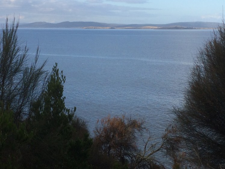
We went down to the marina on a sunny day and stepping on board Samos I noticed a swirling black ring beneath the water, just behind the yacht’s transom, and an overlapping circle of silver, moving that little bit quicker. A cormorant was hunting a school of bait fish that panicked into a leaping confusion as the bird downed its catch while rising to the surface.
Relaxing beneath the boom tent with a g&t on a blue day before summer’s lease expired, we watched a puffer fish slowly inspecting the seaweed attached to the floating marina and each time the black swans came visiting the dogs were transfixed.
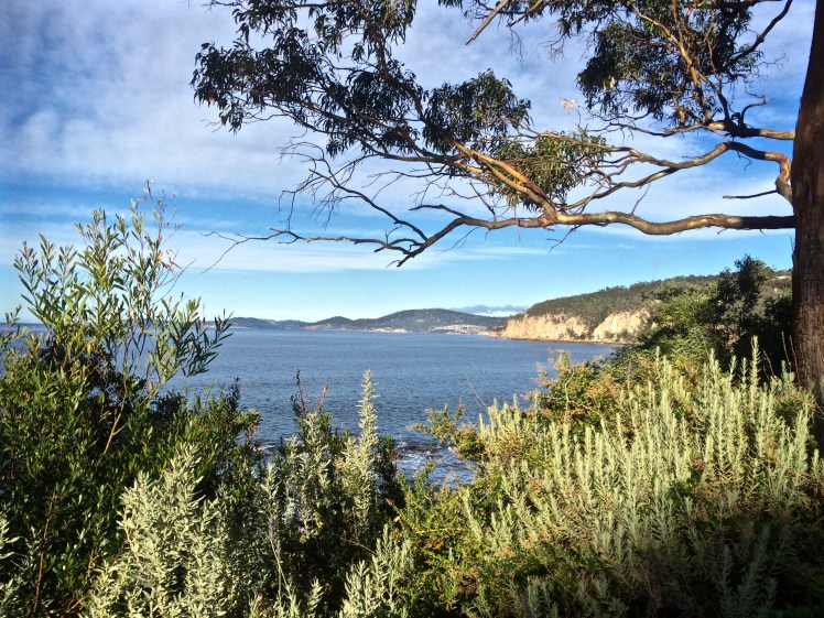
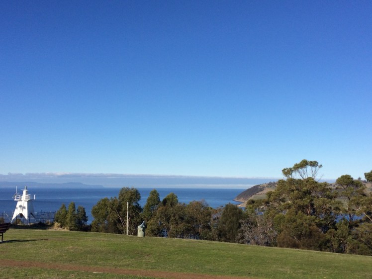
Life in the marina spools out slowly. Those of us working on our boats shared tools, suggestions, advice and meals while in the background yachts slipped quietly through the marina, the Bruny Island ferries came and went where once the Nuenonne paddled their bark canoes, where Bruni D’Entrecasteaux sailed – sealers and whalers too – and the constant sound on the boat, in the quieter moments and most noticeably in the silence of the night, was the idle clicking of tiny beings feasting on the hull.
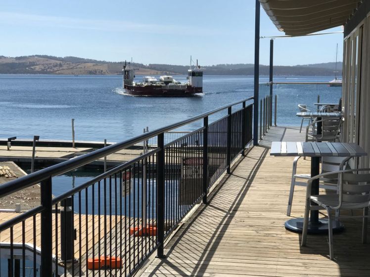
The additional summer ferry crossing to Bruny Island from Kettering
The super blue blood moon rose over Bruny Island, the Channel and the yachts while the dark hills slept and we looked up at the moon and also down at its reflection, snagged in the riggings of yachts impressed by its light on the water.
There have been other times at the marina when nature has gifted us a surprise or two. We’ve been astonished by flocks of about 200 black cockatoos swirling around the pine trees. We’ve stopped to watch the parade of crabs along the marina shallows. Kayaking this cove I once followed a ray as it made its way around the north east corner. I like rays. The ones I have encountered all seem capable and full of purpose.
We were at the marina long enough to enjoy several coffees and breakfasts at the café beside the ferry terminal with its views of Bruny Island and to enjoy the pub up the hill. Really, the marina is for me the heart of Kettering and Kettering the link between mainland Tasmania and Bruny Island. For a small place it’s pretty amazing that along with the pub it has three cafes as well as artistic credentials and links, some believe to planets elsewhere. This extra terrestrial history inspired the Kettering Incident.
We walked the short track through coastal woodland around to Trial Bay, lazed at Kettering Point and in the evening took the short walking track below the cricket oval on the northern side of the cove. There are houses on the hills which were once entirely forested, that therefore drew timber cutters in Kettering’s early days, and tucked away in the valleys behind the village are farms producing organic produce for which Tasmania is rightly famous.
Marinas can be tough on the watery world but this one has achieved some recognition for its environmental efforts and living on board proved so enjoyable that we agreed that while small is beautiful if we want to live on board all summer long then a yacht a little bigger would be more comfortable. And so our lovely yacht Samos is on the market and a new adventure is about to begin.
Once, several years ago, bound for Stanley across Sawyer Bay, an open, 25 kilometre long coastline, I sailed passed Port Latta in a fast diminishing gap between gales. While the skipper took waves in her face with the broadest of grins, my friend and I tucked up under the dodger and watched the coastline go by. I was identifying old landmarks I hadn’t seen in a while – Rocky Cape, where this bay begins, and then the long jetty of Port Latta. Behind that jetty there’s Australian Bulk Mineral’s large, grey processing plant that belches smoke and in its shadow there’s a cluster of houses. Looking at them from out at sea, I felt for the people who had to live there and knocked it off my bucket list.
***
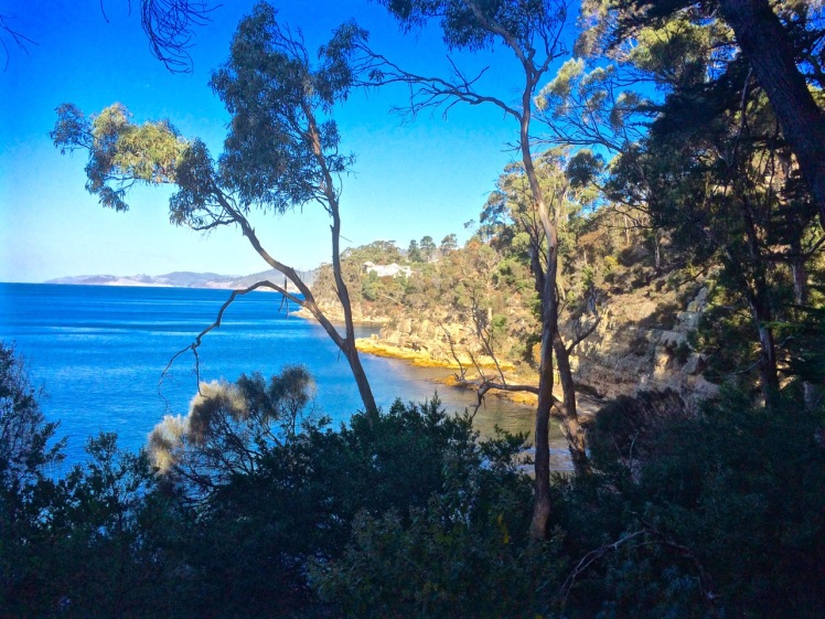
The holiday home had a couple of books on local history and an outstanding view along the coastline of the bay all the way to the volcanic neck that is The Nut, standing elevated above the landscape at Stanley, but I had not realised until we arrived that Cowrie Point was the site of those homes I’d looked at through the rain from that bucking yacht all those years before.
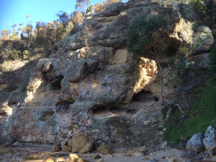
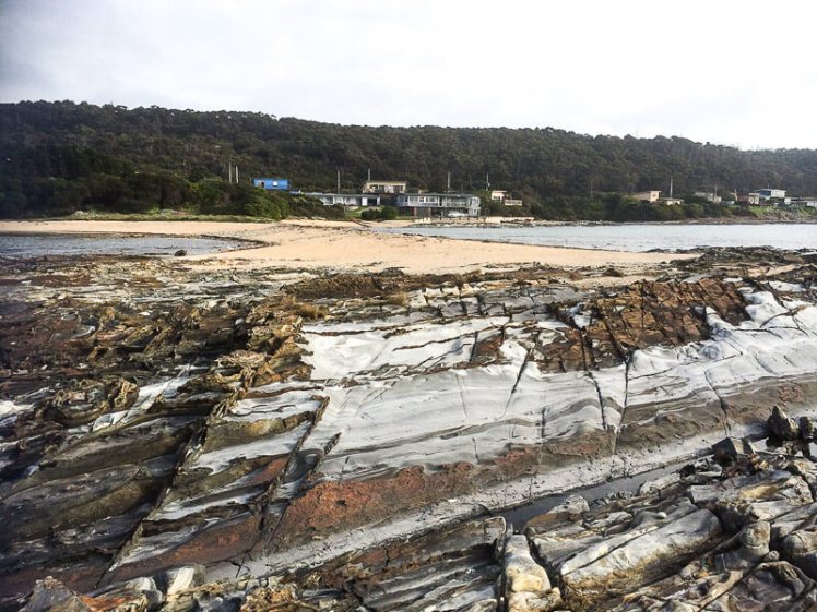
I went down to the inviting beach to stick my feet into Bass Strait’s waters. The high tide had piled seaweed high along the wrackline and the beach was backed by both feral and native plants over to my right. The rocky platforms of what I took to be a point, and the pebbles that I found, were unexpectedly stunning. They looked like agate with volcanic intrusions but when the geo went to take a look he said no, they’re Precambrian sediments with iron oxide deposits in the joints and sometimes in the bedding plates. There were stratigraphies laid on their side with sharp edges, long thin columns with longitudinal jointing, tessellations, pale colours, burnt ochres, swirls and speckles. Neptune’s necklace flourished in some of the rock pools but others seemed entirely empty. Cowrie Point, he said, was actually a tombolo.
Cowrie Point. The view from the tombolo of T 996 and T997
On the eastern side of the tombolo I found another beach (T 997), this time a half crescent curve of about 100m, rather narrow, that backed onto the beach I’d just come from. Again, but that bit closer, there was a view of the jetty and the looming plant, the white smoke dense in the sky, sitting improbably with the lovely proportions of the quiet beaches. Occasionally there was a low industrial rumble.
Just passed another outcrop of rock was a third beach (T998) and beyond it a stretch of rocks and then the industrial works. There was a lone house above the rocks of T998. Two men stood below it with a dog. I was strolling slowly, looking at the differently shaped sponges that had washed up, but eventually I turned and walked away.
Later, when one of the men came around to the Coral Point Beach with his dog, he told us his family’s story of Port Latta.
He was barely school age when his family built their Cowrie Point home and it predated the refinery which was built in 1967/68. It’s the terminus of an 85 km pipeline that starts at Savage River mine on the West Coast. What runs through this pipe is a slurry of crushed ore. When it reaches Port Latta it’s transformed into marble sized pellets that are baked at 1000 degrees C, which then travel via a conveyor belt along the jetty to the ships that take the pellets away to Port Kembla and China.
The refinery, he said, spoiled everything and devastated the shack owners. Thirty seven homes were razed so it could be built and for the first twenty years they’d been unable to use their house at all. The plant was so loud and noisy, the smoke terrible. When they hung up their washing it turned black. Worse, the chemicals that leached into their water burnt them, but the company didn’t want to know. The conditions were so intolerable and depressing that those who could moved away.
‘There weren’t any greenies back then,’ he said, as though that might just have made a difference, and expanded on how beautiful this stretch of coastline had once been, the ways they had enjoyed it and just how much it had been spoiled. He said more recently the processing plant had changed to gas and it wasn’t so bad anymore but as we stood there white smoke was dense in the sky and the whole place began rumbling.
‘It rumbles when they’re tweaking the mix,’ he said. ‘Wind’s northwesterly.’ We stood in silence, happily upwind, listening to the plant before saying our good byes.
Port Latta processing plant and jetty
I couldn’t find anything about Cowrie Point’s social history but I did find out that there is a landfill at Port Latta that accepts general and hazardous material and this has resulted in groundwater contamination. I also found out that ABM holds the Savage River Project through its indirect subsidiary, Goldamere who in 1996, entered into an asset purchase agreement with the State Government of Tasmania. Goldamere would purchase the Savage River mining operation assets as well as the Port Latta pelletising and shiploading facilities for a deferred payment of Aus$13 million. As well as that, the government agreed to indemnify them against all liabilities, both pre-existing and on-going, caused by environmental pollution or contamination that have resulted from past operations.
Port Latta to the east, The Nut rising above a faint sea mist to the west, and Cowrie Point perched on the edge of the Little Peggs Beach State Reserve. There were spectacular sunsets and lovely beach walks and Stanley not that far away. It was all exquisite, as long as I kept looking west.
Go there. Definitely go there. Explore the exceptional beauty. Discover what it’s like to think you own paradise and then to have hell settle in beside you.
It’s a little known fact but upstream of Dennes Point, just across the water from Pierson’s Point, there’s a shark refuge and the men in grey suits and the freezing water in which they undertake business were on my mind as I climbed into my kayak to paddle the Tinderbox coastline. I would have liked company but I had no takers and so I’d decided to go alone.
On a fine day.
With the water like a mirror.
And on a low tide.
‘We’ve kayaked it before,’ the geo had said. ‘You don’t need to do it again.’
I could not remember kayaking the whole length of Tinderbox, and if we had done so it was back when I thought of Tinderbox as one long stretch of formidable coastline with no discerning features other than cliff face and rocks. Now I knew better and had reached the conclusion that the best way to get to know the peninsula was by kayak, right up close to the rocks, in part because I didn’t want to be that kayaker who made the headlines through being snaffled in the Derwent. After all, Hobart is full of sea kayakers who paddle this stretch and think nothing of it.
But I wasn’t one of them. I simply had a little goal to achieve and a mystery to solve: where was the door to the underground tunnel behind the cliffs?
‘Sailing is all about anticipation,’ my friend M, used to remind me and it’s perhaps more so with kayaking. I checked the Bureau of Meteorology site and chose my day – swell beneath 0.5 m and north westerly winds below 10 knots turning variable later in the day. It sounded perfect.
A small wave splashed over my map as the geo pushed me off and even before I’d made it out to Flowerpot Point, kayaking through the moored yachts in the southern corner of Blackmans Bay, I could tell the river was intent on being a trickster. Because the water was in fact lumpy, and so another fear assailed me. If I fell out, it would be mere moments before I died of the cold and much as I love the river I did not want its bed to be my last one. As I rounded Flowerpot Point I felt threatened by swell coming at me from all directions, no doubt lingering from previous bad weather. The surf breaking on Soldier’s Rocks a couple of hundred metres away looked downright intimidating.
I stopped. ‘Too rough… poor visibility,’ I advised myself and I wobbled into the little cobbled bay (T468) that I thought I had befriended on one of my earlier walks only to find it fractious and lumpy, the water disconcertingly black. I began to reach for my mobile (geo, come back!) but I didn’t feel steady enough to use it.
‘You miserable little coward,’ admonished the chorus in my head. I could already see Passage Point and North Bruny Island and they didn’t actually look that far away. We’d figured it would take me three hours (based on my dawdling on previous paddles) and certainly sailing along here sometimes takes a goodly length of time. And so I pointed my kayak south again, put my head down and paddled briskly towards my first waypoint, Soldiers Rocks, adrenalin ratcheting up my heartbeats. My seat wasn’t properly adjusted; my legs were already going numb. This was affecting my balance. No ways was I going to reach for my camera.
I burned passed Soldiers Rocks, keeping a distance between us because of the toothy break and reflective swell, and my compromised ability to use the pedals I could no longer feel. The Lucas Point Sewage Plant now seemed more friend than foe. I could see how in this little bay the beaches from the water seemed a single beach rather than two or three, but I was not game to reach for my iPhone.
There was no going back now.
Because of the slop I couldn’t get near the shoreline and so I had to put a big fat cross through the image I’d had of myself, drifting along a feet or two from the cliffs, trailing my hand along rocks from time to time (hello, rocks! hey, sea anemone!) imprinting the geography in my head, scrutinising the cliffs for the hidden doorway.
My next waypoint was Fossil Cove and I could see the arch ahead of me. The geo and the dogs were going to walk through it to the part of the beach on the northern side and I’d said I might see them here but little did I know, they were way behind me. (And little did they know I was ahead. They waited here a long, long time.) Ahead, closer to the eastern shore, was a ship at anchor. There is often a ship at anchor, presumably waiting to proceed upriver but they are like ghost ships. Sailing past, you never see crew. Back when Sandy Bay was barely populated, the ships at anchor often had clandestine grog on board that was collected by smugglers under cover of darkness.
A smaller ship came around the Bruny Island coastline and headed down the D’Entrecasteaux just as a boat came roaring out of it, headed my way. Fishers, I thought, but no. They began to reverse their boat into an extremely narrow gulch on the southern side of Fossil Cove. Neat! And what a clue! They’d been invited to lunch!
To keep my mind off sharks I contemplated the cliff top with its magnificent view, far more alluring IMHO, than an underground dining room but I guess diversity is the spice of life.
Lucas Point came and went. Before I knew it I was past Passage Point where, in the wind shadow, the water lay down. The tide was more resistant here but I was quickly through the gap between Dennes Point on North Bruny and Piersons Point on the Tasmanian mainland and in the channel flat water with a quiet lattice of ripples welcomed me. Beneath me, arrow squid, australian salmon, barracuda, pike, flathead, whiting and silver trivially glided, but I was unaware of them. Beneath the cliffs a seal lolled in the water, one flipper up. I paddled past the two little cobbled beaches, the tiny gulches and the sea cave and made it on to the beach before the geo and dogs arrived to give me a lift home. I hadn’t managed to explore the beaches but, chased ever onwards by imaginary sharks snapping at my stern, I did do this leg in 1 hour flat!
Cobbled beach, Pierson’s Point and quieter water
Cliffs at the start of the D’Entrecasteaux Channel
Moorings off Tinderbox Beach. Bruny Island (left).
Piersons Point with the Tasman Peninsula in the distance and Bruny Island just across the water
Just because you’re a long way from an empire’s capital, with limitless miles between your island home and battlefields and just because a feud can begin and end in the space of time it takes to receive a letter doesn’t mean that you’re not going to get the jitters hanging out at the end of the world. So when GovernorLachlan Macquarie visited the Hobart Town settlement in 1811, his mind turned to the enemies that could arrive unannounced up the Derwent River – the French, for example, not that long ago defeated in the Napoleonic Wars. His perspective was military; the place clearly needed fortification, and so a network of batteries, some interlinked by means of tunnels, took shape along both the eastern and western shores of the river. I had long ago passed Alexandra Battery, which sits above Blinking Billy Point. The battery at Piersons Point is significant because along with Fort Direction on the far side of the river, it protected the river mouth (although it was a late comer to the system as it was actually only constructed and used during WWII). Prior to that time there was a pilot station here, at the junction between bay, river and channel and on fine days the family based at the Iron Pot lighthouse sometimes rowed across for a bit of conviviality.
When we’d arrived after our wander along this stretch of shoreline, there were some Sudanese children playing tennis on the court that seems as oddly placed here as the idea of a battery is now. Bruny Island is a short hop across the water, the river was to my left, the D’Entrecasteaux Channel flowing into it from my right, and Storm Bay spread south. I could look back down the long stretch of coast I had explored and across the river to Cape Direction and the Iron Pot light.
It had taken a bit of research but I now knew that the river was not only a drowned river valley but also a rift valley. I knew there was a bar beneath some 15m of water just north of Pierson’s Point and I knew that there was likewise a bar running from Piersons to Dennes Point on Bruny Island, because the depth instrument on Samos registers this as we sail over it. But the geo had also put me straight about the the river, the channel and their geological inter-relationship and his take is attached at the bottom of this entry.
It was ages since I had set out to explore beaches, yet here I was still in the Derwent. I had discovered parts of the shoreline I hadn’t really known existed. I had discovered it’s vague and sketchy nomenclature and I had discovered that it wasn’t supporting nearly as many birds as I had anticipated. I now knew these beaches were pocket beaches and that it’s pointless walking beaches without giving equal weight to the coastline in between and I had discovered that the means of travel impacts greatly on the experience. My most profound realisation had been that I was not nearly as hefted to the land as I had once thought I was.
I’d walked along Tinderbox’s spine but the road is narrow and while picturesque it can occasionally be at an unrewarding distance from the river. I knew I would cycle it one sunny day, but that’s more about a ribbon of bitumen than it is about the river and its beaches. I sail this coastline frequently, but then my attention is more on the boat’s interaction with wind and water. That being so, I felt I wouldn’t have done it to my liking unless I kayaked it too. I thought that in my kayak I could really acquaint myself with its rocky shore. And besides, hidden among those cliffs was, bizarrely, a secret door and I was keen to find it.
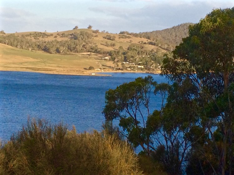
We set out the teapot and cups, then sat down and enjoyed a little tea ceremony to honour the Derwent. There were cumulus clouds in a blue sky. On such a stunning day, watching the ferry crossing the channel further south between Kettering on the Tasmanian mainland and Roberts Point on Bruny Island those old geographic anxieties seemed peculiar indeed. My geographical anxieties were of a far smaller scale than the governor’s. They were focussed on how I was going to co-ordinate my blog with the places I was intent on exploring. How to proceed, I was wondering. South down the Channel, and if so by what means? Or north from Sandy Bay through Battery Point and if so, how far up river? And if I mixed it up how would I keep a sense of continuity going in both my brain and on my blog?
Looking across at Dennes Point, Bruny Island from Piersons Point.
Lacking the grace of an old lighthouse and looking more like something from outer space. Automated light at Piersons Point with the Iron Pot lighthousein the distance.
Blackmans Bay: just south of Kingston Beach between Boronia Hill to the north and Flowerpot Hill to the south, is a long curve of pale sand surrounded by suburb. A rivulet enters the beach at each end and the presence of a stormwater outlet defiles an otherwise beautiful beach. Yachts moor beneath Flowerpot Hill.
Blackmans Bay Beach
We sat in the Beach Cafe looking out over the river on a cold, bleak day, talking about memory. Afterwards I stepped outside and surveyed the beach. There was still time enough for some exploring and so I walked the extent of the beach. The traffic has been slowed, native vegetation has been planted, the community has crafted tiles and inserted them into the pavement. They’ve beautified the esplanade and when I was here last week (May 2016) approximately 200 silver gulls, an oyster catcher and a pacific gull had the beach to themselves.
The view over the beach from Boronia Hill
Boronia Hill: The cliffs, the rocks and the blow hole
Boronia Hill gifts Kingston Boronia Beach with its little penguins and gifts Blackmans Bay a blow hole. I’ve walked the cliff top path between Powell Street and the beach on more than one occasion, gazing out over the river, peering down in search of this blow hole thinking I was drinking everything in.
Actually, I wasn’t.
On a warm, blue day I walked the rocks. Surfers were taking the clear, cold breaks and small parties of people were spread across the accommodating boulders enjoying a champagne Saturday. My walk north towards Boronia Beach was stymied by a gash too wide to jump. On the other side a group of girls were scuba diving off the extensive rock platform I’d seen from above.
This had to be where the blow hole was – and so I headed up to the wooded cliff top again, past the bird kindly signs reminding that ‘the sniff of a dog can snuff out a family’. So can human feet, I thought, attempting to stick to the path. This time I was alarmed to discover a man sitting on a precarious outcrop of rock on the wrong side of the safety fence. Worried about his intentions, I engaged him in conversation and was relieved when he climbed off his rock (‘just enjoying the view’) to come and show me the blowhole.
The view north along the cliffs
‘It’s right beneath your feet,’ he said and, puzzled, I walked a short distance into the remnant bushland with him. Maybe this was why I’d never noticed it from the water?
I don’t know that it’s actually a blow hole anymore. It’s more of a sea arch (the bit I’ve walked on several occasions) and behind it is a long drop down to the tiny cobbled beach building up inside it. Having found it, I then became aware of the signage pointing to it off Blowhole Road.
The Blackmans Bay blow hole (currently a sea arch)
When I returned to this area the other day I discovered that the corners of this beach hold their secrets close. I found a little rivulet here, a muddy little trench running through grass below a eucalypt canopy of black gums that I’d overlooked on previous walks. This small trail through the Mary Knoll Reserve has a minty fragrance and it’s the teensiest remnant of Blackmans Bay’s native vegetation, a mere 1 km long stretch available for the endangered swift parrot to attempt to sustain itself in this Hobartian suburb. Understandably, with so much of its habitat logged and cleared around the island, it’s having a hard time and has just been added to the endangered species list. The interpretive signboard announced that the ‘reserve frames one of the last natural watercourses in the Blackmans Bay area’ but it never calls this shy and tiny rivulet by its name.
Flowepot Point and Beach T 468
Flowerpot Point extends 200 m east at the southern end of the bay, with beach T468 located immediately south of the point in a small rocky embayment. The beach is 200m long and consists of a steep cobble and boulder beach bordered by the point and rock platforms, together with a central rocky bluff and outcrop. Steep vegetated bluffs rising to 40 m in the south back the beach, with bluff top houses behind. ~ Andrew Short (2006).
The tide was high but I saw three figures just beyond the boathouse, a mother trailed by small children, picking their way back over the rocks below the hill and so I waited to talk to them.
They were avid beach adventurers and knew the area well and so I asked about the beaches of the Tinderbox Peninsula, further south. They mentioned Sleepo’s and one called Fisho’s and talked about a rocky beach beyond this point. After we parted company I retraced their footsteps, past the boat house and the yachts and out along the rocky point noticing some beautiful sandstone rock formations and tessellated platforms beneath the crumbling cliffs.
Patterns in the sandstone, Flowerpot Point
There was a little path up a slight cliff edge at the very tip of the point, and then a small rock formation formed an island just offshore. In company I’d have swung around the end of the point but the gap was a bit risky and if I’d fallen the tide might have collected me up before anyone noticed. I had to wait for a spring tide when the reef lay fully exposed to walk around to an exquisite cobbled beach fringed with forest. This secret beach held far more interest to me than the main beach. There were houses visible on the clifftops yet it retained a sense of quite intense quietude and mystery, as if moments before my arrival a small band of Mouheneer had disappeared around the far corner and the idea of tall ships sailing down the river was beyond the realms of possibility.
View from the Suncoast Track of beach T 468
Flowerpot Hill and the Suncoast Headlands Track
When I first used to come to Flowerpot Hill it was a whole lot more rural. Friends lived in a small house full of books and art on a big block with magnificent views. Now small lanes between a mass of houses link the roadways on the hill and lead walkers on to the Suncoast Track from many different directions.
The dogs and I last came here on a quiet week day to walk the Suncoast Headlands Track again – I’d walked it with a friend long ago. We drove there taking careful note of rivulets and the catchments I knew we were passing through and the ones I didn’t. Marina Abramaviks was talking about her art on the radio, the silent hours of communing with a donkey, and long hours of shared contemplation with the people who came and sat in front of her as part of museum exhibitions. I wondered yet again – how best does a person commune with a beach?
This thin ribbon of a track is scantily bordered by remnant native vegetation – casurinas and understory species, but the path is beautiful, with expansive views of the estuary and Storm Bay and human domesticity at your shoulder. As well as the long views you can also peep down and see Flowerpot Hill’s two cobbled beaches, the one I’d visited and the next one south. At times you walk alongside fences, at other times you almost feel you are in someone’s garden. Small signs erected by a local (an avid sailor, I’m pleased to say) asked others to come and help with weed control in this vicinity.
Where the houses end on the southern slope there’s a great grassy expanse that sweeps down to a copse of casurinas through which you can glimpse the Lucas Point Sewage Plant. This charges the atmosphere unpleasantly and so we turned back.
I met a Ten Pound Pom as I returned to Blackmans Bay beach. She lives near the spot where the bulrushes grow and the dinghies lie upside down on the grass. She told me how much the beach has changed over the decades. She said it’s a lot narrower than it used to be and put it down to repeated storm damage.
Together we stood there and regarded the beach and contemplated its future.
Source: Short, A.D. 2006. Beaches of the Tasmanian coast and islands. Sydney University Press, Sydney.
Kingston has three beaches. Boronia, tucked away behind cliffs is the most southern one.
Looking back at Kingston Beach from the Boronia Point track
May 2015
‘It’s a nudist beach,’ someone told me.
‘We’ve kayaked past it,’ the geo said.
‘Heaps of sea dragons. Brilliant for scuba diving!’
Whatever, the beach was there and I wanted to explore it. On foot. Especially because of a blog post and what the ornithologists had told me long ago – and then, when the time came, I totally forgot the most interesting thing about Boronia Beach. I was too engrossed in the place itself.
I had already had an encounter with Boronia Point. One Saturday, as we milled around behind the starting line with the fleet of yachts in the long distance race, I was surprised to discover that one buoy would be off that point.
‘Where’s that?’ some of the crew wondered, and S rushed off to confirm it on the chart. I planned to take a good look at the beach as we laid the line to that buoy but a great gust of wind swept down the valley and gave us a whack right at the opportune moment. We heeled with remarkable swiftness. There were yells to reef along with the arrival of that particular intensity that sharpens focus when the mast leans down to kiss the water and it’s all action stations on board. That’s why I totally forgot to study the beach.
This day there was a lot of canine energy going on as we three urban explorers (two of us canine) headed off along the track, starting on Boronia Point behind the Kingston Sailing Club, where Boronia Hill descends down to the water. They pulled me along, at first along the cliff top path under gums and casuarina trees. There are paths and wooden steps leading down to the track from gardens and hill top roads, and there is a small wooden bridge. On this day music drifted out an open window. Someone was practising at their piano, and an elderly man sat on a bench where trees give way to a swathe of grass, absorbing the long views north over Kingston and Tyndall Beaches and across the river to the South Arm Peninsula. The river gleamed with patches of white foam and still water. (It’s worth mentioning that rather sadly the bushland of the point is separated by a thick strip of houses and roads from the lovely top of Boronia Hill where there are tracks through remnant dry sclerophyll forest and delicious views from a grouping of large lichen dappled boulders beneath the trees.)
Soon we arrived at a fence, a gate and a sign saying reserve; no dogs, not cats, no camping – and there we turned back. I’d known this would be the case and I didn’t mind at all. This track was a real find. It made me feel expansive. I was happy to walk it any time.
THE SECOND EXPEDITION
Snow was forecast and although the wild wind had calmed it wasn’t until I reached Kingborough that the sky turned blue. Again the beauty. Again the piano music . I had a vague notion of what to expect beyond the gate because I’d explored the point using Google Earth the previous night, seeking a connecting path to Blackmans Bay further south but it was still a surprise to find that quite quickly after the gate the path started to descend. There are cyprus pines, the small cove of Boronia Beach opens up and the cliff line comes into view. Honestly, my first thought was Mama Mia! This could be a beach on a Greek island. Clearly a conventional thought – I’ve now seen is described this way many times. (But the sky has to be blue. I brought my sister here one overcast day not so long ago and it felt uncharacteristically sombre.)
The great view east: South Arm Peninsula hiding Ralphs Bay from sightLooking south with the Tinderbox Peninsula in the distanceBoronia’s cliffs. Not short on character
Some of the beach was in shadow but I had it all to myself (not a nudist in sight) as I wandered around absorbing its serenity. I discovered a manmade rock wall, quite low, just where there’s a rock platform, and I praised the cliffs for their beauty but mostly I was trying to find a way to walk to Blackmans Bay along the rocks.
There’s a small overhang below these cliffs (which are themselves full of incipient caves) and a crevice which stopped my progress. No route south, it seems, but as I walked back through the clearing I saw I now had company. Two people were walking stealthily and silently across the slope, bending down periodically to peer at the ground with torches. On their advice, I took a path that led me through a small gate, past a tap and into someone’s garden. Dead end. I turned back and discovered they had gone. Next I tried the path that led directly up the hill. It emerged through another gate (a weakness for this reserve – two gates) and onto a long dirt road, rather beautiful.
This sign reads no dogs, no cats, no camping… and people! Shut the gate!Jindabyne Road above the beach. Pony trap and picnic basket required.
I met a man collecting armloads of eucalyptus bark in a paddock on the other side of the road and somewhere around here the Boronia Country House Hotel once stood. Curzona Allport sketched it. You can see this print and a couple of postcards at the State Library of Tasmania. Back in the early 1900s people liked to take the ferry that docked at the Kingston Beach jetty and visit this hotel for refreshments, just like at Crayfish Point. A garden with rhododendrums and dreamy views. But I was more conscious of the cyprus pines and the casurinas that had dropped curled tendrils all over the paths, the wallabies that scattered as I made my way along the paths and evidence of middens, testifying to a pleasantly sheltered spot to light a fire and enjoy the river’s bounty before ships began coming up the river.
Making like a swimming pool
Looking north up the Derwent River from Boronia Beach
It was only when I was heading home (through that first gate into this reserve – left open by the party of three I’d just past – that I remembered that the ornithologists had told me that Boronia Beach is the home of one of the last remaining rookeries of little penguins on the Derwent. Even the sight of that suspicious couple with their tiny torches, walking where, ethically, they should not have been, peering down burrows, risking putting their troublemaking feet right through them – even this had not triggered memory. But what I did remember more clearly was a blog post written by Mike Litzow, an Alaskan cruiser who liked visiting this beach with his family while living in Hobart for a year. Someone had not shut the gate, he wrote – and here I just have to say how sickened I am by how many gates to reserves along the Derwent I find left open. Who are these people??
I’m letting Mike tell the story of blood and carnage. His story testifies yet again to our great disconnect from nature. Here’s the link. It starts with the death of one little penguin, ends with the death of more than 20 and the comments are worth reading too.
The rookeries around the Derwent are very small and very endangered. At Boronia I’ve witnessed the gates left open, human feet trampling and, on my visit there earlier this month, people camping.
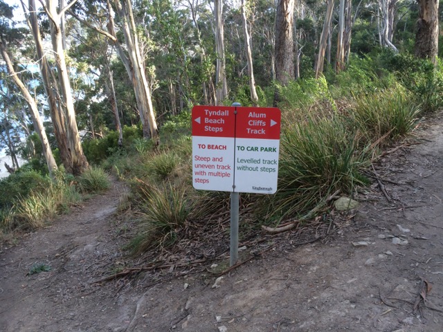
Looking north towardsHinsby Beach from the Alum Cliffs track
I had an assignation with Mr Brown’s River and so it seemed quite appropriate to invite him to accompany me, if only in mind, on the cliff top walk above the Alum Cliffs one day late last year.
That day I’d paused at the beginning of the track, surveying the view from a picnic table above the cliffs while chatting to locals, but mainly, I was quizzing Mr Brown, a drop out medical student from the University of Edinburgh who was thinking about all things floral while his fellow students focussed on cadavers, and whose enquiring mind and botanical obsession had, with a little help from Joseph Banks, brought him here aboard the Investigator in 1801, on Matthew Flinders expedition to discover whether New Holland was one island or many.
There was a breeze, I was ostensibly alone and a single yacht had the white capped river to itself as it headed up river just like the Investigator, which spent some time in the D’Entrecasteaux and the Derwent. Accordingly, Robert Brown spent a lot of time collecting plant specimens from Table Mount (aka kunanyi / Mount Wellington) and along the river, encountering and following the course of Brown’s River in the process. These are my tramping grounds, but on the voyage out he’d visited another of my favourite haunts – Cape Town, where he climbed Table Mountain several times and enjoyed botanising in the fynbos and across the surroundings slopes, including Devil’s Peak.
Defeated by the boulders below the cliffs (see previous blog) it was a whole lot easier rambling along a well formed path that often felt more bushland than clifftop as it wove through eucalypts (silver peppermint and blue gum) and banksias, past epacris in bold red flower, with the companionable little sounds of small birds calling. It’s a sunny and shadowed path with a faintly minty fragrance in places, that occasionally deposits one at the cliff edge for filtered views across to Trywork and Gorringes Points and the long vista through the gap into Ralphs Bay as well as north and south along the river’s two shores. The Iron Pot was visible out towards Storm Bay. I had no doubt that samples of the plants I was walking amongst were included in the 3000 specimens my companion collected and that made their way back to the UK on the very damp Investigator. A conversation between Robert Brown and Charles Darwin, I decided, would have been interesting. They were both lateral thinkers with acute observational skills of the natural world, including geology who spent time here that led to new insights.
Rock platform below the cliffs
These cliffs, where Bonnet Hill abruptly meets the estuary, are unstable and prone to collapsing into the river along their fractures and faults. They’re siliceous and weather from their greenish-grey to a far paler white, patterned with hues of oranges and lemons. Sometimes oxides and pyrites stain their fractures and as they’re composed of Fern Tree Permian siltstone they occasionally bear fossils. I sauntered over all this rich geology not much thinking about it except to wonder, as I walked by the junction of the Brickfields Track, whether the alum they hold ever found its way into the tanneries that used to line the Hobart Rivulet and made it whiffy back in the early years of settlement. Robert Brown came from Edinburgh, that cold city of stone and so it’s not surprising that geological samples, the substrate on which plants grow, and which moss, a favourite plant of his, is prone to nibble, were among his samples too.
I crossed three small rivulets by way of wooden bridges and passed a few other people out walking that day but otherwise had the friendly solitude of the forest all to myself until, quite unexpectedly, I was out of the forest and crossing a broad and sunny expanse of grassy reserve with lovely views from the bench down to the beach where people walked their dogs oblivious to the fact that they were being observed from up on high. I clambered down the steep steps to the beach. I had left Taroona behind and was now in Kingston, originally known as the Brown River Settlement.
Brown’s River, or Promenalinah, as it was named by the Aborigines who enjoyed its bounty before their lives were rudely disrupted, divides Kingston Beach into two shifting halves and although it’s really a single beach the northern section that has gone to the dogs in the best possible way (although shorebirds would disagree), is known as Tyndall Beach. This section is continuously shape shifting in the most beautiful way. There’s a small cove in the northernmost corner tucked behind a lovely rock formation, it is fringed by vegetation and eucalypts as opposed to the houses and shops along the main beach but we walk it with a heavy footstep and so there are few shorebirds.
Brown’s River (upstream)
Tyndall Beach looking north
After lingering at the cove, I chose the narrow path that winds through the strip of vegetation at the foot of the cliffs in deference to my companion. A fair number of his new discoveries from this area turned out to have been discovered already by La Billardière on D’Entrecasteaux’s 1792 expedition. The two men didn’t just have botany in common. Conversely, La Billardiere started off with botany but later qualified in medicine.
I crossed the casual parking area between park and beach. Time was against me but the northwesterly was due to swing south westerly so at least I’d have the wind at my back on the return walk. And so there I paused on the footbridge over Mr Brown’s River contemplating both it and the floodplain it has carved between Bonnet Hill and Boronia Point. The tannin in the river makes it whisky coloured. It rises on kunanyi and I’ve followed much of its course, from above Silver Falls, down to the estuary. It runs narrow and free down the slopes (although some of its water is detoured into Hobart’s water supply) and then it weaves through its floodplain.
Robert Brown found the river when Aborigines still camped here and enjoyed the river’s largess and the hunting to be had behind the beach. There’s still a remnant wetland and there’s still the remnant bush I’d walked through, but my eyes took in an urban landscape – houses smothering the floodplain, and houses on the surrounding hills with their gobsmacking views. Looking down from the Channel Highway, the clubhouse of the golfcourse is the Red House built by John Lucas way back when. He was a a member of the first settler family to acquire land here. They picked up several hundred acres of land around Brown’s River and it’s on this land that, in about 1808, Kingston began to take shape. (For a historical perspective see the photos below). He found other things to, being the first person to describe a living cell nucleus and observing the tiny random movements of miniature particles down his microscope. You learned about this in Biology. It’s named after him – Brownian motion.
I retraced my steps, trailing my companion but mingling with modern day locals using the track. With the arrival of the south westerly the river grew wilder and the forest canopy transformed into an orchestra of wind instruments. I hoped the trees would hold.
I once took a walk in Eastern Turkey with a friend. That path was the only link between two villages. It crossed a shallow river that my friend traversed on a donkey. There were caves where hermits had once meditated; the way we were walking was thousands of years old. The Alum Cliff track links Taroona and Kingston but it is purely recreational. It’s quite possible that Aboriginal feet originally made it but I don’t know this to be a fact. Even though these days the purpose of footpaths has diminished, in the same way that arriving at an anchorage by boat is so different in feeling from arriving by car, so is it different arriving at a well known destination by foot.
There are at least two suburban developments in Hobart that would have thrown Robert Brown into an apoplectic fit behind his desk in Joseph Banks’s library (he became its librarian). One is Tolmans Hill, completely natural not that long ago. The profound shock when the first house appeared up there! The dismay as the suburb grew. The other is the small enclave above Tyndall Beach that doesn’t really belong anywhere but has further eroded the landscape Robert Brown found so rich and strange. This used to be native bush but subdivisions continue to happen on Bonnet Hill and in the fullness of time the land still open land looks set to disappear.
Historic Photos of Brown’s River (Source: LINC Tasmania)
They were mine for paddling, and kayak along these cliffs I did, before discovering sailing and long before embarking on this humble little project. Now, standing on Hinsby Beach gazing south along their tall and shadowed extent, I wondered about the possibility of actually walking along their base. I’d once assumed the Alum Cliff track that begins at the bottom of Taronga Road on Bonnet Hill was the only way. Now I was not so sure.
Alum Cliffs from the path above Hinsby Beach
The coastline south from Hinsby Beach to Kingston is known as Alum Cliffs; the hill’s abrupt and perpendicular descent into the river. There is no beach at its feet, just rocks and boulders, as well as a rocky platform containing fossils beneath Taronga Road (a cul de sac that runs from the Channel Highway down to the edge of the cliffs not too far north of the point where the highway – in reality a narrow semi rural road – begins descending down to Kingston Beach).
Rocky platform, Alum Cliffs
I knew about this fossilised platform from chats with locals on Hinsby Beach and from Sue Mount’s article. They said that once it was possible to reach it on foot but a local landholder had built a fence that now excluded the public. Did they mean from their beach, or, in hindsight, did they misunderstand me and mean from Taronga Road? Exactly how you accessed this platform wasn’t too clear but I was determined to try.
Many years ago, when I was deeply into archaeology I walked the Brickfields Track (also accessed on Bonnet Hill) with the Tasmanian Archaeology Society. The Taronga Road area has mudstone, dolerite and a patch of quality sandstone along its ridge and is strewn with evidence of early colonial activities.
On that walk we came across remnants of the Brown’s River Probation Station (1840s) where over three hundred predominantly road building convicts once lived. There were the remains of a kiln used for brickmaking. Bits of the station are scattered through local gardens now and there’s a house with a swimming pool built into the old quarry. As the years have unfolded some of the bricks once part of structures or left lying about have been removed and incorporated into new structures or lost altogether. Some have no doubt ended up in the river. On my earlier walks I’d encounter red bricks remoulded into satisfyingly round and textured shapes by water.
On the Channel Highway, close to Taronga Road, there is still evidence of an old convict built wall. Some of that high quality sandstone (by Tasmanian standards) from the Taronga Ridge became the Shot Tower, locally famous for being the last remaining circular standstone shot tower in the world, built in 1870, almost twenty years after the probation station had become redundant. It, too, eventually became redundant but in its heyday was used for producing lead shot.
Kayaking, you can get much closer to the cliffs than when you’re on a yacht, although it can be unpleasant when the waves rebound strongly off them. On a yacht it’s best to leave a little seaway, especially along a lee shore, and when I pass by Alum Cliffs these days I’m usually sailing, observing these dark cliffs rising from the water, more wildness in the city precincts, topped as they are by communities of trees and shrubs forming a satisfying stretch of bushland.
There was a strong north westerly wind blowing on the first day I first set off to uncover a route along the cliffs from Taroona itself and I was feeling uncharacteristically despondent, in need of an activity to blast that mood away. Sue Mount’s article seemed to be a hint that the Alum Cliffs track had once started at the right of way onto the beach at lllawong Crescent. I’d looked at other brochures and I’d looked on Google Maps. None of them show it starting at this point.
But still I searched. I returned to the start of the Hinsby Beach track at Wendell Crescent. I walked down it and saw that there was in fact a path to the right that went along the very edge of the cliff, somewhat steep and slippery. I got as far as a patch of escaped daisies from the garden above. They were growing over the track and to proceed I had to grab hold of vegetation to pull myself upward. It wasn’t clear that the path continued on the other side so I decided that as I was alone and the path a tenuous, unused one so hazardously close to the edge, I’d best go up to Taronga Road and see if I could meet up with it by heading north.
I was enthused by the discovery that I could indeed head north to Taroona on the Alum Cliff track but I was not far along it when I met a local walking her dog, one like Ash, and so we got talking. She confirmed what I had already learned: that once it had been possible to take a path down to a large rock platform at the base of the cliffs hereabout and continue along towards Taroona, but it had been closed off by a landowner. If I continued along this path I’d reach the Shot Tower.
‘And it’s steep,’ said a man I encountered a little further along, and he was right. I came to a point where I had a clear view of the path heading downhill and then up the other side. My focus is on beaches and the stretches of coastline between them, and with these beaches it’s on the river itself, particularly (but not only) where it interfaces the land.
I declined the path’s feeble invitation and turned back.
On the rocks below Alum Cliffs
This was back in June 2015. Since then, I’ve gone back to Hinsby Beach on five or six separate occasions, all on the most promising of low tides, sometimes in winter but also at the supermoon’s low last month (9 March), when, unfortunately, the seabreeze worked against me, hurling waves at my knees in a quite malicious fashion as I tried to negotiate a watery gap in the rocks close – very close, I feel – to the little turn the cliffs take as they head to the area beneath Taronga Road. You’ve no business to be here, I felt they were saying. You people have made your track, now walk it.
But that day beneath the supermoon, I sat for a long time enjoying my splendid isolation, looking back towards Hinsby Beach, marvelling at seeing the cliffs with so much more of their base exposed, and enjoying their powerful presence at my back. They are not the only cliffs in the world. They are not even spectacularly tall but all the silence of the ages they contain gives them an undeniable aura in which I basked while deciding that, feeling personally rejected by the cliffs and the river, reaching the rocky platform and climbing up to Taronga Road wasn’t going to happen. The track above the cliffs is there for a purpose, I could only agree, and it affords a different vantage point from my watery stamping grounds. I decided with regret that I’d be satisfied with that.
Dropstone and periwinkles
The rocks below Alum Cliffs
And so that walk along the top of the Alum Cliffs from Taroona to Kingston is the subject of my next entry.
Several years ago I went on a weekend course to learn to sail. There were four teachers: the skipper, the yacht, the wind and the river. I made some good friends and the wind, which until then I’d abhorred, was one of them. ‘Learn to feel it on your face,’ the skipper said and I realised that the wind was really a stranger to me, in part because I struggled to tell west from south and north from east. The wind also presented a very different personality depending on what quarter it emerged from.
If it blew from one direction it blew consistently, right? But no. Focus on it against your face and you’ll see how much it flickers around, how much its strength can vary. A prevailing wind is not a single tone; there are plenty of other notes in there too and there’s no better guide than the windvane (aka masthead fly). When you sail you spend a lot of time looking up because the wind on your face and the wind at the top of the mast might well be behaving differently.
I learned that what the wind is doing above the Tasman Bridge might be different from what’s happening further down the estuary. It messes with the northerlies rampaging down (and vice versa the southerlies heading up). Betsy Island, the South Arm Peninsula and the Eastern Shore contrive to block the south easterly but wind spills in through the valleys. I learned from the geo that landforms can bend and twist the wind, spread it, funnel it (North West Bay is notorious) spin it, like in Sullivans Cove, deflect it, like at Sandy Point, block it as does Pierson’s Point so that suddenly the sails flap and you’re pooling around in a wind shadow.
There are the winds caused by the big weather systems, like the prevailing westerlies that cycle eastwards in these middle latitudes and then there are more local winds like the sea breeze that arrives in the afternoon on those summer days when the island has warmed enough, and it sometimes arrives gently but often it barges in with its muscles flexed. It may stall for a while at the entrance to the Derwent – you watch that dark blue line of indecision, and then the wind rushing across the water towards you, it’s speed and power influenced by the ‘fetch’ as it begins to fill in and in so doing it might ‘knock’ you inconveniently or give you a ‘lift’ to where you are headed. One thing is for sure, on the Derwent the wind takes a different guise diurnally, a different speed depending on where it happens to be (stronger in the wider zones, milder in sheltered bays) and it differs depending on the season. Katabatic winds prevail, blowing in from the NW and the temperature inversion that takes place as wintery cold air sinks to the valley floor gives rise to the Bridgewater Jerry that moves magnificently south down the river, a beautiful white snake of a cloud, its belly down low on the water and awfully cold to be stuck in.
You and your yacht become that pivot point between the wind and the water, their dance made manifest. You learn to read the wind in the water. It might be barely perceptible where you are, about Force 4 on the Beaufort scale for instance, but further away those yachts all heeled over to starboard? The wind is coming your way and it means business. And so you reef because two of the arts of sailing are observational skills and, as my partner on Birngana’s big mainsail used to say ‘Anticipation’.
There are other skills to be learned by the wind out on the Derwent. There’s patience when it deserts you and there’s staying grounded when it thrashes you, so that you’re all heeled over, hanging on and staring directly down into the water, the boom dragging through it, the headsail ripped, the person on the winch knee deep in the river coming over the coaming.
True wind is the wind au naturel. Apparent wind is when the wind made by motion combines with true wind to change its angle and speed. The more you speed up, the more the apparent wind slips ahead of you, streaming through the ‘slot’ between your mainsail and your headsail and powers you along. In effect, it’s your yacht’s most local wind.
When you’re close hauled and the wind is strong, the sails in tight, it’s a bouncy ride, sometimes tense, maybe exhilarating and then when you come about and the wind slips behind you, you can spread your sails out wide, kick back and relax, and the breeze that seemed to have it in for you when you were up against it, becomes a friendly zephyr following behind you. Yet it’s the same breeze and the way you experience it depends on the way you approach it – much like life.
By the same token, it’s easy to let your defences down and wonder why others have their life jackets on when you’re reaching for your bikini because its glassy out there and your boat is going nowhere. But it could be into a vacuum like this that the south westerly roars, attempting to break its own speed record, taking you and the Met Bureau unawares.
Glassy conditions on the Derwent: barely a breeze
The wind lifts sand from dunes and spreads it along beaches. It might take from one beach and deposit elsewhere. It may work with a high tide to push waves harder and higher up dunes and cliffs, or it may lose its territorial battle and be shoved aside by an opposing, more powerful wind from another quarter.
The interplay is dynamic and affects you whether you’re walking, kayaking, cycling or sailing and the Derwent is a brilliant playground to learn all about it’s subtle idiosyncrasies and its full and merciless fury. While conscious of the wind that fills the sail there are other breezes far higher in the atmosphere that pass overhead unregistered. Aeolian drift in the highest reaches carries tiny beings – small spiders, for instance – as well as seeds over vast intercontinental and oceanic distances, making a mockery of quarantine services. And out on the ocean birds, like sailors, yearn for a favourable wind to support their trip or exhausted from flying head on into stormy conditions, might hitch a ride on a yacht, trying to regain the strength to carry on.
On the river in the bleakest of weathers, the world becomes magical, the rain in one’s face exhilarating, the shoreline intoxicating as powered by that beach making and breaking wind we make our way.
Last October I was at Eumarrah, Hobart’s oldest wholefoods shop, when I bumped into an acquaintance I hadn’t seen in quite a while. It so happens that we are both interested in the environment, and birds in particular have been a long and avid interest of his.
I was keen to find out his take on my observation of low bird numbers around the Derwent’s shores, be they on the western or eastern side or in Ralphs Bay, that beautiful low energy embayment near the mouth of the Derwent, these being some of my current stomping grounds. I had also walked ocean beaches with this concern uppermost in my mind and actually, it was while writing this now in my little mountain study, that it dawned on me that there used to be a flock of seagulls that flew over our ridge en route from North West Bay (we used to assume) to the tip in South Hobart. ‘ When had this stopped?’ I asked the geo. ‘The sight and sound of them used to be part of the daily rhythm up here.’
‘I reckon they stopped flying over about two years ago,’ he said.
Two years for us to notice a pretty obvious change in our environment. That’s sobering. The only large flock I’ve seen since I started my walks has been at the dirty little mouth of New Town rivulet but perhaps I have not been focussing on gulls sufficiently because today, sailing Samos into Sullivans Cove just as the cold front arrived with a blast, I noticed a fair number perched on the roof of the new Institute of Marine and Antarctic Studies building and there was also a small flock at the Wrest Point casino.
It’s easy to assume that these birds, long considered the rats of the sea, are safe from our abuse of the environment… but what if something sinister is going on right under our noses that we are not aware of? And what if the seagulls are not as robust as we once thought? Of course, there could be some perfectly simple explanation. Down at the tip they might have introduced a management practice to stop scavenging seagulls from spreading toxic debris along the shorelines. Certainly, some councils have waged war on them (see links below).
Gulls and cormorants are also regarded with trepidation by those sailors who have boats on moorings. I have a couple of friends who have been most unhappy to discover a seagull after party mess on their yachts. Some people resort to nautical scarecrows, profiles of eagles, plastic bags and webbing. Take your eye off your yacht and this is what happens.
Seagull central: it’s our palace now
Anyway, this man so knowledgeable about all things avian, was kind enough to let me record our talk and so here are some of the points he made during the course of our long conversation.
Shorebirds are in decline. Some natural causes include high tides washing away nests. When you think about the more volatile oceans and weather we’re getting with climate change and the way dunes are being hammered by sea level rise, this would be headline news if birds like little penguins and short tailed shearwaters produced newspapers. Native fauna like quolls prey on birds too.
I could add my own examples: go out to Chappel Island in the Furneaux Group off Tasmania’s north eastern coastline and you can barely put one careful foot in front of the other without stepping on the snakes that prey on the short tailed shearwaters that have their southern summer burrows there.
He cited more examples and based on what he had to say I suggest we all go and peer at ourselves in the mirror because the main cause is our lack of restraint in the way we behave around beaches. Some locals walk straight through the plastic fences that councils erect on dunes to safeguard both nesting birds and eroding dunes. People camp on beaches, dunes, or just behind them. Radios blare, kids race about on quad bikes and dirt bikes. Adults in four wheel drive vehicles mistake dunes for playthings, crush nests and mess with the role of dunes as a barricade against the sea.
‘When this sort of thing is happening on remote ocean beaches,’ he said. ‘You know there’s no haven.’ And he mentioned a researcher dissecting a bird on Lord Howe Island, (a tiny speck in the ocean 600 km off the Australian coastline) and finding it chock full of plastics.
‘ And over fishing, acidification of the oceans, the warming seas,’ I said.
‘Dogs,’ he said. ‘Horses on beaches.’
‘Seven Mile Beach,’ I said.
‘Marion Bay Narrows,’ he added.
He had begun talking about birds, like oyster catchers and the endangered hooded plover that choose to nest in the tiny scrapes they make in soft sand. Instead of limiting themselves to the hard sand close to the watermark, people and their dogs trample all over the beaches. It’s possible to stamp on a nest oblivious to what you are doing. ‘You may think your dog is doing no damage, but these nests are hard to see.’ And dogs, he emphasised, run all over the beaches. ‘It’s bad enough when they’re leashed. They still scare birds away.’
He told me about the annual gull count that is run over the June long weekend and includes the Derwent River. On Bellerive Beach, for example, ‘there’s a veritable passeggiato of dogs and their owners and so there’s no chance for a bird to make use of it’, he said.
I began to feel uneasy. I have two beautiful canine companions, fellow adventurers where their presence is allowed. I thought of all our lovely beach walks. It seems to me that even people walking quietly and carefully down a beach with no dog at all disturb birds and even scientists monitoring or researching bird behaviour and lifestyles have that same effect no matter how careful they try to be. Birds nestled over their eggs leave their nests, for instance, when they see that most dangerous of all mammals (us) looming, albeit with a scientific title. But mostly I was thinking about the consequences for me in raising my awareness about this issue. My dogs! The beach! Were they two incompatible loves? And what was more important? Shorebirds, or the delight of seeing my happy dogs enjoying the surf?
‘And boats too,’ I said with a heavy heart.
‘Yes,’ he said. And he told me about a particular reserve on the Derwent River, a little one, just a handful of hectares. He’d recently gone there to do a survey and he explained how its done. You spend twenty minutes on each hectare noting the birds you see and hear. ‘That’s how the atlas [Bird Atlas of Australia] was done, right across Australia. But in those twenty minutes there was a jet ski out on the river in front of me, jets from the display squadron from the RAAF – two went up the river, a helicopter going up the river, a fixed wing aircraft directly overhead at low altitude, there was big earthmoving equipment on a block just up the road from me and somebody was using a brush cutter the whole time I was there. So how am I to rely on my ears to do the survey?’
And, I wondered, how do birds communicate against so much mechanical volume.
I walked out of that shop with a lot on my mind. Shorebirds are up against our way of life. To be a migratory bird travelling the Asia-East Australian Flyway the odds are getting steeper. Will there be water in a particular wetland or will a new housing development have put paid to that refuge? Will weeds have covered your burrow or stifled a food source when you arrive? And let’s not even talk about hunters.
It seemed to me that if I was going to walk the birds’ beaches then I had to do it with even more care, in a way that gave more than it took. But how?
I tried to think of communities that live with restraint. Apart from the locals of North Sentinel Island, denizens of the deep Amazon or the San still sort of clinging to a Kalahari lifestyle, I could only think of the Amish.
But on the bright side, a friend is elated to discover that ten Little Black Cormorants have come to hang out with the Pied Cormorants living on Cormorant Rock off her home (see here).
And on a really world changing scale, Boyan Slat, a teenager from Holland, has come up with an idea, now crowdfunded, backed by the scientific community and at pilot study stage, for cleaning the oceans of plastics within a ten year period. Impossible? His Ted Talk is here. See what you think


")