D’Entrecasteaux Channel: North West Bay by kayak

What my kayak and I discovered in Ranggoeradde [North West Bay]

The Tortoise and the Elephant

NW BAY SECTION 1-1-2.jpg
Cliffs passed as I entered  Ranggoeradde

And so I left vibrant Tinderbox Marine Reserve behind me and turned into Ranggoeradde,  better known as North West Bay. Calling it by a name so redolent in history restores something of its original character, despite the fact that it has been stripped of its myths and stories and the people who told them aren’t really recognised anymore.

NW BAY SECTION 1-1-3.jpg
Fallen giant

A lot may have been lost in  translation.  It’s easy to withhold, mislead, confuse or misunderstand when it comes to words and their meanings, particularly when the relationship between the teller and the person with the quill is untrusting, or uncertain at best.  Ranggoeradde may not have been properly translated at all.

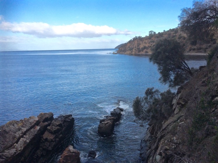
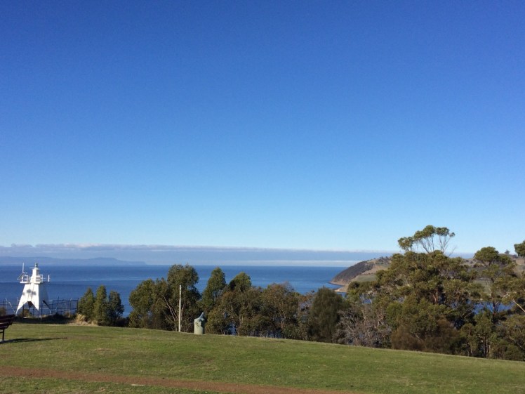
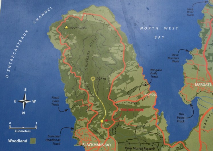
It’s a low energy embayment of about 2,000 ha. and it now  lay spread out before me.  It’s eastern shore is also the western shore of the Tinderbox Peninsula and it’s easy to forget this as you wander about this area.  There’s a long winding road that feels its way down that particular edge of the bay, past a number of Howden houses set in big blocks of land, a couple of small bays (somewhat muddy) and a bus shelter that doubles as a local book exchange or perhaps a community library.  It’s a good road to cycle but it’s still on my ‘to do’ list.  It’s a good area to walk too, and on this eastern side there are three spots of interest:  Wingara, Stinkpot Bay and the Peter Murrell Reserve, and I was heading to Wingara to catch up with the patient geo.

NW BAY SECTION 1-1

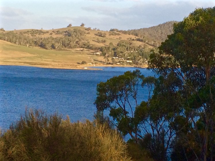
The further I went into the bay, the more I noticed that diversity beneath my kayak  was diminishing, and I realised that this bay is like a tortoise trying to support an elephant on its stoic little back.  It carries the suburb of Howden, the country towns of Margate, Electrona and Snug, as well as Conningham, where shacks along a short series of sandy beaches now make up something of a commuter suburb.

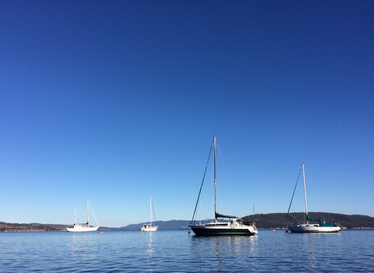
The North West River plummets down the southern slope of kunanyi (Mt Wellington) and when it happens to be dry its bed gleams with large, pale boulders and when it’s in flood it’s strength is so awesome your breath catches.  It enters Ranggoerrade, and so does the lovely Snug Rivulet, hugging its secrets to itself in a dreamy sort of way, a perfectly beautiful miniature estuary.  They, along with various rivulets entering the bay, carry local litter, grey water, toxins and the like.  That’s more than enough,  but there’s a fish farm here that ups the nutrient load, a bit of light industry (pre-cast concrete and glazing), a seafood factory and a marina, moorings and a boat yard as well as a sewage works. (Jordan et al. 2002) as cited here.

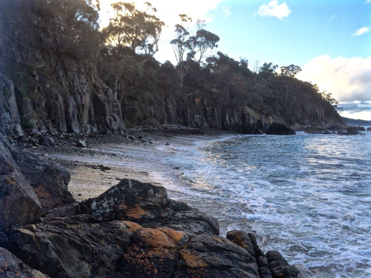
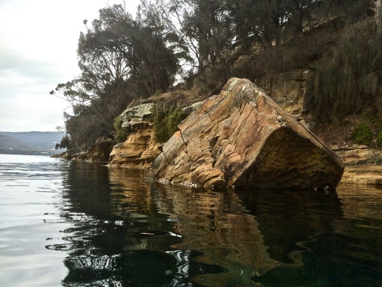
It wouldn’t take me long to reach Wingara, I figured, but then I saw the sandstone cliffs and my speed slackened off again.  They were stunning and I got snap happy.  Never high, they sloped downwards, eucalypts and grasslands above, and gave way to a cobbled shoreline.

NW BAY SECTION 1-2
Weathering artistically – when geology morphs into art form

Andrew Short (2006) doesn’t mention beaches on this side of the bay in his inventory of Tasmanian beaches, and I had flipped my strategy for exploring beaches.  Instead of high tide, for the D’Entrecasteaux and kayaking I wanted high tides, expecting mostly muddy shores.  That’s why, on this trip, I sometimes floated above beaches drowned by the tide and gazed at ancient ones laid down in the sandstone’s stratigraphy.  I came to a cove with  a private beach and tried that lifestyles on for size.

NW BAY SECTION 1-5
The quietude of private beaches
NW BAY SECTION 1-4
Only rec fishers! For a moment I thought they were  fish farm workers out to bust me for straying into fish farm waters
NW BAY SECTION 1-7
The bay spread before me but below the water it wasn’t so uplifting anymore

It was as I paddled along the shoreline beside the fish farm that I really noticed the decline in seagrasses and seaweed. From the fish farm and that first house on the shore, it became less interesting beneath the water but the cliffs were awesome. Sometimes I had to go out a little wider to avoid the ‘bommies’. Occasional the kayak scratched as I went over them in too shallow water. I was constantly lifting my rudder.

I negotiated the fish farm and the Wingara jetty, passing cormorants holding their wings out to dry.  The geo was standing on the rocky platform staring at the cliffs.  So far, it had been an absorbing paddle, but I thought how westerners accuse some of the cultures amongst whom they’ve settled their flagpoles of not planning for tomorrow. We haven’t necessarily recognised that actually, we are the ones that haven’t planned for tomorrow in the most significant of ways.  We’ve used up ecosystems like their isn’t going to be one.  We’re the destruction and destruction doesn’t give a damn.  That’s why all around us there are tortoises balancing elephants.

~~~~~~~~~~~~~~~~~~~~~~

A little more about this tortoise and that elephant:

The State of the D’Entrecasteaux Channel and the lower Huon Estuary report (Parsons, 2012) states the following about North WestBay:

  • At risk from nutrient loading due to high terrestrial inputs of nutrients and reduced flushing times
  • Experiences turbidity values far in excess of the upper national guideline value during high flows of the North WestBayRiver
  • Dissolved oxygen (DO) levels in North WestBay are variable and have dipped as low as 58% saturation in bottom waters during summer, reflecting poor environmental health
  • Occasional elevated values of contamination highlight the vulnerability of some beaches and other recreational sites to short‐term spikes in bacterial loads. Primary areas of concern in recent years include Margate and Snug
  • Evidence of environmental legacy issues at the former heavy industrial site at Electrona, although measures have been implemented to mitigate impacts on the Channel
  • Heavy metals are also elevated in sediments in deep, silty areas of North WestBay

Source:  Kingborough Council. North West Bay

D’Entrecasteaux Channel: Tinderbox: Crossing the Gulch

Tree and cliff at Tinderbox

I.

Walking With My Plank

In the company of a plank, meant to provide a way across the gulch so that I could wander the cobble beaches, I returned to Tinderbox on what was supposed to be a low tide.

It wasn’t.  That tide had firm tenure on the rocky platforms.  It was in fact so high the shore was sometimes unrecognisable and I could not even find the sea cave.  I did reach a cobbled beach and later, from the top of Pierson’s Point, I walked through bush to the cliff tops, seeking a path down to another cobbled shoreline but my bushbashing was entirely unsuccessful.

Actually, it transpired that I was 365 days late for that low tide. I had consulted the 2015 tide table by mistake.    Still, it’s not every day you walk out with a plank.  Strange to say,  it’s quite companionable and will lie down on slippery seaweed if you need it to.

Grange Beach to Karringal Crescent rocks

II.

‘Everything that arises is an invitation…’*

When I learned that Susan Murphy was leading a retreat on kunanyi I thought that  I would take this invitation to escape my cocoon of fatigue (jetlag & flu) and find my way back into a practice that includes the fine honing of awareness and attunement to the natural world.

I had been on the river for a few days in a row, servicing winches, cleaning the bilge, sorting out engine problems and flat batteries. Still, we’d managed a little break in all of this and had packed a picnic and gone up river in Samos, enjoying the quietude of sunshine on water in Shag Bay and exploring hidden beaches on the other side of the river, just north of Cornelian Bay.

Then I became mountain focussed, walking to the retreat along forest trails, through leaf litter and peels of eucalypt tangled on the mossy slopes.

img_1984
Eucalypt bark

For three days I absorbed the soundscape of the mountain. The kurrawongs are building nests; their conversation carried across the canopy. The frogs are seeking mates. In the pools outside the window they sang serenades. The wattle bird punctuated the silence from a eucalypt nearby, the rosellas called to each other as they flew between kunanyi and Chimney Pot Hill and the wrens held intimate conversations in the garden’s undergrowth. All this beneath a sky by turns cobalt and domed with cumulus transforming, and one turned grey, the raindrops falling quietly into the pools, repatterning the reflections of the trees all about.

During a break I sat down on a lichened rock in a part of the forest where I sometimes walk, enfolded in its deep and friendly silence, noticing the beauty of random scatterings of leaves, twigs and impressions in the earth, and the slightly anxious flight of a bumble bee. I must have sat for about ten minutes when a gentle trilling began to rise through the forest. This insectivorous chorus was one I had never heard before, and so neither had I experienced the way the forest seemed to attend to this shimmering music.

On a Bedfordia salicina - communities
Many make one: communities living on a blanket bush (Bedford salicina), kunanyi

It evoked that perpetual question, that one too big to have an answer: what is the secret life of the forest, what the mysteries of the river and the sea? What happens when we are not there to witness it?

Krishnamurti (2000), in All the Marvelous Earth asks

‘…what is beauty? This is one of the most fundamental questions, it is not superficial, so don’t brush it aside. To understand what beauty is, to have that sense of goodness which comes when the mind and heart are in communion with something lovely without any hindrance so that one feels completely at ease – surely, this has great significance in life; and until we know this response to beauty our lives will be very shallow.’

It’s a closed loop

And,

it’s an open invitation, because ‘medicine and sickness heal each other.  The whole world is medicine.  Where do you find your self?’ (Yunmen, 9th C China).

In effect, the extensive damage we have done grants to us an opportunity to develop a symbiotic ease in our relationship with the earth and bring about the healing change so urgently needed right now.


Robert Hass puts it beautifully: ‘We are the only protectors, and we are the thing that needs to be protected, and we are what it needs to be protected from.’**

* Murphy, S. (2012). Minding the Earth, Mending the World: the offer we can no longer refuse. Picador, Sydney.

**Robert Hass, as quoted in Murphy, S. (2012). Minding the Earth, Mending the World: the offer we can no longer refuse. Picador, Sydney.

Derwent River: Kayaking the Tinderbox Peninsula

Smacking Down Fear with a Paddle

It’s a little known fact but upstream of Dennes Point, just across the water from Pierson’s Point, there’s a shark refuge and the men in grey suits and the freezing water in which they undertake business were on my mind as I climbed into my kayak to paddle the Tinderbox coastline.  I would have liked company but I had no takers and so I’d decided to go alone.

On a fine day.

With the water like a mirror.

And on a low tide.

‘We’ve kayaked it before,’ the geo had said. ‘You don’t need to do it again.’

I could not remember kayaking the whole length of Tinderbox, and if we had done so it was back when I thought of Tinderbox as one long stretch of formidable coastline with no discerning features other than cliff face and rocks. Now I knew better and had reached the conclusion that the best way to get to know the peninsula was by kayak, right up close to the rocks, in part because I didn’t want to be that kayaker who made the headlines through being snaffled in the Derwent.  After all, Hobart is full of sea kayakers who paddle this stretch and think nothing of it.

But I wasn’t one of them.  I simply had a little goal to achieve and a mystery to solve: where was the door to the underground tunnel behind the cliffs?

‘Sailing is all about anticipation,’ my friend M, used to remind me and it’s perhaps more so with kayaking. I checked the Bureau of Meteorology site and chose my day – swell beneath 0.5 m and north westerly winds below 10 knots turning variable later in the day. It sounded perfect.

A small wave splashed over my map as the geo pushed me off and even before I’d made it out to Flowerpot Point, kayaking through the moored yachts in the southern corner of Blackmans Bay, I could tell the river was intent on being a trickster. Because the water was in fact lumpy, and so another fear assailed me.  If I fell out, it would be mere moments before I died of the cold and much as I love the river I did not want its bed to be my last one.   As I rounded Flowerpot Point I felt threatened by swell coming at me from all directions, no doubt lingering from previous bad weather. The surf breaking on Soldier’s Rocks a couple of hundred metres away looked downright intimidating.

I stopped.  ‘Too rough… poor visibility,’ I advised myself and I wobbled into the little cobbled bay (T468) that I thought I had befriended on one of my earlier walks only to find it fractious and lumpy, the water disconcertingly black.  I began to reach for my mobile (geo, come back!) but I didn’t feel steady enough to use it.

‘You miserable little coward,’ admonished the chorus in my head.  I could already see Passage Point and North Bruny Island and they didn’t actually look that far away. We’d figured it would take me three hours (based on my dawdling on previous paddles) and certainly sailing along here sometimes takes a goodly length of time. And so I pointed my kayak south again, put my head down and paddled briskly towards my first waypoint, Soldiers Rocks, adrenalin ratcheting up my heartbeats. My seat wasn’t properly adjusted; my legs were already going numb.   This was affecting my balance.  No ways was I going to reach for my camera.

I burned passed Soldiers Rocks, keeping a distance between us because of the toothy break and  reflective swell,  and my compromised ability to use the pedals I could no longer feel. The Lucas Point Sewage Plant now seemed more friend than foe. I could see how in this little bay the beaches from the water seemed a single beach rather than two or three, but I was not game to reach for my iPhone.

There was no going back now.

Because of the slop I couldn’t get near the shoreline  and so I had to put a big fat cross through the image I’d had of myself, drifting along a feet or two from the cliffs, trailing my hand along rocks from time to time (hello, rocks!  hey, sea anemone!) imprinting the geography in my head,  scrutinising the cliffs for the hidden doorway.

My next waypoint was Fossil Cove and I could see the arch ahead of me.  The geo and the dogs were going to walk through it to the part of the beach on the northern side and I’d said I might see them here but little did I know, they were way behind me.   (And little did they know I was ahead.  They waited here a long, long time.)  Ahead, closer to the eastern shore, was a ship at anchor. There is often a ship at anchor, presumably waiting to proceed upriver but they are like ghost ships. Sailing past, you never see crew. Back when Sandy Bay was barely populated, the ships at anchor often had clandestine grog on board that was collected by smugglers under cover of darkness.

A smaller ship came around the Bruny Island coastline and headed down the D’Entrecasteaux just as a boat came roaring out of it, headed my way.  Fishers, I thought, but no.  They began to reverse their boat into an extremely narrow gulch on the southern side of Fossil Cove.  Neat!  And what a clue!  They’d been invited to lunch!

To keep my mind off sharks I contemplated the cliff top with its magnificent view, far more alluring IMHO, than an underground dining room but I guess diversity is the spice of life.

Lucas Point came and went.  Before I knew it I was past Passage Point where, in the wind shadow, the water lay down. The tide was more resistant here but I was quickly through the gap between Dennes Point on North Bruny and Piersons Point on the Tasmanian mainland and in the channel flat water with a quiet lattice of ripples welcomed me. Beneath me, arrow squid, australian salmon, barracuda, pike, flathead, whiting and silver trivially glided, but I was unaware of them. Beneath the cliffs a seal lolled in the water, one flipper up. I paddled past the two little cobbled beaches, the tiny gulches and the sea cave and made it on to the beach before the geo and dogs arrived to give me a lift home.  I hadn’t managed to explore the beaches but, chased ever onwards by imaginary sharks snapping at my stern, I did do this leg in 1 hour flat!

Cobbled beach, Pierson's Point
Cobbled beach, Pierson’s Point and quieter water


The day I kayaked from Blackmans Bay
Cliffs at the start of the D’Entrecasteaux Channel


Taken the day I kayaked from Blackmans Bay to Tinderbox Beach.
Moorings off Tinderbox Beach.  Bruny Island (left).


Derwent River: Tinderbox Beaches: Pierson’s Point

Geographical Anxieties

 D’Entrecasteaux gave the point this name when surveying the area in 1792.  It was also known, briefly Point Lewis and Blythe’s Point. 

(Source: Robinson-Moore, 2014) 

Light and cannon and Bruny from Piersons
Piersons Point with the Tasman Peninsula in the distance and Bruny Island just across the water

Just because you’re a long way from an empire’s capital, with limitless miles between your island home and battlefields and just because a feud can begin and end in the space of time it takes to receive a letter  doesn’t mean that you’re not going to get the jitters hanging out at the end of the world.  So when Governor Lachlan Macquarie visited the Hobart Town settlement in 1811, his mind turned to the enemies that could arrive unannounced up the Derwent River – the French, for example, not that long ago defeated in the Napoleonic Wars.   His perspective was military; the place clearly needed fortification, and so a network of batteries, some interlinked by means of tunnels, took shape along both the eastern and western shores of the river.  I had long ago passed Alexandra Battery, which sits above Blinking Billy Point.  The battery at Piersons Point is significant because along with Fort Direction on the far side of the river, it protected the river mouth (although it was a late comer to the system as it was actually only constructed and used during WWII).  Prior to that time there was a pilot station here, at the junction between bay, river and channel and on fine days the family based at the Iron Pot lighthouse sometimes rowed across for a bit of conviviality.

When we’d arrived after our wander along this stretch of shoreline, there were some Sudanese children  playing tennis on the court that seems as oddly placed here as the idea of a battery is now.   Bruny Island is a short hop across the water, the river was to my left, the D’Entrecasteaux Channel flowing into it from my right, and Storm Bay spread south. I could look back down the long stretch of coast I had explored and across the river to Cape Direction and the Iron Pot light.

It had taken a bit of research but I now knew that the river was not only a drowned river valley but also a rift valley.  I knew there was a bar beneath some 15m of water just north of Pierson’s Point and I knew that there was likewise a bar running from Piersons to Dennes Point on Bruny Island, because the depth instrument on Samos registers this as we sail over it.  But the geo had also put me straight about the the river, the channel and their geological inter-relationship and his take is attached at the bottom of this entry.

It was ages since I had set out to explore beaches, yet here I was still in the Derwent.  I had discovered parts of the shoreline I hadn’t really known existed.  I had discovered it’s vague and sketchy nomenclature and I had discovered that it wasn’t supporting nearly as many birds as I had anticipated.  I now knew these beaches were pocket beaches and that it’s pointless walking beaches without giving equal weight to the coastline in between and I had discovered that the means of travel impacts greatly on the experience.  My most profound realisation had been that I was not nearly as hefted to the land as I had once thought I was.

I’d walked along Tinderbox’s spine but the road is narrow and while picturesque it can occasionally be at an unrewarding distance from the river.  I knew I would cycle it one sunny day, but that’s more about a ribbon of bitumen than it is about the river and its beaches.  I sail this coastline frequently, but then my attention is more on the boat’s interaction with wind and water. That being so, I felt I wouldn’t have done it to my liking unless I kayaked it too.  I thought that in my kayak I could really acquaint myself with its rocky shore.  And besides, hidden among those cliffs was, bizarrely, a secret door and I was keen to find it.

We set out the teapot and cups, then sat down and enjoyed a little tea ceremony to honour the Derwent.  There were cumulus clouds in a blue sky. On such a stunning day,  watching the ferry crossing the channel further south  between Kettering on the Tasmanian mainland and Roberts Point on Bruny Island those old geographic anxieties seemed peculiar indeed.   My geographical anxieties were of a far smaller scale than the governor’s.  They were focussed on how I was going to co-ordinate my blog with the places I was intent on exploring. How to proceed, I was wondering. South down the Channel, and if so by what means?  Or north from Sandy Bay through Battery Point and if so, how far up river?  And if I mixed it up how would I keep a sense of continuity going in both my brain and on my blog?


Dennes point from Pierson's Point
Looking across at Dennes Point, Bruny Island from Piersons Point.


IMG_4183
Lacking the grace of an old lighthouse and looking more like something from outer space. Automated light at Piersons Point with the Iron Pot lighthousein the distance.

The geo’s take: Derwent Rv and D’Entrecasteaux Channel.

See also On the Convict Trail

And Beach Stories, for life at the old Pilot Station


Derwent River: Tinderbox coastline: Passage Point

With a Dark and Stormy in one Hand and a Pencil in the Other

PASSAGE POINT

Passage Point is a notable promontary at the mouth of the Derwent Estuary and is both lovely from the water and green and pleasant from the road – a rolling hillside, a rustic shed, an abrupt cliff line carved by the waters of the Derwent, the D’Entrecasteaux and Storm Bay.

Signage
Map from the Kingborough Council Signage at the start of the Tinderbox Hills track:  nomenclature is thinly used.  Passage Point, Piersons Point and Tinderbox Beach,  all important landmarks, are not noted. (Passage Point is to the left of Mount Louis.)

Having finally decided that ‘not the real Fishermans Haul’ was in fact the real Fishermans Haul (see last blog post), we went to Passage Point to see if there was some way we could access the little cobbled beach I’d noticed.  There wasn’t.  We had to make do with expansive views but as these were superlative and so vast in scope we could hardly complain.  Mount Louis, Tinderbox’s highest point and forested in eucalypts rose behind us.

Birngana long distance race off Tinderbox
Birngana off Passage  Point

My guess on how Passage Point got its name was all tied up with waypoints, landmarks and the ocean because if you’re heading off in your yacht on a trip of any distance, it pays to sit down and plan your passage.  With a ‘dark and stormy’* in one hand, and a pencil in the other, take a careful note of the tides, currents and potential hazards.  Become familiar with the landmarks you’ll pass, navigational signs you’ll encounter, channels or reefs you may need to negotiate and choose your waypoints.  Make Meteye your new best friend and despite being in love with your chartplotter, tuck the paper version into your nav table too because it’s less likely to let you down.  Departing the Derwent at this point to head out across Storm Bay is always a bit of a passage into the unknown because the bay is notorious for conjuring tempests up out of the most benign conditions.

Because  this familiar promontary is just there where the waters of Storm Bay, the Derwent and the D’Entrecasteaux merge, it’s symbolic of passages about to begin and passages almost completed.  So it goes without saying that this is how it got its name, right?

Wrong.

I checked Placenames Tasmania and found some unverified information. A boat called the Fancy was one of ‘the few remaining trading boats called passage boats.’ Back in slower more leisurely days these boats used to ply the Derwent and the Channel.  In doing so, they had to round Passage Point and in so doing, they gave the point its name.

This information in the database comes from a boating article in the Saturday Mercury, Jan 2002 where it’s also noted that ‘most features on coasts were named by mariners and seeking reasons for names means looking at it [sic] from a mariner’s point of view.  Thus Passage Point was a marker for south-bound boats of the entrance of ‘the passage’ or the Channel.’

Exploring the sweep of shoreline from Sandy Bay to Tinderbox had triggered my curiosity about the way places were named but I had not considered that mariners had a big hand in the names of the places I was exploring.  This was an unforgiveable oversight because it’s obvious that many major features first got their names from the early voyages of discovery.  My impression of the western shoreline of the Derwent was that places were usually named after the early landowner’s or overlooked in the naming process altogether but I could see that in a tiny colony at the end of the world there’d be a sense of familiarity and homeliness for locals who plied these waterways in naming the places they were passing by the names of the people they knew. On dark and stormy nights in particular, the ability to recognise familiar landmarks and tick off waypoints is comforting and engenders hope when you’re toughing out rugged conditions.

We paused here to savour the view.  Passage Point felt extremely evocative for me:  I had walked out one wintery morning and followed the Sandy Bay Rivulet down to its mouth.  I had turned right and wandered the shoreline from there to here, a distance of some 35  kilometres, give or take a few and although I had done this as an urban explorer, little bit by little bit, it had been fun, it had changed the way I related to the coast as well as dramatically expanding my knowledge of the city I live in.

And then we continued on our ‘way ‘ – a word itself entangled with ‘passage’, and like ‘passage’ one with an evocative history.  I liked the definition from the Free Dictionary best:  ‘a. A road, path, or highway affording passage from one place to another. b. An opening affording passage’.

  • Dark and Stormy: rum and Coke / ginger beer or ale; a drink that’s popular with sailors.  The link is to one version, but there are many.


Derwent River: Tinderbox Beaches: Not the Real Fisherman’s Haul

Beaches T 471 (Fisherman’s Haul) & T472 Fisherman’s Haul South

Having scrutinised more maps I began to doubt that the Lucas Point Sewage Plant was actually at Lucas Point.  It’s the landmark that helps identify Fisherman’s Haul and as conversations with locals had helped me fix it in my mind that it lay just south of Flowerpot Hill I started to think that the problem was one of language – ‘just’ is a stretchy kind of word for a start, and may not have been used by anyone I’d spoken to.  It may simply have been a supposition I’d made from what had been said to me.

Our modus operandi was to drive along the Tinderbox road slowly (not difficult – there were quite a few cyclists out and about) and check for detours down the slope.  The geo noticed a sizeable piece of green land with car tracks on it, somewhat sheltered from the road by a partial row of caesurinas.  We did a u-turn and went back to investigate.

Close by a man was burning off.  He ambled over to talk to me and I asked him if this was Lucas Point.

‘Some people think it is, but it isn’t really.’

‘Is it back where the sewerage plant is?’

‘Nope.  Some people think that’s Lucas Point too, but it isn’t really.’

‘So where is the real Lucas Point?’

He pointed vaguely over his shoulder. ‘Back there a bit.’

‘Okay…  And so I’m wondering, if Lucas Point is back there, then is this Fishermans Haul?’

‘Some people say it is but it isn’t really the real Fishermans Haul.’

‘Is there a beach down there?’

‘Nope.’

‘Is there a path down?’

‘Maybe.  You should be okay if you’ve got your balancing shoes on.’

‘Well, thanks, I might go and explore.’

The geo  was down at the bottom of the slope reading a sign.  It stated ‘Lucas Point’.  A thin band of caesurinas lined the vertical cliff top so we put the dogs on leads and slithered down a very steep path of sorts beside a short deep gully carved by another youthful rivulet, at that time dwelling soley in a few remnant pools.  An old rusty cable lay beside the track but we couldn’t identify a use for it unless haulage came into it.  It didn’t take at all long before we came to the end of the path.  It stopped for me at a rather cracked and fragile looking rock arch left over from a previous coastline.  It might have been fine to walk over it onto the high rocky platform but I didn’t like the look of the cracks in the unconsolidated cliff face to which it was attached.  The geo and the dogs stopped a bit further back because it really wasn’t a place for the dogs to be at all – it was all rather precipitous.

Looking down at Lucas Point Tinderbox
The rocks at the real Lucas Point; climbers’ secret

It goes without saying that the long views  were superlative.   Down this end of the river we were getting closer views of the Iron Pot, the lighthouse at the entry to the Derwent River and in the southern curve of Lucas Point (the cliff I was presumably standing on) was a very beautiful and quiet cobbled beach and just to the north of where I was standing was another cobbled beach.  Looking directly south at the cliffs that work around to Passage Point I saw a third.  And looking directly down was a tiny narrow gulch.

Fishermans Haul North from Lucas Point
Fisherman’s Haul
Looking south to Passage Point from Lucas Point
Looking south from Lucas Point, the beach below Passage Point just visible.

Andrew Short notes a Fishermans Haul (S) and a Fishermans Haul.  Here’s his description of Fisherman’s Haul:

‘Fishermans Haul is a small curving cobble beach (T 471) located to the lee of 40 m high Lucas Point. Steep vegetated bluffs rise to 50 m behind the small beach, which is partly sheltered by the point and rock reefs resulting in low waves at the shore. The road runs along the top  of the bluff 100 m west of the beach with access via a steep descent. ‘(Short, 2006)

And here’s his description of Fishermans Haul South:

‘Beach T 472 commences 100 m south of the Haul, and is a 200 m long east- to northeast-facing narrow high tide cobble beach located at the base of 50 m high cliffs, with a steep gully descending to the centre of the beach.’ (Short, 2006)

New discoveries!  Seen so often from the water but not really properly seen at all.  I was happy to believe the sign and this time, added to the slippery geography I’ve been doing battle with, was that local’s wicked sense of humour and the entertainment he got from causing confusion.

This coastline may seem impossible to access on foot but later I discovered that it’s loved for being a climbing area rich in deepwater solos, that method of climbing that evolved in SW England.  Nick Hancock makes it clear that for this you need a kayak you can tie up while you climb up dolerite boulders or columns at this point and you need to be confident that the water is deep and safe enough to splash down into.  Don’t even think about trying this unless you have plenty of experience, not just about deepwater solos but weather conditions and the sea state too because Tinderbox is unforgiving. And if you think the name makes it promising for fishing, pack your tackle and take your rod further afield.  Too many fish have been hauled and this area is now protected within the bounds of the Tinderbox Marine Reserve – no fishing allowed.

The view east from Lucas Point Tinderbox
View across the river to South Arm from the real Lucas Point.  The Iron Pot is that tiny dot to the right.


Derwent River: Tinderbox Beaches: Flowerpot Coastal Reserve (T469?)

The Artist and the Donkey

Flowerpot Coastal Reserve Beach

Beneath the Lucas Point Sewage Plant there’s a bay and in that bay there’s a thin cobbled beach divided by boulders from another stretch of tide constricted beach.  (Possibly Andrew Short’s beaches T469 & T470, but I could well be wrong.)

We’d started the day with brunch at MONA, Hobart’s incredible Museum of Old and New Art, way upriver and  I only mention this because I’d spent an inordinately long time at the Marina Abramovic exhibition, engrossed in watching her meditatively regard a donkey and the donkey’s long considered response to her. The immaculate stillness of it all; the way the observer is absorbed into the dynamic of the interaction and how, in paying attention, new details about the donkey, or Marina, or even the pared down environment emerge into focus long after you think you’ve observed everything there is to see alerts you to the fact that perception is fickle and attention is a skill that needs honing.

It made me wonder how long I should spend regarding a beach and how you express gratitude to such a multi-diminsional part of this planet.

Later we packed a rucksack and headed down to the Tinderbox Peninsula. The off the leash exercise area behind the Lucas Point Sewage station was vibrant with canine energy but we detoured up Flowerpot Hill’s southern slope. A blue sky, and a light sea breeze …we reached the place I’d stopped before  and paused to consider the various blossoms in flower along the edge of the cliff line.

Gum blossom Flowerpot Hill south
This beautiful eucalyptus is not indigenous to this area. 


I quizzed each local I met about beaches. I was particularly after information about a beach called Fisherman’s Haul but no one could enlighten me.

We snooped around the sewage plant and debated taking a tangled path then elected instead to descend to the shore via another steep path that followed the edge of the short deep gorge carved by the rivulet that inhabits this valley. There’s no sign to identify it but it reaches the Derwent via a cobbled beach and there, that day, it stopped behind the pebbles heaped up on the steeply sloping little beach that was being pounded by business minded waves. Occasionally we’d hear the sound of those cobbles making music as the waves retreated.

The tide was high and I had to calculate the time between waves in order to reach a spot at the northern end from where I could peer over boulders into the Lucas Point Sewage Plant’s beach  (if indeed it really was a separate beach).

Tinderbox Flowerpot Coastal Reserve Beach
Lucas Point Sewage Plant’s beach just north of the Flowerpot Coastal Reserve beach.

The tide had left only one small, dry patch  at the southern end and so I didn’t think it was wise to gamble with the waves. There was graffiti on its cliffs and above that I could see the sewage plant. Both detracted from its original beauty, one of austere rock and wild water. I could see Soldiers Rocks and just this side of them a lone man  fishing. It seemed somewhat too close to the sewage plant to be a palatable past time.

Meanwhile, the geo had brewed the tea given to us by a friend who’d departed in his yacht to sail home to NZ. We sat back and contemplated the beach and the little rivulet, the cliffs to our south and the kayaker who surfed one of the breaking waves before heading on north with no break to his momentum.

Tinderbox Flowerpot Coastal Reserve kayaker
Lone kayaking along a rugged shore ~ Soldiers Rocks in the distance

In that beautiful setting the tea tasted divine and lent a meditative quality to the attention I was lavishing on the shoreline.  Then I performed a tea ceremony to honour the beach. A little liquid connection. A means of feeling my way towards how one says thank you to a beach for its existence.

Tea at Flowerpot Coastal Reserve Beach
Gratitude to all things beach and water


Afterwards I walked the small bushland path beyond the dog exercise ground by myself, wondering where it would take me. Like a lot of my coastal explorations, I ended up walking a circle. What beach we’d found I did not  know but I did find out it wasn’t Fishermans Haul – the map said no. So for want of knowing the local name, I’m calling it Flowerpot Coastal Reserve beach and if you’re idling in this area it’s worth seeking it out. Because it exists, and it’s hidden away, and it’s very Tinderbox.


Derwent River: Tinderbox Beaches: Zawns and Sea Caves

Walking on Sunshine and Fat Boy Splashes

Leaning into the Vertical along the Tinderbox Shoreline

Looking south to Passage Point from Lucas Point


This Tinderbox shoreline is another where the cartographers have pretty much mooched on by, leaving others to fill in the blanks. But it would seem that many locals, spending their time on the clifftops only, are ignorant of the particular beauty of zawns and arête,  cobbled beaches, sea caves and the communities living below the water.

Down on the reefs it’s a multicultural world.  There are green and snakeskin chitons, common beaked and flea mussels, tall-ribbed and scaly limpets, chequered, ribbed and tessellated top-shells, common shelf-limpets, banded austral winks, lined whelks and common cartrut-shells…  and there are the refugees that  jumped ship and found a rock to cling to, escaping the polluted bilge water of their vessel of choice – the mediterranean mussel and pacific oyster may have arrived this way. (Grove, de Little).

These fantastical names and molluscs could arguably be equaled by the climbers  who have transported a love of a particular sort of coastal climbing (deep water soloing) from the Cornwall and Devon coastlines to Tasmania and who have applied colourful names to the vertical routes that they alone can see and cling to.  Pinnacle zawn has climbs called Fatman’s Splash and Fatboy’s Swim, Walking on Sunshine and Danni’s Pants.  Climbers’ fingers and toes have found cracks in the chimneys and buttresses, they know the arête and sea caves and they’ve swum or kayaked across gulches to reach their next challenge.

This coast is loved by  jumpers too.  The young and the reckless risk broken backs, head injuries and death, doing backflips off Soldier’s Rocks and leaping off the Cemetery at the Blowhole (see Blackmans Bay Beach).

Lacking this intimate geography of place,  no boulders known to me, I checked my chart, I peered at my maps,  took a spin on Google Earth, then set off in search of hidden beaches.  Top of my list was Fishermans Haul or Fisho’s and I thought I knew exactly where I could find it. 

© Tasmanian Beaches: Small Adventures Exploring the Coast on Foot, by Bicycle, Kayak and Sail

Derwent River: The Tinderbox Peninsula

A Different Sort of Tasmanian Beach: Hard, hidden and hostile

Whole sign Tinderbox Hills
Tinderbox Hills Trail: signage delineating the peninsula

The Tinderbox Peninsula, approximately 5.5 km long, points south east and rises steeply from the water.  It’s forested with eucalypts that make their living on hungry soil and its cliffs make the Alum Cliffs look positively inviting.  What’s more, they shoulder into at  least three bodies of water:  the Derwent, the D’Entrecasteaux Channel and North West Bay.  I think it’s reasonable to add a fourth because water pays no heed to lines in the sand. Storm Bay is supposed to come to a halt a tiny bit south at Dennes Point, North Bruny Island but I think it exercises free will in this regard.  Tinderbox is not outside its orbit.

If you take the lovely walk along the Tinderbox Hills Trail (see sign above), following the backbone of the peninsula the views of all this water – all the same water really – are pretty spectacular.

VIEW FROM TINDERBOX HILLS OVER RALPHS
Looking across the Derwent, South Arm Peninsula and Ralphs Bay to Frederick Henry Bay from the Tinderbox Hills
Tinderbox Hills looking se
The south west view to Tasman Peninsula from the Tinderbox Hills

South Africa (once my homeland) has one vast and  magnificent peninsula, the Cape Peninsula, which is justly famous.  There, mountains plummet into the sea. But Tasmania is an island of water bodies, peninsulas, isthmuses, mountains, lakes and islands. And there is quite a lot that is special about this particularly scenic peninsula.  The white gums and blue gums that push their roots deep into the usually dry ground provide a livelihood for the forty spotted pardalottes, green rosellas and swift parrots.  These trees are an endangered habitat and it makes for endangered birds.

This is a coastline I’ve mostly sailed along, both in calms and in gales.  When you’re sailing along these Tasmanian beaches and the wind is from the west you can find yourself in a wind shadow along here.  Conversely if it’s whipping across from the east beware this lee shore.  One wintery night stands out.  We’d been becalmed and then, passing Blackmans Bay  a sinister, warm wind flowed over the beach and curled around the corner,  a portent that as a rookie with a pretty sketchy knowledge of winds and landforms I noted with unease.  We were becalmed again off Tinderbox, left far behind by the rest of the fleet, but what, two of us had been wondering, might be awaiting us in the D’Entrecasteaux Channel when we emerged from the shelter of the cliffs beside us?  It had to be, and it was, total pandemonium.

Birngana long distance race off Tinderbox
Birngana off Passage Point, Tinderbox Peninsula

Conversely, on the day this photo was taken I wasn’t on Birngana, the boat I was crewing on some time later. I was at Boat Sales, finalising the purchase of Samos, but after that was done I drove along the Peninsula to see how the long distance race was panning out.  Birngana was in the vicinity of Passage Point, heading for home and an easy win.  We were well positioned to win the whole series but a week or two later disaster struck and there would be no more racing.

On board they could see the cliffs and the beaches, which from the road aren’t visible at all.  They could see the cliff top houses in their spacious grounds – although, focussed on victory perhaps they were not looking.  And there was one building that would  certainly pass unnoticed, no matter how hard they looked for it.

Some people build themselves castles (even in Tasmania) but a South African millionaire decided to build himself  ‘a boozy bunker’ – a tunnel and a cave worth millions, behind the cliffs – as you do.  A place to party, to drink and to feast.   There’s a door (disguised by a veneer of  sandstone) that opens on to a rocky platform.  You’d never know it was there.

And here’s another thing.  For a long time it was supposed that the waters of the Derwent feed the D’Entrecasteaux Channel but actually, it’s mostly the other way around – channel waters predominantly feed the Derwent.  (This is something Christine Coughenowr, Manager of the Derwent Estuary Program) explained to members of the Cruising Yacht Club of Tasmania at a meeting recently.)

Another observation from sailing this shoreline – as you enter the relatively small opening to the channel between Tinderbox and North Bruny Island, the depth decreases quite dramatically, just briefly.  Imagine a different geography, with Tinderbox and the island connected. During the last Ice Age you could have strolled across to Bruny Island, rather than paddling your canoe.  Bruny would have been a long, ‘isthmused’ extension of the Tinderbox Peninsula.

Along the Derwent River side of the peninsula the Tinderbox beaches are mostly inaccessible, mostly cobbled.  They are my kind of beach – the type you have to go searching for.

And so I did.