A Different Sense of Direction: the intimacy of Sea and Soil
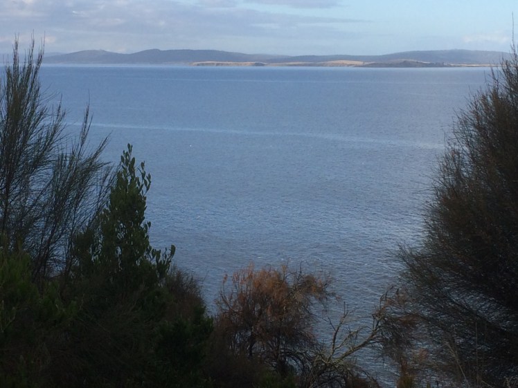
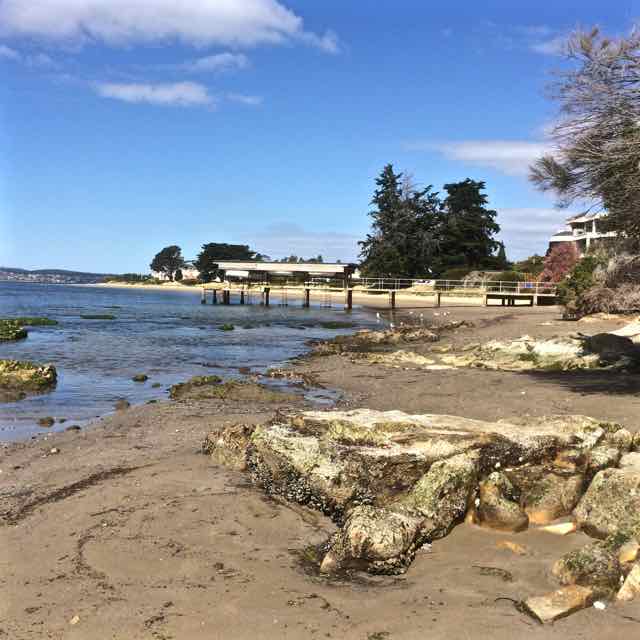
Clifton Beach and Cape Deslacs
It seems so long ago now, but during summer, shortly after friends told me they’d seen thousands of shearwaters from their yacht as they were crossing Frederick Henry Bay, we came to Cape Deslacs one evening to watch the shearwaters return to their burrows.
It seemed to me that this, really is the best way to experience the cape – as a refuge for these well travelled birds and so rather than wander its tracks or follow its roads, we sought out the viewing platform.
I’d once seen large flocks of Short-tailed Shearwaters (Puffinus tenuirostris) rafting in Port Davey and I’d seen the very first of them return one year from their long migration down the latitudes to Fisher Island, a tiny granite island in the Great Dog Island Group between Flinders and Cape Barren Islands. Those Fisher Island birds have been the subject of a longitudinal monitoring program extending back to the 1950s and because they return literally to the day, we were there when the leaders arrived. A scratching in the soil the next morning gave their presence away.
Although I’d read that they could be seen rafting off Taroona I’d rarely seen any on the Derwent River but when returning from Recherche Bay on Samos we saw for the first time in the D’Entrecasteaux a flock of perhaps two hundred winging their way down the Channel. I’ve been unlucky because these long winged birds are Australia’s most numerous seabirds and while there are no longer flocks of many millions, as the explorer, Matthew Flinders in 1798 asserted he’d seen, the flocks are large enough still to create awe when you see them.
The track to the platform led through native bushland. The day was already darkening and gradually the stars came out. In total there were four of us stargazing on the platform, our sense of self miniaturised by the Milky Way and the looming sky. All around Tasmania and especially around the Bass Strait islands great flocks of shearwaters were on their way home to their burrows but when the first dark shadows flitted overhead we thought at first that they might have been bats.
Aborigines believed they wintered behind the moon. That’s apparently how they got the name ‘moon bird’. They make a good meal and taste like sheep and so they’re more commonly called ‘mutton birds’. They might migrate almost the length of the globe on those metre long wings and swim proficiently with those webbed feet, and for a bird have a keen sense of smell, but they are so inelegant at landing that you swear they must sustain bruises. They are renowned for their excellent time management and for their magnificent sense of direction. They set off at the end of each Northern summer from the waters off Japan, Siberia and Alaska, barely, if ever making landfall, honing in on their tiny burrow at the far ends of the earth.
They partner for life (mostly), lay their single egg at the end of the November and watch it crack open in January. Then they take turns minding their one and only, feeding it up until it’s double their size. Come April they fly north without it and abandoned, wandering about and testing their wings, the chicks don’t eat. They tone down, feather up and intuitively follow their parents north a few weeks later in May.
Shearwaters are predators at sea and on land they are prey. The snakes that inhabit some Bass Strait islands rely almost wholly on the chicks for sustenance. It’s a physically close and terrible relationship. They are also commercially harvested for feathers, oil and meat and the traditional mutton bird harvesting practised by Aboriginal Australians continues. Modern life has thrown in further difficulties. Think gill nets and plastic, habitat loss and feral predators like cats.
That night on the cape the sky was soon awash with birds cascading down through the air. It was awesome. It was impossible to count them. There was a profound sense of a community returning, of lives lived with purpose and capability, of birds bringing their oceanic experience back with them and deep down into their burrows within the earthy skin of the cape.
Clifton Beach and Pipe Clay Lagoon viewed from Cape Contrierity
Tiptoeing Along a Cliff Edge
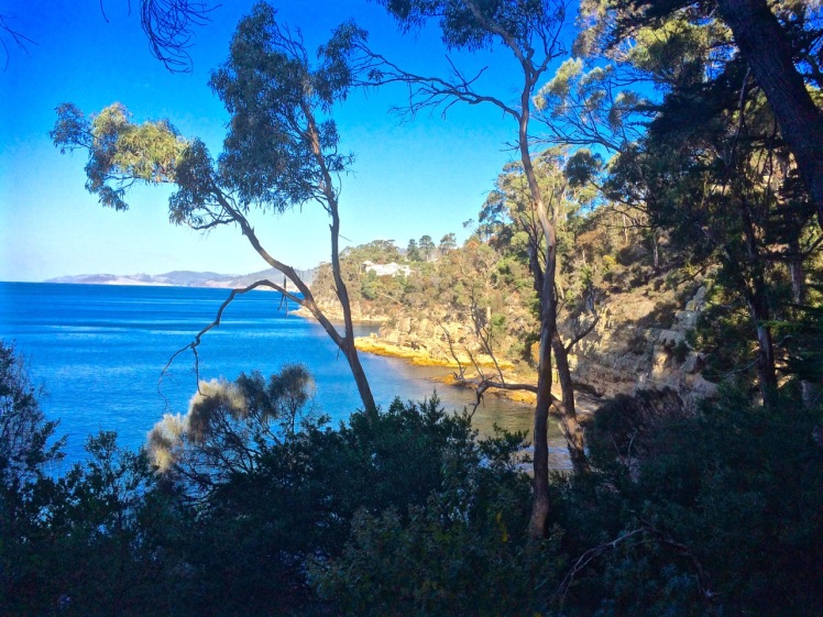
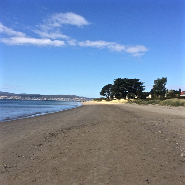
Zooming in with Google Earth I thought I spied a couple of small beaches north of Smugglers Cove and the light tracing of a path through what looked to be a nature reserve. It was enough to convince us that it was worth trying to tackle the cape from Clifton Beach on the northern side and so on a sunny day at low tide, while people swam between the flags and surfers lolled on their boards beyond the break Cathy and I scrutinised the dunes and the cliffs at the southern end of the beach and found a path that led up a steep gully. With an eye out for snakes, we scrambled up it, trusting our weight to the branches of a couple of conveniently located bushes.
There was a narrow strip at the top between the ‘keep out’ barbed wire fencing and casurinas rimming the high cliffs, some of which had fallen away. Peering over the edge we could see their broken pieces tumbled down against the sea.
We found a path, but it looked wallaby made and we meandered on and off it making a difficult passage over and under vegetation, sometimes trusting to the generosity of land owners by slipping over the fenceline to where the walking was easier. In one memorable spot, we had pretty well a foot wide space of sky we needed to cross. I avoided looking down. The drop was horrible, but Cathy skipped over it oblivious to Death’s outstretched hands.
Our tardy progress was made even slower because the views were compelling and so we’d stop, point out landmarks we were confident about and speculate about those we weren’t.
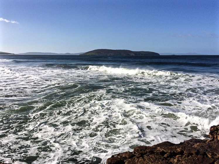
Clifton Beach and Cape Deslacs. Tasman Peninsula is visible across Frederick Henry Bay
We finally found ourselves on the far end of the casurina copse, gazing down a long slope of golden grass and up the slope on the other side. There was no clear path and it had the look of large expanses of private land. With a couple of households dotting the cape, we decided to avoid rebuke and reluctantly turned back, walking single file. Cathy quietly observed the tail of a snake disappearing down a hole between us, so we were pretty pleased to reach the beach unbitten, and as the day was still young and the beach glorious, we decided to take an amble to the cliffs below Cape Deslacs.
The interplay of land and water made the walk worthwhile
Not much has been written about this cape, but on Placenames Tasmania I discovered that D’Entrecasteaux had noted this name on his voyages of discovery and that it had another as well – Watsons Bluff. Watson was definitely no lady because it’s my observation that places get named after men, rarely women. No doubt he was merely an earlier landowner whose name buried earlier ones tangled with mythology,
I dug about on Trove as well and discovered a 2000 fisheries arrangement between the Commonwealth and Tasmania that referred to a shark nursery in the ‘area known as Frederick Henry Bay and Norfolk Bay being all waters within an imaginary straight line between North-West Head and Cape Contrariety’ and in an article on geology in the Sanford area, Green (1961) mentions dolerite intrusions into mudstone as well as landslips in the cape’s basalt soil. As he also mentions lavas here, this little cape has some complexity but keeps a low profile in the island’s literature.
‘The Mountain in the Water’ viewed from Mount Nelson
Who are you really, Betsey Island?
Betsey is a hump of island, the largest of the three in the Betsey Island Group and although it is visible from a number of Hobart suburbs, because of the hilly landscape and the peninsulas that surround the city, it often disguises itself as just another bump in the landscape. Like Tinderbox Peninsula, its reefs were shaped by volcanic activity and on three sides cliffs rise steeply. It has a small pebbled beach, Black Jack Reef lies between Betsey and Hope Beach and if Tinpot Island, also a member of the Betsey Group, is the sentinel for the Derwent River, then Betsey Island in Storm Bay is a sentinel as you sail towards Frederick Henry Bay.
Betsey Island and Little Betsey Island viewed from the Hope Beach reef
Sailing Betsey
I was pretty excited the first time I took part in one of the 29 nm races from its start at Castray Esplanade in the Derwent River, out around Betsey Island and back to start on a Trad 30. It remained a favourite race because it left the confines of the river and took in a stretch of coastline I walked but rarely sailed.
It was on race that I discovered that Betsey Island had a tiny companion, Little Betsey Island, tucked under its southern shoulder and that this little island trails a reef too. On the lovely Birngana, we came in tantalisingly close beneath Betsey’s eastern cliffs on one race (seabirds swirling above), seemed just behind Hope’s breaking waves on another and, each time I’ve done this race, it’s proved long enough to glide to a halt on a mirrored surface in the river, to enjoy a reach exhilaratingly heeled, to watch the sea state change time over time with the arrival of catspaws or wild gusts. Spinnakers up, or reefs in, maybe romping back up the river or stuck at the back of the fleet, the sailing on Birngana was always convivial, the rounding of the two Betseys full of curiosity and wonder, and the fun of the race always continued through drinks and snacks back in the berth.
Confused Identity
Names come and go and play a role shaping identify. For the longest time Betsey Island is understood to have been called Teemiteletta or Lore.by.larner.wa. There is a record of both names, presumably given by different tribes – the latter name seems linked to the Moomairremener, who had a myth about a group of girls who went across to Lore.by.larner.wa to enjoy themselves, but were chased by some men. To escape them they leapt into the sea and a spirit, Rageoropper, who judged in favour of the girls, turned the men into rock, while the girls swam back to rejoin their tribe. (Go girls! #metoo.)
Those name givers that made their way over the water to the island as wild swimmers or in their bark canoes left memories of their journeys by way of scatters of shell and stone. They’d have been seeking mutton birds, shellfish and penguin eggs. Bruni D’Entrecasteaux, the French explorer, called the mountain in the sea Willaumez Island after Jean Baptiste Willaumez, who was on board the Recherche with him.
In the 1800s the British came with a heavier footstep and in short succession the island gained a string of new names – Lady Franklin Island, Franklin Island and these days Betsey Island. It’s possible it may have been named after Betsey, the daughter of Sergeant MaCauley and his wife Maria, who farmed in the Clarence area and were friends with the Reverend Knopwood.
The island was still being used by the Moomairremener in the first years though, because in 1804 an aboriginal man was taken from the island into Hobart and the governor ordered him to be dressed in European clothes. Luckily he was able to escape that night (Nicholls, cited by Clarence City Council).
In 1814 another group of aborigines were found sitting around a fire on the island and encouraged to visit Hobart. Again they were inspected by the Governor and given clothes. After being offended by a local it is unclear whether they were taken to Bruny Island or drowned as they tried to reach it.
Betsey’s Many Uses
In the early days of the colony two convicts were placed there to signal when a ship was sighted, either by firing a gun by day or lighting a fire by night. It was used as a lookout by whalers.
It also became the home of the offspring of five rabbits who were on the First Fleet to Australia. In the 1820s, when the island was bought by a Mr James King, he built himself a stone house, took his water from a couple of fresh water springs and set about breeding rabbits for the Chinese fur trade, a profound shock to the island’s ecosystem. His endeavours were quite successful but he sold the island on for 470 pounds to Captain John Bell and Mr Crombie, who continued this business … and while the men sold rabbit pelts to China, the rabbits nibbled steadily through Teemiteletta’s pelt.
By the 1840s the dishevelled island had been bought by Sir John and Lady Jane Franklin for 910 pounds and one of her many creative notions was to establish a botanical garden or game reserve there. The plan never came together and the island was left to itself, although it was visited occasionally by fishermen and was the temporary hang out of a handful of deserters, feasting on rabbits and birds, no doubt, while they patiently waited for their ship, the Cicero (American) to leave Hobart.
Then, in The Mercury of 24 May 1876 there’s this intriguing report:
Land Slip at Franklin Island.
A letter received by Mr. J. W. Graves from’James Alexander, better known as ” Old Alick,” who has for some years resided on Franklin Island, recorded an interesting occurrence that occurred there on the 18th inst. Alick states that himself and the boy who resides with him were at the back of the island about four o’clock in the afternoon, when they had a narrow escape of being buried alive.
They had just crossed the flat ground at the back end of the long hill, when the land began to move steadily, ” the same as a ship being launched.” In a few moments an immense mass of earth,’ the best piece of land on the island, fell into the water, leaving, as the writer describes it, “a great gulf.”
Alick seemed very much concerned about it, probably from an idea that at any moment the whole island may disappear in a similar manner.’ He says it does not look like the same island, and wants Mr. Graves to go down and see it. Franklin Island, as is well known, was named after that noble lady who passed away last year; but the native name of it was Teemiteletta, or, mountain in the water. It was given by Lady Franklin to the people of the colony, and has always been looked upon with great interest. It would be a thousand pities if it was swallowed up in the Derwent.
The Real Owners
Forget the affairs and acquisitiveness of men. These two islands and the Betsey Reef are now part of a 176 ha nature reserve which somewhat protects its natural owners. On its rocky dolerite cliffs, with outcrops of sandstone, on its scree slopes, sedgeland and saltmarsh life exists. White’s skink and the she-oak skink live here. Birds add colour and music to the open eucalypt woodlands and burrow into the sandier soils but there is only one mammal – the silver-haired rabbit – that erodes Teemiteletta still – well, at least up until 2002 – but let’s hope the Tasmanian Parks and Wildlife Service has rectified this by now.
In 1985 and 1999, when Nigel Brothers and David Pemberton surveyed the island there were over 15,000 little penguins living there, joined in summer by approximately 150,000 shearwaters. The penguins, arriving and departing the island risked their lives because both professional and recreational fishers set nets just offshore. It is outrageous that nets were not been banned decades ago.
232 black-faced cormorant couples also lived on Betsey then. Kelp gulls were outsiders – only 3 pairs and 11 individuals set up home here.
They saw a white-faced heron. A pair of sea-eagles had a nest in the eucalyptus forest but wedge tailed eagles also had a presence. Other raptors included swamp harriers and the brown goshawk and in the Eucalyptus globulus woodland there were spotted pardalote, noisy miners, various honeyeaters, the grey butcherbird, the forest raven, the nankeen kestrel and silvereyes.
The thunder of the human footprint also exists in the weeds that limit Teemiteletta’s life giving generosity. Boxthorn and Cape Leeuwin wattle restrict the natural habitat available to the amazing diversity of species this small 175.13 ha island supports.
Beautiful Graveyard
I didn’t know when we sailed by Betsey that beneath us lay wooden and metallic corpses, now bejewelled with marine flora. Old ships need graveyards and since 1916 they’ve been dragged out to Little Betsey Island to create vibrant underwater gardens frequented by divers. Two of the ships are flattened 1930s freighters now lying off Little Betsey Island reef and a number of harbour vessels lie out to the west. There’s even a section of Hobart’s old pontoon bridge there.
Black Jack Rocks, closely associated with Betsey Island snared a nautical prize in 1994. Incat, Hobart’s ferry making success story, had been contracted to build Condor 11, a 78 m vessel, but on its trial in Storm Bay on 8 October 1994, there was a navigational slip up and in the darkness of the night the ferry rushed a full boat length on to the semi-submerged reef – and stayed there for a good two months, its stern and portside hull clear of the water, while repeated rescues were attempted until finally it was freed.
Fish Farms
Change is coming again to the mountain in the sea. Conscious of the damage done to the D’Entrecasteaux Channel and Macquarie Harbour, fish farms are moving out into Storm Bay. The proliferation in this area will have a negative environmental and recreational impact on the bay and the island.
Sources:
Brothers, Nigel; Pemberton, David; Pryor, Helen; & Halley, Vanessa. (2001). Tasmania’s Offshore Islands: seabirds and other natural features. Tasmanian Museum and Art Gallery: Hobart.
Donnelly, Area. Bunnies by the billions thanks to one gun-loving Englishman. The Daily Telegraph January 12, 2016.
HISTORY OF BETSY ISLAND. The Mercury (Hobart, Tas. : 1860 – 1954). Hobart, Tas.: National Library of Australia. 14 October 1913. p. 4. Retrieved 5 January 2016.
Wickham, Mark. 2005. Entrepreneurship and the management of innovation in the global marketplace: the Incat story. The Management Case Study Journal Vol.5 Issue2 Nov 2005: pp83-93
South Arm is Calvert country. The name is everywhere and at the eastern entrance to the river the Calverts once had fruit orchards on a farm called Pleasant View. In September 1939 they sold it to the army and in 1944 the army built Fort Direction. The military base extends across both Cape Deliverance and Cape Direction.
Even down at the bottom of the world, the idea of falling to the enemy made people jumpy. That’s why, from 1804, shortly after the colony was established and on into WWII, a network of batteries and bunkers was built down both shores of the Derwent to where in Storm Bay the river merges with the Southern Ocean. Standing right at the river’s mouth, Fort Direction and the Pierson’s Point battery were the first line of defence against enemies arriving by way of the Southern Ocean (Tasmanian Times, 25 Feb 2011).
Seacroft Bay and Fort Beach
On one of summer’s more perfect days, Cathy and I set off on a walk along Fort Beach, Seacroft Bay’s only beach. It was low tide and our ambition was to walk across both capes and on to Hope Beach. But the army had not responded to my request for permission to traverse military land and we anticipated that our walk would be a brief one that would end abruptly where the beach gave way to military land.
The low dunes backing the beach are infested with marram grass and the river had been nibbling away at them. Blessington Street runs behind them and the houses here enjoy superb views over the estuary. We chose to walk along the swash, stopping to consider an outcrop of rock emerging from the sand and remarking to each other that we had finally reached the last beach on the Derwent River’s eastern shore.
There was a woman with a dog quite a distance ahead of us. Beyond her a man took a path up from the beach and disappeared into the bush on to what had to be military land. If he’d gone that way then so would we.
The dog owner had stripped down to her bathers and was about to plunge into the perfectly transparent water by the time we reached her. We got chatting and she told us it was possible to continue on via the rocks, or alternatively by way of the path the man had taken. We quickly decided that the rocks would be more adventurous and walked on, undeterred by the sign we saw on the beach.
Passing four pied oyster catchers, I wondered about the impact of toxic waste on the birds who call by and unwittingly spread toxicity further afield and on those birds who make their summer residence here and possibly bury into it.
Cape Deliverance
The rocky platform at the base of Cape Deliverance was beautiful, the pools rich with kelp and seaweed. It was tessellated in places and there were dropstones and small formations that the geo later suggested were probably remnants of an earlier rock platform.
Soon we came to the kind of risky gulch that has you wishing you’d remembered to bring a first aid kit along, just in case. A little later we walked around a point and were elated to see the Iron Pot lighthouse right ahead of us, at the end of the low lying reef.
The Iron Pot light and the possible remnant from an earlier rock platform now weathered away
Pot Bay
This was not the only surprise. In Pot Bay, tucked between the two capes, there was another beach. While Fort Beach gives every impression of being the last beach, this secret beach appeared to hold that honour. Obviously I hadn’t been too observant when sailing passed this area, perhaps because it’s not possible to sail between the capes and the Iron Pot. There’s that dodgy reef and sometimes there are cray pots off it, so it pays to have ample sea room.
Marram grass hadn’t made as much of an inroad on this beach’s dunes. Native vegetation still owned them. Cathy pointed out that we were not the first to have visited that day. There were footprints: human, dog and bird.
Tucked away beside the dunes we found a structure made from driftwood and plastic debris and after enjoying it we carried on walking along this largely litter free beach.
Pots Bay and its beach. The Derwent, Hobart and kunanyi in the background.
The Last Beach on the Derwent
Beyond Pots Beach we found another, even smaller beach (T 414, Short 2006). Although little more than a 80 m cove below Cape Direction, it is the beach that actually has the honour of being the last beach on either side of the river.
The last beach
Tackling Cape Direction
That small beach was so protected we couldn’t get all the way around the rocks because of a fairly dramatic drop off and so we decided to do like mountain goats and scramble up the cliff. I was still picking my path upwards when Cathy disappeared from view. Although I was sure I’d have heard her if she’d fallen over the edge, I tried peering over the edge to make sure she wasn’t spreadeagled on the rocks below. I called her once and then I called her again, this time a whole lot louder.
She appeared above me and said she’d found a path. Trusting that no snakes were sunbaking in this vicinity, we made our way through tall grass and scrub to a path that led around the headland, taking cover when we noticed a Toyota 4×4 heading towards us. Behind us, and way up on Fort Hill, there are Defence Dept buildings and houses. The Toyota must have seen us but as no one accosted us we continued on our way.
Ahead we could see signs and a small concrete building. Later I read that:
‘The naval command [lived] on the hill at Fort Direction. These men had to carry out watch over the entrance to the harbour. A small weather board building of four rooms was constructed on the top of the hill with the adjacent flag pole for the raising of signal flags. A watch was maintained 24 hours a day from 1940 – 1945. As many as fifteen naval personnel lived in quarters just below the top of the hill.’ (Potter, RSL website)
The signs warned about asbestos in this vicinity but beyond them there were cliff top views to die for, so as a vague protection I held my phone in front of my nose. The sea breeze hadn’t yet roused itself and we figured any asbestos left on the surface was dormant today and must surely have been blown far and wide by now, or was beneath ground lining shearwater burrows. It was easier to simply not think about the other nasty chemicals we might be exposing ourselves too but instead to focus on the quite dramatic views of the Iron Pot and Bruny Island from this high vantage point. They were heady, and so we lingered.
As we searched around for an onward path we discovered that there were middens up and a steeply plunging cliff face on the north eastern side with a pebbled cove beneath it. We could now see all the way along the cliff line to Hope Beach. Hope looked so close yet so unattainable.
Headlands are tricky for walkers because the way can be barred by private land, but being military land we didn’t want to find ourselves in the middle of an explosives test. There were fences and box thorn and no doubt moon bird burrows, and although it was conceivable we might find a way, we decided on balance that we would turn back. I wondered about kayaking the capes and then I remembered one particular time I’d sailed them.
Midden in foreground. Beneath the cliff the cobbled cove. Hope Beach in the distance
The Capes by Sea
The fleet stretched out ahead of us one balmy Saturday on the return leg of a long distance race around Betsey Island. We were towards the back of the fleet, the conditions favouring lighter yachts and we were sailing excitingly close to the surf break off Hope Beach.
We were off Cape Direction when we observed that the boats out ahead of us had heeled dramatically. The big blue Beneteau liked rough weather. When lighter yachts heeled, she’d barely lean, but this southwesterly was intent on causing havoc. Much earlier in the day the frustration had been a long period becalmed while the rest of the fleet sailed a sneaky breeze.
We hadn’t even considered reefing before the wind whammed into us and the yacht heeled like I’d never experienced her heel before. Suddenly the cliffs and the Iron Pot, on what was now a lee shore, seemed exceedingly close and the normally laid back crew leapt into action with alacrity. There was a cacophony of yells to ‘down traveller!’ ‘main out!’ and ‘reef!’ And where there were usually one pair of hands on a line there was now the urgency of many, some at cross-purposes.
As we made it around both capes and the Iron Pot with sufficient sea room to keep us safe, the wind swung behind us, the crew grew animated with unanticipated hope and the yacht, now sailing in far more favourable conditions, began to power up steadily through the fleet.
The Iron Pot, the reef and Bruny Island in the distance. Beach T414 below.
Making Like a Ghost
Cathy and I turned back (but If you’re planning to walk further than us then see below for a couple of tips.)
This time we took the path that ran along the cliff top passed the shearwater colonies and in so doing bypassed the Lone Pine Memorial where a dawn service is held each ANZAC Day. At various points we tried short cuts but we didn’t want to damage burrows and the hollows behind the dunes roared ‘Snakes!’ at us and so we kept out.
There was something quite old time about taking the neat path we found over a fully mown hill as though we were on a clear road to somewhere, like walkers between villages in the olden days. The sweep up Fort Hill was devoid of people until we crested a rise and saw not very far away from us the same white Toyoto we’d seen earlier. Three people were bent over, working silently at some incomprehensible task, apparently just as eager to ignore us, while we, trying to avoid them, searched again (but more frantically) for a short cut off military land and on to the beach.
They were only about 10 metres away from us anyway, and we were beginning to feeling foolish. Tired of feeling like ghosts we called out, ‘are you conservation volunteers?’
‘Army,’ they said, avoiding eye contact, and turned back to fencing a tiny tree (a lone pine?) behind a small monument while we stood about a metre away photographing the little memorial in front of the tree with its engraving of the Dardenelles. Then, feeling as though we had transformed into ghosts again, we carried on down the path back on to Pot Bay Beach.
Au revoir, timtumili minanya
We had stood at the mouth of the Derwent (known before settlement as timtumili minanya to at least some of those living along its banks). Ocean beaches and headlands stretched out to the east. Our walk had included two capes and and had taken us from the river to the meeting place on the eastern shore of the Derwent River, Frederick Henry Bay and Storm Bay with three of the Betsey Island group of islands – Betsey, Little Betsey (hidden from our vantage points) and the Iron Pot just off shore. From this point on we’d be walking ocean beaches all the way to the mouth of Pittwater Lagoon, but we thought we might just have a go at seeing if we could walk Cape Direction from the Hope Beach side.
‘Thu 17 Aug South Arm to Cape Direction Grade: Easy Map reference: Blackmans Bay 1:25k Book by: 8:00pm Wed 16 Aug Start at: 10:45am at car park opposite South Arm War Memorial Group limit: 20 Bring: The usual daywalk gear This is an easy walk from South Arm to Cape Direction opposite the Iron Pot Lighthouse along a newly made track and the fore shore. We will do it `out and back` rather than as a circuit, avoiding the steep box thorn and mutton bird burrow ridden climb up from the western end of Hope Beach and precarious cliff top walk to the cape. It is an easy 4 hour walk with time for coffee at `The Sand Bar` on the way home. There are magnificent panoramic views, especially from the cape.’
* This is an Aboriginal name for the Derwent River, found in the Tasmanian Aboriginal gallery at the Tasmanian Museum and Art Gallery. Interestingly, the spelling for the people living along the western shore is given as Muwinina, which is different to the spelling I’ve found in other sources.
Johns Point and its Beach (T417): The minuscule, the long and the vast
There is a great sweep of rock platform with cracks and tessellations that curves around Johns Point at the western end of Fort Beach and then narrows as it wanders north along the base of the cliffs. We’d planned to walk out of Half Moon Bay south onto Fort Beach, but we ended up doing it the other way around because sometimes its okay to be contrary.
The Minuscule but Long
Invertebrates in their tiny rock pool worlds live their quiet watery lives along the reefs here, grazing and hiding out in the variegated forests of seaweed, while beside them the river and Storm Bay sweep one into the other. There’s an altitudinal order on the reef. When the tide recedes some barnacles, periwinkles and limpets will sit out the dry period while other reef species make sure they’re fully immersed.
Many of these tiny beings know more about the river than we would imagine and between conversations with Cathy as we walked along beneath the cliffs that sunny day I was contemplating barnacles in particular, those small hermaphrodites in their calcareous huts that choose to stand on their heads, that relative to their size have the longest penises* in the world (it’s true – move over, elephants!), their wispy little cirri feet swaying in the water but who look to be as sessile as trees. Why move, when the river brings endless meals of assorted meats and veg in the form of phytoplankton and zooplankton, right on to your calcareous plates and your perfectly adequate cirri spoon them into your mouth?
Only, if these arthropods were really that sedentary I wouldn’t find them seeking trips on Samos’shull, so what’s going on?
What’s going on is the exploratory tendencies of all of us who are either young or young at heart. After being brooded by their parent they become travellers in the body of water they find themselves in, swimming free in their naplius one-eyed larval stage, part of the great planktonic realms of the river. These little crustaceans are in their cyprid stage by the time they’re ready to settle down. Brushing up against a boat’s hull, they choose it. Landing on a rock, that’s where they stay. Shoved against a jetty paling, their little feet cling to it or, more adventurously, they hitch a ride on a passing whale**. The cement they exude from their antennae is so powerful science is trying to mimic it and Charles Darwin, who walked this river paying deep attention to its geology and life forms, had a particularly fascination for the not so humble barnacle — he knew of its achievements, both physical and chemical.
Vast
I knew from my earlier walks that across the Derwent, just inside the D’Entrecasteaux Channel, there were other rock platforms with a similar species richness and that just as the barnacle’s home looked like a tiny volcano, Charles Darwin had discovered deposits from an extinct one off Taroona. I was beginning to see how the vast geology of Tasmania reveals itself if you put on your walking shoes – fossils in siltstone and sandstone on either bank, similar weathering, layers of shell in the South Arm stratigraphy. We were enjoying the patterns unfolding in the rocks when unexpectedly we arrived on a little beach. Cathy pointed out a line of houses on the cliff top. My attention had been on the tiny secrets the rocks and pools were unveiling and I was somewhat surprised to see civilisation above the blue sweep of the river that was filling the hollows and depths of the drowned rift valley spread about us.
Beside the jetty we stood on the sand for a moment contemplating the scope of Half Moon Bay and relishing the fact that we had now walked its entirety, avoiding pesky roads. But beaches are transient landscapes. They change every day, and incrementally so do we. Some events marked in the sand – the small wanders of a plover, for example – get extinguished by wind or water. Some traces and tracks get sandwiched by sand, perhaps even fossilised. That’s one of life’s lessons you can read on a beach, the nature of memory.
We could not claim to know the beaches we had walked so far. In human terms, our meetings with beaches were no more than briefly meeting someone’s eye at a bus stop, but this walk around the reef, and the pleasure of discovering a beach was a completely fulfilling way to while away an hour at the end of a longer walk.
*This Californian Academy of Science video is worth a watch.
** A whale washed up on a NZ beach carrying some stupendous barnacles. A video worth watching because it also demonstrates the respect of the local maori for the whale.
The Bay of Fires from Humbug Point northwards is an exhilarating stretch of Tasmanian coastline. There’s just something about the white sand, the lichened granite boulders and the crystal clear water that combine to make it particularly awesome and peaceful at the same time. In summer, when it’s warm, the bush camping along The Gardens Road is the loveliest we’ve found in the state and in the cooler months there are plenty of beach houses available for hire.
Binalong is a small settlement on the northern slope of Humbug Hill, backed by a great reserve and with wonderful views. It has a tiny permanent population of about 200 people and is a mix of small shacks, large mansions and modest beach houses. There is no shop but there is a small cafe with a good menu and expansive views. Behind the bay and at the foot of the hill lies Grants Lagoon, wonderful for birdwatching or kayaking.
The complexity of the landscape – the casuarina forests, the photogenic rock formations and the dune trapped lagoons combine with the beaches to make this area totally compelling. Apart from cycling, swimming and kayaking, there’s a surf break at the northern end of Binalong Beach and at the southern end there are a number of beautiful coves separated from each other by massive boulders. There’s a gulch that forms a tiny harbour of sorts and these days an ecotour leaves from here and heads out by boat along the coastline as far north as Eddystone Lighthouse.
This spot hasn’t always been called Binalong Bay. It was once Boat Harbour but as there is also a Boat Harbour in the North West, it cast off name confusion and opted for something more indigenous. The Bay of Fires was known as Larapuna by the people these days known as the North East nation. There are believed to have been seven clans in all (Johnson & Mcfarlane, 2015) , roughly totalling about 500 people* who willingly granted seasonal access to the Ben Lomond nation, probably for reciprocal rights, enabling them to benefit from the area’s rich pickings. It was a meeting place and as the climate was mild, it could well have been where most Tasmanians chose to live in earlier periods of the Holocene.
The current name of the Bay of Fires was provided by Tobias Furneaux, who captained the HMS Adventure (part of Cook’s Great Antarctic Expedition of 1772-1775). He and his expeditioners noticed many campfires burning in this area at night, and aboriginal stone formations, seal traps, burial sites and middens still exist, so treading lightly and respectfully needs to go hand in hand with leisure and enjoyment when visiting this area.
After the European invasion, sheep farming, fishing, forestry and the transporting of these commodities grew in importance and on our last visit we discovered the tracks of what had once been a local railway. It follows a contour, then ends at the gulch, where today there’s a jetty and boat ramp.
We’ve been to the Bay of Fires three times this year. First we camped and then we brought some of our overseas family here. The mad keen cyclist promptly headed for the Blue Tiers track while the rest of us, being of more idle dispositions, merely rode from Binalong to the The Gardens, did a bit of Humbug Point exploring and had a pleasant amble along Binalong Bay Beach, the white sand soft underfoot.
It was only when we were at the farthest end of the beach where the big boulders begin, that we realised the cyclist had taken both sets of car keys. He was expecting us to meet him in Derby later on that particular day but his mobile had no Australian reception, so while he waited and wondered what had happened to us, we tried to relax into the knowledge that there was nowhere to go and nothing we could do except soak up the sun and admire the sublime view from the beach house.
The geo and I came back again shortly after our Hong Kong to London train trip. This time we focused on exploring with a little bit of kayaking thrown in for good measure. We met a local artist and had some long chats with a new friend who is walking the beaches from the Tamar to Freycinet.
Binalong Bay beach is a poignant beach for me. A good friend, who loved this spot too, had a heart attack on an early morning stroll along the sand and although he recovered, did not see out the year, dying on my birthday.
*Given the fact that European invasion of Tasmania caused numbers to collapse quickly and dramatically, this number is a best guess by some of those working in the field.
References:
Johnson, M & I. McFarlane. 2015. Van Diemen’s Land: an aboriginal history, UNSW Press, Sydney.
Kingston has three beaches. Boronia, tucked away behind cliffs is the most southern one.
Looking back at Kingston Beach from the Boronia Point track
May 2015
‘It’s a nudist beach,’ someone told me.
‘We’ve kayaked past it,’ the geo said.
‘Heaps of sea dragons. Brilliant for scuba diving!’
Whatever, the beach was there and I wanted to explore it. On foot. Especially because of a blog post and what the ornithologists had told me long ago – and then, when the time came, I totally forgot the most interesting thing about Boronia Beach. I was too engrossed in the place itself.
I had already had an encounter with Boronia Point. One Saturday, as we milled around behind the starting line with the fleet of yachts in the long distance race, I was surprised to discover that one buoy would be off that point.
‘Where’s that?’ some of the crew wondered, and S rushed off to confirm it on the chart. I planned to take a good look at the beach as we laid the line to that buoy but a great gust of wind swept down the valley and gave us a whack right at the opportune moment. We heeled with remarkable swiftness. There were yells to reef along with the arrival of that particular intensity that sharpens focus when the mast leans down to kiss the water and it’s all action stations on board. That’s why I totally forgot to study the beach.
This day there was a lot of canine energy going on as we three urban explorers (two of us canine) headed off along the track, starting on Boronia Point behind the Kingston Sailing Club, where Boronia Hill descends down to the water. They pulled me along, at first along the cliff top path under gums and casuarina trees. There are paths and wooden steps leading down to the track from gardens and hill top roads, and there is a small wooden bridge. On this day music drifted out an open window. Someone was practising at their piano, and an elderly man sat on a bench where trees give way to a swathe of grass, absorbing the long views north over Kingston and Tyndall Beaches and across the river to the South Arm Peninsula. The river gleamed with patches of white foam and still water. (It’s worth mentioning that rather sadly the bushland of the point is separated by a thick strip of houses and roads from the lovely top of Boronia Hill where there are tracks through remnant dry sclerophyll forest and delicious views from a grouping of large lichen dappled boulders beneath the trees.)
Soon we arrived at a fence, a gate and a sign saying reserve; no dogs, not cats, no camping – and there we turned back. I’d known this would be the case and I didn’t mind at all. This track was a real find. It made me feel expansive. I was happy to walk it any time.
THE SECOND EXPEDITION
Snow was forecast and although the wild wind had calmed it wasn’t until I reached Kingborough that the sky turned blue. Again the beauty. Again the piano music . I had a vague notion of what to expect beyond the gate because I’d explored the point using Google Earth the previous night, seeking a connecting path to Blackmans Bay further south but it was still a surprise to find that quite quickly after the gate the path started to descend. There are cyprus pines, the small cove of Boronia Beach opens up and the cliff line comes into view. Honestly, my first thought was Mama Mia! This could be a beach on a Greek island. Clearly a conventional thought – I’ve now seen is described this way many times. (But the sky has to be blue. I brought my sister here one overcast day not so long ago and it felt uncharacteristically sombre.)
The great view east: South Arm Peninsula hiding Ralphs Bay from sightLooking south with the Tinderbox Peninsula in the distanceBoronia’s cliffs. Not short on character
Some of the beach was in shadow but I had it all to myself (not a nudist in sight) as I wandered around absorbing its serenity. I discovered a manmade rock wall, quite low, just where there’s a rock platform, and I praised the cliffs for their beauty but mostly I was trying to find a way to walk to Blackmans Bay along the rocks.
There’s a small overhang below these cliffs (which are themselves full of incipient caves) and a crevice which stopped my progress. No route south, it seems, but as I walked back through the clearing I saw I now had company. Two people were walking stealthily and silently across the slope, bending down periodically to peer at the ground with torches. On their advice, I took a path that led me through a small gate, past a tap and into someone’s garden. Dead end. I turned back and discovered they had gone. Next I tried the path that led directly up the hill. It emerged through another gate (a weakness for this reserve – two gates) and onto a long dirt road, rather beautiful.
This sign reads no dogs, no cats, no camping… and people! Shut the gate!Jindabyne Road above the beach. Pony trap and picnic basket required.
I met a man collecting armloads of eucalyptus bark in a paddock on the other side of the road and somewhere around here the Boronia Country House Hotel once stood. Curzona Allport sketched it. You can see this print and a couple of postcards at the State Library of Tasmania. Back in the early 1900s people liked to take the ferry that docked at the Kingston Beach jetty and visit this hotel for refreshments, just like at Crayfish Point. A garden with rhododendrums and dreamy views. But I was more conscious of the cyprus pines and the casurinas that had dropped curled tendrils all over the paths, the wallabies that scattered as I made my way along the paths and evidence of middens, testifying to a pleasantly sheltered spot to light a fire and enjoy the river’s bounty before ships began coming up the river.
Making like a swimming pool
Looking north up the Derwent River from Boronia Beach
It was only when I was heading home (through that first gate into this reserve – left open by the party of three I’d just past – that I remembered that the ornithologists had told me that Boronia Beach is the home of one of the last remaining rookeries of little penguins on the Derwent. Even the sight of that suspicious couple with their tiny torches, walking where, ethically, they should not have been, peering down burrows, risking putting their troublemaking feet right through them – even this had not triggered memory. But what I did remember more clearly was a blog post written by Mike Litzow, an Alaskan cruiser who liked visiting this beach with his family while living in Hobart for a year. Someone had not shut the gate, he wrote – and here I just have to say how sickened I am by how many gates to reserves along the Derwent I find left open. Who are these people??
I’m letting Mike tell the story of blood and carnage. His story testifies yet again to our great disconnect from nature. Here’s the link. It starts with the death of one little penguin, ends with the death of more than 20 and the comments are worth reading too.
The rookeries around the Derwent are very small and very endangered. At Boronia I’ve witnessed the gates left open, human feet trampling and, on my visit there earlier this month, people camping.
There’s a concrete path that curves around the southern edge of Long Beach and leads out past Blinking Billy Point to Blinking Billy Beach. When the South Westerly is churning up white caps on the river this path is sheltered and has a great view north across Long Beach and down to the bridge but once you step from the behind the shelter of the hill the wind is out to get you and its Antarctic breath can cause your eyes to stream.
The narrow way
Conversely, when the tide is high and waves are being hurried into the bay by an exuberant North Easterly, you may find yourself attacked by an encroaching wave and forced to turn back. Mostly, though, it’s a sunny light hearted sort of stroll, long enough to sniff the breeze but too short to regard as exercise.
The view north on the path to Blinking Billy Point
A friend had told me there was a Sandy Bay beach where dogs were welcome any time of day but her description was vague and I had struggled to find it. Then one day, coming back up river after a weekend of sailing in the D’Entrecasteaux Channel I noticed two labradors with their people on a stretch of sand I hadn’t paid attention to before, and recognition dawned. It’s now become a favourite walk when the dogs are keen to go adventuring and I can’t quite match their enthusiasm, or I want to catch up with a friend for a coffee and treat them too.
As with most of this coast, Blinking Billy Point has changed names like people change clothes. It used to be called One Tree Point until (I’m supposing) that lone tree was no more. It was also once called Garth’s Point.
The Garth’s came here from Norfolk Island with seven children in tow and made a quick segue from the merest of shelters to owners of two land grants, the one encompassing the point and the land uphill through what’s now the Alexander Battery Reserve, and the other spread across Porter Hill.
The Garth’s were farmers by day and smugglers by night. The submerged reef below the point was called Garth’s Bank and served two purposes: fishing and smugglers’ lookout. Further uphill on their smaller Porter Hill grant, they built their smugglers’ hut and it lasted until a fire burned it down in 1978. Devon and Cornwall can move over, I think, because Tassie has a rich smuggling history too.
One fine day when we were idling past the point on a light breeze someone mentioned that long ago William Watchorn, harbour master, a man with nervous eyes, lived on the point. He lobbied for a light and he got it. Both the point and the light assumed his nickname: Blinking Billy. The light still stands and while its gaze was fixed and unblinking in its time, it works no longer and is disregarded by river traffic.
This light was rendered useless by the John Garrow Light, a navigational structure, cormorant hang out and sometime racing mark, that took its place offshore on Garth reef. For some obscure reason this light is named after a pastry chef who lived in Bath Street (Battery Point) and the pastry chef’s name was extended to Garth reef as well. It’s now known as the John Garrow shoal.
Blinking Billy LightJohn Garrow Light
For a low, unassuming point, Blinking Billy Point carries a wealth of history and interesting buildings. Along with the navigation light there is the remains of the searchlight emplacement. Two spotlights, precursors to the Dark Mofo lights, but focussed on defence not entertainment, lit up the sky from 1890 to WWII, playing their role as part of the the Derwent Defence Network, which included, in this vicinity, the Alexandra Battery further up the hill and the artillery at Fort Nelson.
Old spotlight emplacement
There’s also an old part of the city’s sewage system – a small blue pumphouse which was built in 1919 and is deceptively pretty.
The pump house
People still cast a line over the smugglers’ reef on fine days, but those of us who sail know only too well the river’s violent mood swings and I’ve seen kayakers caught out here, just metres off the pointt, overturned and struggling to reach the shore.
Sources:
Nautical News: the newsletter of the Maritime Museum Association of Tasmania. Winter edition, 2002.
Goc, N. 1997. Sandy Bay: a social history, Gentrx Publishing, Hobart.
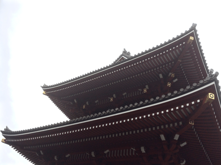
When someone you love says ‘Meet me in Tokyo,’ the temptation is just too great. I put my blog aside, abandoned social media and headed out into the world on a small adventure that involved food safaris, onsin challenges and meditative pilgrimages to shrines, both Shinto and Buddhist. In Kyoto the leaves were turning.
Sky Tree, the Asahi Flame and Sumida River
We took up residence for a while in Asakusa, an old part of Tokyo, where the Sky Tree towers over an already tall city and the Asahi flame, such as it is, lies heavily on its side beneath it. We were close to shrines, big and small, that honour the Bodhisattva Kannon who is intimately linked to the Sumida River. The story goes that back in 628 AD when the area was a delta, three fishermen hauled a statue of this particular Bodhisattva out of the river. The first shrine was made of straw. Now there’s a complex of wonderful shrines, including Tokyo’s biggest and most visited.
The gift of the Sumida River hasn’t saved it from all sorts of atrocities. It may know daylight but it has concrete hips. There’s minimal habitat for river species. The Derwent in comparison is a wild eyed hippie, a moody and creative artist with a flare for change.
I didn’t notice anyone fishing in the Sumida and barely a bird apart from a lone cormorant and a tiny flock of seagulls that flew into sight beneath a bridge. In fact, with a bridge literally every kilometre along its length there’s not much river traffic either because the bridges are so low.
Flying back into Hobart is a beautiful experience – that first riveting sighting of the mountain and that most magnificent of rivers, always so spectacularly stunning from the air, is riveting.
Once my feet were on the mountain and my eyes on the river, I felt reconnected to home, ready to curl my hand around the tiller, jump on my bike, lug my kayak down to the water or take another stroll along the coastline somewhere.
Nutgrove Beach with Sandy Bay Point at the far end.
Two beaches radiate from unassuming Sandy Bay Point: Nutgrove to the north and Long Beach to the south, with green and leafy Sandown Park fanning out behind the point. The Sandy Bay Sailing Club is prominent above the dunes. It, along with its parking area inhabit the dunes and the area behind them. Last summer a creative French traveller parked his colourful van here and settled in, just one of the travellers passing through in their camper vans, their tenures normally much briefer affairs.
The day I walked from Lords Beach to Sandy Bay Point I had Hobart’s early regattas and yacht races in mind along with that first horse race (see post on Nutgrove). In the early years of the colony Nutgrove was a wider beach and on this particular day I got a clue as to what it had once been like because as I walked around the Red Chapel cliffs and found the little cove the birds have been gifted I saw that everything about the beach was different. It was wider than I think I’ve ever seen it before and at Sandy Bay Point, where beach access at high tide is often not possible except over the fragile dunes, there was a surprisingly generous sweep of sand. I was so deeply absorbed in the past that it was almost unsettling that no horses hurtled around that corner as they did back in the early 1800s when local accents were different, dresses were long and riotous parties were a part of the regatta and racing celebrations – to the point that Sir John Franklin (of North West Passage fame and, locally, as the Governor) put a stop to the regattas below Government House because there was too much unruliness and litter. James Kelly, chair of the Regatta committee (who’d circumnavigated Van Diemen’s Land and discovered Port Davey), moved it to Chaffey’s Point (today’s Wrest Point). Mr Chaffey made a killing at his pub – and Sandy Bay Point featured more strongly in the races.
Wide enough to race horses
Sandy Point, back in the 1800s, had smuggling coves to the right of it and smuggling coves to the left. The little rivulets – Waimea, Maning and Lamberts, for example, provided access routes for getting smuggled grog up into the bush but the inns along the coastline were conveniently located for receiving rum and other spirits from the ships anchored offshore too.
One of these ships was the Thomas. One dark night in 1833 Captain Hanley anchored off Sandy Bay. He’d cut deals with the smugglers, so his pockets were full and likewise the longboats were all weighed down as the smugglers rowed back into the coves.
Later that night the Thomas went up in flames and the fire raging on the river lit up the sky, mesmerising those awake on shore and ‘looking almost splendid’ according to an onlooker. Hanley and three other crew members were the only ones on board at the time. They jumped into a longboat and set off for the shore but because the fire seemed contained to the stern they returned for another look, while two boats, the Mary and the Stakesby came slowly to their rescue. As they stood near the poop the fire reached the magazine and their was a massive explosion. In the little farm houses along the coast people asleep in their beds shot upright and got to experience an unanticipated fireworks night. Somehow the sailors escaped with their lives.
‘At eight o’ clock on the Sunday morning the dying Thomas was towed burning to nearby Sandy Bay Point where she grounded in about five feet of water and continued burning through the Sabbath with crowds flocking to Long Beach to view the spectacle. (Goc, 1997).
Suspicion over who’d started the fire swirled through the community and over the ensuing days what was left – casks of rum and casks of salt floated on the water, easy pickings for the opportunistic.
The Thomas stamped its presence on the point, predating the ‘boat park’ with its pirate ship in Sandown Park. In fact, in 1880 ‘H’ wrote ‘…anyone walking now along the beach at high water past Murdoch’s fence would hardly believe that the ship Thomas which was wilfully burnt about 1831, and was beached at Sandy Bay Point, was available to ramblers at low watermark. Many a time I have with my young companions mounted the ribs of the old ship, which stood on the sands, a place which to get at now would be in 20ft water.’
It’s a whodunnit without an answer. The fire may have been caused by a smuggler dissatisfied with his deal, a mutinous crew member or, for all we know, the captain himself.
Source: Goc, N. 1997. Sandy Bay: a social history. Gentrx Publishing, Hobart.
Sandy Bay Sailing ClubRounding Sandy Bay Point
Approaching Sandy Bay Point: the path over the eroding dunes
Prossers Restaurant: a prime position on Sandy Bay Point. Rocks shoring up the eroding beach, usually below waterThe Sandy Bay Point walkway to the beach


")