Breaking Away: Hong Kong to London by Train

 The Joys and Sorrows of a Small Blue World

The owl is calling in the garden.  The river is quiet, the mountain is alive with night life of a different kind… the wallabies, bandicoots, sugar gliders, frogmouths and the moths.  This is home but sometimes it’s nice to go away and expose yourself to the joys and sorrows of a greater world.

The Trans Siberian Express, and Then Some

I had thought that by focussing my attention on the local coastline I’d subdue the travel bug but that’s a hard call when someone you love wants you to visit them in London.

Of course you say yes.

But to tread more lightly on the earth we decided to take the train from Hong Kong to London – a cruise overland, country and cultures slowly revealing themselves.  Sailors who have spent days at sea get this but most people I told were bemused. ‘That’s a long time on a train,’ they said.

In fact, the days flew.

I’d do it all over again in a heartbeat even though you see the damage as well as the beauty.

Silent Summer

Whenever he emerged from the vodka soaked conviviality he was enjoying with the Russians in the next compartment, the American would say, ‘Why has China got no bugs?’  And I would reply, ‘Why are we not seeing any birds?’

It seemed a silent summer.

Between Hong Kong and Beijing we saw a horse, a cow and a few tiny flocks of sheep but no birds.  We saw new cities of derelict buildings and a countryside devoid of life.  As we walked seven stages of the Great Wall  one hot and humid afternoon we encountered two red bottomed bumble bees (name unknown) and although about half the bumble bee species known to the world occur in China, I see heaps more in my garden on any sunny summer’s day.

Siberia does have insects. We met our first big winged thing at the border. Siberia also has a multitude of mosquitoes, but across it’s whole extent we barely saw a bird, let alone a flock, despite passing wetlands, Lake Baikel and rivers.

‘There’s plenty of wildlife in Russia,’ said one of the Russians.  ‘I’m going hunting as soon as I’ve unpacked my bags.’   And after giving the matter some more thought, he said the train probably scared the birds away.

Slicing through country in a train is no way to monitor wildlife  but in trying to find out why the emptiness I found my concerns are shared by Pakistan – they’ve noticed a drop in migratory birds from Siberia.

Australia has also noted a similar collapse.

Personally, I’m sad the birds were foraging elsewhere because Siberian birdlife is magnificent and migrating flocks, though smaller, are also  apparently returning home  earlier than usual each year.

We saw two storks in Poland, the odd bird in Germany and a small flock of waterfowl  in Holland. In the UK the skies were busier but we were on foot and bicycles there and that might have been the difference.

Plastics Rule

Walking through history and past longboats along the lovely Regents Canal in London, birds were nesting amongst the plastic drifting on its surface (see below – that mound in the water is a nest).

Regent Canal plastic

We rode along the Thames to Greenwich, looking at the little beaches where in the nineteenth century mudlarks (the human variety) searched for pickings. A small yacht negotiating the lock from the Thames into the Limehouse Marina was surrounded by plastic litter, a bit like that nest.


Yacht entering Limehouse Basin Thames River bike ri

No Tasmanian Coastline, This

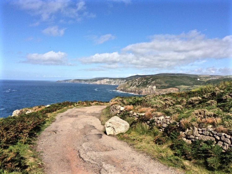
We cycled from St Michael’s Mount to Mousehole in Cornwall and walked from St Ives to Zennor.

It was summer; it was magical. The weather was warm, the leaves full of sap, the wild flowers  in blossom and the breeze was fragrant.

Land's End

It was tough returning to winter.

Storms had pummelled the island while we were away. The Hobart Rivulet, imprisoned beneath the city streets had flooded and damaged buildings.  It had been an expensive and inconvenient pest, apparently, but I felt empathy for its bid for freedom.

It just wanted to do what rivers do best: shape and nourish landscapes.

And me: I’m just dancing in the rain because hey, it’s still a vibrant, abundant world with far more joys than sorrows, and there’s an owl calling in the garden.


Derwent River: Tinderbox Beaches: Pierson’s Point

Geographical Anxieties

 D’Entrecasteaux gave the point this name when surveying the area in 1792.  It was also known, briefly Point Lewis and Blythe’s Point. 

(Source: Robinson-Moore, 2014) 

Light and cannon and Bruny from Piersons
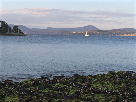
Piersons Point with the Tasman Peninsula in the distance and Bruny Island just across the water

Just because you’re a long way from an empire’s capital, with limitless miles between your island home and battlefields and just because a feud can begin and end in the space of time it takes to receive a letter  doesn’t mean that you’re not going to get the jitters hanging out at the end of the world.  So when Governor Lachlan Macquarie visited the Hobart Town settlement in 1811, his mind turned to the enemies that could arrive unannounced up the Derwent River – the French, for example, not that long ago defeated in the Napoleonic Wars.   His perspective was military; the place clearly needed fortification, and so a network of batteries, some interlinked by means of tunnels, took shape along both the eastern and western shores of the river.  I had long ago passed Alexandra Battery, which sits above Blinking Billy Point.  The battery at Piersons Point is significant because along with Fort Direction on the far side of the river, it protected the river mouth (although it was a late comer to the system as it was actually only constructed and used during WWII).  Prior to that time there was a pilot station here, at the junction between bay, river and channel and on fine days the family based at the Iron Pot lighthouse sometimes rowed across for a bit of conviviality.

When we’d arrived after our wander along this stretch of shoreline, there were some Sudanese children  playing tennis on the court that seems as oddly placed here as the idea of a battery is now.   Bruny Island is a short hop across the water, the river was to my left, the D’Entrecasteaux Channel flowing into it from my right, and Storm Bay spread south. I could look back down the long stretch of coast I had explored and across the river to Cape Direction and the Iron Pot light.

It had taken a bit of research but I now knew that the river was not only a drowned river valley but also a rift valley.  I knew there was a bar beneath some 15m of water just north of Pierson’s Point and I knew that there was likewise a bar running from Piersons to Dennes Point on Bruny Island, because the depth instrument on Samos registers this as we sail over it.  But the geo had also put me straight about the the river, the channel and their geological inter-relationship and his take is attached at the bottom of this entry.

It was ages since I had set out to explore beaches, yet here I was still in the Derwent.  I had discovered parts of the shoreline I hadn’t really known existed.  I had discovered it’s vague and sketchy nomenclature and I had discovered that it wasn’t supporting nearly as many birds as I had anticipated.  I now knew these beaches were pocket beaches and that it’s pointless walking beaches without giving equal weight to the coastline in between and I had discovered that the means of travel impacts greatly on the experience.  My most profound realisation had been that I was not nearly as hefted to the land as I had once thought I was.

I’d walked along Tinderbox’s spine but the road is narrow and while picturesque it can occasionally be at an unrewarding distance from the river.  I knew I would cycle it one sunny day, but that’s more about a ribbon of bitumen than it is about the river and its beaches.  I sail this coastline frequently, but then my attention is more on the boat’s interaction with wind and water. That being so, I felt I wouldn’t have done it to my liking unless I kayaked it too.  I thought that in my kayak I could really acquaint myself with its rocky shore.  And besides, hidden among those cliffs was, bizarrely, a secret door and I was keen to find it.

We set out the teapot and cups, then sat down and enjoyed a little tea ceremony to honour the Derwent.  There were cumulus clouds in a blue sky. On such a stunning day,  watching the ferry crossing the channel further south  between Kettering on the Tasmanian mainland and Roberts Point on Bruny Island those old geographic anxieties seemed peculiar indeed.   My geographical anxieties were of a far smaller scale than the governor’s.  They were focussed on how I was going to co-ordinate my blog with the places I was intent on exploring. How to proceed, I was wondering. South down the Channel, and if so by what means?  Or north from Sandy Bay through Battery Point and if so, how far up river?  And if I mixed it up how would I keep a sense of continuity going in both my brain and on my blog?


Dennes point from Pierson's Point
Looking across at Dennes Point, Bruny Island from Piersons Point.


IMG_4183
Lacking the grace of an old lighthouse and looking more like something from outer space. Automated light at Piersons Point with the Iron Pot lighthousein the distance.

The geo’s take: Derwent Rv and D’Entrecasteaux Channel.

See also On the Convict Trail

And Beach Stories, for life at the old Pilot Station


Derwent River: Tinderbox Beaches: Not the Real Fisherman’s Haul

Beaches T 471 (Fisherman’s Haul) & T472 Fisherman’s Haul South

Having scrutinised more maps I began to doubt that the Lucas Point Sewage Plant was actually at Lucas Point.  It’s the landmark that helps identify Fisherman’s Haul and as conversations with locals had helped me fix it in my mind that it lay just south of Flowerpot Hill I started to think that the problem was one of language – ‘just’ is a stretchy kind of word for a start, and may not have been used by anyone I’d spoken to.  It may simply have been a supposition I’d made from what had been said to me.

Our modus operandi was to drive along the Tinderbox road slowly (not difficult – there were quite a few cyclists out and about) and check for detours down the slope.  The geo noticed a sizeable piece of green land with car tracks on it, somewhat sheltered from the road by a partial row of caesurinas.  We did a u-turn and went back to investigate.

Close by a man was burning off.  He ambled over to talk to me and I asked him if this was Lucas Point.

‘Some people think it is, but it isn’t really.’

‘Is it back where the sewerage plant is?’

‘Nope.  Some people think that’s Lucas Point too, but it isn’t really.’

‘So where is the real Lucas Point?’

He pointed vaguely over his shoulder. ‘Back there a bit.’

‘Okay…  And so I’m wondering, if Lucas Point is back there, then is this Fishermans Haul?’

‘Some people say it is but it isn’t really the real Fishermans Haul.’

‘Is there a beach down there?’

‘Nope.’

‘Is there a path down?’

‘Maybe.  You should be okay if you’ve got your balancing shoes on.’

‘Well, thanks, I might go and explore.’

The geo  was down at the bottom of the slope reading a sign.  It stated ‘Lucas Point’.  A thin band of caesurinas lined the vertical cliff top so we put the dogs on leads and slithered down a very steep path of sorts beside a short deep gully carved by another youthful rivulet, at that time dwelling soley in a few remnant pools.  An old rusty cable lay beside the track but we couldn’t identify a use for it unless haulage came into it.  It didn’t take at all long before we came to the end of the path.  It stopped for me at a rather cracked and fragile looking rock arch left over from a previous coastline.  It might have been fine to walk over it onto the high rocky platform but I didn’t like the look of the cracks in the unconsolidated cliff face to which it was attached.  The geo and the dogs stopped a bit further back because it really wasn’t a place for the dogs to be at all – it was all rather precipitous.

Looking down at Lucas Point Tinderbox
The rocks at the real Lucas Point; climbers’ secret

It goes without saying that the long views  were superlative.   Down this end of the river we were getting closer views of the Iron Pot, the lighthouse at the entry to the Derwent River and in the southern curve of Lucas Point (the cliff I was presumably standing on) was a very beautiful and quiet cobbled beach and just to the north of where I was standing was another cobbled beach.  Looking directly south at the cliffs that work around to Passage Point I saw a third.  And looking directly down was a tiny narrow gulch.

Fishermans Haul North from Lucas Point
Fisherman’s Haul
Looking south to Passage Point from Lucas Point
Looking south from Lucas Point, the beach below Passage Point just visible.

Andrew Short notes a Fishermans Haul (S) and a Fishermans Haul.  Here’s his description of Fisherman’s Haul:

‘Fishermans Haul is a small curving cobble beach (T 471) located to the lee of 40 m high Lucas Point. Steep vegetated bluffs rise to 50 m behind the small beach, which is partly sheltered by the point and rock reefs resulting in low waves at the shore. The road runs along the top  of the bluff 100 m west of the beach with access via a steep descent. ‘(Short, 2006)

And here’s his description of Fishermans Haul South:

‘Beach T 472 commences 100 m south of the Haul, and is a 200 m long east- to northeast-facing narrow high tide cobble beach located at the base of 50 m high cliffs, with a steep gully descending to the centre of the beach.’ (Short, 2006)

New discoveries!  Seen so often from the water but not really properly seen at all.  I was happy to believe the sign and this time, added to the slippery geography I’ve been doing battle with, was that local’s wicked sense of humour and the entertainment he got from causing confusion.

This coastline may seem impossible to access on foot but later I discovered that it’s loved for being a climbing area rich in deepwater solos, that method of climbing that evolved in SW England.  Nick Hancock makes it clear that for this you need a kayak you can tie up while you climb up dolerite boulders or columns at this point and you need to be confident that the water is deep and safe enough to splash down into.  Don’t even think about trying this unless you have plenty of experience, not just about deepwater solos but weather conditions and the sea state too because Tinderbox is unforgiving. And if you think the name makes it promising for fishing, pack your tackle and take your rod further afield.  Too many fish have been hauled and this area is now protected within the bounds of the Tinderbox Marine Reserve – no fishing allowed.

The view east from Lucas Point Tinderbox
View across the river to South Arm from the real Lucas Point.  The Iron Pot is that tiny dot to the right.


Derwent River: Blinking Billy Point

The Geography of Nervous Twitches

There’s a concrete path that curves around the southern edge of Long Beach and leads out past Blinking Billy Point to Blinking Billy Beach. When the South Westerly is churning up white caps on the river this path is sheltered and has a great view north across Long Beach and down to the bridge but once you step from the behind the shelter of the hill the wind is out to get you and its Antarctic breath can cause your eyes to stream.

Blinking Billy Path
The narrow way

Conversely, when the tide is high and waves are being hurried into the bay by an exuberant North Easterly, you may find yourself attacked by an encroaching wave and forced to turn back. Mostly, though, it’s a sunny light hearted sort of stroll, long enough to sniff the breeze but too short to regard as exercise.

Looking north on the walk to Blinking Billy Point
The view north on the path to Blinking Billy Point

A friend had told me there was a Sandy Bay beach where dogs were welcome any time of day but her description was vague and I had struggled to find it. Then one day, coming back up river after a weekend of sailing in the D’Entrecasteaux Channel I noticed two labradors with their people on a stretch of sand I hadn’t paid attention to before, and recognition dawned. It’s now become a favourite walk when the dogs are keen to go adventuring and I can’t quite match their enthusiasm, or I want to catch up with a friend for a coffee and treat them too.

As with most of this coast, Blinking Billy Point has changed names like people change clothes. It used to be called One Tree Point until (I’m supposing) that lone tree was no more. It was also once called Garth’s Point.

The Garth’s came here from Norfolk Island with seven children in tow and made a quick segue from the merest of shelters to owners of two land grants, the one encompassing the point and the land uphill through what’s now the Alexander Battery Reserve, and the other spread across Porter Hill.

The Garth’s were farmers by day and smugglers by night. The submerged reef below the point was called Garth’s Bank and served two purposes: fishing and smugglers’ lookout. Further uphill on their smaller Porter Hill grant, they built their smugglers’  hut and it lasted until a fire burned it down in 1978. Devon and Cornwall can move over, I think, because Tassie has a rich smuggling history too.

One fine day when we were idling past the point on a light breeze someone mentioned that long ago William Watchorn, harbour master, a man with nervous eyes, lived on the point. He lobbied for a light and he got it. Both the point and the light assumed his nickname: Blinking Billy. The light still stands and while its gaze was fixed and unblinking in its time, it works no longer and is disregarded by river traffic.

This light was rendered useless by the John Garrow Light, a navigational structure, cormorant hang out and sometime racing mark, that took its place offshore on Garth reef. For some obscure reason this light is named after a pastry chef who lived in Bath Street (Battery Point) and the pastry chef’s name was extended to Garth reef as well. It’s now known as the John Garrow shoal.

Blinking Billy Light
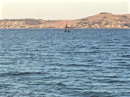
John Garrow Light
John Garrow Light

For a low, unassuming point, Blinking Billy Point carries a wealth of history and interesting buildings. Along with the navigation light there is the remains of the searchlight emplacement. Two spotlights, precursors to the Dark Mofo lights, but focussed on defence not entertainment, lit up the sky from 1890 to WWII, playing their role as part of the the Derwent Defence Network, which included, in this vicinity, the Alexandra Battery further up the hill and the artillery at Fort Nelson.

Searchlight
Old spotlight emplacement

There’s also an old part of the city’s sewage system – a small blue pumphouse which was built in 1919 and is deceptively pretty.

Pumphouse for blog
The pump house

People still cast a line over the smugglers’ reef on fine days, but those of us who sail know only too well the river’s violent mood swings and I’ve seen kayakers caught out here, just metres off the pointt, overturned and struggling to reach the shore.

Sources:

Nautical News: the newsletter of the Maritime Museum Association of Tasmania. Winter edition, 2002.

Goc, N. 1997. Sandy Bay: a social history, Gentrx Publishing, Hobart.


Derwent River: Maning Reef: A Beach Where the Rocks Used to Be

Unveiled beaches and doppelgängers

Saluting the Governor

The sailing season officially opened last Saturday, the 10th October and Hobart’s recreational sailing fleet turned out in good numbers for the annual sail by  the Governor’s vessel Egeria, moored in Sullivan’s Cove.  Some boats adorned themselves in nautical finery.  We forgot to take off our fenders but by the time we realised this we were relaxing at the rendevouz off Nutgrove Beach and having imbibed a wine or two were feeling too mellow to care that we had not kept up appearances.

The geologist and I had invited three friends along, one an able seaman of the four legged variety, our sole adornment in his coat of yellow.  The sky was blue, the sun shone and there was a breeze strong enough to fill sails.  As this was the first time I was skippering on an opening day we stayed on the edge of the fleet, detouring under the bridge, confusing ourselves over the instructions until order was established in the fleet. We snuck in towards the rear, trying our best to keep ahead of the  Beneteau and MONA cat bearing down on us as we headed into the tight conditions in Sullivans Cove, more alarming last year on a larger boat.

IMG_5795

We dropped our anchor at the back of the fleet, by now mostly rafted up together off the beach, and I lined us up with a group of large boulders off Maning Reef, clearly much loved by cormorants. The tide was low and the coastline had a surprise for me. Lords Bay had spread itself out. It wasn’t a little beach at all but a long, thin sandy beach running along the back of Maning Reef all the way to Red Chapel Beach, validating my belief that in earlier days this coastline was one long stretch of sand, at least between Short and Long Beaches, if not beyond. As we drank wine and picnicked and the talk turned to rugby, I discussed its changed appearance with E who knew this stretch in all its variations better than me.

Later I quizzed a friend who lives above this beach for a bit more information, and then, when the tide was low yesterday afternoon I went walking, hoping to find bouquets of sea tulips waiting for me on the jetty pilings.

And here’s the thing. I didn’t find a single one, but I did find numerous other little squirts who looked remarkably like pyura Doppelgangera and squirted just to show me how it’s done.

IMG_5769
Oysters and sea squirts on a jetty piling.

Despite their name they hadn’t contrived to look anything like the elegant sea tulip I was beginning to believe I’d conjured up. They’re squat, rotund, pustular and a mucky colour, probably impeccably beautiful for blending into their surroundings but a challenge for the human eye to appreciate aesthetically.  A Tasmanian native, it’s well travelled, having hitchhiked on boats since ships first came here, making a pest of itself in New Zealand and the mainland.

I walked on, from stormwater drain to jetty piling to rocky outcrop musing about what it really was I’d seen on the hull. Had it really had a stalk? Had it even been red? Chances are it wasn’t a tulip at all but one of these doppelgängers given they are particularly captivated by artificial structures, according to the literature.

IMG_5767
A green tongued stormwater drain.

While thinking about how dramatically we have changed the ocean and the locations of its denizens,  I located Maning Rivulet (I think) which gave me a small thrill.  As I reached the little cove I’d seen from Samos when sailing with my friend the sky filled with tiny floating seeds like small white butterflies.  They made drifts on the sand and  laced  the rock pools, and the next day, around in New Town, the same phenomenon took place beside New Town Rivulet and I saw that they came from tall graceful trees whose name I still need to find out.

IMG_5859

Here are some more photos of the Maning Reef section of the walk that I took with my trusty iphone 5s.

They’re in no particular order.

IMG_5766

IMG_5784

One of two stormwaters very close to each other that are probably both linked to Maning Rivulet

IMG_5848

Jetty and the Casino
Looking back at the jetty and Casino
Ducks drinking from a stormwater
The consequences of our filth
Reaching the cove at Red Chapel Beach

Inspiration Has Many Threads (3)

Small Adventures

Version 3

We live in a wonderful world that is full of beauty, charm and adventure. There is no end to the adventures that we can have if only we seek them with our eyes open. 

~ Jawaharial Nehru

This year no further overseas travel is on the agenda. A small yacht, perfect for exploring the Derwent and the D’Entrecasteaux, has been nibbling at my wallet as yachts and ponies are known to do.  But the boat is a partnered venture. There are weekends when I’m free to do other things.

One Sunday, with the boat on the hard, I suggested we go up the Derwent Valley, away from the coast, to see the leaves turning. At Plenty we kept on going. Soon we were passing the farm where we’d once holidayed with friends. A fine drizzle blurred the land but on we went into territory I’d all but forgotten. I could barely remember the Craigbourne Dam and it was a novelty to stop in Hamilton (a tiny sandstone town surrounded by hills) for a coffee.

This sense of disconnection had me thinking about local adventures – small adventures with more modest carbon footprints than jet planes. Deciding against googling the definition of ‘small adventures’ I decided that for my purposes a small adventure would be limited to the state, either planned or serendipitous. I believe you can have an adventure sitting mindfully in a garden if you are open to the world about you. It’s how birds land on your head and skinks climb over you. There does not need to be high drama or fear of loss of life or limb. An event or occasion can be an adventure, it simply depends on cultivating a particular state of mind, squeezing adventure from what’s already known and ordinary. An adventure can be minuscule but the pleasure can be immense. It could involve an epiphany. Conversely, there could be terror.

I had thought, when I took up sailing, that I would drift beneath a blue sky sipping gin and tonics. Instead I’ve got to know the wild wind and I’ve enjoyed countless exhilarating days on local waterways, getting to know these aspects of the island better but neglecting to stay in touch with others.
So I made a decision. My year of small adventures would be opportunistic and would focus largely on sailing and beaches, be that by foot, kayak or bicycle.  And for that I needed a plan.

Kelp detail