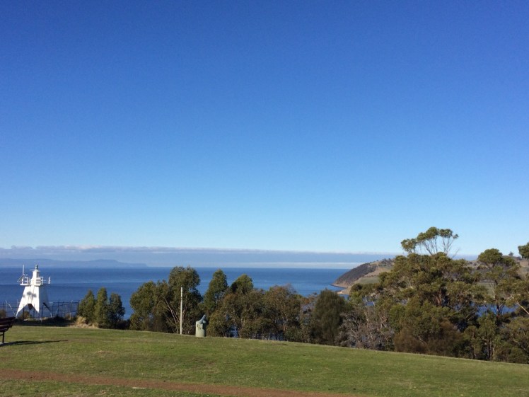
Piersons Point with the Tasman Peninsula in the distance and Bruny Island just across the water
Just because you’re a long way from an empire’s capital, with limitless miles between your island home and battlefields and just because a feud can begin and end in the space of time it takes to receive a letter doesn’t mean that you’re not going to get the jitters hanging out at the end of the world. So when GovernorLachlan Macquarie visited the Hobart Town settlement in 1811, his mind turned to the enemies that could arrive unannounced up the Derwent River – the French, for example, not that long ago defeated in the Napoleonic Wars. His perspective was military; the place clearly needed fortification, and so a network of batteries, some interlinked by means of tunnels, took shape along both the eastern and western shores of the river. I had long ago passed Alexandra Battery, which sits above Blinking Billy Point. The battery at Piersons Point is significant because along with Fort Direction on the far side of the river, it protected the river mouth (although it was a late comer to the system as it was actually only constructed and used during WWII). Prior to that time there was a pilot station here, at the junction between bay, river and channel and on fine days the family based at the Iron Pot lighthouse sometimes rowed across for a bit of conviviality.
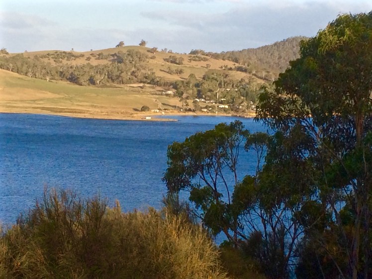
When we’d arrived after our wander along this stretch of shoreline, there were some Sudanese children playing tennis on the court that seems as oddly placed here as the idea of a battery is now. Bruny Island is a short hop across the water, the river was to my left, the D’Entrecasteaux Channel flowing into it from my right, and Storm Bay spread south. I could look back down the long stretch of coast I had explored and across the river to Cape Direction and the Iron Pot light.
It had taken a bit of research but I now knew that the river was not only a drowned river valley but also a rift valley. I knew there was a bar beneath some 15m of water just north of Pierson’s Point and I knew that there was likewise a bar running from Piersons to Dennes Point on Bruny Island, because the depth instrument on Samos registers this as we sail over it. But the geo had also put me straight about the the river, the channel and their geological inter-relationship and his take is attached at the bottom of this entry.
It was ages since I had set out to explore beaches, yet here I was still in the Derwent. I had discovered parts of the shoreline I hadn’t really known existed. I had discovered it’s vague and sketchy nomenclature and I had discovered that it wasn’t supporting nearly as many birds as I had anticipated. I now knew these beaches were pocket beaches and that it’s pointless walking beaches without giving equal weight to the coastline in between and I had discovered that the means of travel impacts greatly on the experience. My most profound realisation had been that I was not nearly as hefted to the land as I had once thought I was.
I’d walked along Tinderbox’s spine but the road is narrow and while picturesque it can occasionally be at an unrewarding distance from the river. I knew I would cycle it one sunny day, but that’s more about a ribbon of bitumen than it is about the river and its beaches. I sail this coastline frequently, but then my attention is more on the boat’s interaction with wind and water. That being so, I felt I wouldn’t have done it to my liking unless I kayaked it too. I thought that in my kayak I could really acquaint myself with its rocky shore. And besides, hidden among those cliffs was, bizarrely, a secret door and I was keen to find it.
We set out the teapot and cups, then sat down and enjoyed a little tea ceremony to honour the Derwent. There were cumulus clouds in a blue sky. On such a stunning day, watching the ferry crossing the channel further south between Kettering on the Tasmanian mainland and Roberts Point on Bruny Island those old geographic anxieties seemed peculiar indeed. My geographical anxieties were of a far smaller scale than the governor’s. They were focussed on how I was going to co-ordinate my blog with the places I was intent on exploring. How to proceed, I was wondering. South down the Channel, and if so by what means? Or north from Sandy Bay through Battery Point and if so, how far up river? And if I mixed it up how would I keep a sense of continuity going in both my brain and on my blog?
Looking across at Dennes Point, Bruny Island from Piersons Point.
Lacking the grace of an old lighthouse and looking more like something from outer space. Automated light at Piersons Point with the Iron Pot lighthousein the distance.
Beaches T 471 (Fisherman’s Haul) & T472 Fisherman’s Haul South
Having scrutinised more maps I began to doubt that the Lucas Point Sewage Plant was actually at Lucas Point. It’s the landmark that helps identify Fisherman’s Haul and as conversations with locals had helped me fix it in my mind that it lay just south of Flowerpot Hill I started to think that the problem was one of language – ‘just’ is a stretchy kind of word for a start, and may not have been used by anyone I’d spoken to. It may simply have been a supposition I’d made from what had been said to me.
Our modus operandi was to drive along the Tinderbox road slowly (not difficult – there were quite a few cyclists out and about) and check for detours down the slope. The geo noticed a sizeable piece of green land with car tracks on it, somewhat sheltered from the road by a partial row of caesurinas. We did a u-turn and went back to investigate.
Close by a man was burning off. He ambled over to talk to me and I asked him if this was Lucas Point.
‘Some people think it is, but it isn’t really.’
‘Is it back where the sewerage plant is?’
‘Nope. Some people think that’s Lucas Point too, but it isn’t really.’
‘So where is the real Lucas Point?’
He pointed vaguely over his shoulder. ‘Back there a bit.’
‘Okay… And so I’m wondering, if Lucas Point is back there, then is this Fishermans Haul?’
‘Some people say it is but it isn’t really the real Fishermans Haul.’
‘Is there a beach down there?’
‘Nope.’
‘Is there a path down?’
‘Maybe. You should be okay if you’ve got your balancing shoes on.’
‘Well, thanks, I might go and explore.’
The geo was down at the bottom of the slope reading a sign. It stated ‘Lucas Point’. A thin band of caesurinas lined the vertical cliff top so we put the dogs on leads and slithered down a very steep path of sorts beside a short deep gully carved by another youthful rivulet, at that time dwelling soley in a few remnant pools. An old rusty cable lay beside the track but we couldn’t identify a use for it unless haulage came into it. It didn’t take at all long before we came to the end of the path. It stopped for me at a rather cracked and fragile looking rock arch left over from a previous coastline. It might have been fine to walk over it onto the high rocky platform but I didn’t like the look of the cracks in the unconsolidated cliff face to which it was attached. The geo and the dogs stopped a bit further back because it really wasn’t a place for the dogs to be at all – it was all rather precipitous.
The rocks at the real Lucas Point; climbers’ secret
It goes without saying that the long views were superlative. Down this end of the river we were getting closer views of the Iron Pot, the lighthouse at the entry to the Derwent River and in the southern curve of Lucas Point (the cliff I was presumably standing on) was a very beautiful and quiet cobbled beach and just to the north of where I was standing was another cobbled beach. Looking directly south at the cliffs that work around to Passage Point I saw a third. And looking directly down was a tiny narrow gulch.
Fisherman’s HaulLooking south from Lucas Point, the beach below Passage Point just visible.
Andrew Short notes a Fishermans Haul (S) and a Fishermans Haul. Here’s his description of Fisherman’s Haul:
‘Fishermans Haul is a small curving cobble beach (T 471) located to the lee of 40 m high Lucas Point. Steep vegetated bluffs rise to 50 m behind the small beach, which is partly sheltered by the point and rock reefs resulting in low waves at the shore. The road runs along the top of the bluff 100 m west of the beach with access via a steep descent. ‘(Short, 2006)
And here’s his description of Fishermans Haul South:
‘Beach T 472 commences 100 m south of the Haul, and is a 200 m long east- to northeast-facing narrow high tide cobble beach located at the base of 50 m high cliffs, with a steep gully descending to the centre of the beach.’ (Short, 2006)
New discoveries! Seen so often from the water but not really properly seen at all. I was happy to believe the sign and this time, added to the slippery geography I’ve been doing battle with, was that local’s wicked sense of humour and the entertainment he got from causing confusion.
This coastline may seem impossible to access on foot but later I discovered that it’s loved for being a climbing area rich in deepwater solos, that method of climbing that evolved in SW England.Nick Hancock makes it clear that for this you need a kayak you can tie up while you climb up dolerite boulders or columns at this point and you need to be confident that the water is deep and safe enough to splash down into. Don’t even think about trying this unless you have plenty of experience, not just about deepwater solos but weather conditions and the sea state too because Tinderbox is unforgiving. And if you think the name makes it promising for fishing, pack your tackle and take your rod further afield. Too many fish have been hauled and this area is now protected within the bounds of the Tinderbox Marine Reserve – no fishing allowed.
View across the river to South Arm from the real Lucas Point. The Iron Pot is that tiny dot to the right.
‘There is much heaving related to water conditions and light structures are moved with the changes’ ~ David Leaman (1999)
I was on such a high after completing that walk that I couldn’t return to those beaches fast enough. The very next day I was back, sleuthing around behind the beaches, particularly the Grange end of Dixons Beach as well as Crayfish Point.
There, in the shade of the canopy behind the boat sheds at Grange Avenue, was the bed the rivulet had made for itself and heading south was a clifftop track.
I bumped into two locals who’ve live behind the beach (Grange, or Grange end of Dixons, take your pick) for decades. I knew the one – she’d taught my daughter. The man and I soon discovered a common connection, this being Hobart. They were happy to share their knowledge about what to expect from the nearby tracks, set me right about the location of Cartwright’s Point but could not identify Beck’s and Retreat Beaches. ‘My dear, I have not been down to the beach for years,’ she said.
The dogs and I pondered the rivulet and the bed it has made for itself then wandered along the cliff top track – and, just for the record, we’ve been back many times since then, accessing it most often from Uitekah Crescent on the southern side of the rivulet. The cliffs are unstable (which is why, for some years, it was closed to the public) and to avoid broken limbs and worse, there’s a wire fence along the edge. There’s also the option, further along the walk, of taking the steep steps down to the shore (where Dixon’s Reef lies wide and exposed on a spring tide) or continuing through a lane, along roads and through bushland down to the beaches at Taroona High School. On this section from Grange there are beautiful views of the estuary through the fringe of casurinas on the cliff edge. On the other side of the path are gardens and the sounds of the suburb.
Sue Mount’s article on bushwalking tracks in Taroona explains that there’s been a path running along the foreshore a long time before the Apex Club upgraded it in 1972 and I like the idea that this was Mouheenener made. I haven’t found anything to suggest that it was but there’s a human tendency to take the path of least resistance and so there would have been a big attraction to following in earlier footsteps. This might seem a long way from Taroona, but in his book Lost trails of the Transvaal (1965), T.V Bulpin says the ox wagon trails of the Voortrekkers often followed already existing tribal pathways through Southern Africa.
Sue Mount also writes in such a way that makes it sound as though the track continues along the Alum Cliffs to the south. I was intrigued – did a path linked with the Taroona beaches run all the way to Kingston or did she mean that you walk along the rocks to Taronga Road and clamber uphill to join the Alum Cliffs track there? This blog heads there next. I made a note to self: find out!
I so wanted to show the geo my new discoveries but when, late one evening, I finally got him to walk the garden path with me down to the beach at Grange, malicious little waves were hammering at the steps and the cliffs.
‘It’s gone!’ I gasped, my disappointment profound. You would not have known a beach had been there. For a moment he looked unimpressed but then he turned to watch the wave action on the cliff with growing interest. ‘It’s being undercut,’ he said and we turned and walked back to the car talking beach erosion. And so, perhaps, I took him there in what were for him, ideal conditions after all, but I felt that I had lost my friend, the beach. (Later, on more long walks, I was to realise that just like Lord’s Beach in Sandy Bay, this beach expands into long and impressive proportions along which there are many instances of beach art.)
The dogs came with me to explore Cartwright Creek too. We followed it from the base of Mount Nelson, across the road and down the grassy bank to the reef below. We visited on high tides and low tides, the expanse of reef exposed and one fine day, with my cycling friend, we walked from Lamberts Rivulet to Cartwright Creek. The creek does have friends. The Friends of Truganini group apparently attempts to make headway against the riot of weeds beneath which it is largely hidden and at this point it does not look as though they are winning the war, at all.
The Sandy Bay beaches inspired me to look into history to make sense of their current shape and appearance but Taroona, with the cone of its volcano beneath the Alexander Battery (Leaman, 1999) and the squiggles in the roads indications of multiple repairs, lured me into burying beneath the surface to try to understand the variable geology of the beaches
Going along for the ride
The land here is unstable, the soils expansive. The schools and many Taroona streets and houses are travelling on the back of a slow moving landslip down towards the river, and yes, on some cliff tops, their tenure could be precarious! Cracks in walls, roads and soils, hummocky earth and gutters, contorted trees and sudden shifts in slope angle are some of the clues as to what’s lying beneath, as are the inclinometers that track it’s incremental journey.
For those with a short attention span for matters geological, I promise I’ll be brief!
Simon Stephens is a geologist who has focused his attention on Taroona and he writes that it is ‘a complete microcosm of the geology of the Derwent Valley’, pointing out that the geology determined the way settlement and construction happened in this area. But long before the explorer’s ships anchored, long before the Mouheenener attuned themselves to this land, and at that point in time when the Permain and Triassic rocks had laid themselves down, Tasmania was a part of Gondwanaland, and was a large basin of accumulating sediments, at other times a shallow sea or lowland flats with icebergs visible offshore. Transformed again, a slow river meandered across ‘a vast riverine plain’ (Stephens). I forget dates fast, so I’m not noting the chronological dimensions of eons here – I’m more interested in the different climates and landscapes that have taken a ride through Taroona.
Today, for instance, there are hard, older rocks on the hills and softer rocks, somewhat younger, on what Stephens refers to as the ‘coastal apron.’ The oldest rock is the Grange Mudstone (Permian) and Fern Tree mudstone also occurs here, sometimes with drop stones in it, as well as worm castings. It smells of sulphur if you strike it – but I haven’t, and I’m not going to run through all the different rock formations either, as there are lots, so instead I’ve linked to relevant resources. Also, because my little project has led to geological conversations at home, I’ll put up the geo’s take on the Derwent and D’Entrecasteaux too, I think perhaps after Pierson’s Point where the view to starboard is of the channel, the view to port the river and Storm Bay.
There are glacial scratches on some rocks that I found along this shore and those stones that have dropped into the mudstone (when it was still mud) have probably dropped out of icebergs and I think that is amazing! It’s actually no wonder that these kaleidoscopic landscapes have led to such a confusing shoreline.
In short, according to Stephens, the climates in which the rocks were laid down varied from Northern Siberian conditions to the sweltering heat of the African Rift Valley. Taroona, (and okay, the island) has had long drawn out climactic moods. But we’ve had our impact too. Here’s a conglomerate of ‘anthropocite’!
After Blinking Billy 3
Taroona’s fault
There are many fault lines in Tasmania and Taroona has it’s very own (although Sandy Bay has more.) It’s about 60 million years old and when the land subsided and formed the Derwent Valley this fault started opening up, quite possibly as a result of Australia breaking apart from Gondwanaland. Stephens says it runs from close to the Grange quarry (Truganini Reserve), across the Channel Highway and south to the top of Taroona Crescent where it turns and travels out to sea near the southern end of Hinsby Beach and not far from Alum Cliffs. That steep gully I thought so pretty as I came down the wooden steps on to Hinsby Beach? It’s an exposed part of this fault.
After Blinking Billy 3
Tropical Taroona
Sometimes Taroona exposes its more tropical self in the form of clay soils and fresh water sediments from when it basked beneath a torrid sun. Stephens says that in the area around Karingal Court ‘the sediments are much finer with clay layers which sometimes contain impressions of leaves and other plant matter.’ A friend of mine recently spent time in Coffs Harbour and couldn’t get over all the turtles she saw swimming around in a lagoon. If we could time travel back to when Taroona was (sub)tropical, we could sip on gin and tonics while watching the turtles, rather similar to the Murray River turtles, swimming around our feet in Taroona. It’s true; there’s evidence in those sub-tropical chapters of the rocks.
BLACK SAND AND ZIRCONS
After the last glacial period the sea rose to today’s level. Dolerite from the hill tops weathered and fell into the sea, releasing heavy minerals like magnetite. There is black sand on Taroona beach and well as magnetite you can find zircons here.
So that’s all I’ll say about reading rocks to discover Taroona’s hidden personality and life experience, but the geo has assured me of the need to look at the big picture and not just the local details and so I tasked him with scoping the Derwent River Valley and the D’Entrecasteaux. I think Pierson’s Point is the right place to point that particular telescope starboard up the channel and port side to Storms Bay and the Derwent River valley and in the meantime there more places to go and people to see.
Bibliography
Leaman, D. (1999). Walk into history in southern Tasmania. Hobart, Tas: Leaman Geophysics.
Mount, S. ([n.d.]). More walking tracks. [Hobart], Tasmania: Dept of Sport and Recreation.
Stephens, S. (n,d,). Introduction and early history. [Hobart].
There’s a concrete path that curves around the southern edge of Long Beach and leads out past Blinking Billy Point to Blinking Billy Beach. When the South Westerly is churning up white caps on the river this path is sheltered and has a great view north across Long Beach and down to the bridge but once you step from the behind the shelter of the hill the wind is out to get you and its Antarctic breath can cause your eyes to stream.
The narrow way
Conversely, when the tide is high and waves are being hurried into the bay by an exuberant North Easterly, you may find yourself attacked by an encroaching wave and forced to turn back. Mostly, though, it’s a sunny light hearted sort of stroll, long enough to sniff the breeze but too short to regard as exercise.
The view north on the path to Blinking Billy Point
A friend had told me there was a Sandy Bay beach where dogs were welcome any time of day but her description was vague and I had struggled to find it. Then one day, coming back up river after a weekend of sailing in the D’Entrecasteaux Channel I noticed two labradors with their people on a stretch of sand I hadn’t paid attention to before, and recognition dawned. It’s now become a favourite walk when the dogs are keen to go adventuring and I can’t quite match their enthusiasm, or I want to catch up with a friend for a coffee and treat them too.
As with most of this coast, Blinking Billy Point has changed names like people change clothes. It used to be called One Tree Point until (I’m supposing) that lone tree was no more. It was also once called Garth’s Point.
The Garth’s came here from Norfolk Island with seven children in tow and made a quick segue from the merest of shelters to owners of two land grants, the one encompassing the point and the land uphill through what’s now the Alexander Battery Reserve, and the other spread across Porter Hill.
The Garth’s were farmers by day and smugglers by night. The submerged reef below the point was called Garth’s Bank and served two purposes: fishing and smugglers’ lookout. Further uphill on their smaller Porter Hill grant, they built their smugglers’ hut and it lasted until a fire burned it down in 1978. Devon and Cornwall can move over, I think, because Tassie has a rich smuggling history too.
One fine day when we were idling past the point on a light breeze someone mentioned that long ago William Watchorn, harbour master, a man with nervous eyes, lived on the point. He lobbied for a light and he got it. Both the point and the light assumed his nickname: Blinking Billy. The light still stands and while its gaze was fixed and unblinking in its time, it works no longer and is disregarded by river traffic.
This light was rendered useless by the John Garrow Light, a navigational structure, cormorant hang out and sometime racing mark, that took its place offshore on Garth reef. For some obscure reason this light is named after a pastry chef who lived in Bath Street (Battery Point) and the pastry chef’s name was extended to Garth reef as well. It’s now known as the John Garrow shoal.
Blinking Billy LightJohn Garrow Light
For a low, unassuming point, Blinking Billy Point carries a wealth of history and interesting buildings. Along with the navigation light there is the remains of the searchlight emplacement. Two spotlights, precursors to the Dark Mofo lights, but focussed on defence not entertainment, lit up the sky from 1890 to WWII, playing their role as part of the the Derwent Defence Network, which included, in this vicinity, the Alexandra Battery further up the hill and the artillery at Fort Nelson.
Old spotlight emplacement
There’s also an old part of the city’s sewage system – a small blue pumphouse which was built in 1919 and is deceptively pretty.
The pump house
People still cast a line over the smugglers’ reef on fine days, but those of us who sail know only too well the river’s violent mood swings and I’ve seen kayakers caught out here, just metres off the pointt, overturned and struggling to reach the shore.
Sources:
Nautical News: the newsletter of the Maritime Museum Association of Tasmania. Winter edition, 2002.
Goc, N. 1997. Sandy Bay: a social history, Gentrx Publishing, Hobart.
In the little nook on the south side of the casino there’s a small, intimate curve of sand that survives despite the development around it. Because it’s below the seawall drivers lost in their own thoughts can overlook its presence. There’s a gate with a Parks and Wildlife sign beside it. No dogs are allowed, and I think perhaps there should be no gate there at all because I’ve gates to beaches are sometimes left open by the careless, making seabirds like penguins vulnerable to attack.
According to Short (2006), this beach was continuous with Short Beach long ago, which means there was once sand around Wrest Point (hard to envisage). Given that early settlers mentioned sea level rise they’d witnessed, this may have been the case although my hunch is that there were some cobbled strips and these days at least, it’s more continuous with beaches to the south.
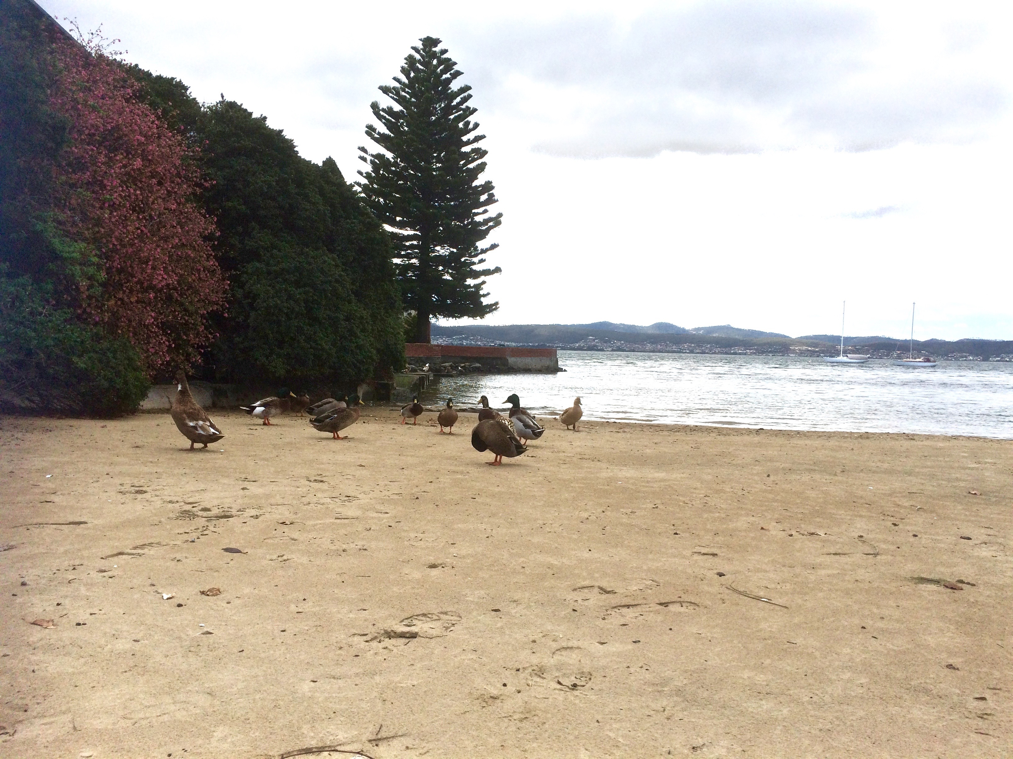
One day when the weather was still warm I went down to the marina to work on the boat and the dogs came with me. Afterwards we walked along Marieville Esplanade, past the casino and around the corner to Lord’s. I tied the dogs up at the fence and went on down the path. I felt I was encroaching – the owners had risen as one and moved out onto the water. There is a bench. I sat on it as unobtrusively as possible. Around me there were footprints and all of them belonged to ducks.
In the afternoon much of this part of the beach lies in the casino’s long shadow. The view up river is blocked by Wrest Point but there’s a longer view across the river and down the estuary, and in the foreground there’s the much photographed jetty with its boat house as well as a cluster of yachts on their moorings. Out a bit further, the casino buoy cleared, we often turn the yacht into the wind and hoist the sails.
There are actually a couple of buoys in this vicinity that the Derwent Sailing Squadron and the RYCT use for the combined club races. As well as the green Casino buoy just off Wrest Point, there’s the DSS permanent further offshore and the Manning Reef buoy, sometimes camouflaged by moorings.
I’ve sailed past this beach many times, and cycled above it on lazy summer rides from the Cenotaph to Hinsby Beach, Taroona but one summer a few years ago, feeling particularly free on a week day, my friend and I walked north from Long Beach further south. The tide was low, but there were some rocks and bits of branch we had to navigate. And this is the thing – you can come to this beach and think that it’s a tiny cove. It isn’t. That little cove is like the bloom of a lily and its stem is a long slender tapering of sand and rock. Jump onto Google Earth and take a ride from the tiny deltoid mouth of Sandy Bay Rivulet south along the coast. You can see clues as to what was there before, you can deduce that older shoreline, marvel (with some concern) at the myriad changes.
Really, the only distraction on the beach is the sound of traffic coming from the road above so if you feel a real urge to come here, bring earphones and relax to music – and bring a bag for litter collection. Picking up the odd cigarette stub or plastic wrapper is a nice way to reciprocate the avian owners for tolerating your inconvenient presence.
The Lords were once the wealthiest family in Hobart, made good from a convict beginning. James, sentenced in York, arrived on the HMS Calcutta in 1804 and quickly grew rich trading in illicit grog. Goc (1997) describes him as a ‘Bobby Shaftoe’ dressed in knee breaches and silver buckles. He and his sons became large landowners in Sandy Bay and bought the Chaffey’s Land, lending their name both to the beach and to Lord Street not that far north from Wrest Point.
But that day last autumn, while my dogs stared down at me feeling cheated, I envisaged the cultivated fields of the New Norfolk settlers and like the Mouheenener children before them, the Chaffey children and others playing on the sand and exploring Manning Reef. Car traffic faded, the road was dirt once more and the Canadian political prisoners on their unsteady legs, plotting their escape, were road building, there was the foot travellers, the odd person on horseback, the sounds of farming and land clearing as well as the odd shot – which would have to be the Rev Knopwood bagging pigeons. Out on the river I imagined a tall ship, whales breaching, gannets diving, and on a light south easterly breeze, the conversation of penguins carried towards me.
Sources:
Goc, N. 1997. Sandy Bay, Gentrx Publishing, Hobart.
Short, A.D. 2006. Beaches of the Tasmanian coast and islands. Sydney University Press, Sydney.
Simplicity, simplicity, simplicity! I say, let your affairs be as two or three, and not a hundred or a thousand; instead of a million count half a dozen, and keep your accounts on your thumb-nail. In the midst of this chopping sea of civilized life, such are the clouds and storms and quicksands and thousand-and-one items to be allowed for, that a man has to live, if he would not founder and go to the bottom and not make his port at all, by dead reckoning,~ Henry David Thoreau
Easy to say, difficult to do. This plan will be competing with other projects I have on the go, which is why my preference is for one I can stretch, shrink or reshape depending on circumstances. Keeping it simple makes sense. A few clear waypoints might support my dead reckoning capabilities. Tasmania is both hefty and plump as islands go but the shorelines can be toothy. The coastline is broken by estuaries, large bays and drowned river valleys. Is it feasible to walk beaches, and rock hop around the island? I doubt it. It would not take long before a cliff would call a halt, or private land deny the way. And what makes a beach anyway? How big must a patch of sand be before it can be adorned with the title of cove or beach? How do you manoeuvre between beaches when topography, vegetation or private ownership block you? Is this project about Sand or Shore? Beaches or coastlines? I decided I would start by exploring in little stages, not necessarily orderly. I’d allow for impulse and serendipity, backtracking and leaps forward, short strides out and longer meanders, walks, paddles, bike rides or sails of an hour or two or weekends and longer away. I’m wondering if my motivation will fade as barriers present themselves and how I’ll manage flagging energy or competing interests.
I met a friend for lunch. She brought enthusiasm and beach pamphlets, and we discussed joint ‘expeditions.’ Then, as I had breakfast one April morning with the geologist, he suggested we start at Opossum Bay.
‘Let’s do it today,’ I said. And just like that we did.
South Arm and Betsy Island viewed from Lower Sandy Bay, Derwent River.
I began these pages for myself, in order to think out my own particular pattern of living, my own individual balance of life, work and human relationships… My situation had, in certain ways, more freedom than that of most people, and in certain other ways, much less.
― Anne Morrow Lindbergh, Gift from the Sea
When I was pondering the shape this blog should take, it wasn’t to other blogs that I turned but to my friends, the books. My reading for pleasure over the past year has been almost solely confined to sailing – mostly circumnavigations by people made of different stuff: Bernard Moitessier, Joshua Slocum and Tania Aebi to name a few. I thought about the writer’s like Dervla Murphy, who have carried me with them on their bicycles, writers like Laurie Lee with whom I walked out one midsummer morning through England and into Franco’s Spain, while managing to co-exist in a boiling high school classroom.
Recently I’ve been listening late at night to The Old Ways: A Journey on Foot by Robert MacFarlane. One moment we’re on an ancient pathway then I wake up to find I’m with him on a boat. Roger Deakin (‘I went to Wales because the place was stiff with magic’) would be right at home adding the chilly Derwent to his Waterlog but wild swimming is not entering into my plans. I like to stay warm. My favourite kayaking companion has always been the enigmatic imposter, Grey Owl, back when you could truly lose yourself (and your identity) in the Canadian wilds. And more recently I’ve also read Cheryl Strayed’s Wild, about the walk she did down the Pacific Coast Trail after her mother died.
I’m no writer, no adventurer. I read, I holiday, I work with people whose memory and bodies are failing them. They are losing their history, grieving the loss of themselves and everything they hold dear. Around me there are beaches. I have two dogs for whom a stretch of sand and a cold current represent the penultimate adventure. I have a helpful geologist who knows his vegetation too. I have feet, a bicycle, a kayak and a yacht.
But reading about grander adventures is inspiring. It occurred to me that down in the depths of the oceanic web I could start a modest blog so that I can scribble a little, fiddle about on beaches, mess about in boats, think as I cycle, sense the earth beneath my feet, carry dreams on my wake and reflect on memories as I peer into rockpools. In trying to shrug off the notion that only great adventures matter I thought again about getting to know the beaches and coastlines and in so doing discover the nature of the world we’re fast rubbing out before loss becomes our nightmare and our sorrow, and the beaches disappear insufficiently recorded.