A story has no beginning or end: arbitrarily one chooses that moment of experience from which to look back or from which to look ahead.
― Graham Greene, The End of the Affair
As soon as we got home from the Arm End walk I grabbed a coffee and began to research the Tasmanian coastline. Someone must have written up their beach walks around Tasmania! My sleuthing uncovered someone Walking the Derwent River, a group walking the beaches in Clarence, and Andrew Short, who has recorded all of Tasmania’s beaches as well as the entire coastline of Australia. As soon as I saw the title of his report I realised I’d seen it before – and so I rang the geologist and suggested he visit the library. (There is nothing like a library – the next day I had it!)
The State Library of Tasmania holds tantalising titles too, and I’m conscious at the same time that although I had to dive deep into the internet to uncover sunken treasure it’s many fathoms deep and oceans vast, and there could well be further riches down there in someone’s lost, forgotten blog.
I flipped through Short’s illuminating report. Mary Ann wasn’t one long beach. She did have a companion, the one apparently nameless that I’m going to personally call (serious nomenclature being one for the state) Gellibrand Vault Beach. Down at The Spit there were two other beaches I’d either not noticed sufficiently or had failed to record. I’m pretty sure locals must call them North and South Spit beaches.
He’d also numbered the beaches along the Derwent Estuary. I’m often on them. How could I not include these old favourites? I looked at my chart of the Derwent, I consulted maps. I thought about the mountain and how it conjures up weather and serves up magic or sorcery for yachties, how when you’re out there sailing, you have to keep your eye on it so you know what might be brewing. The river is inextricably bound to the mountain, not just through the wind but because rivulets carrying altitudinal memories and stories flow down into it, bringing their own unique chemistries to the Derwent.
The mountain’s personal space extends some way out to sea – you feel its moods, it’s muscle flexing. How could I not take all that into account? I looked again at Andrew Short’s incredible number, 1,067, and quickly remembered that in all things, small is beautiful. Perhaps 100 beaches was a more suitable goal. Perhaps I should focus on a particular locale. I decided to make my mistakes close to home and start with the beaches of the Derwent and the South Arm Peninsula, possibly even the D’entrecasteau Channel, but I didn’t dare count them.
I had walked several beaches before I realised the beginning was merely symbolic. Exploring the beaches, laying down memories about them, began on my first visit to Tasmania many years ago.
Still, I felt that before I began on the beaches not that far from my front door, I needed to know more about that beautiful thing, the river, its currents and waves, which along with the wind shapes the shoreline, and the small but powerful rivulets that merge and become one with it.
This project was proving to be as shapeshifting as the beaches themselves.
Conditions: SW wind about 15-20 knots, tide going out.
The walk we did is in the area that is red on the map
After our impulsive breakfast decision to head out to South Arm Peninsula (see previous entry), we gathered up the dogs and set off knowing only that there was a walk at the end of the peninsula but not much more about it. We supposed it would take a mere 30 minutes to walk that stretch of coastline.
The peninsula forms the southern end of the Derwent River’s eastern shore, on the far side of the low lying isthmus at Lauderdale, a suburb at the eastern end of Ralphs Bay. Somewhat uncertainly, and without consulting a map, I’d thought this might be where I’d choose to start my coastal walks from.
There are no real suburbs on the peninsula, just a couple of communities, farmland and conservation areas. South Arm Peninsula has many varied beaches – some coastal, some on the Derwent Estuary and quieter ones in Ralphs Bay. If this was a day in the last interglacial (about 125 million years ago) we’d be climbing in a boat and heading out to a series of islands and as there is evidence of current sea level rise this will eventually be the case again.
We crossed the isthmus and then we were on to the peninsula and turning right for Opossum Bay. There’s a small collection of homes and beach shacks here, many with their foundations right on the diminishing strip of beach itself. There’s a corner store and not much more. It’s quaint, it’s quiet and from this part of the peninsula looking north there are the most riveting views across the Derwent River back towards Hobart and the mountain. Looking south you can see the western shore receding south to Storm Bay and Bruny Island.
We crossed the equally low lying but skinnier isthmus called South Arm Neck and continued through Opossum Bay and on to what was once pastoral land but is now, south of the recreation reserve, giving way to a subdivision of new homes and that’s where we parked our car. A sign right there announced the start of the Arm End walk.
The walk begins
We were rugged up against the cold and across the river the mountain loomed, snow still on its peak from the big dump the previous week. These were some of the observations we made to each other as we walked along the track above the coastline:
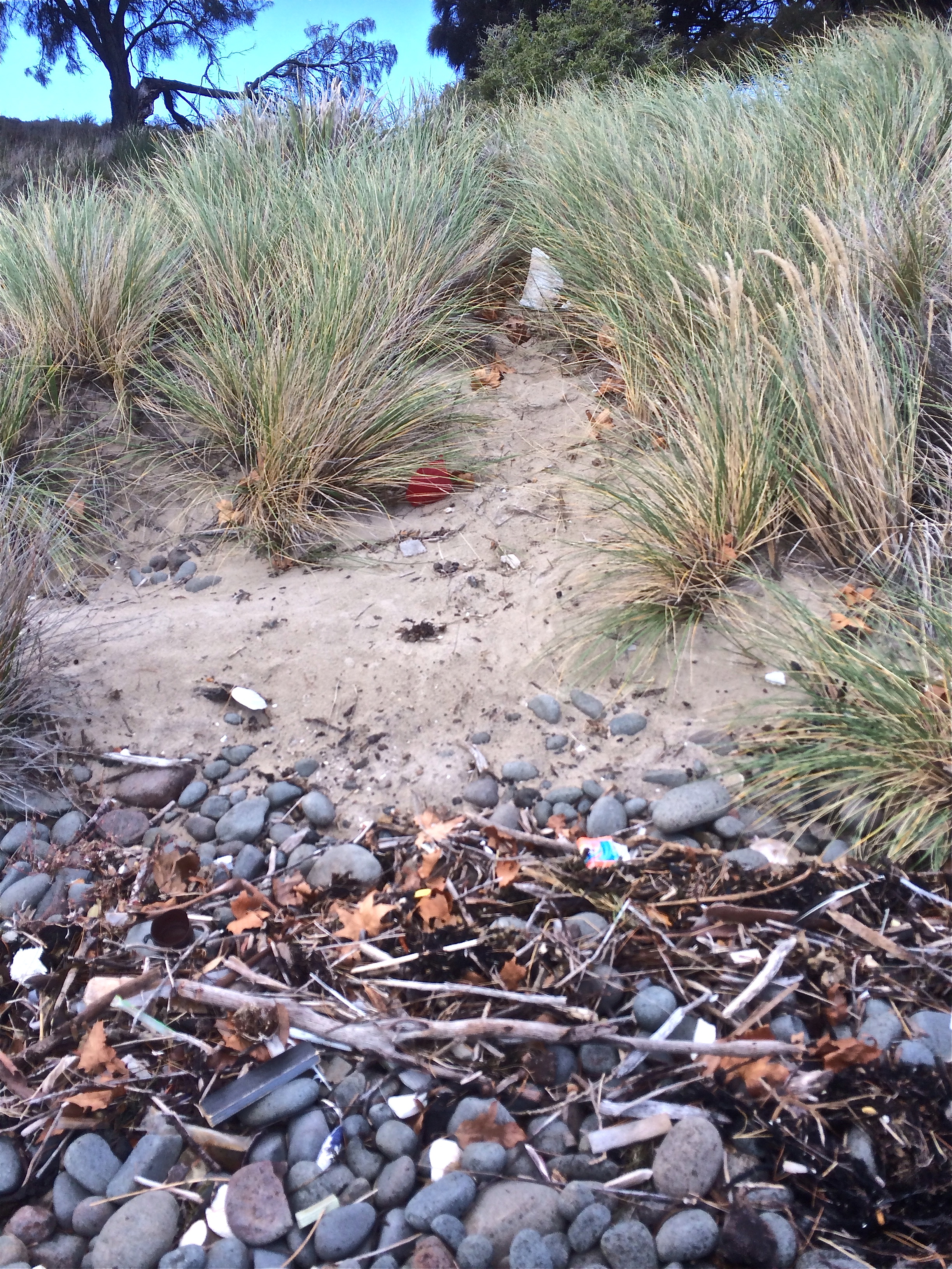
~ There are an awful lot of different weeds invading this landscape.
~ This is a fantastic walk to do with dogs.
~ This walk is going to take us more than 30 minutes.
~ Are we doing this right? (This was me. I was beginning to realise that a plan written on a finger nail was no plan at all. I now saw that many compromises might. For instance, we were enjoying following the path that made its way over grassy paleo dunes, but the actual shoreline was hidden beneath us. I wanted to walk along the edge.
We thought that, if you put to one side the knowledge that you were not going to stumble upon a village, strike a lane or happen across a pub the walk felt a bit like rambling through the countryside in England.
Beginning of the path
The path reached the cliff edge. Peering over I saw that the option of rock hopping the shoreline in between sauntering beaches was clearly not realistic. And when we came to our first beach, a dark, cobbled and fairly short one (I discovered later that this was the western end of Mitchells Beach), I failed my first test. I wanted to go down and put my feet on its sand but the slope looked friable and what might have been a slithery exercise for me was potentially ruinous for the slope.
Mitchells Beach
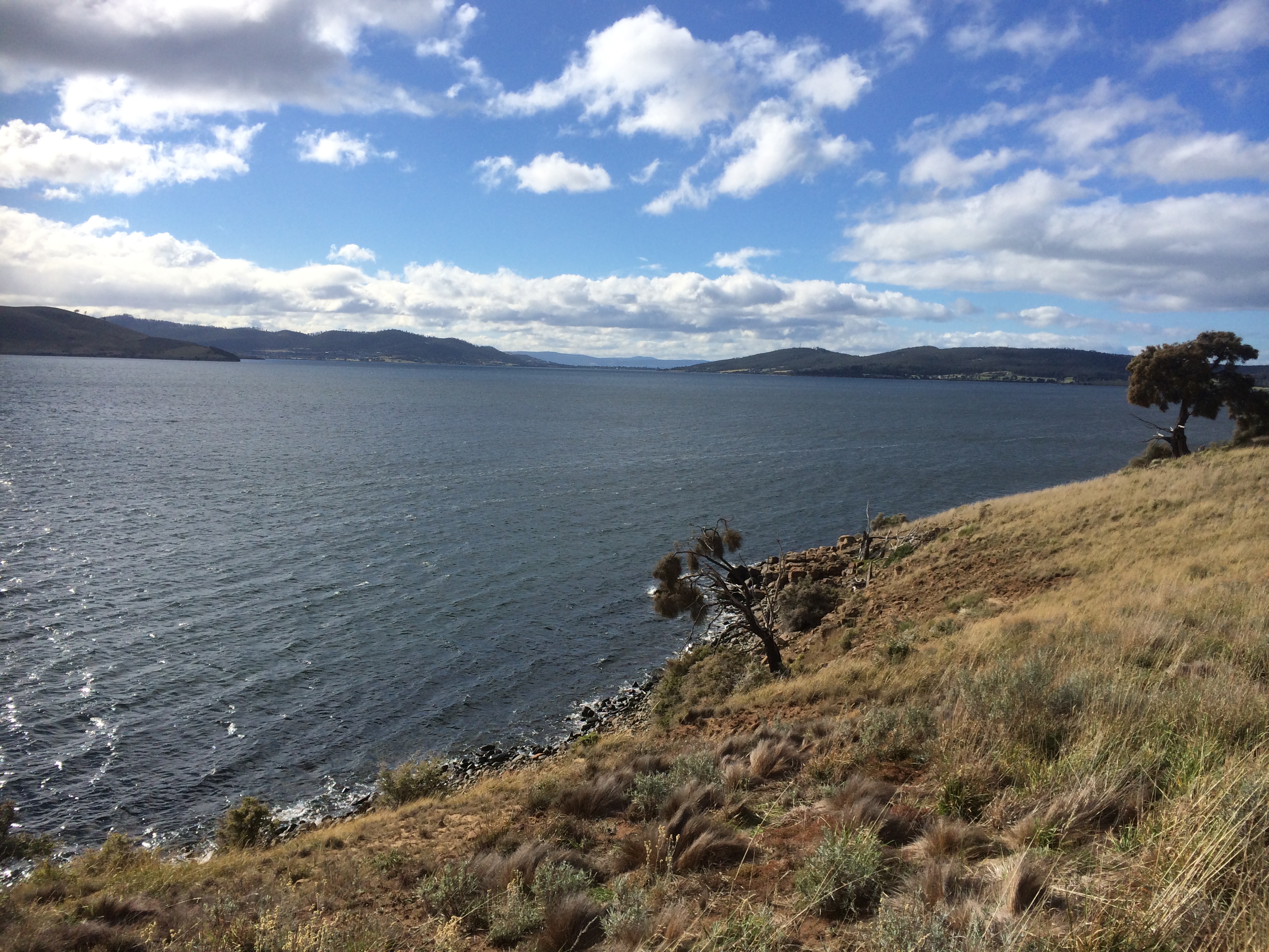
’Do that one on the way back,’ the geologist suggested and on we walked. My first beach – opportunity missed! But from this view another beach to the east (further back along our path) was also evident, possibly separate, possibly the eastern end of Mitchells. We came to a radio transmitter station at White Rock Point and this view up the Derwent River (see below).
There are some perspectives from this area where the river looks like a gigantic lake with small settlements, the city and single households spread across the hills, a known geography strangely altered. I sail along this coastline, but now, looking down at the river from a new vantage point, and seeing this lovely sailing ground spread out all about me, it felt good to be enjoying the water from a different perspective.
Looking north to the entrance to Ralphs Bay
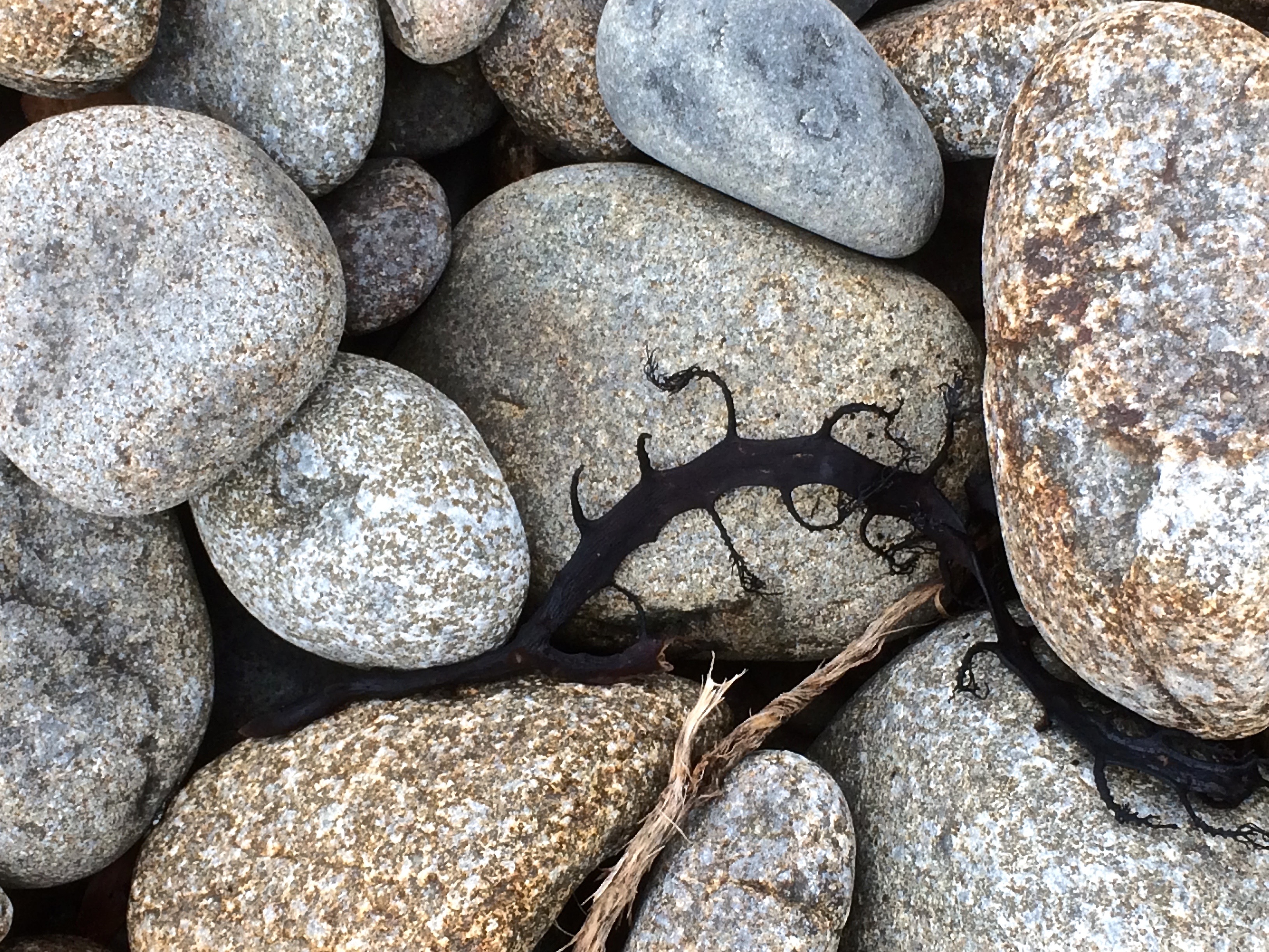
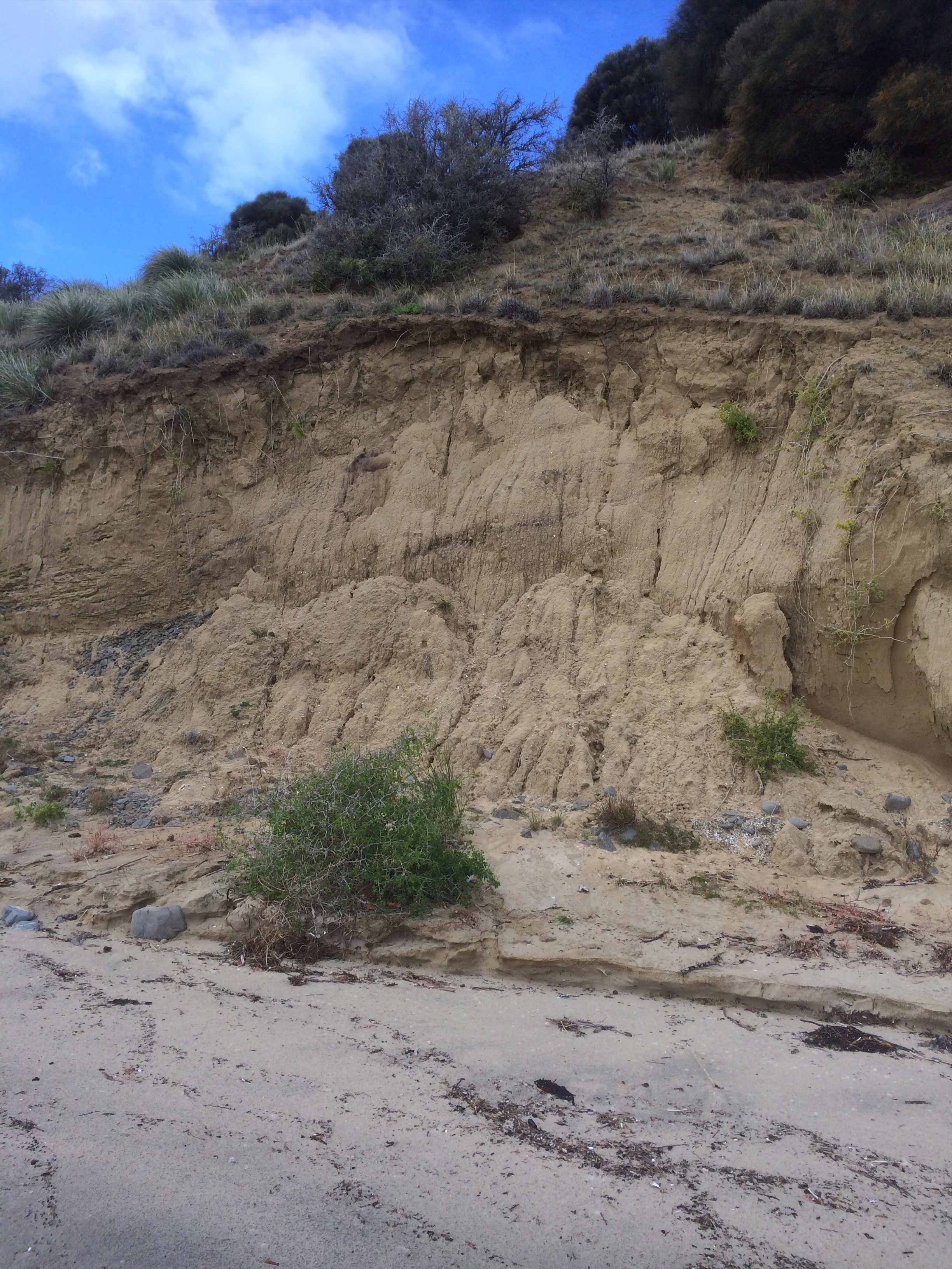
We hopped through compromised vegetation (weeds and litter) and down the eroding dunes, marram pelted, on to the beach at Mary Ann Bay.This is a bay that’s a popular day anchorage and it can get crowded with yachts. It’s where I once let myself down by reversing far to fast on someone else’s boat while we were anchoring. Now I could see (at least with the tide we had) that it’s a slender beach, quite enigmatic, darkened by dolerite, and there’s a lot of litter among the belt of cobbles that lie at the base of the cliff. We realised most of it would be swept this way from the city when the wind is blowing from the north west and the tide is running out. (I made a mental note to include rubbish bags as part of my beach walking equiment from now on.) Although I know the winch handle that we accidentally dropped overboard last summer would most likely have ended up on Bellerive Beach, I scrutinised the debris on the off chance it had circumnavigated the Derwent. I didn’t find our winch handle but I did find a small yellow super ball and claimed it to save a bird from swallowing it. So here’s a shout out. Mary Ann needs friends! She’s being strangled by Hobart’s litter.
Mary Ann asphyxiating under litter
.
Mary Ann: Looking northMary Ann Bay: Eroding semi-consolidated cliffs
We walked along Mary Ann and at the end scrambled up the cliff to where the caesurinas grow.
Caesurinas, cliffs and rocky shores above Mary Ann
I also discovered a small reef, clear and precise amongst the white caps off Mary Ann. I think it’s the two tiny black dots that are noted on the nautical chart but are very easy to overlook or to miss altogether on a higher tide when you’re sailing along chatting with friends and not paying sufficient attention.
Looking north along Mary Ann under variable skies
The next beach along the route is still Mary Ann, I think, but I was fast discovering that beach identification is a bit of an art. There was a sign that said Gellibrand Vault on the map I found later online (see link at top) but at the time we walked along it I assumed it was the northern part of Mary Ann. We discovered the vault itself and climbed up the slope to take a peek. Mr Gellibrand was the first land owner in this area. I later read he loved to sit in this spot to enjoy the view. The words testify to his good nature and it does have a fabulous view but it’s likely that in the fullness of time the dune in which his body rests may slide inadvertently into the river.
Mr Gellibrand’s VaultWalking Mary Ann
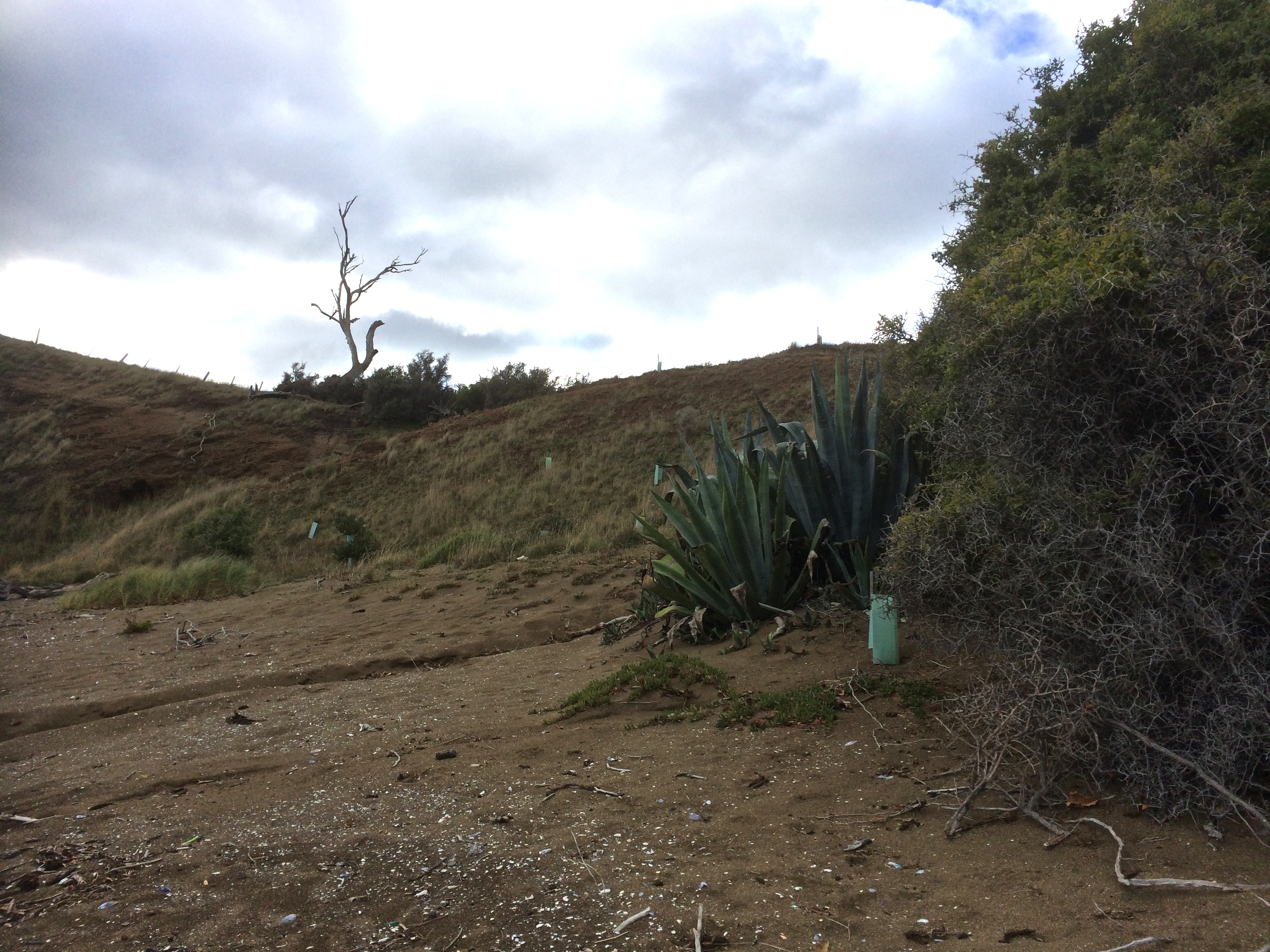
This beach does in fact have friends. There are new plants in green plastic casings. They are trying to stabilise the dunes. Like Mary Ann, it’s beauty is also marred by litter. It’s narrow too, and at the end, where a cliff barricades the way, someone had placed a vertical series of small round cobbles along a ridge of rock. It made me pay attention. I enjoyed a moment contemplating my surroundings. I looked across the river, trying to imagine what it was like to be Moomairremener because this was their domain and I have no doubt the land would be happier if that was still the case – just ask Mary Ann. I imagined the suburbs gone and the forests on kunanyi’s foothills still pristine, the smoke rising from the fires made by the Mouheneener tribe on the western shore, their known world ending and another about to assume its place, the first omens the ships, the second their settlement at Risdon Cove.
Landcare trying to stem the damageOn the Gellibrand Vault part of the beach, looking southLooking across the river to kunanyi / Mt WellingtonLooking south back the way we’d come
It was an easy walk the rest of the way to Gellibrand Point but we were definitely taking more than 30 minutes. When we got there, and stood looking back the way we’d come, across the water westward to the mountain, north to Droughty Point and even further upriver where rain was falling north of the bridge, we had a decision to make: continue the circuit or backtrack along our route, visiting the beach(es) we’d missed. On the off chance that somewhere we could cut across and do a figure of eight I agreed to continue and I’m glad we did although we didn’t cross back over and Mitchells has been put aside until another time.
Looking north to Ralphs Bay under darkening skiesThe view from Gellibrand Point into Ralphs Bay
There was long grass on either side of the track and periodically the sudden dark blur of a mouse, perhaps native antechinus, disappearing into the undergrowth, and flocks of birds on the slender spit extending into Ralph Bay’s still waters. Far away to the south I could just make out a catamaran against a background of trees.
Small wetland and The Spit: tranquility in the lee of the peninsula
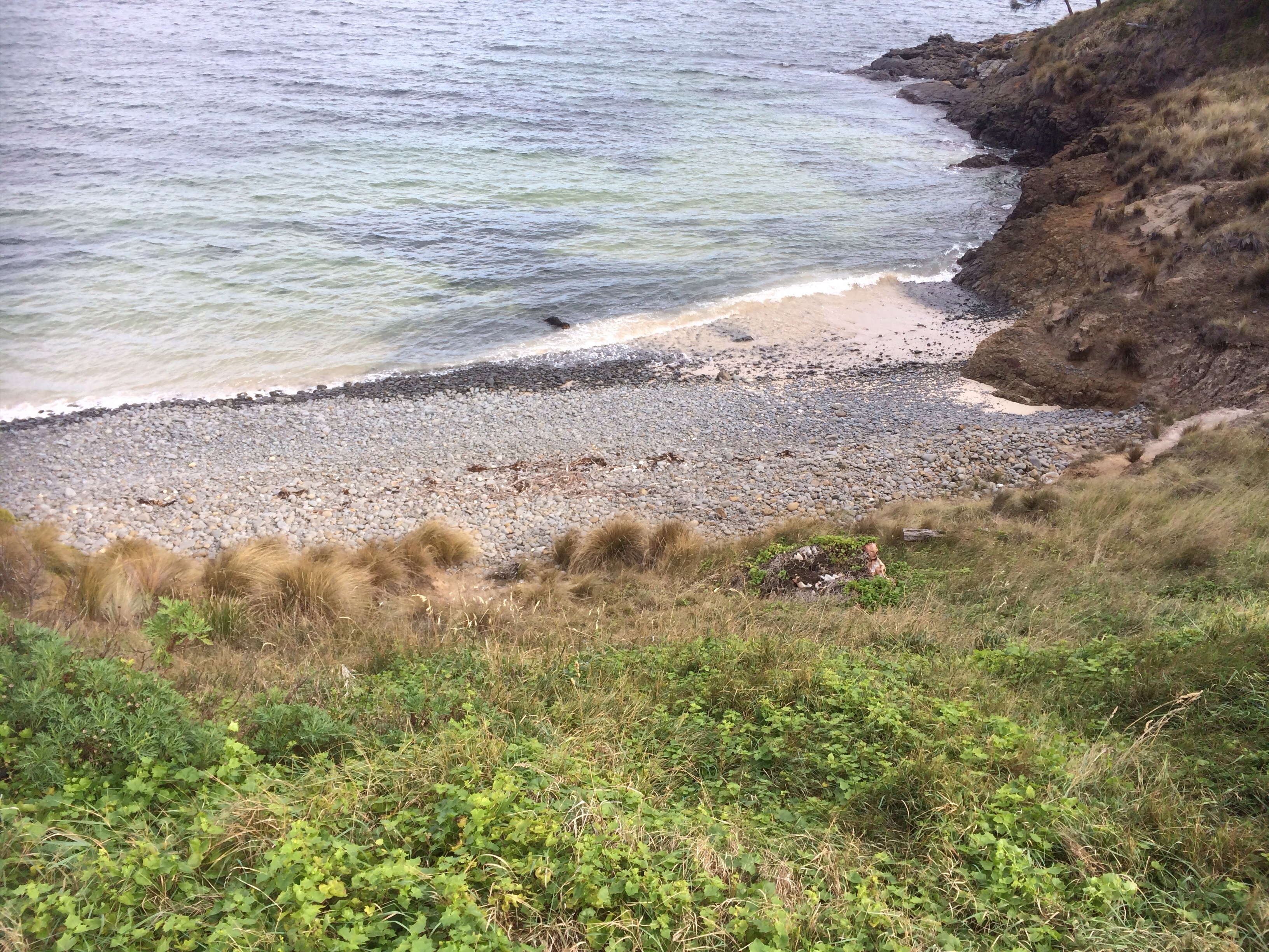
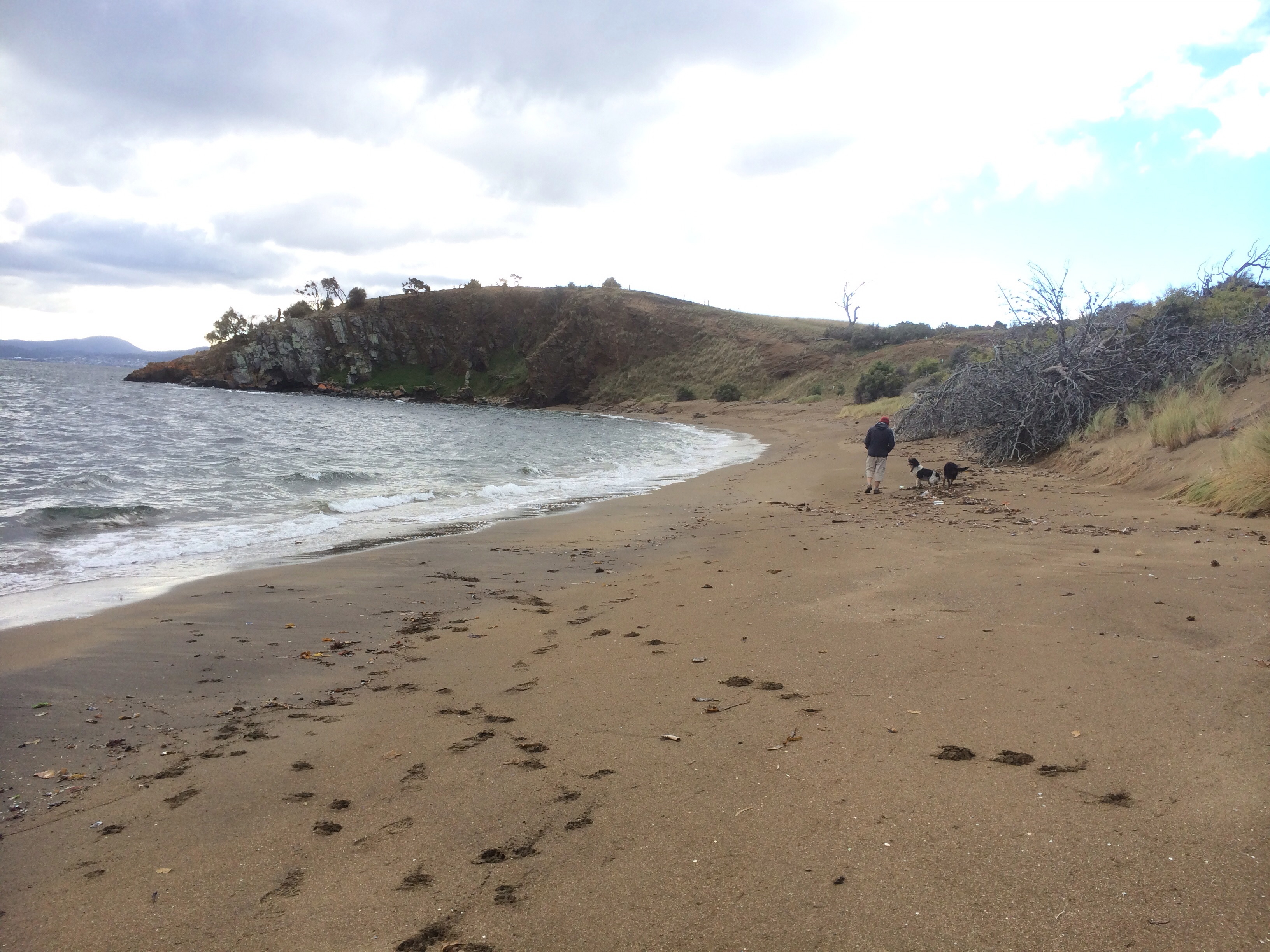
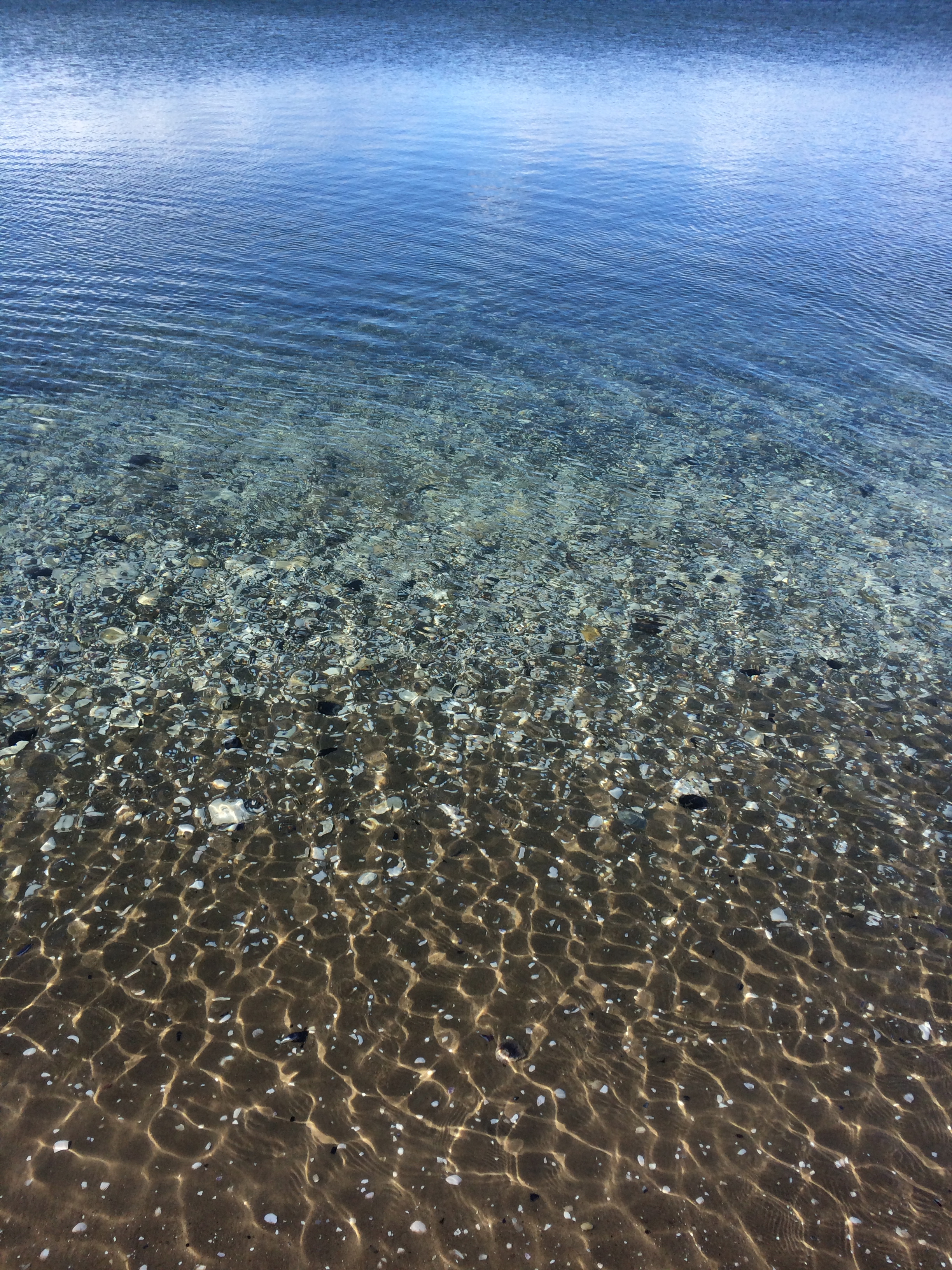
We saw the radio transmitter on the far side of the point and then it was lost again behind a low hill in the centre of the nature reserve and shortly afterwards we reached a corral we guessed was designed with sheep in mind. We descended down to the boggy edge of Shelly Beach.
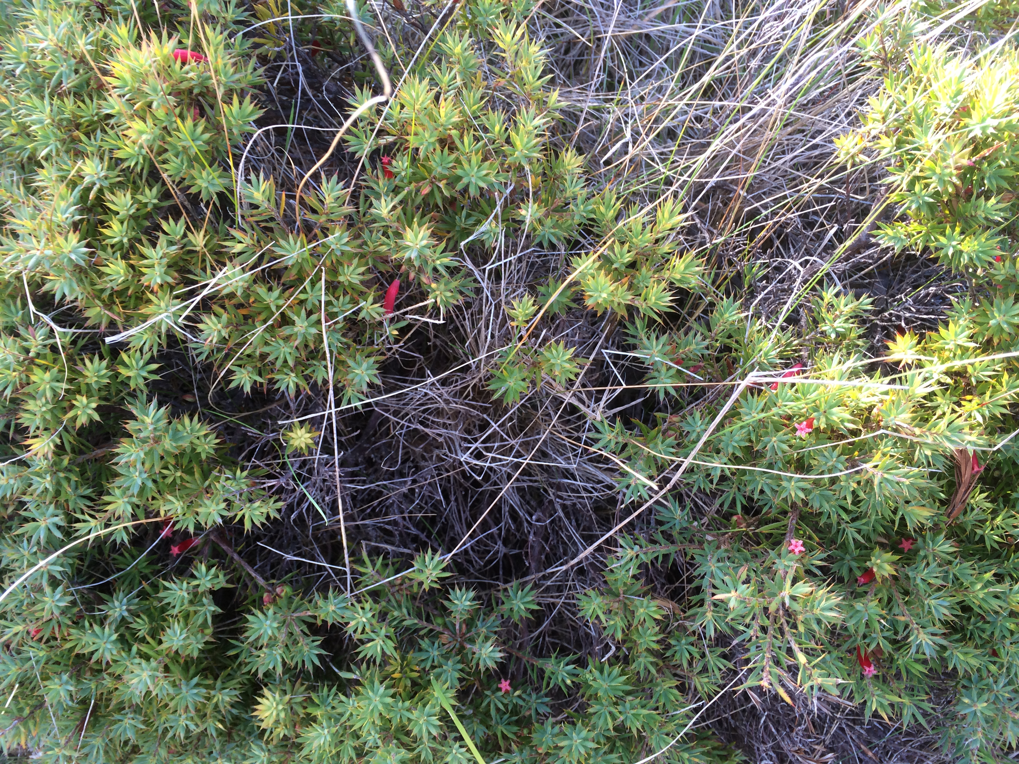
Towards the stockyardsNative flora (epacris impressa?)
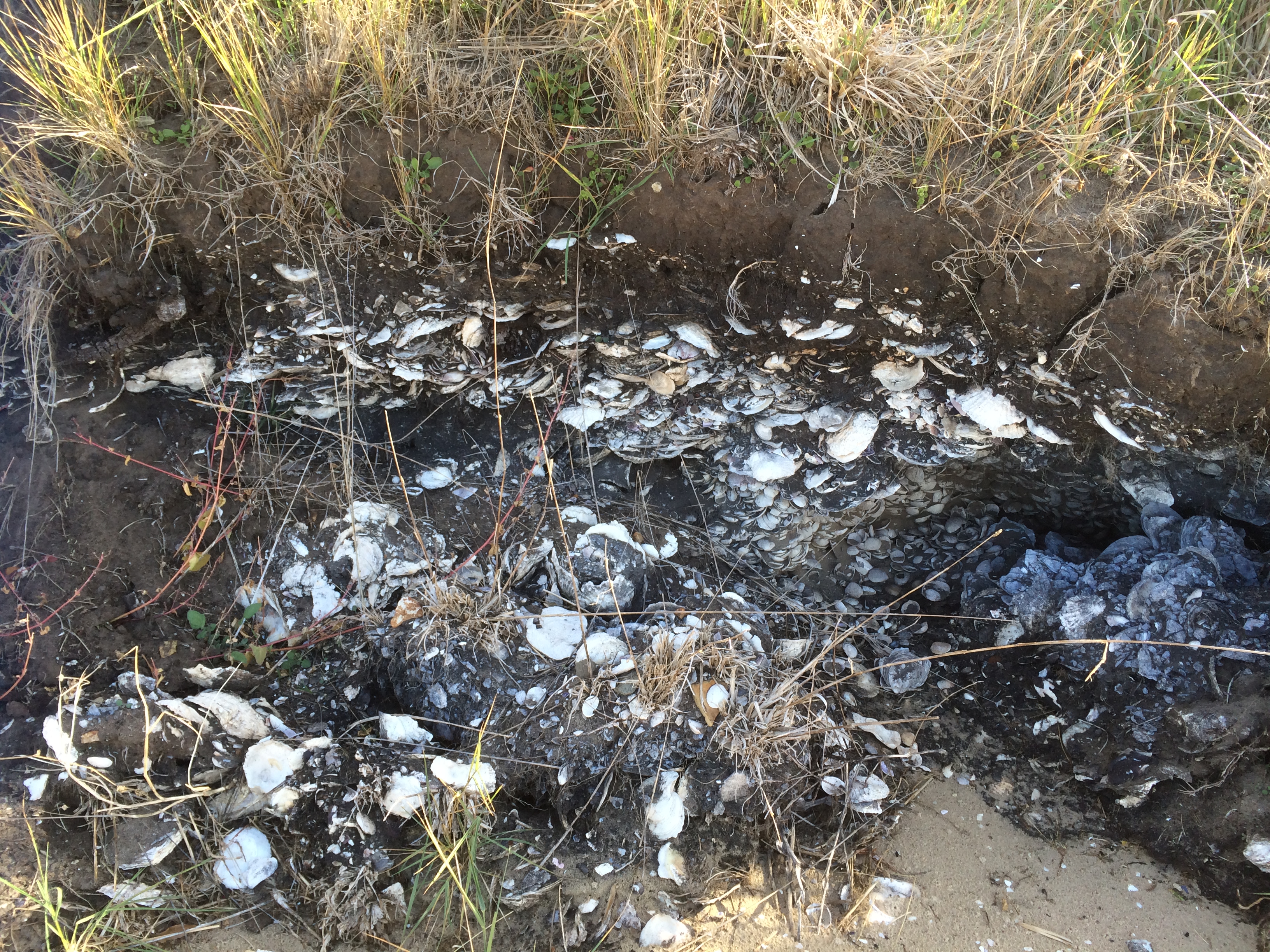
It was so sheltered and so shallow and the bottom glistened with white shells. We paused to consider a surprising discovery – a dense layer of shell sandwiched between layers of dark soil in the bank behind the beach, meandering delicately the extent of the bank.
‘I’ve been here before,’ said the geologist. It had been a field trip with an archaeologist we know, to consider whether this was a vast kitchen midden or a natural deposit eons ago. They’d decided it was too extensive to be a midden and there was not enough evidence of fire in the layer with the shells.
The shallows (Shelly Beach)Shelly Beach
As we began to see people again – a lone walker, a jogger with her dog, a family group – I was reflecting that I had to be better prepared – things like consulting maps, doing research, checking the tides and the moon, the weather forecast and distance to be walked. It struck me that there was a stark difference between looking from the water, where all I’d only ever noticed about Mary Ann was her unprepossessing cliff face, whereas walking her slender length, the cliff becomes intriguing, you notice the dark sand and the wind and wave working dynamically to reshape her. Windswept, and beneath an overcast sky, the beach had been sombre but beaches are many faced and on a sunny day with a low tide Mary Ann might be more light hearted.
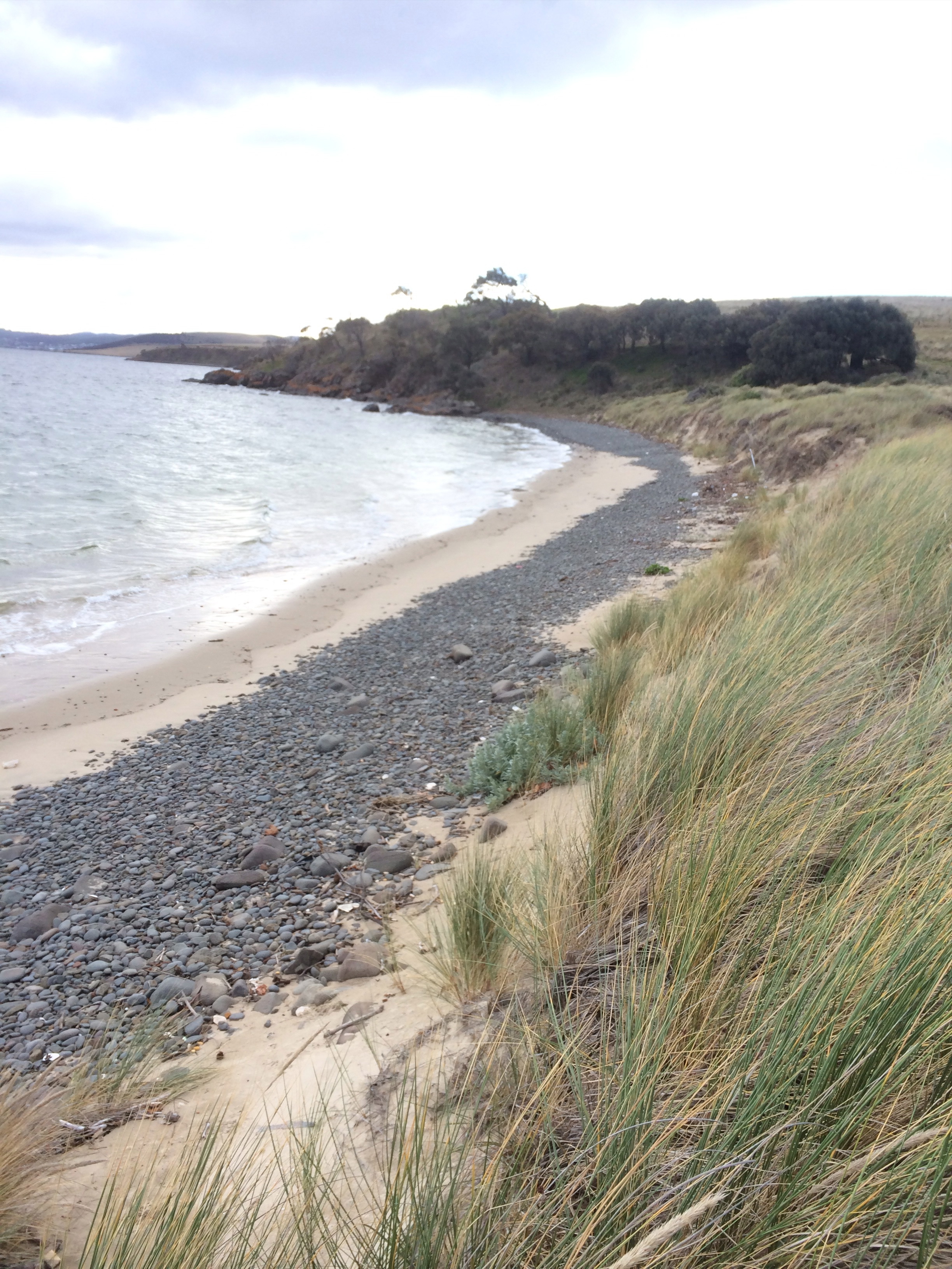
Shelly, on the other hand, was quiet and reflective, openly spilling secrets, providing a long view into history. I imagined a sunny day, a beach umbrella and a book, toddlers splashing in the shallows. Personally, I was tantalised but the curve of sand I had not walked, that curled like a thin white line all the way around to the other side of Ralphs Bay. I wanted to return, both on foot and by kayak.
It was a great kick off to walking the rest of the South Arm coastline and the beaches – Mary Ann, the most sombre and littered beach, so different from others I’ve encountered in Tasmania and Shelly with its clear water and amazing soil profile, so different in character – had given me a lot to think about.