Reflection: Where the Starfish Are Always Pointing

Reflection

Yacht on the D'Entrecasteaux Channel.jpg
Lone yacht sailing the D’Entrecasteaux  Channel

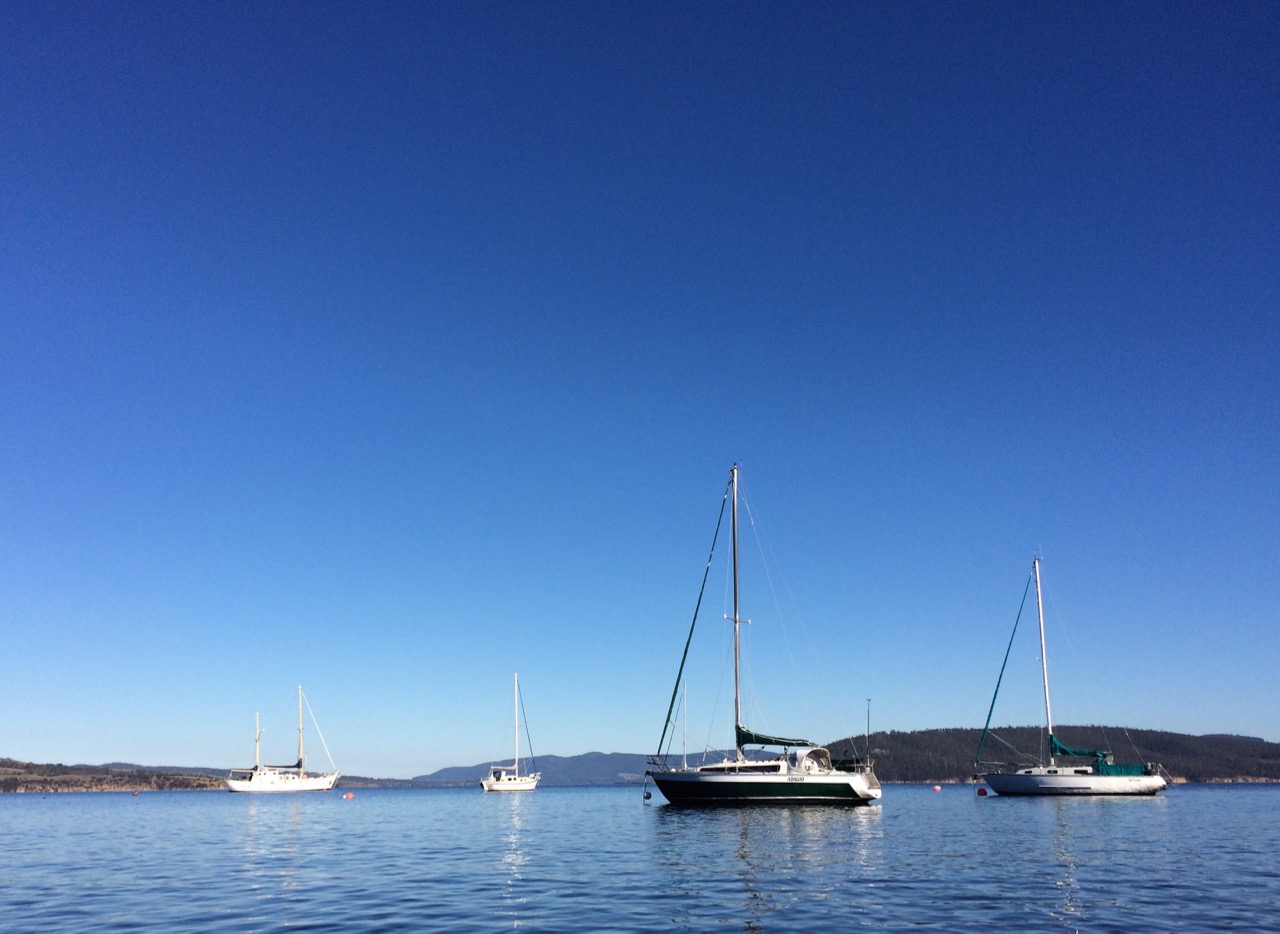
I once had a friend who died far too young of breast cancer and sailed away to where the starfish are always pointing.  Here’s to you, Vicky, the first woman I knew to buy her own yacht.  Groundbreaking is difficult work to do.

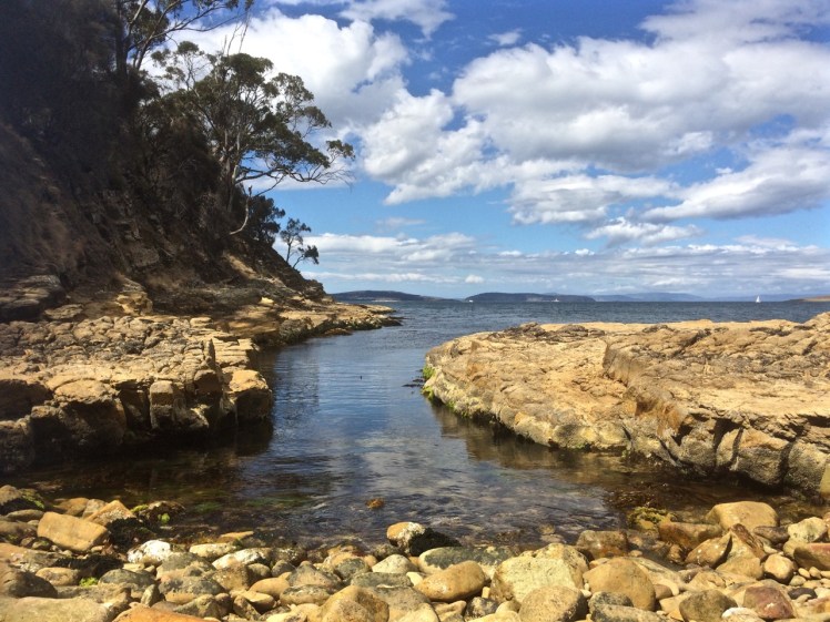
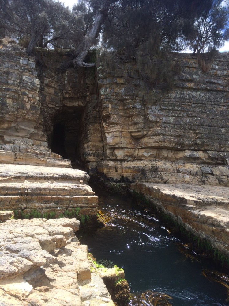
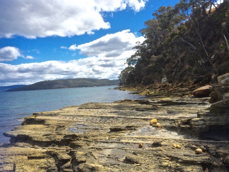
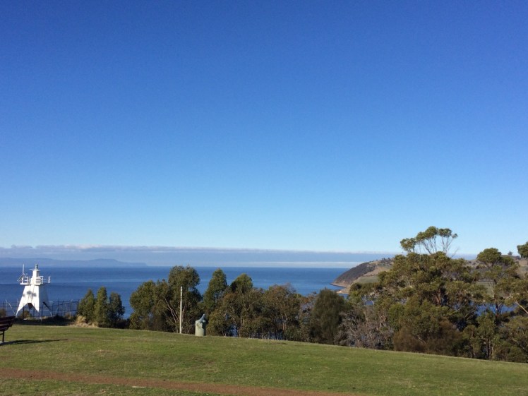
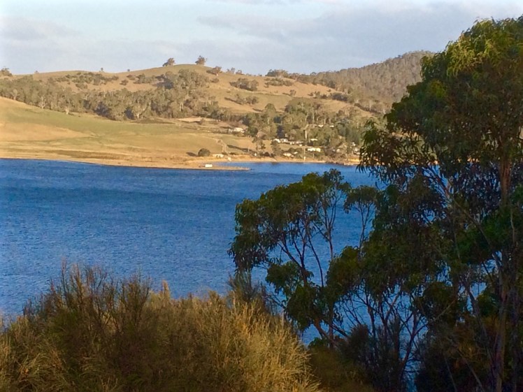
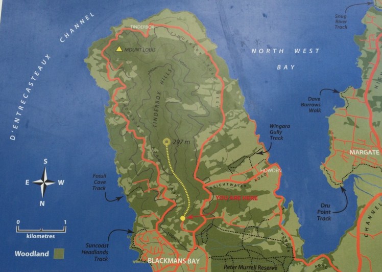
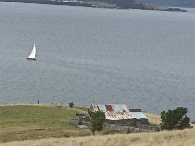
As for me,  I walked down the mountain one day last year, following the course of a small rivulet that not many Hobartians seem to know much about and wandered south down the western shore of the Derwent and around the corner into the D’Entrecasteaux Channel.  It may seem a sequential endeavour but it hasn’t been, because over this period I’ve also walked north along the river and across it and explored the eastern shore, reached Fort Direction and gone out along  the ocean beaches of South Arm Peninsula.  I’ve gone alone, with friends, family and my dogs.  I’ve spent a lot of time, thanks to my baggy old sails and the masthead fly, looking up at sky and clouds and birds, and at stars at night in quiet anchorages.   I’ve also spent a lot of time looking down from Samos at water, it’s ripples and waves and bioluminescence, from cliffs to rocky platforms, from mud and sand into the earth’s crevices, at leaves and moss and lichen and under rocks, and in the pools where the communities of starfish live, their tiny pointers creating a lattice of  directions.

I’ve strolled some North West Tasmanian beaches and responded loyally to the magnetic lure of the Bay of Fires and on the way back home I’ve reconnoitred the East Coast, pondering logistical difficulties for coastal exploring that’s still to happen.

Then just the other day  I met a man who has nearly finished walking all the beaches between the Tamar River and the Freycinet Peninsula and I’ve heard of another who has walked the entire Tasmanian coastline thinking hard about birds and their diminishing habitat.

That’s inspirational!

It seems to me an empty exercise to tick off beaches although each time I find one that hasn’t been noted by Andrew Short* I experience a small thrill.  Actually, whether it’s kayaking, sailing, walking or cycling I particularly enjoy it when it provides an opportunity to listen to the land and the water, learning to read them, losing myself in them, enjoying the whole unfolding of the coastline, the patterns that repeat, the intrusions, the formations that mystify, the dropstones, colours and hues.

Without exception I’ve returned home from every small local exploration seeking answers to a new question or mulling over a new observation.  I’ve often gone back to some part of the coastline again and again, because I felt its call, or because I wanted to clarify something, or because I was seeking replenishment.

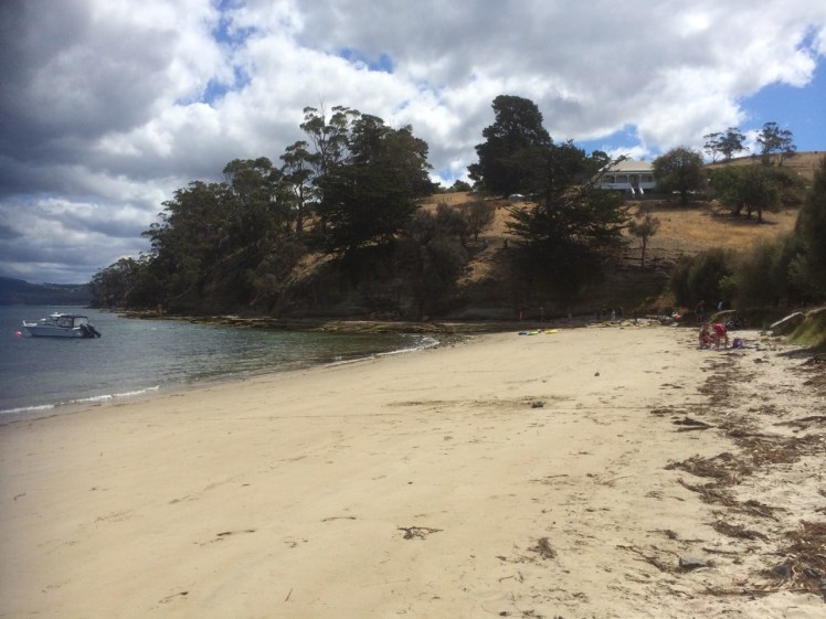
A beach is a shapeshifter.  The beach you visit one day is never the same the next.  All you can ever be reasonably certain of is it’s location and that is sometimes shockingly transitory too.  That’s why a top 10 beaches is meaningless to me.  Ultimately each one has it’s charm but the best is the one you know the most deeply; it’s moods, the way it changes through the seasons and the years, the way the elements  combine to recreate it and the beauty that coastal wanderers leave behind them – adornments like shells patterned into something new and strange, zen cairns and the tipis made of sticks, so easy to miss inside the coastal forest.  Sometimes they’re the abandoned shell of some small being or the delicate bones and feathers of a bird.  That beach you know best is usually the beach that most changes you, and you it.

Before I record more D’Entrecasteaux meanderings I’m pausing to cover some of the other coastlines I’ve been exploring.

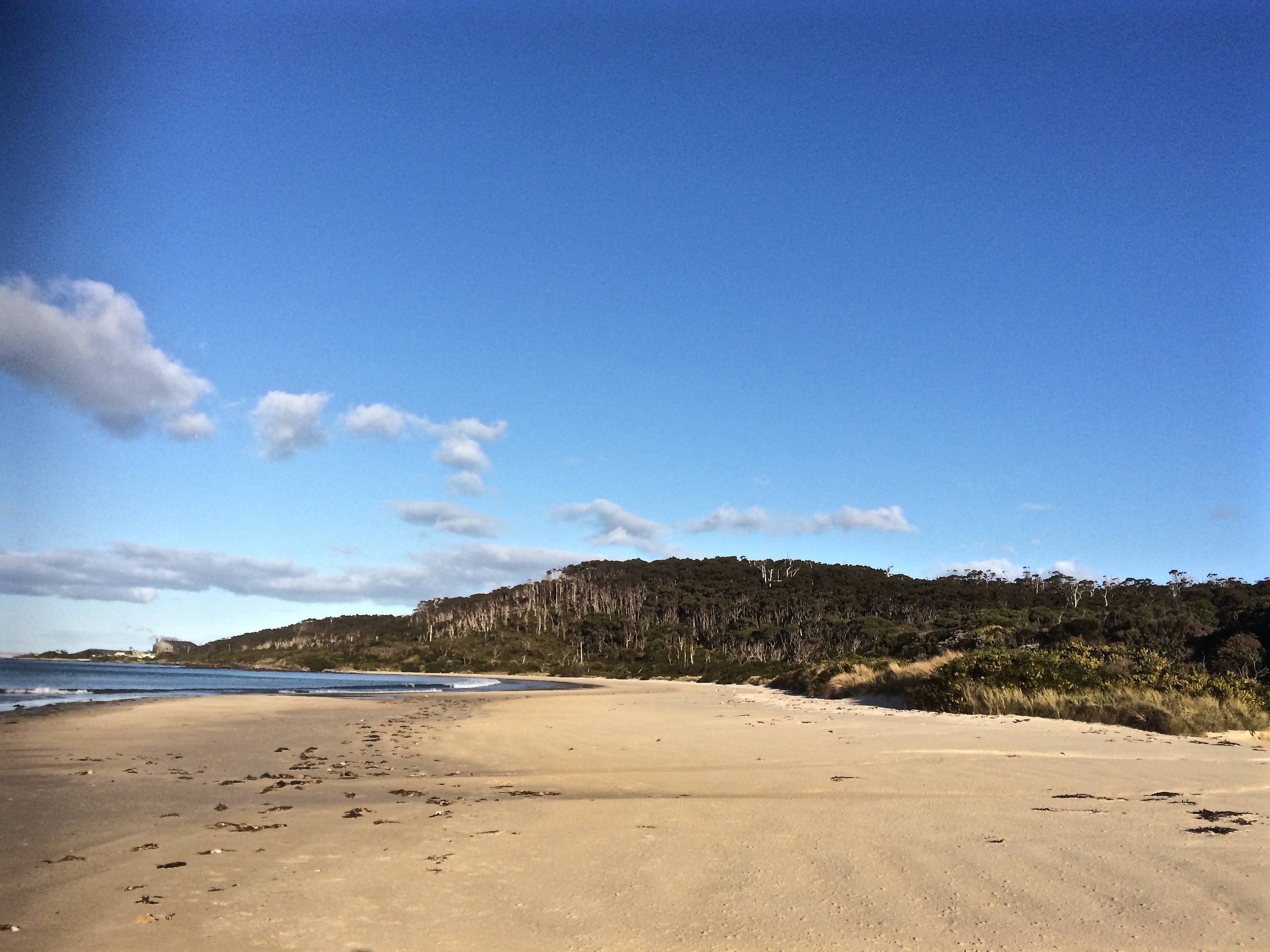
First to a beach on the Forestier Peninsula.

And that on account of the birds.

* Short, A.D. 2006.  Beaches of the Tasmanian coast and islands.  Sydney University Press, Sydney.


D’Entrecasteaux Channel: Tinderbox Beach History

Wrecks and Ancient Litter

A silver memento

Up on the hills, Tinderbox Peninsula is often so dry it’s pretty reasonable to assume that’s why it got this name, but the story is actually more interesting.

In the early 1800s Joshua Fergusson, who lived on the land just above the beach, saw a business opportunity and planted tobacco here with a view to supplying the local pipe smokers.

Joshua Ferguson
Land that once belonged to Joshua Ferguson – this house was once his barn, according to the interpretive panel at the beach.

One day he found a silver tinderbox inscribed in French, an indication that some thirty years before early French expeditioners, perhaps with Baudin, maybe with Bruny D’Entrecasteaux, had visited this beach and most likely made a fire, and stood around talking, perhaps exploring a little.  Maybe this tinderbox slipped out of someone’s pocket or maybe it was left on a stone and forgotten.  There’s also a chance that it had been traded or that it had washed ashore.  Regardless, it’s owner sailed home to France but the tinderbox remained in Van Diemen’s Land.

One day Joshua Ferguson came beach combing, picked it up, and thought, ‘I know – I’ll name this beach after it.’

Shipwrecks

Bruny Island may protect the channel from the vast fetch of the Southern Ocean but the wind can funnel up and down this waterway, aided and abetted by the hills and valleys, descending with rapid speed upon the unwary.

Tinderbox Beach lies close to the northern (Storm Bay) entrance and the gap between the island and Tasmania is particularly narrow and also shallower here. As a consequence, a few boats have been caught out and come to grief on its shore.

On 6 July 1822 a government vessel (name unknown) sailed from Hobart and capsized in Tinderbox Bay. Two men drowned.

On 21 May 1887 the Alice, a ketch, dragged her anchors and went ashore in Tinderbox Bay.

On 12 March 1925 the Rebecca, a ketch (but officially a ‘barge’), heading from Hobart to Strathblane, was overwhelmed off Tinderbox Point by a massive squall, blew out her mizzen sail and drifted on to the rocks. She’d been built by Thomas Inches and James McLaren further down the channel on the Huon River in 1853 and was owned by Edward Knight.

As a small group of yachts moor off just offshore, and as the channel is a popular place to sail, there have doubtless been more nautical dramas on this little beach.

Back in 1948 the Government planned a vehicular crossing between Tinderbox and Dennes Point. This made sense – it was reasonably close to Hobart and this is, after all, the narrowest point.  But again a storm came raging and this put paid to that idea* and so  this beautiful spot (along with Nevada Beach on the Bruny Island side) remains intact – in fact, more so than most others as Tinderbox Beach was declared a marine reserve in 1991.

Pilot Station

Up above the beach and a little to to east there used to be a pilot station at Pierson’s Point.  This beach would have been a great adventuring place for the children living there, and for parents to relax or mess about in boats, in much the same way as today.   For more about life at the station, see Bill Harvey’s remembrances on the  Beach Stories page.

* Tasmanian Year Book – Issue 23 – Page 228

https://books.google.com.au/books?id=m_N9AAAAIAAJ, 1992.

Wrecks: Source http://oceans1.customer.netspace.net.au/tas-wrecks.html


D’Entrecasteaux Channel: Tinderbox Beach (475)

Ancient Ripples

Queensland man with little mate
Tinderbox Beach with jetty & Bruny Island across the D’Entrecasteaux Channel

The headsail was torn, the furler broken and so on that fine day last summer I found myself down on Tinderbox Beach as the seabreeze swooped in and the tide ran out.

This beach is small and beautiful, with a jetty, yacht moorings and the great bulk of Bruny Island protecting it from the worst of the Southern Ocean’s temper tantrums.

I walked east, past children playing on the sand and adults relaxing and on to the rocks, heading for the small cobbled beach below Pierson’s Point. I hadn’t gone very far when a man stopped me.

‘What’s over there?’ he said, sweeping his hand across the northern extent of Bruny Island. ‘More of the same?’

‘Not at all!’ I said and passionately described the unique qualities of Bruny Island. ‘Not to be missed,’ I concluded.

‘More of the same,’ he said morosely. ‘I think I’ll just climb in the back of my ute and have a sleep with my little mate.’

He was well set up. He and his travel worn blue heeler had driven down from Queensland rather quickly, then crossed to Tasmania on the overnight ferry which makes port on Tasmania’s north coast.  They’d then hurtled down the extent of the island to this beach at the southern end, all in one day.

Walking on beneath the cliffs, I found some beautiful rock platforms that were (at least to my untrained eye) tessellated. There are well known ones at Eaglehawk Neck but on my walks I was finding them in many more places. Soon I noticed a couple who had set themselves up in a small, sheltered corner and I stopped to ask how far it was possible to continue walking in this easterly direction.

‘Not far,’ they told me. ‘You come to a gulch that’s just too wide to jump. We’ve often thought we should bring along a plank to get over it.’

Looking north again from Tinderbox Beach
From the rocks at Tinderbox looking north into the Derwent River

It wasn’t long before I came to that gulch. I had paused at many rock pools along the way – amongst the most beautiful I could recall seeing in Tasmania – but this gulch was exceptionally dense with beauty – kelp and a variety of other bright seaweeds. I regretted leaving my rocky shore guidebook at home because quite clearly a person should never visit a marine reserve without one.

Seaweeds at Tinderbox

The gulch was just too wide for me to jump. The pebble beach beneath Pierson’s Point was simply unattainable, at least today.

The other exquisite thing about the gulch was that it led into a small sedimentary sea cave. The rocks at its base and under the water had a shimmery pink glow. Right at the end of its deep resounding depths, small cobbles had been pushed up in a pile by the water, which was just deep enough to deter me and so I took a seat at the entrance of the cave and listened meditatively to what it had to say; and taped its voice.

Seacave and gulch at Tinderbox Beach
The sea cave

I could have sat there all afternoon, listening to that gurgling water resonate in the cave but eventually I roused myself and walked back, climbing the cliff and finding that it ended up in someone’s garden. The man who had given me directions was now alone. We discovered we had mutual friends and I told him about the places I’d been and what I’d seen along the coastline and how puzzling the paucity of nomenclature was. We were standing on Mouheener land – they’d once enjoyed the bounty of the Derwent’s western shore, the Channel and Bruny Island. He thought the Aboriginal tribes probably named significant spots on the landscape for people in much the same we so frequently name them but I shared my different perspective, that places are named in accordance with long held myths, that the landscape is redolent with story but has lost its voice and then I walked back along the rocks, wishing I’d brought a plank with me.

The blue heeler was not asleep although his big mate was. We acknowledged each other and then I crossed the beach and walked westward, bound for North West Bay.

Tinderbox Beach with swimmers.jpg

Swimmers told me the temperature was not too bad and in fact, that summer, the waters around Tasmania experienced heatstroke, their highest temperatures ever, the East Australian current extending further south than usual and bringing with it fish from warmer climes.

Rocky platform west of Tinderbox Beach.jpg
Rocky platform west of Tinderbox Beach.  Looking into North West Bay (right)

I had the rocks to myself. The sandstone cliffs were photogenic. I was able to walk almost to the point where North West Bay begins – but not quite. Still, I was satisfied to have discovered that kayaking along here was likely to be rewarding, and so after studying the ripple marks of ancient beaches etched in the surface of ancient sandstone I followed the sea breeze back into Hobart, feeling exultant.

Tinderbox Beach

Historic photograph of this view is at https://stors.tas.gov.au/AUTAS001124067968w800 – View of Tinder Box Bay, the northern part of D’Entrecasteaux Channel Residence of Joshua Fergusson Esq. Walter Synnot.

Derwent River: Kayaking the Tinderbox Peninsula

Smacking Down Fear with a Paddle

It’s a little known fact but upstream of Dennes Point, just across the water from Pierson’s Point, there’s a shark refuge and the men in grey suits and the freezing water in which they undertake business were on my mind as I climbed into my kayak to paddle the Tinderbox coastline.  I would have liked company but I had no takers and so I’d decided to go alone.

On a fine day.

With the water like a mirror.

And on a low tide.

‘We’ve kayaked it before,’ the geo had said. ‘You don’t need to do it again.’

I could not remember kayaking the whole length of Tinderbox, and if we had done so it was back when I thought of Tinderbox as one long stretch of formidable coastline with no discerning features other than cliff face and rocks. Now I knew better and had reached the conclusion that the best way to get to know the peninsula was by kayak, right up close to the rocks, in part because I didn’t want to be that kayaker who made the headlines through being snaffled in the Derwent.  After all, Hobart is full of sea kayakers who paddle this stretch and think nothing of it.

But I wasn’t one of them.  I simply had a little goal to achieve and a mystery to solve: where was the door to the underground tunnel behind the cliffs?

‘Sailing is all about anticipation,’ my friend M, used to remind me and it’s perhaps more so with kayaking. I checked the Bureau of Meteorology site and chose my day – swell beneath 0.5 m and north westerly winds below 10 knots turning variable later in the day. It sounded perfect.

A small wave splashed over my map as the geo pushed me off and even before I’d made it out to Flowerpot Point, kayaking through the moored yachts in the southern corner of Blackmans Bay, I could tell the river was intent on being a trickster. Because the water was in fact lumpy, and so another fear assailed me.  If I fell out, it would be mere moments before I died of the cold and much as I love the river I did not want its bed to be my last one.   As I rounded Flowerpot Point I felt threatened by swell coming at me from all directions, no doubt lingering from previous bad weather. The surf breaking on Soldier’s Rocks a couple of hundred metres away looked downright intimidating.

I stopped.  ‘Too rough… poor visibility,’ I advised myself and I wobbled into the little cobbled bay (T468) that I thought I had befriended on one of my earlier walks only to find it fractious and lumpy, the water disconcertingly black.  I began to reach for my mobile (geo, come back!) but I didn’t feel steady enough to use it.

‘You miserable little coward,’ admonished the chorus in my head.  I could already see Passage Point and North Bruny Island and they didn’t actually look that far away. We’d figured it would take me three hours (based on my dawdling on previous paddles) and certainly sailing along here sometimes takes a goodly length of time. And so I pointed my kayak south again, put my head down and paddled briskly towards my first waypoint, Soldiers Rocks, adrenalin ratcheting up my heartbeats. My seat wasn’t properly adjusted; my legs were already going numb.   This was affecting my balance.  No ways was I going to reach for my camera.

I burned passed Soldiers Rocks, keeping a distance between us because of the toothy break and  reflective swell,  and my compromised ability to use the pedals I could no longer feel. The Lucas Point Sewage Plant now seemed more friend than foe. I could see how in this little bay the beaches from the water seemed a single beach rather than two or three, but I was not game to reach for my iPhone.

There was no going back now.

Because of the slop I couldn’t get near the shoreline  and so I had to put a big fat cross through the image I’d had of myself, drifting along a feet or two from the cliffs, trailing my hand along rocks from time to time (hello, rocks!  hey, sea anemone!) imprinting the geography in my head,  scrutinising the cliffs for the hidden doorway.

My next waypoint was Fossil Cove and I could see the arch ahead of me.  The geo and the dogs were going to walk through it to the part of the beach on the northern side and I’d said I might see them here but little did I know, they were way behind me.   (And little did they know I was ahead.  They waited here a long, long time.)  Ahead, closer to the eastern shore, was a ship at anchor. There is often a ship at anchor, presumably waiting to proceed upriver but they are like ghost ships. Sailing past, you never see crew. Back when Sandy Bay was barely populated, the ships at anchor often had clandestine grog on board that was collected by smugglers under cover of darkness.

A smaller ship came around the Bruny Island coastline and headed down the D’Entrecasteaux just as a boat came roaring out of it, headed my way.  Fishers, I thought, but no.  They began to reverse their boat into an extremely narrow gulch on the southern side of Fossil Cove.  Neat!  And what a clue!  They’d been invited to lunch!

To keep my mind off sharks I contemplated the cliff top with its magnificent view, far more alluring IMHO, than an underground dining room but I guess diversity is the spice of life.

Lucas Point came and went.  Before I knew it I was past Passage Point where, in the wind shadow, the water lay down. The tide was more resistant here but I was quickly through the gap between Dennes Point on North Bruny and Piersons Point on the Tasmanian mainland and in the channel flat water with a quiet lattice of ripples welcomed me. Beneath me, arrow squid, australian salmon, barracuda, pike, flathead, whiting and silver trivially glided, but I was unaware of them. Beneath the cliffs a seal lolled in the water, one flipper up. I paddled past the two little cobbled beaches, the tiny gulches and the sea cave and made it on to the beach before the geo and dogs arrived to give me a lift home.  I hadn’t managed to explore the beaches but, chased ever onwards by imaginary sharks snapping at my stern, I did do this leg in 1 hour flat!

Cobbled beach, Pierson's Point
Cobbled beach, Pierson’s Point and quieter water


The day I kayaked from Blackmans Bay
Cliffs at the start of the D’Entrecasteaux Channel


Taken the day I kayaked from Blackmans Bay to Tinderbox Beach.
Moorings off Tinderbox Beach.  Bruny Island (left).


Derwent River: Tinderbox Beaches: Pierson’s Point

Geographical Anxieties

 D’Entrecasteaux gave the point this name when surveying the area in 1792.  It was also known, briefly Point Lewis and Blythe’s Point. 

(Source: Robinson-Moore, 2014) 

Light and cannon and Bruny from Piersons
Piersons Point with the Tasman Peninsula in the distance and Bruny Island just across the water

Just because you’re a long way from an empire’s capital, with limitless miles between your island home and battlefields and just because a feud can begin and end in the space of time it takes to receive a letter  doesn’t mean that you’re not going to get the jitters hanging out at the end of the world.  So when Governor Lachlan Macquarie visited the Hobart Town settlement in 1811, his mind turned to the enemies that could arrive unannounced up the Derwent River – the French, for example, not that long ago defeated in the Napoleonic Wars.   His perspective was military; the place clearly needed fortification, and so a network of batteries, some interlinked by means of tunnels, took shape along both the eastern and western shores of the river.  I had long ago passed Alexandra Battery, which sits above Blinking Billy Point.  The battery at Piersons Point is significant because along with Fort Direction on the far side of the river, it protected the river mouth (although it was a late comer to the system as it was actually only constructed and used during WWII).  Prior to that time there was a pilot station here, at the junction between bay, river and channel and on fine days the family based at the Iron Pot lighthouse sometimes rowed across for a bit of conviviality.

When we’d arrived after our wander along this stretch of shoreline, there were some Sudanese children  playing tennis on the court that seems as oddly placed here as the idea of a battery is now.   Bruny Island is a short hop across the water, the river was to my left, the D’Entrecasteaux Channel flowing into it from my right, and Storm Bay spread south. I could look back down the long stretch of coast I had explored and across the river to Cape Direction and the Iron Pot light.

It had taken a bit of research but I now knew that the river was not only a drowned river valley but also a rift valley.  I knew there was a bar beneath some 15m of water just north of Pierson’s Point and I knew that there was likewise a bar running from Piersons to Dennes Point on Bruny Island, because the depth instrument on Samos registers this as we sail over it.  But the geo had also put me straight about the the river, the channel and their geological inter-relationship and his take is attached at the bottom of this entry.

It was ages since I had set out to explore beaches, yet here I was still in the Derwent.  I had discovered parts of the shoreline I hadn’t really known existed.  I had discovered it’s vague and sketchy nomenclature and I had discovered that it wasn’t supporting nearly as many birds as I had anticipated.  I now knew these beaches were pocket beaches and that it’s pointless walking beaches without giving equal weight to the coastline in between and I had discovered that the means of travel impacts greatly on the experience.  My most profound realisation had been that I was not nearly as hefted to the land as I had once thought I was.

I’d walked along Tinderbox’s spine but the road is narrow and while picturesque it can occasionally be at an unrewarding distance from the river.  I knew I would cycle it one sunny day, but that’s more about a ribbon of bitumen than it is about the river and its beaches.  I sail this coastline frequently, but then my attention is more on the boat’s interaction with wind and water. That being so, I felt I wouldn’t have done it to my liking unless I kayaked it too.  I thought that in my kayak I could really acquaint myself with its rocky shore.  And besides, hidden among those cliffs was, bizarrely, a secret door and I was keen to find it.

We set out the teapot and cups, then sat down and enjoyed a little tea ceremony to honour the Derwent.  There were cumulus clouds in a blue sky. On such a stunning day,  watching the ferry crossing the channel further south  between Kettering on the Tasmanian mainland and Roberts Point on Bruny Island those old geographic anxieties seemed peculiar indeed.   My geographical anxieties were of a far smaller scale than the governor’s.  They were focussed on how I was going to co-ordinate my blog with the places I was intent on exploring. How to proceed, I was wondering. South down the Channel, and if so by what means?  Or north from Sandy Bay through Battery Point and if so, how far up river?  And if I mixed it up how would I keep a sense of continuity going in both my brain and on my blog?


Dennes point from Pierson's Point
Looking across at Dennes Point, Bruny Island from Piersons Point.


IMG_4183
Lacking the grace of an old lighthouse and looking more like something from outer space. Automated light at Piersons Point with the Iron Pot lighthousein the distance.

The geo’s take: Derwent Rv and D’Entrecasteaux Channel.

See also On the Convict Trail

And Beach Stories, for life at the old Pilot Station


Derwent River: Tinderbox coastline: Passage Point

With a Dark and Stormy in one Hand and a Pencil in the Other

PASSAGE POINT

Passage Point is a notable promontary at the mouth of the Derwent Estuary and is both lovely from the water and green and pleasant from the road – a rolling hillside, a rustic shed, an abrupt cliff line carved by the waters of the Derwent, the D’Entrecasteaux and Storm Bay.

Signage
Map from the Kingborough Council Signage at the start of the Tinderbox Hills track:  nomenclature is thinly used.  Passage Point, Piersons Point and Tinderbox Beach,  all important landmarks, are not noted. (Passage Point is to the left of Mount Louis.)

Having finally decided that ‘not the real Fishermans Haul’ was in fact the real Fishermans Haul (see last blog post), we went to Passage Point to see if there was some way we could access the little cobbled beach I’d noticed.  There wasn’t.  We had to make do with expansive views but as these were superlative and so vast in scope we could hardly complain.  Mount Louis, Tinderbox’s highest point and forested in eucalypts rose behind us.

Birngana long distance race off Tinderbox
Birngana off Passage  Point

My guess on how Passage Point got its name was all tied up with waypoints, landmarks and the ocean because if you’re heading off in your yacht on a trip of any distance, it pays to sit down and plan your passage.  With a ‘dark and stormy’* in one hand, and a pencil in the other, take a careful note of the tides, currents and potential hazards.  Become familiar with the landmarks you’ll pass, navigational signs you’ll encounter, channels or reefs you may need to negotiate and choose your waypoints.  Make Meteye your new best friend and despite being in love with your chartplotter, tuck the paper version into your nav table too because it’s less likely to let you down.  Departing the Derwent at this point to head out across Storm Bay is always a bit of a passage into the unknown because the bay is notorious for conjuring tempests up out of the most benign conditions.

Because  this familiar promontary is just there where the waters of Storm Bay, the Derwent and the D’Entrecasteaux merge, it’s symbolic of passages about to begin and passages almost completed.  So it goes without saying that this is how it got its name, right?

Wrong.

I checked Placenames Tasmania and found some unverified information. A boat called the Fancy was one of ‘the few remaining trading boats called passage boats.’ Back in slower more leisurely days these boats used to ply the Derwent and the Channel.  In doing so, they had to round Passage Point and in so doing, they gave the point its name.

This information in the database comes from a boating article in the Saturday Mercury, Jan 2002 where it’s also noted that ‘most features on coasts were named by mariners and seeking reasons for names means looking at it [sic] from a mariner’s point of view.  Thus Passage Point was a marker for south-bound boats of the entrance of ‘the passage’ or the Channel.’

Exploring the sweep of shoreline from Sandy Bay to Tinderbox had triggered my curiosity about the way places were named but I had not considered that mariners had a big hand in the names of the places I was exploring.  This was an unforgiveable oversight because it’s obvious that many major features first got their names from the early voyages of discovery.  My impression of the western shoreline of the Derwent was that places were usually named after the early landowner’s or overlooked in the naming process altogether but I could see that in a tiny colony at the end of the world there’d be a sense of familiarity and homeliness for locals who plied these waterways in naming the places they were passing by the names of the people they knew. On dark and stormy nights in particular, the ability to recognise familiar landmarks and tick off waypoints is comforting and engenders hope when you’re toughing out rugged conditions.

We paused here to savour the view.  Passage Point felt extremely evocative for me:  I had walked out one wintery morning and followed the Sandy Bay Rivulet down to its mouth.  I had turned right and wandered the shoreline from there to here, a distance of some 35  kilometres, give or take a few and although I had done this as an urban explorer, little bit by little bit, it had been fun, it had changed the way I related to the coast as well as dramatically expanding my knowledge of the city I live in.

And then we continued on our ‘way ‘ – a word itself entangled with ‘passage’, and like ‘passage’ one with an evocative history.  I liked the definition from the Free Dictionary best:  ‘a. A road, path, or highway affording passage from one place to another. b. An opening affording passage’.

  • Dark and Stormy: rum and Coke / ginger beer or ale; a drink that’s popular with sailors.  The link is to one version, but there are many.


September on Tasmanian Beaches

A Little Pause

There’s been a delay in posting because of visitors, learning about beekeeping and preparing a beehive, travel about the state and trying to get my first issue of a local newsletter to the printer on time. But while it may seem I’m making my way excruciatingly slowly down the Western shore of the Derwent Estuary, I did in fact reach Piersons Point much earlier this year and so I’m playing catch up on this blog.

While writing, I’ve walked some beaches down the D’Entrecasteaux Channel and on the South Arm Peninsula.

I can also report that from Cockle Creek to Couta Rocks the boobiala has been in brilliant yellow blossom. Epacrids and cyathodes have also been adding colour to the coastal landscape. There are a diverse range of sponges washing up on the Cowrie Point beaches and while the sand at Robbins Passage seems pale at first glance, a little digging reveals black sand lies just beneath those beautiful ripple marks the outgoing tide leaves far behind. The surf was big at Marrawah and at Mt Cameron West, a place I’ve long wanted to visit, we acquisced to aboriginal requests not to take dogs in, and we turned back.

This month I also got to know the sandhoppers at Sarah Ann Rocks (West Coast) far more intimately than I’d ever anticipated. If any beach was aptly named its Sarah Ann. That sand is rocking and hopping beneath your feet and unless you go digging you would probably never know.

The plover that gave me an in the face warning that I was not welcome on Red Chapel beach (see my last post) also  gave me reason to pause and think a little.  I phoned the Parks and Wildlife Service to report the broken gate but more than that, as a person who has long bewailed the dog apartheid on many of Tasmania’s beaches my walking has led me to the conclusion that during the prime breeding months in spring, we should all be avoiding the beaches, ceding tenure to the birds, so that they can enjoy their parenting without abandoning nests or succumbing to anxiety and alarm. After all, it’s we, not our dogs who are the most menacing of species and with the dunes eroding on many beaches, it’s a hard call for nesting birds to simply find a spot to lay an egg.

This is why over the next few months I’m exchanging my walking shoes for my bicycle. I’m hopping in my kayak and I’m hoisting my sails.  Walking, developing an intimacy with landscape, paying attention to it and asking questions of it has been exhilarating and has expanded my thinking but now I’m curious to experience small adventures out on the water.