Derwent River: Kingston’s Whitewater Creek: Beautiful and charismatic. Skinny, bruised and battered
Kingston Beach and Whitewater Creek
Three of us rode from the mountain to Kingston Beach, land once shared by the Mouheneer and the Nuenone but now an ever expanding suburb south of Hobart.
The rivulet track was a loose, slithery surface beneath the forest canopy, Strickland Avenue a fabulous swoop, the linear park serene, Sandy Bay Road provided a cycle lane, the Long Beach precinct a bounty of birds – swift parrots, galahs and cockatoos in the tall eucalypts, Taroona a snack and Bonnet Hill the exhilaration of views and the final descent down to Tyndall Beach. We crossed the footbridge, rode along the Esplanade and headed on to the sailing club beneath Boronia Hill.

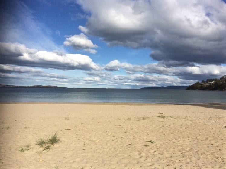
Kingston Beach lies between Bonnet Hill and Boronia Hill and it is beautiful and charismatic. Unlike many of the pocket beaches of the Derwent that come and go with tides and the seasons and are hidden away down side roads, it’s a focal point. It has a eucalypt lined esplanade, a road running past it, beachside houses and a small but popular café strip.

The beach lies open to Storm Bay, staring it straight in the face like an ocean beach and small waves lure people into the water even on some of the coldest days. The fetch is wide here and as Sydney to Hobart yacht races are often lost or won on this last stretch up the fickle Derwent, it pays to know the way landforms shape the flow of wind and water.

The beach has its offshoot, Tyndalls Beach, running below Alum Cliffs, it has Browns River, arriving from its source on the mountain, visible in the background, by way of the Summerleas Rd valley as well as via Vincents Rivulet that flows along Proctors Road beneath Albion Heights. And it is a generous urban stretch of blond sand that stops at a rock platform where the sailing club is based, just below the headland of Boronia Hill.

But I’m interested in things less obvious and so to ponder the beach and its environment I went walking with my canine companions, down a path whose sign I’d previously ignored.
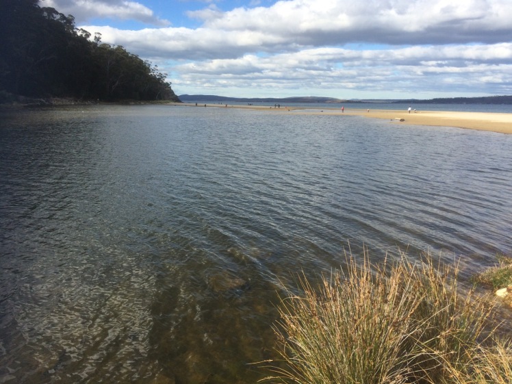
If Kingston Beach is the beautiful extrovert in the room, then the myriad of rivulets in its hinterland are shy and unassuming – Fisher, Coffee, Dunns Creek and the like. Whitewater Creek, while actually bearing signage and showing evidence of community adoption, is mysterious, and on first appearance gives every impression of being the skinny, bruised and battered victim in the corner.

We walked beside it from the Summerleas Road entry point, across a small bridge where, curiously, the rivulet goes two separate ways, and followed its leftward flow until we reached the entrance to an underpass, where signs amongst planted native vegetation explained that the pool in front of me was part of Kingston’s stormwater treatment plan. But the walk was desultory. Running behind houses on one side and the weed-choked creek on the other, it struck me that if there was an emergency number you could dial for a creek then I would be ringing it. Even the dogs seemed subdued. This was no path for an uplifting walk, I decided, but I would come back and ride it.
The next day I was back with my bicycle and the stretch we had walked (seemingly flat) turned out to be a long, descending gradient. With the wind at my back I was through that ugly underpass in no time at all, and continued my descent into Kingston.
And this was where Whitewater Creek showed me a different face. That stormwater pool was the first of many and when I crossed the highway and cycled down a path I’d never noticed before, I found myself weaving around a series of beautiful ponds, happily enveloped in flourishing native vegetation that local birds, including Tassie hens, were enjoying. There were sculptures, but most heart-warming was that the Kingston community was taking creative and active steps to make sure that the water spilling out of the creek and into Brown’s River was clean when it got there. I thought about poor, filthy, Sandy Bay rivulet. If only it, too, had this sort of support. Was there not scope for a small stormwater pool to be created somewhere along its urban extent?

I stopped for an ice cream at a café on the beach, then rode back into the wind and through the ponds and under the highway to the point where the creek diverged.
The rivulet and the track crossed Summerleas Road and I figured I must be headed towards the Fork in the Road. Tassie hens, a curious horse and browsing cattle turned out to be more visible than the rivulet itself, particularly as the path began to climb and close in on the highway. Beside a bridge it veered right and dropped me on to Spring Farm Road but I remained puzzled. All the other rivulets I’ve encountered take the most efficient course to the estuary but this wayward rivulet seemed to be having it both ways, travelling across country into the Blackmans Bay catchment.

I discovered that Whitewater Creek has a deep and ancient secret as the Mines Department discovered when surveying for a dam on its upper reaches in the 1970s. They discovered back in the there Tertiary era, far below the present horizon, another creek flowed beneath it in a ‘buried valley filled with sand, clay and gravel’. They traced it to Pritchards Road where it joined with an eastern tributary valley discovered in 1969. From here the water flowed south through the saddle between Doctors and Little Parks Hills (new names to me) down to North West Bay.
Well, who’d have thought?
‘From what had been up to this date strictly a dam site investigation widened in an attempt to trace the main Tertiary valley south to North West Bay and the two tributary valleys upstream into the two reservoir areas of the proposed dam sites on Whitewater Creek (Dept of Mines, 1979).’
Apart from learning a little more about the geology and geography behind Kingston Beach, I discovered the importance of geological surveys before you build a dam – leakage can be caused by an unfriendly geological substrate, like the faults this area is full of, and can render your dam useless.
I turned to my maps and saw that flowing south, it meets up with Boddys Rivulet to bring life to Leslie Vale, before flowing ultimately into North West Bay. Here were secrets I hadn’t known but now the course of the rivulets down from the mountain and the remnant vegetation around Brown’s River inform my view of what this landscape once looked like.

Source: Tasmania. Dept of Mines. 1979. Whitewater Creek dam sites, Kingston and the Tertiary channels of the Kingston-Margate area. (Geological Survey ; Paper No. 3)


