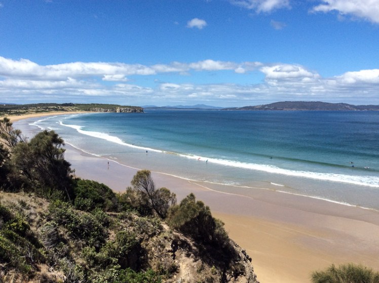
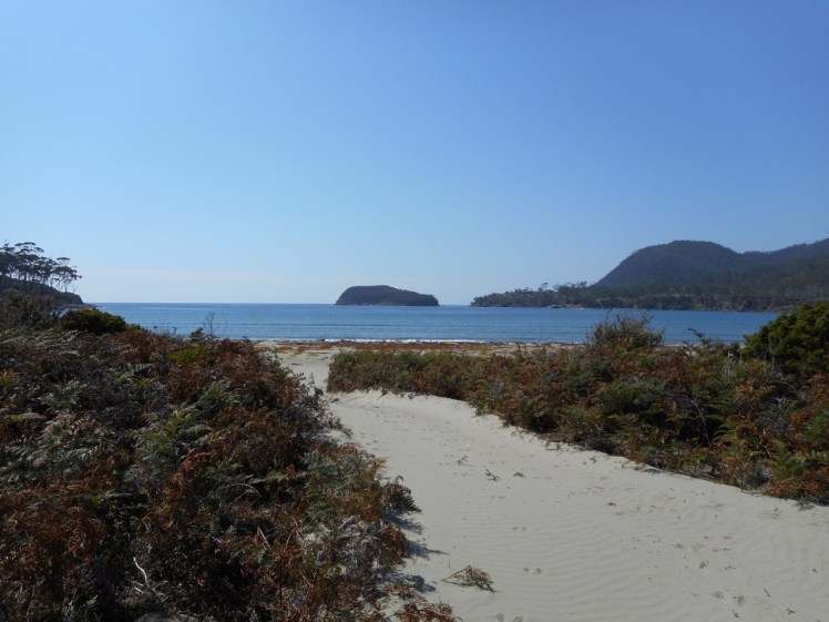
Clifton Beach and Pipe Clay Lagoon viewed from Cape Contrierity
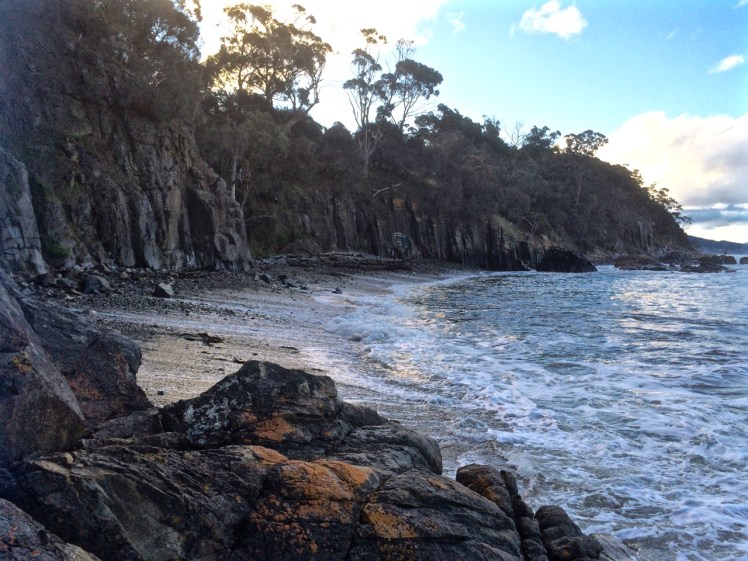
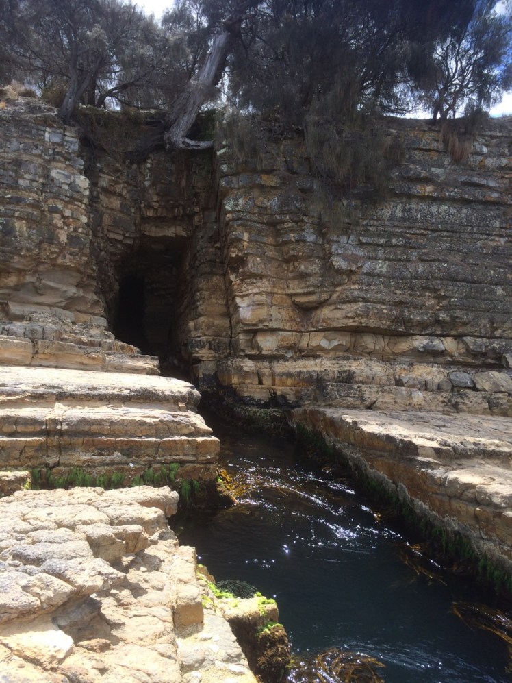
Tiptoeing Along a Cliff Edge
Zooming in with Google Earth I thought I spied a couple of small beaches north of Smugglers Cove and the light tracing of a path through what looked to be a nature reserve. It was enough to convince us that it was worth trying to tackle the cape from Clifton Beach on the northern side and so on a sunny day at low tide, while people swam between the flags and surfers lolled on their boards beyond the break Cathy and I scrutinised the dunes and the cliffs at the southern end of the beach and found a path that led up a steep gully. With an eye out for snakes, we scrambled up it, trusting our weight to the branches of a couple of conveniently located bushes.
There was a narrow strip at the top between the ‘keep out’ barbed wire fencing and casurinas rimming the high cliffs, some of which had fallen away. Peering over the edge we could see their broken pieces tumbled down against the sea.
We found a path, but it looked wallaby made and we meandered on and off it making a difficult passage over and under vegetation, sometimes trusting to the generosity of land owners by slipping over the fenceline to where the walking was easier. In one memorable spot, we had pretty well a foot wide space of sky we needed to cross. I avoided looking down. The drop was horrible, but Cathy skipped over it oblivious to Death’s outstretched hands.
Our tardy progress was made even slower because the views were compelling and so we’d stop, point out landmarks we were confident about and speculate about those we weren’t.
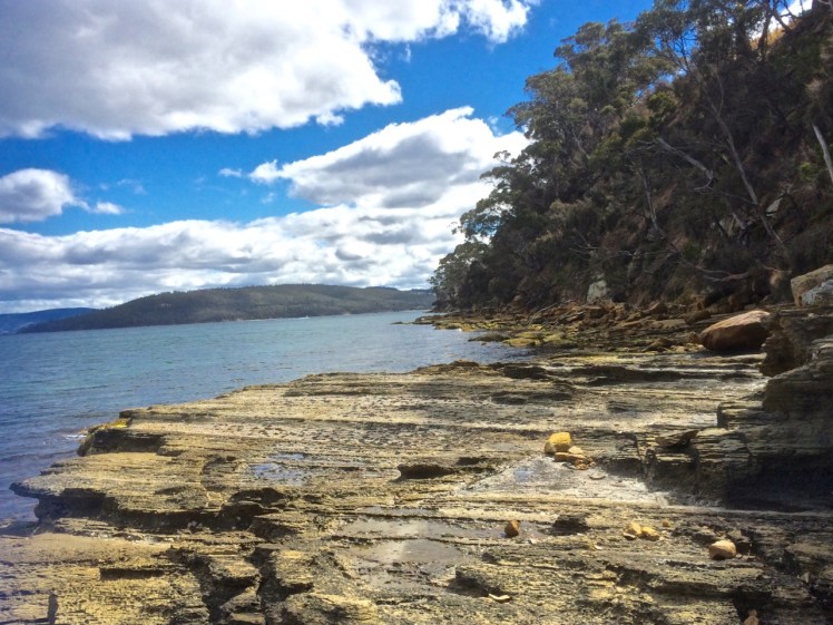
Clifton Beach and Cape Deslacs. Tasman Peninsula is visible across Frederick Henry Bay
We finally found ourselves on the far end of the casurina copse, gazing down a long slope of golden grass and up the slope on the other side. There was no clear path and it had the look of large expanses of private land. With a couple of households dotting the cape, we decided to avoid rebuke and reluctantly turned back, walking single file. Cathy quietly observed the tail of a snake disappearing down a hole between us, so we were pretty pleased to reach the beach unbitten, and as the day was still young and the beach glorious, we decided to take an amble to the cliffs below Cape Deslacs.
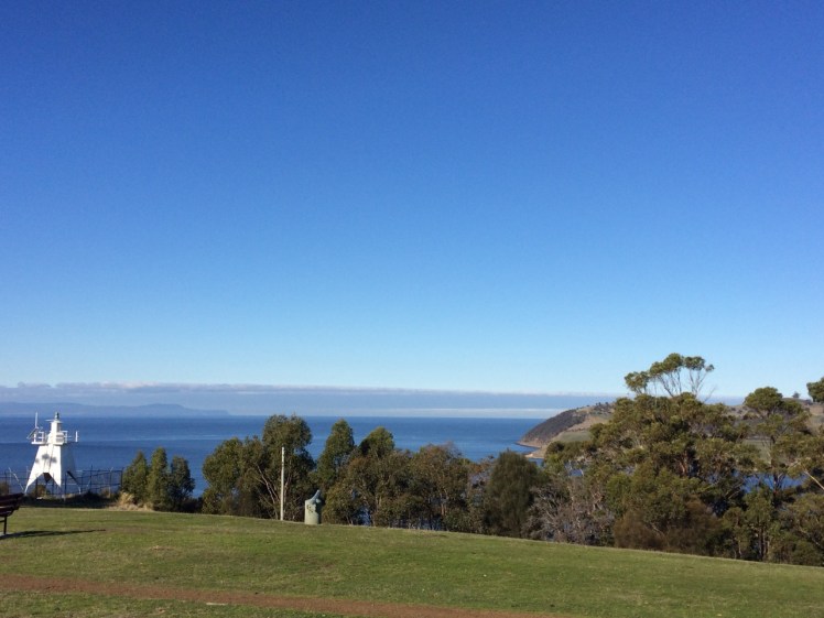
The interplay of land and water made the walk worthwhile
Not much has been written about this cape, but on Placenames Tasmania I discovered that D’Entrecasteaux had noted this name on his voyages of discovery and that it had another as well – Watsons Bluff. Watson was definitely no lady because it’s my observation that places get named after men, rarely women. No doubt he was merely an earlier landowner whose name buried earlier ones tangled with mythology,
I dug about on Trove as well and discovered a 2000 fisheries arrangement between the Commonwealth and Tasmania that referred to a shark nursery in the ‘area known as Frederick Henry Bay and Norfolk Bay being all waters within an imaginary straight line between North-West Head and Cape Contrariety’ and in an article on geology in the Sanford area, Green (1961) mentions dolerite intrusions into mudstone as well as landslips in the cape’s basalt soil. As he also mentions lavas here, this little cape has some complexity but keeps a low profile in the island’s literature.
Back at the cottage after kayaking Sloop Lagoon, I was flipping through Marianne Robertson’s book From Petal Point to Cockle Cove over a well deserved cup of tea, and discovered a beach that I hadn’t been aware of before. Tucked away behind the big boulders at the south end of Taylor’s Beach was apparently another small cove called Sloop Reef Cove, also known as South Taylor’s Beach.
It was time to go searching – and so we went immediately.
But we couldn’t find a path. Instead, we four, two of us canines on leads, scrambled up enormous boulders and searched around when we got to the top. Faint trails sometimes led to dead ends but we finally found a vague track that led on to a better formed path through the casuarinas and finally dropped us down to a secluded campsite where two men with a van were stoking a fire. Down on the tiny north facing beach four people were enjoying a picnic while the surf pounded in. It’s an intimate cove; we felt we were invading and so we sat only momentarily on the rocks discussing the undercut dune behind the beach. The cove sloped; the surf that day rolled in and and streamed out, deflecting around the corner. We saw the back of the waves as they raced onwards to east facing Taylors. There is a permanent rip here. Swimming in the cove or the southern part of Taylor’s beach looks pretty dodgy because of the criss cross waves you get here. It was a most unsettled sea.
The boulders of Sloop Reef Cove
To Sloop Point
We knew Sloop Point well, or so we thought, but yet again, finding a trail from Sloop Reef Cove that would lead us there took a bit of effort. We considered giving up – and considered this several times more during the course of this walk – but eventually the trail we found joined a well made contour path, which I later discovered was an old tramway track.
But why would you have a tram way here? What sort of tram? What was the purpose?
The walking was soft; layers of casuarina curls lay on the ground. We passed beautiful boulders near a point with a sign that read Sloop Rock Jetty and stopped here, contemplating the dreamtime stories that would once have been associated with these powerful formations.
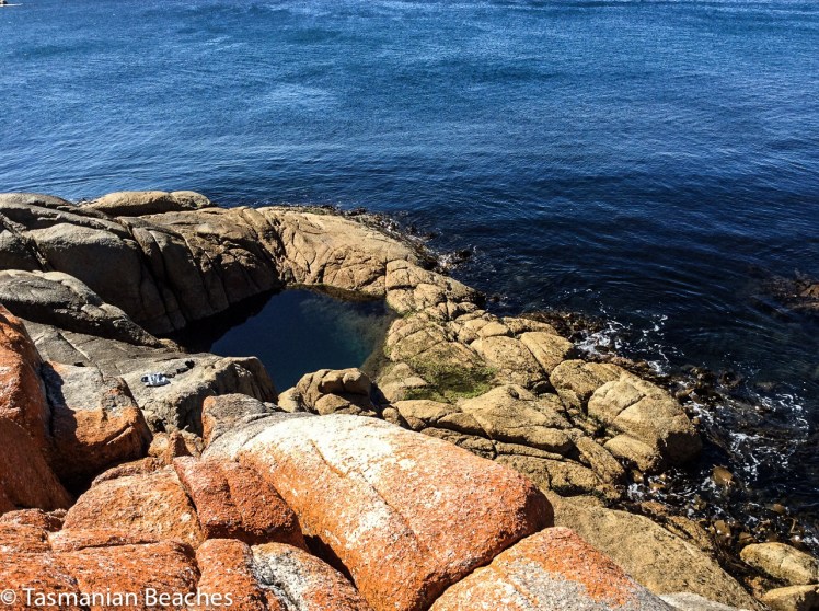
The path came out at the parking place for Sloop Point. Four of us, plus the two canines, had come here on a warm April day and meandered down the path to the massive sheets of lichened granite that make up the point . It has a fantastic rockpool, deep and clear and private, suspended above the ocean and claimed that day by a travelling couple in their twenties. This is the sort of place that’s probably seen a lot of people rip free off their clothes to skinny dip and enjoy the sun au naturale. It’s a highly risky business as others coming after can be as surprised as those caught cavorting in this spectacular rock pool above the sea.
Offshore were the Sloop Rocks, the bay’s most fascinating feature and visible over a vast distance. I call the most spectacular the Sitting Buddha but it probably has many names. I have a friend who calls it the Witch’s Hat.
Rock pool at Sloop PointSloop Rocks
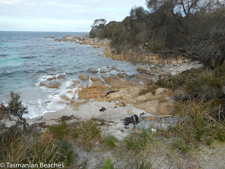
T 82 Seaton Cove
No amount of searching in the bracken revealed an onward path and so we took the dirt road down to Seaton Cove, another spot we’ve overlooked on our many visits to Bay of Fires. It was astonishing to come to a tiny, rather suburban looking enclave in the coastal forest after wandering through the bush, sometimes on paths and sometimes not. A camper van had settled in here (there is a little bit of camping space) but he was close by a short row of about five houses that looked like they’d lost their way to Launceston. Like Sloop Reef Cove, this is tiny and the boat drawn up on the sand, with only one motor, must rely heavily on good weather, particularly for its return trips, because there isn’t much room for error. It’s rocky here, both above and below the waterline and what beach there is has coarse granite sand and much kelp strewn about. I found some sea glass and a beautiful quartz pebble well polished by the sea.
But a well defined path led on past the bottom of the gardens, following the fence line, and back into the peaceful casuarina forest. Again the path grew uncertain. We’d lose the trail then find it again. Finally we found ourselves in a patch of sand surrounded by boulders and apparently isolated from the sea. Even here, so close to the sea, frogs serenaded near the small soaks in the rocks.
We had been walking along the top of these massive sloping granite platforms and boulders for some 500 m but they were getting to look familiar. Sure enough, we soon saw people on top of the huge boulders we know well – we’d made it to Cosy Corner.
We lingered here, feeling triumphant and wondering whether to head for the main road. It was getting on for 4 pm. This seemed an unadventurous option and so we turned around and walked back across boulders and through the bush to Seaton Cove. I was surprised on this visit to notice the beach was longer than I’d thought before, rocks dividing the cove into a north (hidden from the road in) and south side.
Looking south over north Seaton beach.
Again we debated resorting to the road we’d walked down before but there was a clear path we could see now, heading around the northern side of the cove at quite a height above the shoreline. We followed it, but it let us down and we got lost in bracken and fallen trees, just pleased it wasn’t snake weather. We could see the tree line along Sloop Point and so we clambered down on to the boulders then bushbashed up the other side when a gulch seemed impassable. Our trusty path finder took the lead. She invariably chose a route better than the ones we selected but she’s getting on and occasionally needed a helping hand over the trickier fallen logs.
This time our choice was clear – buoyed by our progress, we took the beautiful contour path we’d walked before. We reached a dirt road descending to Sloop Reef Cove but noticed the path continued across the road, above a few houses nestled in the southern corner of Taylors Beach. Orchids grew along here, pale purple and unassuming. It wasn’t long before we met the Gardens Road just above Taylors Beach and Sloop Lagoon.
This is the kind of walk I find the most exhilarating – a walk where the way is unknown and sometimes hides itself, demanding a degree of perseverance to continue, but offering up surprises – like another of those branch shelters that we’ve seen at Tinderbox, Dora Point and a few places elsewhere.
As I’d walked the Geography Bay beaches it had dawned on me that I was seeing very few birds. When I shared this observation with my friends most would think a little, then remember a couple of birds they’d seen on a rock the day before, or noticed on a beach they’d visited, or comment on seagulls that had been pesky down at the wharf.
This is very different from the year 1798, when Matthew Flinders estimated that there were at least one hundred million short tailed shearwaters within a single flock sighted in Bass Strait. They’re still Australia’s most common seabird but their numbers are nothing like that these days because of habitat loss and predation – especially by snakes and humans. (This Parks and Wildlife brochure explains more about these birds and their challenges.)
My friends’ answers perplexed me. I wondered if we’d normalised the low bird numbers we were seeing. Most of us don’t notice the loss of a particular birdsong from our garden because we don’t know the calls in the first place and we’re barely aware of our disruptive presence on birds when we wander along a beach.
One day earlier this year a notification arrived in my intray. Birdlife Tasmania was going on an expedition to Bangor, a well known farm on the Forestier Peninsula. There would be a beach walk and they’d be monitoring seabirds. I decided that this was a great opportunity to see a magnificent farm with 35 km of beaches and to learn more about shorebirds from those in the know.
And so I went along.
We were a group of about thirteen that hot day. A warm wind was blowing from the north east and then, in the afternoon (when we were at Swan Lagoon) the sea breeze filled in as is its wont from the south east, bringing a refreshing change.
Matt Dunbabin, the owner, met us and filled us in on the history and environment of the farm, telling us about the damage sustained in the bushfire two years ago and then we set off in convoy, travelling slowly over the farm tracks beside water, across Blackman Plains and through dry sclerophyll forest. We stopped regularly, safari style, to observe birds, to listen to their calls against the backdrop of silence. I felt humbled by everyone’s enthusiasm and knowledge knowing my own to be pitiful.
We came to the airstrip. On a hill behind the headland forming the southern end of Lagoon Beach there was a small wooden house and between this headland and its northerly, forested neighbour, but hidden by scrub, lay Lagoon Beach. It’s possible to camp here and people were. In fact, they’d been coming here regularly for the past 30 years.
The beach was irresistible and while the group broke up and went off to various spots to observe birds I set off to walk it. I was dismayed by the extent of the litter. ‘It’s the worst we’ve seen here,’ said the campers, stopping on their way back up the beach to talk about it. ‘No doubt those storms we had brought this mess in.’ I went back to get some bags and soon the group from WildWays, also a part of the group that day, were also picking up litter.
The campers certainly had a point. There had been storms and in fact 2016 has brought odd weather to Tasmania. When I drafted this blog post last summer, fires were still burning in the South West World Heritage Area and water storages had fallen beneath a mind boggling 12% through drought, mismanagement and a broken undersea cable that transports hydro electric energy to the mainland. Then, astonishingly, the north of the state was beset not once but several times by extremely damaging floods.
I saw oyster catchers, Pacific gulls and two hooded plovers as I walked along, sticking as close as possible to the water’s edge. The tide was up and the sand was mostly quite soft. The endangered hooded plover, a tiny, well camouflaged bird that makes its nest in a barely noticeable scoop of sand, breeds here and is susceptible to being wiped out by misplaced human feet, the sniff of a dog or a storm event.
Lagoon Bay beach
The beach was different from those I’d recently been walking. It was quite wide and apart from plastic bottles with Japanese print on them and other assorted plastic debris that hinted at fishing boats being the source, I saw an abandoned eggshell that testified to a new bird somewhere in the vicinity. There was a heap of kelp and sometimes the bones of fish, bird and possibly a marsupial. Growing over much of the beach was a prostate, four petalled plant, which I tentatively identified as sea rocket, a plant with an interesting back story. It seemed to be beach building, shaping the sand into slight dips and hollows and it was being thoroughly serviced by the bees – a bumble bee, honey bees and a small native bee were collecting nectar from its tiny flowers with quiet assiduity.
There is a small rivulet at the southern end of this beach, running along the bottom of the hillside. The campers had noticed discoloured water around here and a bad smell. Standing beside it I noticed a fairly empty Hills pesticide container (5l), the potential culprit. It seemed sadly ironic that this beach that would otherwise be so pristine, cared for as it is by environmentally aware owners, suffers, because of human carelessness, in this case probably coming from boats offshore.
It was on this beach that the difficulties posed for beach walkers by private land and rugged shorelines really hit home. TheList indicates land tenure so that bit is easy. Identifying owners is not, so private land poses an access problem for those of us keen to access hidden beaches, headlands and rocky stretches.
PART TWO
Two Mile Beach (Forestier Peninsula)
‘Two Mile Beach (T 299) is a gently curving 3 km long northeast-facing sandy beach located in 3 km wide North Bay … The bay is bordered by the prominent Cape Paul Lamanon and Monument Point in the north and 138 m high Cape Frederick Hendrick to the east. The beach receives refracted waves which average about 1 m at the shore and maintain a 50 m wide low tide terrace, cut by up to 12 rips during periods of higher waves. It is backed by a continuous foredune, which has a series of blowouts along the northern and central sections, some extending 200 m inland. The dunes are backed by 200 ha Top and Swan lagoons and associated partly drained wetlands, with Swan Lagoon draining out via a small creek at the southeastern end of the beach. Farmland borders and backs the lagoon, with vehicle access to Parrot Point at the southeastern end of the beach.’
I regrouped with those bird watching near the campsite and we were reminded of the importance of not going up into the dunes because of breeding birds. More soberingly, I discovered that the breeding season extends over spring and summer. Human summer holidays happen at absolutely the wrong time of the year for the birds and as for me, I mused yet again about how best to limit beach walking to autumn and winter.
If we were a kinder, less self indulgent species we would quarantine beaches, or at least a goodly number, so that birds are still capable of breeding, nesting and fledging their young. Our presence on beaches is a huge reason for breeding failure. There are beaches completely exempt to dogs or sometimes limited to particular times of the day but we put no restraints on ourselves.
About nine of us decided to walk up through the dry sclerophyll forest and down to Two Mile Beach. I had the most uncanny sense as we walked there of having been here before, on the wide track up through the forest, and I remembered how once long ago I’d gone with a keen birdwatching friend on a university ornithological weekend. Where the zoologists had placed a mist net back then had been so similar to where we were walking that just possibly it was in fact the same spot, given that we’d also gone to count shorebirds at Marion Bay, not that far from here.
Two Mile Beach was a vast, impeccable curve of sand – an irresistible walk. Far away it curved and ran out to a point. You could see the surf breaking on the rocks. But we didn’t walk it. We sat on the rocks, some of us in shade, some in the bright, hot sun and ate our lunches and talked, and I discovered that the youngest two members of our group originated overseas – one from Nepal and one from Canada.
A ‘tin dish’ that had been bobbing out in the bay came and anchored close to where we were sitting and the sole occupant began scuba diving along the peaceful reef.
As we began walking down the beach we noticed a few more things. Litter had been collected, and stockpiled in the corner. Fissure Island – it has a huge fissure separating its two sides one from the other – became visible around the headland.
Looking at the beach profile I think I figured out why dunes on this beach are also building and not receding. The kelp washes up. The sea rocket is nourished by it. It, in turn, nourishes secondary species, of which on this beach there was a profusion – the dunes were healthy and although marram grass was washing up it did not seem to be taking much hold… so many dunes around Tasmania have been damaged by the deliberate planting of marram grass, considered an asset back in the twentieth century.
In single file, out of respect for the birds, we walked carefully across the dunes to Swan Lagoon, brown and brackish. There were more bird species here – black swans, for one. There were hooded plovers on this beach, some juveniles too, and we counted and identified dead shearwaters – mostly Fluttering Shearwaters, recent arrivals from NZ, I learned, and increasing in numbers, as well as fairy prions and a little penguin. A juvenile Pacific gull with a damaged wing walked ahead of us, doing a short glide each time we got too near. On the way back, as we approached the end of the beach and it feared being cornered, it took fright and managed a longer flight out onto the water where it sank down amongst some other gulls.
It arrived and they departed and I thought it must have drowned because I did not see it leave with them and doubted its strength to do so in any case, and soon there was no evidence of any bird at all on that clear blue water. This passed without comment. My observation of declining bird numbers was taken as a given, the reasons well known. We discussed loss of habitat in places like China – either before or after this expedition I heard a man weep on Radio National because of the almost total loss of habitat for migrating birds along China’s Yellow Sea coastline. I was yet to experience the literally birdless skies I saw from the train as I traversed Asia and Europe by train and yet to read a report from Pakistan about the Indus Flyway (International Migratory Bird Route Number 4).
Again we sat on the rocks while the less heat tolerant members of our group ran across the sand and into the water for a skinny-dip – it was the kind of day and the sort of place that made a swim most compelling.
Bangor has a lovely restaurant, built after the bushfire, but we were all so engrossed in enjoying the lovely surroundings, both in and out of the water, on the beach and in the bush, that our progress out was slow and by the time we reached it, it was closing. I made a note to come back some other time to sample the wine and enjoy the oysters, at that particular moment in time being devastated by POMS up and down the east coast, just another unusual event down here in Tasmania and linked perhaps to the East Australian current flowing so much further south than usual.
Up on the hills, Tinderbox Peninsula is often so dry it’s pretty reasonable to assume that’s why it got this name, but the story is actually more interesting.
In the early 1800s Joshua Fergusson, who lived on the land just above the beach, saw a business opportunity and planted tobacco here with a view to supplying the local pipe smokers.
Land that once belonged to Joshua Ferguson – this house was once his barn, according to the interpretive panel at the beach.
One day he found a silver tinderbox inscribed in French, an indication that some thirty years before early French expeditioners, perhaps with Baudin, maybe with Bruny D’Entrecasteaux, had visited this beach and most likely made a fire, and stood around talking, perhaps exploring a little. Maybe this tinderbox slipped out of someone’s pocket or maybe it was left on a stone and forgotten. There’s also a chance that it had been traded or that it had washed ashore. Regardless, it’s owner sailed home to France but the tinderbox remained in Van Diemen’s Land.
One day Joshua Ferguson came beach combing, picked it up, and thought, ‘I know – I’ll name this beach after it.’
Shipwrecks
Bruny Island may protect the channel from the vast fetch of the Southern Ocean but the wind can funnel up and down this waterway, aided and abetted by the hills and valleys, descending with rapid speed upon the unwary.
Tinderbox Beach lies close to the northern (Storm Bay) entrance and the gap between the island and Tasmania is particularly narrow and also shallower here. As a consequence, a few boats have been caught out and come to grief on its shore.
On 6 July 1822 a government vessel (name unknown) sailed from Hobart and capsized in Tinderbox Bay. Two men drowned.
On 21 May 1887 the Alice, a ketch, dragged her anchors and went ashore in Tinderbox Bay.
On 12 March 1925 the Rebecca, a ketch (but officially a ‘barge’), heading from Hobart to Strathblane, was overwhelmed off Tinderbox Point by a massive squall, blew out her mizzen sail and drifted on to the rocks. She’d been built by Thomas Inches and James McLaren further down the channel on the Huon River in 1853 and was owned by Edward Knight.
As a small group of yachts moor off just offshore, and as the channel is a popular place to sail, there have doubtless been more nautical dramas on this little beach.
Back in 1948 the Government planned a vehicular crossing between Tinderbox and Dennes Point. This made sense – it was reasonably close to Hobart and this is, after all, the narrowest point. But again a storm came raging and this put paid to that idea* and so this beautiful spot (along with Nevada Beach on the Bruny Island side) remains intact – in fact, more so than most others as Tinderbox Beach was declared a marine reserve in 1991.
Pilot Station
Up above the beach and a little to to east there used to be a pilot station at Pierson’s Point. This beach would have been a great adventuring place for the children living there, and for parents to relax or mess about in boats, in much the same way as today. For more about life at the station, see Bill Harvey’s remembrances on the Beach Stories page.
Tinderbox Beach with jetty & Bruny Island across the D’Entrecasteaux Channel
The headsail was torn, the furler broken and so on that fine day last summer I found myself down on Tinderbox Beach as the seabreeze swooped in and the tide ran out.
This beach is small and beautiful, with a jetty, yacht moorings and the great bulk of Bruny Island protecting it from the worst of the Southern Ocean’s temper tantrums.
I walked east, past children playing on the sand and adults relaxing and on to the rocks, heading for the small cobbled beach below Pierson’s Point. I hadn’t gone very far when a man stopped me.
‘What’s over there?’ he said, sweeping his hand across the northern extent of Bruny Island. ‘More of the same?’
‘Not at all!’ I said and passionately described the unique qualities of Bruny Island. ‘Not to be missed,’ I concluded.
‘More of the same,’ he said morosely. ‘I think I’ll just climb in the back of my ute and have a sleep with my little mate.’
He was well set up. He and his travel worn blue heeler had driven down from Queensland rather quickly, then crossed to Tasmania on the overnight ferry which makes port on Tasmania’s north coast. They’d then hurtled down the extent of the island to this beach at the southern end, all in one day.
Walking on beneath the cliffs, I found some beautiful rock platforms that were (at least to my untrained eye) tessellated. There are well known ones at Eaglehawk Neck but on my walks I was finding them in many more places. Soon I noticed a couple who had set themselves up in a small, sheltered corner and I stopped to ask how far it was possible to continue walking in this easterly direction.
‘Not far,’ they told me. ‘You come to a gulch that’s just too wide to jump. We’ve often thought we should bring along a plank to get over it.’
From the rocks at Tinderbox looking north into the Derwent River
It wasn’t long before I came to that gulch. I had paused at many rock pools along the way – amongst the most beautiful I could recall seeing in Tasmania – but this gulch was exceptionally dense with beauty – kelp and a variety of other bright seaweeds. I regretted leaving my rocky shore guidebook at home because quite clearly a person should never visit a marine reserve without one.
The gulch was just too wide for me to jump. The pebble beach beneath Pierson’s Point was simply unattainable, at least today.
The other exquisite thing about the gulch was that it led into a small sedimentary sea cave. The rocks at its base and under the water had a shimmery pink glow. Right at the end of its deep resounding depths, small cobbles had been pushed up in a pile by the water, which was just deep enough to deter me and so I took a seat at the entrance of the cave and listened meditatively to what it had to say; and taped its voice.
The sea cave
I could have sat there all afternoon, listening to that gurgling water resonate in the cave but eventually I roused myself and walked back, climbing the cliff and finding that it ended up in someone’s garden. The man who had given me directions was now alone. We discovered we had mutual friends and I told him about the places I’d been and what I’d seen along the coastline and how puzzling the paucity of nomenclature was. We were standing on Mouheener land – they’d once enjoyed the bounty of the Derwent’s western shore, the Channel and Bruny Island. He thought the Aboriginal tribes probably named significant spots on the landscape for people in much the same we so frequently name them but I shared my different perspective, that places are named in accordance with long held myths, that the landscape is redolent with story but has lost its voice and then I walked back along the rocks, wishing I’d brought a plank with me.
The blue heeler was not asleep although his big mate was. We acknowledged each other and then I crossed the beach and walked westward, bound for North West Bay.
Swimmers told me the temperature was not too bad and in fact, that summer, the waters around Tasmania experienced heatstroke, their highest temperatures ever, the East Australian current extending further south than usual and bringing with it fish from warmer climes.
Rocky platform west of Tinderbox Beach. Looking into North West Bay (right)
I had the rocks to myself. The sandstone cliffs were photogenic. I was able to walk almost to the point where North West Bay begins – but not quite. Still, I was satisfied to have discovered that kayaking along here was likely to be rewarding, and so after studying the ripple marks of ancient beaches etched in the surface of ancient sandstone I followed the sea breeze back into Hobart, feeling exultant.
Historic photograph of this view is at https://stors.tas.gov.au/AUTAS001124067968w800 – View of Tinder Box Bay, the northern part of D’Entrecasteaux Channel Residence of Joshua Fergusson Esq. Walter Synnot.
It’s a little known fact but upstream of Dennes Point, just across the water from Pierson’s Point, there’s a shark refuge and the men in grey suits and the freezing water in which they undertake business were on my mind as I climbed into my kayak to paddle the Tinderbox coastline. I would have liked company but I had no takers and so I’d decided to go alone.
On a fine day.
With the water like a mirror.
And on a low tide.
‘We’ve kayaked it before,’ the geo had said. ‘You don’t need to do it again.’
I could not remember kayaking the whole length of Tinderbox, and if we had done so it was back when I thought of Tinderbox as one long stretch of formidable coastline with no discerning features other than cliff face and rocks. Now I knew better and had reached the conclusion that the best way to get to know the peninsula was by kayak, right up close to the rocks, in part because I didn’t want to be that kayaker who made the headlines through being snaffled in the Derwent. After all, Hobart is full of sea kayakers who paddle this stretch and think nothing of it.
But I wasn’t one of them. I simply had a little goal to achieve and a mystery to solve: where was the door to the underground tunnel behind the cliffs?
‘Sailing is all about anticipation,’ my friend M, used to remind me and it’s perhaps more so with kayaking. I checked the Bureau of Meteorology site and chose my day – swell beneath 0.5 m and north westerly winds below 10 knots turning variable later in the day. It sounded perfect.
A small wave splashed over my map as the geo pushed me off and even before I’d made it out to Flowerpot Point, kayaking through the moored yachts in the southern corner of Blackmans Bay, I could tell the river was intent on being a trickster. Because the water was in fact lumpy, and so another fear assailed me. If I fell out, it would be mere moments before I died of the cold and much as I love the river I did not want its bed to be my last one. As I rounded Flowerpot Point I felt threatened by swell coming at me from all directions, no doubt lingering from previous bad weather. The surf breaking on Soldier’s Rocks a couple of hundred metres away looked downright intimidating.
I stopped. ‘Too rough… poor visibility,’ I advised myself and I wobbled into the little cobbled bay (T468) that I thought I had befriended on one of my earlier walks only to find it fractious and lumpy, the water disconcertingly black. I began to reach for my mobile (geo, come back!) but I didn’t feel steady enough to use it.
‘You miserable little coward,’ admonished the chorus in my head. I could already see Passage Point and North Bruny Island and they didn’t actually look that far away. We’d figured it would take me three hours (based on my dawdling on previous paddles) and certainly sailing along here sometimes takes a goodly length of time. And so I pointed my kayak south again, put my head down and paddled briskly towards my first waypoint, Soldiers Rocks, adrenalin ratcheting up my heartbeats. My seat wasn’t properly adjusted; my legs were already going numb. This was affecting my balance. No ways was I going to reach for my camera.
I burned passed Soldiers Rocks, keeping a distance between us because of the toothy break and reflective swell, and my compromised ability to use the pedals I could no longer feel. The Lucas Point Sewage Plant now seemed more friend than foe. I could see how in this little bay the beaches from the water seemed a single beach rather than two or three, but I was not game to reach for my iPhone.
There was no going back now.
Because of the slop I couldn’t get near the shoreline and so I had to put a big fat cross through the image I’d had of myself, drifting along a feet or two from the cliffs, trailing my hand along rocks from time to time (hello, rocks! hey, sea anemone!) imprinting the geography in my head, scrutinising the cliffs for the hidden doorway.
My next waypoint was Fossil Cove and I could see the arch ahead of me. The geo and the dogs were going to walk through it to the part of the beach on the northern side and I’d said I might see them here but little did I know, they were way behind me. (And little did they know I was ahead. They waited here a long, long time.) Ahead, closer to the eastern shore, was a ship at anchor. There is often a ship at anchor, presumably waiting to proceed upriver but they are like ghost ships. Sailing past, you never see crew. Back when Sandy Bay was barely populated, the ships at anchor often had clandestine grog on board that was collected by smugglers under cover of darkness.
A smaller ship came around the Bruny Island coastline and headed down the D’Entrecasteaux just as a boat came roaring out of it, headed my way. Fishers, I thought, but no. They began to reverse their boat into an extremely narrow gulch on the southern side of Fossil Cove. Neat! And what a clue! They’d been invited to lunch!
To keep my mind off sharks I contemplated the cliff top with its magnificent view, far more alluring IMHO, than an underground dining room but I guess diversity is the spice of life.
Lucas Point came and went. Before I knew it I was past Passage Point where, in the wind shadow, the water lay down. The tide was more resistant here but I was quickly through the gap between Dennes Point on North Bruny and Piersons Point on the Tasmanian mainland and in the channel flat water with a quiet lattice of ripples welcomed me. Beneath me, arrow squid, australian salmon, barracuda, pike, flathead, whiting and silver trivially glided, but I was unaware of them. Beneath the cliffs a seal lolled in the water, one flipper up. I paddled past the two little cobbled beaches, the tiny gulches and the sea cave and made it on to the beach before the geo and dogs arrived to give me a lift home. I hadn’t managed to explore the beaches but, chased ever onwards by imaginary sharks snapping at my stern, I did do this leg in 1 hour flat!
Cobbled beach, Pierson’s Point and quieter water
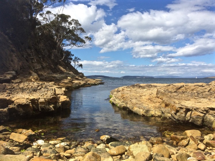
Cliffs at the start of the D’Entrecasteaux Channel
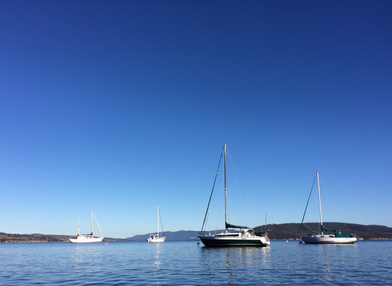
Moorings off Tinderbox Beach. Bruny Island (left).
Piersons Point with the Tasman Peninsula in the distance and Bruny Island just across the water
Just because you’re a long way from an empire’s capital, with limitless miles between your island home and battlefields and just because a feud can begin and end in the space of time it takes to receive a letter doesn’t mean that you’re not going to get the jitters hanging out at the end of the world. So when GovernorLachlan Macquarie visited the Hobart Town settlement in 1811, his mind turned to the enemies that could arrive unannounced up the Derwent River – the French, for example, not that long ago defeated in the Napoleonic Wars. His perspective was military; the place clearly needed fortification, and so a network of batteries, some interlinked by means of tunnels, took shape along both the eastern and western shores of the river. I had long ago passed Alexandra Battery, which sits above Blinking Billy Point. The battery at Piersons Point is significant because along with Fort Direction on the far side of the river, it protected the river mouth (although it was a late comer to the system as it was actually only constructed and used during WWII). Prior to that time there was a pilot station here, at the junction between bay, river and channel and on fine days the family based at the Iron Pot lighthouse sometimes rowed across for a bit of conviviality.
When we’d arrived after our wander along this stretch of shoreline, there were some Sudanese children playing tennis on the court that seems as oddly placed here as the idea of a battery is now. Bruny Island is a short hop across the water, the river was to my left, the D’Entrecasteaux Channel flowing into it from my right, and Storm Bay spread south. I could look back down the long stretch of coast I had explored and across the river to Cape Direction and the Iron Pot light.
It had taken a bit of research but I now knew that the river was not only a drowned river valley but also a rift valley. I knew there was a bar beneath some 15m of water just north of Pierson’s Point and I knew that there was likewise a bar running from Piersons to Dennes Point on Bruny Island, because the depth instrument on Samos registers this as we sail over it. But the geo had also put me straight about the the river, the channel and their geological inter-relationship and his take is attached at the bottom of this entry.
It was ages since I had set out to explore beaches, yet here I was still in the Derwent. I had discovered parts of the shoreline I hadn’t really known existed. I had discovered it’s vague and sketchy nomenclature and I had discovered that it wasn’t supporting nearly as many birds as I had anticipated. I now knew these beaches were pocket beaches and that it’s pointless walking beaches without giving equal weight to the coastline in between and I had discovered that the means of travel impacts greatly on the experience. My most profound realisation had been that I was not nearly as hefted to the land as I had once thought I was.
I’d walked along Tinderbox’s spine but the road is narrow and while picturesque it can occasionally be at an unrewarding distance from the river. I knew I would cycle it one sunny day, but that’s more about a ribbon of bitumen than it is about the river and its beaches. I sail this coastline frequently, but then my attention is more on the boat’s interaction with wind and water. That being so, I felt I wouldn’t have done it to my liking unless I kayaked it too. I thought that in my kayak I could really acquaint myself with its rocky shore. And besides, hidden among those cliffs was, bizarrely, a secret door and I was keen to find it.
We set out the teapot and cups, then sat down and enjoyed a little tea ceremony to honour the Derwent. There were cumulus clouds in a blue sky. On such a stunning day, watching the ferry crossing the channel further south between Kettering on the Tasmanian mainland and Roberts Point on Bruny Island those old geographic anxieties seemed peculiar indeed. My geographical anxieties were of a far smaller scale than the governor’s. They were focussed on how I was going to co-ordinate my blog with the places I was intent on exploring. How to proceed, I was wondering. South down the Channel, and if so by what means? Or north from Sandy Bay through Battery Point and if so, how far up river? And if I mixed it up how would I keep a sense of continuity going in both my brain and on my blog?
Looking across at Dennes Point, Bruny Island from Piersons Point.
Lacking the grace of an old lighthouse and looking more like something from outer space. Automated light at Piersons Point with the Iron Pot lighthousein the distance.
With a Dark and Stormy in one Hand and a Pencil in the Other
PASSAGE POINT
Passage Point is a notable promontary at the mouth of the Derwent Estuary and is both lovely from the water and green and pleasant from the road – a rolling hillside, a rustic shed, an abrupt cliff line carved by the waters of the Derwent, the D’Entrecasteaux and Storm Bay.
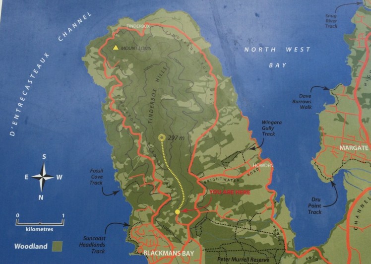
Map from the Kingborough Council Signage at the start of the Tinderbox Hills track: nomenclature is thinly used. Passage Point, Piersons Point and Tinderbox Beach, all important landmarks, are not noted. (Passage Point is to the left of Mount Louis.)
Having finally decided that ‘not the real Fishermans Haul’ was in fact the real Fishermans Haul (see last blog post), we went to Passage Point to see if there was some way we could access the little cobbled beach I’d noticed. There wasn’t. We had to make do with expansive views but as these were superlative and so vast in scope we could hardly complain. Mount Louis, Tinderbox’s highest point and forested in eucalypts rose behind us.
Birngana off Passage Point
My guess on how Passage Point got its name was all tied up with waypoints, landmarks and the ocean because if you’re heading off in your yacht on a trip of any distance, it pays to sit down and plan your passage. With a ‘dark and stormy’* in one hand, and a pencil in the other, take a careful note of the tides, currents and potential hazards. Become familiar with the landmarks you’ll pass, navigational signs you’ll encounter, channels or reefs you may need to negotiate and choose your waypoints. Make Meteye your new best friend and despite being in love with your chartplotter, tuck the paper version into your nav table too because it’s less likely to let you down. Departing the Derwent at this point to head out across Storm Bay is always a bit of a passage into the unknown because the bay is notorious for conjuring tempests up out of the most benign conditions.
Because this familiar promontary is just there where the waters of Storm Bay, the Derwent and the D’Entrecasteaux merge, it’s symbolic of passages about to begin and passages almost completed. So it goes without saying that this is how it got its name, right?
Wrong.
I checked Placenames Tasmania and found some unverified information. A boat called the Fancy was one of ‘the few remaining trading boats called passage boats.’ Back in slower more leisurely days these boats used to ply the Derwent and the Channel. In doing so, they had to round Passage Point and in so doing, they gave the point its name.
This information in the database comes from a boating article in the Saturday Mercury, Jan 2002 where it’s also noted that ‘most features on coasts were named by mariners and seeking reasons for names means looking at it [sic] from a mariner’s point of view. Thus Passage Point was a marker for south-bound boats of the entrance of ‘the passage’ or the Channel.’
Exploring the sweep of shoreline from Sandy Bay to Tinderbox had triggered my curiosity about the way places were named but I had not considered that mariners had a big hand in the names of the places I was exploring. This was an unforgiveable oversight because it’s obvious that many major features first got their names from the early voyages of discovery. My impression of the western shoreline of the Derwent was that places were usually named after the early landowner’s or overlooked in the naming process altogether but I could see that in a tiny colony at the end of the world there’d be a sense of familiarity and homeliness for locals who plied these waterways in naming the places they were passing by the names of the people they knew. On dark and stormy nights in particular, the ability to recognise familiar landmarks and tick off waypoints is comforting and engenders hope when you’re toughing out rugged conditions.
We paused here to savour the view. Passage Point felt extremely evocative for me: I had walked out one wintery morning and followed the Sandy Bay Rivulet down to its mouth. I had turned right and wandered the shoreline from there to here, a distance of some 35 kilometres, give or take a few and although I had done this as an urban explorer, little bit by little bit, it had been fun, it had changed the way I related to the coast as well as dramatically expanding my knowledge of the city I live in.
Beaches T 471 (Fisherman’s Haul) & T472 Fisherman’s Haul South
Having scrutinised more maps I began to doubt that the Lucas Point Sewage Plant was actually at Lucas Point. It’s the landmark that helps identify Fisherman’s Haul and as conversations with locals had helped me fix it in my mind that it lay just south of Flowerpot Hill I started to think that the problem was one of language – ‘just’ is a stretchy kind of word for a start, and may not have been used by anyone I’d spoken to. It may simply have been a supposition I’d made from what had been said to me.
Our modus operandi was to drive along the Tinderbox road slowly (not difficult – there were quite a few cyclists out and about) and check for detours down the slope. The geo noticed a sizeable piece of green land with car tracks on it, somewhat sheltered from the road by a partial row of caesurinas. We did a u-turn and went back to investigate.
Close by a man was burning off. He ambled over to talk to me and I asked him if this was Lucas Point.
‘Some people think it is, but it isn’t really.’
‘Is it back where the sewerage plant is?’
‘Nope. Some people think that’s Lucas Point too, but it isn’t really.’
‘So where is the real Lucas Point?’
He pointed vaguely over his shoulder. ‘Back there a bit.’
‘Okay… And so I’m wondering, if Lucas Point is back there, then is this Fishermans Haul?’
‘Some people say it is but it isn’t really the real Fishermans Haul.’
‘Is there a beach down there?’
‘Nope.’
‘Is there a path down?’
‘Maybe. You should be okay if you’ve got your balancing shoes on.’
‘Well, thanks, I might go and explore.’
The geo was down at the bottom of the slope reading a sign. It stated ‘Lucas Point’. A thin band of caesurinas lined the vertical cliff top so we put the dogs on leads and slithered down a very steep path of sorts beside a short deep gully carved by another youthful rivulet, at that time dwelling soley in a few remnant pools. An old rusty cable lay beside the track but we couldn’t identify a use for it unless haulage came into it. It didn’t take at all long before we came to the end of the path. It stopped for me at a rather cracked and fragile looking rock arch left over from a previous coastline. It might have been fine to walk over it onto the high rocky platform but I didn’t like the look of the cracks in the unconsolidated cliff face to which it was attached. The geo and the dogs stopped a bit further back because it really wasn’t a place for the dogs to be at all – it was all rather precipitous.
The rocks at the real Lucas Point; climbers’ secret
It goes without saying that the long views were superlative. Down this end of the river we were getting closer views of the Iron Pot, the lighthouse at the entry to the Derwent River and in the southern curve of Lucas Point (the cliff I was presumably standing on) was a very beautiful and quiet cobbled beach and just to the north of where I was standing was another cobbled beach. Looking directly south at the cliffs that work around to Passage Point I saw a third. And looking directly down was a tiny narrow gulch.
Fisherman’s HaulLooking south from Lucas Point, the beach below Passage Point just visible.
Andrew Short notes a Fishermans Haul (S) and a Fishermans Haul. Here’s his description of Fisherman’s Haul:
‘Fishermans Haul is a small curving cobble beach (T 471) located to the lee of 40 m high Lucas Point. Steep vegetated bluffs rise to 50 m behind the small beach, which is partly sheltered by the point and rock reefs resulting in low waves at the shore. The road runs along the top of the bluff 100 m west of the beach with access via a steep descent. ‘(Short, 2006)
And here’s his description of Fishermans Haul South:
‘Beach T 472 commences 100 m south of the Haul, and is a 200 m long east- to northeast-facing narrow high tide cobble beach located at the base of 50 m high cliffs, with a steep gully descending to the centre of the beach.’ (Short, 2006)
New discoveries! Seen so often from the water but not really properly seen at all. I was happy to believe the sign and this time, added to the slippery geography I’ve been doing battle with, was that local’s wicked sense of humour and the entertainment he got from causing confusion.
This coastline may seem impossible to access on foot but later I discovered that it’s loved for being a climbing area rich in deepwater solos, that method of climbing that evolved in SW England.Nick Hancock makes it clear that for this you need a kayak you can tie up while you climb up dolerite boulders or columns at this point and you need to be confident that the water is deep and safe enough to splash down into. Don’t even think about trying this unless you have plenty of experience, not just about deepwater solos but weather conditions and the sea state too because Tinderbox is unforgiving. And if you think the name makes it promising for fishing, pack your tackle and take your rod further afield. Too many fish have been hauled and this area is now protected within the bounds of the Tinderbox Marine Reserve – no fishing allowed.
View across the river to South Arm from the real Lucas Point. The Iron Pot is that tiny dot to the right.
Beneath the Lucas Point Sewage Plant there’s a bay and in that bay there’s a thin cobbled beach divided by boulders from another stretch of tide constricted beach. (Possibly Andrew Short’s beaches T469 & T470, but I could well be wrong.)
We’d started the day with brunch at MONA, Hobart’s incredible Museum of Old and New Art, way upriver and I only mention this because I’d spent an inordinately long time at the Marina Abramovic exhibition, engrossed in watching her meditatively regard a donkey and the donkey’s long considered response to her. The immaculate stillness of it all; the way the observer is absorbed into the dynamic of the interaction and how, in paying attention, new details about the donkey, or Marina, or even the pared down environment emerge into focus long after you think you’ve observed everything there is to see alerts you to the fact that perception is fickle and attention is a skill that needs honing.
It made me wonder how long I should spend regarding a beach and how you express gratitude to such a multi-diminsional part of this planet.
Later we packed a rucksack and headed down to the Tinderbox Peninsula. The off the leash exercise area behind the Lucas Point Sewage station was vibrant with canine energy but we detoured up Flowerpot Hill’s southern slope. A blue sky, and a light sea breeze …we reached the place I’d stopped before and paused to consider the various blossoms in flower along the edge of the cliff line.
This beautiful eucalyptus is not indigenous to this area.
I quizzed each local I met about beaches. I was particularly after information about a beach called Fisherman’s Haul but no one could enlighten me.
We snooped around the sewage plant and debated taking a tangled path then elected instead to descend to the shore via another steep path that followed the edge of the short deep gorge carved by the rivulet that inhabits this valley. There’s no sign to identify it but it reaches the Derwent via a cobbled beach and there, that day, it stopped behind the pebbles heaped up on the steeply sloping little beach that was being pounded by business minded waves. Occasionally we’d hear the sound of those cobbles making music as the waves retreated.
The tide was high and I had to calculate the time between waves in order to reach a spot at the northern end from where I could peer over boulders into the Lucas Point Sewage Plant’s beach (if indeed it really was a separate beach).
Lucas Point Sewage Plant’s beach just north of the Flowerpot Coastal Reserve beach.
The tide had left only one small, dry patch at the southern end and so I didn’t think it was wise to gamble with the waves. There was graffiti on its cliffs and above that I could see the sewage plant. Both detracted from its original beauty, one of austere rock and wild water. I could see Soldiers Rocks and just this side of them a lone man fishing. It seemed somewhat too close to the sewage plant to be a palatable past time.
Meanwhile, the geo had brewed the tea given to us by a friend who’d departed in his yacht to sail home to NZ. We sat back and contemplated the beach and the little rivulet, the cliffs to our south and the kayaker who surfed one of the breaking waves before heading on north with no break to his momentum.
Lone kayaking along a rugged shore ~ Soldiers Rocks in the distance
In that beautiful setting the tea tasted divine and lent a meditative quality to the attention I was lavishing on the shoreline. Then I performed a tea ceremony to honour the beach. A little liquid connection. A means of feeling my way towards how one says thank you to a beach for its existence.
Gratitude to all things beach and water
Afterwards I walked the small bushland path beyond the dog exercise ground by myself, wondering where it would take me. Like a lot of my coastal explorations, I ended up walking a circle. What beach we’d found I did not know but I did find out it wasn’t Fishermans Haul – the map said no. So for want of knowing the local name, I’m calling it Flowerpot Coastal Reserve beach and if you’re idling in this area it’s worth seeking it out. Because it exists, and it’s hidden away, and it’s very Tinderbox.


")


")