A Different Sort of Tasmanian Beach: Hard, hidden and hostile

The Tinderbox Peninsula, approximately 5.5 km long, points south east and rises steeply from the water. It’s forested with eucalypts that make their living on hungry soil and its cliffs make the Alum Cliffs look positively inviting. What’s more, they shoulder into at least three bodies of water: the Derwent, the D’Entrecasteaux Channel and North West Bay. I think it’s reasonable to add a fourth because water pays no heed to lines in the sand. Storm Bay is supposed to come to a halt a tiny bit south at Dennes Point, North Bruny Island but I think it exercises free will in this regard. Tinderbox is not outside its orbit.
If you take the lovely walk along the Tinderbox Hills Trail (see sign above), following the backbone of the peninsula the views of all this water – all the same water really – are pretty spectacular.


South Africa (once my homeland) has one vast and magnificent peninsula, the Cape Peninsula, which is justly famous. There, mountains plummet into the sea. But Tasmania is an island of water bodies, peninsulas, isthmuses, mountains, lakes and islands. And there is quite a lot that is special about this particularly scenic peninsula. The white gums and blue gums that push their roots deep into the usually dry ground provide a livelihood for the forty spotted pardalottes, green rosellas and swift parrots. These trees are an endangered habitat and it makes for endangered birds.
This is a coastline I’ve mostly sailed along, both in calms and in gales. When you’re sailing along these Tasmanian beaches and the wind is from the west you can find yourself in a wind shadow along here. Conversely if it’s whipping across from the east beware this lee shore. One wintery night stands out. We’d been becalmed and then, passing Blackmans Bay a sinister, warm wind flowed over the beach and curled around the corner, a portent that as a rookie with a pretty sketchy knowledge of winds and landforms I noted with unease. We were becalmed again off Tinderbox, left far behind by the rest of the fleet, but what, two of us had been wondering, might be awaiting us in the D’Entrecasteaux Channel when we emerged from the shelter of the cliffs beside us? It had to be, and it was, total pandemonium.
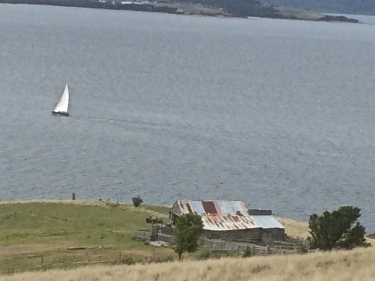
Conversely, on the day this photo was taken I wasn’t on Birngana, the boat I was crewing on some time later. I was at Boat Sales, finalising the purchase of Samos, but after that was done I drove along the Peninsula to see how the long distance race was panning out. Birngana was in the vicinity of Passage Point, heading for home and an easy win. We were well positioned to win the whole series but a week or two later disaster struck and there would be no more racing.
On board they could see the cliffs and the beaches, which from the road aren’t visible at all. They could see the cliff top houses in their spacious grounds – although, focussed on victory perhaps they were not looking. And there was one building that would certainly pass unnoticed, no matter how hard they looked for it.
Some people build themselves castles (even in Tasmania) but a South African millionaire decided to build himself ‘a boozy bunker’ – a tunnel and a cave worth millions, behind the cliffs – as you do. A place to party, to drink and to feast. There’s a door (disguised by a veneer of sandstone) that opens on to a rocky platform. You’d never know it was there.
And here’s another thing. For a long time it was supposed that the waters of the Derwent feed the D’Entrecasteaux Channel but actually, it’s mostly the other way around – channel waters predominantly feed the Derwent. (This is something Christine Coughenowr, Manager of the Derwent Estuary Program) explained to members of the Cruising Yacht Club of Tasmania at a meeting recently.)
Another observation from sailing this shoreline – as you enter the relatively small opening to the channel between Tinderbox and North Bruny Island, the depth decreases quite dramatically, just briefly. Imagine a different geography, with Tinderbox and the island connected. During the last Ice Age you could have strolled across to Bruny Island, rather than paddling your canoe. Bruny would have been a long, ‘isthmused’ extension of the Tinderbox Peninsula.
Along the Derwent River side of the peninsula the Tinderbox beaches are mostly inaccessible, mostly cobbled. They are my kind of beach – the type you have to go searching for.
And so I did.

I enjoyed this post, as you write very well! Thanks for following my blog, sophiasailing.com. I look forward to reading more about your adventures!
Thanks so much for taking the time to comment.