Breaking Away: Hong Kong to London by Train

 The Joys and Sorrows of a Small Blue World

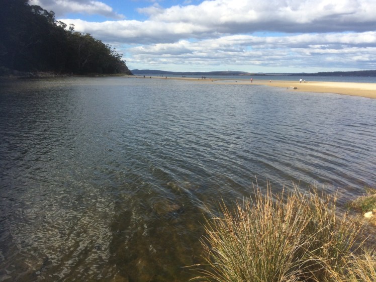
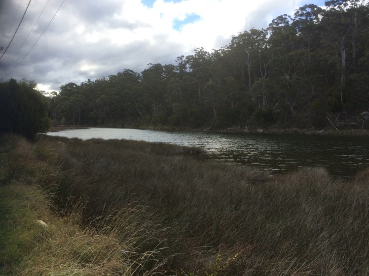
The owl is calling in the garden.  The river is quiet, the mountain is alive with night life of a different kind… the wallabies, bandicoots, sugar gliders, frogmouths and the moths.  This is home but sometimes it’s nice to go away and expose yourself to the joys and sorrows of a greater world.

The Trans Siberian Express, and Then Some

I had thought that by focussing my attention on the local coastline I’d subdue the travel bug but that’s a hard call when someone you love wants you to visit them in London.

Of course you say yes.

But to tread more lightly on the earth we decided to take the train from Hong Kong to London – a cruise overland, country and cultures slowly revealing themselves.  Sailors who have spent days at sea get this but most people I told were bemused. ‘That’s a long time on a train,’ they said.

In fact, the days flew.

I’d do it all over again in a heartbeat even though you see the damage as well as the beauty.

Silent Summer

Whenever he emerged from the vodka soaked conviviality he was enjoying with the Russians in the next compartment, the American would say, ‘Why has China got no bugs?’  And I would reply, ‘Why are we not seeing any birds?’

It seemed a silent summer.

Between Hong Kong and Beijing we saw a horse, a cow and a few tiny flocks of sheep but no birds.  We saw new cities of derelict buildings and a countryside devoid of life.  As we walked seven stages of the Great Wall  one hot and humid afternoon we encountered two red bottomed bumble bees (name unknown) and although about half the bumble bee species known to the world occur in China, I see heaps more in my garden on any sunny summer’s day.

Siberia does have insects. We met our first big winged thing at the border. Siberia also has a multitude of mosquitoes, but across it’s whole extent we barely saw a bird, let alone a flock, despite passing wetlands, Lake Baikel and rivers.

‘There’s plenty of wildlife in Russia,’ said one of the Russians.  ‘I’m going hunting as soon as I’ve unpacked my bags.’   And after giving the matter some more thought, he said the train probably scared the birds away.

Slicing through country in a train is no way to monitor wildlife  but in trying to find out why the emptiness I found my concerns are shared by Pakistan – they’ve noticed a drop in migratory birds from Siberia.

Australia has also noted a similar collapse.

Personally, I’m sad the birds were foraging elsewhere because Siberian birdlife is magnificent and migrating flocks, though smaller, are also  apparently returning home  earlier than usual each year.

We saw two storks in Poland, the odd bird in Germany and a small flock of waterfowl  in Holland. In the UK the skies were busier but we were on foot and bicycles there and that might have been the difference.

Plastics Rule

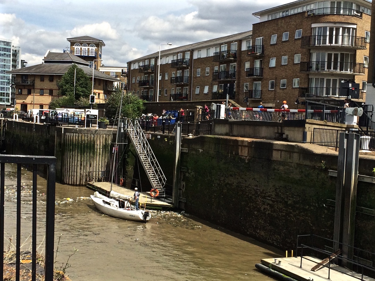
Walking through history and past longboats along the lovely Regents Canal in London, birds were nesting amongst the plastic drifting on its surface (see below – that mound in the water is a nest).

Regent Canal plastic

We rode along the Thames to Greenwich, looking at the little beaches where in the nineteenth century mudlarks (the human variety) searched for pickings. A small yacht negotiating the lock from the Thames into the Limehouse Marina was surrounded by plastic litter, a bit like that nest.


Yacht entering Limehouse Basin Thames River bike ri

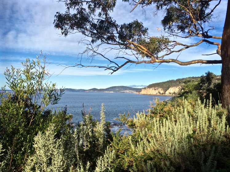
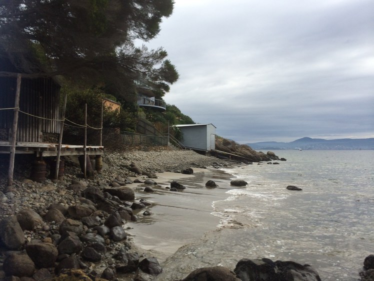
No Tasmanian Coastline, This

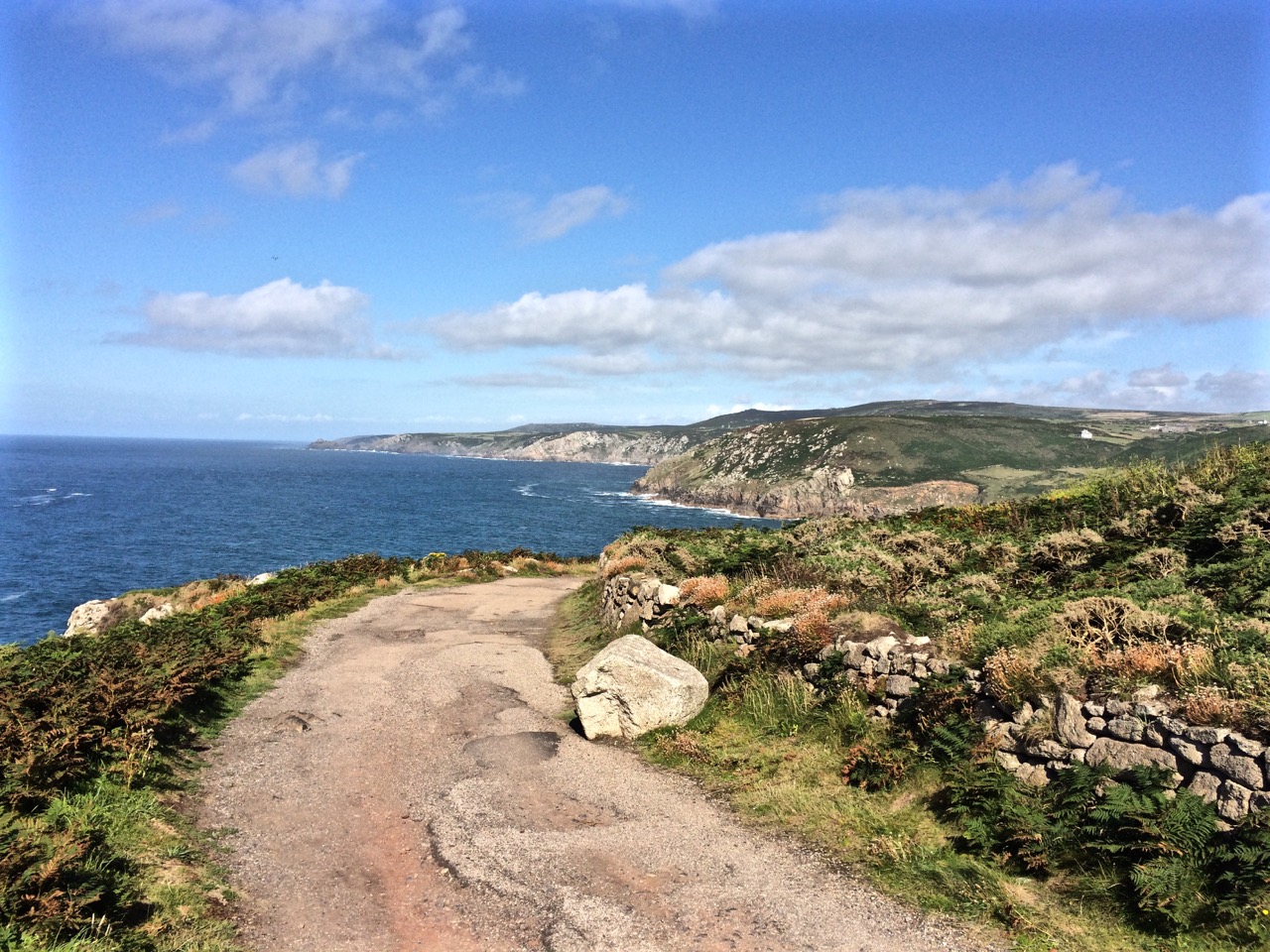
We cycled from St Michael’s Mount to Mousehole in Cornwall and walked from St Ives to Zennor.

It was summer; it was magical. The weather was warm, the leaves full of sap, the wild flowers  in blossom and the breeze was fragrant.

Land's End

It was tough returning to winter.

Storms had pummelled the island while we were away. The Hobart Rivulet, imprisoned beneath the city streets had flooded and damaged buildings.  It had been an expensive and inconvenient pest, apparently, but I felt empathy for its bid for freedom.

It just wanted to do what rivers do best: shape and nourish landscapes.

And me: I’m just dancing in the rain because hey, it’s still a vibrant, abundant world with far more joys than sorrows, and there’s an owl calling in the garden.


Derwent River: Kayaking the Tinderbox Peninsula

Smacking Down Fear with a Paddle

It’s a little known fact but upstream of Dennes Point, just across the water from Pierson’s Point, there’s a shark refuge and the men in grey suits and the freezing water in which they undertake business were on my mind as I climbed into my kayak to paddle the Tinderbox coastline.  I would have liked company but I had no takers and so I’d decided to go alone.

On a fine day.

With the water like a mirror.

And on a low tide.

‘We’ve kayaked it before,’ the geo had said. ‘You don’t need to do it again.’

I could not remember kayaking the whole length of Tinderbox, and if we had done so it was back when I thought of Tinderbox as one long stretch of formidable coastline with no discerning features other than cliff face and rocks. Now I knew better and had reached the conclusion that the best way to get to know the peninsula was by kayak, right up close to the rocks, in part because I didn’t want to be that kayaker who made the headlines through being snaffled in the Derwent.  After all, Hobart is full of sea kayakers who paddle this stretch and think nothing of it.

But I wasn’t one of them.  I simply had a little goal to achieve and a mystery to solve: where was the door to the underground tunnel behind the cliffs?

‘Sailing is all about anticipation,’ my friend M, used to remind me and it’s perhaps more so with kayaking. I checked the Bureau of Meteorology site and chose my day – swell beneath 0.5 m and north westerly winds below 10 knots turning variable later in the day. It sounded perfect.

A small wave splashed over my map as the geo pushed me off and even before I’d made it out to Flowerpot Point, kayaking through the moored yachts in the southern corner of Blackmans Bay, I could tell the river was intent on being a trickster. Because the water was in fact lumpy, and so another fear assailed me.  If I fell out, it would be mere moments before I died of the cold and much as I love the river I did not want its bed to be my last one.   As I rounded Flowerpot Point I felt threatened by swell coming at me from all directions, no doubt lingering from previous bad weather. The surf breaking on Soldier’s Rocks a couple of hundred metres away looked downright intimidating.

I stopped.  ‘Too rough… poor visibility,’ I advised myself and I wobbled into the little cobbled bay (T468) that I thought I had befriended on one of my earlier walks only to find it fractious and lumpy, the water disconcertingly black.  I began to reach for my mobile (geo, come back!) but I didn’t feel steady enough to use it.

‘You miserable little coward,’ admonished the chorus in my head.  I could already see Passage Point and North Bruny Island and they didn’t actually look that far away. We’d figured it would take me three hours (based on my dawdling on previous paddles) and certainly sailing along here sometimes takes a goodly length of time. And so I pointed my kayak south again, put my head down and paddled briskly towards my first waypoint, Soldiers Rocks, adrenalin ratcheting up my heartbeats. My seat wasn’t properly adjusted; my legs were already going numb.   This was affecting my balance.  No ways was I going to reach for my camera.

I burned passed Soldiers Rocks, keeping a distance between us because of the toothy break and  reflective swell,  and my compromised ability to use the pedals I could no longer feel. The Lucas Point Sewage Plant now seemed more friend than foe. I could see how in this little bay the beaches from the water seemed a single beach rather than two or three, but I was not game to reach for my iPhone.

There was no going back now.

Because of the slop I couldn’t get near the shoreline  and so I had to put a big fat cross through the image I’d had of myself, drifting along a feet or two from the cliffs, trailing my hand along rocks from time to time (hello, rocks!  hey, sea anemone!) imprinting the geography in my head,  scrutinising the cliffs for the hidden doorway.

My next waypoint was Fossil Cove and I could see the arch ahead of me.  The geo and the dogs were going to walk through it to the part of the beach on the northern side and I’d said I might see them here but little did I know, they were way behind me.   (And little did they know I was ahead.  They waited here a long, long time.)  Ahead, closer to the eastern shore, was a ship at anchor. There is often a ship at anchor, presumably waiting to proceed upriver but they are like ghost ships. Sailing past, you never see crew. Back when Sandy Bay was barely populated, the ships at anchor often had clandestine grog on board that was collected by smugglers under cover of darkness.

A smaller ship came around the Bruny Island coastline and headed down the D’Entrecasteaux just as a boat came roaring out of it, headed my way.  Fishers, I thought, but no.  They began to reverse their boat into an extremely narrow gulch on the southern side of Fossil Cove.  Neat!  And what a clue!  They’d been invited to lunch!

To keep my mind off sharks I contemplated the cliff top with its magnificent view, far more alluring IMHO, than an underground dining room but I guess diversity is the spice of life.

Lucas Point came and went.  Before I knew it I was past Passage Point where, in the wind shadow, the water lay down. The tide was more resistant here but I was quickly through the gap between Dennes Point on North Bruny and Piersons Point on the Tasmanian mainland and in the channel flat water with a quiet lattice of ripples welcomed me. Beneath me, arrow squid, australian salmon, barracuda, pike, flathead, whiting and silver trivially glided, but I was unaware of them. Beneath the cliffs a seal lolled in the water, one flipper up. I paddled past the two little cobbled beaches, the tiny gulches and the sea cave and made it on to the beach before the geo and dogs arrived to give me a lift home.  I hadn’t managed to explore the beaches but, chased ever onwards by imaginary sharks snapping at my stern, I did do this leg in 1 hour flat!

Cobbled beach, Pierson's Point
Cobbled beach, Pierson’s Point and quieter water


The day I kayaked from Blackmans Bay
Cliffs at the start of the D’Entrecasteaux Channel


Taken the day I kayaked from Blackmans Bay to Tinderbox Beach.
Moorings off Tinderbox Beach.  Bruny Island (left).


Derwent River: Tinderbox Beaches: Flowerpot Coastal Reserve (T469?)

The Artist and the Donkey

Flowerpot Coastal Reserve Beach

Beneath the Lucas Point Sewage Plant there’s a bay and in that bay there’s a thin cobbled beach divided by boulders from another stretch of tide constricted beach.  (Possibly Andrew Short’s beaches T469 & T470, but I could well be wrong.)

We’d started the day with brunch at MONA, Hobart’s incredible Museum of Old and New Art, way upriver and  I only mention this because I’d spent an inordinately long time at the Marina Abramovic exhibition, engrossed in watching her meditatively regard a donkey and the donkey’s long considered response to her. The immaculate stillness of it all; the way the observer is absorbed into the dynamic of the interaction and how, in paying attention, new details about the donkey, or Marina, or even the pared down environment emerge into focus long after you think you’ve observed everything there is to see alerts you to the fact that perception is fickle and attention is a skill that needs honing.

It made me wonder how long I should spend regarding a beach and how you express gratitude to such a multi-diminsional part of this planet.

Later we packed a rucksack and headed down to the Tinderbox Peninsula. The off the leash exercise area behind the Lucas Point Sewage station was vibrant with canine energy but we detoured up Flowerpot Hill’s southern slope. A blue sky, and a light sea breeze …we reached the place I’d stopped before  and paused to consider the various blossoms in flower along the edge of the cliff line.

Gum blossom Flowerpot Hill south
This beautiful eucalyptus is not indigenous to this area. 


I quizzed each local I met about beaches. I was particularly after information about a beach called Fisherman’s Haul but no one could enlighten me.

We snooped around the sewage plant and debated taking a tangled path then elected instead to descend to the shore via another steep path that followed the edge of the short deep gorge carved by the rivulet that inhabits this valley. There’s no sign to identify it but it reaches the Derwent via a cobbled beach and there, that day, it stopped behind the pebbles heaped up on the steeply sloping little beach that was being pounded by business minded waves. Occasionally we’d hear the sound of those cobbles making music as the waves retreated.

The tide was high and I had to calculate the time between waves in order to reach a spot at the northern end from where I could peer over boulders into the Lucas Point Sewage Plant’s beach  (if indeed it really was a separate beach).

Tinderbox Flowerpot Coastal Reserve Beach
Lucas Point Sewage Plant’s beach just north of the Flowerpot Coastal Reserve beach.

The tide had left only one small, dry patch  at the southern end and so I didn’t think it was wise to gamble with the waves. There was graffiti on its cliffs and above that I could see the sewage plant. Both detracted from its original beauty, one of austere rock and wild water. I could see Soldiers Rocks and just this side of them a lone man  fishing. It seemed somewhat too close to the sewage plant to be a palatable past time.

Meanwhile, the geo had brewed the tea given to us by a friend who’d departed in his yacht to sail home to NZ. We sat back and contemplated the beach and the little rivulet, the cliffs to our south and the kayaker who surfed one of the breaking waves before heading on north with no break to his momentum.

Tinderbox Flowerpot Coastal Reserve kayaker
Lone kayaking along a rugged shore ~ Soldiers Rocks in the distance

In that beautiful setting the tea tasted divine and lent a meditative quality to the attention I was lavishing on the shoreline.  Then I performed a tea ceremony to honour the beach. A little liquid connection. A means of feeling my way towards how one says thank you to a beach for its existence.

Tea at Flowerpot Coastal Reserve Beach
Gratitude to all things beach and water


Afterwards I walked the small bushland path beyond the dog exercise ground by myself, wondering where it would take me. Like a lot of my coastal explorations, I ended up walking a circle. What beach we’d found I did not  know but I did find out it wasn’t Fishermans Haul – the map said no. So for want of knowing the local name, I’m calling it Flowerpot Coastal Reserve beach and if you’re idling in this area it’s worth seeking it out. Because it exists, and it’s hidden away, and it’s very Tinderbox.


Derwent River: Blackmans Bay and Beach T468: from Boronia Hill to Flowerpot Hill

Unseen Beneath My Feet

Blackmans Bay: just south of Kingston Beach between Boronia Hill to the north and Flowerpot Hill to the south, is a long curve of pale sand surrounded by suburb. A rivulet enters the beach at each end and the presence of a stormwater outlet defiles an otherwise beautiful beach.   Yachts moor beneath Flowerpot Hill.

Blackmans Bay Beach

We sat in the Beach Cafe looking out over the river on a cold, bleak day, talking about memory. Afterwards I stepped outside and surveyed the beach. There was still time enough for some exploring and so I walked the extent of the beach. The traffic has been slowed, native vegetation has been planted, the community has crafted tiles and inserted them into the pavement.  They’ve beautified the esplanade and when I was here last week (May 2016) approximately 200 silver gulls, an oyster catcher and a pacific gull had the beach to themselves.

Long shadows and moorings
The view over the beach from Boronia Hill


Boronia Hill:  The cliffs, the rocks and the blow hole

Boronia Hill gifts Kingston Boronia Beach with its little penguins and gifts Blackmans Bay a blow hole. I’ve walked the cliff top path between Powell Street and the beach on more than one occasion, gazing out over the river, peering down in search of this blow hole thinking I was drinking everything in.

Actually, I wasn’t.

On a warm, blue day I walked the rocks. Surfers were taking the clear, cold breaks and small parties of people were spread across the accommodating  boulders enjoying a champagne Saturday. My walk north towards Boronia Beach was stymied by a gash too wide to jump. On the other side a group of girls were scuba diving off the extensive rock platform I’d seen from above.

This had to be where the blow hole was – and so I headed up to the wooded cliff top again, past the bird kindly signs reminding that ‘the sniff of a dog can snuff out a family’.  So can human feet, I thought, attempting to stick to the path.  This time I was alarmed to discover a man sitting on a precarious outcrop of rock on the wrong side of the safety fence. Worried about his intentions, I engaged him in conversation and was relieved when he climbed off his rock (‘just enjoying the view’) to come and show me the blowhole.

Looking north along Boronia Point
The view north along the cliffs


‘It’s right beneath your feet,’ he said and, puzzled, I walked a short distance into the remnant bushland with him.  Maybe this was why I’d never noticed it from the water?

I don’t know that it’s actually a blow hole anymore. It’s more of a sea arch (the bit I’ve walked on several occasions) and behind it is a long drop down to the tiny cobbled beach building up inside it. Having found it, I then became aware of the signage pointing to it off Blowhole Road.

Best photo of sea arch blackmans bay
The Blackmans Bay blow hole (currently a sea arch)

When I returned to this area the other day I discovered that the corners of this beach hold their secrets close. I found a little rivulet here, a muddy little trench running through grass below a eucalypt canopy of black gums that I’d overlooked on previous walks. This small trail through the Mary Knoll Reserve has a minty fragrance and it’s the teensiest remnant of Blackmans Bay’s native vegetation, a mere 1 km long stretch available for the endangered swift parrot to attempt to sustain itself in this Hobartian suburb. Understandably, with so much of its habitat logged and cleared around the island, it’s having a hard time and has just been added to the endangered species list. The interpretive signboard announced that the ‘reserve frames one of the last natural watercourses in the Blackmans Bay area’ but it never calls this shy and tiny rivulet by its name.

Flowepot Point and Beach T 468

Flowerpot Point extends 200 m east at the southern end of the bay, with beach T468 located immediately south of the point in a small rocky embayment. The beach is 200m long and consists of a steep cobble and boulder beach bordered by the point and rock platforms, together with a central rocky bluff and outcrop. Steep vegetated bluffs rising to 40 m in the south back the beach, with bluff top houses behind. ~ Andrew Short (2006).


The tide was high but I saw three figures just beyond the boathouse, a mother trailed by small children, picking their way back over the rocks below the hill and so I waited to talk to them.

They were avid beach adventurers and knew the area well and so I asked about the beaches of the Tinderbox Peninsula, further south. They mentioned Sleepo’s and one called Fisho’s and talked about a rocky beach beyond this point. After we parted company I retraced their footsteps, past the boat house and the yachts and out along the rocky point noticing some beautiful sandstone rock formations and tessellated platforms beneath the crumbling cliffs.

Rose and white sandstone
Patterns in the sandstone, Flowerpot Point


There was a little path up a slight cliff edge at the very tip of the point, and then a small rock formation formed an island just offshore.   In company I’d have swung around the end of the point but the gap was a bit risky and if I’d fallen the tide might have collected me up before anyone noticed.   I had to wait for a spring tide when the reef lay fully exposed to walk around to an exquisite cobbled beach fringed with forest. This secret beach held far more interest to me than the main beach. There were houses visible on the clifftops yet it retained a sense of quite intense quietude and mystery, as if moments before my arrival a small band of Mouheneer had disappeared around the far corner and the idea of tall ships sailing down the river was beyond the realms of possibility.

Beach T468
View from the Suncoast Track of beach T 468

Flowerpot Hill and the Suncoast Headlands Track

When I first used to come to Flowerpot Hill it was a whole lot more rural. Friends lived in a small house full of books and art on a big block with magnificent views. Now small lanes between a mass of houses link the roadways on the hill and lead walkers on to the Suncoast Track from many different directions.

The dogs and I last came here on a quiet week day to walk the Suncoast Headlands Track again – I’d walked it with a friend long ago.  We drove there taking careful note of rivulets and the catchments I knew we were passing through and the ones I didn’t. Marina Abramaviks was talking about her art on the radio, the silent hours of communing with a donkey, and long hours of shared contemplation with the people who came and sat in front of her as part of museum exhibitions. I wondered yet again – how best does a person commune with a beach?

This thin ribbon of a track is scantily bordered by remnant native vegetation – casurinas and understory species, but the path is beautiful, with expansive views of the estuary and Storm Bay and human domesticity at your shoulder. As well as the long views you can also peep down and see Flowerpot Hill’s two cobbled beaches, the one I’d visited and the next one south. At times you walk alongside fences, at other times you almost feel you are in someone’s garden. Small signs erected by a local (an avid sailor, I’m pleased to say) asked others to come and help with weed control in this vicinity.

Where the houses end on the southern slope there’s a great grassy expanse that sweeps down to a copse of casurinas through which you can glimpse the Lucas Point Sewage Plant. This charges the atmosphere unpleasantly and so we turned back.

I met a Ten Pound Pom  as I returned to Blackmans Bay beach.  She lives near the spot where the bulrushes grow and the dinghies lie upside down on the grass. She told me how much the beach has changed over the decades. She said it’s a lot narrower than it used to be and put it down to repeated storm damage.

Together we stood there and regarded the beach and contemplated its future.

Dinghies at Blackmans Bay


Source:  Short, A.D. 2006.  Beaches of the Tasmanian coast and islands.  Sydney University Press, Sydney.

Derwent River: Kingston’s Whitewater Creek: Beautiful and charismatic. Skinny, bruised and battered

Kingston Beach and Whitewater Creek

Three of us rode from the mountain to Kingston Beach, land once shared by the Mouheneer and the Nuenone  but now an ever expanding suburb south of Hobart.

The rivulet track was a loose, slithery surface beneath the forest canopy, Strickland Avenue a fabulous swoop, the linear park serene, Sandy Bay Road provided a cycle lane, the Long Beach precinct a bounty of birds – swift parrots, galahs and cockatoos in the tall eucalypts, Taroona a snack and Bonnet Hill the exhilaration of views and the final descent down to Tyndall Beach. We crossed the footbridge, rode along the Esplanade and headed on to the sailing club beneath Boronia Hill.

Kingston Beach

Kingston Beach lies between Bonnet Hill and Boronia Hill and it is beautiful and charismatic. Unlike many of the pocket beaches of the Derwent that come and go with tides and the seasons and are hidden away down side roads, it’s a focal point.  It has a eucalypt lined esplanade, a road running past it, beachside houses and a small but popular café strip.

Esplanade Kingston Beach

The beach lies open to Storm Bay, staring it straight in the face like an ocean beach and small waves lure people into the water even on some of the coldest days. The fetch is wide here and as Sydney to Hobart yacht races are often lost or won on this last stretch up the fickle Derwent, it pays to know the way landforms shape the flow of wind and water.

Facing Storm Bay, Kingston beach

The beach has its offshoot, Tyndalls Beach, running below Alum Cliffs, it has Browns River, arriving from its source on the mountain, visible in the background, by way of the Summerleas Rd valley as well as via Vincents Rivulet that flows along Proctors Road beneath Albion Heights. And it is a generous urban stretch of blond sand that stops at a rock platform where the sailing club is based, just below the headland of Boronia Hill.

Tyndall, Brown's and Kingston Beach
Brown’s River separates the beach into two.  Kingston Beach is on the right

But I’m interested in things less obvious and so to ponder the beach and its environment I went walking with my canine companions, down a path whose sign I’d previously ignored.

If Kingston Beach is the beautiful extrovert in the room, then the myriad of rivulets in its hinterland are shy and unassuming – Fisher, Coffee, Dunns Creek and the like. Whitewater Creek, while actually bearing signage and showing evidence of community adoption, is mysterious, and on first appearance gives every impression of being the skinny, bruised and battered victim in the corner.

Whitewater Rivulet

We walked beside it from the Summerleas Road entry point, across a small bridge where, curiously, the rivulet goes two separate ways, and followed its leftward flow until we reached the entrance to an underpass, where signs amongst planted native vegetation explained that the pool in front of me was part of Kingston’s stormwater treatment plan. But the walk was desultory. Running behind houses on one side and the weed-choked creek on the other, it struck me that if there was an emergency number you could dial for a creek then I would be ringing it. Even the dogs seemed subdued. This was no path for an uplifting walk, I decided, but I would come back and ride it.

The next day I was back with my bicycle and the stretch we had walked (seemingly flat) turned out to be a long, descending gradient. With the wind at my back I was through that ugly underpass in no time at all, and continued my descent into Kingston.

And this was where Whitewater Creek showed me a different face. That stormwater pool was the first of many and when I crossed the highway and cycled down a path I’d never noticed before, I found myself weaving around a series of beautiful ponds, happily enveloped in flourishing native vegetation that local birds, including Tassie hens, were enjoying. There were sculptures, but most heart-warming was that the Kingston community was taking creative and active steps to make sure that the water spilling out of the creek and into Brown’s River was clean when it got there. I thought about poor, filthy, Sandy Bay rivulet. If only it, too, had this sort of support. Was there not scope for a small stormwater pool to be created somewhere along its urban extent?

IMG_8199

I stopped for an ice cream at a café on the beach, then rode back into the wind and through the ponds and under the highway to the point where the creek diverged.

The rivulet and the track crossed Summerleas Road and I figured I must be headed towards the Fork in the Road. Tassie hens, a curious horse and browsing cattle turned out to be more visible than the rivulet itself, particularly as the path began to climb and close in on the highway. Beside a bridge it veered right and dropped me on to Spring Farm Road but I remained puzzled. All the other rivulets I’ve encountered take the most efficient course to the estuary but this wayward rivulet seemed to be having it both ways, travelling across country into the Blackmans Bay catchment.

Whitewater Creek track south

I discovered that Whitewater Creek has a deep and ancient secret as the Mines Department discovered when surveying for a dam on its upper reaches in the 1970s. They discovered back in the there Tertiary era,  far below the present horizon, another creek flowed beneath it in a ‘buried valley  filled with sand, clay and gravel’. They traced it to Pritchards Road where it joined with an eastern tributary valley discovered in 1969. From here the water flowed south through the saddle between Doctors and Little Parks Hills (new names to me) down to North West Bay.

Well, who’d have thought?

‘From what had been up to this date strictly a dam site investigation widened in an attempt to trace the main Tertiary valley south to North West Bay and the two tributary valleys upstream into the two reservoir areas of the proposed dam sites on Whitewater Creek (Dept of Mines, 1979).’

Apart from learning a little more about the geology and geography behind Kingston Beach, I discovered the importance of geological surveys before you build a dam – leakage can be caused by an unfriendly geological substrate, like the faults this area is full of, and can render your dam useless.

I turned to my maps and saw that flowing south, it meets up with Boddys Rivulet to bring life to Leslie Vale, before flowing ultimately into North West Bay.  Here were secrets I hadn’t known but now the course of the rivulets down from the mountain and the remnant vegetation around Brown’s River inform my view of what this landscape once looked like.

IMG_8212
Brown’s River: the view north, an indicator of the forests and wetlands that once inhabited the floodplain behind the beach


Source:  Tasmania.  Dept of Mines. 1979.  Whitewater Creek dam sites, Kingston and the Tertiary channels of the Kingston-Margate area. (Geological Survey ; Paper No. 3)

Derwent River: A Short Walk with Mr Brown

Taroona to Brown’s River

Looking north towardsHinsby Beach from the Alum Cliffs track

I had an assignation with Mr Brown’s River and so it seemed quite appropriate to invite him to accompany me, if only in mind, on the cliff top walk above the Alum Cliffs one day late last year.

IMG_3494

That day I’d paused at the beginning of the track, surveying the view from a picnic table above the cliffs while chatting to locals, but mainly, I was quizzing Mr Brown, a drop out medical student from the University of Edinburgh who was thinking about all things floral while his fellow students focussed on cadavers, and whose enquiring mind and botanical obsession had, with a little help from Joseph Banks, brought him here aboard the Investigator in 1801, on Matthew Flinders expedition to discover whether New Holland was  one island or many.

There was a breeze, I was ostensibly alone and a single yacht had the white capped river to itself as it headed up river just like the Investigator, which spent some time in the D’Entrecasteaux and the Derwent. Accordingly, Robert Brown spent a lot of time collecting plant specimens from Table Mount (aka kunanyi / Mount Wellington) and along the river, encountering and following the course of Brown’s River in the process. These are my tramping grounds, but on the voyage out he’d visited another of my favourite haunts – Cape Town, where he climbed Table Mountain several times and enjoyed botanising in the fynbos and across the surroundings slopes, including Devil’s Peak.

Defeated by the boulders below the cliffs (see previous blog) it was a whole lot easier rambling along a well formed path that often felt more bushland than clifftop as it wove through eucalypts (silver peppermint and blue gum) and banksias, past epacris in bold red flower, with the companionable little sounds of small birds calling. It’s a sunny and shadowed path with a faintly minty fragrance in places, that occasionally deposits one at the cliff edge for filtered views across to Trywork and Gorringes Points and the long vista through the gap into Ralphs Bay as well as north and south along the river’s two shores. The Iron Pot was visible out towards Storm Bay. I had no doubt that samples of the plants I was walking amongst were included in the 3000 specimens my companion collected and that made their way back to the UK on the very damp Investigator. A conversation between Robert Brown and Charles Darwin, I decided, would have been interesting. They were both lateral thinkers with acute observational skills of the natural world, including geology who spent time here that led to new insights.

Perhaps this is the rocky platform you can reach from Taroona?
Rock platform below the cliffs

These cliffs, where Bonnet Hill abruptly meets the estuary, are unstable and prone to collapsing into the river along their fractures and faults. They’re siliceous and weather from their greenish-grey to a far paler white, patterned with hues of oranges and lemons. Sometimes oxides and pyrites stain their fractures and as they’re composed of Fern Tree Permian siltstone they occasionally bear fossils. I sauntered over all this rich geology not much thinking about it except to wonder, as I walked by the junction of the Brickfields Track, whether the alum they hold ever found its way into the tanneries that used to line the Hobart Rivulet and made it whiffy back in the early years of settlement. Robert Brown came from Edinburgh, that cold city of stone and so it’s not surprising that geological samples, the substrate on which plants grow, and which moss, a favourite plant of his, is prone to nibble, were among his samples too.

Crossing bridges

I crossed three small rivulets by way of wooden bridges and passed a few other people out walking that day but otherwise had the friendly solitude of the forest all to myself until, quite unexpectedly, I was out of the forest and crossing a broad and sunny expanse of grassy reserve with lovely views from the bench down to the beach where people walked their dogs oblivious to the fact that they were being observed from up on high. I clambered down the steep steps to the beach. I had left Taroona behind and was now in Kingston, originally known as the Brown River Settlement.

On Tyndall's Beach

Brown’s River, or Promenalinah, as it was named by the Aborigines who enjoyed its bounty before their lives were rudely disrupted, divides Kingston Beach into two shifting halves and although it’s really a single beach the northern section that has gone to the dogs in the best possible way (although shorebirds would disagree), is known as Tyndall Beach. This section is  continuously shape shifting in the most beautiful way. There’s a small cove in the northernmost corner tucked behind a lovely rock formation, it is fringed by vegetation and eucalypts as opposed to the houses and shops along the main beach but we walk it with a heavy footstep and so there are few shorebirds.

Brown's River
Brown’s River (upstream)

Tyndalls Beach looking northTyndall Beach looking north

After  lingering at the cove, I chose the narrow path that winds through the strip of vegetation at the foot of the cliffs in deference to my companion. A fair number of his new discoveries from this area turned out to have been discovered already by La Billardière on D’Entrecasteaux’s 1792 expedition. The two men didn’t just have botany in common. Conversely, La Billardiere started off with botany but later qualified in medicine.

I crossed the casual parking area between park and beach. Time was against me but the northwesterly was due to swing south westerly so at least I’d have the wind at my back on the return walk. And so there I paused on the footbridge over Mr Brown’s River contemplating both it and the floodplain it has carved between Bonnet Hill and Boronia Point. The tannin in the river makes it whisky coloured. It rises on kunanyi and I’ve followed much of its course, from above Silver Falls, down to the estuary. It runs narrow and free down the slopes (although some of its water is detoured into Hobart’s water supply) and then it weaves through its floodplain.

Robert Brown found the river when Aborigines still camped here and enjoyed the river’s largess and the hunting to be had behind the beach. There’s still a remnant wetland and there’s still the remnant bush I’d walked through, but my eyes took in an urban landscape – houses smothering the floodplain, and houses on the surrounding hills with their gobsmacking views.  Looking down from the Channel Highway, the clubhouse of the golfcourse is the Red House built by John Lucas way back when.  He was a a member of the first settler family to acquire land here.  They picked up several hundred acres of land around Brown’s River and it’s on this land that, in about 1808, Kingston began to take shape.  (For a historical perspective see the photos below).  He found other things to, being the first person to describe a living cell nucleus and observing the tiny random movements of miniature particles down his microscope.  You learned about this in Biology.  It’s named after him – Brownian motion.

I retraced my steps, trailing my companion but mingling with modern day locals using the track. With the arrival of the south westerly the river grew wilder and the forest canopy transformed into an orchestra of wind instruments. I hoped the trees would hold.

I once took a walk  in Eastern Turkey with a friend. That path was the only link between two villages. It crossed a shallow river that my friend traversed on a donkey.  There were   caves where hermits had once meditated; the way we were walking was thousands of years old. The Alum Cliff track links Taroona and Kingston but it is purely recreational. It’s quite possible that Aboriginal feet originally made it but I don’t know this to be a fact. Even though these days the purpose of footpaths has diminished, in the same way that arriving at an anchorage by boat is so different in feeling from arriving by car, so is it different arriving at a well known destination by foot.

There are at least two suburban developments in Hobart that would have thrown Robert Brown into an apoplectic fit behind his desk in Joseph Banks’s library (he became its librarian). One is Tolmans Hill, completely natural not that long ago. The profound shock when the first house appeared up there! The dismay as the suburb grew. The other is the small enclave above Tyndall Beach that doesn’t really belong anywhere but has further eroded the landscape Robert Brown found so rich and strange. This used to be native bush but subdivisions continue to happen on Bonnet Hill and in the fullness of time the land still open land looks set to disappear.

Historic Photos of Brown’s River (Source: LINC Tasmania)

With Mount Wellington in the background

The Red House, cleared land and jetty

Bridge across the river

Brown’s River: looking across the river to Boronia Point

Entrance to Brown’s River (Mary Morton Allport)

Further Reading:
Leaman, David. 1999. Walk into history in Southern Tasmania. Lehman Geophysics, Hobart
Brown’s River History Group
Kingborough Council website
Australian Dictionary of Biography

Derwent River: Alum Cliffs

No Business of Yours

They were mine for paddling, and kayak along these cliffs I did, before discovering sailing and long before embarking on this humble little project.  Now, standing on Hinsby Beach gazing south along their tall and shadowed extent, I wondered about the possibility of actually walking along their base.  I’d once assumed the Alum Cliff track that begins at the bottom of Taronga Road  on Bonnet Hill was the only way.  Now I was not so sure.

Alum Cliffs
Alum Cliffs from the path above Hinsby Beach

The coastline south from Hinsby Beach to Kingston  is  known as Alum Cliffs; the hill’s abrupt and perpendicular descent into the river.  There is no beach at its feet, just rocks and boulders, as well as a rocky platform containing fossils beneath Taronga Road (a cul de sac that runs from the Channel Highway down to the edge of the cliffs  not too far north of the point where the highway – in reality a narrow semi rural road – begins descending down to Kingston Beach).

Perhaps this is the rocky platform you can reach from Taroona?
Rocky platform, Alum Cliffs

I knew about this fossilised platform from chats with locals on Hinsby Beach and from Sue Mount’s article.  They said that once it was possible to reach it on foot  but a local landholder had built a fence that now excluded the public.  Did they mean from their beach, or, in hindsight, did they misunderstand me and mean from Taronga Road?  Exactly how you accessed this platform wasn’t too clear but I was determined to try.

Many years ago, when I was deeply into archaeology I walked the Brickfields Track (also accessed on Bonnet Hill) with the Tasmanian Archaeology Society.  The Taronga Road area has mudstone, dolerite and a patch of quality sandstone along its ridge and is strewn with evidence of early colonial activities.

On that walk we came across remnants of the Brown’s River Probation Station (1840s) where over three hundred predominantly road building convicts once lived.  There were the remains of a kiln used for brickmaking.  Bits of the station are scattered through local gardens now and there’s a house with a  swimming pool built into the old quarry. As the years have unfolded some of the bricks once part of structures or left lying about have been removed and incorporated into new structures or lost altogether.  Some have no doubt ended up in the river.  On my earlier walks I’d encounter red bricks remoulded into satisfyingly round and textured shapes by water.

On the Channel Highway, close to Taronga Road, there is still evidence of an old convict built wall.  Some of that high quality sandstone (by Tasmanian standards) from the Taronga Ridge became the Shot Tower, locally famous for being the last remaining circular standstone shot tower in the world, built in 1870, almost twenty years after the probation station had become redundant.  It, too, eventually became redundant but in its heyday was used for producing lead shot.

Kayaking, you can get much closer to the cliffs than when you’re on a yacht, although it can be unpleasant when the waves rebound strongly off them.  On a yacht it’s best to leave a little seaway, especially along a lee shore, and when I pass by Alum Cliffs these days I’m usually sailing, observing these dark cliffs rising from the water, more wildness in the city precincts, topped as they are by communities of trees and shrubs forming a satisfying stretch of bushland.

There was a strong north westerly wind blowing on the first day I first set off to uncover a route along the cliffs from Taroona itself and I was feeling uncharacteristically despondent, in need of an activity to blast that mood away.  Sue Mount’s article  seemed to be a hint that the Alum Cliffs track had once started at the right of way onto the beach at lllawong Crescent.  I’d looked at other brochures and I’d looked on Google Maps.  None of them show it starting at this point.

But still I searched.  I returned to the start of the Hinsby Beach track at Wendell Crescent.  I walked down it and saw that there was in fact a path to the right that went along the very edge of the cliff, somewhat steep and slippery.  I got as far as a patch of escaped daisies from the garden above.  They were growing over the track and to proceed I had to grab hold of vegetation to pull myself upward.  It wasn’t clear that the path continued on the other side so I decided that as I was alone and the path a tenuous, unused one so hazardously close to the edge, I’d best go up to Taronga Road and see if I could meet up with it by heading north.

I was enthused by the discovery that I could indeed head north to Taroona on the Alum Cliff track but I  was not far along it when I met a local walking her dog, one like  Ash, and so we got talking.  She confirmed what I had already learned: that once it had been possible to take a path down to a large rock platform at the base of the cliffs hereabout and continue along towards Taroona, but it had been closed off by a landowner.  If I continued along this path I’d reach the Shot Tower.

‘And it’s steep,’ said a man I encountered a little further along, and he was right.  I came to a point where I had a clear view of the path heading downhill and then up the other side.  My focus is on beaches and the stretches of coastline between them, and with these beaches it’s on the river itself, particularly (but not only) where it interfaces the land.

I declined the path’s feeble invitation and turned back.

On the rocks below Alum Cliffs

This was back in June 2015.  Since then, I’ve gone back to Hinsby Beach on five or six separate occasions, all on the most promising of low tides, sometimes in winter but also at the supermoon’s low last month (9 March), when, unfortunately, the seabreeze worked against me, hurling waves at my knees in a quite malicious fashion as I tried to negotiate a watery gap in the rocks close – very close, I feel – to the little turn the cliffs take as they head to the area beneath Taronga Road.  You’ve no business to be here, I felt they were saying. You people have made your track, now walk it.

But that day beneath the supermoon, I sat for a long time enjoying my splendid isolation, looking back towards Hinsby Beach, marvelling at seeing the cliffs with so much more of their base exposed, and enjoying their powerful presence at my back.  They are not the only cliffs in the world.  They are not even spectacularly tall but all the silence of the ages they contain gives them an undeniable aura in which I basked while deciding that, feeling personally rejected by the cliffs and the river, reaching the rocky platform and climbing up to Taronga Road wasn’t going to happen.  The track above the cliffs is there for a purpose, I could only agree, and it affords a different vantage point from my watery stamping grounds.  I decided with regret that I’d be satisfied with that.

And so that walk along the top of the Alum Cliffs from Taroona to Kingston is the subject of my next entry.

Derwent River: Blinking Billy to Hinsby Beach: Part 7: Reaching High School Point

The Name Confusion Never Ends

Detail: baby mussels and limpets on rock
A detail from this walk: mussels and limpets exposed by the tide

The eucalypt that had confused me as I approached Grange Beach a little earlier in the walk had done so because my next waypoint, already known to me, was another  bleached eucalypt lying prone across pebbles and sand, supported on the tiptoes of its branches.  But now, walking along south of Grange Beach I was still trying to clarify the coastline in my head.  Where, really, did Grange begin and end?  Why was what I was seeing not according with what I’d read in Short’s inventory?

I rounded a slight point and finally reached the eucalypt I’d encountered the previous Sunday, a day that had begun sluggishly because I’d been reading Cheryl Strange’s book Wild, about her long walk down the Pacific Crest Trail, well into into the early hours of the morning. It had made me itchy to get out and walk beaches again, especially as so much of my time had been spent on Samos, back in the water finally after a long time on the slip, but still needing new batteries and a new anchor.  Down at the boat that Sunday, ready to do some work, the geo and I  realised we could do nothing – the shipbuilder had one of our keys and we’d forgotten the other – and so, with just a short space in my day before heading off on a beekeeping course, I’d set off on my initial sortie into Taroona to identify beach access points.

I’d parked the car at the southern end of Flinders Esplanade and found a path that led down to the beach beside a double story house.  This path followed the short, steep edge of a gully that was the home of a rivulet.  At the bottom of the cliff a huge, bleached eucalypt tree stretched across the sand.  On the other (southern side of the rivulet) another path ascended.

KARINGAL COURT 2 the eucalypt
The prone eucalypt at the bottom of Karingal Court

I thought initially that I was on the beach that Short calls T458 (aka Blinking Billy Beach 3 – yep, I know; I was very confused!) because he describes that as being a narrow reflective sand and rocky beach that extends along the base of 20-30 m high bluffs for 200m. Only this wasn’t that long – or then again, maybe on a different tide it was? I also thought that it might be T459 which he describes as extending south of the sloping 20m high Cartwright Point. When I read this I still thought that Cartwright Point was actually High School Point visible in the distance, so it didn’t make sense. (He says of T459 that it’s a narrow eroding beach, is backed by vegetated bluffs that rise to 20m in the south, that there are houses on top of them and steps at the northern end. Not knowing the shoreline to the north at all that Sunday, I decided for the time being that this was the one I was on, not thinking twice about the steps at Grange Beach.

Welcome to my geographically confused world!

I hadn’t had time on that Sunday visit to walk north of the eucalypt, otherwise I’d have realised then that in the absence of a firm nomenclature there are different ways of viewing the coastline. Short, it seems, has taken a larger coastal/geomorphological perspective and identified longer strips – the three Blinking Billy Beaches with the third extending to Mitah Crescent (I think), and Dixons extending south from Grange Avenue to Taroona High School and High School Point. It was only when I revisited on a summer spring tide that I saw that on this strip Grange, Karringal and Dixons really do become one.

One long beach
Karingal Court, Grange Beach, Dixon Beach merge on a spring low tide, Jan 2016

That Sunday, I simply walked about on the shrunken sandy portion of the beach as far as I could go, which wasn’t far as the tide was quite high.  It was indeed narrow here, and as you can see, there are a lot of cobbles and sand and a reef. I found a quite astonishing square rock pool carved into a huge boulder that looked at first like a boat and then like a plane. It’s at the southern end close to the geologically interesting cliff that barred my way further south on that particular tide.

Karingal Court 1

The carved pool at Karingal

So on my long walk I sauntered along knowing that at some point I’d see the bleached and fallen eucalypt below Karringal Court and when I did the somewhat longer beach thrilled me just as much the second time, although I paused with concern to reconsider the dank little rivulet trapped behind a buildup of pebbles.

Karingal Court looking north up its beach
Revisited:  The beach below Karingal Court on the spring low tide, Jan 2016.

From here I could see past the pebble strip I was on to how the beach I assumed was Dixon’s curves to the point at the High School and that, in fact, this wasn’t all that far away.

There is a path you’re encouraged to take as your near the high school, but I’d come back after my beekeeping course was over, and walked that then, trying to shrug off a small despair that had nothing to do with the keeping of bees. That path sometimes uses streets, sometimes paths through bush and across grassy spaces, and sometimes brings you to cliff tops and as a result I was beginning to wonder about the geography behind the beach too.

Rather than choosing this path again I continued along the pebbles beneath tall yellow, unconsolidated cliffs before I stepped onto the beach that I’d identified  as the one Sue Mount refers to as Dixons, but which, on a more recent visit, some locals spread on towels told me they simply call High School beach. They did not know it had another name.

Quiet view from Karingal
High School Point from Karingal Court beach, Taroona

As I walked along Dixons I kept a closer lookout for middens but the evidence I found was frail and barely present. I stopped to try and make sense of a layout of rocks that brought fish traps to mind, but if Tasmanian aborigines did not eat fish from  3700 years ago onwards – there was a dietary transition at this point (Johnson & McFarlane, 2015) –  then why would they have built a trap, if that’s what it is?  I must be one of many who have thought about this because on that later visit one of the people I stopped to chat with on this beach had wondered the same thing and as archaeologists have visited the midden on Dixons, they must have regarded/disregarded this feature too. It doesn’t feature in Jim Stockton’s Tasmanian Naturalist article on the matter.

I rounded the point I thought was Cartwright’s, puzzled, because it was disassociated from the reserve to which it was supposed to be attached.  Instead the school grounds rise behind it.  Is there a school anywhere else in Australia that has such a fantastic setting – surrounded by two beaches and a third (Retreat) across the road really just artificially divided from the other two?

There was a small cluster of seabirds hanging out on the boulders at the point (not Cartwright’s at all, but High School Point, just to be clear).  There nearly always are seabirds here and, buoyed by this fabulous walk, I adjusted the pick up arrangements and then I carried on walking.

(Andrew Short’s report is referenced on The Bookshelf page).

Johnson, M & I McFarlane. 2015.  Van Diemen’s Land: an aboriginal history, UNSW, Sydney


Derwent River: Blinking Billy to Hinsby Beach – Part 3: To Mitah Crescent Cove

I Know You, Boulder

The walk continued…

At the end of the beach I had to hop onto rocks and make my way between the river and a concrete wall.  Around  the corner  a wooden boatshed looked as though it might end my walk but I found a way around it and although my walk felt seamless this is where I regard the Blinking Billy Beach 3 section as beginning.   Just look at this picture.  Who’d think there was a city here?

Boatshed marking beginning of BB3
As you turn the corner at the point at the southern end of  Blinking Billy Beach 2 (aka Half Moon Bay) you see this structure.

The same subjects preoccupied me as I walked along – the geology, the history, the structures – and, specifically, locating myself on this piece of shoreline.  I kept changing my mind as to where I was in relation to the road above me but I wanted to do this walk without the help of Google Maps so that I had a real sense of (urban) adventuring into the unknown.

Blinking Billy 3 wild coast
As you turn the corner at the point at the southern end of  Blinking Billy Beach 2 (aka Half Moon Bay) you see this structure.

In  wild weather this would be a windswept stretch of rocky coastline with views north to town, south into Storm Bay and across the river to more loveliness along the southern section of the eastern shore.  On the day of my walk these lonely stretches felt pensive, secret and self-contained, and I felt myself more likely to encounter a nineteenth century smuggler along here than back at Red Chapel Beach or Blinking Billy Point.  At the same time I felt as though the shoreline was as aware of me as I was of it.

I figured I was out of Geography Bay and this new perspective of the river renewed my feeling of exhilaration in the landscape and perplexity about ourselves – that we Westerners have been here since the beginning of the 1800s and yet, so close to the city centre, the nomenclature is still so sparse as to be mostly non-existent and so slippery where it is there at all.   Many of us know more about London, Paris and places overseas than we do the intimate nooks and crannies of the river, the mountain and the great rifted catchment.

A few months after this walk I had a debate with a friend over just this issue.  He’s a man that does real adventuring and exploring – the further off the beaten tracks of this world and out of communication the better.  He is against nomenclature.  He wants the earth’s places (mountains, rivers) left untainted by names but is prepared to compromise on a latitude/longitude co-ordinate.

I feel differently.  As I walked along this stretch of coast wondering about the original aboriginal names for the places and features I was passing – names that over 30,000 years just have to have been rich, dense and redolent with mythology – it struck me like an epiphany, the extremely serious and overlooked disconnection we have with the earth.  A shrieking Disconnection.  A Disconnection so profound we’re trashing the planet beyond redemption and losing ourselves.  No names – no recognition. No relationship.  No honouring.  No sense of gratitude. I looked at the magnificent, powerful river that I love so much, as much a goddess as the Ganges, and wished ‘sacred’ had not become a disparaged word because if anything felt sacred it was the animation I perceived in this river and its shoreline, so dynamic and timeless despite our culture turned beautiful parasite glued to its side. At the most profound level this existential disconnection is manifesting in more damaged psyches as each generation becomes less connected to the earth because how do you honour yourself if you can’t relate to and stand in awe of the greater entity you’re part of?  As I wandered along the rocks, pausing to ponder their origins, diversity and beauty, I felt so utterly enthralled at the profligate beauty about me and a real grief that so many other compelling distractions have made it difficult for us to immerse ourselves in a landscape unfettered by human notions of time as was the case before our cultural evolution careered us away from hunting and gathering.

I had begun to pay more attention to my thoughts and less to the landscape when a sloping and strangely familiar boulder blocked my route.

Boulder and yacht
Hello, Boulder.

About two feet of estuary rose and fell about its base.  I didn’t want to take off my shoes and wade, the river’s temperature making it somewhat untouchable.  On the other hand, my first strategy for climbing up the boulder’s side was hampered by the fact that a few weeks before I had dislocated and fractured my little finger while working on the boat with our mechanic, who I think of as being to engines what Leonard Cohen is to music.

I put my hands on the sloping rock.  ‘I know you, Boulder.’  We had not met for a Very Long Time.  Looking up I noticed a huge house with enormous windows.  Now that was new to me.

When we were a whole lot younger we had come to  look at a  house – a beach shack really – at the bottom of Mitah Crescent.  The owners walked us through their cacti and succulent garden down to a large boulder.  The river lapped around its base but they assured us there was sand when the tide went out.   We desired that boulder and that river access but knew that once we had paid for the property we would not be able to afford renovations for a while to come and so we sadly and stupidly decided not to make an offer.

I  leaned my back against the boulder for a while, thinking that on this walk I’d barely noticed the Eastern Shore – I was so busy ‘paying attention’ (my current mantra) to the rocks about my feet and the all enveloping personality of the shore.  My iPhone was losing power rapidly because of happy snapping and  jubilant voice memos.  I looked back along the way I’d come.  I tested my finger’s capacity to help draw my weight up the side of the boulder.  Not looking good.

Looking back from Mitah Crescent
Looking back at Blinking Billy Beach 3 from Mitah Crescent

My options were limited – I could fall, climbing that boulder.  But if so, there was reason to hope that I’d be spotted sooner rather than later by the big windowed houses above me because at this point of the walk they had drawn closer and lower to the shore  and so I took my chances, shifted my weight from disabled finger to used-to-being-bruised knee.   Trying to be discrete, because I could not definitely recall whether the  boulder was a right of way, I crept across it, slithered down over the boat shed’s jetty and found myself in an intimate and beautiful sandy cove.  If the tide had been out when we’d viewed that house, we would both have lost our heads and hearts.

Cove at Mitah Crescent
Looking back at Mitah Crescent cove

More rocks, more pebbles, the occasional rivulet and astonishing discoveries.  I sometimes thought that paying too much attention to where I was about to place my feet I was missing out on rivulets, but in fact the way you find a Hobart rivulet is to use your nose.  As they emerge dishevelled and emaciated from their concrete prisons they bring with them a distinct smell: stale old detergent.  Yep.  The cleaner we are, the dirtier we make the environment.

Then I encountered another boulder and, with an awkward gap, a double set of rails leading from boat sheds to the water.  I slithered down to the base of the boulder and timed my scramble for a gap in the waves – and made it under the structure.

Double boatshed
Double boat shed

I was about to leave Sandy Bay and enter the suburb of Taroona. but a little way around the next corner I found some more appealing structures and to my surprise, a sphinx like rock gazing out to sea.  It’s waypoints like this that would undoubtedly have carried names earlier in the Holocene and I paused, feeling the loss of the language that once sung this landscape into being, the loss of a way of being in the landscape and interpreting the subtle nuances our less sophisticated gaze  misses.  I work with people who have dementia.  In a more holistic way I think we have robbed the landscape of its earlier identity and a significant part of its memory.

Sphinx
As you turn the corner at the point at the southern end of  Blinking Billy Beach 3 you see this structure.  In the absence of official nomenclature, my personal name for it is The Mouheenener Sentinal


And it was along this stretch of shore that I nagging awareness came to the fore – one huge river, but only a handful of avian wanderers.

Where the hell were the birds?

Next blog entry: Photographs – Blinking Billy to the Sandy Bay border