LIST OF DERWENT RIVER BEACHES (WESTERN SHORE)
Sandy Bay Beaches
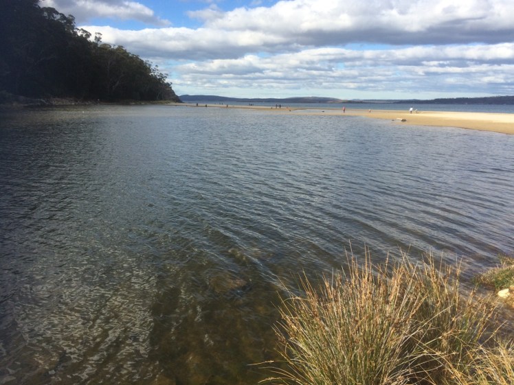
This list begins where the Sandy Bay Rivulet enters the Derwent River. I’ll be adding to it as my blog entries progress.
T 451 Short Beach | Sandy Bay Rivulet | Marieville Esplanade

Short Beach lies just south of Battery Point on Marieville Esplanade, faces south-southeast, is protected from northerly winds, backed by grass and housing. The Sandy Bay Rivulet enters the beach at the northern end and it’s possibly Lambert’s Rivulet that enters via a stormwater drain at the southern end of the DSS and Marieville Esplanade. (There was also a rivulet that ran down Lord’s Street. It may possibly enter here, or further north between the two clubs.)
Good for: dog walking, launching a kayak, rowing, sailing. Facilities: rowing sheds, children’s playground, park, seats, public toilet. Water quality is poor. Not a swimming beach.
The Royal Yacht Club of Tasmania and the Derwent Sailing Squadron are west of the current beach. Learn to sail or crew by contacting the clubs.
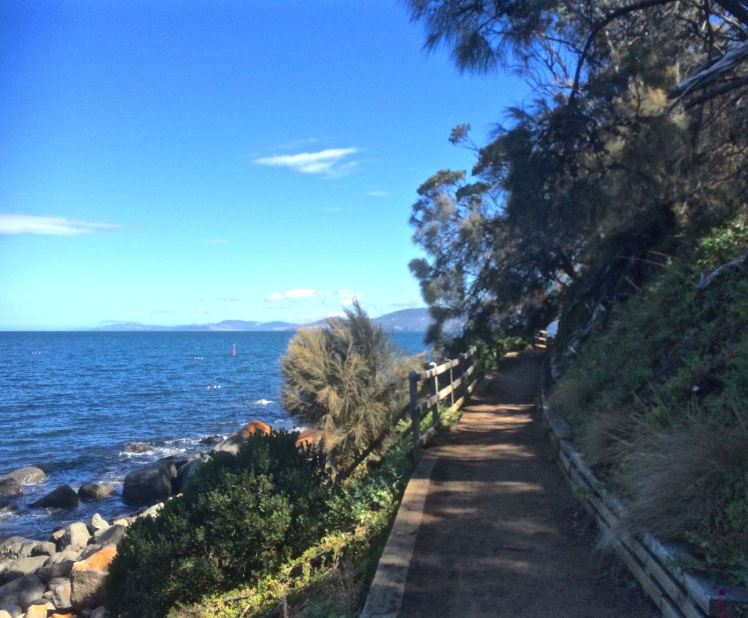
Cycling: Marieville Esplanade is a pleasant diversion from the bicycle route on Sandy Bay Road.
Walking: from here, head south along Sandy Bay and Taroona foreshores, follow the sculpture trial or walk the Sandy Bay Rivulet.
Sandy Bay Rivulet Walk Directions: Start on the O’Grady’s trail off the Summit Road on the mountain. Take the Jackson’s Bend track and at Huon Road turn right. At Hall’s Saddle take the Pipeline Track to Gentle Annie Falls. Then take the Circuit Track and after Waterworks Reserve continue on this track to the Romilly Street track. At Romilly Street turn right into Waterworks Road. At Linton Avenue turn right. Your next sight of the rivulet will be at Overall Street where you can access Fitzroy Gardens with some effort, or continue down Pillinger Street and cross over, walking up to the turn off to Fitzroy Place. Descend and cross Regent Street. More sightings of the rivulet are at Lincoln Street, Jersey Street, at Dr Syntax parking area and Sandy Bay Rd. Last sightings are Osborne Street (view from Sandy Bay Road) and the bottom of Quail Street where the rivulet enters the beach. (Walk requires a moderate level of fitness.)
More info: Beachsafe. | Friends of the Sandy Bay Rivulet | BlogPost
Landmark: Wrest Point.
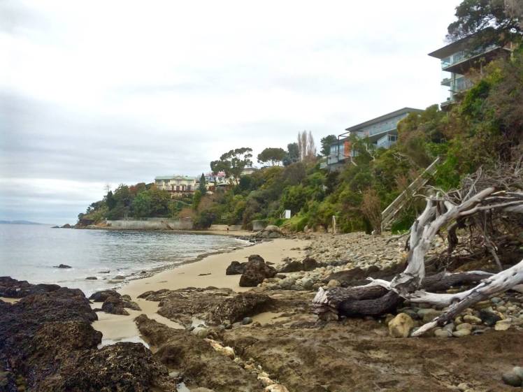
T 452 Lords Beach

Lords Beach is immediately south of Wrest Point, below road level. It looks like a small cove but this is an illusion. It extends as a long thin strip of sand at low tide for some distance and then peters out into rocks that link it to Red Chapel Beach further south. There is a beautiful jetty with a boatshed at its southern end and most people enjoy this beach from the pavement.
Water quality is poor. Not for swimming. The Parks and Wildlife Service manage this beach. Respect the seabirds.
More information: Beachsafe | Blog post
T 453 Red Chapel Beach

Red Chapel Beach is a ten minute walk south from Lords Beach along Sandy Bay Road. It’s accessed via the small park beside St Stephens church. It’s a beautiful, small beach with boat sheds and overhanging trees. There are boats moored offshore.
This beach is managed by the Parks and Wildlife Service. Make sure to close the gate behind you. No dogs allowed. Birds breed on this beach.
More information: Beachsafe | Blog post
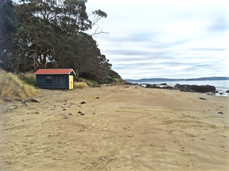
T 454 Nutgrove Beach

A 700m long beach with multiple entrances, a private jetty, a diving platform, a sailing club and small northern section for seabirds only. Lipscombe Rivulet enters the Derwent at this point. The beach is backed by Sundown Park and there is also easy access to Long Beach just behind Sandy Point at its southern extent. This beach has views north to the casino, bridge and mountain. There are also good views of the eastern shore.
Access points: Down a right of way opposite Lipscombe Larder on Sandy Bay Road; there are a couple of access points from Nutgrove, from Long Beach and from the parking area behind the Sandy Bay Sailing Club.
Water quality varies and is poor after storms. Check the Hobart City Council site for up to date information. Dogs are welcome but only between certain hours and these shift according to daylight savings.
There are toilet facilities half way along the beach and at Sundown Park, where showers are also available.
Good for: Walking, dinghy sailing, swimming (depending on water conditions).
T 455 Long Beach (also known as Little Sandy Bay beach)
Long Beach is a sheltered beach facing east, backed by a seawall that forms an esplanade, a park and cafes. Dogs are not allowed on the beach but can be walked on a leash along the Esplanade and the path leading to Blinking Billy Point.
Parking: Some parking behind the beach with overflow areas to both the north and south.
Good for swimming, walking, picnicking (BBQ facilities exist), meals or coffees. There is a playground with other recreational activities (athletics, croquet, petanque) available at Sundown Park.
Facilities: Public showers,toilets, BBQ area. Wheelchair friendly.
Landmark: Blinking Billy Point. Blog Post

Seamark: John Garrow light, located on the John Garrow Shoal off Long Beach reserve.

In Geography Bay:
Warning: The beaches from Blinking Billy Point to Taroona require good mobility and balance. Check the tide tables before you go and select a day with a good low tide. Allow a couple of hours to enjoy the walk and spread these hours around the low tide mark as it’s possible to get cut off by the tide. Take a camera and a first aid kit is advisable. Respect the seabirds you may encounter.
T 465 Blinking Billy Beach 1

A narrow pocket beach generally reduced to a thin strip of cobbles in winter.
Access: Via Long Beach, where parking and other facilities are available. Follow the path out to Blinking Billy Point. This beach extends south of the point and has interesting historical and geological features. Harder to negotiate at high tide.
Facilities: See Long Beach.
Dog friendly but only as far as its southern point where it is off limits in order to protect seabirds.
Good for: Walking dogs off lead or for walking as part of an extended walk south to Taroona (minus Fido) or north from Taroona.
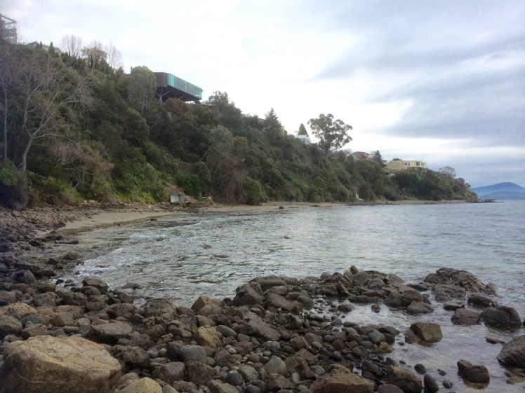
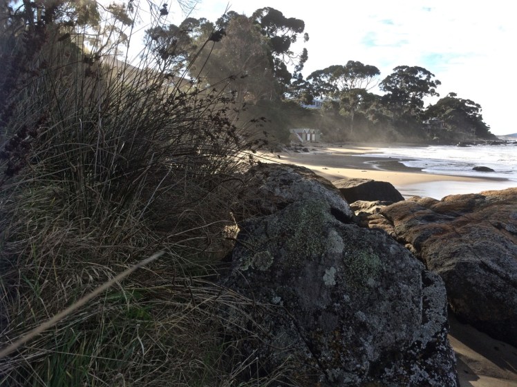
T 457 Blinking Billy Beach 2
A south trending beach with a reef at its northern point and a seawall at its southern extent. Discontinuous sand and pebbles. Folder Creek, where there was once a small landslide (1999), enters to the south. Choose a low tide to visit this beach, particularly if you’re planning to walk further south. It can be difficult to get around the seawall, except at low tide.
Facilities: No public facilities. Closest are at Long Beach.
Good for: 1. Walking, as part of a longer walk that includes the Taroona beaches – but at low tide only.
2. Bird Watching
3. Rockpools
This beach does not seem to be covered by Beachsafe. According to Andrew Short:
[it lies 100 m to the south [of Blinking Billy Beach 1] around a bluff-backed rocky point. The beach trends to the south for 100 m as a discontinuous narrow strip of high tide sand and rocks, backed by vegetated bluffs rising steeply to 30 m, then bluff top houses and the Sandy Bay Road. Three boat sheds are located along the southern half of the beach with small Folder Creek draining across the southern end.
In Half Moon Bay
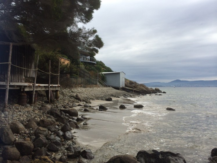
T458 Blinking Billy Beach 3
Access to this beach is most easily done via the beaches to the north. It’s in the bay that David Leaman calls Half Moon Bay in his book* covering this area and is just south and around the corner from Blinking Billy Beach 2. It’s also a reflective beach comprised of sand and pebbles, also narrow and also running below cliffs that rise up to 30m. There are boat sheds below and houses on the cliffs.
Good for: Walking, if you don’t mind this being over rocks and pebbles. Not advised for anyone who isn’t a competent walker and only walk it on a low tide with time on your side.
- Leaman, David. 1999. Walk into history in Southern Tasmania. Lehman Geophysics, Hobart
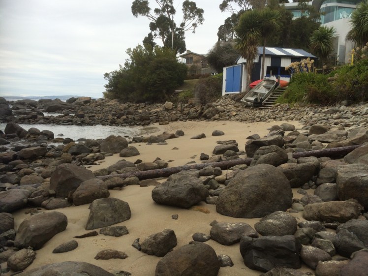
T458A: Mitah Crescent Cove
Access: From the bottom of Mitah Crescent via a right of way.
Not listed by Short, who may have regarded it as part of Blinking Billy Beach 3. Access from the north may be impossible for some as a large boulder is an impediment. There are also a couple of boat sheds with rails that may stop your progress and it isn’t clear where private property begins and ends and whether the boulder is a right of way… it looks to be a right of way. The rocky coastline continues around the corner, heading south to Taroona.
On a low tide this is a small, intimate cove, but it’s lost with the rising tide.
Good for: Taking a photograph and continuing on your way.
Taroona Beaches
T459: Cartwright Point Cove (North)
This is the most northern beach/cove in Taroona and lies just south of Pierce’s Reserve and Cartwright Creek. This reserve provides some protection for the weed infested rivulet as it makes its way down from Mount Nelson and the Trumanini Reserve. The cove is small and north facing, surrounded by reefs and is sheltered from the south westerlies by the point.
Access: Pierce’s Reserve. There is a steep path at the bottom of the reserve. Good mobility required.
Parking: On Sandy Bay Road or in the pull off at the start of the Truganini Reserve.
Facilities: None.
Dog friendly reserve.
Good for: Picnics, rock pools.
Walks: walk south to Hinsby Beach or north towards Sandy Bay. Alternatively, follow the rivulet through Truganini Reserve to the summit of Mount Nelson. You can cross the catchments of the Sandy Bay rivulets by following a Mount Nelson trail and descend along Lamberts Rivulet to its mouth at the Derwent Sailing Squadron.
Landmark: Cartwright Point. See Beachsafe and blog post above for further information
T459 A: Cartwright Point (South) / Grange Beach / Dixons Beach

The nomenclature along this coastline is unclear on maps and charts and locals refer to the beach(es) by different names. In his inventory of beaches Andrew Short seems to be referring to the beach at the bottom of Grange Avenue as Cartwright Beach (south). It is also known as Grange Beach and sometimes as Dixons Beach as on a low tide it expands into a long thin beach that runs the extent of the cliffs to Taroona High School. The reef along the extended beach is known as Dixons Reef. This beach and Lords-Maning Reef-Red Chapel-Nutgrove have similar characteristics.
Access: Multiple access points: via two walk ways at either end of Grange Avenue (the southern access point also provides a point of access to the clifftop walk running south, as does Utiekah Drive.) Flinders Esplanade (South)and Karringal Court are also access points.
If you are coming from the south you can access the beach(es) from Tarooona High School.
This beach (or these beaches, depending on your point of view) are a good example of a pocket beach as they emerges with the low tide and disappears on high tides particularly in winter, presenting as coves or as a long thin strip. The walk along the sand (or pebbles, when the tide is higher) is wonderful, with a lot of interesting geological features. Easier access to the coast is by way of the path above the cliffs. It descends via some roads and bushland to deposit you on the beach at the high school.
Facilities: None
Good mobility required when the only bit of beach accessible is a thin, cobbled strip.
Danger: Check your tide timetable before you go. Low tide only. Respect the birds.
There are no facilities but there are two private boat sheds.
Activities: Boulders available for those who like to climb. Kayaking, swimming. Clifftop walk begins behind the beach.
T 460 Dixons Beach
At the very least the stretch of beach (approx 200 m long) on the northern extent of Taroona High School is called Dixons Beach although locals may know it as High School Beach.
Access: Via the school or Melinga Place from the South. Also accessible from the walking track behind the beach.
Facilities: None, unless you are connected to Taroona High School
Activities:
Swimming; bird watching, or walk the track behind the beach.
There are the remains of a midden. Please respect aboriginal heritage – look but do not touch. There are also interesting rock formations. Swimming is possible but better options are available in Taroona.
Dog friendly: No.
Landmark: High School Point.

T461 Retreat / Taroona High School Beach (South)
This narrow beach with its undercut shoreline, is south of the point and backed by the high school. It is notable for the rocks that are popular with seabirds. This beach would once have extended further south, running seamlessly into Beck’s Beach but they have been separated by Melinga Place road.
Access: Via Dixons Beach from the north. Melinga Place and the high school provide access from the south.
Facilities: None, unless you are connected with Taroona High School
Activities: Bird watching, walking (in particular as part of a longer Taroona foreshore walk).
T462 Beck’s Beach / Melinga Place Beach
A short, picturesque beach backed by private boat sheds and a grassy slope.
Access: South: From the Taroona Foreshore Walk around Crayfish Point. Immediate: From Melinga Place. North: from Retreat (High School Beach).
Facilities: None, unless you are connected to the high school.
Activities: Picnicking, swimming, kayaking. It is also the northern access point to the Taroona Foreshore Trail.
Landmark: Crayfish Point
The Taroona Foreshore walk (get brochure) extends from the southern to the northern ends of Crayfish Point. There are interpretation panels, you can download a podcast to accompany the walk, the track is dog friendly and exceedingly scenic. Apart from one section, where walkers cross a cobbled beach, it makes for an easy stroll.There are facilities at the southern (Taroona Beach) end.
The point has an interesting history. See my blog or alternatively visit this Taroona Community Website.
T463 Taroona Beach
A popular beach for picnics, swimming and water sports, with a touch of history at its northern end.
Facilities: The Taroona Foreshore Walk begins above the beach. There is a playground, BBQ area and public toilet.
Access: Via Taroona Crescent.
T464 Hinsby Beach
Smaller than Taroona Beach, this beach ends abruptly at the Alum Cliffs. It is secluded, backed by a couple of boat houses, bush and some homes.
Activities: Swimming, exploring the boulders beneath the cliffs or taking the walk up the fault line in the southern corner of the beach.
Access: various paths from suburban roads enter the beach, but for most visitors it’s an easy walk south from Taroona Beach.
Facilities: The closest facilities are at Taroona Beach, a few minutes walk away.
Landmark: The Alum Cliffs and Bonnet Hill
There is a beautiful walk 6 km along the top of the cliffs between Taronga Road on Bonnet Hill and Tyndall Beach. This path also provides access down to a rocky cove just around the corner from Tyndall Beach. The path up/down from the beach is short but steep. There is a seat in an open area above the beach but otherwise much of the walk is beneath forest canopy.
Kingston Beaches
T465 Tyndall Beach
This is possibly Hobart’s most popular dog walking beach and has a number of public facilities including car parking behind the beach (as well as access via a footbridge from Osbourne Esplanade), a small reserve, a Sea Scout building and a tap (dog watering spot). The beach has an interesting rock formation and there is a path that runs behind the beach and continues up the steps to Alum Cliffs.
Cars access the beach from the Channel Highway.
T 466 Kingston Beach

Kingston’s most popular and most easily accessible beach. It’s backed by homes and cafés and a playground and access is via the Esplanade. It has a surf life saving club (patrolling Dec-April) and a sailing club.
Landmark: Boronia Point (and Boronia Hill)
This headland forms the southern extent of Kingston Beach (see photo of Kingston Beach above) and tucked away, just beyond the point lies Boronia Beach (see below). The headland has lost much of its natural values to suburb but there are great views to be had if you make your way up to the top of the hill, where there is a walking/cycling track (Boronia Hill Walking Track) that runs through the remnant vegetation you’ll find up there. Unfortunately, it really is a remnant (with some big boulders you can stand on for an even better view). The houses up there have fantastic views but the reserve, its flora and fauna, would benefit from being extended through to Blackmans Bay and Tinderbox.
T467 Boronia Beach

This is one of those secluded coves that make Hobart special because there’s a good chance that many people living in Blackmans Bay / Kingston don’t even know that it’s there. It’s been described as being like a Greek Island beach and under a perfect hot, blue sky, this r. The cove is small, south facing, shaded by cyprus trees and has interesting rock platforms and cliffs.
If you dive, you may see seahorses; it’s a great spot for diving and swimming.
There is a little penguin rookery here. It’s their beach, so respect, and tread softly – the path is for you, the slope is for them.
Access: From Mt Royal Road (Kingston Beach) or Jindabyne Road (Blackmans Bay). Each entry has a gate – please close them securely to protect the penguins. The walk in is less than 2km. Not wheelchair friendly. Reasonable mobility required for the steeper parts. There are no facilities. From Kingston in particular, it’s scenic.
T467 Blackmans Bay Beach

About 700m long, this beach faces east and it also has views south to the Iron Pot light. It’s bound by Boronia Point to the north and Flowerpoint Point to the south. It is backed by suburb, eateries, has a playground and a wheelchair friendly esplanade. There are public facilities, including a car park, sailing club, boat ramp and moorings.
Landmark: Flowerpoint Hill
This lies at the southern extent of Blackmans Bay beach. It is possible to walk along the reef below on a low tide, but the walk on the hill itself is more popular because of the Suncoast Headland walk with its river views.
Tinderbox Peninsula
The Tinderbox Peninsula has seven beaches that are used mostly by locals, when they are accessible.
T 468
There is an unnamed bay that lies just around the point at the southern end of Blackman’s Bay and is only accessible at low tide. The cobbled beach is backed by cliffs and rocks and given a high tide, it would be easy to find yourself cut off here, so caution is required, but viewing it is a lovely reward when you reach the end of the reef. Scuba divers might find this area rewarding.

T 469 Soldiers Point (S1)
500 m south of Soldiers Rocks there’s a curving cobble beach about 150 m long, located below some high sandstone cliffs. There is no way to safely access it except by the water. The beach is protected by rock platforms at each end and there are more rock reefs off the beach.
T 470 Soldiers Point (S2)
About 700 m further south , this inaccessible cobble beach is in a tiny embayment. It’s about 100 m long and is also backed by cliffs with rocky reefs offshore.
Fossil Cove
A steep but easily accessible path leads down to Fossil Cove by way of a rivulet and gully. There are steps so reasonable mobility is required. The cove has a stunning arch, beautiful pebbles and reefs and is rich in fossils. At low tide it’s possible to walk through the arch, so check the tide table before visiting.
T 471 Fishermans Haul
This is another of Tinderbox’s small curving cobble beaches and it’s located beneath Lucas Point with very steep vegetated bluffs rising up behind it and although access is possible, it’s down a steep and dodgy path and isn’t recommended. Come here by boat.
T472 Fishermans Haul (S)
This is on the southern side of Lucas Point below high cliffs and at around 200m it’s longer than the more northerly beaches. It faces east- to northeast and is a thin cobble strip only accessible by water. As with all these beaches, beware the high tide.
