The Last Leg… Or So I Thought
Before they built the High School that provides ‘an education fit for a princess,’ a nod to the fact that Mary Donaldson (also known as Princess Mary of Denmark) attended school here, an earlier school for girls existed on this spot and before that, in the 1830s, it was an inn, The Retreat, run by Harriet Baines, and reached via a rough track (now Sandy Bay Road) from town or via the water, where visitors made landfall at the Crayfish Point jetty. (There is still evidence on offshore rocks of some of the original structure and the crayfish, for which it is named, are apparently still plentiful but not for the taking).
The Retreat had a cricket pitch and a bowling green. Back then, a lot of people had their own boats but if you were one of those who didn’t, you could hire one here and go fishing, or ride a horse, or simply unpack your bags and spend the weekend relaxing in the garden, enjoying the substantial meals Harriet put on.
In the early days of the settlement the sailing races sometimes used Crayfish Point as a down river mark and so The Retreat would have been a good spot to watch the yachts gybe or tack for the homeward stretch, sails goose winged before the sea breeze. Some people like the Reverand Knopwood came out here by boat to fish a little, sometimes with women from the Aboriginal community who were skilled divers for crayfish.
These days, given student activities, it was good to see cormorants and gulls still making use of the rocks on High School point.
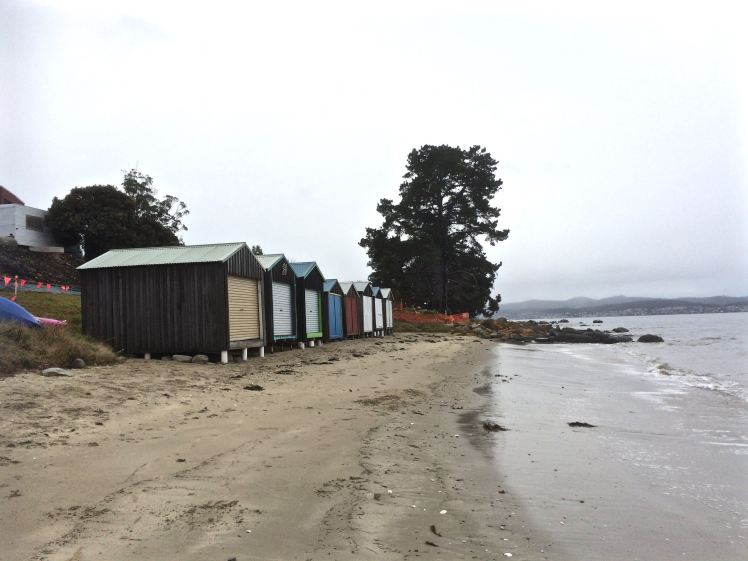
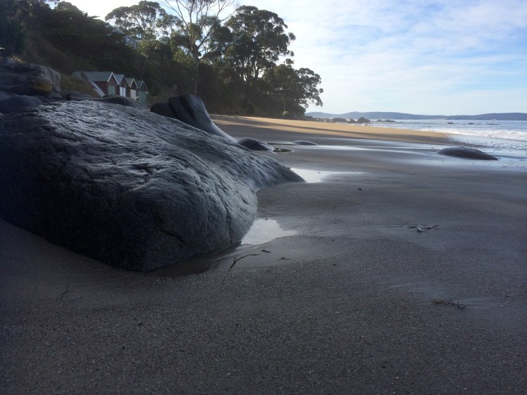
After the walk along Retreat Beach, the undercut slope on my right, the tree with its roots exposed, the school grounds above, I crossed the road on to Beck’s beach, tame and civilised compared to the beaches earlier in my walk. No more than a cove, marooned from Retreat by the road, it is known for its quaint row of boatsheds and the dinghies/kayaks that lie upside down on the grassy slope. Further back there’s a row of houses with great views out across the river. Beck’s (also known as Melinga Place Beach) is tucked into the northern corner of Crayfish Point, but the Taroona Foreshore trail that I ambled onto behind the rocks at the beach’s southern end, meant easy walking along a well made track with a number of different points of interest – the casurina trees, the blackwoods, the Tasmanian Aquaculture and Fisheries Institute’s labs higher up above the track and, behind it, unseen, bowls and tennis grounds.
It’s also on this point that the Parks and Wildlife Service has enclosures for the Tasmanian devils that are part of its release program, a project attempting to save from extinction this unique marsupial that’s been suffering from a rare infectious cancer, Tasmanian Devil Facial Tumour Disease, in epidemic proportions. There are also breeding aviaries here, designed to support the endangered and migratory orange bellied parrot to make a recovery from near extinction. There are really so very few of them left.
Crayfish Point is a lightly wooded hillside but it’s the water views that make it the kind of place that draws you back and the sewerage works that once tainted the air aren’t quite so repellent anymore. But this place also has contact history: in 1805 it was one of the first places that the aborigines and the settlers made contact, exchanging kelp and crayfish for potatoes and bread . Later, Norfolk Island settlers like the Colleys (who arrived desperate for food, their ship having been poorly provisioned) were granted land in this area (Goc, 1997).

According to the Derwent Estuary Program, there are approximately 3.3 square kilometres of rocky/cobble reef in the Derwent estuary and a fair bit of this is along the Taroona shoreline. Kelp forests grow here, thanks, no doubt, to the Crayfish Point Scientific Reserve in front of the TAFI labs.
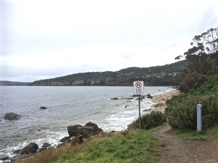
I revelled in the river views. On the Eastern shore, between Trywork Point and Gellibrand Point there’s the opening to Ralphs Bay, an area a local I chatted to on Hinsby Beach did not know about – I had to point out its entrance. There’s often a ship anchored in the middle of the river avoiding port taxes and there’s an open view downriver into Storm Bay.
There were more people on this part of the walk, several couples, a mother and her children. I loped past Batchelor’s 1810 grave (one of the earliest in Tasmania), across Taroona Beach, Taroona’s most popular, where we’ve launched our kayaks from in the past, and then I walked along the track that runs below the houses to Hinsby Beach.
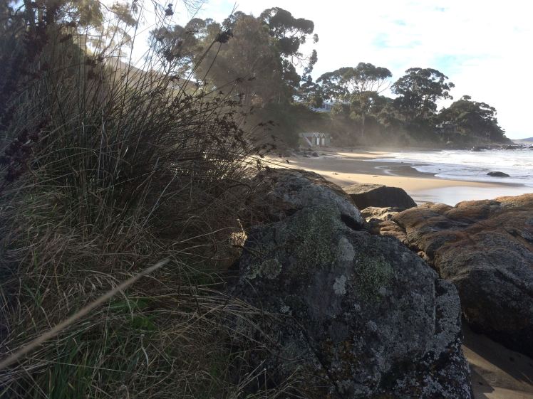
Not that long before this walk, down a cul de sac, I had found the long steps at its southern extent. They led down a steep, quite dramatic ravine onto the beach, just where the Alum Cliffs begin. In fact, for a small, secluded beach it has a lot of different access points, as well as boat sheds and rivulets, but it also has an interesting feeling of intimacy and wildness in comparison to Beck’s, the Alum Cliffs looming large along its southern extent.
High above I could see Taronga Road where the Alum Cliff walk begins but I promised myself that on another generous low tide I’d try to walk along the base to the rocky platform at the bottom of Taronga Road where I’d heard there were fossils.
Just for a moment I stood and considered the walk I had done and all I had seen and then I turned around and made my way back to Taroona Beach and my waiting lift. The walk had taken three hours. My phone was flat because of all the photos I’d taken and voice memos I’d made. It had been exhilarating and explorative and full of fantastic discoveries. I’d never left the city and yet I’d felt worlds away and I couldn’t have felt more inspired than I did at that moment to carry on exploring Tasmanian beaches.


One thought on “Derwent River: Blinking Billy to Hinsby Beach: Part 9”