With a Dark and Stormy in one Hand and a Pencil in the Other
PASSAGE POINT
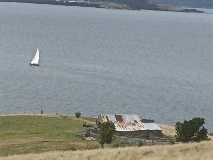
Passage Point is a notable promontary at the mouth of the Derwent Estuary and is both lovely from the water and green and pleasant from the road – a rolling hillside, a rustic shed, an abrupt cliff line carved by the waters of the Derwent, the D’Entrecasteaux and Storm Bay.
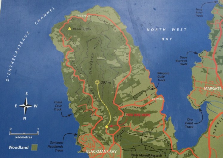
Map from the Kingborough Council Signage at the start of the Tinderbox Hills track: nomenclature is thinly used. Passage Point, Piersons Point and Tinderbox Beach, all important landmarks, are not noted. (Passage Point is to the left of Mount Louis.)
Having finally decided that ‘not the real Fishermans Haul’ was in fact the real Fishermans Haul (see last blog post), we went to Passage Point to see if there was some way we could access the little cobbled beach I’d noticed. There wasn’t. We had to make do with expansive views but as these were superlative and so vast in scope we could hardly complain. Mount Louis, Tinderbox’s highest point and forested in eucalypts rose behind us.
Birngana off Passage Point
My guess on how Passage Point got its name was all tied up with waypoints, landmarks and the ocean because if you’re heading off in your yacht on a trip of any distance, it pays to sit down and plan your passage. With a ‘dark and stormy’* in one hand, and a pencil in the other, take a careful note of the tides, currents and potential hazards. Become familiar with the landmarks you’ll pass, navigational signs you’ll encounter, channels or reefs you may need to negotiate and choose your waypoints. Make Meteye your new best friend and despite being in love with your chartplotter, tuck the paper version into your nav table too because it’s less likely to let you down. Departing the Derwent at this point to head out across Storm Bay is always a bit of a passage into the unknown because the bay is notorious for conjuring tempests up out of the most benign conditions.
Because this familiar promontary is just there where the waters of Storm Bay, the Derwent and the D’Entrecasteaux merge, it’s symbolic of passages about to begin and passages almost completed. So it goes without saying that this is how it got its name, right?
Wrong.
I checked Placenames Tasmania and found some unverified information. A boat called the Fancy was one of ‘the few remaining trading boats called passage boats.’ Back in slower more leisurely days these boats used to ply the Derwent and the Channel. In doing so, they had to round Passage Point and in so doing, they gave the point its name.
This information in the database comes from a boating article in the Saturday Mercury, Jan 2002 where it’s also noted that ‘most features on coasts were named by mariners and seeking reasons for names means looking at it [sic] from a mariner’s point of view. Thus Passage Point was a marker for south-bound boats of the entrance of ‘the passage’ or the Channel.’
Exploring the sweep of shoreline from Sandy Bay to Tinderbox had triggered my curiosity about the way places were named but I had not considered that mariners had a big hand in the names of the places I was exploring. This was an unforgiveable oversight because it’s obvious that many major features first got their names from the early voyages of discovery. My impression of the western shoreline of the Derwent was that places were usually named after the early landowner’s or overlooked in the naming process altogether but I could see that in a tiny colony at the end of the world there’d be a sense of familiarity and homeliness for locals who plied these waterways in naming the places they were passing by the names of the people they knew. On dark and stormy nights in particular, the ability to recognise familiar landmarks and tick off waypoints is comforting and engenders hope when you’re toughing out rugged conditions.
We paused here to savour the view. Passage Point felt extremely evocative for me: I had walked out one wintery morning and followed the Sandy Bay Rivulet down to its mouth. I had turned right and wandered the shoreline from there to here, a distance of some 35 kilometres, give or take a few and although I had done this as an urban explorer, little bit by little bit, it had been fun, it had changed the way I related to the coast as well as dramatically expanding my knowledge of the city I live in.
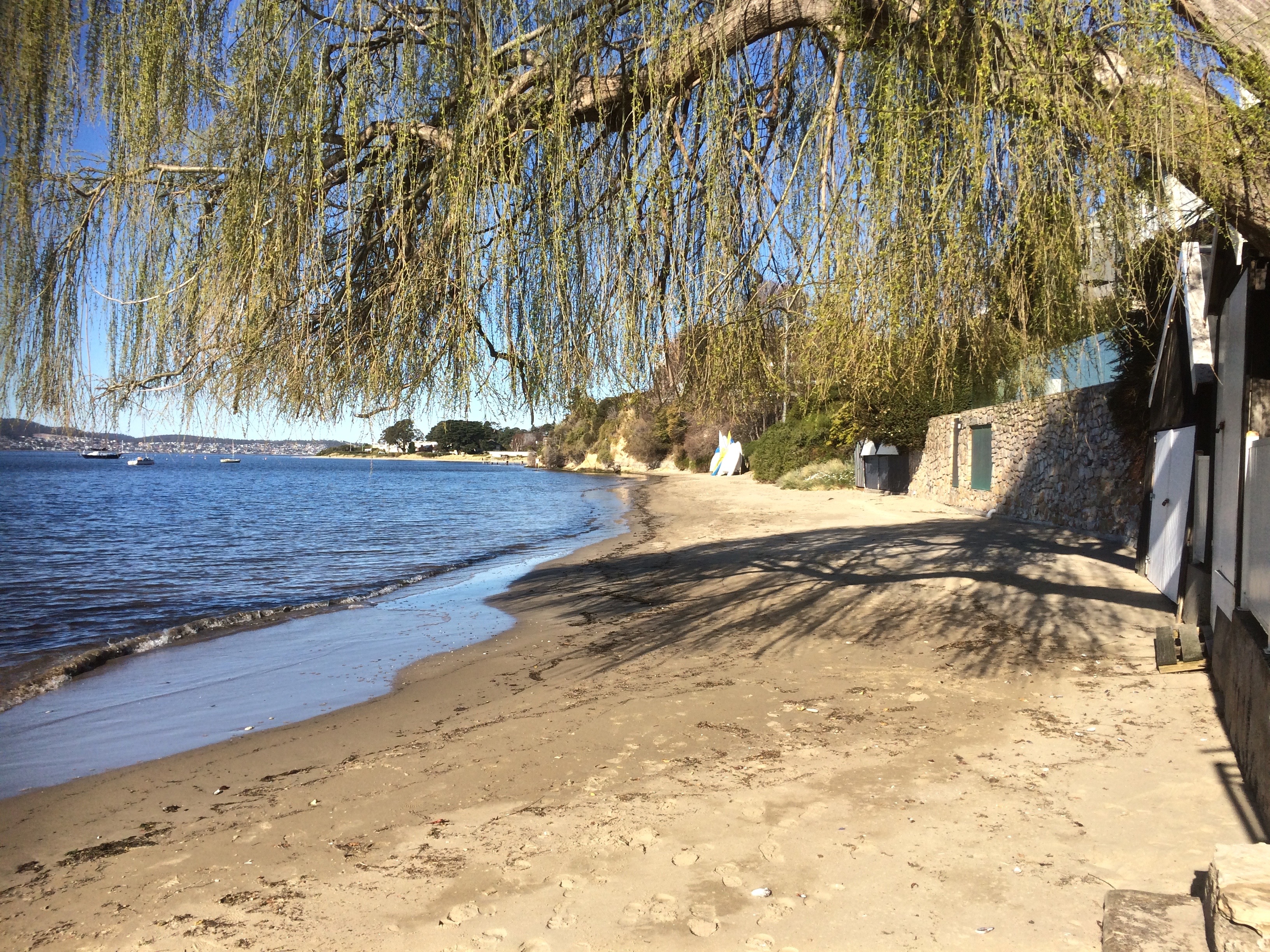
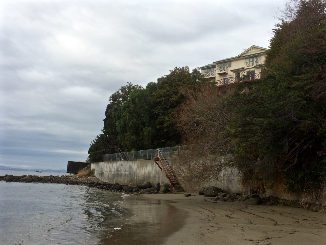
At the end of the beach I had to hop onto rocks and make my way between the river and a concrete wall. Around the corner a wooden boatshed looked as though it might end my walk but I found a way around it and although my walk felt seamless this is where I regard the Blinking Billy Beach 3 section as beginning. Just look at this picture. Who’d think there was a city here?
As you turn the corner at the point at the southern end of Blinking Billy Beach 2 (aka Half Moon Bay) you see this structure.
The same subjects preoccupied me as I walked along – the geology, the history, the structures – and, specifically, locating myself on this piece of shoreline. I kept changing my mind as to where I was in relation to the road above me but I wanted to do this walk without the help of Google Maps so that I had a real sense of (urban) adventuring into the unknown.
As you turn the corner at the point at the southern end of Blinking Billy Beach 2 (aka Half Moon Bay) you see this structure.
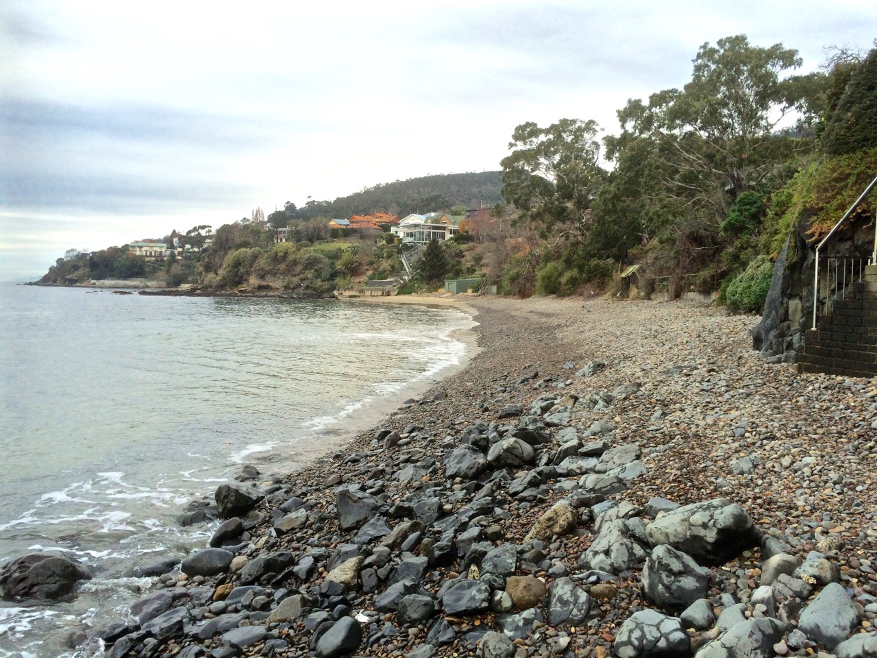
In wild weather this would be a windswept stretch of rocky coastline with views north to town, south into Storm Bay and across the river to more loveliness along the southern section of the eastern shore. On the day of my walk these lonely stretches felt pensive, secret and self-contained, and I felt myself more likely to encounter a nineteenth century smuggler along here than back at Red Chapel Beach or Blinking Billy Point. At the same time I felt as though the shoreline was as aware of me as I was of it.
I figured I was out of Geography Bay and this new perspective of the river renewed my feeling of exhilaration in the landscape and perplexity about ourselves – that we Westerners have been here since the beginning of the 1800s and yet, so close to the city centre, the nomenclature is still so sparse as to be mostly non-existent and so slippery where it is there at all. Many of us know more about London, Paris and places overseas than we do the intimate nooks and crannies of the river, the mountain and the great rifted catchment.
A few months after this walk I had a debate with a friend over just this issue. He’s a man that does real adventuring and exploring – the further off the beaten tracks of this world and out of communication the better. He is against nomenclature. He wants the earth’s places (mountains, rivers) left untainted by names but is prepared to compromise on a latitude/longitude co-ordinate.
I feel differently. As I walked along this stretch of coast wondering about the original aboriginal names for the places and features I was passing – names that over 30,000 years just have to have been rich, dense and redolent with mythology – it struck me like an epiphany, the extremely serious and overlooked disconnection we have with the earth. A shrieking Disconnection. A Disconnection so profound we’re trashing the planet beyond redemption and losing ourselves. No names – no recognition. No relationship. No honouring. No sense of gratitude. I looked at the magnificent, powerful river that I love so much, as much a goddess as the Ganges, and wished ‘sacred’ had not become a disparaged word because if anything felt sacred it was the animation I perceived in this river and its shoreline, so dynamic and timeless despite our culture turned beautiful parasite glued to its side. At the most profound level this existential disconnection is manifesting in more damaged psyches as each generation becomes less connected to the earth because how do you honour yourself if you can’t relate to and stand in awe of the greater entity you’re part of? As I wandered along the rocks, pausing to ponder their origins, diversity and beauty, I felt so utterly enthralled at the profligate beauty about me and a real grief that so many other compelling distractions have made it difficult for us to immerse ourselves in a landscape unfettered by human notions of time as was the case before our cultural evolution careered us away from hunting and gathering.
I had begun to pay more attention to my thoughts and less to the landscape when a sloping and strangely familiar boulder blocked my route.
Hello, Boulder.
About two feet of estuary rose and fell about its base. I didn’t want to take off my shoes and wade, the river’s temperature making it somewhat untouchable. On the other hand, my first strategy for climbing up the boulder’s side was hampered by the fact that a few weeks before I had dislocated and fractured my little finger while working on the boat with our mechanic, who I think of as being to engines what Leonard Cohen is to music.
I put my hands on the sloping rock. ‘I know you, Boulder.’ We had not met for a Very Long Time. Looking up I noticed a huge house with enormous windows. Now that was new to me.
When we were a whole lot younger we had come to look at a house – a beach shack really – at the bottom of Mitah Crescent. The owners walked us through their cacti and succulent garden down to a large boulder. The river lapped around its base but they assured us there was sand when the tide went out. We desired that boulder and that river access but knew that once we had paid for the property we would not be able to afford renovations for a while to come and so we sadly and stupidly decided not to make an offer.
I leaned my back against the boulder for a while, thinking that on this walk I’d barely noticed the Eastern Shore – I was so busy ‘paying attention’ (my current mantra) to the rocks about my feet and the all enveloping personality of the shore. My iPhone was losing power rapidly because of happy snapping and jubilant voice memos. I looked back along the way I’d come. I tested my finger’s capacity to help draw my weight up the side of the boulder. Not looking good.
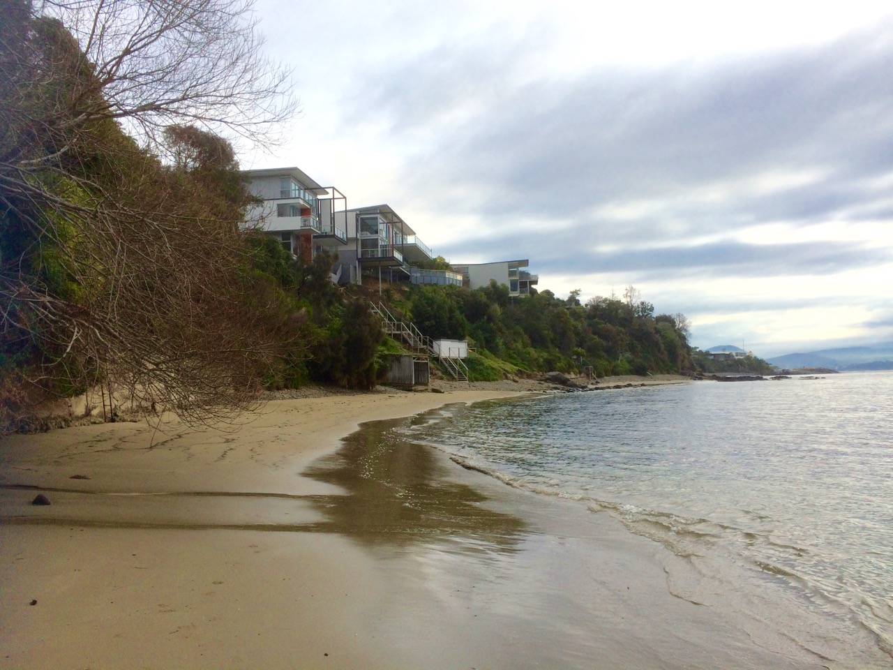
Looking back at Blinking Billy Beach 3 from Mitah Crescent
My options were limited – I could fall, climbing that boulder. But if so, there was reason to hope that I’d be spotted sooner rather than later by the big windowed houses above me because at this point of the walk they had drawn closer and lower to the shore and so I took my chances, shifted my weight from disabled finger to used-to-being-bruised knee. Trying to be discrete, because I could not definitely recall whether the boulder was a right of way, I crept across it, slithered down over the boat shed’s jetty and found myself in an intimate and beautiful sandy cove. If the tide had been out when we’d viewed that house, we would both have lost our heads and hearts.
Looking back at Mitah Crescent cove
More rocks, more pebbles, the occasional rivulet and astonishing discoveries. I sometimes thought that paying too much attention to where I was about to place my feet I was missing out on rivulets, but in fact the way you find a Hobart rivulet is to use your nose. As they emerge dishevelled and emaciated from their concrete prisons they bring with them a distinct smell: stale old detergent. Yep. The cleaner we are, the dirtier we make the environment.
Then I encountered another boulder and, with an awkward gap, a double set of rails leading from boat sheds to the water. I slithered down to the base of the boulder and timed my scramble for a gap in the waves – and made it under the structure.
Double boat shed
I was about to leave Sandy Bay and enter the suburb of Taroona. but a little way around the next corner I found some more appealing structures and to my surprise, a sphinx like rock gazing out to sea. It’s waypoints like this that would undoubtedly have carried names earlier in the Holocene and I paused, feeling the loss of the language that once sung this landscape into being, the loss of a way of being in the landscape and interpreting the subtle nuances our less sophisticated gaze misses. I work with people who have dementia. In a more holistic way I think we have robbed the landscape of its earlier identity and a significant part of its memory.
As you turn the corner at the point at the southern end of Blinking Billy Beach 3 you see this structure. In the absence of official nomenclature, my personal name for it is The Mouheenener Sentinal
And it was along this stretch of shore that I nagging awareness came to the fore – one huge river, but only a handful of avian wanderers.
Where the hell were the birds?
Next blog entry: Photographs – Blinking Billy to the Sandy Bay border
I woke with a huge sense of anticipation about this next walk, keen to get going, but the aroma of coffee filled the kitchen, scrambled eggs were on offer and the woodheater warmed the house. The flame robin in the garden seemed an auspicious omen and so I breakfasted at home in preference to stopping by a Long Beach cafe.
I saw yachts sailing before a light northerly breeze as I approached my starting point. The sky was a milky dome of cloud and the landscape was quiet and dreamy. It stayed that way all day and the mountain was hidden from view except for occasional glimpses of forested flank through small gaps in the clouds.
There were plovers on the beach and a lone cormorant fishing as I set off down the path from Long Beach and soon I was swinging around Blinking Billy Point into Geography Bay, the old lighthouse on my right pressed up against the houses, past the old search light and the Charles Darwin Cliffs and down on to Blinking Billy Beach, the small waves breaking on the pebbles and little sand evident because the winter river had drowned the beach.
I had not always known this was the case. I thought it’s disappearance indicated climate change, but the Salty Seadog had once told me it went submarine in winter. On rough, wintry days the beach makes music, the cobbles rolling in the waves. The Salty Seadog writes music and plays music so I guess it’s her kind of beach.
Blinking Billy Beach 1: the view from the north
I’d walked this coastline by the time I discovered Lena Lencek’s book The Beach: The History of Paradise on Earth (2009) as an audio recording on Scribd, my new favourite app. She’d spent her childhood in Trieste, enjoying the Adriatic coast and then her family moved to the USA and she got to know vastly different kinds of beaches. Listening to this book at night, speakers in my ears, I learned about pocket beaches, and the landscape I was walking fell into place.
A pocket beach is normally a fairly thin, crescent shaped beach nestled between rocky headlands. It’s possible to find strings of them along coastlines – beach, headland, beach – and although they are sedimentary (the sand, shell and pebbles laid down in beautiful layers by water) the headlands, and the rocky platforms at their feet, isolate the beaches from each other, and that means they can be subjected to different types of beach making and breaking processes, like the angle of waves and higher tides in winter which often cause them to disappear. (And if, like me, you’d forgotten that tides are higher in winter, it’s because the sun, like the moon, has an influence on tides and in winter we’re tilted further away from the sun and so it’s gravitational pull is much slacker and the tides aren’t drawn back quite as much.)
I was so excited by this concept of pocket beaches that I just had to enlighten the geologist. ‘I’m sure Blinking Billy is a pocket beach,’ I enthused.
He looked at me bemused. ‘We’re surrounded by pocket beaches,’ he said. ‘There are heaps of pocket beaches along the Derwent. Name any one. Chances are it’s a pocket beach.’ And thus began a second lesson in all things pocket beach and Derwent River. I listened, but at the same time I was hatching a plan to subvert the concept – each beach in my pocket. I ordered vials off Etsi and began to gather each beach’s signature, it’s fingerprint in these tiny bottles. Because this is the thing – the sand on each beach is different and after all, one day these beaches will really drown.
It’s a short walk from one end of the first Blinking Billy beach to the other but a little longer when the sand is submerged and you’re walking on cobbles. At the far end I made a voice memo: ‘I’m about to go where I have never been before’. That was because I’ve always been here with dogs, and I’ve always stopped obediently at the sign commanding no dogs to go any further because of seabird habitat.
Blinking Billy Beach 1: view from the south
I may never have been here but I knew that Darwin had. He’d sailed into Hobart on the Beagle in 1836 and been pretty unimpressed with the town initially but this changed as walked about. He headed up the mountain, guided by the Sandy Bay Rivulet (my first recorded walk), he walked along the river’s eastern shore where I’m currently spending a bit of time and he walked this coastline too. I felt he was a suitable companion in spirit because he had the observant eye I lack and was able to make sense of the Derwent’s complex geology in a way I could not. He’d named kunanyi/Mt Wellington Table Mountain, after another mountain I have lived beneath and his grandfather Erasmus and my sister both made Lichfield their home. If he was up for a little idle chatter, conversation should flow. And there were moments on this walk when the landscape felt so timeless I felt I could well have encountered him contemplating pebbles and stones on some of the wilder sections.
Such was his observant eye that on his fifth day here he found volcanic rocks near Blinking Billy Point on his walk from Battery Point to Sandy Bay and realized that the cliff revealed two lava flows and that volcanic rocks lay strewn about. ‘Hah!’ was his reaction (or something like this). ‘I’m standing in the eroded heart of an ancient volcano!’ He figured this out way back then yet many locals are unaware of this even today.
I’d stumbled into the heart of the volcano often and unknowingly, oblivious to the story the Charles Darwin cliffs were telling, more concerned about the smelly water that seems to be deposited straight onto the concrete path from a house above the cliffs and so the fact that Hobart is situated on the remnants of a volcano was news to me when, after this walk, I tried to make sense of it all. The reef extending out to the John Garrow Light is an old lava flow and fault lines abound through this area.
I rounded the point at the end of the beach. There, before my eyes, was another beach – Blinking Billy Beach 2, according to Short or Half Moon Bay, according to Leaman (1999). In the distance, a man in a red jumper was throwing sticks for his dog. I navigated a bit more reef and cobbles then stepped on to the sand.
The reef between Blinking Billy Beaches 1 & 2 (aka Half Moon Bay)
A cockatoo flew overhead, yelling for its mob. And then again more pebbles and then another sandy stretch and another six private stairways down onto the beach. I noticed a rivulet. This is poor little Folder Rivulet, according to Andrew Short, emerging out of its drain into sunlight, unloved and disregarded, too tiny to matter. (I watched this little rivulet being bulldozed unceremoniously into its drain, back in the day. It looked so wrong it hurt. And recently I returned to its valley to try to discover how much of it can still be seen above ground. Not much.) We communed, the rivulet and I, and then I took photos of beautiful conglomerate rocks and and made another voice memo:
I’m on another sandy cove with some interesting old beach structures. It’s quite a long sandy cove with a rocky reef in the centre of it. As I walked along the second stretch of sand a white speed boat came up river and the yacht I’d thought was leading the race (they rounded the buoy at Nutgrove all bunched up) has proceeded on down the river with its spinnaker up… this is such a lovely walk.’
Blinking Billy Beach 2 from the north
And it was true; I felt elated, thrown back into childhood recollections of The Famous Five and their explorations which we tried to mimic on holidays on South Africa’s eastern seaboard. I felt invigorated by a sense of adventure and discovery and on this beach there were so many new discoveries – new perspectives of the river and tiny, exquisite details.
Here’s the southern end of the beach, and the man and the dog had already disappeared around the corner.
Southern end of Blinking Billy beach 2
Blinking Billy Beach 2 from the south
The reef at this end of the beach held my attention for quite some time. The rocks were interesting, human debris, although depressing, also managed to look artistic and I began to do a little bit of amateur geological sleuthing perplexed by rocks that didn’t always seem to belong together – sedimentary, conglomerate and igneous, worn red bricks, smashed and violently weathered rock, unconsolidated slopes, conglomerates of modern material – and delicate combinations of life forms were represented here or lay ahead of me.
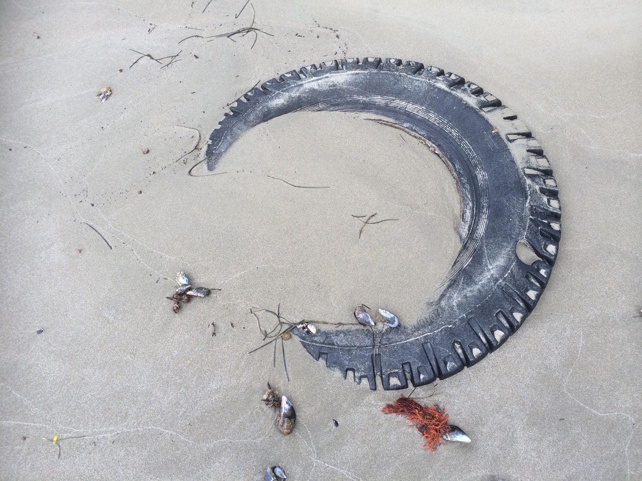
Found on Blinking Billy Beach 2Beach detail.
When I reached the next point there was a yellow unconsolidated cliff, a wall someone had built beneath it, and a rosy coloured boulder near an intrusion.
I was seriously losing track of where I was in relation to Blinking Billy beach numbers as devised by Andrew Short (see The Book Shelf) and I hadn’t got very far at all. I was lost in thoughts to do with defining beaches – how much sand do you need before you have a cove? How much before you have a beach? Were the long stretches of boulders and pebbles actually beaches at all or just the bits in between?
And did it even matter where beaches began and ended scientifically, subjectively or according to the whimsy of the tides when I was engrossed in the landscape, entranced by the huge views and fabulous details – utterly blown away by the wild grandeur so totally divorced, below the cliffs from the houses in some other more banal, irrelevant world up top?
This coastline is divine but also tragic because it’s along here that the mouheenener once walked with confidence, and after their lands had been taken that traumatised families would have retreated.
To be continued…
Sources:
Leaman, David. 1999. Walk into history in Southern Tasmania. Lehman Geophysics, Hobart
Royal Society of Tasmania, Charles Darwin in Hobart Town, edited by Margaret Davies, Hobart, Royal Society of Tasmania, 2009.
It’s night time on Red Chapel Beach and the birds are loud. There’s a crescent moon rising and out near the middle of the river the foreign vessel at anchor is barely visible. James Moodie and a mate or two are in his boat closer to the shore. They’re waiting for a fish to bite but that’s not all they’re waiting for. The conversation in the boat is quiet; sound carries over water. They have one eye on the ship. Up above the beach there’s a light shining from his cottage window.
A long boat leaves the ship and heads towards them. They raft up but from the shore you’d be hard pressed to know that business is being transacted. All done, Moodie rows ashore. The oars creak, there’s the small splash of water. The birds fall silent.
The boat, carried onto the shore by the quiet water, takes clearer form. It’s a heavy duty wooden rowboat. And those men are taking out boxes. There’s the sound of ceramic and glass. They push that boat right up the sand. Their accents are strong. There’s both glee and caution in their voices. The birds are on alert and the hillside is still and dark. The men are discussing how they’re going to get the sly grog up the hill. They know where they’re going to hide it. They’ve planned what they’re going to do with their share of the takings and Moodie is reckoning on a good profit selling it from his cottage to the passers by on the Sandy Bay Road.
James Moodie, back in England, was a highwayman who’d been jailed for robbing on the King’s Highway and for assaulting a Constable Jelly. For these crimes he was separated from his wife and children and deported after first spending two years in the misery of Guildford prison and more time amidst the filth and vermin of the prison hulk, Retribution out on the Thames. Lightfingered in NSW, he ended up in Van Diemen’s Land, where light fingered again, he nicked some rope. Illiterate but smart, he amassed sufficient wealth through money lending (at 12 %), hard work and dodgy deals to buy the land above the handy beach now known as Red Chapel.
At 55 he married Ann Barnes (27), had five children and began to gain respect as a carpenter and a farmer. He had a thing for rope because he learned how to spin native hemp and New Zealand flax together to make a high quality product he could sell, and he acquired further respectability with the building of St Stephen’s Church which would have been a place of community connection for the Norfolk Island convicts living in this area. It stood out as a landmark, his apparently pious act clearly evident for all to see.
When Ann died, his eldest daughter, Mary, 12, took on her mother’s household and parental role, but she married at fourteen, a dubious marriage that was not in her best interests. The tale deteriorates into one of financial and sexual abuse.
St Stephens Church holds summer memories for me. Occasionally I’d go down to this beach to absorb some of its serenity while music carried from the piano in the hall and little girls thumped the floorboards yearning for the day they’d dance on points.
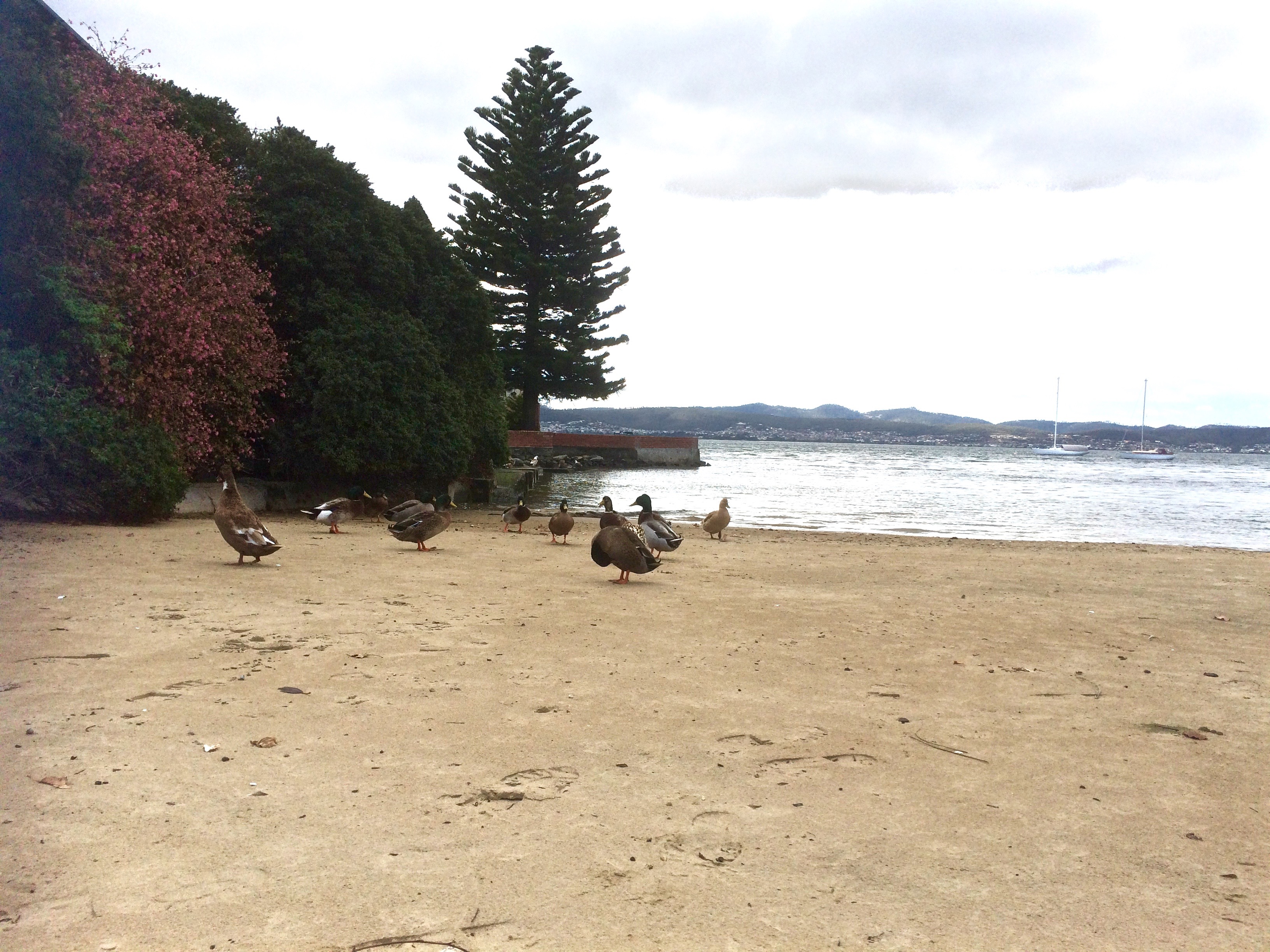
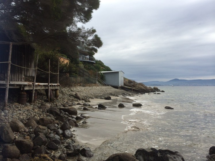
I came back to this beach in August, many years after those tranquil afternoons. I stood in the small park and looked down at the moored yachts just offshore. The gate with its Parks and Wildlife sign had been left open by a careless visitor. There was the willow tree and the boat sheds. There were dinghies neatly stacked. There was no one else on this small, intimate city beach except me and a few ducks. When I looked up, there were the mansions but there was no sign of life behind the windows.
I walked along the northern rocks where they curve out around a garden wall. There’s a small sandy cove around there that looks to have been isolated by this garden. To reach the sand you have to scramble across the jetty of another boat shed. To the south the beach continues a little way below the headland. It’s been isolated from Nutgrove Beach, the next beach along, by sea level rise but once they would have been a continuous strip.
I came back again on my yacht. My friend had the tiller as we motored close to the moorings and I took photos and regarded the bay. From this perspective it’s clear that Red Chapel shares Sandy Bay (as in the actual bay) with Lords Beach to the north. In effect, they’re the same beach tied to each other by the stretch of rocks, the visible part of Manning Reef, below the seawall. The Mannings, also convicts from Norfolk Island, had land here once, and Manning Rivulet enters the river here. You would not know it existed. Its trapped in a stormwater drain. From the water you can look at the shore and imagine a different Sandy Bay – a more kindlier planned one where the rivulets run free and linear parks retain and support native fauna and flora.
‘How much water do you like beneath the keel?’ my friend asked.
‘About four.’
‘Bit less than one now. We’re over the reef.’
‘Out we go then,’ I said.
Again I returned, talking on the phone to the little girl I’d waited for on the beach all those summers ago. She’s grown now and was in Sydney, in transit home from the UK. We reminisced. I told her there was, unusually, someone else on the beach. I said that three ducks sitting together observing the river were preventing me from walking around to the cove. I told her there were plovers nesting, that while one circled high above the other was dive bombing me then veering in a circle and flying hard and fast straight at my face.
I left the three ducks to their ruminating and respected the plovers wishes. The young boy on the beach had left the gate open again, only this time it was completely off its hinges.
Further information: Goc, N. 1997. Sandy Bay: a social history. Gentrx Publishing, Hobart.
In the little nook on the south side of the casino there’s a small, intimate curve of sand that survives despite the development around it. Because it’s below the seawall drivers lost in their own thoughts can overlook its presence. There’s a gate with a Parks and Wildlife sign beside it. No dogs are allowed, and I think perhaps there should be no gate there at all because I’ve gates to beaches are sometimes left open by the careless, making seabirds like penguins vulnerable to attack.
According to Short (2006), this beach was continuous with Short Beach long ago, which means there was once sand around Wrest Point (hard to envisage). Given that early settlers mentioned sea level rise they’d witnessed, this may have been the case although my hunch is that there were some cobbled strips and these days at least, it’s more continuous with beaches to the south.
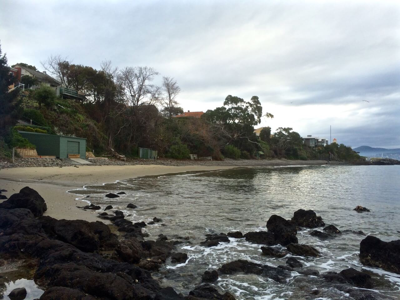
One day when the weather was still warm I went down to the marina to work on the boat and the dogs came with me. Afterwards we walked along Marieville Esplanade, past the casino and around the corner to Lord’s. I tied the dogs up at the fence and went on down the path. I felt I was encroaching – the owners had risen as one and moved out onto the water. There is a bench. I sat on it as unobtrusively as possible. Around me there were footprints and all of them belonged to ducks.
In the afternoon much of this part of the beach lies in the casino’s long shadow. The view up river is blocked by Wrest Point but there’s a longer view across the river and down the estuary, and in the foreground there’s the much photographed jetty with its boat house as well as a cluster of yachts on their moorings. Out a bit further, the casino buoy cleared, we often turn the yacht into the wind and hoist the sails.
There are actually a couple of buoys in this vicinity that the Derwent Sailing Squadron and the RYCT use for the combined club races. As well as the green Casino buoy just off Wrest Point, there’s the DSS permanent further offshore and the Manning Reef buoy, sometimes camouflaged by moorings.
I’ve sailed past this beach many times, and cycled above it on lazy summer rides from the Cenotaph to Hinsby Beach, Taroona but one summer a few years ago, feeling particularly free on a week day, my friend and I walked north from Long Beach further south. The tide was low, but there were some rocks and bits of branch we had to navigate. And this is the thing – you can come to this beach and think that it’s a tiny cove. It isn’t. That little cove is like the bloom of a lily and its stem is a long slender tapering of sand and rock. Jump onto Google Earth and take a ride from the tiny deltoid mouth of Sandy Bay Rivulet south along the coast. You can see clues as to what was there before, you can deduce that older shoreline, marvel (with some concern) at the myriad changes.
Really, the only distraction on the beach is the sound of traffic coming from the road above so if you feel a real urge to come here, bring earphones and relax to music – and bring a bag for litter collection. Picking up the odd cigarette stub or plastic wrapper is a nice way to reciprocate the avian owners for tolerating your inconvenient presence.
The Lords were once the wealthiest family in Hobart, made good from a convict beginning. James, sentenced in York, arrived on the HMS Calcutta in 1804 and quickly grew rich trading in illicit grog. Goc (1997) describes him as a ‘Bobby Shaftoe’ dressed in knee breaches and silver buckles. He and his sons became large landowners in Sandy Bay and bought the Chaffey’s Land, lending their name both to the beach and to Lord Street not that far north from Wrest Point.
But that day last autumn, while my dogs stared down at me feeling cheated, I envisaged the cultivated fields of the New Norfolk settlers and like the Mouheenener children before them, the Chaffey children and others playing on the sand and exploring Manning Reef. Car traffic faded, the road was dirt once more and the Canadian political prisoners on their unsteady legs, plotting their escape, were road building, there was the foot travellers, the odd person on horseback, the sounds of farming and land clearing as well as the odd shot – which would have to be the Rev Knopwood bagging pigeons. Out on the river I imagined a tall ship, whales breaching, gannets diving, and on a light south easterly breeze, the conversation of penguins carried towards me.
Sources:
Goc, N. 1997. Sandy Bay, Gentrx Publishing, Hobart.
Short, A.D. 2006. Beaches of the Tasmanian coast and islands. Sydney University Press, Sydney.
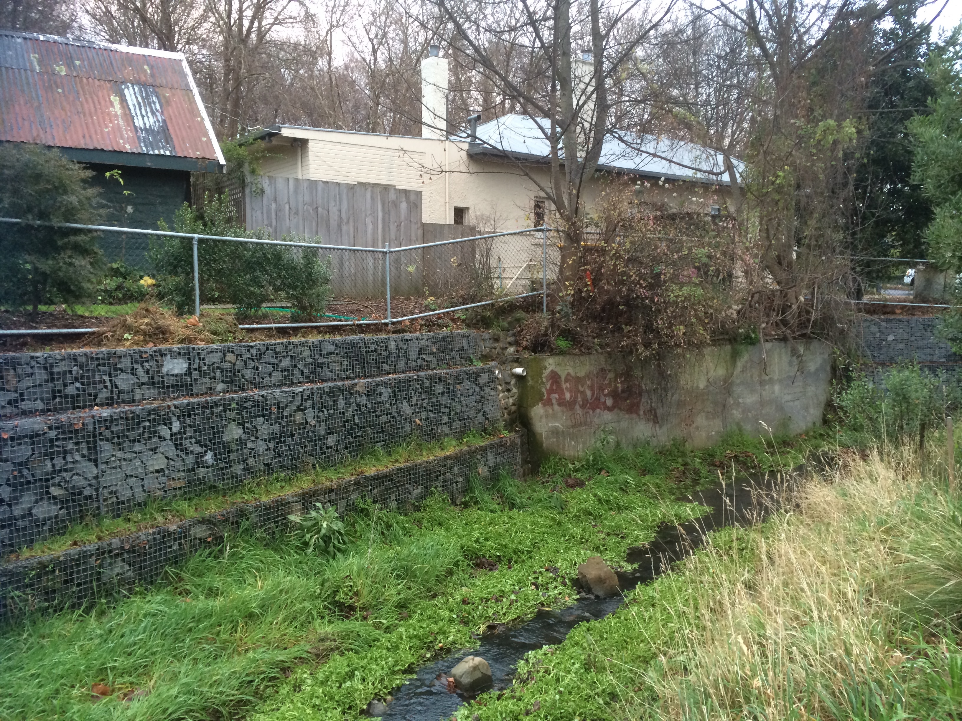
South Hobart, Dynnyrne, Sandy Bay – the suburban route began with a nondescript path outside the park gates that ran downhill to the rivulet, returning in a rush to its natural bed. I explored a bit, then crossed it to reach the forest track above it through to Romilly Road.
So here’s the sobering truth. The houses begin and the rivulet gets roughed up. A sign of worse to come, it travels between banks entangled with blackberries and forgot me nots, lawns and paddock. Some gardens make it their focus, others shun it. Regardless, it sounded almost cheerful flowing thin and narrow at this interface between forest and habitation. I had a good view of the state of affairs; this path follows a higher contour just below Stony Steps, another of Hobart’s secret places. There were cliffs; I reflected on how this rivulet, eons ago, before its landscaping capacity had been thwarted by us newbies, had carved an impressively deep valley.
I arrived at Romilly Street. After my wanderings the concrete seemed cold, shadowed and unforgiving. I, myself, mentally immersed in the rivulet, felt out of place as I paused to take some photos from the bridge. I could see no way of getting to the bottom. It was the domain of the ducks.
You barely catch a glimpse of the rivulet on the last stretch of Waterworks Road and what you see is hardly edifying. By the time it gets to Linton Avenue it looks scruffy and unkempt – and then it’s gone! it simply disappears beneath the road.
With a sense of anticipation, I took the little path I’d discovered at Linton Avenue on a previous sortie, full of anticipation that I would burst through into the park but my conjecture was wrong. It led me through to an enclave of flats. Back on Linton, I peered through a wild tangle of tall, dense brambles and weeds, a sign of neglect that indicated a rivulet could well be travelling underneath. There was nothing to see, nowhere to go and so at the Foodstore on King I turned into Overall Street, braving a soapy smelling periwinkle clad bank, down to the rivulet, where I stood over it taking photos of where it emerges from its tunnel and its route down through the park. Then I chose to walk the road rather than that sodden weed infested bank and encountered it at Parliament Street where it travels beside the oval. I was retracing my steps from a brief exploration of this area the previous week.
That morning frost had crunched under my shoes as I walked upstream along the rivulet flowing between gardens and park. I’d tiptoed past a tiny tent in a hidden glade (someone sleeping rough) and had expected to emerge on Linton Avenue but had arrived, instead, on the freeway, quickly ducking back down lest I be noticed by the morning traffic.
Again I crossed the road. There was the place where I’d stopped to chat with a man who directed my attention to a house, once a mill, on the banks of the rivulet, and there again, down a steep descent, was the end of Fitzroy Place and the woebegone rivulet now in a stormwater drain heading beneath Regent Street. I sauntered down Queen Street and detoured into Lincoln Street to meet it again where the story was one of ducks and daks – ducks fossicking on the bank and old underpants caught on a rock.
I walked down Jersey Street and found the rivulet carrying a plastic bag. I was there to greet it at Dr Syntax, where it had accumulated plastic cartons and I was there as it entered another stormwater drain (yep, we really esteem this rivulet) and was there to witness it running down its gutter behind the back gardens on Osborne Road. Sombered, I headed down Quayle Street.
Down near the beach the rivulet gets some recognition but litter marrs the scene – spray cans, McDonalds takeaway products, trapped by a buffer – Mary Ann Bay Beach is grateful. What a terribly filthy, crass minded species we are, I was thinking, and then a welcoming tide came rolling in, and the rivulet, once fragrant, now toxic, depleted itself into the Derwent. My dogs rushed to greet me and the geologist waited. Short Beach was lit with slow afternoon activity and the light was mellow. Feeling like a traveller arriving in another land, I was both buoyed by the loveliness of the walk to Romilly, the activity on the Esplanade and sobered by how quickly the rivulet had been ravaged.
We found a bench, we spread a cloth, we poured puerh tea, and sitting side by side eating chocolate and imbibing this smooth antique tea, I told the geologist of the places I’d been and the things that I’d seen.
Meeting forget-me-nots, top of Waterworks Rd
Sandy Bay Rivulet running past Pillinger RoadSandy Bay Rivulet from Dr SyntaxSandy Bay Rivulet mouth, Short Beach Sandy BayTea time after the rivulet walk


")