Frederick Henry Bay: Lauderdale’s May’s Point to Seven Mile Beach along Roches Beach and Single Hill

Roches With Gritted Teeth

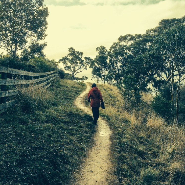
We couldn’t have chosen a worst day for our walk.  It was snowing on the mountain, raining in town and the best the temperature could manage was a measely 7 degrees centigrade.

Cathy reminded me that we had stoic Scottish blood coursing our veins; I kept secret my preference for a sauna.  Our hardiness extended only so far and we agreed to leave one car at Seven Mile Beach.  That done we sought out a Lauderdale cafe to psych ourselves up for the miserable walk ahead.

Our cafe on the western side of the suburb had a view across Ralphs Bay on the Derwent River  to the city and the mountain and from the table we’d chosen beside the wood heater we looked out at water chaotic with white caps.  Kunanyi, normally dominating the western horizon, had vanished,  the wind was loud and I was pretty damned glad I wasn’t sailing.

‘We had hardy ancestors,’ said Cathy firmly.

‘There might not be much beach to walk on,’ I suggested in a faint voice.  It looked to me like the conditions had whipped up a higher than usual tide.

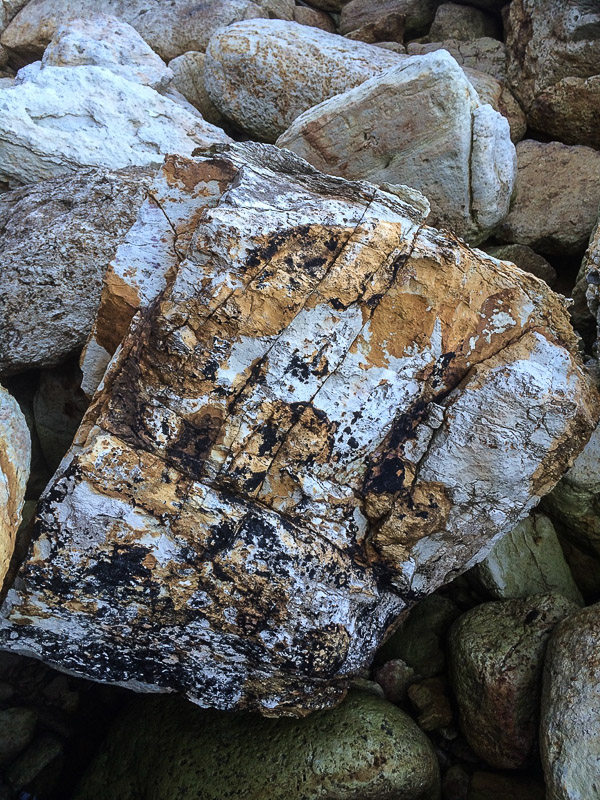
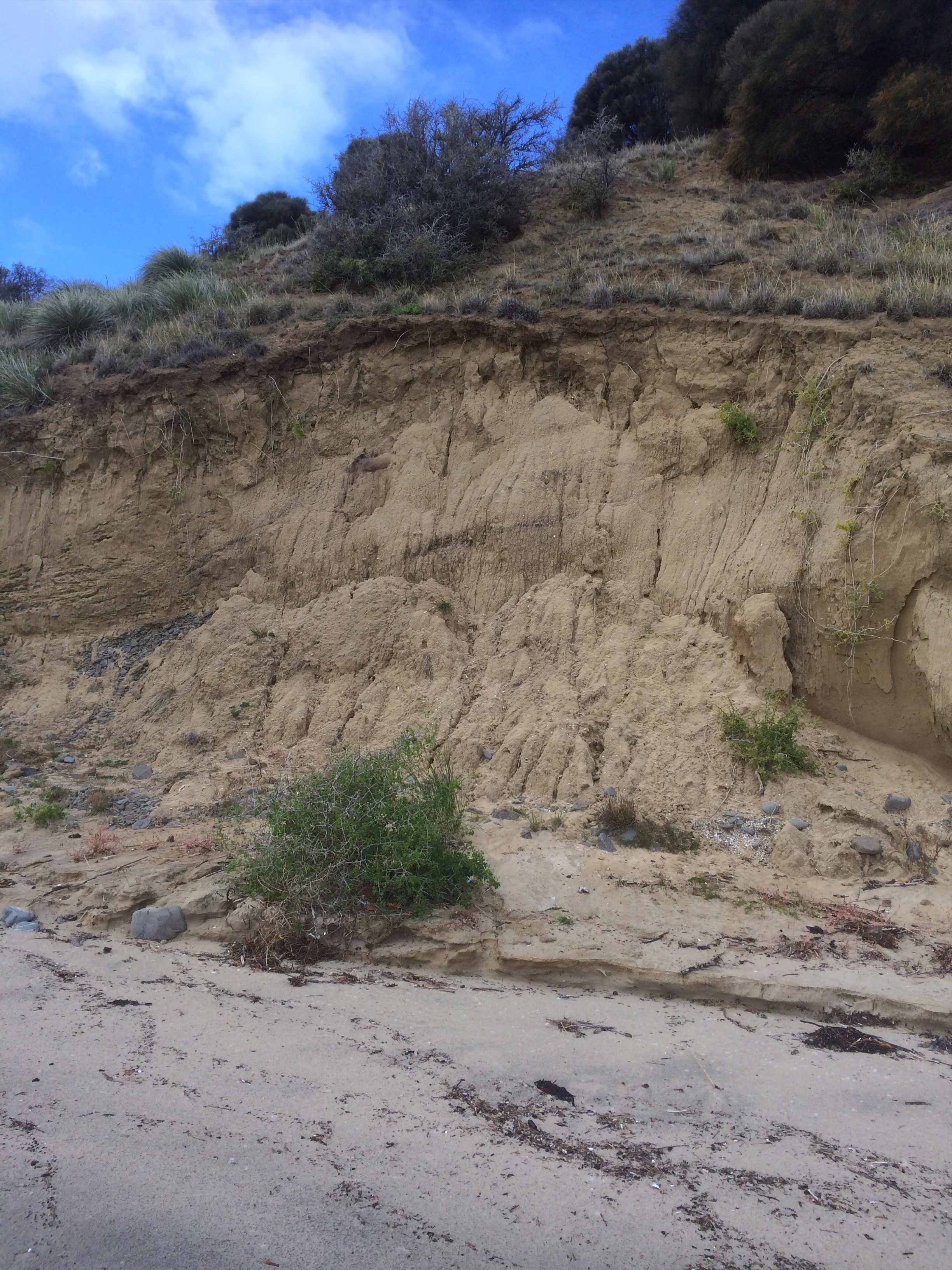
Lauderdale is a largely low lying suburb that takes in the isthmus where the South Arm Peninsula begins and straddles Frederick Henry Bay in the east and the Derwent River in the west. Back in the early 1900s there had been enthusiasm for a canal that would reduce the distance to Hobart for the shipping of farm produce, much like the Dunally canal further north saves yachts the trip around the Tasman Peninsula today.  But work was hampered by the First World War  and when they got down to business in 1924 storms made it apparent breakwaters would be needed on Roches Beach to prevent silting.  Too expensive, the decision makers concluded and the project was abandoned, leaving a 1 km canal that doesn’t quite reach the beach and is hardly visible at the Ralphs Bay end (Alexander). Later I discovered that the layer of sand in this area is skimpy.  It covers over two hundred metres of clay, sandy clay and boulder beds that filled in the ‘eroded, ancient rift valley landscape as sea level rose.’ (Leaman, 1999).

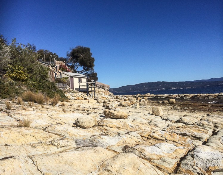
The two most significant bumps in its landscape are Richardson’s Hill with May’s Point below it at the southern end of Roches Beach and Single Hill to its north.  Our walk was to begin below the first and take us around the second – but the weather was so truly terrible that we prevaricated by driving slowly up Richardsons Hill and then slowly back down to Roches Beach, slowly parking the car close to May’s Point and slowly donning extra thermals and wet weather gear before braving the lashing rain.

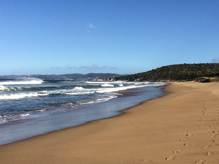
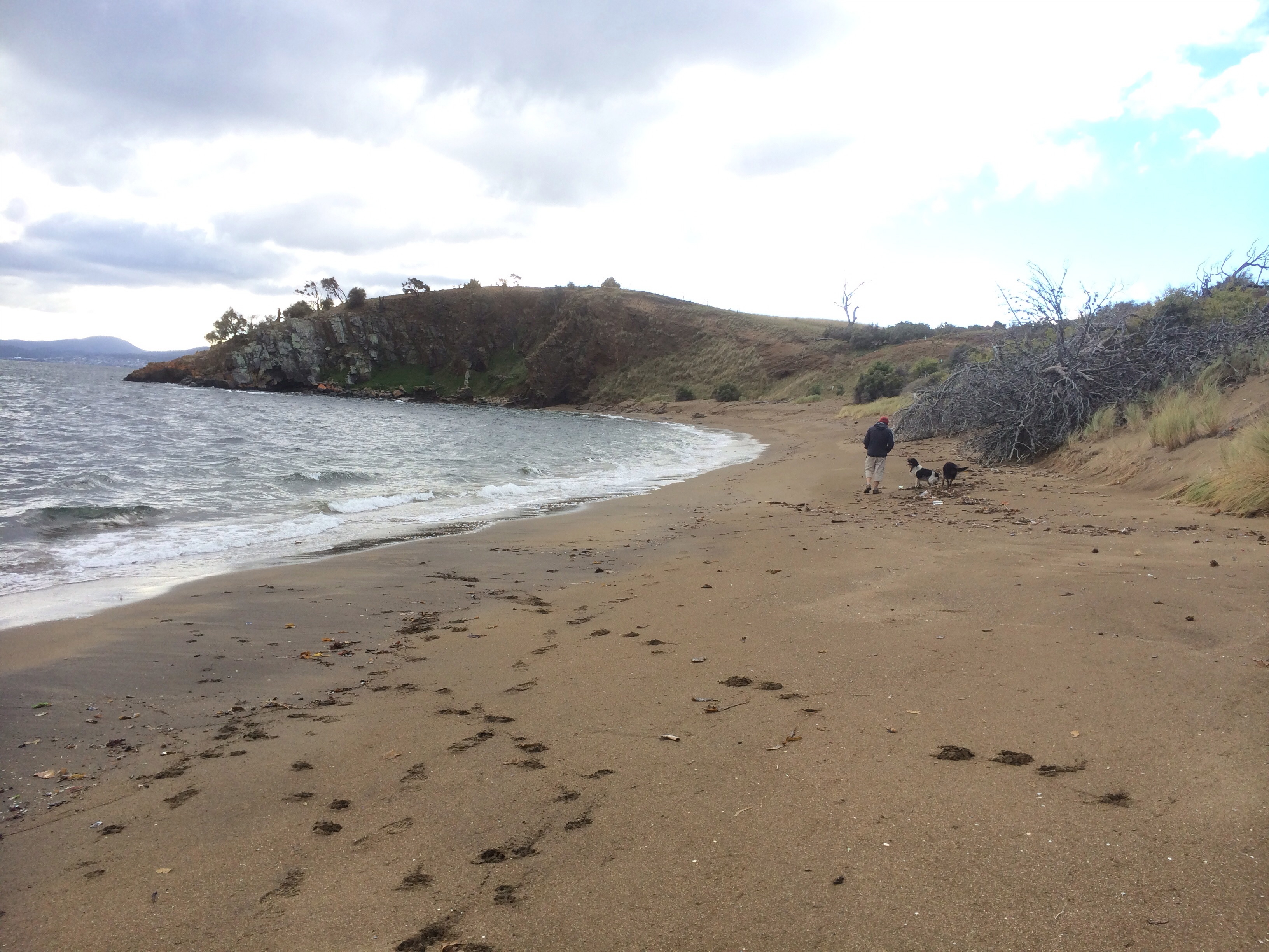
We began walking down the beach in a most unhardy manner.  The tide was indeed high, the work of the stormy south westerly, but at least the wind was at our backs. Slowly our Scottish blood began exerting itself and snug in all our layers we got our stride up and congratulated ourselves for defying the weather.

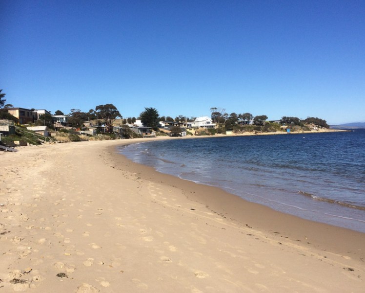
Lauderdale takes its name from Ann and Robert Mather’s Ralphs Bay farm, Lauderdale Park.  They were early settlers and their inspiration was Lauder, Robert’s birthplace near Berwick-upon-Tweed in Scotland. When it comes to hardiness Ann totally put us to shame, ‘raising her children and managing an unwilling convict workforce’ on this isolated farm (Clarence City Council).  By the 1950s settler hardiness had given way to hedonism and holiday shacks began filling in the landscape.  These days it’s suburban homes fronting up to the dunes along this 3.5 km section of the beach, their gardens spilling out into the public reserve.

Shells on Roches
Beach assemblage both human and natural

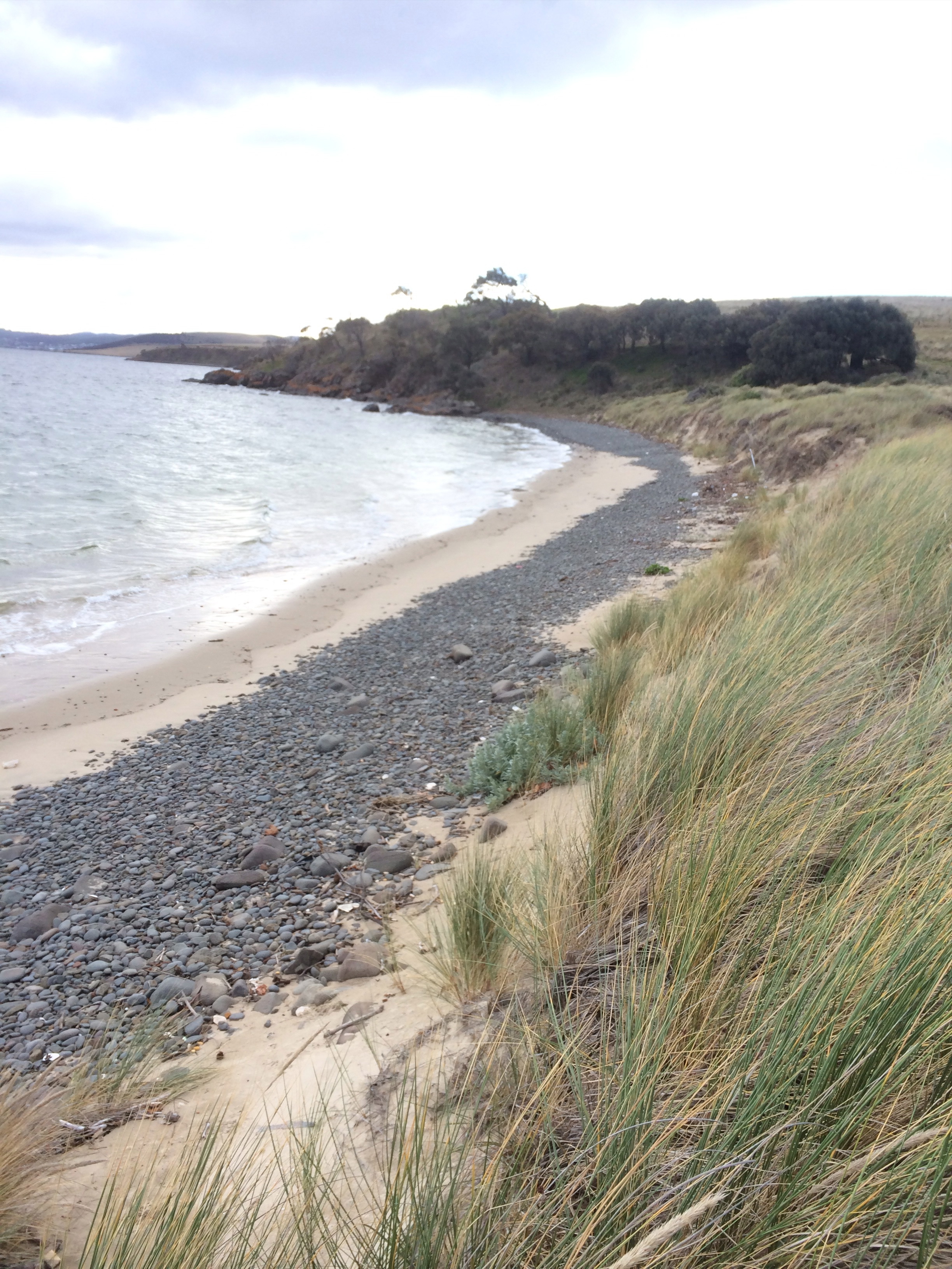
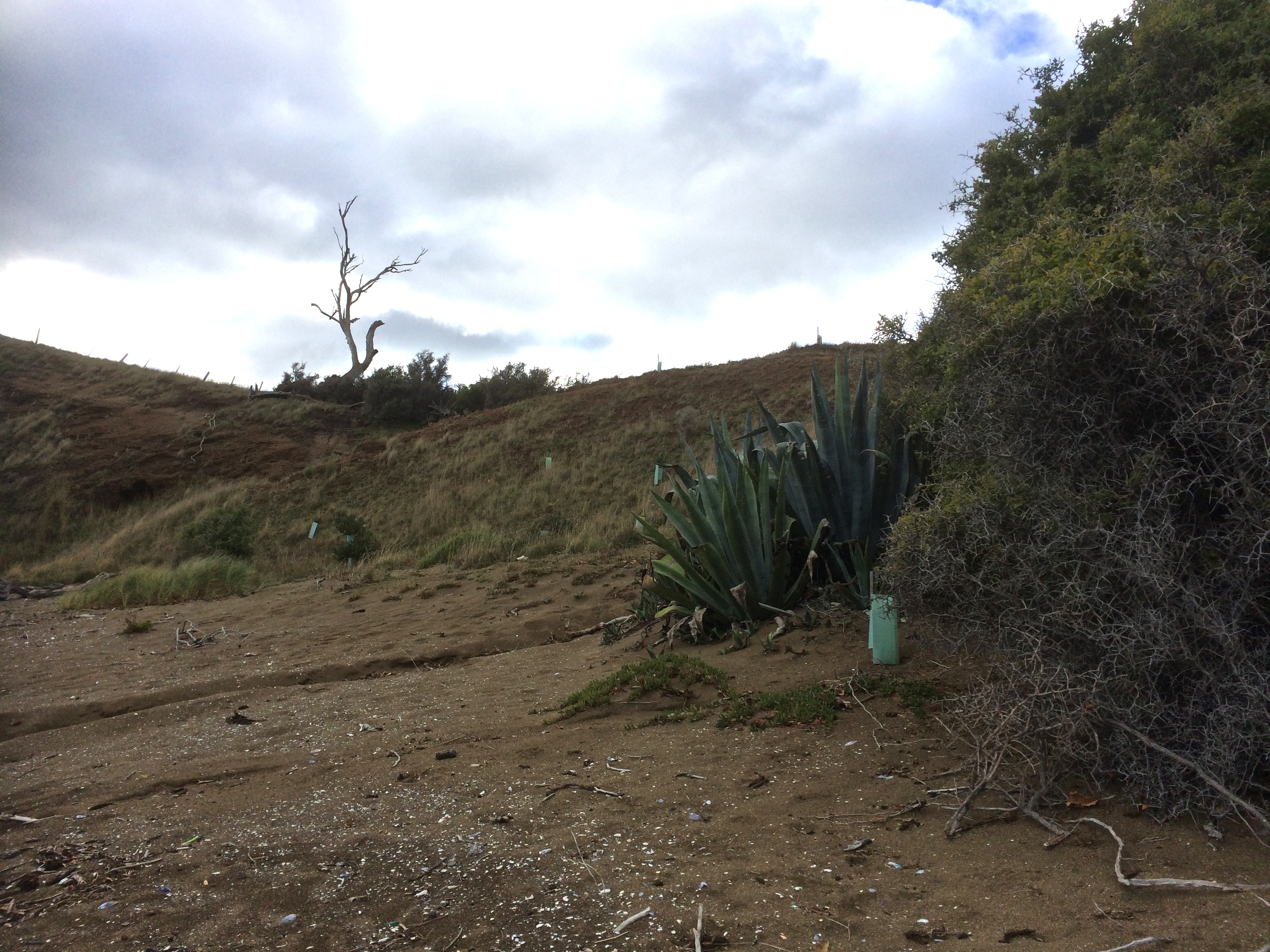
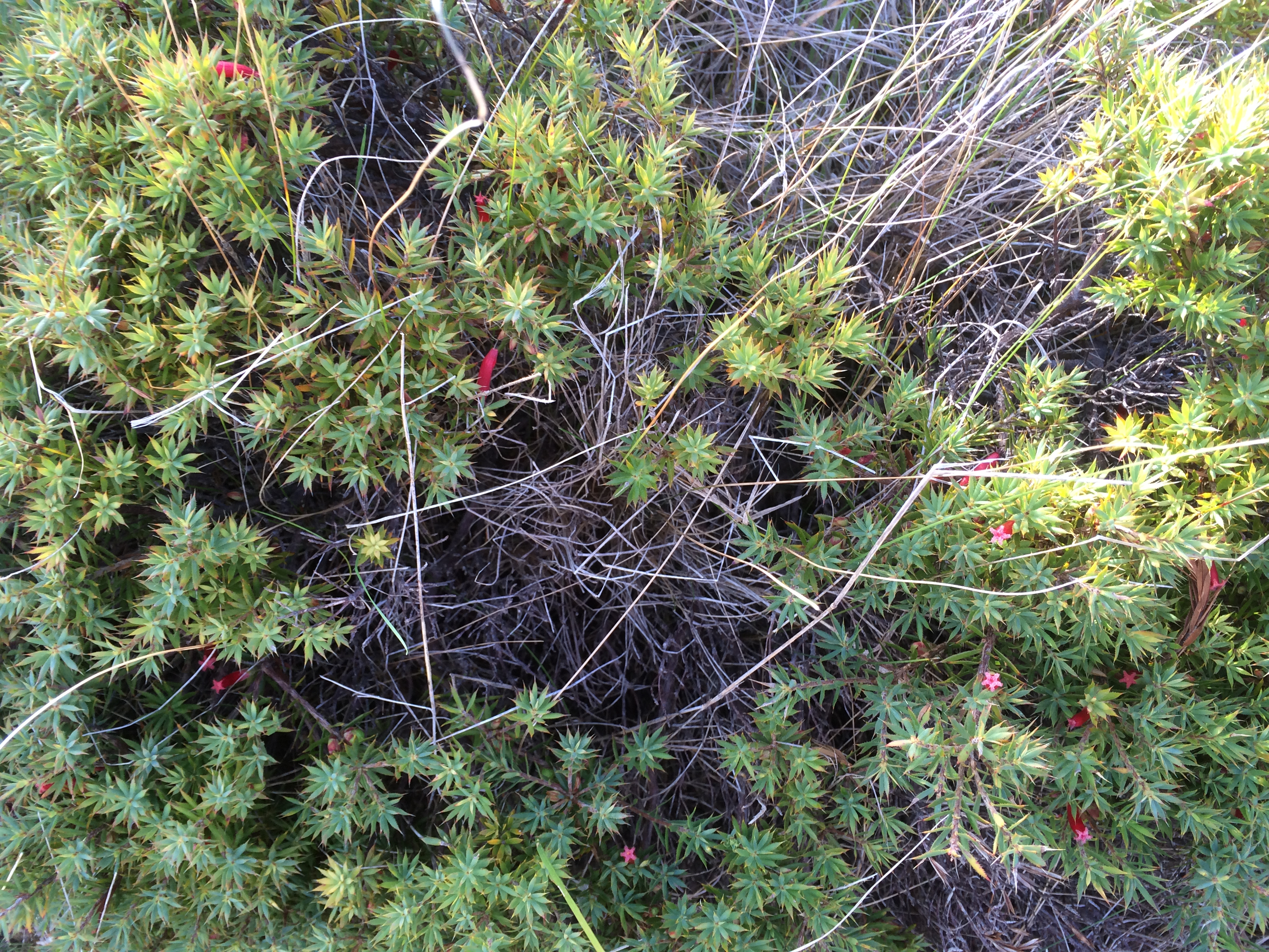
The narrow beach sloped steeply that day and the waves were slapping at the dunes in some places, undercutting them and threatening to saturate our ankles, so we decided to see if we could find a track behind the beach and for a while picked our way through undergrowth and escapee plants. This high sea also had us discussing Lauderdale’s vulnerability to storm surges and sea level rise, much like its southern neighbour, Cremorne.  The isthmus isn’t much above sea level and the small dunes along Roches are already compromised by human impacts.  We also spent considerable time discussing whether we were walking one beach or several and what, if anything they were called. Later I referred to the guru, Andrew Short, who in his inventory referred to Roches Beach as a 5 km stretch of increasingly wider beaches lying between Mays Point and Single Hill, although actually 3 and 4 narrow again, we found. For the record, he called them Roches Beach and then Roches Beach North 1, 2, 3 and 4 but the locals probably have different names for them.

IMG_4500.jpg
The beach makes another curve at Bambra Reef and begins to broaden

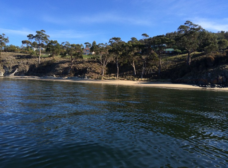
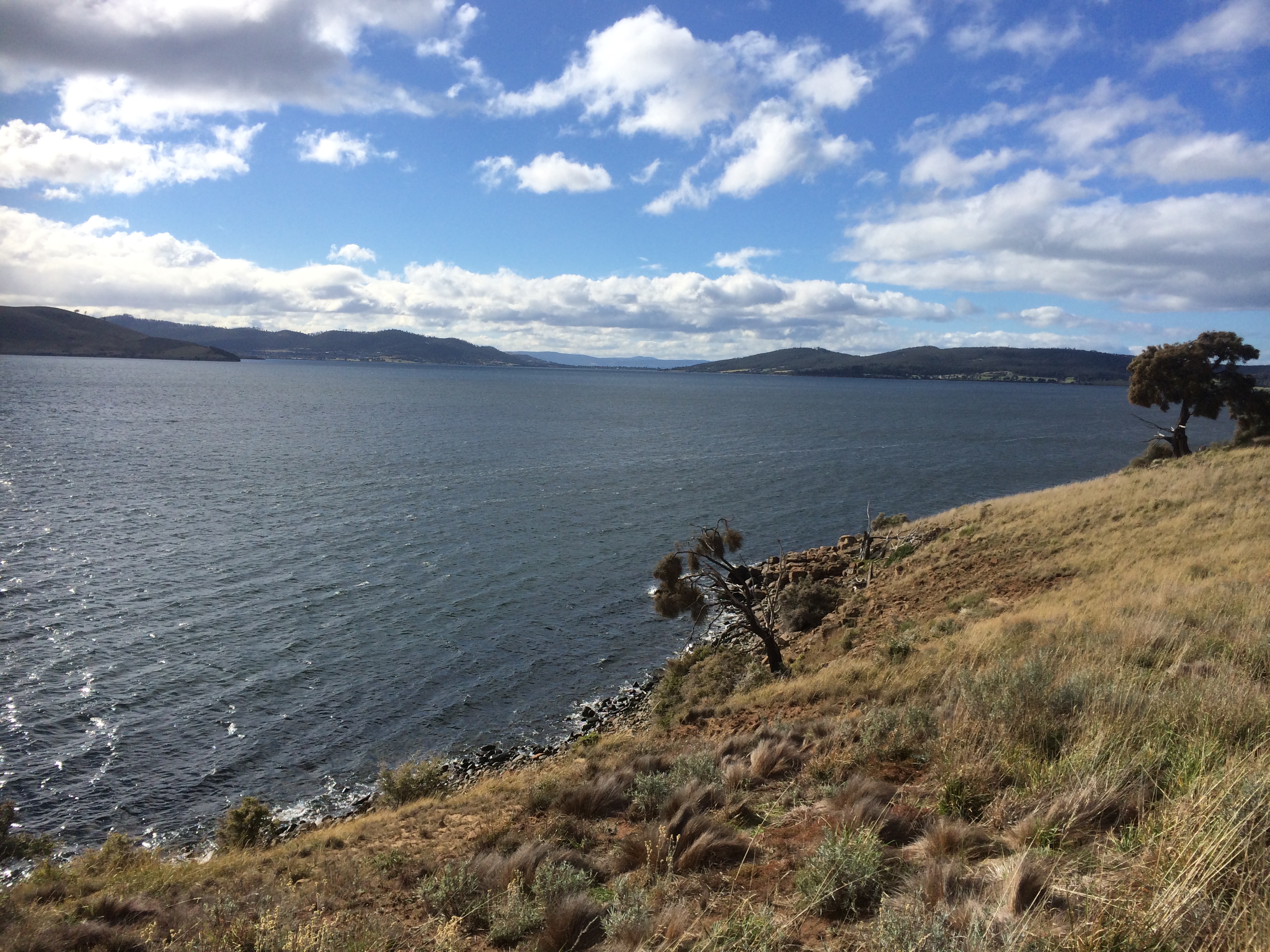
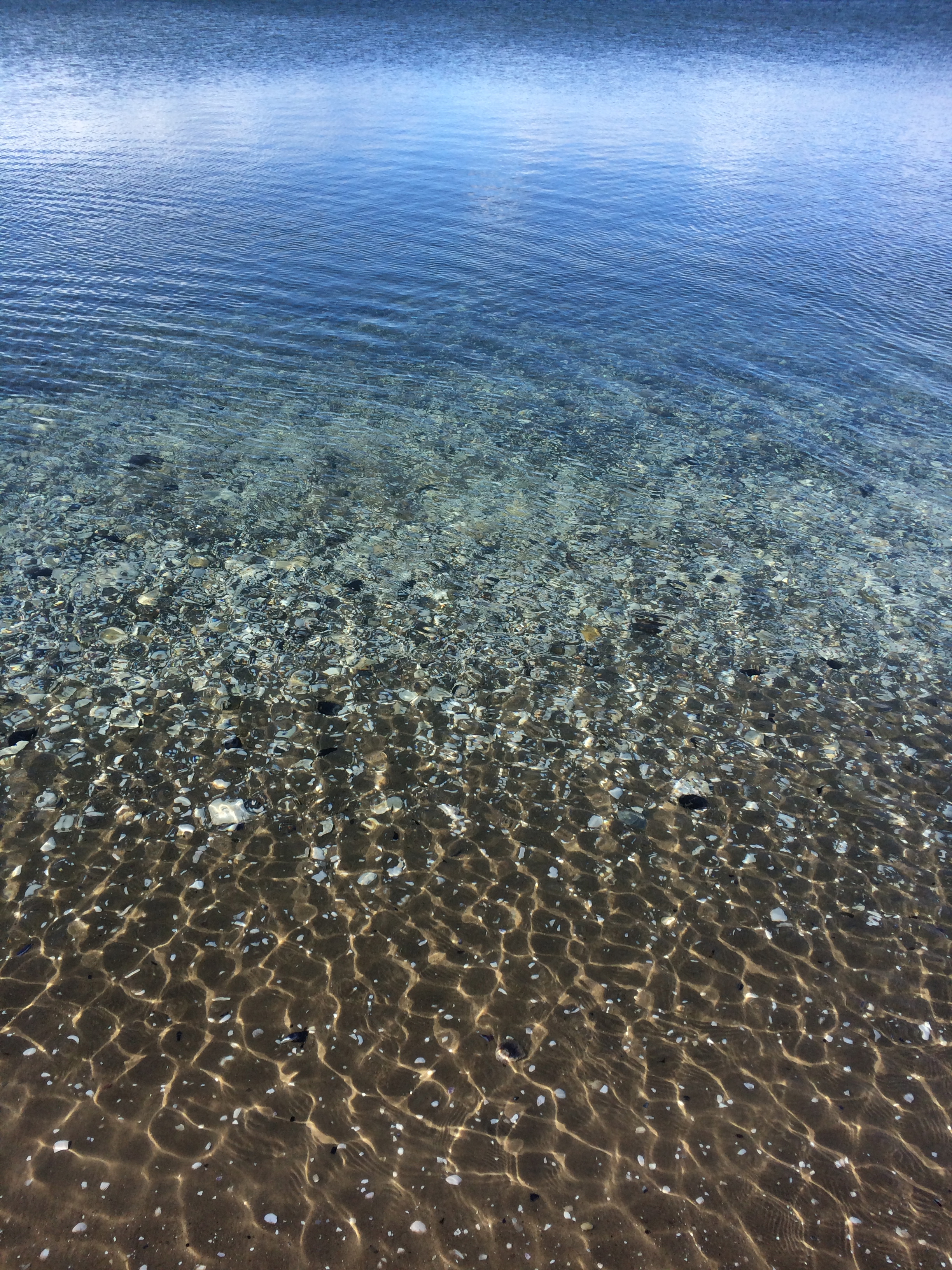
We passed Bambra Point and its reef as the weather began clearing and reached the part of the beach that Cathy most loves because it holds memories of regular visits with her children when they were little.  She pointed out the shelter provided by the trees and Epping Park Reserve behind the dunes and took me up there to take a peek at Lauderdale Yacht Club, the base for catamaran sailing in Hobart.  Later, reading David Leaman’s Walk into History (1999) I learned that there are some brilliant examples of Permian rocks in this area.  Also, right at this point on a low tide you can see the irregular roof of the main Jurassic dolerite intrusion.  (If you want to know why the dolerite in this area is great for giving you an idea of the gigantic intrusions dominating central and eastern Tasmania  pick up a copy of this book and take a stroll here – it’s definitely worth it.)

IMG_4655
Not just any old rock.

Single Hill and North Roches Beach (T 398)

We passed the sailing club and the boat ramp and took the path leading up Single Hill, that singular landmark as you fly into Hobart. Initially we walked below big houses I hadn’t known existed and at the base of the hill Roaches Beach (N3) aka Short’s T399, a narrow 50m ribbon of sand and rock, that is a continuation of Roches Beach N2 aka T400 was being bashed by waves.

View from Single Hill.jpg
On Single Hill with Richardson’s Hill, Cremorne and Cape Deslacs in the distance and the Tasman Peninsula in the distance

We were walking amongst eucalypts and she-oaks following  what is really pretty much a contour path with a lovely sandstone bridge.

IMG_4510.jpg
Walking Single Hill

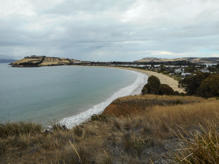
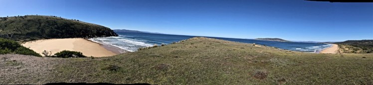
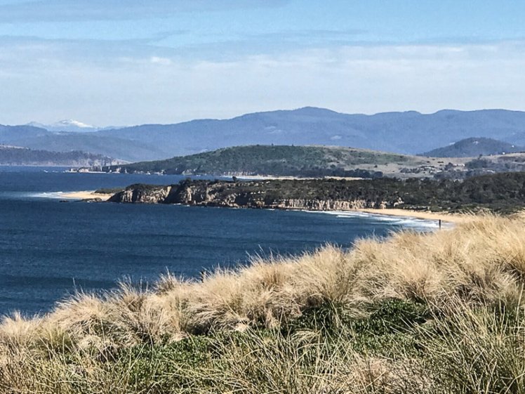
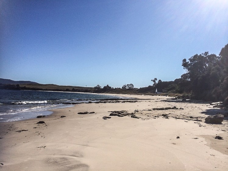
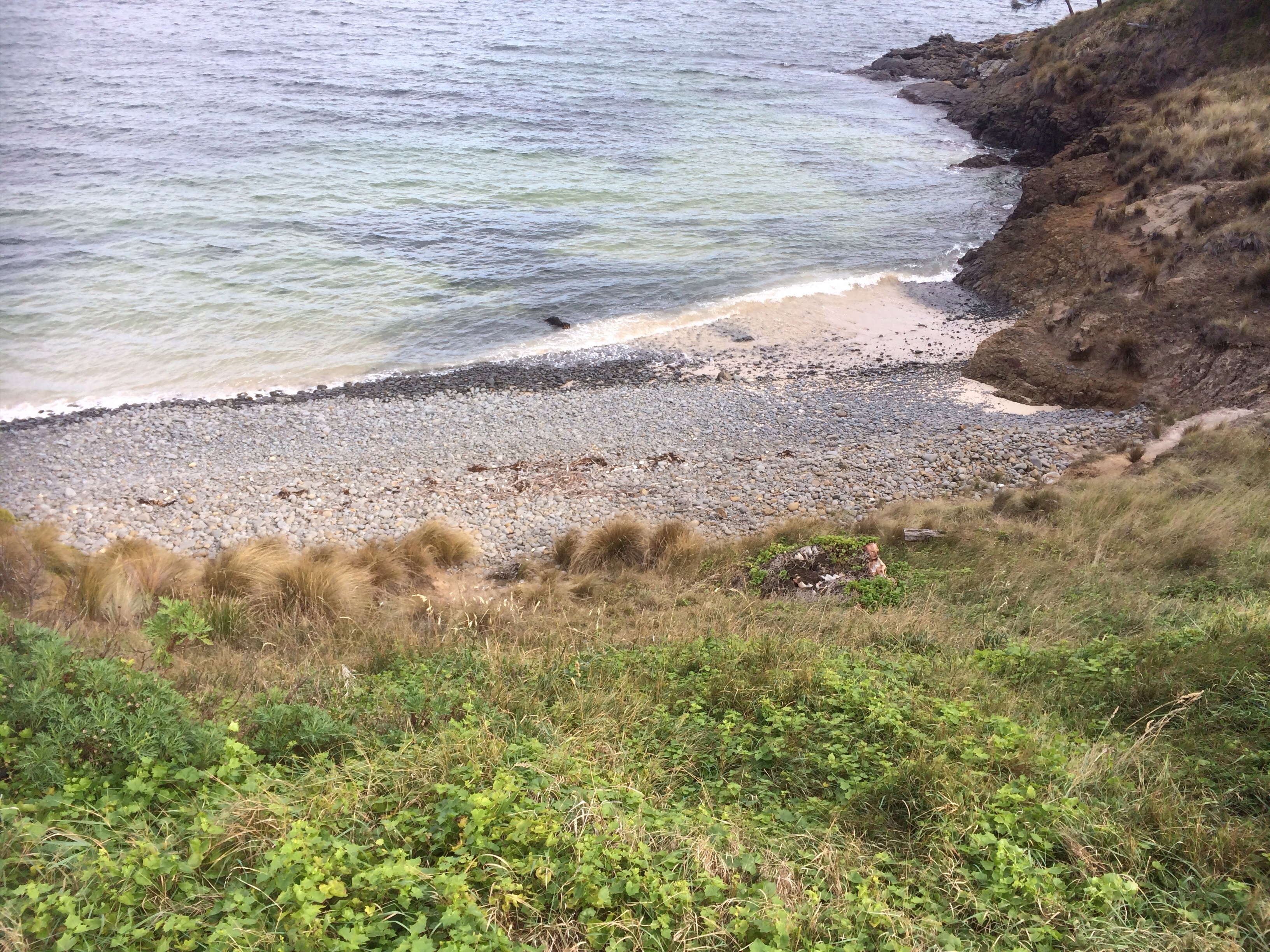
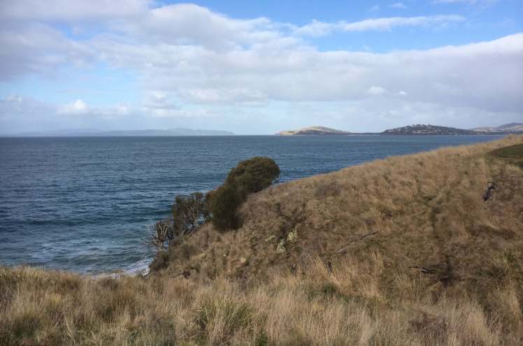
Cathy pointed out the most northern beach below us (T398). There were steep steps leading down to it but we continued on around the hill, stopping every now and then to take in the sweeping views of Frederick Henry Bay and the Tasman Peninsula.   But if you’re keen on geology this little beach is definitely worth a visit because according to Leaman the Permian rich siltstone here is rich in fossils.  Far away over the bay we saw enormous waves breaking on a point we struggled to identify. Eventually the path turned towards Seven Mile Beach and we gradually descended on to the sand.

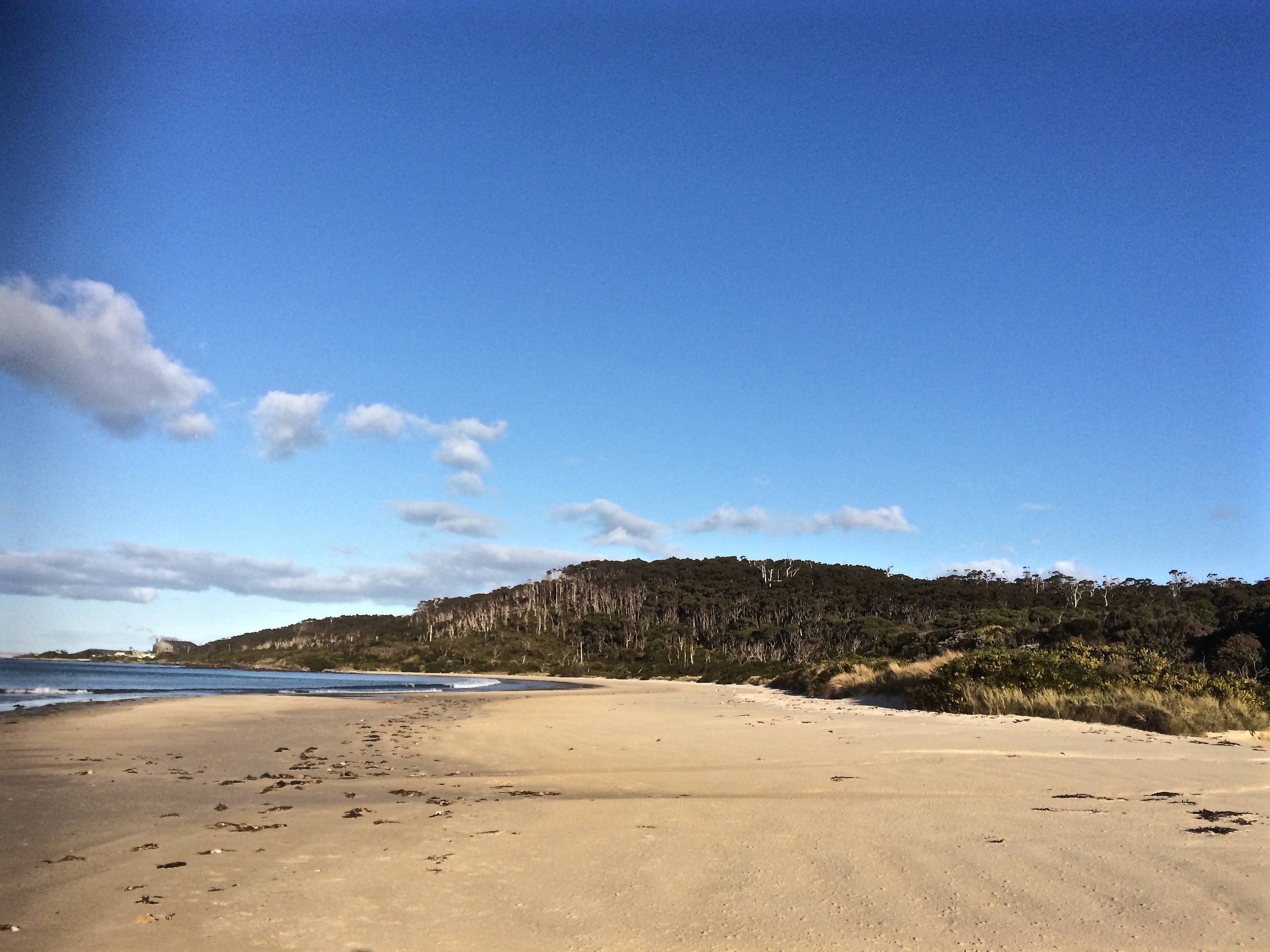
T 397 Seven Mile Beach (southern corner)

There are shacks clustered in the corner beneath the hill south of where picturesque Acton River enters the beach.  A small flock of ducks were enjoying it as we crossed the wooden bridge.

The walk had taken roughly 3 hours but I was enthralled by it and so the next Saturday I was back with my friend Rosemary White, who had sore knees and wanted an easy walk.  This time, with an impeccable blue sky and far kinder weather we walked it the other way around, from Seven Mile to Launderdale.

Again, the beautiful creek at Seven Mile, and again the expectant flock of ducks.  Walking this way there were points where it seemed we were trailing the edge of a great bay with a relatively small opening.  Identifying landmarks was difficult but our geographic guesses were confirmed by a local we encountered, walking alone with his radio tuned in to the racing.

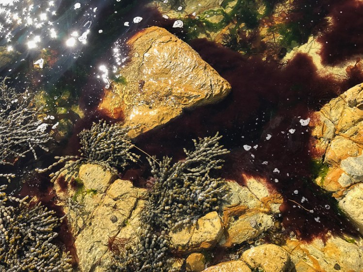
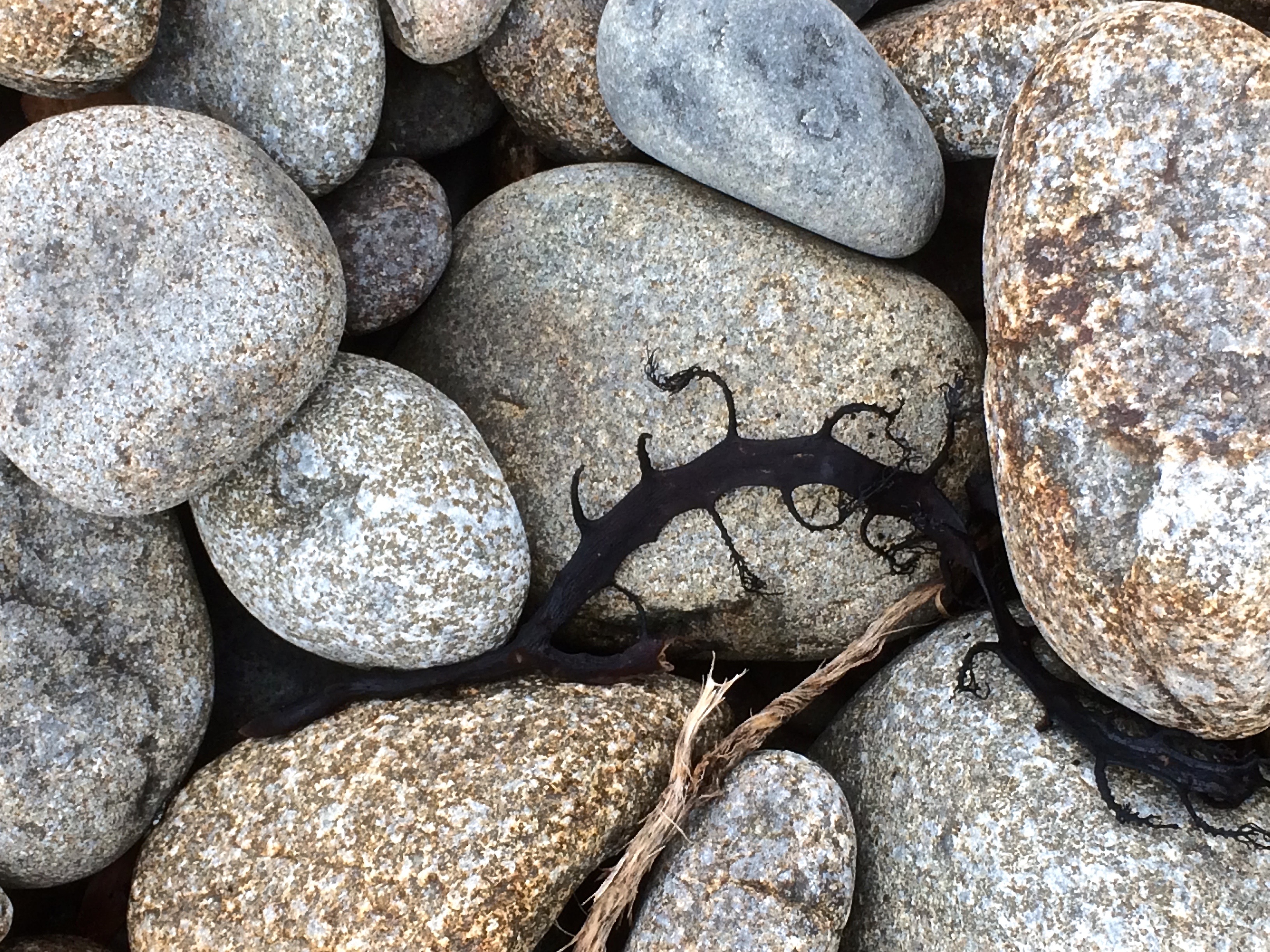
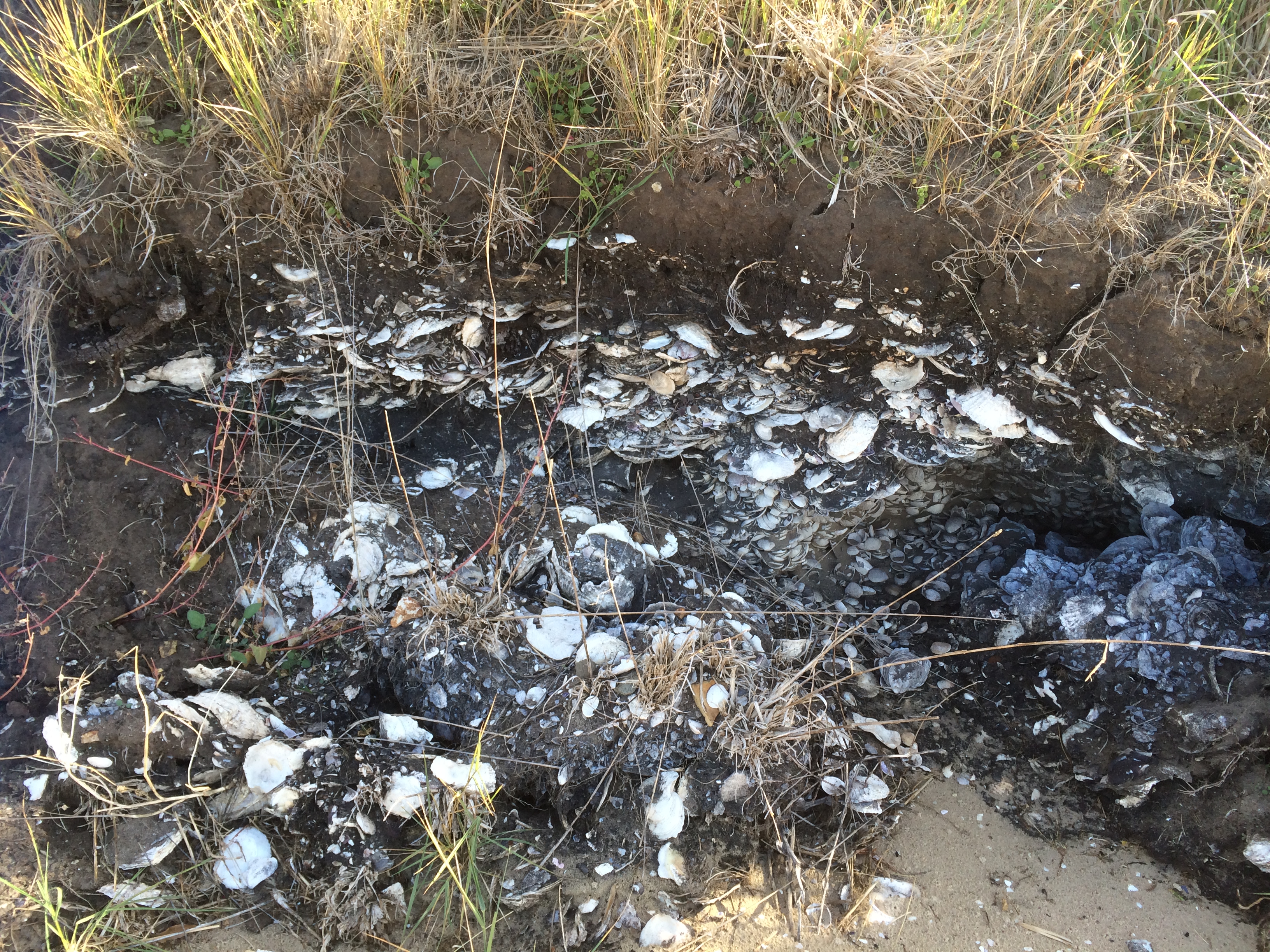
Reaching Roches we turned and walked Roches N3, pausing to examine the small butterfly shaped shells that had washed up everywhere on the sand.

Kayaking Single Hill

Still not done with this area  I brought others to walk it and keen to explore Roches N4 I paddled around Single Hill from Seven Mile Beach to Lauderdale.  It’s a short paddle but (small confession) when the wind came up my enthusiasm for paddling to May’s evaporated and I pulled in early.

Kayaking Single Hill.jpg
Calm moments off Single Hill and Roches Beach N4


Frederick Henry Bay: Cremorne Beach to Lauderdale

Walking Swathes of Yellow

There are homes on the low dunes backing Cremorne beach and behind them the small community stretches across the flat land in the elbow between the beach and Pipeclay Lagoon.  These reaches of Moomairemener land were first reshaped into farmland by the McCauley family who arrived in 1804 and ran cattle and sheep.  They also grew potatoes, barley and beans.  These days it’s a small community of permanent residents and holidaymakers; a place unspoilt by the inappropriate development that marrs so many other beachside villages although there is currently a developer who would really like to try.  I for one hope this community holds out against greed.

Cremorne Beach looking south
Cremorne Beach with Pipeclay Lagoon in the distance

Pipeclay Lagoon

Cremorne benefits from Pipeclay Lagoon, an enclosed, tidal body of water  that separates it from Clifton to the south.  I discovered, when I kayaked it, that it is shallow and that I’d chosen the perfect way to enjoy its serenity. There are oyster farms here and along its margins there are 45 ha of saltmarsh wetlands, protected to some extent by coastal reserve and the attentions of the Wildcare Deslacs Group, but also threatened by changes in tidal flows, habitat disturbance, unmanaged tracks and roads, ditches and litter.

One of the first farms on the banks of the lagoon was Waterloo Farm, owned by Captain Busby and his wife Mary.  When John Morrisby bought it from Mary he developed orchards of apples, pears, apricots and cherries and grew peas and root crops between the rows, enriching the alluvial soils with seaweed.  There’s a rare eucalypt (Eucalyptus Morrisbyi) that grows in this area and it takes its name from this farming family, who eventually sold, the subdivided land along the waterfront and lagoon giving way to weekenders.

Today, on the Cremorne side of the lagoon there is a narrow road squeezed between backyard fences and the shore.  It runs down to a tapering of beach beside the lagoon’s channel to the sea.  Four dolphins came through this channel earlier this year and stranded but for walkers it’s a good place to begin exploring the short, narrow beach.

Cremorne Beach (T405)

The beach has a domesticated feel because of the houses on the low dunes, but this is deceptive. When there are storm surges such as there were in 2010 and 2011, the waves have been known to undercut sections of the dunes and there have been a number of dramas at sea off this coastline.

Cathy and I came to Cremorne hoping to find a track we thought might exist at the northern end of the beach. It was a cold day, the tide was out and rain threatened but quite quickly we had walked the kilometer or so along the sand. Ahead of us was the steepish, yellowish slope of Calverts Hill, much of which was owned in the early days of the colony by Elias Grimsey, whose neighbour for a while was the  Rev Knopwood’s adopted daughter, Elizabeth.

Calverts Hill and Cremorne North (Beach T404)

We quickly found the track and walked quite easily across hillsides of tall yellow grass, coming across a small cove  about ten minutes into the walk. Beach T 404 is a short 50m pocket beach that looked to be mainly cobbles  trapped by the cliffs that are some 30m high.  It’s also only accessible from the sea and apparently at times sand fills it to form a low tide made terrace.

Most of Calverts Hill is reserve, perhaps to protect the endangered Eucalyptus morrisbyi which  is in decline, but fortunately there are people who care.

Cremorne walk with Cathy.jpg
On Calverts Hill

For a while we followed a fence line and then we descended down to the rocks and most of our walk ended up taking place just above the waterline as the path curved around one undulating hillside after another.   We idled along, discussing the rock formations we encountered.  The sea was quiet and rain was visible in the distance.  There were good views over Sloping Island to the Tasman Peninsula.

We passed five pied oyster catchers standing quietly on the rocks. We passed a couple of pacific gulls and then a shag standing very still on a pole, imbuing the mood of the day. It was hard to gauge how far we still had to walk.

Mays Beach (T403)

I was keen to reach Mays Beach because I had only ever seen it from the top of Richardson’s (aka Nobs) Hill and from there it seemed unattainable down at the bottom of the steep slope, separated from the road by private land, but as we rounded Calverts Hill on our walk the land flattened out and there before us was the beach, occupied just then by a flock of about twenty plovers.

We were fascinated to discover a small number of houses in the bush behind us, but they’re so tucked away that we couldn’t easily discern any driveways or even a road and as we crossed the beach we puzzled over their means of access – down Richardson’s Hill or from somewhere to the south?

This walk had taken about 2.5 hours and we were yearning for lunch and racing the approaching rain. Still, while Cathy explored the hillside looking for the path, I walked along the kilometre long curve of beach, crossing a spine of rock that divided it into two sections to its conclusion at Mays Point, where there is a right hand break.

MAY'S BEACH FROM THE POINT.jpg
Mays Beach viewed from the point at the northern end

Richardson’s Hill

The hill is 79 m high but the good news is that the track is well made and links the beach to the top of the hill where the private road begins behind a gate.  We literally ran up it to reach the car we’d had the foresight to park at the top.  We had finished just in time – the temperature was dropping and the rain slammed down on us just as we got there.

One of us was digging about frantically in pockets but to no avail.  The car and its  keys were separated by the distance of our walk.  All thoughts of lunch in a cosy café faded.  Wildly we surveyed the landscape beneath us for a shortcut back to Cremorne but faced with what looked like a lot of private land we didn’t like our chances and so we set off back down the hill at a trot, laughing over our misadventure.

Cremorne walk with Cathy - Lauderdale.jpg
The view from the top of Richardson’s Hill

Listen to the locals tell you what they love about Cremorne and help support them in their fight against Inappropriate Development.

Further reading:  The Cremorne community website 

Frederick Henry Bay: Goat Bluff to Cape Contrariety – Calverts Beach

CALVERTS BEACH (T411)

The moon had given us a low tide and with a slender window between cold fronts Cathy and I whipped on our walking gear to continue our saunter along the coastline.

We paused on Goats Bluff to look across the long expanse of Hope Beach before making our way down the narrow path through native bush to the beach. The last time I’d come here it had been 25 degrees and people, heavily tattooed, were lounging under umbrellas beside the sedimentary cliffs.  Today was crisp but sunny. Ever since the geo and I had driven off the ferry after a couple of weeks spent in shorts and t shirts on the mainland, Tassie had been lashed by a bout of wild, wintery weather, so this was a brilliant reprieve.

FEATURE BENEATH GOAT BLUFF.jpg
This feature in the cliffs below Goat Bluff may be linked to its history (see previous blog post)

Calverts had been our ‘go to beach’ when we first came to Tasmania.  Every time I walk it I remember a tiny kelpie x border collie puppy from the Stirling Ranges in Western Australia. Along with two of his siblings he’d been bundled into a box and on to a plane in Perth. Several hours later I plucked him out of that box at Kununurra Airport in the Kimberly region of WA and for the next two years he enjoyed field camp living with us. The creek, the waterholes, the fishing expeditions and the parties in the annex, the walks down to the chopper to meet the guys returning from another blisteringly hot day doing mag anomalies. Two years in a caravan in boab country, living small. Two years in a tiny field camp in all that wild, vast inaccessible space. We were lucky though, because sometimes, in the chopper, we got to explore caves rich with rock art and canyons with verdant microenvironments that felt way off the map, far from roads or even a track, that you wouldn’t know were there unless you could spot them from the air.

This puppy, born of working stock, climbed trees (sort of). His acrobatics intrigued children. His speed was astonishing and Calverts was a beach he raced along, trying unsuccessfully to round up seagulls. He drove around Australia, squeezed on top of a mattress that was wedged on top of a motorbike, that weighed down the already sagging boot of our Holden station wagon.

Cathy and I walking along discussing economic conundrums, saw a spout of water off Betsey Island, just as two birds lifted into the air close by.  Further down the beach a lone man stood on the sand dunes assessing the swell on this rip-prone beach. Behind him, the dunes sloped down to Calverts Lagoon, a change in the vegetation and a quieter sort of environment.

We reached the opposite headland. This is where the geo and I have always turned back, but had occasionally noticed people making their way down it and had puzzled over where they were coming from. Cathy was the person who let me in on that secret, but before we set off up that path we explored the rock platform that slants upwards around its base because another beachwalking friend had told me that if you climbed to the end of it and peered around the corner you could see a little cobbled beach. But what we saw when we reached the end was the narrow shape of a gulch that at low tide probably did leave cobbles and rocks exposed. While I stood there musing, Cathy bounded up the daunting cliff face and when I looked up I could see her standing on the headland enjoying the view.

I followed slowly up that steep side. There was only marram grass to grab hold and it looked rather puny. Besides, it’s hostile and I wasn’t wearing gloves. I surveyed the big drop beneath me and the hard faced rocks. Those I was clambering up were damp and my shoes lacked grip. One up to Cathy, I decided, and slithered slowly down to a more welcoming ledge before seeking out the little path further back along the headland.

From the top we could see Calverts Lagoon, fingers of land and stretches of sea. The best was yet to come, because on the other side of the bluff lies a hidden beach, outstandingly beautiful. I’d been here once before, pretty much as soon as Cathy had told me about it. It had been a hot day and our party had disturbed a lover’s tryst. ‘Beware the snake,’ the man had yelled at us, jumping up to shoo us away. We had clearly destroyed their moment because it wasn’t too long before they were trailing us back along Calverts.


Smugglers Cove and Calverts Beach agn-1
Smugglers Cove and Calverts Beach


Smugglers Cove (Beach T 410)

We descended through soft sand, stepping over dead birds and a dead sheep to reach Smugglers Cove. It’s seriously lovely and is cupped by the steep headlands of Cape Contrariety. It’s also seriously private and intimate even though it’s spacious enough to accommodate several parties of beach goers. Two eagles wheeled above us and a pied oyster catcher stood on the rocks regarding us.

After a while we followed a fence line up the bluff on the other side, keen to reach the other end of the Cape. I’d tried hunting down the owner of the private land without any luck, so we didn’t like our chances. There were mutton bird burrows. There were sheep, happily alive. We followed their tracks until we reached a fence that crossed our path.

This was as far as we figured we could go. From there we could see the spot we’d reached on an earlier expedition, when we’d attempted to cross the Cape from the Clifton side (see next blog post), so that long slope separating us from that point near the top was frustrating. We knew there was a nature reserve along the tip of the cape and that another beach (T409) was down there too.

On the Beachsafe site its described as ‘a 150 m long high tide cobble beach located along the western end of the cove, with a sand and rock low tide terrace. Waves averaging about 1 m break across the 50 m wide bar and surge up the cobbles, with the steep slopes right behind. The 4 ha tip of the cape is a private wildlife sanctuary.’

Cape Contrarity Calverts side.jpg
Walking Cape Contrierty

We’d been defeated but the walk back was uplifting. A yacht was crossing Norfolk Bay, a north easterly filling its sails. That whale breached and blew again. We saw Little Betsey Island tucked away behind Betsey Island, Black Jack Reef and the great sweep of Hope Beach beyond Goats Bluff.  We saw the Iron Pot at the entrance to the Derwent and snow on kunanyi and the Snowy Range.   And as we clambered back down the path to Calverts there were seven surfers in the swell beneath us, where originally there had been only one. You’ve got to have ichor coursing through your veins to take  on Tasmania’s winter ocean. I lack even a single drop and just the sight of them had me zipping up my down jacket.

Cape Contrarity Calverts side - snow.jpg
Calverts and Hope, with snow in the background


This walk: 1 September 2017. If you’ve walked this cape or know the contact details of the farmer, please let me know so we can try again.


South Arm Beaches: Hope Beach

HOPE BEACH (T413)

Hope Beach from Goat's Bluff
The eastern end of Hope Beach

Hope Beach spreads itself from Cape Direction in the west to Goats Bluff in the east, a distance of about 5 km.  It is backed by dunes that are quite large by Tasmanian standards. The beach forms the southern shoreline of the South Arm isthmus.  Ralphs Bay is contained behind the dunes and this large embayment of the Derwent River provides a sheltered habitat for shorebirds.  

Betsey Island lies offshore and between the island and the beach lies Black Jack Reef, notorious for snaffling the boats of the unwary.

Although we had come to Hope (driving through farmland then walking in along the dune top path)  we weren’t sure we were done with Cape Direction. I stood beneath the cyprus pines that grow on the dunes  in this western corner of the beach and contemplated its shaggy slope. Cathy energetically sought  a path and  although it was  possible a way existed, the dense scrub made it uninviting.  So we  decided to tackle the rocks instead.

The reef at the base of the cape was an equally unlikely route around  to Pot Bay but we gave it a go, timing breakers.  It defeated us within metres but presented us with a great view westwards towards the Iron Pot Reef.

3 Iron Pot from the Cape Direction Rocks
The Iron Pot from the Cape Direction rocks, western end of Hope Beach

As we set off along the sand  a lone surfer stood on the dunes assessing the surf. A pied and sooty oystercatcher were chilling together, and later we spotted six more of the pied variety, along with a dozen hooded plovers – a great sight, given they are endangered.

5 Looking back along Hope Beach.jpg
Looking back along Hope Beach

It was only when we’d reached the eastern end (where the beach unexpectedly curves and broadens) and had climbed up Goats Bluff  that we saw that those sand dunes, a bulwark against the ocean, were being sand mined.

Dune trapped lake or mining pit
Dune trapped lake behind Hope Beach with Cape Direction in the distance.

We could make out Black Jack  Reef where one of the Incat ferries, Condor 11, ground to a halt on a trial run in 2011.   But it is only the most recent shipwreck in this area.  The best known one gave the beach its name.

The Loss of the Hope

The Hobart Colonial Times May 1827 

We have the painful duty to report the loss of the barque Hope, which vessel was wrecked on Sunday morning last, on the long Sandy Beach, between Betsy and Iron-pot Islands. It appears she was on her way from Sydney hither, with about 100 tons of freight, and the following passengers: Ensign Barcley, 40th Regiment; Mrs. Bisbee and Mr. Bisbee (wife and brother of Mr. Bisbee of Hobart Town who came as passengers in the ship Elizabeth from England to Sydney); also Mrs. Westbrook mother of Dr. Westbrook. Of this place, another passenger per the Elizabeth, and three others, among whom is Mr. Edmund Johnson, nephew of Mr. Joseph Johnson of the Green Ponds.

The Hope made the Heads on Saturday afternoon; and took on board, off Cape Raoul, the pilot, Mr. Mansfield, the same evening, shortly before dusk. The Hope at this time was being towed in by two of the ship’s boats; but the pilot having taken charge of the vessel, told Captain Cunningham, that he could safely bring her up the river, without the assistance of the boats; from which, in consequence, she parted.

The Captain, however, wished the vessel might be towed in; but the Pilot observed, that his long experience in the river Derwent would enable him to bring her up in safety otherwise. The Captain was perfectly aware of sufficient room being afforded in the Derwent for any vessel to be brought up with almost any wind, and therefore acquiesced with the Pilot’s wishes; and, leaving the charge of the vessel in his hands, retired to rest, where he remained until awakened by the vessel running on shore.

The wind light and variable, and the vessel proceeded up the river but slowly. The night was rather dark and rainy; and about 4 o’clock on the morning of Sunday; about two hours before day break, she, by some means, we can scarcely conceive how, ran ashore, on the long sandy beach, in Shoal Bay, as above stated.

Although the night was rather dark, the wind was not violent, but the surf was running tremendously high. On the lead line being thrown, she was discovered to be in seven feet of water, while her proper draught was fifteen. The moment she struck, the consternation and terror became general; and the scene is described as truly terrific.

The Captain raving at the pilot like a man distracted, the latter standing in mute dismay— females just left their beds— sailors not knowing which way to turn, to relieve the creaking vessel, which was expected to go to pieces every moment, as she already leaked like a sieve— the heavy surf rolling over her, adding horror to the scene— while the dismal half hour guns of distress seemed to signal the death knell of all on board. Daylight at length appeared and discovered to the sufferers their truly perilous situation.

About 10 o’clock of the Sunday morning, two whale-boats, of Mr. Lucus’s fishing party, which had been laying off Bruny Island, came up to the wreck. They had heard the proceeding evening the signal-gun nfor the Pilot, which drew their attention and induced them to bend their steps thitherward.

They immediately lent their aid, with the ship’s jolly boat, in getting out the ship’s bower and kedge anchors; but the attempt proved fruitless, for one of the whaleboats (the property of Mr. Kelly), was stove, having her head absolutely dashed off, and the crew narrowly escaped with their lives. Captain Cunningham then jumped into the jolly boat alone, which parted from the other boat, and nearly fell a sacrifice to his eager promptitude, to save the vessel. Finding every other hope lost, to all the lives they could became their chief object.

The venerable Mrs. Westbrook and Mrs. Bisbee were safely conveyed on shore, after a state of most dreadful suspense for four hours. All this time, the rolling of the vessel almost precluded anyone from keeping their feet, while the state of the two females was most dreadful; overcome with weakness and terror, and fatigue, they could not stand without support, which was kindly afforded by a Mr. John Elliot and some other Gentlemen passengers. With the Ladies, Mr. Clarkson, charterer  of the Hope, came up to Hobart Town  by the whale-boat in the course of Sunday, bringing the fatal news to Town, leaving the other persons on board. Immediately on learning the fate of the Hope, the Agent (Mr. Behune), dispatched the sloop Recovery, a small craft, in order to bring away a portion of her cargo, in which she succeeded, having returned the following evening with as many tons of goods as could be thrown on board from the wreck.

But to return to the ship. On Sunday night, between 11 and 12 o’clock, the rudder gave way, and the upper part of her stern was driven in. At this critical hour of the night, it was every moment feared that the stern post would give way or be driven in also; in which case the vessel must soon afterwards have foundered, and every soul on board perished as the surf was still running mountains high. The other passengers who did not come up on Sunday safely arrived in Town on Tuesday – till which period all hands were employed at the pumps, in imminent peril, every moment in danger of being washed overboard. When some Gentlemen who left the wreck on Tuesday, who had visited it on Monday, the sea was gaining on the vessel every hour, her main mast had been cut away, and all hopes of saving her were given up. Some casks of spirits, which were on board, were ascertained to have been damaged by the salt water; and the tea and sugar, which also formed part of her cargo, must inevitably be destroyed. We understand, that among the persons who had merchandise on board is Mr. James Lord, owner of  the Marquis of Lausdown.—- We are not aware whether the vessel is insured or not.

The government brig Prince Leopold, in coming from Maria Island with the remainder of the wreck of the Apollo, saw the Hope off the Heads on Saturday, and safely arrived in the Harbour the same evening. Monday she discharged her lading, and on Tuesday was immediately sent to the relief of the wrecked Hope.

There were rumours that £30,000 in silver coin had been buried on the beach by two soldiers.  Captain John Laughton purchased the wreck at an auction, but in another nasty twist of fate he drowned while inspecting it (Shipwrecks of Tasmania).

More

Hope Beach walked on Friday 13th May 2016.


Derwent River: South Arm Beaches: Johns Point, Half Moon Bay

Johns Point and its Beach (T417):  The minuscule, the long and the vast

Johns Point walk top

There is a great sweep of rock platform with cracks and tessellations that curves around Johns Point at the western end of Fort Beach and then narrows as it wanders north along  the base of the cliffs.  We’d planned to walk out of Half Moon Bay south onto Fort Beach, but we ended up doing it the other way around because sometimes its okay to be contrary.

The Minuscule but Long

Invertebrates in their tiny rock pool worlds live their quiet watery lives along the reefs here, grazing and hiding out in the variegated forests of seaweed, while beside them the river and Storm Bay sweep one into the other. There’s an altitudinal order on the reef.  When the tide recedes some barnacles, periwinkles and  limpets will sit out the dry period while other reef species make sure they’re fully immersed.

Many of these tiny beings know more about the river than we would imagine and between conversations with Cathy as we walked along beneath the cliffs that sunny day I was contemplating barnacles in particular, those small hermaphrodites in their calcareous huts that choose to stand on their heads, that relative to their size have the longest penises* in the world (it’s true – move over, elephants!), their wispy little cirri feet swaying in the water but who look to be as sessile as trees. Why move, when the river brings endless meals of assorted meats and veg in the form of phytoplankton and zooplankton, right on to your calcareous  plates and your perfectly adequate cirri spoon them into your mouth?

Only, if these arthropods were really that sedentary I wouldn’t find them seeking trips on Samos’s hull, so what’s going on?

What’s going on is the exploratory tendencies of all of us who are either young or young at heart.  After being brooded by their parent they become travellers in the body of water they find themselves in, swimming free in their naplius one-eyed larval stage, part of the great planktonic realms of the river. These little crustaceans are in their cyprid stage by the time they’re ready to settle down.  Brushing up against a boat’s hull, they choose it.  Landing on a rock, that’s where they stay.  Shoved against a jetty paling, their little feet cling to it or,  more adventurously, they hitch a ride on a passing whale**.  The cement they exude from their antennae is so powerful science is trying to mimic it and Charles Darwin, who walked this river paying deep attention to its geology and life forms, had a particularly fascination for the not so humble barnacle — he knew of its achievements, both physical and chemical.

Vast

I knew from my earlier walks that across the Derwent, just inside the D’Entrecasteaux Channel, there were other rock platforms with a similar species richness and that just as the barnacle’s home looked like a tiny volcano, Charles Darwin had discovered deposits from an extinct one off Taroona. I was beginning to see how the vast geology of Tasmania reveals itself if you put on your walking shoes – fossils in siltstone and sandstone on either bank, similar weathering, layers of shell in the South Arm stratigraphy. We were enjoying the patterns unfolding in the rocks when unexpectedly we arrived on a little beach. Cathy pointed out a line of houses on the cliff top. My attention had been on the tiny secrets the rocks and pools were unveiling and I was somewhat surprised to see civilisation above the blue sweep of the river that was filling the hollows and depths of the drowned rift valley spread about us.

Beside the jetty we stood on the sand for a moment contemplating the scope of Half Moon Bay and relishing the fact that we had now walked its entirety, avoiding pesky roads.  But beaches are transient landscapes.  They change every day, and incrementally so do we. Some events marked in the sand – the small wanders of a plover, for example – get extinguished by wind or water.  Some traces and tracks get sandwiched by sand, perhaps even fossilised.  That’s one of life’s lessons you can read on a beach, the nature of memory.

We could not claim to know the beaches we had walked so far.  In human terms, our meetings with beaches were no more than briefly meeting someone’s eye at a bus stop, but this walk around the reef, and the pleasure of discovering a beach was a completely fulfilling way to while away an hour at the end of a longer walk.

*This Californian Academy of Science video is worth a watch.

** A whale washed up on a NZ beach carrying some stupendous barnacles.  A video worth watching because it also demonstrates the respect of the local maori for the whale.

To read more see the website Life on Australian Seashores

This slideshow requires JavaScript.

Derwent River: South Arm Beaches: Opossum and Half Moon Bays

Mitchells Beach the view of kunanyi south end
View of kunanyi from Mitchells Beach

Clarence Beaches: The South Arm Peninsula

Lauderdale, an outer suburb about a forty minute drive east from central Hobart, is situated on the isthmus where the South Arm peninsula officially begins.  Carry on through it and there are two routes you can take to reach the Arm End beaches that are on the far side of a second more southerly isthmus.  Of the two options, I like taking  Rifle Range Road.  It wanders along the western slope of Mount Augustus and continues onto Collins Springs Hill.  There are tracts of dry sclerophyll forest, views west across Ralphs Bay to kunanyi, views east over Calverts Beach and lagoon and finally a spectacular view of the Iron Pot and Betsy Island.


.

IMG_2370
Source: Tasmap. 2007. Tasmanian map book: south region, Hobart. (Scale: 1:50,000)

Opossum Bay Beaches

Opossum Bay stretches its 1.5 km length west to southwest.  It harbours three beaches,  although, if you’re not a local, its easy to make the mistake of thinking that there is one beach only. Opossum Bay beach is easy to find while the other two are easy to overlook, unless you are  paying close attention to the landscape.

I pretty much started this blog here, with my first walk around Gellibrand Point, accessible from this point.  Now I was back here with my friend Cathy.  We’d set ourselves the goal of walking the coastline to the end of Seven Mile Beach and we’d planned to do it on low tide days over the coming months.

T 422 Mitchells Beach: in the shadow of its middle sibling

Mitchells Beach the view behind
Looking north along Mitchells Beach

The tide was out on Mitchells Beach and it seemed lighter and more gracious than when I had been here last.  On that day a  band of cobbles barely separated the winter sea from the eroding slope at the western end of Opossum Bay and the stone percussion in the roll of the swell had been audible to us some distance above it. But the day Cathy and I had chosen had begun with a big frost.  Now the sky was blue  and on the far side of the river there was snow on kunanyi.

We turned our backs to the mountain and walked east along the pale terrace of sand the low tide had exposed, in the long gone footsteps of family bands of the Moomairemener, believed to be members of the Paredarerme (Oyster Bay tribe).  They called the land along the eastern shore of the Derwent River Nannyelebata and they were people of both the coast, the river and the lagoons that are to be found on this diverse peninsula, a peninsula  largely in kunanyi’s rain shadow with few hills.  As there are no real makers of rivers around here (save Den Hill, Jim’s Hill and Blatherwick Rise – all rather too lowly to whip up a creek) their water sources were springs and the freshwater that collected in the dunes, as well as their freedom to follow the seasons further up the river and to cross it in places.

Mitchells is a reflective beach of about 850m, the longest in this bay, and stormy weather can invigorate the waves that are eating away at the weed infested slope. We stopped for a moment because I wanted to try to understand what the stratigraphy was saying about this beach’s past.

Still catching up on each other’s news, we reached the rocky platform and headland  that separate this beach from Opossum Bay Beach, embraced with so much enthusiasm by the locals that houses literally perch on the wrack line.

T 421 Opossum Bay Beach: houses as rampart

Opossum Bay Beach.jpg
Opossum Bay Beach: looking south

We walked along sharing the memories it has given us. Cathy knows it far better than me and she mentioned that we had the option of a footpath between here and South Arm.  I’ve viewed its houses, boatsheds and slender sweep of sand on windy days from heeling yachts and also when, becalmed,  there’s been ample time to absorb the view more fully.  The beach houses and shacks on their bluff are the rampart the rising river meets and the views are of the estuary widening.

There’s a difference between walking and exploring, and concluding that today at least we fitted in the latter category, we shunned the pathways on the headland above us at the eastern end in favour of the shoreline and clambered around the headland with its jetty by way of the rocks.

Opossum Bay Beach jetty.jpg
Southern end of Opossum Bay Beach

T 420 Glenvar Beach: The Secret Beach

We crossed a boat ramp and walked into the more hidden part of the bay.  Too often I’ve been that sort of beach walker who stops at the end of a stroll along the sand without testing its boundaries.  That’s why I’d never found Glenvar Beach.   Recently a friend had told me that she’d rented a beach house at a Gellibrand Beach.  She described where it was and spoke about the lovely way the swells sometimes swept into the bay from three different directions.


Glenvar Beach.jpg
Glenvar Beach

Glenvar is definitely the smallest and most crescent shaped beach in the bay.  Here, the houses also show an inclination to cosy up to the water, but held more tightly between two headlands, the feeling is more intimate.  I figured this had to be my friend’s ‘Gellibrand Beach’.  Cathy and I lingered on the rocks before beginning our walk out of it, admiring all the things large and minuscule about it – the nautical things like boat sheds, the sea walls in places, the features in the siltstone – fossils included – a feather or two along with shells and the vibrant seaweeds of the reef.


Glenvar beach boatshed.jpg
Glenvar boat shed

I came back here the other day after a storm.  Kelp lay washed up on the beach.  This time I walked the lanes between the houses on on the headland seeking out a path to the beach.  That’s the way to arrive on Glenvar.  Not by directions but by following the lean of the land until you arrive on the sand.

Glenvar Beach heading around to Pigeon Holes.jpg
Rock platform at the southern end of Glenvar Beach

Pigeon Holes

Blatherwick Rise* stops Glenvar Beach. We set off along the rock platform at its base.  The siltstone here has been sculpted by the winds and rain so that its stippled with   hollows.  I was pretty thrilled to have reached this spot because once, crewing on the big blue Beneteau in a long distance race, a buoy was placed off here and we’d had to check the chart, none of us precisely certain about where the mysterious Pigeons Holes were to be found.

It’s a favourite spot with the cormorants, perhaps because there’s quite a variety of fish here.  I counted twenty one of the birds taking in the long view and apart from a gull or two, they were the only members of the avian nations that we saw on this walk.  We also discovered the remnants of a battered metal boat lodged on the rocks.

Rock white and orange dropstoneRock white and orange

Seaweeds and rockpool.jpg

Our rock hopping had warmed us.  We took off our jackets and explored the platform with its  mollusc rich rock pools fringed with red and green seaweeds. Beneath the water where the rocks give way to sand the stingrays and the flathead lie camaflaged  and all these are reasons why divers like this spot.

We walked the shoreline, sometimes scrambling, wondering where above us the  house owned by Brian Ritchie (Violent Femmes) happened to be.  According to the website for the tv series Sandcastles that featured it, he left the Big Apple seeking the serenity of The Apple Isle and bought this land from Peter Garrett (Midnight Oil and ex Labor MP).

At one point we found a narrow path beneath casuarinas and sauntering along this cliff top path we heard voices below us.   The water seemed unusually blue just there.  Two heavily tattoed men on a motorboat, oblivious to our presence, were getting ready to dive. We regarded them silently  before continuing on, coming to a small beach neither of us expected to encounter.  Its beauty was marred by the litter it was assiduously collecting.  (Later I checked Short’s inventory but it isn’t noted there.)

We filled our bags with plastic bottles and styrofoam and then clambered over more rocks and down on to another  beach in the next bay along.


Half Moon Bay

Like Opossum Bay, Half Moon Bay  has three beaches within its 3 km extent and it also faces west across the Derwent’s estuary, which  is vast here, the swells and waves from Storm Bay flow directly into the river, merging with the water from the D’Entrecasteaux on the other shore.  Humans may demarcate the boundary with a mark (the Iron Pot in this case) but the moon and the weather determine where and how the waters mingle.

Pigeon Holes cliffs.jpg
Rock formations at Pigeon Holes.  Note the jointing in the rocks – there are some beautiful examples here.

T 419 Half Moon Bay Beach and its smaller sibling

This beach (T419) we found ourselves on was known to Cathy but not to me.  Robertson (2008) calls it Half Moon Beach and Short (2006) calls it Pigeon Holes Beach .  It’s about 150m long and  on a summer’s day it would be a lovely place to come to with a beach umbrella and a good book.  But if you were a bird, that’s what you’d be dreading.  Your eye would be on making a nest here and beach umbrellas play havoc with that.

The smaller beach we’d stopped to spring clean is in effect a little  companion tucked into the long headland that is Blatherwick Rise, so seemed to me to be not quite Opossum Bay and not quite Half Moon either.  Unrecognised, it’s without a Beachsafe number (unless my beach interpretation is shaky here and I’m suffering from beach confusion).

Pigeon Holes beach.jpg
The little west facing beach beneath Blatherwick Rise.
View from Half Moon Beach.jpg

The view from Half Moon Beach: straight down the D’Entrecasteaux on the other side.

T 418 South Arm Beach

A quick clamber over the next lot of rocks and we were on South Arm Beach, the long, generous curve of sand backed by dunes.  We increased our pace because we were fast running out of time.  Sometimes we walked below houses.  We exchanged waves with a couple on a sundeck toasting their mountain view with glasses of wine.  I found an enigmatic layer of shell in the dunes.   It could have been a midden, but one of Ralphs Bay’s most intriguing features are the dense layers of shell.  This lovely embayment lies held in the crook of the peninsula’s skinny arm and I thought I might be seeing an exposed part of that layer.

We walked passed boat sheds.  We passed the conifers.  We reached South Arm (no more than a village or a far-flung Hobart suburb, take your pick) and as we turned to walk over the headland by way of the roads, we eyed out the rocks below  Johns Point. We’d hoped to walk around and complete Half Moon Bay but we had run out of time.

If we’d taken the South Arm to Opossum Bay trail that runs close to the road,  we’d have done that 4.5 km walk in less than two hours, but we had chosen to scramble over rocks instead and we had dallied  on beaches. The school bell chimes at 3 p.m. though, and one of us could not be late.  That last Half Moon beach would have to wait until next time.

View from Half Moon Beach of South Arm.jpg
The sweep of South Arm Beach in the distance  and the village at the far end.

* According to Place Names Tasmania, this name was ‘advised by Mr G. Calvert and Mrs B. Gellibrand; family by this name lived for many years in old days at top of rise on South Arm Road.’  Locals also call it Blatherwick Hill.

** They also record this information about (The) Pigeon Holes: “Pigeons as we know, favour ledges for nesting and roosting. Mr Cramp recalls that pigeons used to nest on a cliff face at Opossum Bay, South Arm. There was a considerable number of them, and the ledges were—“.


Walked on 24 August 2015


September on Tasmanian Beaches

A Little Pause

There’s been a delay in posting because of visitors, learning about beekeeping and preparing a beehive, travel about the state and trying to get my first issue of a local newsletter to the printer on time. But while it may seem I’m making my way excruciatingly slowly down the Western shore of the Derwent Estuary, I did in fact reach Piersons Point much earlier this year and so I’m playing catch up on this blog.

While writing, I’ve walked some beaches down the D’Entrecasteaux Channel and on the South Arm Peninsula.

I can also report that from Cockle Creek to Couta Rocks the boobiala has been in brilliant yellow blossom. Epacrids and cyathodes have also been adding colour to the coastal landscape. There are a diverse range of sponges washing up on the Cowrie Point beaches and while the sand at Robbins Passage seems pale at first glance, a little digging reveals black sand lies just beneath those beautiful ripple marks the outgoing tide leaves far behind. The surf was big at Marrawah and at Mt Cameron West, a place I’ve long wanted to visit, we acquisced to aboriginal requests not to take dogs in, and we turned back.

This month I also got to know the sandhoppers at Sarah Ann Rocks (West Coast) far more intimately than I’d ever anticipated. If any beach was aptly named its Sarah Ann. That sand is rocking and hopping beneath your feet and unless you go digging you would probably never know.

The plover that gave me an in the face warning that I was not welcome on Red Chapel beach (see my last post) also  gave me reason to pause and think a little.  I phoned the Parks and Wildlife Service to report the broken gate but more than that, as a person who has long bewailed the dog apartheid on many of Tasmania’s beaches my walking has led me to the conclusion that during the prime breeding months in spring, we should all be avoiding the beaches, ceding tenure to the birds, so that they can enjoy their parenting without abandoning nests or succumbing to anxiety and alarm. After all, it’s we, not our dogs who are the most menacing of species and with the dunes eroding on many beaches, it’s a hard call for nesting birds to simply find a spot to lay an egg.

This is why over the next few months I’m exchanging my walking shoes for my bicycle. I’m hopping in my kayak and I’m hoisting my sails.  Walking, developing an intimacy with landscape, paying attention to it and asking questions of it has been exhilarating and has expanded my thinking but now I’m curious to experience small adventures out on the water.

Tasmanian Beaches: Reflections 1

MONDAY 11 MAY 2015

THE BEGINNING POINT

One the shores of the Derwent

A story has no beginning or end: arbitrarily one chooses that moment of experience from which to look back or from which to look ahead. 
Graham Greene, The End of the Affair

As soon as we got home from  the Arm End walk I grabbed a coffee and began to research the Tasmanian coastline.  Someone must have written up their beach walks around Tasmania!  My sleuthing uncovered someone Walking the Derwent River, a group walking the beaches in Clarence, and Andrew Short, who has recorded all of Tasmania’s beaches as well as the entire coastline of Australia.  As soon as I saw the title of his report I realised I’d seen it before – and so I rang the geologist and suggested he visit the library.  (There is nothing like a library – the next day I had it!)

The State Library of Tasmania holds tantalising titles too, and I’m conscious at the same time that although I had to dive deep into the internet to uncover sunken treasure it’s many fathoms deep and oceans vast, and there could well be further riches down there in someone’s lost, forgotten blog.

I flipped through Short’s illuminating report.  Mary Ann wasn’t one long beach.  She did have a companion, the one apparently nameless that I’m going to personally call (serious nomenclature being one for the state) Gellibrand Vault Beach.  Down at The Spit there were two other beaches I’d either not noticed sufficiently or had failed to record.  I’m pretty sure locals must call them North and South Spit beaches.

He’d also numbered the beaches along the Derwent Estuary. I’m often on them.  How could I not include these old favourites?  I looked at my chart of the Derwent, I consulted maps.   I thought about the mountain and how it conjures up weather and serves up magic or sorcery for yachties, how when you’re out there sailing, you have to keep your eye on it so you know what might be brewing.  The river is inextricably bound to the mountain, not just through the wind but because rivulets carrying altitudinal memories and stories flow down into it, bringing their own unique chemistries to the Derwent.

The mountain’s personal space extends some way out to sea – you feel its moods, it’s muscle flexing.  How could I not take all that into account?  I looked again at Andrew Short’s incredible number, 1,067, and quickly remembered that in all things, small is beautiful. Perhaps 100 beaches was a more suitable goal.  Perhaps I should focus on a particular locale.  I decided to make my mistakes close to home and start with the beaches of the Derwent and the South Arm Peninsula, possibly even the D’entrecasteau Channel, but I didn’t dare count them.

I had walked several beaches before I realised the beginning was merely symbolic.  Exploring the beaches, laying down memories about them, began on my first visit to Tasmania many years ago.

Still, I felt that before I began on the beaches not that far from my front door, I needed to know more about that beautiful thing, the river, its currents and waves, which along with the wind shapes the shoreline, and the small but powerful rivulets that merge and become one with it.

This project was proving to be as shapeshifting as the beaches themselves.

Detail, Grange Beach section

Derwent River: South Arm Peninsula Walk: Arm End Walk

10 May 2015

Mr Gellibrand’s Temporary Tenure

Conditions: SW wind about 15-20 knots, tide going out.

Clarence Map
The walk we did is in the area that is red on the map

After our impulsive breakfast decision to head out to South Arm Peninsula (see previous entry), we gathered up the dogs and set off knowing only that there was a walk at the end of the peninsula but not much more about it.  We supposed it would take a mere 30 minutes to walk that stretch of coastline.

The peninsula forms the southern end  of the Derwent River’s eastern shore, on the far side of the low lying isthmus at Lauderdale, a suburb at the eastern end of Ralphs Bay.  Somewhat uncertainly, and without consulting a map, I’d thought this might be where I’d choose to start my coastal walks from.

There are no real suburbs on the peninsula, just a couple of communities, farmland and conservation areas.  South Arm Peninsula has many varied beaches – some coastal, some on the Derwent Estuary and quieter ones in Ralphs Bay.  If this was a day  in the last interglacial (about 125 million years ago) we’d be climbing in a boat and heading out to a series of islands and as there is evidence of current sea level rise this will eventually be the case again.

We crossed the isthmus and then we were on to the peninsula and turning right for Opossum Bay.  There’s a small collection of homes and beach shacks here, many with their foundations right on the diminishing strip of beach itself.  There’s a corner store and not much more.  It’s quaint, it’s quiet and from this part of the peninsula looking north there are the most riveting views across the Derwent River back towards Hobart and the mountain. Looking south you can see the western shore receding south to Storm Bay and Bruny Island.

We crossed the equally low lying but skinnier isthmus called South Arm Neck and continued through Opossum Bay and on to what was once pastoral land but is now, south of the recreation reserve, giving way to a subdivision of new homes and that’s where we parked our car.  A sign right there announced the start of the  Arm End walk.

South Arm sign
The walk begins

We were rugged up against the cold and across the river the mountain loomed, snow still on its peak from the big dump the previous week.  These were some of the observations we made to each other as we walked along the track above the coastline:

~ There are an awful lot of different weeds invading this landscape.

~ This is a fantastic walk to do with dogs.

~ This walk is going to take us more than 30 minutes.

~ Are we doing this right? (This was me.  I was beginning to realise that a plan written on a finger nail was no plan at all.  I now saw that many compromises might.  For instance, we were enjoying following the path that made its way over grassy paleo dunes, but the actual shoreline was hidden beneath us.  I wanted to walk along the edge.

We thought that, if you put to one side the knowledge that you were not going to stumble upon a village, strike a lane or happen across a pub the walk felt a bit like rambling through the countryside in England.

SettingOffAlongTheGellibrandTrack
Beginning of the path

The path reached the cliff edge. Peering over I saw that the option of rock hopping the shoreline in between sauntering beaches was clearly not realistic.  And when we came to our first beach, a dark, cobbled and fairly short one (I discovered later that this was the western end of Mitchells Beach), I failed my first test.  I wanted to go down and put my feet on its sand but the slope looked friable and what might have been a slithery exercise for me was potentially ruinous for the slope.

NinOnMitchells
Mitchells Beach

’Do that one on the way back,’ the geologist suggested and on we walked.  My first beach – opportunity missed!  But from this view another beach to the east (further back along our path) was also evident, possibly separate, possibly the eastern end of Mitchells. We came to a radio transmitter station at White Rock Point and this view up the Derwent River (see below).

DerwentAsLake

There are some perspectives from this area where the river looks like a gigantic lake with small settlements, the city and single households spread across the hills, a known geography strangely altered.  I sail along this coastline, but now, looking down at the river from a new vantage point, and seeing this lovely sailing ground spread out all about me, it felt good to be enjoying the water from a different perspective.

AnotherViewNorth
Looking north to the entrance to Ralphs Bay

We hopped through compromised vegetation (weeds and litter) and down the eroding dunes, marram pelted, on to the beach at Mary Ann Bay.This is a bay that’s a popular day anchorage and it can get  crowded with yachts.  It’s where I once let myself down by reversing far to fast on someone else’s boat while we were anchoring.  Now I could see (at least with the tide we had) that it’s a slender beach, quite enigmatic, darkened by dolerite, and there’s a lot of litter among the belt of cobbles that lie at the base of the cliff.  We realised most of it would be swept this way from the city when the wind is blowing from the north west and the tide is running out. (I made a mental note to include rubbish bags as part of my beach walking equiment from now on.) Although I know the winch handle that we accidentally dropped overboard last summer would most likely have ended up on Bellerive Beach, I scrutinised the debris on the off chance it had circumnavigated the Derwent.  I didn’t find our winch handle but I did find a small yellow super ball and claimed it to save a bird from swallowing it.  So here’s a shout out.  Mary Ann needs friends! She’s being strangled by Hobart’s litter.

LitterOnMaryann
Mary Ann asphyxiating under litter

.

MaryAnnCobbledstrip
Mary Ann: Looking north
CliffProfileMaryAnn
Mary Ann Bay: Eroding semi-consolidated cliffs

We walked along Mary Ann and at the end scrambled up the cliff to where the caesurinas grow.

GellibrandwalkOnTheCliffs
Caesurinas, cliffs and rocky shores above Mary Ann

I also discovered a small reef, clear and precise amongst the white caps off Mary Ann.  I think it’s the two tiny black dots that are noted on the nautical chart but are very easy to overlook or to miss altogether on a higher tide when you’re sailing along chatting with friends and not paying sufficient attention.

GellibrandLookingNorth
Looking north along Mary Ann under variable skies

The next beach along the route is still Mary Ann, I think, but I was fast discovering that beach identification is a bit of an art.  There was a sign that said Gellibrand Vault on the map I found later online (see link at top) but at the time we walked along it I assumed it was the northern part of Mary Ann.  We discovered the vault itself and climbed up the slope to take a peek.  Mr Gellibrand was the first land owner in this area.  I later read he loved to sit in this spot to enjoy the view.  The words testify to his good nature and it does have a fabulous view but it’s likely that in the fullness of time the dune in which his body rests may slide inadvertently into the river.

GellibrandVault
Mr Gellibrand’s Vault
WalkingMaryAnn
Walking Mary Ann

This beach does in fact have friends.  There are new plants in green plastic casings.  They are trying to stabilise the dunes.  Like Mary Ann, it’s beauty is also marred by litter.  It’s narrow too, and at the end, where a cliff barricades the way, someone had placed a vertical series of small round cobbles along a ridge of rock.  It made me pay attention.  I enjoyed a moment contemplating my surroundings.  I looked across the river, trying to imagine what it was like to be Moomairremener because this was their domain and I have no doubt the land would be happier if that was still the case – just ask Mary Ann.  I imagined the suburbs gone and the forests on kunanyi’s foothills still pristine, the smoke rising from the fires made by the Mouheneener tribe on the western shore, their known world ending and another about to assume its place, the first omens the ships, the second their settlement at Risdon Cove.

LandcareEfforts
Landcare trying to stem the damage
MaryAnn
On the Gellibrand Vault part of the beach, looking south
LookingAcrosstoMtWellington
Looking across the river to kunanyi / Mt Wellington
Looking south back the way we’d come

It was an easy walk the rest of the way to Gellibrand Point but we were definitely taking more than 30 minutes.  When we got there, and stood looking back the way we’d come, across the water westward to the mountain, north to Droughty Point and even further upriver where rain was falling north of the bridge, we had a decision to make: continue the circuit or backtrack along our route, visiting the beach(es) we’d missed.  On the off chance that somewhere we could cut across and do a figure of eight I agreed to continue and I’m glad we did although we didn’t cross back over and Mitchells has been put aside until another time.

AnotherViewNorth
Looking north to Ralphs Bay under darkening skies
Gellibrand view north
The view from Gellibrand Point into Ralphs Bay

There was long grass on either side of the track and periodically the sudden dark blur of a mouse, perhaps native antechinus, disappearing into the undergrowth,  and flocks of birds on the slender spit extending into Ralph Bay’s still waters.  Far away to the south I could just make out a catamaran against a background of  trees.

Gellibrand_TheSpit
Small wetland and The Spit: tranquility in the lee of the peninsula

We saw the radio transmitter on the far side of the point and then it was lost again behind a low hill in the centre of the nature reserve and shortly afterwards we reached a corral we guessed was designed with sheep in mind.  We descended down to the boggy edge of Shelly Beach.

TowardstheStockYardsShellyBeach
Towards the stockyards
NativePlantsShellyBeach
Native flora (epacris impressa?)

It was so sheltered and so shallow and the bottom glistened with white shells.  We paused to consider a surprising discovery – a  dense layer of shell sandwiched between layers of dark soil in the bank behind the beach, meandering delicately the extent of the bank.

‘I’ve been here before,’ said the geologist.  It had been a field trip with an archaeologist we know, to consider whether this was a vast kitchen midden or a natural deposit eons ago.  They’d decided it was too extensive to be a midden and there was not enough evidence of fire in the layer with the shells.

The shallows (Shelly Beach)
ShellyBeach
Shelly Beach

Stratigraphy at Shelly Beach

As we began to see people again – a lone walker, a jogger with her dog, a family group – I was reflecting that I had to be better prepared – things like consulting maps, doing research, checking the tides and the moon, the weather forecast and distance to be walked. It struck me that there was a stark difference between looking from the water, where all I’d only ever noticed about Mary Ann was her unprepossessing cliff face, whereas walking her slender length, the cliff becomes intriguing, you notice the dark sand and the  wind and wave working dynamically to reshape her.  Windswept, and beneath an overcast sky, the beach had been sombre but beaches are many faced and on a sunny day with a low tide Mary Ann might be more light hearted.

Shelly, on the other hand, was quiet and reflective, openly spilling secrets, providing a long view into history.  I imagined a sunny day, a beach umbrella and a book, toddlers splashing in the shallows.  Personally, I was tantalised but the curve of sand I had not walked, that curled like a thin white line all the way around to the other side of Ralphs Bay.  I wanted to return, both on foot and by kayak.

It was a great kick off to walking the rest of the South Arm coastline and the beaches – Mary Ann, the most sombre and littered beach, so different from others I’ve encountered in Tasmania and Shelly with its clear water and amazing soil profile, so different in character – had given me a lot to think about.

Gift from Mary Ann, litter from Hobart