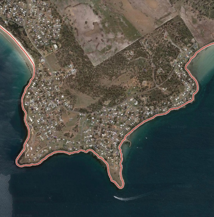
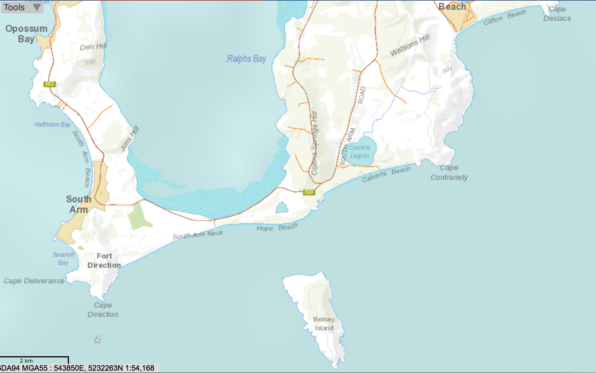
Renaud and Primrose Points. (Source: Google Earth)
At the eastern end of Primrose Beach there’s a two pronged point. The western tip is called Renaud Point, the eastern one is Primrose Point and between them lies a cobbled beach. I didn’t know this at the time because our walk was unplanned. We were here after one of our failed attempts at Carlton Bluff and had decided we’d explore this headland instead. It seemed more modest in proportion and couldn’t have been easier to access.
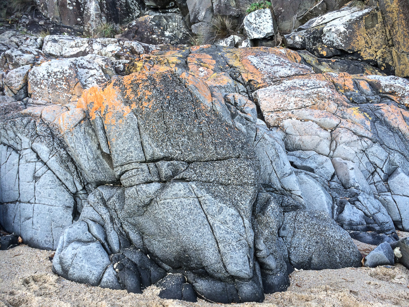
Renaud Point: down on the rocks. Carlton Bluff in the distance
Renaud Point
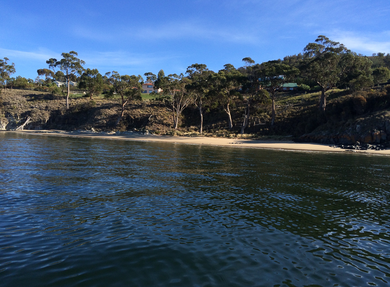
We took the rocks as far as we could go before taking an idle, conversational walk along the clifftop in front of the houses, where we found a path which we followed down to the thin, dark shore. In one particular cove, quiet and shadowed, absent locals were nevertheless a presence because of things they’d left there. An old seat. Boats. Other bits and pieces of fishing gear. It was a small domesticated spot where serenity pooled that late afternoon in the low, cold sunlight.
Matisse exploring. Twenty years old and not phased by rock hopping
This isn’t the kind of place I’ve ever heard anyone suggest for a walk and yet it was a pleasure discovering this unfamiliar corner of Hobart’s outer lying environs. Invariably walks in guide books are easy choices but we were certainly finding enjoyment in straying into less visited places and discovering sparks of magic.
Small delights along the way
We continued along the rocks at the bottom of the cliffs, manoeuvring slowly towards a cobbled beach that had come into view. Two men stood on it, deep in conversation, looking at the sea then turning at times to observe our futile attempts to trump geology. I was excited to reach it and discover what lay behind it.
But a buttress of rock rose between us and that beach and while possibly two of us might have made it over the top it would have been too onerous for our canine companion. Turning back, defeated now by both ends of Primrose Sands, we agreed we’d try to reach this spot again. Next time, we agreed, we’d begin further up the coast and walking east to west.
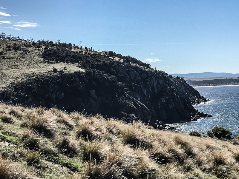
By means of the path and the road we reached the summit of Spectacle Head. It was arguably the most perfect day of summer and we visually wallowed in the landscape about us.
We walked passed the ceramic whale that is a feature of this headland and took a track beneath the casurinas that border the houses (friendly residents, curious dogs) to another clearing. Beneath the cliffs we saw a rocky shoreline interrupted by cobbled beaches. Two 80 year olds drowned off here in the summer of 2017, caught out by rough weather while checking their craypots.
The land was fairly clear of trees on the eastern side of the point and again we lingered, enjoying looking down at the surfers and the long view out along Park and Carlton beaches, with the Carlton river entrance tiny in the distance and Carlton Bluff a heft of shoulder on the far side looking every bit an island and blocking from our view our onward passage.
The track down the cliff face looked too risky, although locals do use it and we ventured some way along it before turning back. A lone Pacific Gull perched on the sharp, narrow edge of cliff. There is no barricade and it would be easy to take a tumble but I liked that it was unfenced and up to individuals to keep themselves safe.
When we got to the bottom by way of the tamer path, the first thing we did was try to get as far around the headland as we could via the rocks. If I’m right this was dolerite, jointed and sandwiched in vertical and horizontal directions that created something of a floral pattern in some areas. That day, we didn’t get far at all.
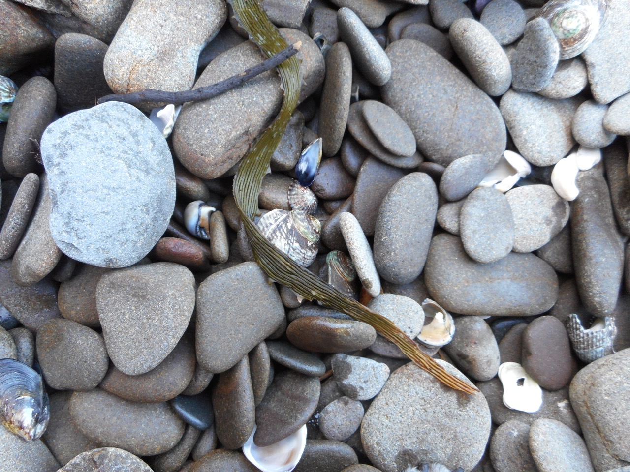
Assemblage of pebbles below Spectacle Head
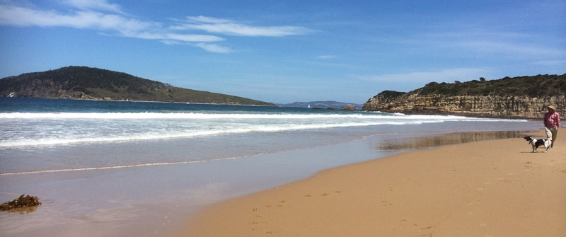
Park and Carlton Beaches (T392)
Park and Carlton, popular Hobart surf beaches, merge into each other with no natural division between them. Really, it’s a single beach approximately 3 km long IMHO, facing south and copping the southerly swell. With the tide reasonably low we wandered barefoot along the swash enjoying the light, offshore breeze and the long ripple lines left behind in the sand.
At the time I did this walk a friend was keen to buy a place behind the beach while it remained relatively undiscovered and we’d discussed beach erosion and done some Google Earth exploring. The beach is backed by a narrow strip of coastal reserve. But what looked like a single line of dunes online was broader than I’d anticipated when I set foot on the beach. Marram grass cloaked the incipient dunes in front of taller, older dunes that had been undercut by waves at some point and it was interesting to try to figure out beach processes here. Just after this walk a local told me some guinea pig refugees have made a home in these dunes. She also told me she’s given up fishing. Apparently the flathead Emmett said were bountiful are not so bountiful anymore.
Carlton River
We reached the Carlton Park Surf Life Saving Club and walked on by. We rounded the bend at the river mouth where clear green water was streaming out into the bay, swirling around this year’s sandbank, and not far away there were some surfers and people on SUPS. We were nicely protected from the sea breeze now and walked along in the water with tiny fish swirling around our legs. Exploring the river mouth made me feel exultant. My only prior contact with the river had been further inland, crossing it by way of the bridge and following some of its bends along the road. The modest proportions of this river appeal to me. In size it’s much like the rivers around the town I grew up in. I was eager to return with my kayak.
Carlton Bluff, liberally dotted with casurina’s, rises on the other side and someone was walking a path up there. Behind the dunes the river broadens to form a wetland with houses on the inland slopes.
Pied oyster catchers walked ahead of us, gulls gathered near a fallen tree and a pair of swans were off in the distance, paddling out from the wetland where they seem to like to gather. I tried to imagine what the river looked like untouched, full of the birds that should have been there but weren’t because of habitat loss – the great flocks of earlier days now reduced so dramatically the world over.
Carlton River shallows
At Steele’s Island resort we again encountered friendliness and stopped for a while to chat to the owners, who were enjoying the fine day beside the river. They talked about its shapeshifting tendencies and how they become an island several times a year when the river water rises and fills the wetland and the dry river bed at their entrance. We walked a big circle around their property, enjoying the birdlife. There was a deepness of large shells beneath our feet and in the stratigraphy of the river banks.
The day after this lovely walk, the friend who was hankering after property here asked if I’d come back to explore with her and so I showed her the circuit around Steele’s Island. This time the tide was higher. A dozen swans looked at us hesitantly across the vast mudflats and so we kept well away from their territory.
Carlton River wetland
Each walk along rivers and beaches throws up new delights. I studied the layers of shell in the undercut bank, the same shells we were walking over and tried to imagine the landscapes further down the stratigraphic layers that had once had their time to emblazon this world with beauty.
In 1952 E.T. Emmett wrote, ‘From Sorell to Hobart you have the choice of keeping to the main road which strikes Bellerive at fourteen miles, or of doubling back to Lewisham, ferrying across to Seven Mile Beach, and walking through Rokeby, a distance of something over twenty miles. I chose the latter.
Lewisham is another old-timer, for this was once the route to Port Arthur, and Pittwater was crossed at Dodge’s Ferry. Since then three causeways have been built … Lewisham’s main fame today is based on the good fare at the hostelry and the fat flounders in the bay. The iron bars at the windows of some of the outhouses explain what the buildings were used for a century ago.’
Tiger Bay Beach (T395)
Emmett travelled south through a different time and landscape. Our walk took us north out of Lewisham and along Tiger Bay Beach, which lies in the lee of Tiger Head between Okines and Red Ochre Beach. Short (2006) refers to two Red Ochre Beaches, but the locals seem to call the last beach along Blue Lagoon Beach.
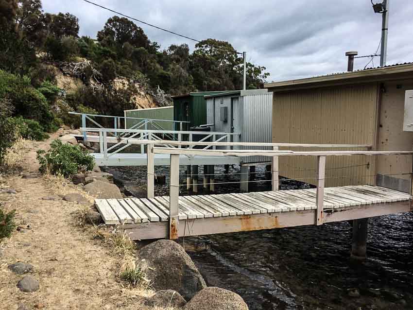
The tide we thought would be low was high, the vast stretches of sand gone. We picked our way along the water’s edge and around the eroding cliffs of friable sandstone at Tiger Head. We found a seat, trees with spaces between their roots and the dune, and the visible signs of human concern – tiles and branches once again heaped there to hold back the ocean’s rising intentions. This beach has boat sheds, there’s a boat ramp and jetties and several boats were moored off the beach.
Red Ochre Beaches 1 and 2 (aka Blue Lagoon Beach)
We encountered a sandstone outcrop here with lovely patterns and strange little indented circles.
Further along we found more boat sheds and this time a significant effort being made to hold back the sea because the path now ran along the top of carefully placed boulders, yet still the sea was winkling out the fill and the sand.
We climbed up onto a thin concrete strip on the side of someone’s garden, clutching on to their fence in order to continue. But returning on a low tide occasion I found I could walk the sand beneath the boulders with ease.
The Ferry Man
This was a nautical walk, because on Blue Lagoon Beach we found ourselves amongst more boat sheds, moorings and jetties sheltered this time by the bulk of Spectacle Head.
Ralph Dodge called the land he bought at Dodges Ferry in 1830 Ferry Farm. It seems he swapped his house in Goulburn Street for these 300 acres and this bit of history still stands, because the house he built can be found at the end of Fourth Avenue, (Southern Beaches Historical Society, 2019), pretty much opposite Sandy Point .
He was a man with an eye for business, because he took the opportunity to establish a ferry service and standing there with the sea breeze filling in, it required no imagination at all to imagine him rowing his neighbours over to Sandy Point on the other side. If only all rivers had their Ralph Dodges walking coastlines would be easier and a lot more fun. Imagining Ralph Dodge I remembered an alpine river in Lesotho where the ferry man challenged his wooden boat with generous loads of locals and read the swirls and rapids with consummate skill while those precariously balanced stayed perfectly silent and perfectly still. In another lifetime perhaps I’ll aspire to being a ferry woman and spend my days napping under a shady tree in a warmer climate, waiting for occasional travellers to come my way.
Spectacle Island
Spectacle Island, one of the Sloping Group of islands, and a mere 3.5 ha lies just offshore. A small number of pied oystercatchers, 600 pairs of little penguins and 8000 pairs of short-tailed shearwater had burrows on the island when Nigel Brothers surveyed it (Brothers, 2001). It belongs to the birds, so respect them by kindly staying away.
A seagull observed us from the boat ramp as we discussed continuing along the rocks or taking the path we could see heading up Spectacle Head behind the boat sheds. We observed the tide and chose the latter.
Walked Feb 2017
Sources:
Brothers, Nigel. 2001. Tasmania’s offshore islands. Tasmanian Museum and Art Gallery, Hobart.
Emmett, E.T. 1952. Tasmania by road and track. Melbourne University Press, Melbourne.
Most of the sand on the world’s beaches consists of two minerals, feldspar and quartz. They are particularly stable and that makes them especially durable. Take a peek at sand through a microscope and you’ll see that the grains look like tiny pebbles bigger than silt, smaller than gravel, many hued, transparent quartz, weathered smooth, pulverised and polished over the millenia. They form the unique, mobile fingerprint of the beach, created by the swish and swash of waves, tides and seafloor shape, gradient and cover. They may wash more or less straight up on to the beach or away from it, or be carried there by longshore drift, arriving at an angle, a part of the shifting sediment carried along by the coast-shaping sea.
***
Seven Mile Beach (T397)
Acton Creek meets Seven Mile Beach
Seven Mile Beach, mostly southeast facing, is 15 km from Hobart and is pretty much the closest surf beach to the city. The waves aren’t usually much more than a metre here, but they’ve travelled across about 20 km of Frederick Henry Bay to break on this seven mile long beach backed by homes at the western end and a beach reserve further east. There’s a road behind the dunes and the reserve. It’s dirt up the eastern end, bitumen down west.
One of the most obvious features of this beach is the unhappy pine plantation that extends behind it and encroaches on the dunes but if you’re standing on the beach it’s the great sweep of sand and the views across Frederick Henry Bay that are the most compelling.
What’s not so obvious when you’re on the beach itself is that it is a massive ‘sand spit that traverses the axis of the eroded Coal River Valley rift’ (Leaman, 1999), where once back in time there were twenty active volcanoes. In this valley early settlers found skinny seams of coal, enough to inspire hope that quickly collapsed into disappointment.
We’ve come to this beach when the tide has been so high it’s been right up to the marram infested, undercut dunes and there’s been insufficent beach for a walk. We’ve come on extreme lows when the beach’s width and a sunny sky has made it particularly inviting and horses, dogs, swimmers and beach umbrellas have given it a festive air. You don’t want for space here. This beach allows everyone to disperse along its generous length. Some people seem to make use of the dunes to disperse with clothing altogether, but in Tasmania the sun has a sharp edge and can end up being a painful experience for delicate extremeties.
This is a go to beach for cycling at low tide when the sand is hard and you can fly along its length all the way out to Sandy Point where Pitt Water, a 3,500 ha barrier estuary spills into the bay and Seven Mile Beach and Five Mile Beach meet. This beach system they’re both a part of has actually built out 1 to 2 km seaward, according to Short (2006), ‘as a series of more than 50 low foredune ridges which have subsequently been transgressed by dune activity that increases to the east.’ It’s on this barrier land feature that the pines were planted and Hobart’s airport built, so a particular Seven Mile Beach experience is planes landing and taking off low overhead. Pitt Water-Orielton Lagoon is one of Tasmania’s ten Ramsar wetlands and provides refuge for threatened species, both avian and botanical.
Looking across Pitt Water to Sandy Point where Seven Mile and Five Mile Beaches meet. Photo taken on Tiger Head Beach, Dodges Ferry
From Sandy Point you can see Lewisham on Pitt Water’s eastern shore, a skinny community of houses that traces the shoreline of this estuarine lagoon with the community of Dodges Ferry at the mouth. Looking west to the far end of Seven Mile Beach where the walk around Single Hill ended is actually the best known part of the beach. The hill, the houses and Acton Creek give it an intimacy the rest of the beach lacks. The thin western finger of the small township broadens out eastwards and the houses start extending inland across that ancient but shallow barrier dune system.
Ripple marks on Seven Mile Beach. The darker lines are caused by heavier minerals or organic matter trapped in the shallow troughs
Five Mile Beach
This is no beach for a bike. As a Ramsar site it’s the domain of shorebirds. I came here with the geo on a spring low tide that hadn’t receded as much as we’d have liked. There’s a track behind the beach that meanders through pine forest, then turns to follow the Pitt Water coast. True forests uplift and Tasmania has magnificent ones that provide this kind of experience, but plantations cast a desolate atmosphere both sad and disturbing.
In his book The hidden lives of trees: what they feel, how they communicate – discoveries from a secret world, forester Peter Wohlleben discusses the various ways trees suffer in plantations. Communicating via electrical impulses and chemical messages with various fungi as support networks the lives of trees is worth getting to know about. A monoculture isn’t healthy and doesn’t make for happy, healthy trees.
Five Mile Beach on Pittwater Lagoon, looking towards Sandy Point
We didn’t complete this walk. I hadn’t read this book yet, but the atmosphere was so unedifying that it stilled conversation and dampened our mood. At a certain point we stopped and reluctantly agreed that we found the damaged dunes and miserable trees (upended in places, and ravaged by the sirex wasp) too disheartening, particularly when we imagined what the dune system was like before human interference.
We found a way on to the beach via a pathway through the eroded dunes and because the tide had receded further out by then we could walk along the shallows enjoying the occasional presence of a few shorebirds. Crabs beginning to emerge from their burrows and apart from the sad sight of trees that had fallen with the collapsing dunes the view of Pitt Water was a whole lot better.
We couldn’t have chosen a worst day for our walk. It was snowing on the mountain, raining in town and the best the temperature could manage was a measely 7 degrees centigrade.
Cathy reminded me that we had stoic Scottish blood coursing our veins; I kept secret my preference for a sauna. Our hardiness extended only so far and we agreed to leave one car at Seven Mile Beach. That done we sought out a Lauderdale cafe to psych ourselves up for the miserable walk ahead.
Our cafe on the western side of the suburb had a view across Ralphs Bay on the Derwent River to the city and the mountain and from the table we’d chosen beside the wood heater we looked out at water chaotic with white caps. Kunanyi, normally dominating the western horizon, had vanished, the wind was loud and I was pretty damned glad I wasn’t sailing.
‘We had hardy ancestors,’ said Cathy firmly.
‘There might not be much beach to walk on,’ I suggested in a faint voice. It looked to me like the conditions had whipped up a higher than usual tide.
Lauderdale is a largely low lying suburb that takes in the isthmus where the South Arm Peninsula begins and straddles Frederick Henry Bay in the east and the Derwent River in the west. Back in the early 1900s there had been enthusiasm for a canal that would reduce the distance to Hobart for the shipping of farm produce, much like the Dunally canal further north saves yachts the trip around the Tasman Peninsula today. But work was hampered by the First World War and when they got down to business in 1924 storms made it apparent breakwaters would be needed on Roches Beach to prevent silting. Too expensive, the decision makers concluded and the project was abandoned, leaving a 1 km canal that doesn’t quite reach the beach and is hardly visible at the Ralphs Bay end (Alexander). Later I discovered that the layer of sand in this area is skimpy. It covers over two hundred metres of clay, sandy clay and boulder beds that filled in the ‘eroded, ancient rift valley landscape as sea level rose.’ (Leaman, 1999).
The two most significant bumps in its landscape are Richardson’s Hill with May’s Point below it at the southern end of Roches Beach and Single Hill to its north. Our walk was to begin below the first and take us around the second – but the weather was so truly terrible that we prevaricated by driving slowly up Richardsons Hill and then slowly back down to Roches Beach, slowly parking the car close to May’s Point and slowly donning extra thermals and wet weather gear before braving the lashing rain.
We began walking down the beach in a most unhardy manner. The tide was indeed high, the work of the stormy south westerly, but at least the wind was at our backs. Slowly our Scottish blood began exerting itself and snug in all our layers we got our stride up and congratulated ourselves for defying the weather.
Lauderdale takes its name from Ann and Robert Mather’s Ralphs Bay farm, Lauderdale Park. They were early settlers and their inspiration was Lauder, Robert’s birthplace near Berwick-upon-Tweed in Scotland. When it comes to hardiness Ann totally put us to shame, ‘raising her children and managing an unwilling convict workforce’ on this isolated farm (Clarence City Council). By the 1950s settler hardiness had given way to hedonism and holiday shacks began filling in the landscape. These days it’s suburban homes fronting up to the dunes along this 3.5 km section of the beach, their gardens spilling out into the public reserve.
Beach assemblage both human and natural
The narrow beach sloped steeply that day and the waves were slapping at the dunes in some places, undercutting them and threatening to saturate our ankles, so we decided to see if we could find a track behind the beach and for a while picked our way through undergrowth and escapee plants. This high sea also had us discussing Lauderdale’s vulnerability to storm surges and sea level rise, much like its southern neighbour, Cremorne. The isthmus isn’t much above sea level and the small dunes along Roches are already compromised by human impacts. We also spent considerable time discussing whether we were walking one beach or several and what, if anything they were called. Later I referred to the guru, Andrew Short, who in his inventory referred to Roches Beach as a 5 km stretch of increasingly wider beaches lying between Mays Point and Single Hill, although actually 3 and 4 narrow again, we found. For the record, he called them Roches Beach and then Roches Beach North 1, 2, 3 and 4 but the locals probably have different names for them.
The beach makes another curve at Bambra Reef and begins to broaden
We passed Bambra Point and its reef as the weather began clearing and reached the part of the beach that Cathy most loves because it holds memories of regular visits with her children when they were little. She pointed out the shelter provided by the trees and Epping Park Reserve behind the dunes and took me up there to take a peek at Lauderdale Yacht Club, the base for catamaran sailing in Hobart. Later, reading David Leaman’s Walk into History (1999) I learned that there are some brilliant examples of Permian rocks in this area. Also, right at this point on a low tide you can see the irregular roof of the main Jurassic dolerite intrusion. (If you want to know why the dolerite in this area is great for giving you an idea of the gigantic intrusions dominating central and eastern Tasmania pick up a copy of this book and take a stroll here – it’s definitely worth it.)
Not just any old rock.
Single Hill and North Roches Beach (T 398)
We passed the sailing club and the boat ramp and took the path leading up Single Hill, that singular landmark as you fly into Hobart. Initially we walked below big houses I hadn’t known existed and at the base of the hill Roaches Beach (N3) aka Short’s T399, a narrow 50m ribbon of sand and rock, that is a continuation of Roches Beach N2 aka T400 was being bashed by waves.
On Single Hill with Richardson’s Hill, Cremorne and Cape Deslacs in the distance and the Tasman Peninsula in the distance
We were walking amongst eucalypts and she-oaks following what is really pretty much a contour path with a lovely sandstone bridge.
Walking Single Hill
Cathy pointed out the most northern beach below us (T398). There were steep steps leading down to it but we continued on around the hill, stopping every now and then to take in the sweeping views of Frederick Henry Bay and the Tasman Peninsula. But if you’re keen on geology this little beach is definitely worth a visit because according to Leaman the Permian rich siltstone here is rich in fossils. Far away over the bay we saw enormous waves breaking on a point we struggled to identify. Eventually the path turned towards Seven Mile Beach and we gradually descended on to the sand.
T 397 Seven Mile Beach (southern corner)
There are shacks clustered in the corner beneath the hill south of where picturesque Acton River enters the beach. A small flock of ducks were enjoying it as we crossed the wooden bridge.
The walk had taken roughly 3 hours but I was enthralled by it and so the next Saturday I was back with my friend Rosemary White, who had sore knees and wanted an easy walk. This time, with an impeccable blue sky and far kinder weather we walked it the other way around, from Seven Mile to Launderdale.
Again, the beautiful creek at Seven Mile, and again the expectant flock of ducks. Walking this way there were points where it seemed we were trailing the edge of a great bay with a relatively small opening. Identifying landmarks was difficult but our geographic guesses were confirmed by a local we encountered, walking alone with his radio tuned in to the racing.
Reaching Roches we turned and walked Roches N3, pausing to examine the small butterfly shaped shells that had washed up everywhere on the sand.
Kayaking Single Hill
Still not done with this area I brought others to walk it and keen to explore Roches N4 I paddled around Single Hill from Seven Mile Beach to Lauderdale. It’s a short paddle but (small confession) when the wind came up my enthusiasm for paddling to May’s evaporated and I pulled in early.
A Different Sense of Direction: the intimacy of Sea and Soil
Clifton Beach and Cape Deslacs
It seems so long ago now, but during summer, shortly after friends told me they’d seen thousands of shearwaters from their yacht as they were crossing Frederick Henry Bay, we came to Cape Deslacs one evening to watch the shearwaters return to their burrows.
It seemed to me that this, really is the best way to experience the cape – as a refuge for these well travelled birds and so rather than wander its tracks or follow its roads, we sought out the viewing platform.
I’d once seen large flocks of Short-tailed Shearwaters (Puffinus tenuirostris) rafting in Port Davey and I’d seen the very first of them return one year from their long migration down the latitudes to Fisher Island, a tiny granite island in the Great Dog Island Group between Flinders and Cape Barren Islands. Those Fisher Island birds have been the subject of a longitudinal monitoring program extending back to the 1950s and because they return literally to the day, we were there when the leaders arrived. A scratching in the soil the next morning gave their presence away.
Although I’d read that they could be seen rafting off Taroona I’d rarely seen any on the Derwent River but when returning from Recherche Bay on Samos we saw for the first time in the D’Entrecasteaux a flock of perhaps two hundred winging their way down the Channel. I’ve been unlucky because these long winged birds are Australia’s most numerous seabirds and while there are no longer flocks of many millions, as the explorer, Matthew Flinders in 1798 asserted he’d seen, the flocks are large enough still to create awe when you see them.
The track to the platform led through native bushland. The day was already darkening and gradually the stars came out. In total there were four of us stargazing on the platform, our sense of self miniaturised by the Milky Way and the looming sky. All around Tasmania and especially around the Bass Strait islands great flocks of shearwaters were on their way home to their burrows but when the first dark shadows flitted overhead we thought at first that they might have been bats.
Aborigines believed they wintered behind the moon. That’s apparently how they got the name ‘moon bird’. They make a good meal and taste like sheep and so they’re more commonly called ‘mutton birds’. They might migrate almost the length of the globe on those metre long wings and swim proficiently with those webbed feet, and for a bird have a keen sense of smell, but they are so inelegant at landing that you swear they must sustain bruises. They are renowned for their excellent time management and for their magnificent sense of direction. They set off at the end of each Northern summer from the waters off Japan, Siberia and Alaska, barely, if ever making landfall, honing in on their tiny burrow at the far ends of the earth.
They partner for life (mostly), lay their single egg at the end of the November and watch it crack open in January. Then they take turns minding their one and only, feeding it up until it’s double their size. Come April they fly north without it and abandoned, wandering about and testing their wings, the chicks don’t eat. They tone down, feather up and intuitively follow their parents north a few weeks later in May.
Shearwaters are predators at sea and on land they are prey. The snakes that inhabit some Bass Strait islands rely almost wholly on the chicks for sustenance. It’s a physically close and terrible relationship. They are also commercially harvested for feathers, oil and meat and the traditional mutton bird harvesting practised by Aboriginal Australians continues. Modern life has thrown in further difficulties. Think gill nets and plastic, habitat loss and feral predators like cats.
That night on the cape the sky was soon awash with birds cascading down through the air. It was awesome. It was impossible to count them. There was a profound sense of a community returning, of lives lived with purpose and capability, of birds bringing their oceanic experience back with them and deep down into their burrows within the earthy skin of the cape.
The moon had given us a low tide and with a slender window between cold fronts Cathy and I whipped on our walking gear to continue our saunter along the coastline.
We paused on Goats Bluff to look across the long expanse of Hope Beach before making our way down the narrow path through native bush to the beach. The last time I’d come here it had been 25 degrees and people, heavily tattooed, were lounging under umbrellas beside the sedimentary cliffs. Today was crisp but sunny. Ever since the geo and I had driven off the ferry after a couple of weeks spent in shorts and t shirts on the mainland, Tassie had been lashed by a bout of wild, wintery weather, so this was a brilliant reprieve.
This feature in the cliffs below Goat Bluff may be linked to its history (see previous blog post)
Calverts had been our ‘go to beach’ when we first came to Tasmania. Every time I walk it I remember a tiny kelpie x border collie puppy from the Stirling Ranges in Western Australia. Along with two of his siblings he’d been bundled into a box and on to a plane in Perth. Several hours later I plucked him out of that box at Kununurra Airport in the Kimberly region of WA and for the next two years he enjoyed field camp living with us. The creek, the waterholes, the fishing expeditions and the parties in the annex, the walks down to the chopper to meet the guys returning from another blisteringly hot day doing mag anomalies. Two years in a caravan in boab country, living small. Two years in a tiny field camp in all that wild, vast inaccessible space. We were lucky though, because sometimes, in the chopper, we got to explore caves rich with rock art and canyons with verdant microenvironments that felt way off the map, far from roads or even a track, that you wouldn’t know were there unless you could spot them from the air.
This puppy, born of working stock, climbed trees (sort of). His acrobatics intrigued children. His speed was astonishing and Calverts was a beach he raced along, trying unsuccessfully to round up seagulls. He drove around Australia, squeezed on top of a mattress that was wedged on top of a motorbike, that weighed down the already sagging boot of our Holden station wagon.
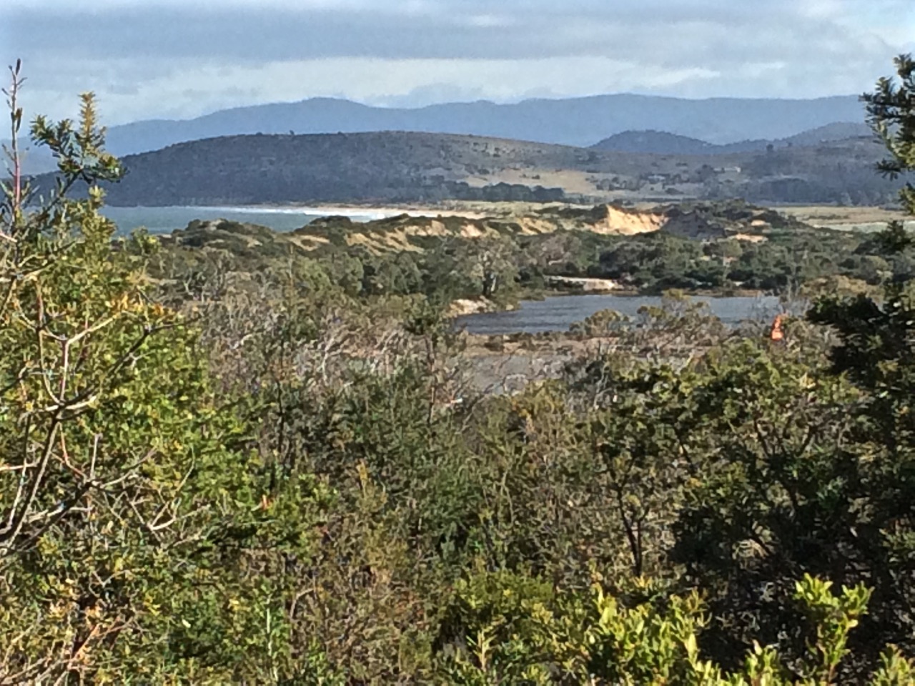
Cathy and I walking along discussing economic conundrums, saw a spout of water off Betsey Island, just as two birds lifted into the air close by. Further down the beach a lone man stood on the sand dunes assessing the swell on this rip-prone beach. Behind him, the dunes sloped down to Calverts Lagoon, a change in the vegetation and a quieter sort of environment.
We reached the opposite headland. This is where the geo and I have always turned back, but had occasionally noticed people making their way down it and had puzzled over where they were coming from. Cathy was the person who let me in on that secret, but before we set off up that path we explored the rock platform that slants upwards around its base because another beachwalking friend had told me that if you climbed to the end of it and peered around the corner you could see a little cobbled beach. But what we saw when we reached the end was the narrow shape of a gulch that at low tide probably did leave cobbles and rocks exposed. While I stood there musing, Cathy bounded up the daunting cliff face and when I looked up I could see her standing on the headland enjoying the view.
I followed slowly up that steep side. There was only marram grass to grab hold and it looked rather puny. Besides, it’s hostile and I wasn’t wearing gloves. I surveyed the big drop beneath me and the hard faced rocks. Those I was clambering up were damp and my shoes lacked grip. One up to Cathy, I decided, and slithered slowly down to a more welcoming ledge before seeking out the little path further back along the headland.
From the top we could see Calverts Lagoon, fingers of land and stretches of sea. The best was yet to come, because on the other side of the bluff lies a hidden beach, outstandingly beautiful. I’d been here once before, pretty much as soon as Cathy had told me about it. It had been a hot day and our party had disturbed a lover’s tryst. ‘Beware the snake,’ the man had yelled at us, jumping up to shoo us away. We had clearly destroyed their moment because it wasn’t too long before they were trailing us back along Calverts.
Smugglers Cove and Calverts Beach
Smugglers Cove (Beach T 410)
We descended through soft sand, stepping over dead birds and a dead sheep to reach Smugglers Cove. It’s seriously lovely and is cupped by the steep headlands of Cape Contrariety. It’s also seriously private and intimate even though it’s spacious enough to accommodate several parties of beach goers. Two eagles wheeled above us and a pied oyster catcher stood on the rocks regarding us.
After a while we followed a fence line up the bluff on the other side, keen to reach the other end of the Cape. I’d tried hunting down the owner of the private land without any luck, so we didn’t like our chances. There were mutton bird burrows. There were sheep, happily alive. We followed their tracks until we reached a fence that crossed our path.
This was as far as we figured we could go. From there we could see the spot we’d reached on an earlier expedition, when we’d attempted to cross the Cape from the Clifton side (see next blog post), so that long slope separating us from that point near the top was frustrating. We knew there was a nature reserve along the tip of the cape and that another beach (T409) was down there too.
On the Beachsafe site its described as ‘a 150 m long high tide cobble beach located along the western end of the cove, with a sand and rock low tide terrace. Waves averaging about 1 m break across the 50 m wide bar and surge up the cobbles, with the steep slopes right behind. The 4 ha tip of the cape is a private wildlife sanctuary.’
Walking Cape Contrierty
We’d been defeated but the walk back was uplifting. A yacht was crossing Norfolk Bay, a north easterly filling its sails. That whale breached and blew again. We saw Little Betsey Island tucked away behind Betsey Island, Black Jack Reef and the great sweep of Hope Beach beyond Goats Bluff. We saw the Iron Pot at the entrance to the Derwent and snow on kunanyi and the Snowy Range. And as we clambered back down the path to Calverts there were seven surfers in the swell beneath us, where originally there had been only one. You’ve got to have ichor coursing through your veins to take on Tasmania’s winter ocean. I lack even a single drop and just the sight of them had me zipping up my down jacket.
Calverts and Hope, with snow in the background
This walk: 1 September 2017. If you’ve walked this cape or know the contact details of the farmer, please let me know so we can try again.
… what is beauty? This is one of the most fundamental questions, it is not superficial, so don’t brush it aside. To understand what beauty is, to have that sense of goodness which comes when the mind and heart are in communion with something lovely without any hindrance so that one feels completely at ease – surely, this has great significance in life; and until we know this response to beauty our lives will be very shallow. One may be surrounded by great beauty, by mountains and fields and rivers, but unless one is alive to it all one might just as well be dead.
~ J. Krishnamurti
A Google Earth image of Goats Bluff to the north of Betsey Island. Calverts Lagoon behind Calverts Beach (right) was largely dry when this image was taken.
On Being a Goat
It may seem strange that I’ve included Krishnamurti’s quote at this point in my blog, because the bluff is unassuming, easy to hurtle by without noticing, and yet it has a certain sense of poise gifted by its location in the landscape between two capes so that, had Krishnamurti, a great nature writer, found his way here, I’m sure he would have taken his seat and looked out at ‘all the marvellous earth’, the hills and the valleys interleaving themselves, and perhaps, while contemplating this magnificent coastline he might also have reflected on human nature – how we are so often goats, with at times, a certain poise, when we make the effort.
Those who appreciate beauty come here at night to star gaze and to wonder at the auroras. In daylight hours, as the sky’s moods play out over the landscape, colours shift transferring the mood of the sky. At this junction of ocean, land and lagoons the biota is rich, the birds are various, the native coastal vegetation still reasonably intact. Surfers carve the breakers; below the cliff to the east is a break called Rebounds. Goats and Wedge are breaks to the west. And from these 30 m high sandstone cliffs you can walk west along Hope Beach (aka Roaring Beach) to Cape Direction or you can go east down Goat Bluff’s flank to Calverts Beach for the walk to Cape Contrairety, or angle slightly inland to circumambulate Calverts Lagoon, binoculars around your neck, field guides in your rucksack.
The bluff’s ramparts with Betsey in the distance
The bluff also provides access to the north. Just cross the road and go west along the isthmus – but think seriously about this – the birds love this thin strip of beach beside the bitumen so it’s unkind to intrude. Perhaps rather choose the meandering track (far more rewarding) along its eastern shore.
Or simply play it like Krishnamurti and make your mind like the sky by lingering on the bluff with its sense of poise drawn mostly from the fact that it is the divide between the Arm End beaches and the sweep of coastline to the east.
In other words, don’t think for one moment that Goat (also known as Goats) is an isolated bluff simply there as a carpark, or a dislocated remnant scrap of reserved native vegetation. The road behind assumes more importance than is warranted. Instead, imagine that you are Nuenonne, that slash of bitumen not there yet and see instead Colin Springs Hill descending gracefully down to the bluff’s sandstone rampart, uninterrupted. Before you there’s a valley, drowned by the ocean that extends down from that rampart and out to Betsey Island, with a dune trapped lake to your right behind Hope Beach, the drowned valley that is Ralphs Bay behind you to the north, a pooling of water in Calverts Lagoon and Pipe Clay Lagoon at Cremorne behind you to your left.
Goats Bluff. A small band of Nuenonne. Shearwaters wheeling on the night sky, and then the aurora.
Short describes it as ‘a 60 m long pocket of rocks and sand set in a gap in the centre of the bluffs and immediately below the lookout. The beach consists of high tide cobbles and boulders against the base of the cliffs, then a sandy 100 m wide bar with rock outcrops that fill the gap. Waves are lowered to 1 m at the bluff owing to sheltering by the island and rocks and break across the bar with a weak rip usually flowing out against the western rocks.’
He says there is no safe access to this beach. To try would be dangerous. So please don’t.
I was surprised to discover another secret on the On the Convict Trail blog: ‘Nearby [to Piersons Point] Goat Bluff was also the location of further underground tunnel systems [associated with the Derwent’s system of battery defence]. But Goat Bluff isn’t near Piersons Point, which is on the western side of the Derwent’s mouth (although distance is relative, I guess) and so I was sceptical until I saw this fact repeated on the South Arm History site. The Fort Direction page by Maurice Potter states ‘at Goat Bluff there are still the remains of underground trenches that were built at that time’ [WWII] and I also discovered on this page that ‘as many will remember, most of the beaches and the hillsides of South Arm were covered with barbwire entanglement and this remained so for some years after the end of war.’ (Potter, n.d.)
Betsey’s Secret
Sitting on the bluff contemplating the landscape you might naturally suppose that Betsey Island is made off the same stuff as the bluff, but you would be wrong. Black Jack Reef and Goat Bluff are sandstone / siltstone but Betsey declares its difference by being Jurassic dolerite (Leaman, 1999). It shares another secret with Hope.
Hope has even more compelling secrets
And as Goat Bluff overlooks Hope here they are.
The first is the precise whereabouts of the wrecked ship, the Hope, that gives the beach its name (Leaman, 1999).
The next secret really belongs to the general vicinity near Hope because between Betsey and the Derwent Light mysterious compass deviations first noted by Mathew Flinders are now assumed to be caused by volcanic necks on the sea floor – and according to Leaman (1999) may possibly have caused the Hope to wreck in the first place.
But here’s the best secret. Eons ago the complicated Derwent entered Storm Bay through the South Arm isthmus, which now blocks it. The best part of this secret is that it seems to have done so through ‘a gorge [now] filled with more than 200 metres of clay, sandy clay, sand and gravel [that] lies hidden from our view…’ (Leaman, 1999).
A mountain. A river. A bluff. They may seem so enduring, but I think all nouns are simply verbs in disguise and everything a process.
Sources:
Leaman, David. 1999. Walk into history in Southern Tasmania. Lehman Geophysics, Hobart
Short, A.D. 2006. Beaches of the Tasmanian coast and islands. Sydney University Press, Sydney.
Hope Beach spreads itself from Cape Direction in the west to Goats Bluff in the east, a distance of about 5 km. It is backed by dunes that are quite large by Tasmanian standards. The beach forms the southern shoreline of the South Arm isthmus. Ralphs Bay is contained behind the dunes and this large embayment of the Derwent River provides a sheltered habitat for shorebirds.
Betsey Island lies offshore and between the island and the beach lies Black Jack Reef, notorious for snaffling the boats of the unwary.
Although we had come to Hope (driving through farmland then walking in along the dune top path) we weren’t sure we were done with Cape Direction. I stood beneath the cyprus pines that grow on the dunes in this western corner of the beach and contemplated its shaggy slope. Cathy energetically sought a path and although it was possible a way existed, the dense scrub made it uninviting. So we decided to tackle the rocks instead.
The reef at the base of the cape was an equally unlikely route around to Pot Bay but we gave it a go, timing breakers. It defeated us within metres but presented us with a great view westwards towards the Iron Pot Reef.
The Iron Pot from the Cape Direction rocks, western end of Hope Beach
As we set off along the sand a lone surfer stood on the dunes assessing the surf. A pied and sooty oystercatcher were chilling together, and later we spotted six more of the pied variety, along with a dozen hooded plovers – a great sight, given they are endangered.
Looking back along Hope Beach
It was only when we’d reached the eastern end (where the beach unexpectedly curves and broadens) and had climbed up Goats Bluff that we saw that those sand dunes, a bulwark against the ocean, were being sand mined.
Dune trapped lake behind Hope Beach with Cape Direction in the distance.
We could make out Black Jack Reef where one of the Incat ferries, Condor 11, ground to a halt on a trial run in 2011. But it is only the most recent shipwreck in this area. The best known one gave the beach its name.
The Loss of the Hope
The Hobart Colonial Times May 1827
We have the painful duty to report the loss of the barque Hope, which vessel was wrecked on Sunday morning last, on the long Sandy Beach, between Betsy and Iron-pot Islands. It appears she was on her way from Sydney hither, with about 100 tons of freight, and the following passengers: Ensign Barcley, 40th Regiment; Mrs. Bisbee and Mr. Bisbee (wife and brother of Mr. Bisbee of Hobart Town who came as passengers in the ship Elizabeth from England to Sydney); also Mrs. Westbrook mother of Dr. Westbrook. Of this place, another passenger per the Elizabeth, and three others, among whom is Mr. Edmund Johnson, nephew of Mr. Joseph Johnson of the Green Ponds.
The Hope made the Heads on Saturday afternoon; and took on board, off Cape Raoul, the pilot, Mr. Mansfield, the same evening, shortly before dusk. The Hope at this time was being towed in by two of the ship’s boats; but the pilot having taken charge of the vessel, told Captain Cunningham, that he could safely bring her up the river, without the assistance of the boats; from which, in consequence, she parted.
The Captain, however, wished the vessel might be towed in; but the Pilot observed, that his long experience in the river Derwent would enable him to bring her up in safety otherwise. The Captain was perfectly aware of sufficient room being afforded in the Derwent for any vessel to be brought up with almost any wind, and therefore acquiesced with the Pilot’s wishes; and, leaving the charge of the vessel in his hands, retired to rest, where he remained until awakened by the vessel running on shore.
The wind light and variable, and the vessel proceeded up the river but slowly. The night was rather dark and rainy; and about 4 o’clock on the morning of Sunday; about two hours before day break, she, by some means, we can scarcely conceive how, ran ashore, on the long sandy beach, in Shoal Bay, as above stated.
Although the night was rather dark, the wind was not violent, but the surf was running tremendously high. On the lead line being thrown, she was discovered to be in seven feet of water, while her proper draught was fifteen. The moment she struck, the consternation and terror became general; and the scene is described as truly terrific.
The Captain raving at the pilot like a man distracted, the latter standing in mute dismay— females just left their beds— sailors not knowing which way to turn, to relieve the creaking vessel, which was expected to go to pieces every moment, as she already leaked like a sieve— the heavy surf rolling over her, adding horror to the scene— while the dismal half hour guns of distress seemed to signal the death knell of all on board. Daylight at length appeared and discovered to the sufferers their truly perilous situation.
About 10 o’clock of the Sunday morning, two whale-boats, of Mr. Lucus’s fishing party, which had been laying off Bruny Island, came up to the wreck. They had heard the proceeding evening the signal-gun nfor the Pilot, which drew their attention and induced them to bend their steps thitherward.
They immediately lent their aid, with the ship’s jolly boat, in getting out the ship’s bower and kedge anchors; but the attempt proved fruitless, for one of the whaleboats (the property of Mr. Kelly), was stove, having her head absolutely dashed off, and the crew narrowly escaped with their lives. Captain Cunningham then jumped into the jolly boat alone, which parted from the other boat, and nearly fell a sacrifice to his eager promptitude, to save the vessel. Finding every other hope lost, to all the lives they could became their chief object.
The venerable Mrs. Westbrook and Mrs. Bisbee were safely conveyed on shore, after a state of most dreadful suspense for four hours. All this time, the rolling of the vessel almost precluded anyone from keeping their feet, while the state of the two females was most dreadful; overcome with weakness and terror, and fatigue, they could not stand without support, which was kindly afforded by a Mr. John Elliot and some other Gentlemen passengers. With the Ladies, Mr. Clarkson, charterer of the Hope, came up to Hobart Town by the whale-boat in the course of Sunday, bringing the fatal news to Town, leaving the other persons on board. Immediately on learning the fate of the Hope, the Agent (Mr. Behune), dispatched the sloop Recovery, a small craft, in order to bring away a portion of her cargo, in which she succeeded, having returned the following evening with as many tons of goods as could be thrown on board from the wreck.
But to return to the ship. On Sunday night, between 11 and 12 o’clock, the rudder gave way, and the upper part of her stern was driven in. At this critical hour of the night, it was every moment feared that the stern post would give way or be driven in also; in which case the vessel must soon afterwards have foundered, and every soul on board perished as the surf was still running mountains high. The other passengers who did not come up on Sunday safely arrived in Town on Tuesday – till which period all hands were employed at the pumps, in imminent peril, every moment in danger of being washed overboard. When some Gentlemen who left the wreck on Tuesday, who had visited it on Monday, the sea was gaining on the vessel every hour, her main mast had been cut away, and all hopes of saving her were given up. Some casks of spirits, which were on board, were ascertained to have been damaged by the salt water; and the tea and sugar, which also formed part of her cargo, must inevitably be destroyed. We understand, that among the persons who had merchandise on board is Mr. James Lord, owner of the Marquis of Lausdown.—- We are not aware whether the vessel is insured or not.
The government brig Prince Leopold, in coming from Maria Island with the remainder of the wreck of the Apollo, saw the Hope off the Heads on Saturday, and safely arrived in the Harbour the same evening. Monday she discharged her lading, and on Tuesday was immediately sent to the relief of the wrecked Hope.
There were rumours that £30,000 in silver coin had been buried on the beach by two soldiers. Captain John Laughton purchased the wreck at an auction, but in another nasty twist of fate he drowned while inspecting it (Shipwrecks of Tasmania).
South Arm is Calvert country. The name is everywhere and at the eastern entrance to the river the Calverts once had fruit orchards on a farm called Pleasant View. In September 1939 they sold it to the army and in 1944 the army built Fort Direction. The military base extends across both Cape Deliverance and Cape Direction.
Even down at the bottom of the world, the idea of falling to the enemy made people jumpy. That’s why, from 1804, shortly after the colony was established and on into WWII, a network of batteries and bunkers was built down both shores of the Derwent to where in Storm Bay the river merges with the Southern Ocean. Standing right at the river’s mouth, Fort Direction and the Pierson’s Point battery were the first line of defence against enemies arriving by way of the Southern Ocean (Tasmanian Times, 25 Feb 2011).
Seacroft Bay and Fort Beach
On one of summer’s more perfect days, Cathy and I set off on a walk along Fort Beach, Seacroft Bay’s only beach. It was low tide and our ambition was to walk across both capes and on to Hope Beach. But the army had not responded to my request for permission to traverse military land and we anticipated that our walk would be a brief one that would end abruptly where the beach gave way to military land.
The low dunes backing the beach are infested with marram grass and the river had been nibbling away at them. Blessington Street runs behind them and the houses here enjoy superb views over the estuary. We chose to walk along the swash, stopping to consider an outcrop of rock emerging from the sand and remarking to each other that we had finally reached the last beach on the Derwent River’s eastern shore.
There was a woman with a dog quite a distance ahead of us. Beyond her a man took a path up from the beach and disappeared into the bush on to what had to be military land. If he’d gone that way then so would we.
The dog owner had stripped down to her bathers and was about to plunge into the perfectly transparent water by the time we reached her. We got chatting and she told us it was possible to continue on via the rocks, or alternatively by way of the path the man had taken. We quickly decided that the rocks would be more adventurous and walked on, undeterred by the sign we saw on the beach.
Passing four pied oyster catchers, I wondered about the impact of toxic waste on the birds who call by and unwittingly spread toxicity further afield and on those birds who make their summer residence here and possibly bury into it.
Cape Deliverance
The rocky platform at the base of Cape Deliverance was beautiful, the pools rich with kelp and seaweed. It was tessellated in places and there were dropstones and small formations that the geo later suggested were probably remnants of an earlier rock platform.
Soon we came to the kind of risky gulch that has you wishing you’d remembered to bring a first aid kit along, just in case. A little later we walked around a point and were elated to see the Iron Pot lighthouse right ahead of us, at the end of the low lying reef.
The Iron Pot light and the possible remnant from an earlier rock platform now weathered away
Pot Bay
This was not the only surprise. In Pot Bay, tucked between the two capes, there was another beach. While Fort Beach gives every impression of being the last beach, this secret beach appeared to hold that honour. Obviously I hadn’t been too observant when sailing passed this area, perhaps because it’s not possible to sail between the capes and the Iron Pot. There’s that dodgy reef and sometimes there are cray pots off it, so it pays to have ample sea room.
Marram grass hadn’t made as much of an inroad on this beach’s dunes. Native vegetation still owned them. Cathy pointed out that we were not the first to have visited that day. There were footprints: human, dog and bird.
Tucked away beside the dunes we found a structure made from driftwood and plastic debris and after enjoying it we carried on walking along this largely litter free beach.
Pots Bay and its beach. The Derwent, Hobart and kunanyi in the background.
The Last Beach on the Derwent
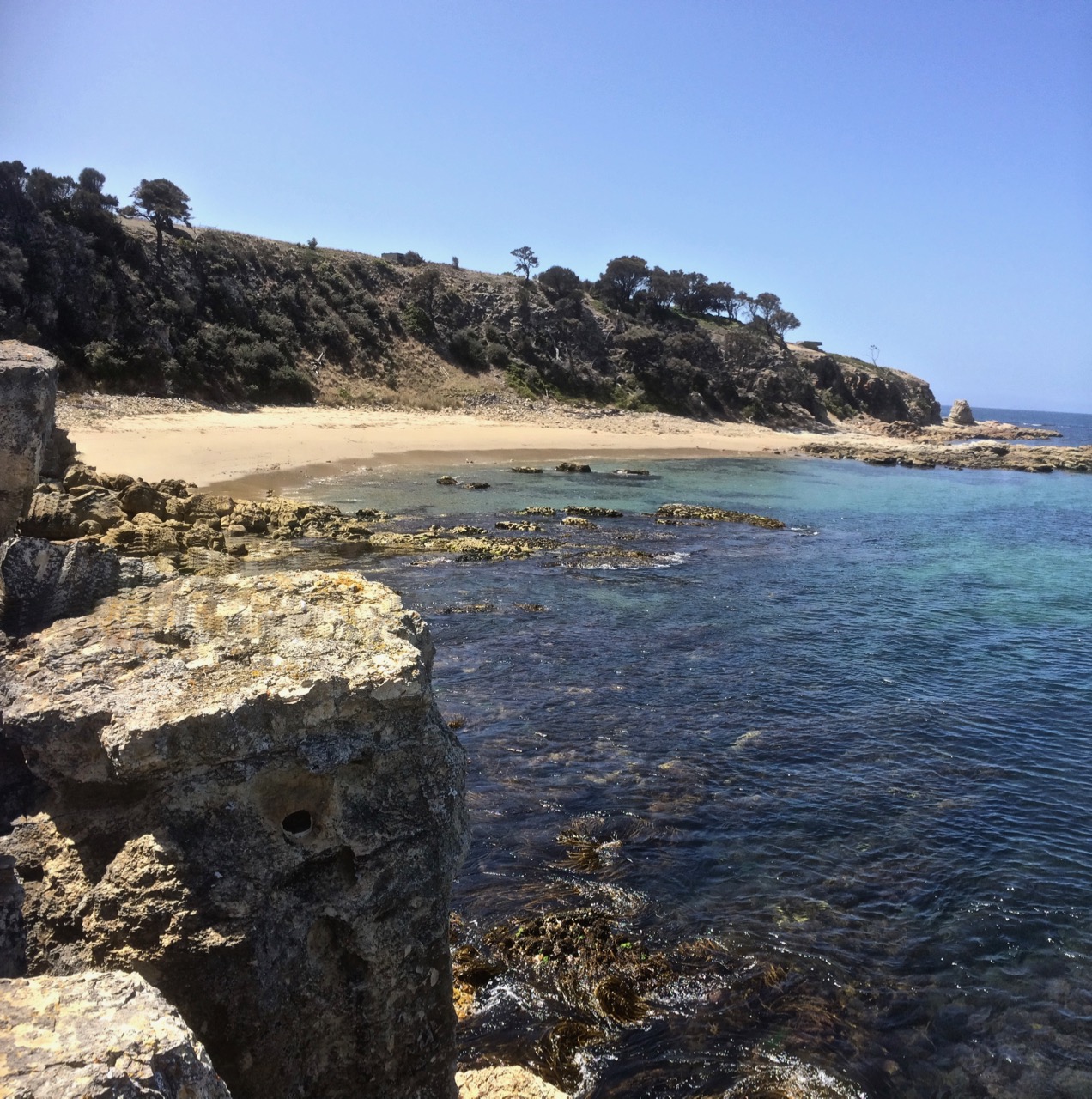
Beyond Pots Beach we found another, even smaller beach (T 414, Short 2006). Although little more than a 80 m cove below Cape Direction, it is the beach that actually has the honour of being the last beach on either side of the river.
The last beach
Tackling Cape Direction
That small beach was so protected we couldn’t get all the way around the rocks because of a fairly dramatic drop off and so we decided to do like mountain goats and scramble up the cliff. I was still picking my path upwards when Cathy disappeared from view. Although I was sure I’d have heard her if she’d fallen over the edge, I tried peering over the edge to make sure she wasn’t spreadeagled on the rocks below. I called her once and then I called her again, this time a whole lot louder.
She appeared above me and said she’d found a path. Trusting that no snakes were sunbaking in this vicinity, we made our way through tall grass and scrub to a path that led around the headland, taking cover when we noticed a Toyota 4×4 heading towards us. Behind us, and way up on Fort Hill, there are Defence Dept buildings and houses. The Toyota must have seen us but as no one accosted us we continued on our way.
Ahead we could see signs and a small concrete building. Later I read that:
‘The naval command [lived] on the hill at Fort Direction. These men had to carry out watch over the entrance to the harbour. A small weather board building of four rooms was constructed on the top of the hill with the adjacent flag pole for the raising of signal flags. A watch was maintained 24 hours a day from 1940 – 1945. As many as fifteen naval personnel lived in quarters just below the top of the hill.’ (Potter, RSL website)
The signs warned about asbestos in this vicinity but beyond them there were cliff top views to die for, so as a vague protection I held my phone in front of my nose. The sea breeze hadn’t yet roused itself and we figured any asbestos left on the surface was dormant today and must surely have been blown far and wide by now, or was beneath ground lining shearwater burrows. It was easier to simply not think about the other nasty chemicals we might be exposing ourselves too but instead to focus on the quite dramatic views of the Iron Pot and Bruny Island from this high vantage point. They were heady, and so we lingered.
As we searched around for an onward path we discovered that there were middens up and a steeply plunging cliff face on the north eastern side with a pebbled cove beneath it. We could now see all the way along the cliff line to Hope Beach. Hope looked so close yet so unattainable.
Headlands are tricky for walkers because the way can be barred by private land, but being military land we didn’t want to find ourselves in the middle of an explosives test. There were fences and box thorn and no doubt moon bird burrows, and although it was conceivable we might find a way, we decided on balance that we would turn back. I wondered about kayaking the capes and then I remembered one particular time I’d sailed them.
Midden in foreground. Beneath the cliff the cobbled cove. Hope Beach in the distance
The Capes by Sea
The fleet stretched out ahead of us one balmy Saturday on the return leg of a long distance race around Betsey Island. We were towards the back of the fleet, the conditions favouring lighter yachts and we were sailing excitingly close to the surf break off Hope Beach.
We were off Cape Direction when we observed that the boats out ahead of us had heeled dramatically. The big blue Beneteau liked rough weather. When lighter yachts heeled, she’d barely lean, but this southwesterly was intent on causing havoc. Much earlier in the day the frustration had been a long period becalmed while the rest of the fleet sailed a sneaky breeze.
We hadn’t even considered reefing before the wind whammed into us and the yacht heeled like I’d never experienced her heel before. Suddenly the cliffs and the Iron Pot, on what was now a lee shore, seemed exceedingly close and the normally laid back crew leapt into action with alacrity. There was a cacophony of yells to ‘down traveller!’ ‘main out!’ and ‘reef!’ And where there were usually one pair of hands on a line there was now the urgency of many, some at cross-purposes.
As we made it around both capes and the Iron Pot with sufficient sea room to keep us safe, the wind swung behind us, the crew grew animated with unanticipated hope and the yacht, now sailing in far more favourable conditions, began to power up steadily through the fleet.
The Iron Pot, the reef and Bruny Island in the distance. Beach T414 below.
Making Like a Ghost
Cathy and I turned back (but If you’re planning to walk further than us then see below for a couple of tips.)
This time we took the path that ran along the cliff top passed the shearwater colonies and in so doing bypassed the Lone Pine Memorial where a dawn service is held each ANZAC Day. At various points we tried short cuts but we didn’t want to damage burrows and the hollows behind the dunes roared ‘Snakes!’ at us and so we kept out.
There was something quite old time about taking the neat path we found over a fully mown hill as though we were on a clear road to somewhere, like walkers between villages in the olden days. The sweep up Fort Hill was devoid of people until we crested a rise and saw not very far away from us the same white Toyoto we’d seen earlier. Three people were bent over, working silently at some incomprehensible task, apparently just as eager to ignore us, while we, trying to avoid them, searched again (but more frantically) for a short cut off military land and on to the beach.
They were only about 10 metres away from us anyway, and we were beginning to feeling foolish. Tired of feeling like ghosts we called out, ‘are you conservation volunteers?’
‘Army,’ they said, avoiding eye contact, and turned back to fencing a tiny tree (a lone pine?) behind a small monument while we stood about a metre away photographing the little memorial in front of the tree with its engraving of the Dardenelles. Then, feeling as though we had transformed into ghosts again, we carried on down the path back on to Pot Bay Beach.
Au revoir, timtumili minanya
We had stood at the mouth of the Derwent (known before settlement as timtumili minanya to at least some of those living along its banks). Ocean beaches and headlands stretched out to the east. Our walk had included two capes and and had taken us from the river to the meeting place on the eastern shore of the Derwent River, Frederick Henry Bay and Storm Bay with three of the Betsey Island group of islands – Betsey, Little Betsey (hidden from our vantage points) and the Iron Pot just off shore. From this point on we’d be walking ocean beaches all the way to the mouth of Pittwater Lagoon, but we thought we might just have a go at seeing if we could walk Cape Direction from the Hope Beach side.
‘Thu 17 Aug South Arm to Cape Direction Grade: Easy Map reference: Blackmans Bay 1:25k Book by: 8:00pm Wed 16 Aug Start at: 10:45am at car park opposite South Arm War Memorial Group limit: 20 Bring: The usual daywalk gear This is an easy walk from South Arm to Cape Direction opposite the Iron Pot Lighthouse along a newly made track and the fore shore. We will do it `out and back` rather than as a circuit, avoiding the steep box thorn and mutton bird burrow ridden climb up from the western end of Hope Beach and precarious cliff top walk to the cape. It is an easy 4 hour walk with time for coffee at `The Sand Bar` on the way home. There are magnificent panoramic views, especially from the cape.’
* This is an Aboriginal name for the Derwent River, found in the Tasmanian Aboriginal gallery at the Tasmanian Museum and Art Gallery. Interestingly, the spelling for the people living along the western shore is given as Muwinina, which is different to the spelling I’ve found in other sources.