Tasman Peninsula: Dark Deeds at Sloping Main

Tasman Peninsula and the beaches of Frederick Henry Bay:  Sloping Main in Stinking Bay (T340)

A Fabulist Disappears

Once, in Africa, we met a charismatic man we thought might be a fabulist.  Over  drinks, as we watched wildlife grazing the plains from the comfort of a lodge, he told us mesmerising stories about his role in the Entebbe raid and other incredible boy’s own adventures in wild and dangerous places, where, risking his life time and again he escaped miraculously.

Mostly we were awed, but when one of us expressed scepticism he told us, ‘every few years I change my job and that way I change my life.  That’s how I’ve done so much living’.  And afterwards, asking each other, could any of it be true  one of the locals said, ‘all these things – they all happened far away.’

I was reminded of the enjoyable time spent in the company of this man when I researched Sloping (aka Slopen) Main and discovered that one day a fabulist trailing many names but not much else,  had arrived there and made himself comfortable in an old convict hut on a farm behind the beach.

Old Habitations

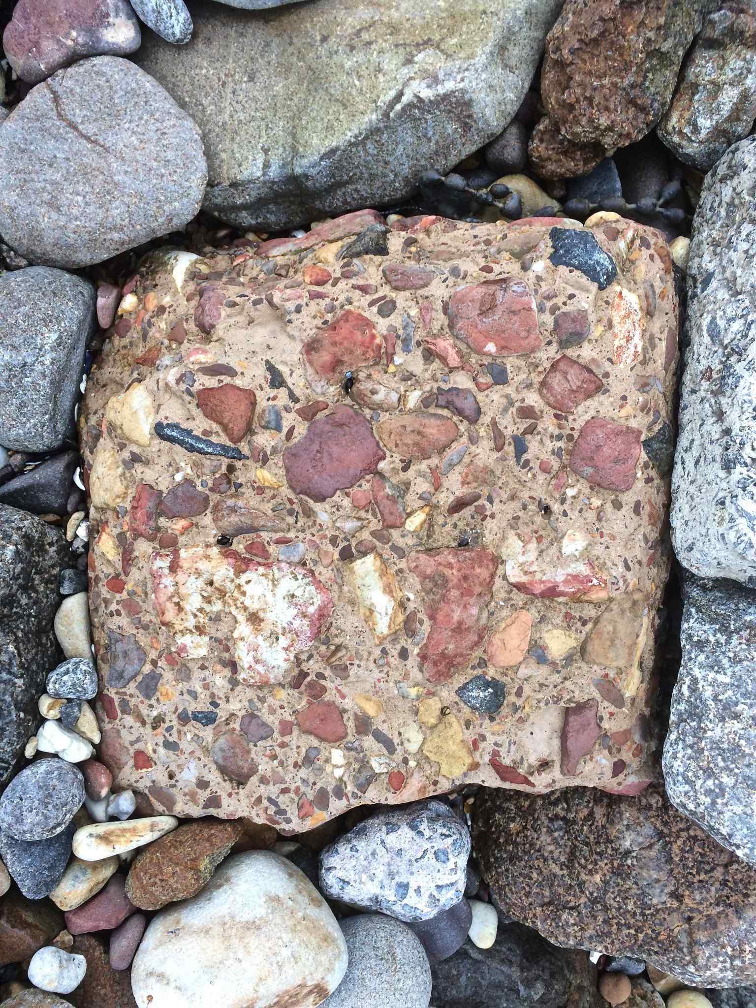
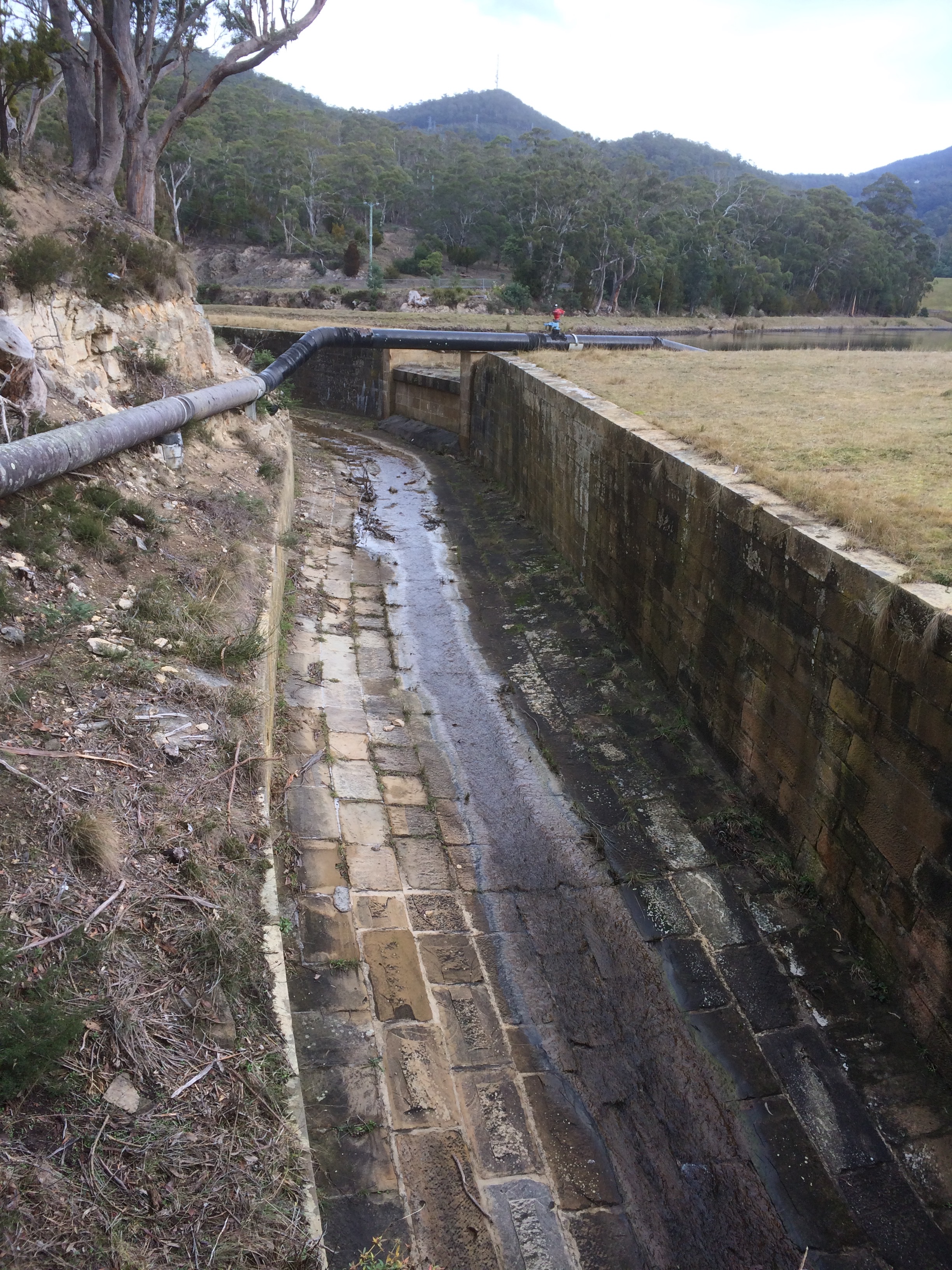
On Sloping Main Marsh, before the Port Arthur penitentiary was built to accommodate the convicts petty and otherwise off the streets of Britain, settlers built a farm.  It was the 1820s and these weatherboard buildings are the oldest on the Tasman Peninsula.  A short drive away there’s the Surgeon’s cottage (red brick) and  a house associated with the semaphore system, but  I walked this beach not thinking about history, and I walked in ignorance of a tale of secret liaisons, disappearance and assumed murder that happened here in the Saltwater – Slopen Main area of the peninsula back in the 1980s.

Walking Sloping Main

Sloping Main and clouds
Rain hides kunanyi from view

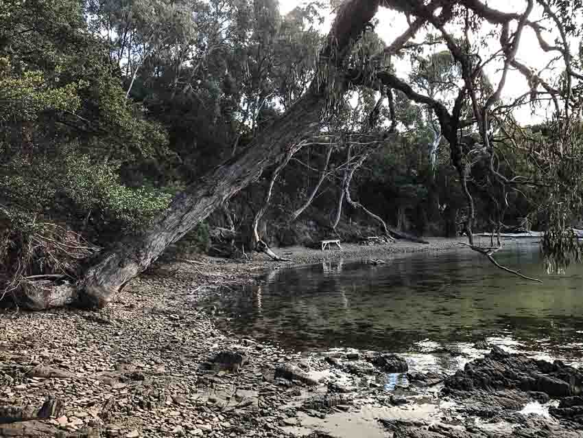
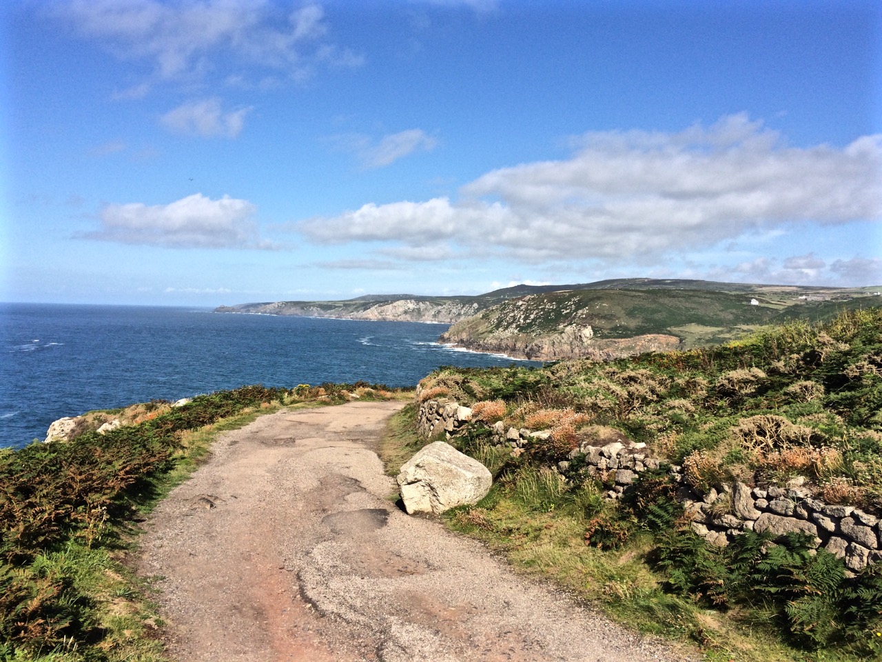
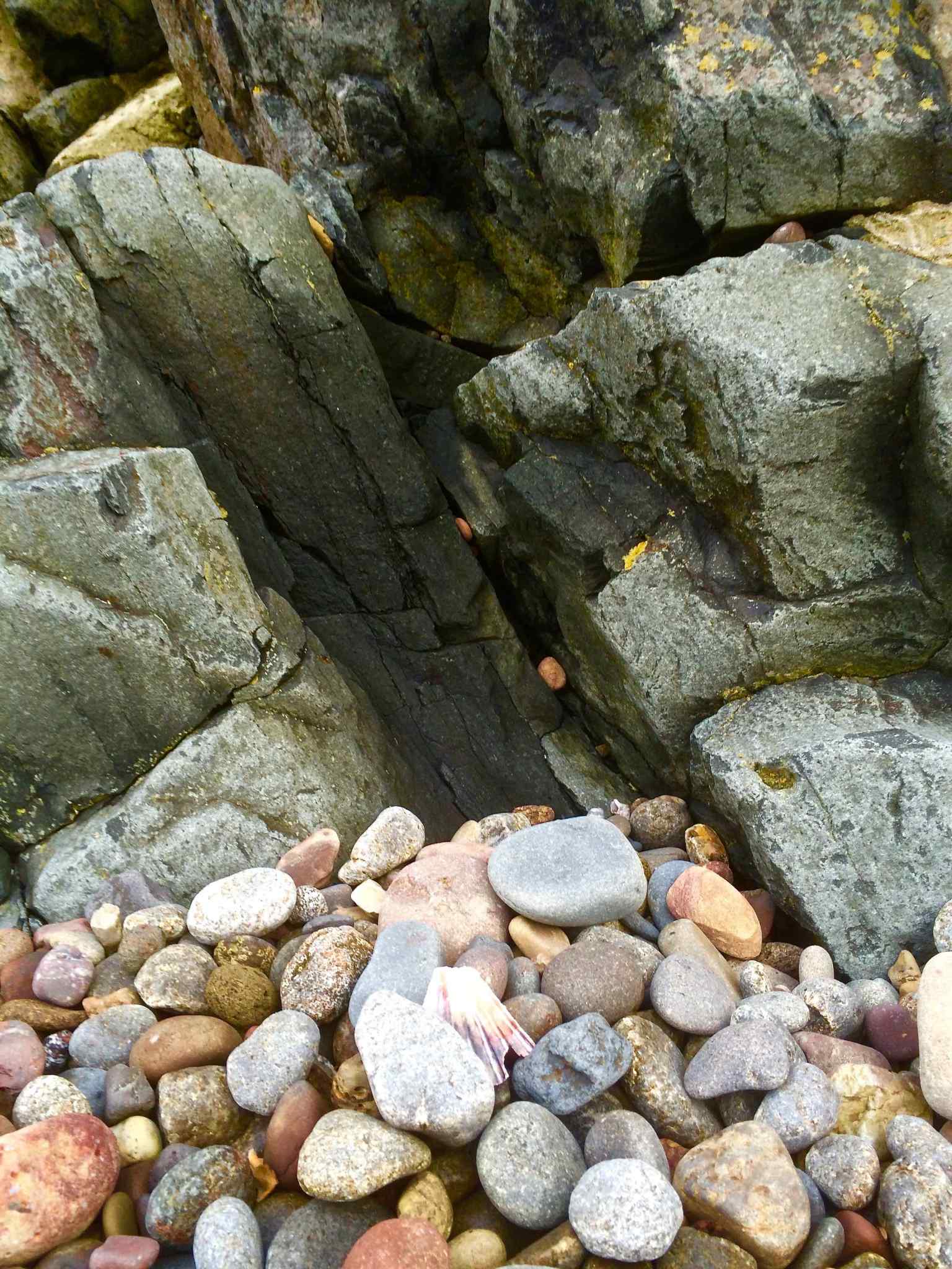
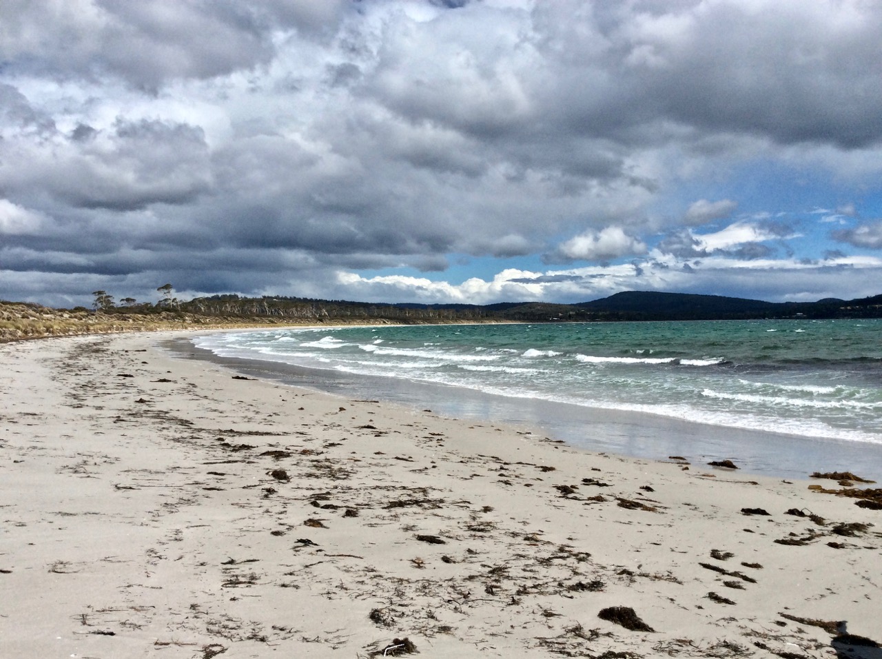
The beach is a 3.5 km long crescent that faces west with Cape Deslacs and Cremorne visible in the distance.  It’s bounded by Black Jack Point below Gwandalan (southern end) and Lobster Point to the north, with Sloping Island just offshore in Stinking Bay.

Ripple lines on Sloping Main Beach
The transience of ripple lines below Gwandalan

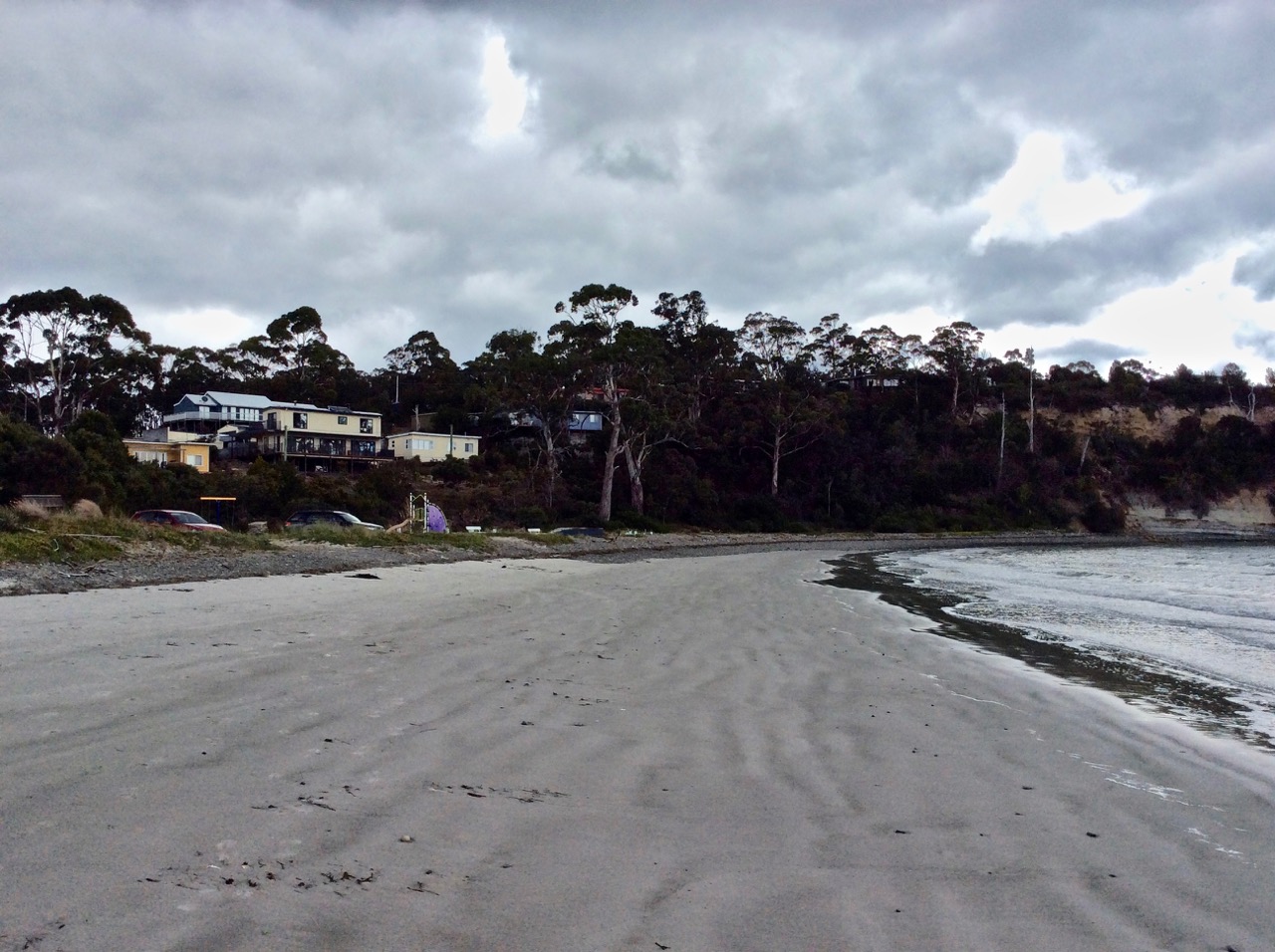
It was raining over the mountain and the sky was dramatic with clouds, shafts of sunshine and drifts of rainfall.  A bevy of clouds was being driven across Storm Bay by the South Westerly heading in our direction. Behind us Gwandalan, a small community of seaside cottages and shacks, perched on the lower edge of Mount Wilmot, just above the point. In front of us a stunning sweep of white sand purled off into the distance and behind the dunes on the forlorn and muddy flat, the land said nothing of dark events.

The wrack line lay along the base of the small incipient dune and was no more than a delicate wavering line of seaweed. Marram grass had taken hold, threatening the gradual gradient of a back dune. There were eucalypts poking out of the dunes, both the living and the dead and  there were gutting tables every so often and sometimes a bench. It’s a low energy beach but the waves that day were hectic and the tide was low, the white sand  lined with cusps.

img_1076

We passed a dead cormorant and two dead fish. We passed kelp glistening on the swash. We walked through a light shower and the temperature dropped – it was summer but snow was forecast. After a bit more than an hour we reached the Cardwell Cliffs  and stood below the headland contemplating the start of Lime Bay National Park above our heads.  A quick scramble up and  we’d have found a walking track.  Whalebone Beach is on the other side.

img_1072
Slopen Island is just north of Cardwell Ridge

Because of the wind we hoped to find a track behind the dunes, which had widened here, but there was nothing.  We found ourselves standing on the bed of a dry rivulet, a crust of white over the mud beneath.  Burdens Marsh, partly drained, was dry but there was a fence and then farmland and so we turned back.  Twelve oyster catchers walked ahead of us, flying occasionally to maintain a safe space. A seagull foraged for sand mussels. High on the cliffs the small community of Gandwanan looked tiny in the vast landscape of sea, islands, peninsulas and distant shores.  That day, because of the moody sea, the landscape seemed gothic and ominous.  Even the names seemed gothic.  I did not yet know about The Disappearance.

Behind Sloping Main
Burdens Marsh 

Man of Mystery

The fabulist, a man of no fixed name or address, was invited to stay in that simple hut by the farming couple who owned the land.   He and his wife knew him as Reuben.  Other friends concurrently knew him by different names entirely.  Later, piecing together the story, the coroner concluded that he was Tony Zachary Harras, sometimes Harris, born in the UK in 1934.  Some of his aliases were  Judah Zachariah Reuben Wolfe Mattathyahu, Karl Wolfe, Carl Wolf, Reuben Wolfe, Zac Mattathyahu, Reuben Mattathyahu, Carl Mattathyahu and also Karl Mattathyahu. 

Beaches acquire different names through no actions of their own and Sloping Main and the island just offshore also have a slippery identity. I couldn’t find their Aboriginal names, but the explorer, D’Entrecasteaux, christened it Frederic Henri / St Aigen when he sailed by in 1792, according to Tasmanian Nomenclature. In 1798 Flinders, circumnavigating Van Diemen’s Land  in the Norfolk, called it Sloping Island and that’s officially what it is today, but it’s just as commonly called Slopen and occasionally Storring.  The Slopen might come from a whaling captain, a farmer or a lazy corruption.  The beach and the island share that same identity.  (Here’s a bit more about that history.)

Unlike the beach and the island the fabulist actively chose a whole series of names.  Why does a man need that many names unless he has profound identity issues, fears for his life or is up to no good?  At any rate, I’m calling him Tony – just because it’s authentic when so little else about this story seems to be.

He  began his working life  in primary industry and moved on to the British Armed Forces before arriving in Australia at about the age of 24.  The period he spent in the forces seems to have influenced him quite profoundly.  Regardless, he was in Australia from 1958 to 1960, then travelled to New Zealand before returning to the UK.  He changed his name to Tony Zackary Harras but he could not settle.  He was soon back in Australia and then he was marrying in the UK.  A son was born. On the birth certificate Tony is Zachary Anthony Harras, vermin controller.

In 1971/1972 he was working as a gardener at the Botanical Gardens in Adelaide  and then threw that in to become  a bushman near Maydena, Tasmania. His marriage was over and he told friends he’d spent time in Israel but in 2014 when the cold case into his disappearance was reopened, the coroner expressed scepticism about that.

At first, in Tasmania, he called himself Judah Zachariah Reuben Wolfe Mattathyahu but he referred to himself by random versions of that name so that various friends knew him by his pseudynyms concurrently.

This aura of mystery was enhanced by the incredible stories he told about himself.  He put it about that after getting interested in Judaism he’d fought for Israel in the Six Day War.  He said his wife and his two children died in a war but when and in which war remained vague as does that family. He told friends he’d gone to Africa with seven others to destabilise a government and was the only one that got out alive.  He’d followed through on orders to kill seven men and then he’d escaped by chopper.  He said he was mixed up in the Entebbe air raid, that the only person shot was his cousin but when that was investigated  no proof was found.  He also said he’d been a Nazi hunter.  Assassin, mercenary… imagination or fact?  These were events that happened far away and could not be verified, not even by the coroner.

Fact:   He was logging on a property on the Tasman Peninsula, at Slopen Main Beach and at the invitation of John and Anne Hull, the owners, who knew him as Reuben, he moved into a little convict built building on their land.  Anne, on this farm, that at times must have felt remote, must have fallen for the stories.  Soon she and Rueben were deep into an affair, her family oblivious.

After the fabulist disappeared and the police came calling, she said there’d never been an affair, but this story didn’t hold up in court. It emerged that he’d phone and say he needed his shirt washed.  This was the code they used.  She’d dress up, at his request, in  her black coat and boots and go over to the little convict building.  His shirt needed washing often; sometimes three times a day.  There was passion unfolding in that building and Tony, aka Rueben Mattathyahu aka whoever  didn’t exactly keep quiet about it.

A friend in Hobart let him have the use of a room in the same building as his shop, a well known shop at the time, that sold outdoor gear.  It became the scene of secret trysts. He showed friends photographs, explicit ones, of what they got up to in that room and so the affair was impossible for Anne to deny.  Faced with proof and under further questioning her story changed. The relationship was nothing much, they seldom met, she had no time.

All this took place in the early 80’s. John Hull said he only found out about it when police arrived at the property in 2012 investigating this old, cold case but the coroner found that at the very least he knew in March 1984 when detectives showed him photographs of Anne and Rueben in the Hobart room.  What had happened to Tony, they wanted to know. The police quizzed Anne too. She said John had been fishing up at the lakes the weekend Tony disappeared and she said that when she’d finally told John about the affair and offered to leave,  they never spoke of it again.  John, in 1984, declared he’d been at the lakes shooting, but at the coronial enquiry in 2014 he said he was in the killing shed slaughtering sheep after dark when Tony’s friend arrived to find out where the fabulist was.  (The coroner didn’t believe he was in either of these places.  The killing shed seems to me to be an ironic place to be at night shortly after a murder.)

The Hulls  agreed that in the final weeks before the fabulist went missing he wanted to be alone. His employer at the time described him  as “fearful” and “agitated”, another friend said that he was looking for other work, anxious to leave Sloping Main.  Another said he thought he’d received a call from Tony, possibly after the Saturday in November that he was supposed to have gone missing.  The coroner was sceptical that the date he gave was correct.

When the Hull’s son Alan was interviewed about those final weeks and that eventful night, he told the coroner he’d seen a terrible altercation and that he had “a sneaky suspicion” that  ‘there was only one other time I seen him after that’.

He said his father had rung him up and said not to come home because Rueben was ‘behaving really badly, he’s about to go’ but Alan said, ‘I’m not real good at doing as I’m told.  So I toddles home.’

That night, he said, he didn’t drive in as usual but parked in the bush and as he walked along the fence line where he could stay hidden he saw a ‘flash looking car’ he didn’t recognise and a rowdy fight taking place  with ‘a bit of noise and clonking and banging you could hear and squealing…’  and these men he didn’t recognise had Tony by the feet as they came out the door.  The fight went on, he said, but finally the fabulist got the upper hand and sent the men packing in their car.

That story, said the coroner, was untruthful and inconsistent because he could not adequately explain why he’d not called the police at the time, even though there was a phone at the main residence.  Neither did he mention this to the police when they were investigating in 1984.  In fact, the Hulls never did tell anyone Rueben had disappeared.  It was March 1984, four months after he’d disappeared, before the friend involved that night told the police that his itinerant friend had vanished.  That’s a long and puzzling gap.  Long enough for any trail to grow cold.

Anne said in 2012 that the police interrogation she’d endured in 1984 was so traumatising it still gave her nightmares.  Her memory was vague and inconsistent about the facts though.  She’d said her husband was away deer hunting but when interviewed the next day he said he was away fishing at the lakes.  (Although actually, up at the lakes, you can do a bit of both if you are so inclined, but John was pretty clear he’d only ever gone fishing there twice before).

Anne said Tony (only she called him Reuben) often left the property, mostly for employment purposes and at times up to three or four months. ‘During these times he was away.,’ she said, ‘I would have a forwarding address to which I wrote to but Reuben never replied.  The last time I saw Reuben was with John at Black Jack Hill gathering sheep. Reuben did not say where he was going when he left in November and I have no idea of his whereabouts. John, Rueben and myself parted on good terms.’   (Years later, though, it emerged that he’d left a letter in the hut for them, asking them to ‘look after the things I love’ until he returned.  It’s odd they didn’t tender this at the time.  It’s also odd that if he feared John he would turn to him to look after his possessions.)

One Dark Night

A witness the coroner did find convincing was a friend who said Tony (only he knew him as Mattathyahu) had no car and relied on others for transport and had asked him the day before he disappeared to pass on a message to this friend’s  cousin for a lift from Slopen Main to Hobart. The arrangement was for this cousin, who was Tony’s friend, to pick him up.  The arrangement was that he’d return with him to  Glen Huon.  Tony would spend the night with him there and then the next day this same man would drive him into Hobart.

That’s some favour to ask for and some favour to give.  The distance one way is 153 km or 2 hrs 18 minutes, excluding the trip into Hobart the next day, which would have been another 90 min return trip for the friend, and these distances and times are based on better road conditions than existed back then. It was a night time journey on a Saturday.  That’s great generosity. The friend connected with the flat in Hobart where the liaisons took place, said Tony (only he knew him as Karl Wolfe) had told him he’d be coming by the next day to fetch some stuff and that he’d had ‘enough down there and had to get out’.  But he never turned up and he never heard from him again.

The  night he was expecting his lift out of Sloping Main to Glen Huon south of Hobart, the fabulist phoned the intermediary at 8.30 p.m. to confirm his lift was arriving.  He was assured it would be arriving in about half an hour. This seems to have been Mattathyahu’s last contact with anyone, anywhere and it’s not clear from the coronial report where he made that phone call from, because he doesn’t seem to have had a phone at the hut.

The friend providing the lift (who the coroner also found to be a reliable witness) was the person who finally reported the November 1983 disappearance in March 1984. He’d visited Mattathyahu at the Sloping Main farm several times and he’d responded to the request for a lift, even though it involved this lengthy   four hour plus return drive at night.  He arrived at 9.30 pm to find lights on, doors open, and the two dogs in the yard. When the friend went into the empty hut the luggage was ready to go,  so after a wait of about 15 mins, he went to the Hulls, a 10 minute drive away at Saltwater River.

He asked Anne if she’d seen Tony, and she said she hadn’t and so this friend, the reliable witness, went back to Mattathyahu’s dwelling.  He said he checked his friend’s belongings – the sleeping bag, a couple of trunks, a toolbox, spade, axe and wooden club, the bags standing at the door.

He waited, but the fabulist did not arrive and so then he drove to the shop at Premaydena, a 20 minute drive away, passed Saltwater River again, to phone his cousin who’d given him the message, then returned to his friend’s place and waited again  until midnight, and this I have to say seems incredibly kind hearted or downright concerned after that long drive from the Huon Valley, especially as he’d only got the message around 4 pm that afternoon, a Saturday and especially if it crossed his mind even just for a moment that his friend was simply standing him up or that there was some confusion.

At the 2014 cold case coronial enquiry, Anne also said that this friend came to their door but she described him as “scared stiff”.  It was “darkish” and she told him she didn’t know where Reuben was.  She didn’t know what date it was either but  “there would have been family” at her place because ‘our place always seemed to be full of people and I can’t remember who they were. All I know is I’d look sometimes and there they’d be sitting around like little birds waiting to be fed.’

But she said when he was leaving she looked through a window and thought she saw Reuben in his car. So why, the coroner asked, was he asking for Reuben if Reuben was in the car (something the friend denied, as well as denying having company for the trip down, putting paid, as far as the coroner was concerned, to the notion of Alan Hull’s suggestion there’d been a violent altercation). And why was he so scared stiff?  She said that would be because he’d seen Reuben, but she had no plausible response for why she hadn’t told the police this at the time, saying only that ‘he came and gone – he came and went as he so chose.’

Alan Hull said that despite his mother not remembering, he was at home on the evening of 12 November 1983  and overheard the conversation with the friend, who was a man he recognised.  He, too, saw Reuben in the car and remembered thinking, ‘I wonder when I’ll see him again.’ But the coroner said this was a story designed to protect his parents, the main suspects.

The last witness was John Hull.  In his 23 March 1984 statement he’d described how the fabulist began living on the property at Sloping Main, how he got to know him “reasonably well” and how they became friendly  and saw each other twice a week.

He thought the last time he saw Tony was about Tuesday 8 November 1983  at his place about 5 pm. He’d seemed his normal self  and had not said anything about leaving, although he  knew he was looking for a job.  Neither did he take much notice of the fact that he’d gone, but ‘now I am aware of the arrangements he made, I find it strange that he didn’t keep them, as he was a meticulous person.’

The night of the disappearance, when the friend had arrived at their house, he was in the killing sheds, slaughtering sheep, he told the coroner. Previously he’d said he was up at the lakes (Central Plateau).  The coroner didn’t think he was in either of these locations and I can’t help wondering whether it is usual for farmers to slaughter their sheep at night.

He said on Sunday 13th he’d gone to Reuben’s camp to get his dogs and returned on several occasions to get tools and guns that belonged to him.

He also mentioned a telephone call he’d received ‘last Monday night 19 March 84’ from an acquaintance who’d seen the notice in the paper about Reuben and had told him he’d had a call from Tony around Christmas enquiring about a job. He said he’d asked Tony (only he called him Reuben) if he was out of money and he said he wasn’t.”

The coroner, after listening to the Hull’s stories found Anne to be ‘grossly exaggerating’ while too reticent about known facts. He said, ‘Those members of the Hull family who gave evidence were in my view at pains to present as a reason for Mattathyahu’s agitation and his intention to leave the idea in some way that his colourful past as a mercenary and Nazi hunter was catching up with him. The much more likely explanation in my view for any agitation and his making arrangements to leave, in something of a hurry, is that his affair with Anne Hull had been discovered by someone and he was anxious to get away from the locality.’

He found that Tony’s disappearance was homicide but could not establish the how and that ‘Mr Mattathyahu died on or about the 12 November 1983 at or near Slopen Main, Tasmania’.

Tony was a man clearly fascinated by war, not averse to killing ‘vermin’ or trees, or, according to the tales he told (truth or lies) killing people too.  He is known to have had guns, spears and knives and a wooden club (Ford, 2019).  It’s an open possibility, one can imagine, that he had enemies who no doubt knew him by some other name.

Out there, there is someone who either knew or knows the truth but isn’t telling.

For more information see the Historic Missing Persons Case and the  Coronial Report. The Mercury newspaper also covered this story.  Australian Broadcasting Commission.  The disappearance of Judah Mattathyahu: Timeline of key events.  Updated 23 Feb 2018. Url: https://www.abc.net.au/news/2015-10-02/judah-mattathyahu-timeline/6815882

Ford, J. 2019. Unsolved Australia: Lost Boys, Gone Girls. Macmillan Publishers, Sydney

Frederick Henry Bay: Gypsy Bay and Susan Bay

Previous Post

Primrose Point and Gypsy Bay

Primrose Point with Gypsy Bay to the east

When we came back to the Primrose Sands area to find our way to the cobbled beach we’d spied as we’d peered over the rocks  on our previous visit, a trim of houses along the shore hid the track from view. Signposting just isn’t that great around here, which means that unless you approach by boat, these coastal spots tend to remain local secrets or the haunts of sailors.

On Primrose Point

Instead we set off along the eastern shore of Gypsy Bay, stopping to chat to a man fishing for flathead, skirting boat houses and spending a long time enjoying the rock platforms. It was a crisp day. A big blue stillness had settled over the water and from the point we had a magnificent view out over Frederick Henry Bay to the Tasman Peninsula.

View from the end of the point

Always Take the Scenic Route

These two bays – Gypsy and Susan – are rather overlooked spots, only stumbled across if you ignore the highway and instead take the scenic route between Hobart and Dunally. We idled at Gypsy Bay enjoying the boat sheds near the boat ramp and the eccentricities that make it appealing.

Upcycled dinghy at Gypsy Bay
Gypsy Bay: the view to the east

Susan Bay

Susan Bay

It proved impossible that day to walk around the shore of Susan Bay but on a spring low it’s possibly a cinch. Disappointed, our moods rose when we stumbled on a path between houses and followed it down to the bottom of the cliffs where we discovered a beach, rather curved, rather dark and rather thin and therefore easy prey for the ocean that nibbles away at the cliff, felling eucalypts out of the failing banks.

Whisker thin though the beach was on the tide that day, it had an appealing sense of moody seclusion, and we wandered along it in no rush whatsoever, enjoying the birdlife and stopping to chat to a local who spoke at length about this bay and with the most enormous affection. He’d bought two properties along the shore and hoped Hobartians never woke up to this small bay’s particular loveliness. As we followed him back up the path, looking back at those lovely views of the Tasman Peninsula, he told us exactly how to find our way on to Carlton Bluff, which meant that at this point we ended up heading west again, putting eastward exploring on hold.

Susan Bay and its moorings
Susan Bay: safe anchorage when the NW or NE winds are blowing


.

Breaking Away: Hong Kong to London by Train

 The Joys and Sorrows of a Small Blue World

The owl is calling in the garden.  The river is quiet, the mountain is alive with night life of a different kind… the wallabies, bandicoots, sugar gliders, frogmouths and the moths.  This is home but sometimes it’s nice to go away and expose yourself to the joys and sorrows of a greater world.

The Trans Siberian Express, and Then Some

I had thought that by focussing my attention on the local coastline I’d subdue the travel bug but that’s a hard call when someone you love wants you to visit them in London.

Of course you say yes.

But to tread more lightly on the earth we decided to take the train from Hong Kong to London – a cruise overland, country and cultures slowly revealing themselves.  Sailors who have spent days at sea get this but most people I told were bemused. ‘That’s a long time on a train,’ they said.

In fact, the days flew.

I’d do it all over again in a heartbeat even though you see the damage as well as the beauty.

Silent Summer

Whenever he emerged from the vodka soaked conviviality he was enjoying with the Russians in the next compartment, the American would say, ‘Why has China got no bugs?’  And I would reply, ‘Why are we not seeing any birds?’

It seemed a silent summer.

Between Hong Kong and Beijing we saw a horse, a cow and a few tiny flocks of sheep but no birds.  We saw new cities of derelict buildings and a countryside devoid of life.  As we walked seven stages of the Great Wall  one hot and humid afternoon we encountered two red bottomed bumble bees (name unknown) and although about half the bumble bee species known to the world occur in China, I see heaps more in my garden on any sunny summer’s day.

Siberia does have insects. We met our first big winged thing at the border. Siberia also has a multitude of mosquitoes, but across it’s whole extent we barely saw a bird, let alone a flock, despite passing wetlands, Lake Baikel and rivers.

‘There’s plenty of wildlife in Russia,’ said one of the Russians.  ‘I’m going hunting as soon as I’ve unpacked my bags.’   And after giving the matter some more thought, he said the train probably scared the birds away.

Slicing through country in a train is no way to monitor wildlife  but in trying to find out why the emptiness I found my concerns are shared by Pakistan – they’ve noticed a drop in migratory birds from Siberia.

Australia has also noted a similar collapse.

Personally, I’m sad the birds were foraging elsewhere because Siberian birdlife is magnificent and migrating flocks, though smaller, are also  apparently returning home  earlier than usual each year.

We saw two storks in Poland, the odd bird in Germany and a small flock of waterfowl  in Holland. In the UK the skies were busier but we were on foot and bicycles there and that might have been the difference.

Plastics Rule

Walking through history and past longboats along the lovely Regents Canal in London, birds were nesting amongst the plastic drifting on its surface (see below – that mound in the water is a nest).

Regent Canal plastic

We rode along the Thames to Greenwich, looking at the little beaches where in the nineteenth century mudlarks (the human variety) searched for pickings. A small yacht negotiating the lock from the Thames into the Limehouse Marina was surrounded by plastic litter, a bit like that nest.


Yacht entering Limehouse Basin Thames River bike ri

No Tasmanian Coastline, This

We cycled from St Michael’s Mount to Mousehole in Cornwall and walked from St Ives to Zennor.

It was summer; it was magical. The weather was warm, the leaves full of sap, the wild flowers  in blossom and the breeze was fragrant.

Land's End

It was tough returning to winter.

Storms had pummelled the island while we were away. The Hobart Rivulet, imprisoned beneath the city streets had flooded and damaged buildings.  It had been an expensive and inconvenient pest, apparently, but I felt empathy for its bid for freedom.

It just wanted to do what rivers do best: shape and nourish landscapes.

And me: I’m just dancing in the rain because hey, it’s still a vibrant, abundant world with far more joys than sorrows, and there’s an owl calling in the garden.


Derwent River: Blinking Billy to Hinsby Beach – Part 10 – Conclusion

Sleuthing Around Taroona

Pebbles make a foot


‘There is much heaving related to water conditions and light structures are moved with the changes’ ~ David Leaman (1999)

I was on such a high after completing that walk that I couldn’t return to those beaches fast enough. The very next day I was back, sleuthing around behind the beaches, particularly the Grange end of Dixons Beach as well as Crayfish Point.

There, in the shade of the canopy behind the boat sheds at Grange Avenue, was the bed the rivulet had made for itself and heading south was a clifftop track.

I bumped into two locals who’ve live behind the beach (Grange, or Grange end of Dixons, take your pick) for decades. I knew the one – she’d taught my daughter. The man and I soon discovered a common connection, this being Hobart. They were happy to share their knowledge about what to expect from the nearby tracks, set me right about the location of Cartwright’s Point but could not identify Beck’s and Retreat Beaches. ‘My dear, I have not been down to the beach for years,’ she said.

The dogs and I pondered the rivulet and the bed it has made for itself then wandered along the cliff top track – and, just for the record, we’ve been back many times since then, accessing it most often from Uitekah Crescent on the southern side of the rivulet. The cliffs are unstable (which is why, for some years, it was closed to the public) and to avoid broken limbs and worse, there’s a wire fence along the edge. There’s also the option, further along the walk, of taking the steep steps down to the shore (where Dixon’s Reef lies wide and exposed on a spring tide) or continuing through a lane, along roads and through bushland down to the beaches at Taroona High School. On this section from Grange there are beautiful views of the estuary through the fringe of casurinas on the cliff edge. On the other side of the path are gardens and the sounds of the suburb.

Clifftop bridge

Sue Mount’s article on bushwalking tracks in Taroona explains that there’s been a path running along the foreshore a long time before the Apex Club upgraded it in 1972 and I like the idea that this was Mouheenener made. I haven’t found anything to suggest that it was but there’s a human tendency to take the path of least resistance and so there would have been a big attraction to following in earlier footsteps. This might seem a long way from Taroona, but in his book Lost trails of the Transvaal (1965), T.V Bulpin says the ox wagon trails of the Voortrekkers often followed already existing tribal pathways through Southern Africa.

Sue Mount also writes in such a way that makes it sound as though the track continues along the Alum Cliffs to the south. I was intrigued – did a path linked with the Taroona beaches run all the way to Kingston or did she mean that you walk along the rocks to Taronga Road and clamber uphill to join the Alum Cliffs track there? This blog heads there next. I made a note to self: find out!

The view from Taroona

I so wanted to show the geo my new discoveries but when, late one evening, I finally got him to walk the garden path with me down to the beach at Grange, malicious little waves were hammering at the steps and the cliffs.

‘It’s gone!’ I gasped, my disappointment profound. You would not have known a beach had been there. For a moment he looked unimpressed but then he turned to watch the wave action on the cliff with growing interest. ‘It’s being undercut,’ he said and we turned and walked back to the car talking beach erosion. And so, perhaps, I took him there in what were for him, ideal conditions after all, but I felt that I had lost my friend, the beach.  (Later, on more long walks, I was to realise that just like Lord’s Beach in Sandy Bay, this beach expands into long and impressive proportions along which there are many instances of beach art.)

The dogs came with me to explore Cartwright Creek too. We followed it from the base of Mount Nelson, across the road and down the grassy bank to the reef below. We visited on high tides and low tides, the expanse of reef exposed and one fine day, with my cycling friend, we walked from Lamberts Rivulet to Cartwright Creek. The creek does have friends. The Friends of Truganini group apparently attempts to make headway against the riot of weeds beneath which it is largely hidden and at this point it does not look as though they are winning the war, at all.

The Sandy Bay beaches inspired me to look into history to make sense of their current shape and appearance but Taroona, with the cone of its volcano beneath the Alexander Battery (Leaman, 1999)  and the squiggles in the roads indications of multiple repairs, lured me into burying beneath the surface to try to understand the variable geology of the beaches

zen

Going along for the ride

The land here is unstable, the soils expansive. The schools and many Taroona streets and houses are travelling on the back of a slow moving landslip down towards the river, and yes, on some cliff tops, their tenure could be precarious! Cracks in walls, roads and soils, hummocky earth and gutters, contorted trees and sudden shifts in slope angle are some of the clues as to what’s lying beneath, as are the inclinometers that track it’s incremental journey.

For those with a short attention span for matters geological, I promise  I’ll be brief!

Simon Stephens is a geologist who has focused his attention on Taroona and he writes that it is ‘a complete microcosm of the geology of the Derwent Valley’, pointing out that the geology determined the way settlement and construction happened in this area. But long before the explorer’s ships anchored, long before the Mouheenener attuned themselves to this land, and at that point in time when the Permain and Triassic rocks had laid themselves down, Tasmania was a part of Gondwanaland, and was a large basin of accumulating sediments, at other times a shallow sea or lowland flats with icebergs visible offshore. Transformed again, a slow river meandered across ‘a vast riverine plain’ (Stephens). I forget dates fast, so I’m not noting the chronological dimensions of eons here – I’m more interested in the different climates and landscapes that have taken a ride through Taroona.

Today, for instance, there are hard, older rocks on the hills and softer rocks, somewhat younger, on what Stephens refers to as the ‘coastal apron.’ The oldest rock is the Grange Mudstone (Permian) and Fern Tree mudstone also occurs here, sometimes with drop stones in it, as well as worm castings. It smells of sulphur if you strike it – but I haven’t, and I’m not going to run through all the different rock formations either, as there are lots, so instead I’ve linked to relevant resources. Also, because my little project has led to geological conversations at home, I’ll put up the geo’s take on the Derwent and D’Entrecasteaux too, I think perhaps after Pierson’s Point where the view to starboard is of the channel, the view to port the river and Storm Bay.

There are glacial scratches on some rocks that I found along this shore and those stones that have dropped into the mudstone (when it was still mud) have probably dropped out of icebergs and I think that is amazing!  It’s actually no wonder that these kaleidoscopic landscapes have led to such a confusing shoreline.

In short, according to Stephens, the climates in which the rocks were laid down varied from Northern Siberian conditions to the sweltering heat of the African Rift Valley. Taroona, (and okay, the island) has had long drawn out climactic moods.  But we’ve had our impact too.  Here’s a conglomerate of ‘anthropocite’!

Anthropocite conglomerate

Clinging to the cliff
After Blinking Billy 3

Taroona’s fault

There are many fault lines in Tasmania and Taroona has it’s very own (although Sandy Bay has more.)  It’s about 60 million years old and when the land subsided and formed the Derwent Valley this fault started opening up, quite possibly as a result of Australia breaking apart from Gondwanaland. Stephens says it runs from close to the Grange quarry (Truganini Reserve), across the Channel Highway and south to the top of Taroona Crescent where it turns and travels out to sea near the southern end of Hinsby Beach and not far from Alum Cliffs. That steep gully I thought so pretty as I came down the wooden steps on to Hinsby Beach? It’s an exposed part of this fault.

Just Past Blinking Billy beach 1
After Blinking Billy 3

Tropical Taroona

Sometimes Taroona exposes its more tropical self in the form of clay soils and fresh water sediments from when it basked beneath a torrid sun. Stephens says that in the area around Karingal Court ‘the sediments are much finer with clay layers which sometimes contain impressions of leaves and other plant matter.’   A friend of mine recently spent time in Coffs Harbour and couldn’t get over all the turtles she saw swimming around in a lagoon. If we could time travel back to when Taroona was (sub)tropical, we could sip on gin and tonics while watching the turtles, rather similar to the Murray River turtles, swimming around our feet in Taroona. It’s true; there’s evidence in those sub-tropical chapters of the rocks.


BLACK SAND AND ZIRCONS

After the last glacial period the sea rose to today’s level. Dolerite from the hill tops weathered and fell into the sea, releasing heavy minerals like magnetite. There is black sand on Taroona beach and well as magnetite you can find zircons here.

So that’s all I’ll say about reading rocks to discover Taroona’s hidden personality and life experience, but the geo has assured me of the need to look at the big picture and not just the local details and so I tasked him with scoping the Derwent River Valley and the D’Entrecasteaux.  I think Pierson’s Point is the right place to point that particular telescope starboard up the channel and port side to Storms Bay and the Derwent River valley and in the meantime there more places to go and people to see.

Bibliography

Leaman, D. (1999). Walk into history in southern Tasmania. Hobart, Tas: Leaman Geophysics.

Mount, S. ([n.d.]). More walking tracks. [Hobart], Tasmania: Dept of Sport and Recreation.

Stephens, S. (n,d,). Introduction and early history. [Hobart].

the face

Walking the Sandy Bay Rivulet from Source to Estuary Part 3

Part 3:  Hall’s Saddle to Waterworks: A rivulet’s point of view

Ridgeway 1 The third stage begins:  Hall’s Saddle

I was strolling a high contour,  the tiny cluster of houses at Finger Post on the far side of the valley.  Far below, the rivulet flowed beneath the forest canopy in the Turnip Fields valley and as I walked I tried to hold its presence in my mind.    Turnip Fields Turnip Fields

The houses on Huon Road hove into sight and the  Derwent River in the distance.  Gracious eucalypts beside the path had bark I had to stop and admire, she-oaks, orange banksia in blossom, and closer to my feet the tiny red flare of epacris impressa.  I was relishing my solitude, enjoying the rhythm of my stride but making slow progress – there were a lot of little water courses I kept stopping to examine.  Alone with my thoughts I faced the same question with the rivulet that I’d had when walking above Mitchells Beach on the South Arm Peninsula:  how close must you physically be to something to be actually walking  it?  And in what way can you be said to be walking something when you don’t know it’s there?  (I was thinking particularly of rivulets in the city and how, walking down a road we are most of us unaware that a rivulet might be flowing beneath us, imprisoned in a drain.)

Ridgeway 3 Near McDermotts Saddle

I reached the abandoned paddocks of McDermotts Saddle, the lumpy land that bears old traces of a building.  Superb blue wrens flitted ahead of me and a raven called lazily.  A little while later I got a view of dark water down at Waterworks. I came to the steps and descended, then lingered.  Gentle Annie Falls and a series of cliffs demanded exploration – their’s is a long quiet dreaming up here in the eucalypt forest.   Contemplation over, I followed the Circuit track, paused again at a poignant memorial seat to young life cut short, then finally arrived down at the rivulet at last, just where it emerged from the forest running small and shallow, slightly cloudy, over its dark forest bed, a stride wide, meandering around boulders.  I walked beside it companionably, stopping to capture its voice at a cliff and again where it runs over pebbles.

Rivulet The rivulet enters Waterworks

Shortly after this I had a choice of path but the rivulet had none. The rivulet is tricked as soon as it enters Waterworks,  apparently for the misdemeanour of flooding (or landscape building, depending on your perspective) in earlier days.   It is  sneakily led into a moat that runs around the reservoir to the right while the usurper, the reservoir, inhabits the bed the rivulet made like a gigantic cuckoo’s egg.

Reservoir Cuckoo’s egg: The Reservoir

I could have walked beside it, commiserating, but having been that way so many times before (the bitumen, the picnic tables), I went left and walked a forest trail.  As usual the gulls were hanging out on the water and when I crossed over between the upper and lower reservoirs  there was a raven grubbing for food, some tassie hens, ducks and plovers. Munching on an apple, I rejoined the disheartened rivulet as it moved unwillingly down its moat, squeezing itself into the very centre as though it didn’t really belong there.  I passed a bbq in action and a couple arm in arm enjoying the view.   Two ducks, flying low, winged pass me on their way up to the top reservoir and as I approached the gate I spotted the first exotic plants: an escaped agapanthus.  It was a harbinger of things to come.

MoatDisplaced rivulet: the ecosystem blanks out. No life to foster, no landscape to build

Inspiration Has Many Threads (2)

It’s Written in the Literature

Version 3

I began these pages for myself, in order to think out my own particular pattern of living, my own individual balance of life, work and human relationships…  My situation had, in certain ways, more freedom than that of most people, and in certain other ways, much less.

― Anne Morrow Lindbergh, Gift from the Sea

When I was pondering the shape this blog should take, it wasn’t to other blogs that I turned but to my friends, the books.  My reading for pleasure over the past year has been almost solely confined to sailing – mostly circumnavigations by people made of different stuff:  Bernard Moitessier, Joshua Slocum and Tania Aebi to name a few.  I thought about the writer’s like Dervla Murphy, who have carried me with them on their bicycles, writers like Laurie Lee with whom I walked out one midsummer morning through England and into Franco’s Spain, while  managing to co-exist in a boiling high school classroom.

Recently I’ve been listening late at night to The Old Ways: A Journey on Foot by Robert MacFarlane. One moment we’re on an ancient pathway then I wake up to find I’m with him on a boat.  Roger Deakin (‘I went to Wales because the place was stiff with magic’) would be right at home adding the chilly Derwent to his  Waterlog but wild swimming is not entering into my plans.  I like to stay warm.  My favourite kayaking companion has always been the enigmatic  imposter, Grey Owl, back when you could truly lose yourself (and your identity) in the Canadian wilds.  And more recently I’ve also read Cheryl Strayed’s Wild, about the walk she did down the Pacific Coast Trail after her mother died.

I’m no writer, no adventurer.  I read, I holiday, I work with people whose memory and bodies are failing them.  They are losing their history, grieving the loss of themselves and everything they hold dear.  Around me there are beaches.  I have two dogs for whom a stretch of sand and a cold current represent the penultimate adventure.  I have a helpful geologist who knows his vegetation too.  I have feet, a bicycle, a kayak and a yacht.

But reading about grander adventures is inspiring.  It occurred to me that down in the depths of the oceanic web I could start a modest blog so that I can scribble a little, fiddle about on beaches, mess about in boats, think as I cycle, sense the earth beneath my feet, carry dreams on my wake and reflect on memories as I peer into rockpools.  In trying to shrug off the notion that only great adventures matter I thought again about getting to know the beaches and coastlines and in so doing discover the nature of the world we’re fast rubbing out before loss becomes our nightmare and our sorrow, and the beaches disappear insufficiently recorded.