Derwent River: Short Beach
Beginnings
I thought I knew Short Beach well but actually I knew little of its past and so I went there intent on peeling back the suburb. Beneath the brief skin of grass, marinas, streets and houses who was this beach really?
It turns out that for thousands of years behind the beach there was forest kept open enough for hunting by firestick farming. There was abundant wildlife, including forester kangaroos and the Tasmanian emu. Birdlife was rich and varied, bronzewing pigeons prolific. Short Beach had a pure mountain stream at each end and the Mouheneener living along the shore fed themselves from the reefs and the forest, leaving the river to the whales, seals, fish and seabirds. There is believed to have been a taboo, perhaps founded in myth, about the taking of fish. When they went out on the water they used bark canoes to navigate the currents.
Before settlement in 1803 (Risdon Cove on the eastern shore) and 1804 (Sullivans Cove, north over the headland from Short Beach) this was a free ranging coastline but no sooner had the ships moored than the land, rivulets and beaches became subject to massive and rapid change. The Mouheneener drew back from this part of their territory and the Reverand Knopwood and his friends moved in, enjoying hunting through here in those early days of settlement, shooting without thought of limitation, bagging pigeons, swans, wattle birds, emus, kangaroos, wallabies and the like. The forest that once supported the Mouheneener with ease was cleared for farming, and in 1804 Captain William Sladden and George Prideaux Harris were farming alongside the rivulet, the land cleared of casurinas and eucalypts by convict labour. Harris built his home pretty much where Ashford (an historic homestead) is today.
I went looking for maps and pictures but recognising the beach isn’t easy. Perspectives and distances in early paintings make parts of the coastline hard to identify and there was considerable reclamation happening right from settlement’s start. In 1840 this article appeared in the Colonial Times:
‘Mr Fredk Bell has erected some splendid baths at an immense expense on the Beach at his estate in Sandy Bay. He has also run a Jetty out a considerable distance into the river at the end of which he is about to erect bathing-rooms, we are fearful it will not pay; but the public will be much indebted to Mr Bell for his spirited conduct in affording such accommodation (nay, luxuries) as the Hot and Cold Bath in a climate where both are so desirable The Beach in front, as well the Sandy Bay Road, have become a fashionable promenade and drive.’
The Victorian Bathing Establishment was divided into Ladies’ and Gentlemen’s baths and there were two refreshment rooms. In 1908 there were complaints about peep-holes between the two sections.
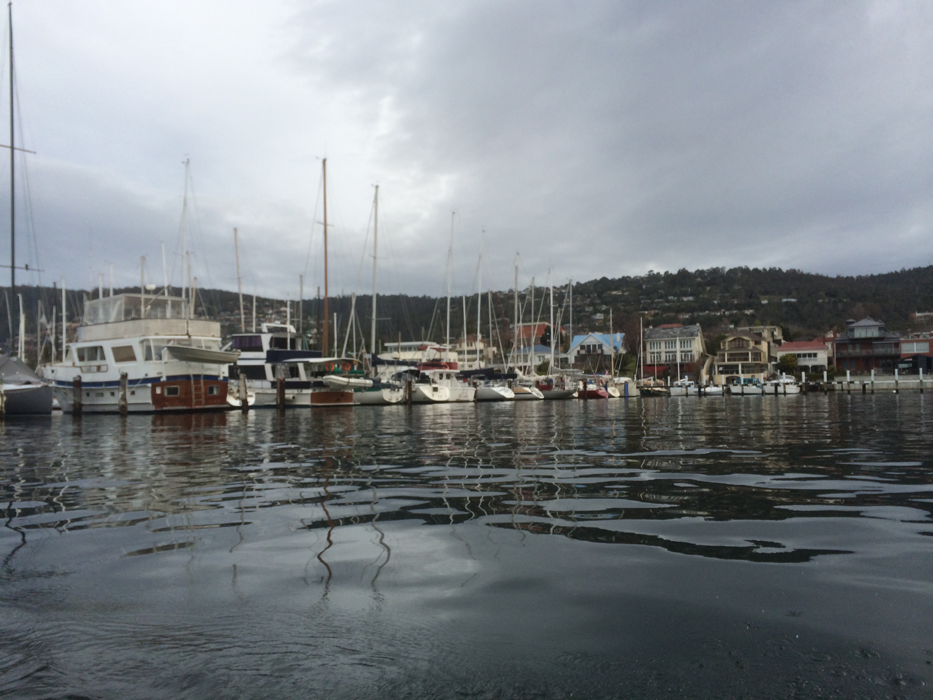
I discovered that many people (including some of the Norfolk Island settlers) had their own yachts and sailing races were held off Sandy Bay from the early years of settlement. The Royal Yacht Club (then called the Derwent Sailing Boat Club) was founded way back in 1859 and the Derwent Sailing Squadron in 1906. The DSS held their first meeting in an old whaling vessel, the Derwent Hunter, berthed off the Domain and in 1955, many years after the whaling vessel had burned down, they got their clubhouse at Cheverton’s Jetty on Marieville Esplanade.
The jetty, the baths, reclamation and pollution from the despoiled rivulet, all messed with the beach, which also has a gothic side to its character. It was once a notorious smuggling hotspot, was where, in the nineteenth century three young girls found a buried baby, where at least one nineteenth century suicide took place, and more recently there was a murder on a yacht moored just offshore.
In 1879 there was public comment that sea level had risen here and that where once it had been 3 ft deep it was now 10 ft deep. By 1834, a commentator mentioned he had once ‘rambled on the Sandy Bay beach near the present Blanchwater and Ashfield beaches, and I can declare that the sea lies greatly encroached there. Where water is now 8 ft deep, I have with my children rambled and got shells… the Sandy Bay beach had been greatly encroached upon by the sea.’ Nevertheless, for many years the beach suffered from the removal of sand by Council decree.
Short Beach then was apparently known by the name of the estate but I’m not sure if Blanchwater was also along Marieville Esplanade. I’m sure more research would clarify what the beach looked like then as well, but I think it was either a long curve stretching from the rivulet to the smaller point where Wrest Point is today or that it had a stretch of cobbles or rock where the park begins, then returned to sand. In the picture below (1855) it presents as a narrow beach with what looks like a line of cobbles, and this is quite common along some parts of the Derwent depending on the season.
Short Beach is part of the Errol Flynn reserve now, established to celebrate that Hobart to Hollywood success story – he swam here as a child – but the beach ends with the rowing sheds, built on the point where the jetty and public baths once stood. There’s a children’s playground, public amenities, a green space and then the two yacht clubs: the Royal Yacht Club of Tasmania and just south of it (but right next door) the Derwent Sailing Squadron, at present extending their marina. Concealed beneath all this there used to be a strip of beach but you would never know.
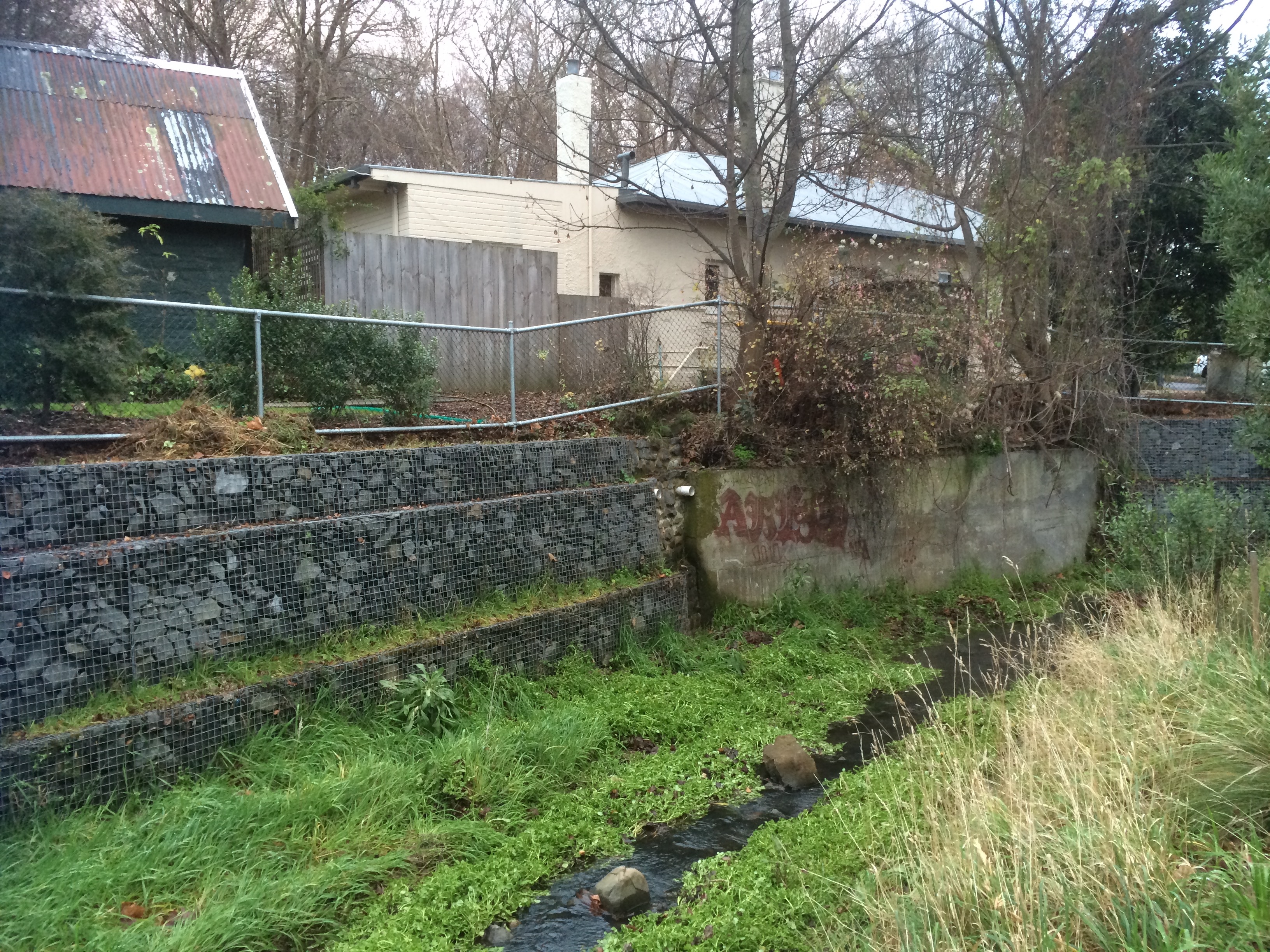
I asked a friend if he could remember what the esplanade looked like when he was young. He said he recalled a rivulet that entered Marieville Esplanade where the DSS is. I went looking, and he was right. Just in the corner where Wrest Point begins and the DSS ends there is a great big stormwater outlet. I’d sailed passed it many time and never noticed it. It creates the channel boats use to get in and out of that marina. There’s a big shallow sandbank here that sets off depth alarms.
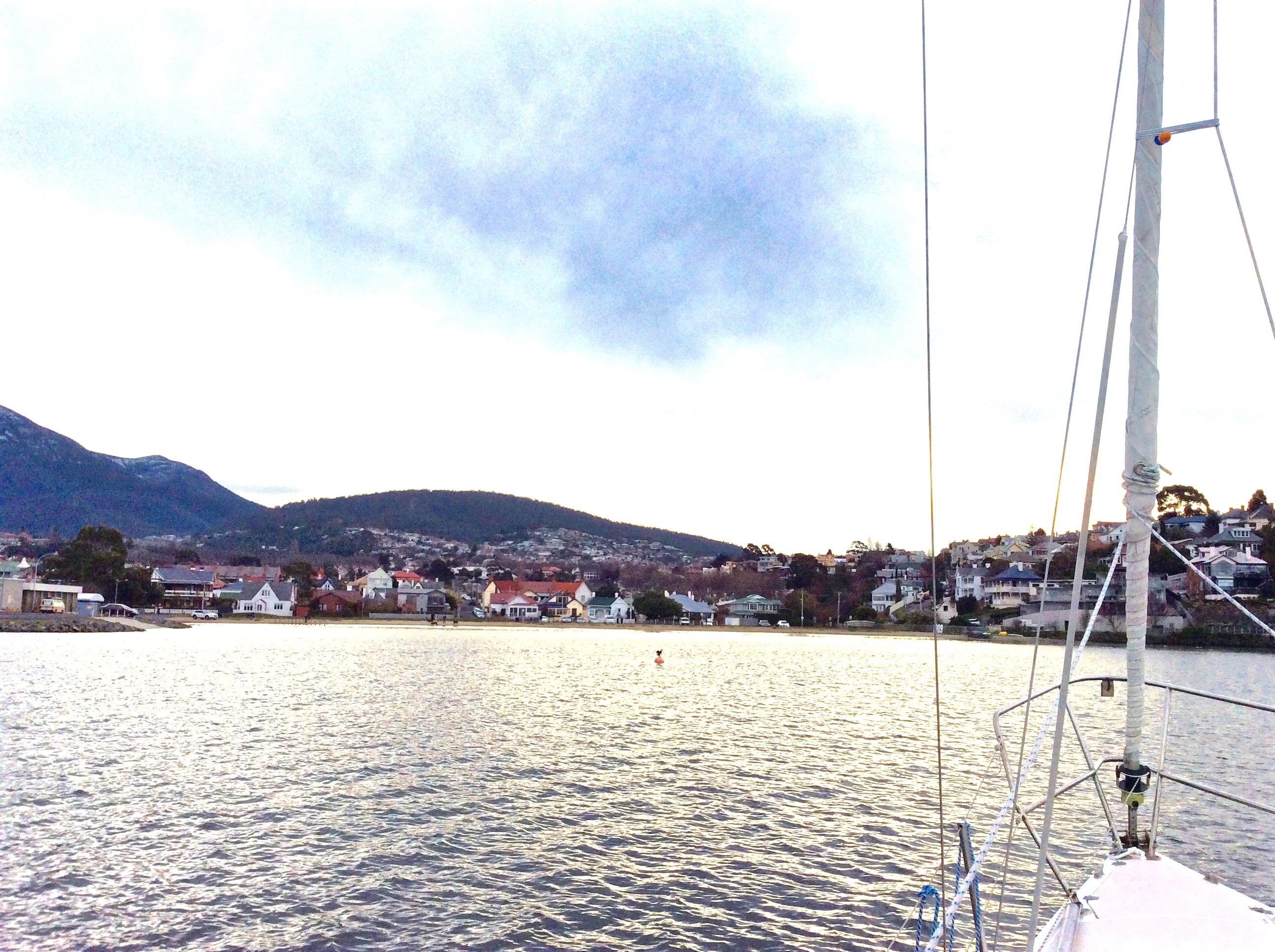
When we first moved to Hobart we lived in Sandy Bay not far from Marieville Esplanade. On windy nights we could hear the clatter of rigging and a couple of times a day we’d take our dog, used to the fenceless expanses of a tree savannah, down to the beach to unleash his canine energy. These days I go to Short Beach to walk the dogs after working on my boat. There is sometimes a group of dog owners in conversation, you can hop over the rivulet onto the tiny, pitcturesque cove of sand at the base of Battery Point. Short Beach is heavily used and is a bit dishevelled and subdued, its dunes long gone, maybe trammelled into the ground or flattened in a reclamation exercise, or never there in the first place. I’m not expert in this matter but I can testify to the fact that although they have good views of the beach and the river, the houses have nothing to protect them from potential inundation.
Short Beach – perhaps Shortened Beach would be a better name – is notable because the Sandy Bay rivulet enters the Derwent below Battery Point, and it is also the first of a string of Sandy Bay Beaches. Before sailing became such a big part of my life I used to like launching my kayak here. Over the last six or seven years I’ve spend a lot of my time at the clubs, sailing out of them, discovering the river’s geography. And while boatyards are not good for the river’s health they have a strong allure, and the combined clubs and the races they hold have added to Hobart’s appeal as a nautical city on a magnificent waterway.
Note: Further information welcomed! Photos below.
Sources:
Centre for Historical Studies (UTas). The Companion to Tasmanian History [website].
Goc, N. A history of Sandy Bay
Short Beach from the water

Looking towards the RYCT and the Wrest Point Casino
![CITE: Sandy Bay from near Bath Street, Battery Point 1885. In: Allport album II No. 6, publ Hobart : s.n., [ca. 1886]. / AUTAS001126183078](https://tasmanianbeaches.net/wp-content/uploads/2015/08/old-sandy-bay.jpg)
Sandy Bay from near Bath Street, Battery Point 1885. In: Allport album II No. 6, publ Hobart : s.n., [ca. 1886]. / AUTAS001126183078. State Library of Tasmania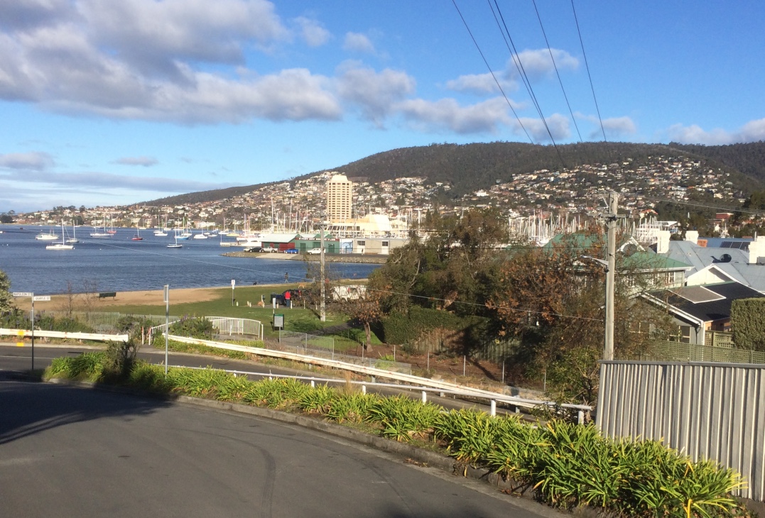
Taken from approximately the same place, 2015.
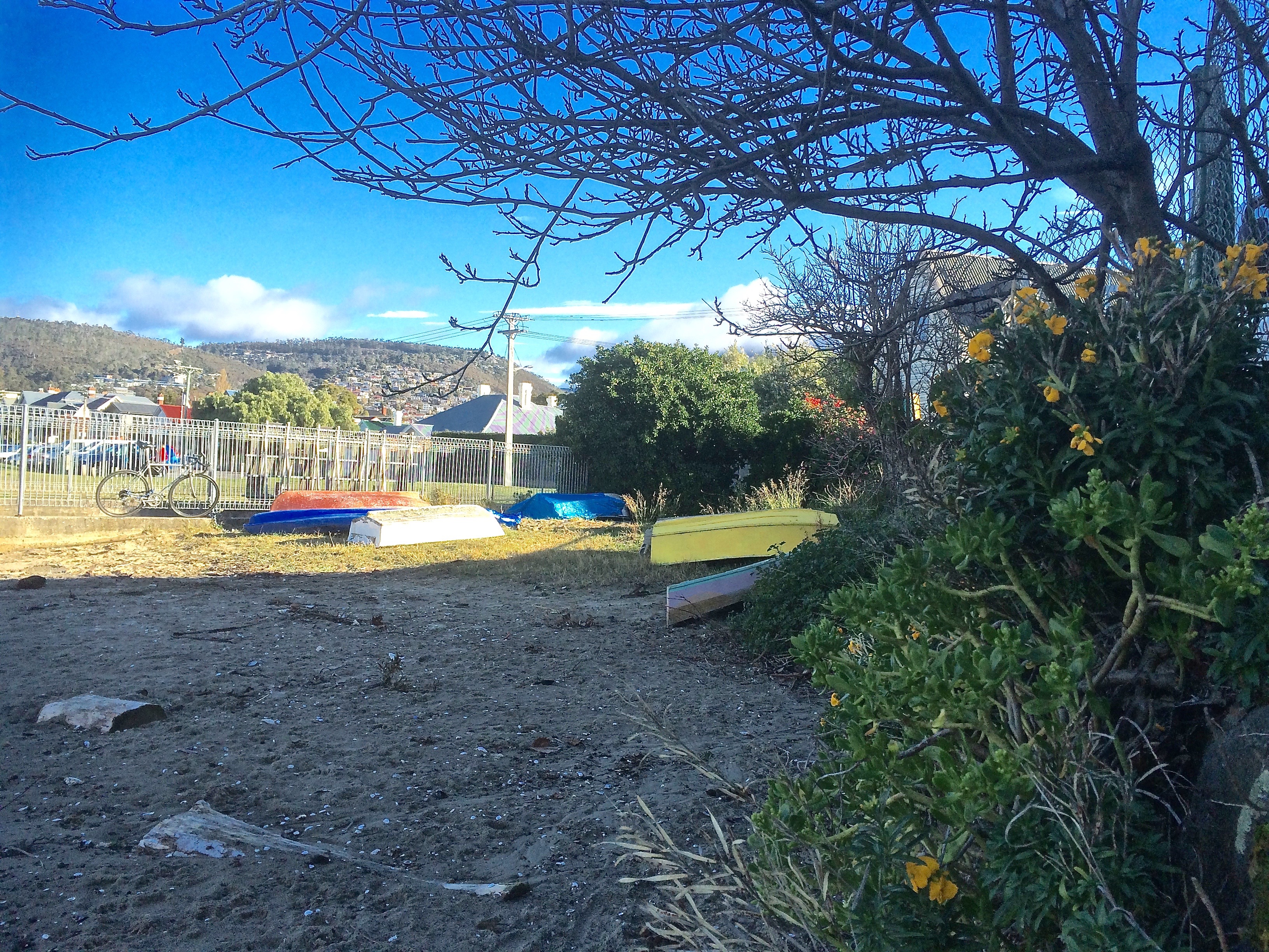
The small cove on the north end of Short Beach.