Walking the Sandy Bay Rivulet from Source to Estuary Part 3

Part 3:  Hall’s Saddle to Waterworks: A rivulet’s point of view

Ridgeway 1 The third stage begins:  Hall’s Saddle

I was strolling a high contour,  the tiny cluster of houses at Finger Post on the far side of the valley.  Far below, the rivulet flowed beneath the forest canopy in the Turnip Fields valley and as I walked I tried to hold its presence in my mind.    Turnip Fields Turnip Fields

The houses on Huon Road hove into sight and the  Derwent River in the distance.  Gracious eucalypts beside the path had bark I had to stop and admire, she-oaks, orange banksia in blossom, and closer to my feet the tiny red flare of epacris impressa.  I was relishing my solitude, enjoying the rhythm of my stride but making slow progress – there were a lot of little water courses I kept stopping to examine.  Alone with my thoughts I faced the same question with the rivulet that I’d had when walking above Mitchells Beach on the South Arm Peninsula:  how close must you physically be to something to be actually walking  it?  And in what way can you be said to be walking something when you don’t know it’s there?  (I was thinking particularly of rivulets in the city and how, walking down a road we are most of us unaware that a rivulet might be flowing beneath us, imprisoned in a drain.)

Ridgeway 3 
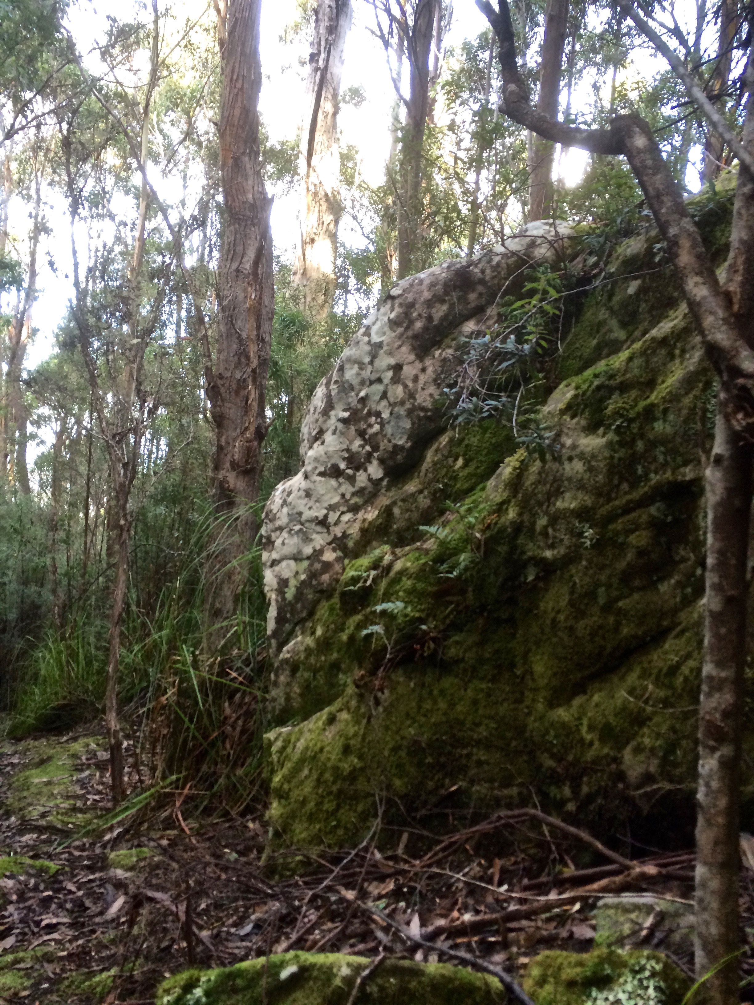
Near McDermotts Saddle

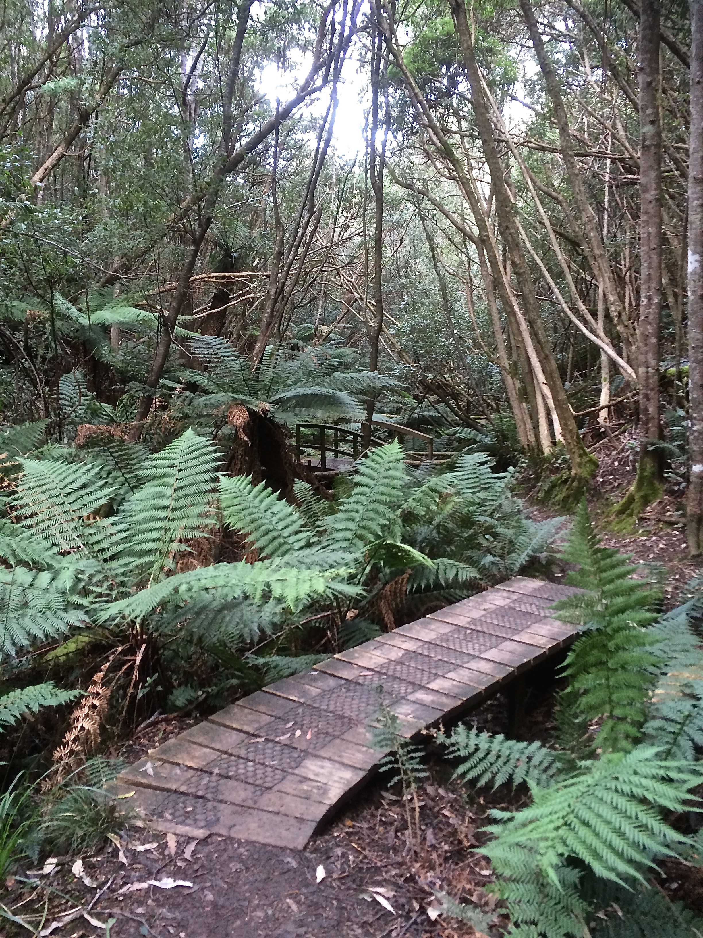
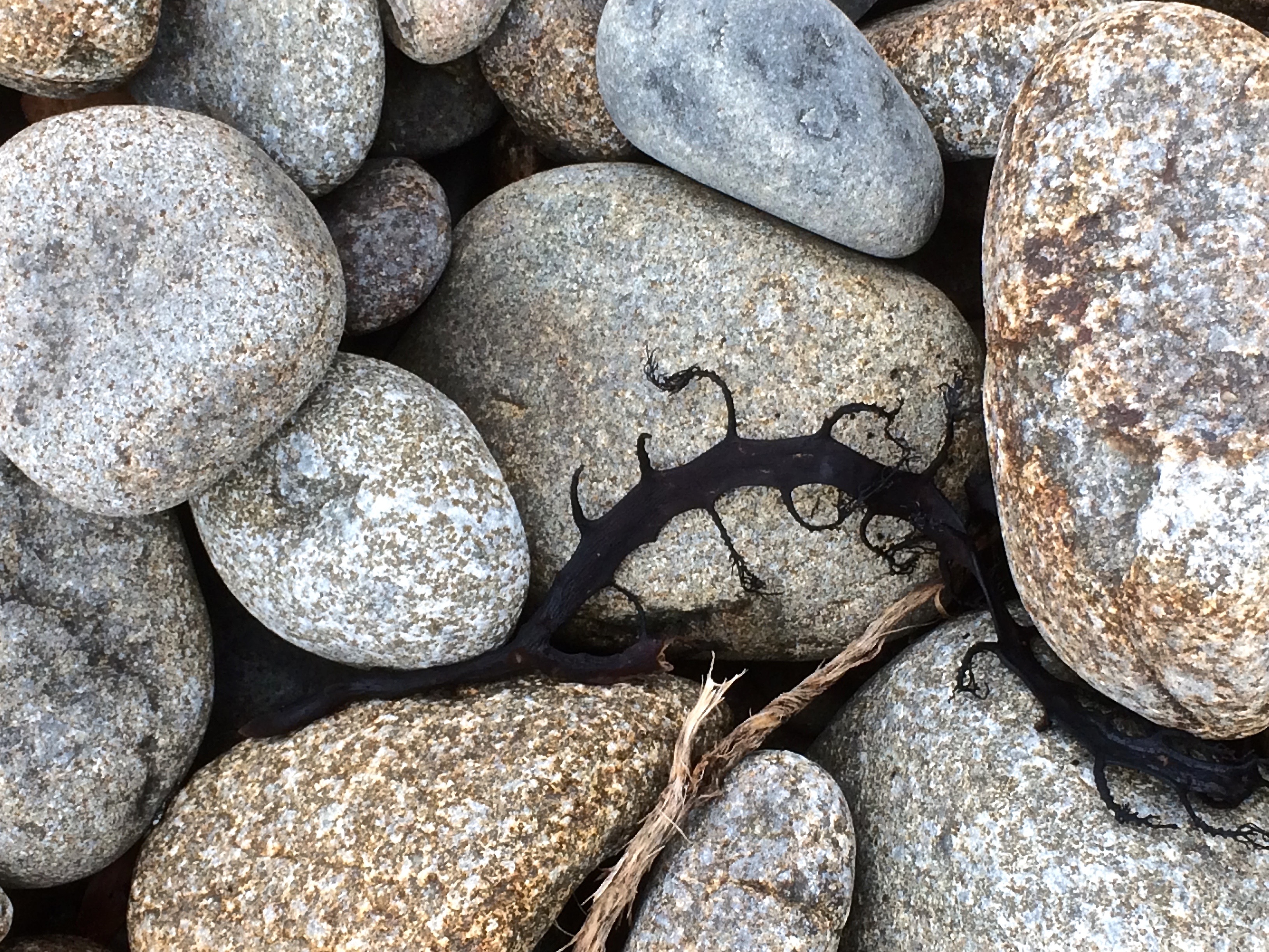
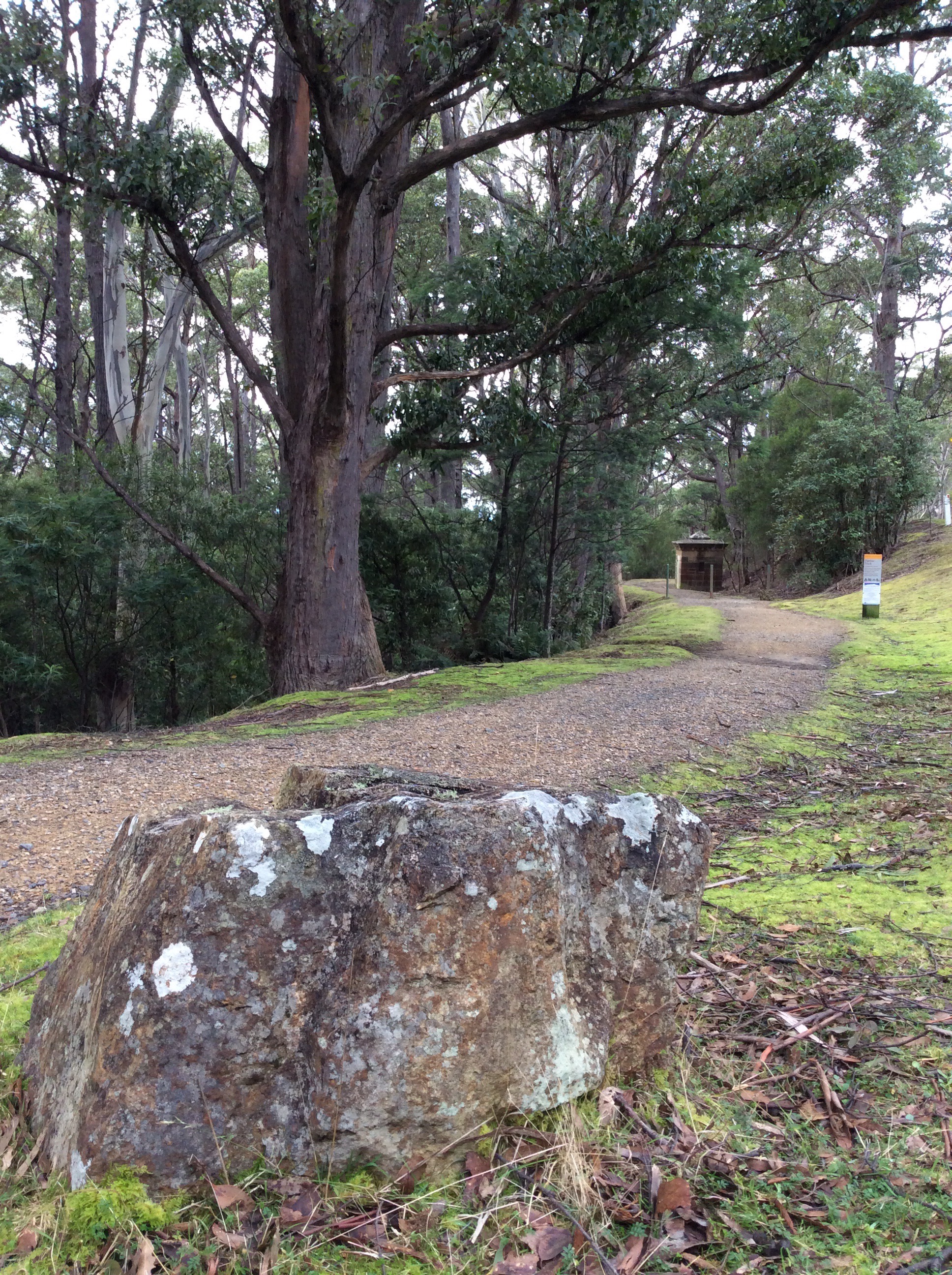
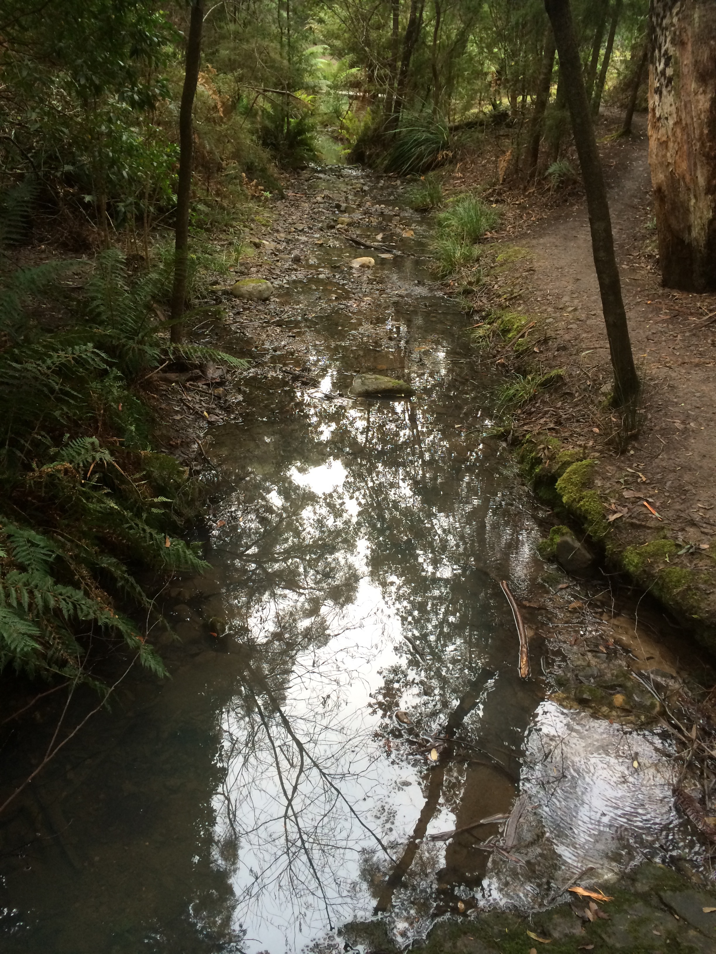
I reached the abandoned paddocks of McDermotts Saddle, the lumpy land that bears old traces of a building.  Superb blue wrens flitted ahead of me and a raven called lazily.  A little while later I got a view of dark water down at Waterworks. I came to the steps and descended, then lingered.  Gentle Annie Falls and a series of cliffs demanded exploration – their’s is a long quiet dreaming up here in the eucalypt forest.   Contemplation over, I followed the Circuit track, paused again at a poignant memorial seat to young life cut short, then finally arrived down at the rivulet at last, just where it emerged from the forest running small and shallow, slightly cloudy, over its dark forest bed, a stride wide, meandering around boulders.  I walked beside it companionably, stopping to capture its voice at a cliff and again where it runs over pebbles.

Rivulet The rivulet enters Waterworks

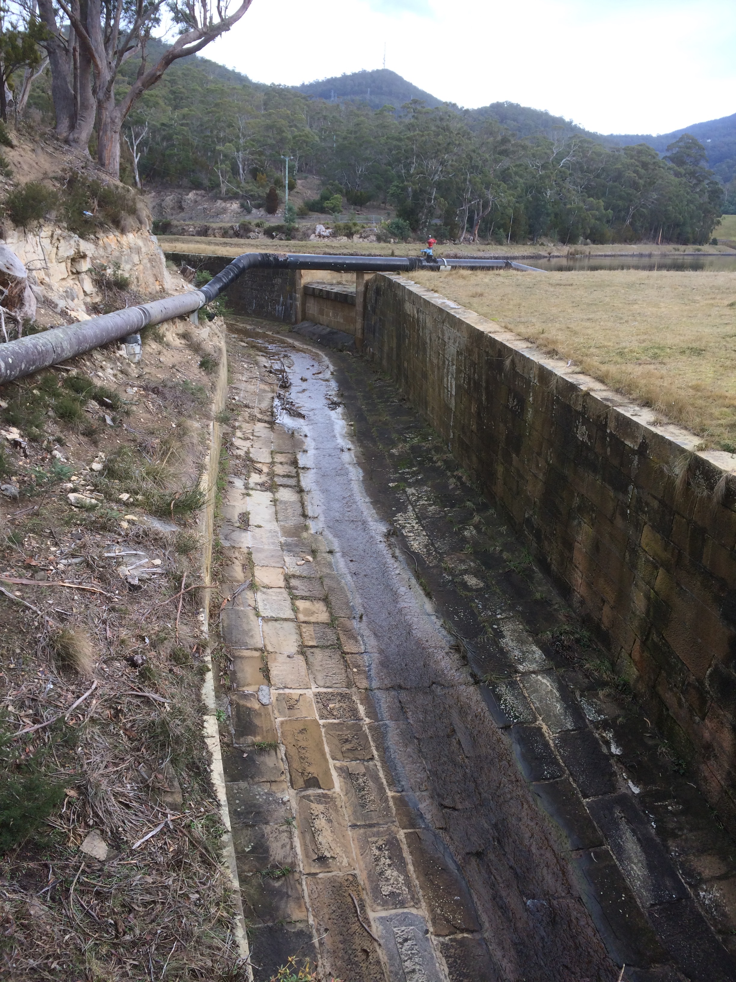
Shortly after this I had a choice of path but the rivulet had none. The rivulet is tricked as soon as it enters Waterworks,  apparently for the misdemeanour of flooding (or landscape building, depending on your perspective) in earlier days.   It is  sneakily led into a moat that runs around the reservoir to the right while the usurper, the reservoir, inhabits the bed the rivulet made like a gigantic cuckoo’s egg.

Reservoir Cuckoo’s egg: The Reservoir

I could have walked beside it, commiserating, but having been that way so many times before (the bitumen, the picnic tables), I went left and walked a forest trail.  As usual the gulls were hanging out on the water and when I crossed over between the upper and lower reservoirs  there was a raven grubbing for food, some tassie hens, ducks and plovers. Munching on an apple, I rejoined the disheartened rivulet as it moved unwillingly down its moat, squeezing itself into the very centre as though it didn’t really belong there.  I passed a bbq in action and a couple arm in arm enjoying the view.   Two ducks, flying low, winged pass me on their way up to the top reservoir and as I approached the gate I spotted the first exotic plants: an escaped agapanthus.  It was a harbinger of things to come.

MoatDisplaced rivulet: the ecosystem blanks out. No life to foster, no landscape to build

Walking the Sandy Bay Rivulet from Source to Estuary Part 2

Part Two:  So You Think You Know Who I Am?

A milky sky, a pensive day. The geologist, still concerned that I would leave the path to seek the rivulet, was not impressed that I was mapless, but I was in familiar terrain and wanted to intuitively feel my way towards the rivulet, maintaining all the while an awareness of the catchment.  There were two rivulets to chose from, if my reading of the landscape was correct.  The one I feel a certain attachment to, that heads down to Turnip Fields via Jacksons Bend and the one that Radfords and Fern Glade, two of my favourite tracks, keep company with.  I chose the latter.

From The Springs I plunged down into the forest along Radford’s Track, conscious of the rivulet somewhere at the bottom of the slope to my right, and the sound I could hear, while possibly the rivulet, was really more likely to be the breeze soughing through the canopy.  It was damp, the vegetation flourishing and aromatic with minty overtones.  Occasionally there was birdsong.

From the Springs to the River: Radfords Track

I turned on to Reid’s track but ignored the turn off to Silver Falls because that’s in the Browns River catchment.  I figured I was walking along a spur dividing the two catchments from each other and so I stuck with my choice, deciding to walk the full extent of Radfords the next weekend, more closely shadowing the rivulet. (And we did, slipping and sliding, initially, in the newly fallen snow at The Springs). Further down, where the trails diverge near the concrete reservoir covered in graffiti (despoiling the forest with a reminder of urban grit) I turned down the bitumen track the council workers use, enjoying the light south easterly and the quiet calls of small birds as I went from valley edge towards the rivulet itself.

From the Springs to the River: Reids Track

REids3

A mountain biker whizzed by, a friend passed at a jog and then I stopped to chat to a woman who told me, as though it was a perfectly ordinary thing to do, that she had walked the Overland Track more than 20 times.  That’s massive! She talked about the enjoyment of taking a backpack and bushwalking alone for days at a time. I was so captivated by her self reliance that when I finally walked on, I took my more usual route and had to backtrack to the Fern Glade path beneath the high canopy with it’s dense understory of tree ferns through which the rivulet weaves, making its way beneath a series of wooden bridges.  Often on this track light falls in luminous bands through the foliage.  Despite the rain and snow we’d had, I’d walked some distance before I found the rivulet pooled in a puddle, and further down the soaked bed, a silvery trickle slipping modestly over the waterfall at the old quarry on Huon Road, a road originally carved out of the forest in the 1830s.

Fern Glade 1

Fern Glade 2

I would not know this until I finally picked up a map a few weeks later but the rivulet along the Fern Glade track is the Longhill Creek.  At its confluence in Fern Tree it travels west.  The actual Sandy Bay rivulet heads down Jacksons Bend and so I should have walked the leech track, (as I’ve done on other occasions) and defied the dangers of the copse.

HelloRivulet
Rivulet sighted on the Fern Glade track. But who is it really?

In my ignorance, I began my next descent from within the tiny heart of Fern Tree, on the Pipeline track, passing old sandstone structures associated with the early supply of water to Hobart, cheering on the trickles of water trying to create new beds for themselves, noting the swish of a cyclist above me on Huon Road, and careful not to disturb two rosellas murmuring sweet nothings to each other in a eucalypt tree above my head.  I co-own a yacht with a friend/neighbour and I co-own a copper beech with some neighbourhood rosellas.  I looked up at them looking down at me and wondered if they are a part of that small flock that make a gentle rain of husks from the swollen leaf buds in the days before the new leaves unfurl.

Pipeline

On Hall’s Saddle the path crosses the road.  I walked on into a dry sclerophyll landscape, heading for Gentle Annie Falls and the Waterworks Reserve.  Finally I really was in the Sandy Bay Rivulet’s catchment and the real walk was just beginning.

Walking the Sandy Bay Rivulet From Source to Estuary Part 1

Part One:  Being Random

Because I live in the Sandy Bay Rivulet’s catchment, it seemed symbolic that I should kick off my beach walks by strolling the Sandy Bay Rivulet from its source at The Springs (about half way up the mountain) to Short Beach where it enters the Derwent.  I looked at the spurs high up near the summit, figuring out the catchment zone.  I read reports and discovered some conflicting facts about where its source is believed to be.  I did some sleuthing, discovering it here and there as it meandered through its urban reaches.  I made an astounding discovery – or so I thought.  It’s the rivulet that flows beside my favourite forest track.

‘You’re going to walk the what?’ said my friends.  It seems that even if you live in its catchment, on the landscape it has made, the rivulet is out of sight and out of mind.

While vacuuming one day, it occurred to me that it must flow through Turnip Fields.  I cut that chore short and went to explore this little known spot.  From the road I saw new houses with names like Mystic Way, and the Derwent, like a heart-shaped lake, captured by the foothills.  I saw the reservoir at Waterworks and down on the valley floor, blocked by private property, I saw the forest it must surely run through.

The one thing I didn’t do was consult a map.

Confident I now knew its route, I told the geologist I would follow the rivulet that slips down beside ‘the leech path’ to Jackson’s Bend on Huon Road.  There’s a steep, forested valley on the lower side and I imagined I would slither down into this copse with my sailing boots in my rucksack in case I had to slosh my way down the rivulet itself.  Over drinks the geologist explained that I would need a compass, that the bush would be dense, and quite possibly impenetrable over the rivulet.  He told me it was even conceivable I could fall over a cliff and die.

I was disbelieving.  The copse is narrow but it’s true the slope is steep.  I had thought of my descent into the valley as a drop into an unknown world – old memories of the Famous Five had stirred, awakening my inner George.  ‘Forget it,’ said the geologist, and told me of his efforts to push through horizontal and the achingly slow progress he had made.  ‘Only masochists will go into that stuff.  There’s too little reward.’

I was unconvinced but I didn’t like the idea of encountering old bones (that cliff!) or trespassing and encountering a landowner bristling with weapons, as occurred to some others in a 4×4 recently.  And so I agreed to begin at The Springs and to follow a more conventional way down to the river.

From the Springs to the River: Radfords Track

Kunanyi

fern

One Christmas when I was new to Hobart, my friend and I rode up the mountain, a long slow ride that kept me at eye level with some of its passing features and wobbling as I got distracted by the silencing view beneath us.  The plants, the water dripping through the sliced soil at the road’s edge, the tall forests of eucalypts and rainforest species, the fragrant air and then in the alpine zone the sculpturally stunted snow gums and cushion plants, were hard and breathless work to get to know.

A rest at the summit, the chill, the distant view of the South West, the disorientating landscape of peninsulas and islands, most of south eastern Tasmania spread out about us, and then the exhilaration of sweeping back down its long flank on the narrow road, all the way back to the city.

The first beaches I’m exploring lie beneath the mountain, the usual term Hobartians use to name it up but when one day not so long ago I turned on to the summit road and saw the new kunanyi / Mt Wellington sign, I thought, quite simply, ‘YES!’

I’d almost forgotten Uluru was once Ayer’s Rock and frankly, for a massive mountain to be bequeathed the name of a mere mortal in a distant land, is an archaic notion. The mountain, through the Ice Ages and the Holocene and past the date of European settlement, carried many names (Unghanyahletta, Pooranetere and others), because there were different languages and dialects spoken here but in 2013, at a ceremony on its summit, the government announced its new dual naming nomenclature policy, a late acknowledgement that this land once had other more authentic and richer names than it currently carries.

Kunanyi

The mountain rises above the city like Table Mountain over Cape Town and although the foothills disguise this fact, kunanyi is actually the taller of the two. In February 1804, dissatisfied with the initial settlement at Risdon Cove, a small party landed at Sullivan’s Cove on the western shore.  In a letter that month the Governor said  there ‘there is a run of clear fresh water, proceeding from a distance and having its source in a rock in the vicinity of Table Mountain…’ (HRA 3,1 p 223 Collins to King 29 February 1804).  Clearly a similarity between the two mountains, the way cloud snags on their summits, had been noted.

We think 100 years a lengthy span.  Kunanyi took the Permian, Triassic and Jurassic ages to achieve its character.  Geologists look at it and see a horst.  For a sailor or explorer, like George Bass, who noted it in 1798, it’s a most significant landmark.  The early settlers appreciated its water but took to soiling it immediately, used as they were to the sewers and drains of cities like London.  Kunanyi had been seen as sacred, the relationship non-duelist, totemic, but Europeans put a higher value on utility and took its timber, stone, wildlife, plants and water.  Non-duelist myself, I can’t begin to imagine the pain that those clans, pushed out of their own home, felt as they watched the earth they belonged to desecrated so wantonly.  Had the new arrivals not been so Cartesian in their perspectives, words like threatened, endangered and extinct would, just maybe, not apply to Tasmania’s natural wealth like it does today.

Mountain fires, floods, landslides, eras, climates and species come and go and despite the  recreational, weather and telecommunication structures on its summit, it’s still magnificent, sometimes so solidly present, sometimes ethereal, and occasionally in humid weather, like a dreamtime serpent, a long ribbon of cloud  slithers through the valleys and wraps itself around the mountain, creating an atmosphere of mystery.

It has a secret night life, most denizens being nocturnal – the chorussing frogs, the sugar gliders, the wallabies, the boobook owl – and it has a diversity of plants, is criss crossed with paths and rivulets, studded with huts and waterfalls. In 1906 the mountain got a little more breathing space from people when it became a park.  When you go walking, its best to be prepared because like so many mountains, it’s wild and can be tempestuous and even today has the capacity to snatch up lives.

This has been a cold winter and most unusually there has been snow on the summit almost every day.  I’m looking at those snow flecked cliffs, the Organ Pipes, up at the peak.  I know that around the corner The Lost World is also under snow.  I’ve been sailing the river and walking the beaches, and making my plans to follow that rivulet whose catchment I live in, (with its tendrils starting above our home, behind it, in front of it and below it)  from its accepted source at The Springs down to the beach at Sandy Bay.

And in walking the rivulet, I’ll also be walking kunanyi.

kunanyi sunset
kunanyi viewed from the Eastern Shore

Tasmanian Beaches: Reflections 1

MONDAY 11 MAY 2015

THE BEGINNING POINT

One the shores of the Derwent

A story has no beginning or end: arbitrarily one chooses that moment of experience from which to look back or from which to look ahead. 
Graham Greene, The End of the Affair

As soon as we got home from  the Arm End walk I grabbed a coffee and began to research the Tasmanian coastline.  Someone must have written up their beach walks around Tasmania!  My sleuthing uncovered someone Walking the Derwent River, a group walking the beaches in Clarence, and Andrew Short, who has recorded all of Tasmania’s beaches as well as the entire coastline of Australia.  As soon as I saw the title of his report I realised I’d seen it before – and so I rang the geologist and suggested he visit the library.  (There is nothing like a library – the next day I had it!)

The State Library of Tasmania holds tantalising titles too, and I’m conscious at the same time that although I had to dive deep into the internet to uncover sunken treasure it’s many fathoms deep and oceans vast, and there could well be further riches down there in someone’s lost, forgotten blog.

I flipped through Short’s illuminating report.  Mary Ann wasn’t one long beach.  She did have a companion, the one apparently nameless that I’m going to personally call (serious nomenclature being one for the state) Gellibrand Vault Beach.  Down at The Spit there were two other beaches I’d either not noticed sufficiently or had failed to record.  I’m pretty sure locals must call them North and South Spit beaches.

He’d also numbered the beaches along the Derwent Estuary. I’m often on them.  How could I not include these old favourites?  I looked at my chart of the Derwent, I consulted maps.   I thought about the mountain and how it conjures up weather and serves up magic or sorcery for yachties, how when you’re out there sailing, you have to keep your eye on it so you know what might be brewing.  The river is inextricably bound to the mountain, not just through the wind but because rivulets carrying altitudinal memories and stories flow down into it, bringing their own unique chemistries to the Derwent.

The mountain’s personal space extends some way out to sea – you feel its moods, it’s muscle flexing.  How could I not take all that into account?  I looked again at Andrew Short’s incredible number, 1,067, and quickly remembered that in all things, small is beautiful. Perhaps 100 beaches was a more suitable goal.  Perhaps I should focus on a particular locale.  I decided to make my mistakes close to home and start with the beaches of the Derwent and the South Arm Peninsula, possibly even the D’entrecasteau Channel, but I didn’t dare count them.

I had walked several beaches before I realised the beginning was merely symbolic.  Exploring the beaches, laying down memories about them, began on my first visit to Tasmania many years ago.

Still, I felt that before I began on the beaches not that far from my front door, I needed to know more about that beautiful thing, the river, its currents and waves, which along with the wind shapes the shoreline, and the small but powerful rivulets that merge and become one with it.

This project was proving to be as shapeshifting as the beaches themselves.

Detail, Grange Beach section