When we came back to the Primrose Sands area to find our way to the cobbled beach we’d spied as we’d peered over the rocks on our previous visit, a trim of houses along the shore hid the track from view. Signposting just isn’t that great around here, which means that unless you approach by boat, these coastal spots tend to remain local secrets or the haunts of sailors.
On Primrose Point
Instead we set off along the eastern shore of Gypsy Bay, stopping to chat to a man fishing for flathead, skirting boat houses and spending a long time enjoying the rock platforms. It was a crisp day. A big blue stillness had settled over the water and from the point we had a magnificent view out over Frederick Henry Bay to the Tasman Peninsula.
View from the end of the point
Always Take the Scenic Route
These two bays – Gypsy and Susan – are rather overlooked spots, only stumbled across if you ignore the highway and instead take the scenic route between Hobart and Dunally. We idled at Gypsy Bay enjoying the boat sheds near the boat ramp and the eccentricities that make it appealing.
Upcycled dinghy at Gypsy BayGypsy Bay: the view to the east
Susan Bay
Susan Bay
It proved impossible that day to walk around the shore of Susan Bay but on a spring low it’s possibly a cinch. Disappointed, our moods rose when we stumbled on a path between houses and followed it down to the bottom of the cliffs where we discovered a beach, rather curved, rather dark and rather thin and therefore easy prey for the ocean that nibbles away at the cliff, felling eucalypts out of the failing banks.
Whisker thin though the beach was on the tide that day, it had an appealing sense of moody seclusion, and we wandered along it in no rush whatsoever, enjoying the birdlife and stopping to chat to a local who spoke at length about this bay and with the most enormous affection. He’d bought two properties along the shore and hoped Hobartians never woke up to this small bay’s particular loveliness. As we followed him back up the path, looking back at those lovely views of the Tasman Peninsula, he told us exactly how to find our way on to Carlton Bluff, which meant that at this point we ended up heading west again, putting eastward exploring on hold.
Susan Bay and its mooringsSusan Bay: safe anchorage when the NW or NE winds are blowing
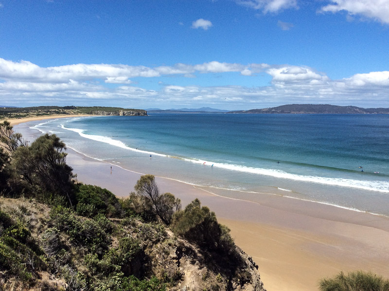
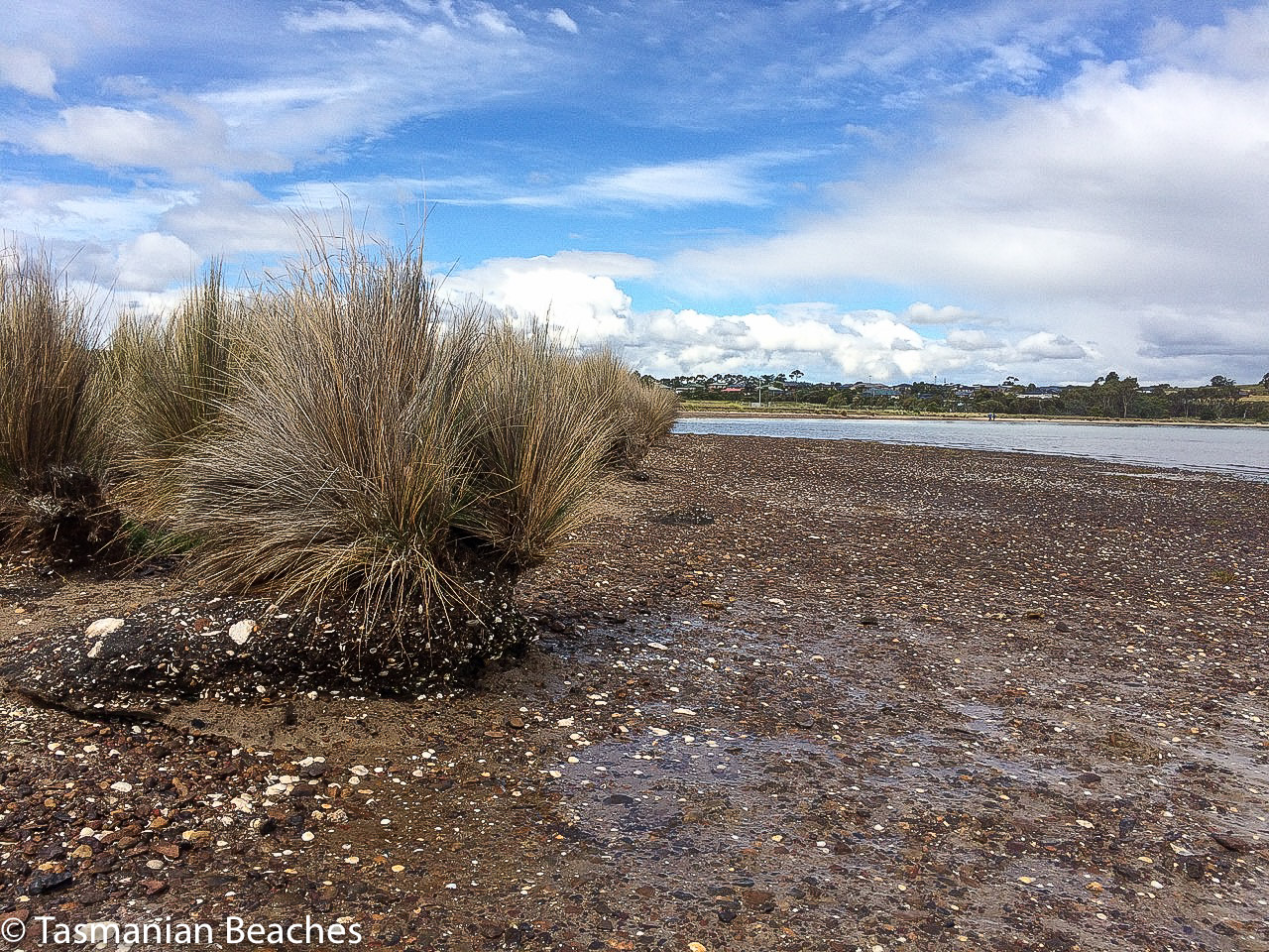
After slithering down off Cape Contrariety we took off our shoes, Cathy and I, and walked barefoot along the swash, quickly leaving behind the small groups of swimmers and surfers taking advantage of sunny weather. Soon we had the whole beach to ourselves and forgot completely about the existence of the low lying houses between the beach and Pipe Clay Lagoon, except for when we paused to study the sand dunes, their shape steeply altered by marram grass, their mass being gnawed away at by the sea. The dunes extend about 300m inland and reach a height of about 20 m (Short, 2006) and amongst the native bush growing on their backs is Acacia longifolia and the threatened species Cynoglossum australe. These Cape Deslacs/Clifton Beach dune fields are a geoconservation site of state significance, and Clifton’s Frederick Henry Bay beach alignment is also considered significant.
Especially along some parts of Bicheno Street the houses here are regarded as being at early risk from sea level rise (Sharples, 2009) and sea level rise will of course impact coastal values too and destroy the dune habitat the Clifton Beach community is currently working to preserve.
We studied the ripple marks and read the southerly swell, counting numerous rips and we observed that apart from a lone juvenile Pacific Gull studying our progress this popular beach, facing south- southeast into Frederick Henry and towards Storm Bay was that day devoid of birds.
When we reached the end we lingered and with a little assistance from Memory Maps pointed out to each other the landmarks we were observing to the south and then we turned our attention to the cliffs at the base of Cape Deslacs taking stabs in the dark about the pale rock, before guessing at sandstone. Later I read that there have been numerous drownings at this northern area of the beach, so it’s a wise swimmer who stays within the flags down the southern end.
Our efforts at amateur geology ending in uncertainty, we walked back down the beach contemplating a stroll around the lagoon on a future low tide and pondering the difficulties Cape Deslacs might pose for our exploring.
Further Reading:
Sharples, C. 2009. Climate change impacts on Clarence coastal areas. Clarence City Council, Clarence.
Short, Andrew. 2006. Beaches of the Tasmanian coast & islands: a guide to their nature, characteristics, surf and safety. Sydney University Press, Sydney.
Tasflora. 2012. Clifton Beach Coastal Reserve: reserve activity plan 2012-2016, draft (revision 3): advice prepared by Tasflora for Clarence City Council. Unpublished report.
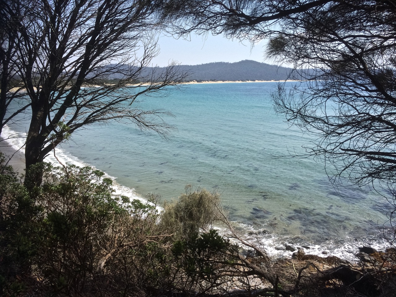
Clifton Beach and Pipe Clay Lagoon viewed from Cape Contrierity
Tiptoeing Along a Cliff Edge
Zooming in with Google Earth I thought I spied a couple of small beaches north of Smugglers Cove and the light tracing of a path through what looked to be a nature reserve. It was enough to convince us that it was worth trying to tackle the cape from Clifton Beach on the northern side and so on a sunny day at low tide, while people swam between the flags and surfers lolled on their boards beyond the break Cathy and I scrutinised the dunes and the cliffs at the southern end of the beach and found a path that led up a steep gully. With an eye out for snakes, we scrambled up it, trusting our weight to the branches of a couple of conveniently located bushes.
There was a narrow strip at the top between the ‘keep out’ barbed wire fencing and casurinas rimming the high cliffs, some of which had fallen away. Peering over the edge we could see their broken pieces tumbled down against the sea.
We found a path, but it looked wallaby made and we meandered on and off it making a difficult passage over and under vegetation, sometimes trusting to the generosity of land owners by slipping over the fenceline to where the walking was easier. In one memorable spot, we had pretty well a foot wide space of sky we needed to cross. I avoided looking down. The drop was horrible, but Cathy skipped over it oblivious to Death’s outstretched hands.
Our tardy progress was made even slower because the views were compelling and so we’d stop, point out landmarks we were confident about and speculate about those we weren’t.
Clifton Beach and Cape Deslacs. Tasman Peninsula is visible across Frederick Henry Bay
We finally found ourselves on the far end of the casurina copse, gazing down a long slope of golden grass and up the slope on the other side. There was no clear path and it had the look of large expanses of private land. With a couple of households dotting the cape, we decided to avoid rebuke and reluctantly turned back, walking single file. Cathy quietly observed the tail of a snake disappearing down a hole between us, so we were pretty pleased to reach the beach unbitten, and as the day was still young and the beach glorious, we decided to take an amble to the cliffs below Cape Deslacs.
The interplay of land and water made the walk worthwhile
Not much has been written about this cape, but on Placenames Tasmania I discovered that D’Entrecasteaux had noted this name on his voyages of discovery and that it had another as well – Watsons Bluff. Watson was definitely no lady because it’s my observation that places get named after men, rarely women. No doubt he was merely an earlier landowner whose name buried earlier ones tangled with mythology,
I dug about on Trove as well and discovered a 2000 fisheries arrangement between the Commonwealth and Tasmania that referred to a shark nursery in the ‘area known as Frederick Henry Bay and Norfolk Bay being all waters within an imaginary straight line between North-West Head and Cape Contrariety’ and in an article on geology in the Sanford area, Green (1961) mentions dolerite intrusions into mudstone as well as landslips in the cape’s basalt soil. As he also mentions lavas here, this little cape has some complexity but keeps a low profile in the island’s literature.
When we were preparing the house for sale earlier this year, we moved on board Samos, thinking we’d be at Kettering in Little Oyster Cove for several months. We planned to spend that time cruising the D’Entrecasteaux and Norfolk Bay but within a matter of days our lovely mountain home had found itself new owners and we barely had time to tackle our list of boat tasks before we were home again packing boxes.
Travelling in a small van as we did last year and cruising in a small yacht proves that truism of life being richer as possessions get exfoliated and waste gets reduced. But moving house is not good for the environment. You may give the Red Cross Shop your library and St Vinnies the clothes off your back, but the recycling and refuse bins fill exponentially and zero waste targets shatter alarmingly.
We went down to the marina on a sunny day and stepping on board Samos I noticed a swirling black ring beneath the water, just behind the yacht’s transom, and an overlapping circle of silver, moving that little bit quicker. A cormorant was hunting a school of bait fish that panicked into a leaping confusion as the bird downed its catch while rising to the surface.
Relaxing beneath the boom tent with a g&t on a blue day before summer’s lease expired, we watched a puffer fish slowly inspecting the seaweed attached to the floating marina and each time the black swans came visiting the dogs were transfixed.
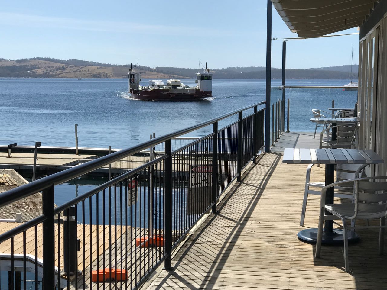
Life in the marina spools out slowly. Those of us working on our boats shared tools, suggestions, advice and meals while in the background yachts slipped quietly through the marina, the Bruny Island ferries came and went where once the Nuenonne paddled their bark canoes, where Bruni D’Entrecasteaux sailed – sealers and whalers too – and the constant sound on the boat, in the quieter moments and most noticeably in the silence of the night, was the idle clicking of tiny beings feasting on the hull.
The additional summer ferry crossing to Bruny Island from Kettering
The super blue blood moon rose over Bruny Island, the Channel and the yachts while the dark hills slept and we looked up at the moon and also down at its reflection, snagged in the riggings of yachts impressed by its light on the water.
There have been other times at the marina when nature has gifted us a surprise or two. We’ve been astonished by flocks of about 200 black cockatoos swirling around the pine trees. We’ve stopped to watch the parade of crabs along the marina shallows. Kayaking this cove I once followed a ray as it made its way around the north east corner. I like rays. The ones I have encountered all seem capable and full of purpose.
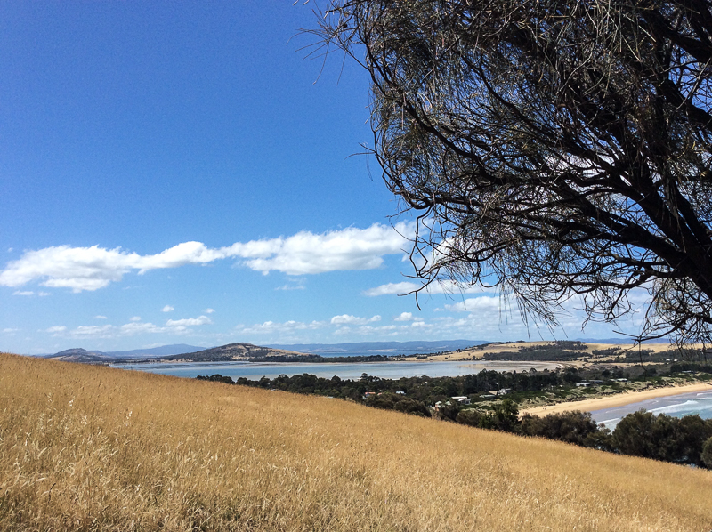
We were at the marina long enough to enjoy several coffees and breakfasts at the café beside the ferry terminal with its views of Bruny Island and to enjoy the pub up the hill. Really, the marina is for me the heart of Kettering and Kettering the link between mainland Tasmania and Bruny Island. For a small place it’s pretty amazing that along with the pub it has three cafes as well as artistic credentials and links, some believe to planets elsewhere. This extra terrestrial history inspired the Kettering Incident.
We walked the short track through coastal woodland around to Trial Bay, lazed at Kettering Point and in the evening took the short walking track below the cricket oval on the northern side of the cove. There are houses on the hills which were once entirely forested, that therefore drew timber cutters in Kettering’s early days, and tucked away in the valleys behind the village are farms producing organic produce for which Tasmania is rightly famous.
Marinas can be tough on the watery world but this one has achieved some recognition for its environmental efforts and living on board proved so enjoyable that we agreed that while small is beautiful if we want to live on board all summer long then a yacht a little bigger would be more comfortable. And so our lovely yacht Samos is on the market and a new adventure is about to begin.
Once, several years ago, bound for Stanley across Sawyer Bay, an open, 25 kilometre long coastline, I sailed passed Port Latta in a fast diminishing gap between gales. While the skipper took waves in her face with the broadest of grins, my friend and I tucked up under the dodger and watched the coastline go by. I was identifying old landmarks I hadn’t seen in a while – Rocky Cape, where this bay begins, and then the long jetty of Port Latta. Behind that jetty there’s Australian Bulk Mineral’s large, grey processing plant that belches smoke and in its shadow there’s a cluster of houses. Looking at them from out at sea, I felt for the people who had to live there and knocked it off my bucket list.
***
The holiday home had a couple of books on local history and an outstanding view along the coastline of the bay all the way to the volcanic neck that is The Nut, standing elevated above the landscape at Stanley, but I had not realised until we arrived that Cowrie Point was the site of those homes I’d looked at through the rain from that bucking yacht all those years before.
I went down to the inviting beach to stick my feet into Bass Strait’s waters. The high tide had piled seaweed high along the wrackline and the beach was backed by both feral and native plants over to my right. The rocky platforms of what I took to be a point, and the pebbles that I found, were unexpectedly stunning. They looked like agate with volcanic intrusions but when the geo went to take a look he said no, they’re Precambrian sediments with iron oxide deposits in the joints and sometimes in the bedding plates. There were stratigraphies laid on their side with sharp edges, long thin columns with longitudinal jointing, tessellations, pale colours, burnt ochres, swirls and speckles. Neptune’s necklace flourished in some of the rock pools but others seemed entirely empty. Cowrie Point, he said, was actually a tombolo.
Cowrie Point. The view from the tombolo of T 996 and T997
On the eastern side of the tombolo I found another beach (T 997), this time a half crescent curve of about 100m, rather narrow, that backed onto the beach I’d just come from. Again, but that bit closer, there was a view of the jetty and the looming plant, the white smoke dense in the sky, sitting improbably with the lovely proportions of the quiet beaches. Occasionally there was a low industrial rumble.
Just passed another outcrop of rock was a third beach (T998) and beyond it a stretch of rocks and then the industrial works. There was a lone house above the rocks of T998. Two men stood below it with a dog. I was strolling slowly, looking at the differently shaped sponges that had washed up, but eventually I turned and walked away.
Later, when one of the men came around to the Coral Point Beach with his dog, he told us his family’s story of Port Latta.
He was barely school age when his family built their Cowrie Point home and it predated the refinery which was built in 1967/68. It’s the terminus of an 85 km pipeline that starts at Savage River mine on the West Coast. What runs through this pipe is a slurry of crushed ore. When it reaches Port Latta it’s transformed into marble sized pellets that are baked at 1000 degrees C, which then travel via a conveyor belt along the jetty to the ships that take the pellets away to Port Kembla and China.
The refinery, he said, spoiled everything and devastated the shack owners. Thirty seven homes were razed so it could be built and for the first twenty years they’d been unable to use their house at all. The plant was so loud and noisy, the smoke terrible. When they hung up their washing it turned black. Worse, the chemicals that leached into their water burnt them, but the company didn’t want to know. The conditions were so intolerable and depressing that those who could moved away.
‘There weren’t any greenies back then,’ he said, as though that might just have made a difference, and expanded on how beautiful this stretch of coastline had once been, the ways they had enjoyed it and just how much it had been spoiled. He said more recently the processing plant had changed to gas and it wasn’t so bad anymore but as we stood there white smoke was dense in the sky and the whole place began rumbling.
‘It rumbles when they’re tweaking the mix,’ he said. ‘Wind’s northwesterly.’ We stood in silence, happily upwind, listening to the plant before saying our good byes.
Port Latta processing plant and jetty
I couldn’t find anything about Cowrie Point’s social history but I did find out that there is a landfill at Port Latta that accepts general and hazardous material and this has resulted in groundwater contamination. I also found out that ABM holds the Savage River Project through its indirect subsidiary, Goldamere who in 1996, entered into an asset purchase agreement with the State Government of Tasmania. Goldamere would purchase the Savage River mining operation assets as well as the Port Latta pelletising and shiploading facilities for a deferred payment of Aus$13 million. As well as that, the government agreed to indemnify them against all liabilities, both pre-existing and on-going, caused by environmental pollution or contamination that have resulted from past operations.
Port Latta to the east, The Nut rising above a faint sea mist to the west, and Cowrie Point perched on the edge of the Little Peggs Beach State Reserve. There were spectacular sunsets and lovely beach walks and Stanley not that far away. It was all exquisite, as long as I kept looking west.
Go there. Definitely go there. Explore the exceptional beauty. Discover what it’s like to think you own paradise and then to have hell settle in beside you.
Back at the cottage after kayaking Sloop Lagoon, I was flipping through Marianne Robertson’s book From Petal Point to Cockle Cove over a well deserved cup of tea, and discovered a beach that I hadn’t been aware of before. Tucked away behind the big boulders at the south end of Taylor’s Beach was apparently another small cove called Sloop Reef Cove, also known as South Taylor’s Beach.
It was time to go searching – and so we went immediately.
But we couldn’t find a path. Instead, we four, two of us canines on leads, scrambled up enormous boulders and searched around when we got to the top. Faint trails sometimes led to dead ends but we finally found a vague track that led on to a better formed path through the casuarinas and finally dropped us down to a secluded campsite where two men with a van were stoking a fire. Down on the tiny north facing beach four people were enjoying a picnic while the surf pounded in. It’s an intimate cove; we felt we were invading and so we sat only momentarily on the rocks discussing the undercut dune behind the beach. The cove sloped; the surf that day rolled in and and streamed out, deflecting around the corner. We saw the back of the waves as they raced onwards to east facing Taylors. There is a permanent rip here. Swimming in the cove or the southern part of Taylor’s beach looks pretty dodgy because of the criss cross waves you get here. It was a most unsettled sea.
The boulders of Sloop Reef Cove
To Sloop Point
We knew Sloop Point well, or so we thought, but yet again, finding a trail from Sloop Reef Cove that would lead us there took a bit of effort. We considered giving up – and considered this several times more during the course of this walk – but eventually the trail we found joined a well made contour path, which I later discovered was an old tramway track.
But why would you have a tram way here? What sort of tram? What was the purpose?
The walking was soft; layers of casuarina curls lay on the ground. We passed beautiful boulders near a point with a sign that read Sloop Rock Jetty and stopped here, contemplating the dreamtime stories that would once have been associated with these powerful formations.
The path came out at the parking place for Sloop Point. Four of us, plus the two canines, had come here on a warm April day and meandered down the path to the massive sheets of lichened granite that make up the point . It has a fantastic rockpool, deep and clear and private, suspended above the ocean and claimed that day by a travelling couple in their twenties. This is the sort of place that’s probably seen a lot of people rip free off their clothes to skinny dip and enjoy the sun au naturale. It’s a highly risky business as others coming after can be as surprised as those caught cavorting in this spectacular rock pool above the sea.
Offshore were the Sloop Rocks, the bay’s most fascinating feature and visible over a vast distance. I call the most spectacular the Sitting Buddha but it probably has many names. I have a friend who calls it the Witch’s Hat.
Rock pool at Sloop Point
Sloop Rocks
T 82 Seaton Cove
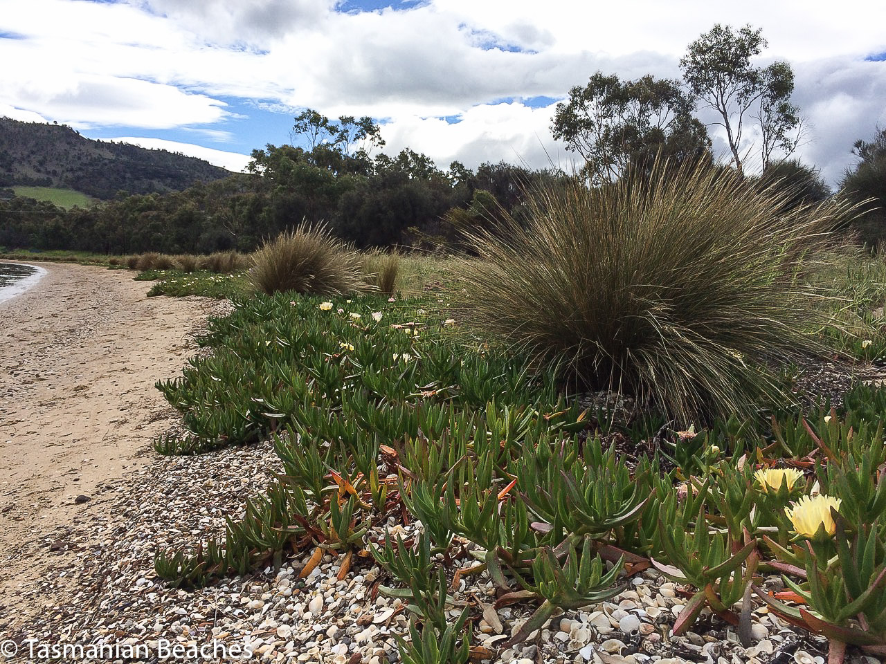
No amount of searching in the bracken revealed an onward path and so we took the dirt road down to Seaton Cove, another spot we’ve overlooked on our many visits to Bay of Fires. It was astonishing to come to a tiny, rather suburban looking enclave in the coastal forest after wandering through the bush, sometimes on paths and sometimes not. A camper van had settled in here (there is a little bit of camping space) but he was close by a short row of about five houses that looked like they’d lost their way to Launceston. Like Sloop Reef Cove, this is tiny and the boat drawn up on the sand, with only one motor, must rely heavily on good weather, particularly for its return trips, because there isn’t much room for error. It’s rocky here, both above and below the waterline and what beach there is has coarse granite sand and much kelp strewn about. I found some sea glass and a beautiful quartz pebble well polished by the sea.
But a well defined path led on past the bottom of the gardens, following the fence line, and back into the peaceful casuarina forest. Again the path grew uncertain. We’d lose the trail then find it again. Finally we found ourselves in a patch of sand surrounded by boulders and apparently isolated from the sea. Even here, so close to the sea, frogs serenaded near the small soaks in the rocks.
We had been walking along the top of these massive sloping granite platforms and boulders for some 500 m but they were getting to look familiar. Sure enough, we soon saw people on top of the huge boulders we know well – we’d made it to Cosy Corner.
We lingered here, feeling triumphant and wondering whether to head for the main road. It was getting on for 4 pm. This seemed an unadventurous option and so we turned around and walked back across boulders and through the bush to Seaton Cove. I was surprised on this visit to notice the beach was longer than I’d thought before, rocks dividing the cove into a north (hidden from the road in) and south side.
Looking south over north Seaton beach.
Again we debated resorting to the road we’d walked down before but there was a clear path we could see now, heading around the northern side of the cove at quite a height above the shoreline. We followed it, but it let us down and we got lost in bracken and fallen trees, just pleased it wasn’t snake weather. We could see the tree line along Sloop Point and so we clambered down on to the boulders then bushbashed up the other side when a gulch seemed impassable. Our trusty path finder took the lead. She invariably chose a route better than the ones we selected but she’s getting on and occasionally needed a helping hand over the trickier fallen logs.
This time our choice was clear – buoyed by our progress, we took the beautiful contour path we’d walked before. We reached a dirt road descending to Sloop Reef Cove but noticed the path continued across the road, above a few houses nestled in the southern corner of Taylors Beach. Orchids grew along here, pale purple and unassuming. It wasn’t long before we met the Gardens Road just above Taylors Beach and Sloop Lagoon.
This is the kind of walk I find the most exhilarating – a walk where the way is unknown and sometimes hides itself, demanding a degree of perseverance to continue, but offering up surprises – like another of those branch shelters that we’ve seen at Tinderbox, Dora Point and a few places elsewhere.
When you fly into Hobart’s airport, peninsulas of land and bodies of water spread out below. One of these watery stretches is the large, relatively shallow estuary/lagoon that forms Pitt Water Nature Reserve and Orielton Lagoon (east, and just off this map). The Coal River, Penna and Iron Creek pour freshwater into it.
This striking body of water is crossed by McGees Bridge and the Sorell causeway, both tethered to a suburbanised headland in the middle of the lagoon called Midway Point. It enters the sea between Seven Mile Beach spit and Lewisham.
I love the view coming in to land, love crossing the causeways, the seagulls hanging in the sky, the salt spray… but it’s not an area that I’ve ever explored. I last flew over it a few weeks ago, returning from a postponed yacht delivery in Queensland. This time I went to the map to find out more about it. The names of the places surrounding Pitt Water intrigued me – Shark Point Road, Penna and Frogmore Creek. It was clearly time to go adventuring in the lands of the Oyster Bay and Big River tribes. The Moomairremener band in particular, spent a lot of time around Pitt Water. Their presence is there in the middens and quarries they left behind.
At Midway Point we turned right along Penna Road and quickly found ourselves in countryside with the water to our left. Then we turned left along Shark Point Road.
This road runs along the northern shore. There’s a row of houses, some beautiful, others not, but if you don’t mind the sight of traffic crossing the causeway in the distance, then the northern shore is a secret gem. The dirt road takes a corner and heads north, up into farmland, home to Highland cattle.
Shark Point Road, it turns out, gets its name because this estuary is much loved by sharks, including the gummy shark. They come here to forage and to breed. It’s the nursery for their babies and while they’re unlikely to nibble a kayak I may put on hold indefinitely my plan to paddle its perimetre. In recognition of its importance to the sharks it was declared their refuge and no-take area in 1995. There has to be something in this for people, right? These sharks are fished commercially.
We turned around and sought out Penna Beach on this northern shore and found that it’s in a part reserve, part dog exercise zone. We walked down to it through tussocks and an astonishing diversity of weeds, including box thorn and boneseed.
White shells clad much of the beach and they’re there again in the soil profile behind the beach, along with a thin trail of pebbles denoting an earlier landscape. We figured this is the same shell layer that is visible at Ralph’s Bay, that beautiful embayment on the Derwent River. Strolling along its full, extremely skinny extent we also noticed that the rising sea had nibbled into the soils behind the beach so that only the roots of the tussocks and a depth of about about 10 cm of loam defended the land from the fluid invader gaining might millimeter by millimetre.
As we walked along we discovered some lovely little salt marshes and wetlands behind the beach, although some had an algal infestation. We didn’t see the little blue butterfly that forages here but we heard some brief birdsong emerging from the tussocks. I thought the area could have provided a wonderful habitat for nesting birds but I suspect there’s far too much human disturbance for them to make a go of it. It was only later that I discovered that this area is renowned for its salt marsh diversity and rare plant species.
With an oyster farm tucked into a corner of Pitt Water at Barilla Bay, as well as at Woody Island and Shark Point, along with other human encroachment, such as homes and causeways, water quality has taken a battering. At least forty different types of fish, including eels, seahorses, pipefish, sharks and rays have been known to glide beneath the surface, some enjoying the seagrass once prolific in the quiet shallows.
There’s a man who, between 1975 and 1995, came to know this area, it’s plants and animals well. Geoff Prestige watched as the banded stingaree, southern conger eel, shot-headed eel, rock ling, pipefish, soldier fish, rock flathead, king barracouta, weedfish and smooth toadfish, once prolific, became rare or vanished completely. He also observed snails and worms and molluscs, along with other invertebrates quietly vanish.
Once at least seven types of migratory birds flew here from Alaska to enjoy Tasmania’s summer. This estuary, since 1982, has been a RAMSAR site – in fact, the southernmost site on the East Australasian Flyway but given our interconnected world and development across both hemispheres, this hasn’t stopped numbers plummeting like a distressed stockmarket.
One little known fact about Pitt Water is that it is the home of a tiny, rare orange seastar (Parvulastra vivipara), one of very few anywhere that gives birth to live young.
People like to fish on the seaward side of McGees Bridge and they like to bird watch at Sorell Causeway and the Waterview Sanctuary. Levees have messed with the tides that supported Pittwater although there’s a bit more flushing happening these days. Farmers have spread fertiliser on their fields, fostering algal growth in the lagoons. Dams on the Coal River have stymied freshwater flow. Seagrass has withered.
This area really symbolises the way we are hammering the lovely world but here’s a small plus. On all the slender extent of Penna Beach I only found two pieces of plastic litter, and I thought that a small solace.
As I’d walked the Geography Bay beaches it had dawned on me that I was seeing very few birds. When I shared this observation with my friends most would think a little, then remember a couple of birds they’d seen on a rock the day before, or noticed on a beach they’d visited, or comment on seagulls that had been pesky down at the wharf.
This is very different from the year 1798, when Matthew Flinders estimated that there were at least one hundred million short tailed shearwaters within a single flock sighted in Bass Strait. They’re still Australia’s most common seabird but their numbers are nothing like that these days because of habitat loss and predation – especially by snakes and humans. (This Parks and Wildlife brochure explains more about these birds and their challenges.)
My friends’ answers perplexed me. I wondered if we’d normalised the low bird numbers we were seeing. Most of us don’t notice the loss of a particular birdsong from our garden because we don’t know the calls in the first place and we’re barely aware of our disruptive presence on birds when we wander along a beach.
One day earlier this year a notification arrived in my intray. Birdlife Tasmania was going on an expedition to Bangor, a well known farm on the Forestier Peninsula. There would be a beach walk and they’d be monitoring seabirds. I decided that this was a great opportunity to see a magnificent farm with 35 km of beaches and to learn more about shorebirds from those in the know.
And so I went along.
We were a group of about thirteen that hot day. A warm wind was blowing from the north east and then, in the afternoon (when we were at Swan Lagoon) the sea breeze filled in as is its wont from the south east, bringing a refreshing change.
Matt Dunbabin, the owner, met us and filled us in on the history and environment of the farm, telling us about the damage sustained in the bushfire two years ago and then we set off in convoy, travelling slowly over the farm tracks beside water, across Blackman Plains and through dry sclerophyll forest. We stopped regularly, safari style, to observe birds, to listen to their calls against the backdrop of silence. I felt humbled by everyone’s enthusiasm and knowledge knowing my own to be pitiful.
We came to the airstrip. On a hill behind the headland forming the southern end of Lagoon Beach there was a small wooden house and between this headland and its northerly, forested neighbour, but hidden by scrub, lay Lagoon Beach. It’s possible to camp here and people were. In fact, they’d been coming here regularly for the past 30 years.
The beach was irresistible and while the group broke up and went off to various spots to observe birds I set off to walk it. I was dismayed by the extent of the litter. ‘It’s the worst we’ve seen here,’ said the campers, stopping on their way back up the beach to talk about it. ‘No doubt those storms we had brought this mess in.’ I went back to get some bags and soon the group from WildWays, also a part of the group that day, were also picking up litter.
The campers certainly had a point. There had been storms and in fact 2016 has brought odd weather to Tasmania. When I drafted this blog post last summer, fires were still burning in the South West World Heritage Area and water storages had fallen beneath a mind boggling 12% through drought, mismanagement and a broken undersea cable that transports hydro electric energy to the mainland. Then, astonishingly, the north of the state was beset not once but several times by extremely damaging floods.
I saw oyster catchers, Pacific gulls and two hooded plovers as I walked along, sticking as close as possible to the water’s edge. The tide was up and the sand was mostly quite soft. The endangered hooded plover, a tiny, well camouflaged bird that makes its nest in a barely noticeable scoop of sand, breeds here and is susceptible to being wiped out by misplaced human feet, the sniff of a dog or a storm event.
Lagoon Bay beach
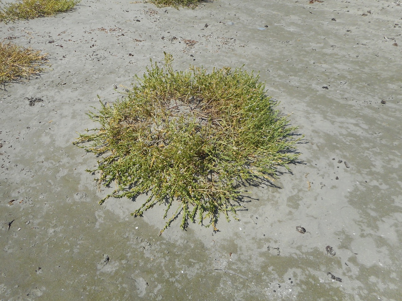
The beach was different from those I’d recently been walking. It was quite wide and apart from plastic bottles with Japanese print on them and other assorted plastic debris that hinted at fishing boats being the source, I saw an abandoned eggshell that testified to a new bird somewhere in the vicinity. There was a heap of kelp and sometimes the bones of fish, bird and possibly a marsupial. Growing over much of the beach was a prostate, four petalled plant, which I tentatively identified as sea rocket, a plant with an interesting back story. It seemed to be beach building, shaping the sand into slight dips and hollows and it was being thoroughly serviced by the bees – a bumble bee, honey bees and a small native bee were collecting nectar from its tiny flowers with quiet assiduity.
There is a small rivulet at the southern end of this beach, running along the bottom of the hillside. The campers had noticed discoloured water around here and a bad smell. Standing beside it I noticed a fairly empty Hills pesticide container (5l), the potential culprit. It seemed sadly ironic that this beach that would otherwise be so pristine, cared for as it is by environmentally aware owners, suffers, because of human carelessness, in this case probably coming from boats offshore.
It was on this beach that the difficulties posed for beach walkers by private land and rugged shorelines really hit home. TheList indicates land tenure so that bit is easy. Identifying owners is not, so private land poses an access problem for those of us keen to access hidden beaches, headlands and rocky stretches.
PART TWO
Two Mile Beach (Forestier Peninsula)
‘Two Mile Beach (T 299) is a gently curving 3 km long northeast-facing sandy beach located in 3 km wide North Bay … The bay is bordered by the prominent Cape Paul Lamanon and Monument Point in the north and 138 m high Cape Frederick Hendrick to the east. The beach receives refracted waves which average about 1 m at the shore and maintain a 50 m wide low tide terrace, cut by up to 12 rips during periods of higher waves. It is backed by a continuous foredune, which has a series of blowouts along the northern and central sections, some extending 200 m inland. The dunes are backed by 200 ha Top and Swan lagoons and associated partly drained wetlands, with Swan Lagoon draining out via a small creek at the southeastern end of the beach. Farmland borders and backs the lagoon, with vehicle access to Parrot Point at the southeastern end of the beach.’
I regrouped with those bird watching near the campsite and we were reminded of the importance of not going up into the dunes because of breeding birds. More soberingly, I discovered that the breeding season extends over spring and summer. Human summer holidays happen at absolutely the wrong time of the year for the birds and as for me, I mused yet again about how best to limit beach walking to autumn and winter.
If we were a kinder, less self indulgent species we would quarantine beaches, or at least a goodly number, so that birds are still capable of breeding, nesting and fledging their young. Our presence on beaches is a huge reason for breeding failure. There are beaches completely exempt to dogs or sometimes limited to particular times of the day but we put no restraints on ourselves.
About nine of us decided to walk up through the dry sclerophyll forest and down to Two Mile Beach. I had the most uncanny sense as we walked there of having been here before, on the wide track up through the forest, and I remembered how once long ago I’d gone with a keen birdwatching friend on a university ornithological weekend. Where the zoologists had placed a mist net back then had been so similar to where we were walking that just possibly it was in fact the same spot, given that we’d also gone to count shorebirds at Marion Bay, not that far from here.
Two Mile Beach was a vast, impeccable curve of sand – an irresistible walk. Far away it curved and ran out to a point. You could see the surf breaking on the rocks. But we didn’t walk it. We sat on the rocks, some of us in shade, some in the bright, hot sun and ate our lunches and talked, and I discovered that the youngest two members of our group originated overseas – one from Nepal and one from Canada.
A ‘tin dish’ that had been bobbing out in the bay came and anchored close to where we were sitting and the sole occupant began scuba diving along the peaceful reef.
As we began walking down the beach we noticed a few more things. Litter had been collected, and stockpiled in the corner. Fissure Island – it has a huge fissure separating its two sides one from the other – became visible around the headland.
Looking at the beach profile I think I figured out why dunes on this beach are also building and not receding. The kelp washes up. The sea rocket is nourished by it. It, in turn, nourishes secondary species, of which on this beach there was a profusion – the dunes were healthy and although marram grass was washing up it did not seem to be taking much hold… so many dunes around Tasmania have been damaged by the deliberate planting of marram grass, considered an asset back in the twentieth century.
In single file, out of respect for the birds, we walked carefully across the dunes to Swan Lagoon, brown and brackish. There were more bird species here – black swans, for one. There were hooded plovers on this beach, some juveniles too, and we counted and identified dead shearwaters – mostly Fluttering Shearwaters, recent arrivals from NZ, I learned, and increasing in numbers, as well as fairy prions and a little penguin. A juvenile Pacific gull with a damaged wing walked ahead of us, doing a short glide each time we got too near. On the way back, as we approached the end of the beach and it feared being cornered, it took fright and managed a longer flight out onto the water where it sank down amongst some other gulls.
It arrived and they departed and I thought it must have drowned because I did not see it leave with them and doubted its strength to do so in any case, and soon there was no evidence of any bird at all on that clear blue water. This passed without comment. My observation of declining bird numbers was taken as a given, the reasons well known. We discussed loss of habitat in places like China – either before or after this expedition I heard a man weep on Radio National because of the almost total loss of habitat for migrating birds along China’s Yellow Sea coastline. I was yet to experience the literally birdless skies I saw from the train as I traversed Asia and Europe by train and yet to read a report from Pakistan about the Indus Flyway (International Migratory Bird Route Number 4).
Again we sat on the rocks while the less heat tolerant members of our group ran across the sand and into the water for a skinny-dip – it was the kind of day and the sort of place that made a swim most compelling.
Bangor has a lovely restaurant, built after the bushfire, but we were all so engrossed in enjoying the lovely surroundings, both in and out of the water, on the beach and in the bush, that our progress out was slow and by the time we reached it, it was closing. I made a note to come back some other time to sample the wine and enjoy the oysters, at that particular moment in time being devastated by POMS up and down the east coast, just another unusual event down here in Tasmania and linked perhaps to the East Australian current flowing so much further south than usual.
I once had a friend who died far too young of breast cancer and sailed away to where the starfish are always pointing. Here’s to you, Vicky, the first woman I knew to buy her own yacht. Groundbreaking is difficult work to do.
As for me, I walked down the mountain one day last year, following the course of a small rivulet that not many Hobartians seem to know much about and wandered south down the western shore of the Derwent and around the corner into the D’Entrecasteaux Channel. It may seem a sequential endeavour but it hasn’t been, because over this period I’ve also walked north along the river and across it and explored the eastern shore, reached Fort Direction and gone out along the ocean beaches of South Arm Peninsula. I’ve gone alone, with friends, family and my dogs. I’ve spent a lot of time, thanks to my baggy old sails and the masthead fly, looking up at sky and clouds and birds, and at stars at night in quiet anchorages. I’ve also spent a lot of time looking down from Samos at water, it’s ripples and waves and bioluminescence, from cliffs to rocky platforms, from mud and sand into the earth’s crevices, at leaves and moss and lichen and under rocks, and in the pools where the communities of starfish live, their tiny pointers creating a lattice of directions.
I’ve strolled some North West Tasmanian beaches and responded loyally to the magnetic lure of the Bay of Fires and on the way back home I’ve reconnoitred the East Coast, pondering logistical difficulties for coastal exploring that’s still to happen.
Then just the other day I met a man who has nearly finished walking all the beaches between the Tamar River and the Freycinet Peninsula and I’ve heard of another who has walked the entire Tasmanian coastline thinking hard about birds and their diminishing habitat.
That’s inspirational!
It seems to me an empty exercise to tick off beaches although each time I find one that hasn’t been noted by Andrew Short* I experience a small thrill. Actually, whether it’s kayaking, sailing, walking or cycling I particularly enjoy it when it provides an opportunity to listen to the land and the water, learning to read them, losing myself in them, enjoying the whole unfolding of the coastline, the patterns that repeat, the intrusions, the formations that mystify, the dropstones, colours and hues.
Without exception I’ve returned home from every small local exploration seeking answers to a new question or mulling over a new observation. I’ve often gone back to some part of the coastline again and again, because I felt its call, or because I wanted to clarify something, or because I was seeking replenishment.
A beach is a shapeshifter. The beach you visit one day is never the same the next. All you can ever be reasonably certain of is it’s location and that is sometimes shockingly transitory too. That’s why a top 10 beaches is meaningless to me. Ultimately each one has it’s charm but the best is the one you know the most deeply; it’s moods, the way it changes through the seasons and the years, the way the elements combine to recreate it and the beauty that coastal wanderers leave behind them – adornments like shells patterned into something new and strange, zen cairns and the tipis made of sticks, so easy to miss inside the coastal forest. Sometimes they’re the abandoned shell of some small being or the delicate bones and feathers of a bird. That beach you know best is usually the beach that most changes you, and you it.
Before I record more D’Entrecasteaux meanderings I’m pausing to cover some of the other coastlines I’ve been exploring.
First to a beach on the Forestier Peninsula.
And that on account of the birds.
* Short, A.D. 2006. Beaches of the Tasmanian coast and islands. Sydney University Press, Sydney.
Up on the hills, Tinderbox Peninsula is often so dry it’s pretty reasonable to assume that’s why it got this name, but the story is actually more interesting.
In the early 1800s Joshua Fergusson, who lived on the land just above the beach, saw a business opportunity and planted tobacco here with a view to supplying the local pipe smokers.
Land that once belonged to Joshua Ferguson – this house was once his barn, according to the interpretive panel at the beach.
One day he found a silver tinderbox inscribed in French, an indication that some thirty years before early French expeditioners, perhaps with Baudin, maybe with Bruny D’Entrecasteaux, had visited this beach and most likely made a fire, and stood around talking, perhaps exploring a little. Maybe this tinderbox slipped out of someone’s pocket or maybe it was left on a stone and forgotten. There’s also a chance that it had been traded or that it had washed ashore. Regardless, it’s owner sailed home to France but the tinderbox remained in Van Diemen’s Land.
One day Joshua Ferguson came beach combing, picked it up, and thought, ‘I know – I’ll name this beach after it.’
Shipwrecks
Bruny Island may protect the channel from the vast fetch of the Southern Ocean but the wind can funnel up and down this waterway, aided and abetted by the hills and valleys, descending with rapid speed upon the unwary.
Tinderbox Beach lies close to the northern (Storm Bay) entrance and the gap between the island and Tasmania is particularly narrow and also shallower here. As a consequence, a few boats have been caught out and come to grief on its shore.
On 6 July 1822 a government vessel (name unknown) sailed from Hobart and capsized in Tinderbox Bay. Two men drowned.
On 21 May 1887 the Alice, a ketch, dragged her anchors and went ashore in Tinderbox Bay.
On 12 March 1925 the Rebecca, a ketch (but officially a ‘barge’), heading from Hobart to Strathblane, was overwhelmed off Tinderbox Point by a massive squall, blew out her mizzen sail and drifted on to the rocks. She’d been built by Thomas Inches and James McLaren further down the channel on the Huon River in 1853 and was owned by Edward Knight.
As a small group of yachts moor off just offshore, and as the channel is a popular place to sail, there have doubtless been more nautical dramas on this little beach.
Back in 1948 the Government planned a vehicular crossing between Tinderbox and Dennes Point. This made sense – it was reasonably close to Hobart and this is, after all, the narrowest point. But again a storm came raging and this put paid to that idea* and so this beautiful spot (along with Nevada Beach on the Bruny Island side) remains intact – in fact, more so than most others as Tinderbox Beach was declared a marine reserve in 1991.
Pilot Station
Up above the beach and a little to to east there used to be a pilot station at Pierson’s Point. This beach would have been a great adventuring place for the children living there, and for parents to relax or mess about in boats, in much the same way as today. For more about life at the station, see Bill Harvey’s remembrances on the Beach Stories page.


")