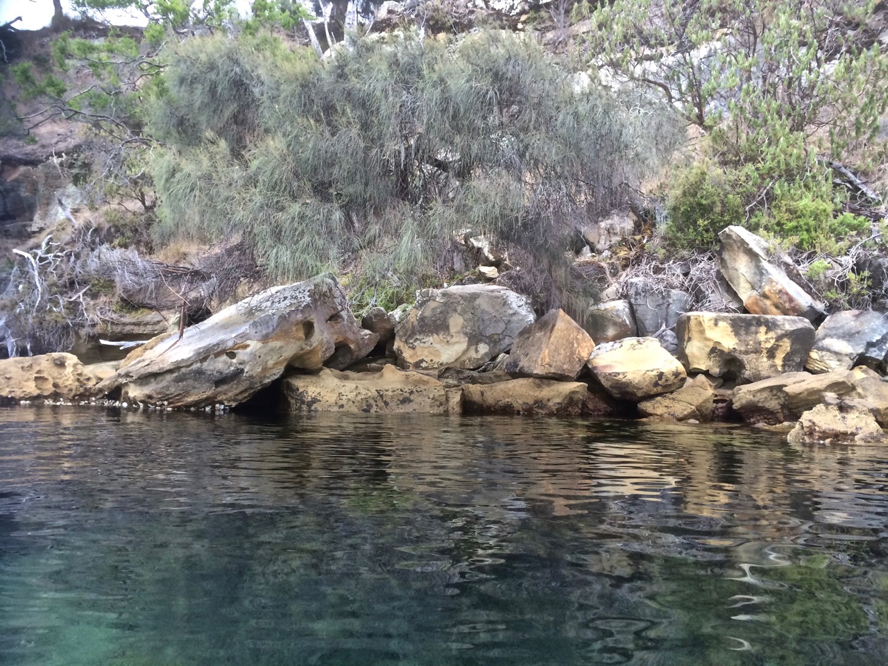
Coningham’s string of pocket beaches, notable for their boat sheds, are skinny, sandy and eroding. Where my kayak and I were carried ashore by a small, crashing wave I found a stormwater outlet and around it, supporting the slope and trying to buy it a little more time, sandbags piled on top of each other.
Beach erosion, Coningham (2017)
Coningham is one of Hobart’s small, outlying beach communities where weekend shacks have given way to full time homes for people willing to commute about forty minutes into the city. Because the beaches are largely backed by reserve and cliffs they aren’t that obvious from down on the sand, but higher up the slopes of Shepherds Hill there are long views across the bay to the Tinderbox Peninsula, the D’Entrecasteaux Channel and Bruny Island. Further off to the north kunanyi dominates the skyline.
kunanyi from Coningham
Little penguins have a tiny presence here, their numbers much reduced now that this area is more built up, the beaches less quiet. Once, two years ago as we sailed down the Channel just off Ranggoerrade (an Aboriginal name for North West Bay), we encountered a group of about two hundred penguins. It’s not uncommon to see or hear a couple out on the water but a flock that big was exhilarating.
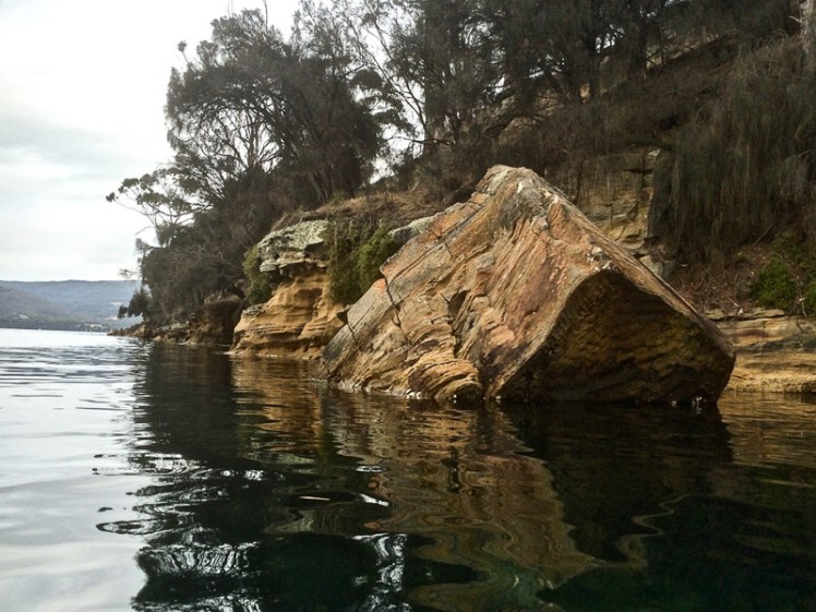
Where the beaches are backed by, or separated from each other by cliffs, they’re mostly composed of hard Triassic fluvial sandstones as well as some Permian marine siltstones (Sharples, 2014). I discovered, when I read this report, that Old Station Road leading in to Coningham is on reclaimed land, and that a small area of low-lying ground on the northern tip of Hurst Point ‘is the artificially lowered floor of a disused coastal sandstone quarry these days fringed by several boatsheds on the shoreline.’
During my first summer of sailing, a group of us once dropped anchor off Coningham Beach to while away some time in the sun. There were beach umbrellas and swimmers in the water and on the boat music and great company. The day felt perfect.
Then, a couple of months after my kayaking trip across Ranggoerrade from Dru Point to these beaches, I came back with a friend and we walked the Coningham Clifftop Track. This peaceful walk takes you from Legacy Beach up behind the cliffs and along the steep shoreline out to Snug Point through dry sclerophyll forest. It’s used by several endangered species, including the forty spotted pardalote and the swift parrot. There are blue gums and sheoaks, heath bent grass, gentle rush and tailed spider orchids. It’s beautifully serene until you reach the point. There’s a turning circle up there. It’s possible to peer down over the cliffs. There directly beneath is an ugly fish farm, that one that always seems to be in the way whenever we want to tack.
Andrew Short (2006) points out that Coningham’s beaches are reflective. He means that of all those beaches thrashed by waves, reflective beaches receive those waves with the least energy. The surf zone is narrow, as are the beaches, and their sand is coarse.
Here’s a quick list of the beaches using Andrew Short’s numbering system:
1. T478, (Clarks Beach, aka The Dog Beach) 150 m of north facing sand with some rock flats between two sandstone points.
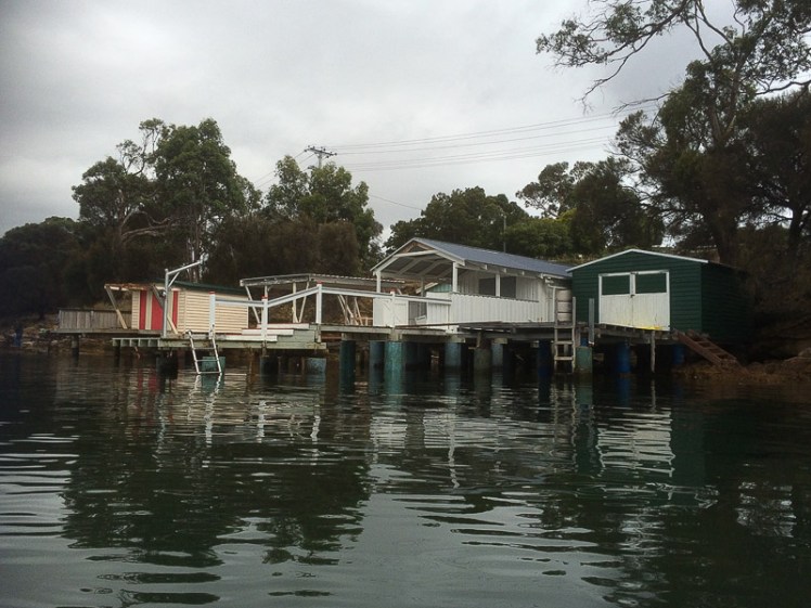
2. T479 (Little Coningham Beach) with its boat sheds. It’s in the next little embayment and is a bit longer than Clarke’s.
3. T480 (Coningham Beach) is on the eastern side of Hurst Point. It’s longer than the first two (about 500m), also has boat sheds and there are houses on the slope behind it.
4. T481 (Legacy Beach) 500m west of Snug Point, backed by forested slopes. It has cliffs and rocky platforms.
Sources:
Sharples, Chris & P. Donaldson (2014). A first pass coastal assessment for Kingborough Local Government Area, Tasmania. University of Tasmania, Hobart.
As I kayaked towards the next headland I couldn’t see a thing beneath the water because of the sea state and I was trying to angle the kayak against the uppity swell. Walking, a path may take you away from the shore. In a kayak, the sea state can keep you at a distance from it too. I was having to focus harder and unlike when I’d kayaked the Tinderbox Peninsula’s eastern shore with numb legs, this time I’d adjusted my pedals too far forward, so the only purchase I was getting was with the tips of my toes. Meanwhile, the fetch was increasing, the water was darker and deeper and the white crests were getting more numerous. There was a small beach, only accessible by boat, on the northern side of the headland. Waves were breaking on it. I’d come back and explore it another day, I decided, because I did not want to risk capsizing.
Snug’s Coastline on Foot
Snug is another place on the Channel Highway that I’ve habitually driven through en route to other destinations, except for once, when we’d walked up to Snug Falls in the forest behind the town one wintery day. Not once when driving did I bother to imagine what it was like when this area was the domain of the South East Tribe or what impressions D’Entrecasteaux, Bass, Flinders and their crews formed on those early expeditions as they made the acquaintance of this part of the bay, comfortably secluded beneath the Snug Tiers and fed by the streams running down from them. Not for a moment had I stopped to imagine a fishing fleet operating out of Snug or small freight ships visiting in the early 1800s. In fact, I had never even connected Snug with the coastline.
In the 1820s timber cutters did business here and farmers took up land. A tiny settlement began to grow, but bushfires destroyed it in 1854, and returned again on 7 February 1967 to repeat the performance. There’s a monument in remembrance of those who lost their lives.
It was only more recently, with my attention increasingly focussed on Tasmania’s coastline, that I decided on a whim one day to turn south off the highway to see if I could reach the shore of North West Bay. I didn’t notice that the road was, in fact, called Beach Road.
Footbridge across Snug River
It took me to the Esplanade and I found a caravan park, a footy field, a beautiful beach and and a peaceful little river. I was immediately won over by the way it curved around some lovely cliffs and quietly nosed its way into the bay between beach and headland. A little footbridge crossed it, providing access to the headland and so, without hesitating, the dogs (on their leads) and I bounded up it. There was a light drizzle. I soaked up the beautiful views. With Bruny Island at the opposite end of the bay it looked like an enclosed lake. There were a couple of yachts on moorings, the water was somnolent and a small motor boat puttered across it.
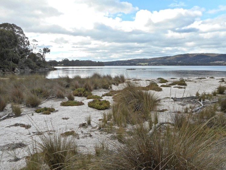
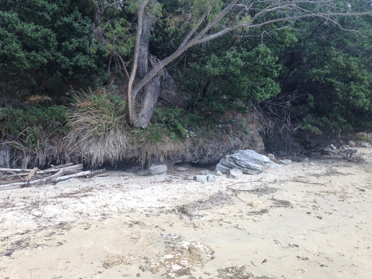
Snug Beach (T477)
Landcare have been doing careful work here and the beach was almost (but not totally) devoid of litter. It’s a lean beach and I think of it as green hued because of the green river and the thin strip of overlapping vegetation separating it from the road. There are no dunes, so to compensate there are neatly laid sandbags suggesting to the sea that it keeps back. Blackwoods grow right down to the beach. Of course, as the sea is swelling, there is coastal erosion because Snug is on a soft sediment plain cupped by sandstone slopes and there are rockfalls on the beach’s southern headland (Sharples & Donaldson, 2014)
Snug Beach: the view north Evidence of coastal erosion: trees losing their foothold
Walking Snug Rivulet
It was a foul day. Snow had fallen and then settled overnight, but been washed away by rain in the early morning, and apart from being bitterly cold the waterladen sky sagged. Grey misery pervaded the landscape.
‘I think this is a great day to go to Recherche Bay,’ said the geologist.
My preference was to sit by the fire with a book, but I was also curious to revisit rivulets, now in flood. As we visited previously dormant streams now grown powerful and active, I recalled the Snug River. This was the perfect day to walk its banks.
Snug River’s estuaryThe river broadens
We started at the coast and walked upstream around a leisurely bend. The tannin water, the reeds, and the river widening peacefully further upstream made for a pleasant stroll. There is a little wetland area with native grasses and reeds and a white faced heron and a large egret were enjoying the mudflats. We counted 22 hooded plovers there too and there was pink epacris in blossom, prickly moses, leptospermum lerigium, acacia dielbata, banksia marginata, eucalyptus amygdalina and sag. The multiplicity was greater than my botanical knowledge.
We passed two black pipes, side by side entering the river close to where I was now picking up litter – a dummy, plastic bottles and a cardboard drink container.
Rapids on the Snug River
Where the river narrowed there were rapids and somewhere along here the path left the wetland and we had to walk along the side of a road. There were signs about dog control – dogs on the loose have been destructive. The river is in close proximity to houses and it isn’t fenced. It’s not just dogs, it’s people too. The litter up here was disappointing.
A native hen swam the river, making use of more rapids further upstream, and as we walked along the bridge on the Channel Highway I saw two tiny black ducklings in the reeds below but could not see their mother. There was a track on the other side of the bridge that followed alongside the opposite bank and then meandered up a hill. It was the old main road, we figured, closed off now to vehicles. We were high above the river flats with a filtered view through eucalypt forest but still we were picking up litter – more and more plastic, more and more styrofoam, all heading incrementally down to the waterway and on out into North West Bay.
At the top there was nowhere to go. We didn’t realise we were in the area allocated to the Electrona Industrial Park. There were houses and a path in the forest nearby had broken bridges. Old car parts were strewn through the undergrowth giving it an abandoned, somewhat hostile appearance. There was no incentive to explore; we returned the same way and when we got back to the beach we crossed the footbridge and did the headland walk the dogs and I had done before, only this time we carried on walking alongside a seafood factory, wondering exactly what it was. We came to its entrance. A notice proclaimed ‘Ralphs’ [Tasmanian Seafood Pty Ltd]. There were piles of abalone shells, a bad smell and a lot of litter.
Another astute business man and this time an Italian migrant success story (if you’re the human and not the piscean abalone predators) because this company had its beginnings when Ralph Caccavo, a prominent Tasmanian businessman, began exporting live abalone to China in 1996. It is now the world’s largest supplier of live abalone caught in the wild, exporting more than 500 tonnes per year out of a total Tasmanian catch of approximately 2,600 tonnes. Ralph’s also owns government-issued abalone catch quotas in Tasmania’ (Company website).
We strolled up to the factory again more recently. The abalone shells were all neatly bagged up and there wasn’t quite as much litter lying about the hillside.
Abalone fisheries are in decline and several areas have been closed this year. In the D’Entrecasteaux, there’s a belief that at least some of the reason is because of fish farms. If a generous proportion of those 2,600 tonnes were still in situ, I wondered, would there be more birds? Would the ecosystems be more intact? One of those self-evident questions, really.
Surfing a Following Sea
I rounded Snug Beach’s southern point and turned into the next bay, rather muddy looking and quite triangular, with Snug Creek entering at its northern end. Out of the corner of my eye I saw a concrete post looking like a monument in the water, but actually just part of a substantial jetty that was now a ruin and maybe a reminder of the days when fishing was more active here. This was another area I wanted to return to because, also out of the corner of my eye, I saw an appealing boatshed on a thin muddy shore. But the swell pushed me, this time from right behind, and I was surfing down a following sea, the kayak’s prow burying itself in the wave ahead. It was getting to be far too full on for my liking and so I turned to face these swells rolling in from the D’Entrecasteaux because at least that way I could keep my eye on them and there was less chance of them knocking me over.
I did not expect much of Electrona, my next waypoint, because I remembered the community objection to the Pioneer Silicon smelter that was built here in the late 1980’s. The company actually only lasted three years. Profit eluded them and those industrial dreams crumbled.
The smelter had risen like a phoenix from the ruins of the Electrona Carbide Works with its strong link to the Great Lake up on the Central Plateau. This company, owned by James Gillies, who dreamed big and clearly had energy, was a motivating factor for the construction of Tasmania’s Hydroelectric Power Scheme. He needed power for his zinc smelting process and calcium carbide factory (built in 1917) and so he made it all happen.
He called his enterprise Electrona because of the electricity and electrodes used for smelting, but after the 1967 bush fires howled through and destroyed it, and demand for carbide kept falling, the company became insolvent and 250 people found themselves reshaping dreams of the good life and looking for work elsewhere.
I wasn’t thinking about wrecked dreams, huge ambition or job anxiety as I paddled passed. I wasn’t even thinking about the beach north of the marina – the one the swans had paddled out from. I wasn’t paying the shore much attention at all because I was tilting with white capped swells and that demanded most of my attention.
On Peggys Beach
To look more closely at what I’d missed, I came back on foot a couple of times and discovered that Electrona now consists of two areas, a residential community called Peggy’s Beach where most of the houses are reasonably new and a small industrial sector.
Where once there were workers’ cottages it’s now a quiet, middle class suburb with some particularly large houses up the northern end. But although it doesn’t look anything like an industrial suburb anymore, it still rubs shoulders with industry because up on the headland dividing the Peggy’s Beach community from Snug, the Electrona Industrial Park has a quite commanding presence on the skyline, and up there, on the road leading into the park, some of the more modest homes remain.
Peggy’s Beach (North)
There are two beaches on either side of the community’s northern headland and on the advice of some small boys with fishing rods coming towards us along a track, we took a path through bushland down to the beach on the northern side. It’s about 250 m long and faces east across the bay, and it’s a varied beach, in some places narrow, rocky and undercut, and in others lightly coved, then spreading out to create, at low tide, a lovely sandy zone much loved by soldier crabs. There are reeds and a wetland of sorts and it has a beautiful serenity on a warm day. Even though it’s not that long, we poked around for quite a while here, chatting to the mother of at least one of the boys with rods. They were heading out in a dinghy to fish for flathead but she lingered on the beach and shared some local information.
Peggy’s Beach (N)
What I liked in particular was the way the coastline weaved an irregular line and it was a great place to cast your mind back across the Holocene, because there are artefact scatters and traces of midden and we also found the silcrete quarry that it’s likely the Mouheneenner and / or Nuenonne used back in the day. Now it’s protected by the Aboriginal Relics Act 1975, so we looked and contemplated the quarry in particular, then walked gently on the beach, not wanting to crush the armies of crustaceans clicking their way across the sand. This beach extends northwards until it reaches the Margate Marina and it’s a shame that this marrs the view a little, as this marina is more of a working boat yard.
Peggy’s Beach (N): Margate Marina visible in the distance
A walk around the headland in a southerly direction leads you to Peggy’s Beach (S), or beach T476, in accordance with Short (2006). I accessed it once via the track around the headland and on a different day by taking a path between houses. It’s short with a slight curve, backed by a rather weed infested hill that is crested by houses. It’s constrained by the headland to the north and to the south by a point that has been industrialised by Tassal. They’ve got two fish pens about opposite a stormwater, it seemed to me. Depending on where you’re standing (or kayaking) these pens don’t look that far off the beach and although they’ve been there each time I’ve visited, perhaps they are in fact empty. Still, the beauty of the beach is compromised by its proximity to aquaculture.
A deep strandline of seaweed on Peggy’s Beach (S).Fish farm activity off the beach with Coningham in the distancePeggy’s Beach (S) on a still day.The view north from above Peggy’s Beach (S)
Driving along the Channel Highway in this vicinity, I’d seen a sign that said Sunshine Industries and it’s supported by some text that is possibly in Mandarin. I couldn’t see where this company was actually located and so I searched the web and discovered that in 2005 five acres of land had been bought on the bay by a Lendlease Project Manager, Jeff Hunt, who had turned it into a company called Coastal Waters Seafoods. On his Linked In page he says he was ‘the sole Director & Secretary, CEO, Contract Administrator and tank Room Manager and built the company from Nothing to a $35m turnover per annum’ – and that he became Tasmania’s second largest exporter of abalone and lobster – ‘by 2012 [he was] exporting over 200 tonne of abalone and 100 tonne of southern rock lobster to Shanghai, Guangzhou, Shenzhen, Taiwan, Japan and Dubai’ (LinkedIn). In 2013 he sold it to a Chinese company and it’s now known as Sunshine Industries.
The southern headland is also better explored on foot but on the day I kayaked this stretch of coastline I was relieved to find that on rounding it I had at last reached Snug and that Coningham, my final destination, looked a whole lot closer.
Note: Like other parts of the coastline I’ve walked and kayaked, there’s a lack of certainty about the nomenclature. Getting conflicting advice about which beach was the actual Peggy’s Beach, I’ve referred to them as North and South, but the northern beach is in Barretta Bay and prior to construction along this shoreline may have been part of one beach around the embayment. (It’s confusing!)
I was back on the little Margate beach just south of Dru Point ready to start on my second expedition in North West Bay. The beach was kayak friendly on the high tide, and I put in there while the ducks looked on and the cormorants held out their wings, enjoying the sun.
The water was clear and shallow. Sunlight made silver waves along the bay’s floor. I paddled over seagrass and a variety of red seaweeds, then through the moorings below the Esplanade (a narrow waterside road backed by a few houses) and within minutes I was at the Margate jetty.
There are two large jetties on this point and they both had fishing boats alongside. I slipped by them and found myself in a small, sombre bay where the aquatic flora looked unhappy. They were competing with a hazy looking algae that seemed to be a stranger amongst them and in the middle of the bay there was an accidental fountain around which a number of bemused seagulls were bobbing. It seemed to be caused by a pipe linked to one of the aquaculture businesses here.
Where there are boats there is diesel and bilge water, the possibility of sewage and waste water and other contaminants from anti-fouling and the like and I figured this might be the reason for the bay’s poor appearance. However this little bay was about to give me a far bigger education about pollution, profits and so-called pristine environments.
Behind the Jetty: Where Fortunes Are Quietly Made
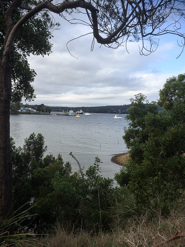
View of the Margate Jetty from the Dave Burrows Reserve
From my kayak I’d never have noticed that in this modest, rather bushy area there’s a place called North West Bay Maritime Park where fortunes are being amassed, but I came here one day in a light drizzle to look around on foot and discovered that behind the jetties there are a couple of thought provoking buildings.
One belongs to Tassal. They own that fish farm off Wingara and the northern jetty seemed to be linked to their operation. Their neighbour is a business linked to one of Tasmania’s wealthiest men, Allen G Hansen. He started the Tasmanian Seafood Companyback in 1969, arriving from Wisconsin with a colourful history and $16,000 in his pocket. Those dollars had expanded into a fortune of $211 million by 2008 thanks to his abalone, sea cucumber and whiting business, and for a while he was amongst Australia’s richest two hundred individuals. That southern jetty looked to be the one his company would use.
OH&S, Environmental Destruction and Overfishing
Tassal receives community flack for habitat destruction and, as this ABC News article (2015) indicates, abalone divers also point to salmon farming as a significant cause of environmental destruction impacting on their livelihoods.
The Tasmanian Seafood Co keeps its head down and on its website it gives little away about how it operates, but the death of a diver in 2007 brought the company’s poor OH&S practices at sea to the attention of the coroner (SMH 16 Jan, 2010) and according to this article the company did not believe it held any responsibility because of the sub-contracting arrangement it had with divers. The Code of Practice on the Worksafe Tasmania website is dated 2002 and does not directly address the issue of overloading boats.
Locally, the Dept of Primary Industries, Water and the Environment regulates the abalone fishery. and they provide access to the IMAS Abalone Stock Assessments reports.. The agency is clearly concerned about the decline in stocks because they have closed some areas. But is it enough? Tasmania’s economy relies on abalone export and salmon farming creating a conflict of interest for the government, who is also the regulator, and there’s a history here of overfishing and its associated environmental consequences. The monitoring is improving, but it’s got to be dire if abalone divers are alarmed.
Giving and Taking
Alan Hansen contributes to sports clubs around his rural home town of Smithton in the North West of the state, and he’s received a citizenship award for this, but I wondered how much this company does to demonstrate gratitude to the marine environment that has extended generosity to the point of exhaustion in enabling him to amass his personal fortune? The website doesn’t mention any reciprocity extending back in this direction. There’s no mention about sustainability either.
Collapsing Fisheries in Pristine Environments
This bay, where these seafood companies have a home, is certainly not pristine although the waters where Tasmanian Seafood gets its abalone from apparently are. Their website states:
But that’s not true. Plastics, often attributed to fish farms (including Tassal), wash up on the shores off which abalone are taken and nanoplastics are part of the food cycle now. The latest 2017 Institute of Marine and Antarctic Studies report on the fishery as at 2015 provides a history of the industry, indicates an overall decline of abalone in Tasmanian waters and comments on the impact of climate change.
I explored up a dirt road close by. Behind a high wire fence an alsatian guard dog went crazy and I backed off. It was intent on protecting what looked to be Tony Garth’s Seafood Company. It specialises in rock lobster and scallops and they come from the ‘pristine waters of Tasmania’ too. They’re another company with the briefest of websites, but they have a more open presence on Facebook and they sell both locally and internationally, whereas, until recently, Tasmania’s commercial abalone landed up on foreign plates.
My perspective of North West Bay had changed significantly. I now knew a whole lot more about abalone. Out of interest, the take of recreational divers is less than 2%.
Industrial pipes crossing Tramway Creek
The Dave Burrows Reserve
The Dave Burrows track starts just east of Tramway Creek (although there’s a link to Beach Road if you want a longer walk and, in fact, you can begin this track from various spots around Barretta, the area between Margate and Electrona).
The track meanders through remnant bushland following the edge of the water and where that fountain was spurting skywards was in the same bay that Tramway Creek flows into. There’s a little bridge that crosses that damaged creek with its infestation of crack willow.
Companies Despoiling Their Local Environment
That’s where a couple of black pipes are horribly visible in this reserve, sloping down the hillside beside the creek and crossing the creek in an anti-social fashion. It was hard to figure our who owned them. They look like in-take and out-take pipes, but I can only speculate, and as I tried to figure it all out it occurred to me that if water is taken out of this bay, what’s it being used for? Signage would help the public to understand. It’s surely not for use on shellfish or fish taken from ‘pristine’ environments, because that bay is dirty and it would further muddy the concept. All I know for sure is that it was visually unpleasing and if those pipes broke they’d make an even bigger mess of that hillside than it currently is, despite the good efforts of the Derwent Avenue Landcare group that tends the reserve.
These pipes may been the cause of the fountain in the bay. The closest company appeared to me to be Tony Garth’s Seafood, but I wasn’t risking the alsatian to find out for sure.
Boats and Bays
As for the beach, it looks south east. It’s skinny and its sand is dark but it has cliffs and still manages to look quite pretty. There was a low point on the southern edge of this bay where a couple of dinghies had been hauled up on the slope. Then the shore curves around and runs a little further along the base of some cliffs composed of soft tertiary sediments* that are prone to slumping. After that the path ran behind a thin cobbled beach to another point.
Coastal erosion and cobble beach detail*
I crossed a tiny rivulet and then noticed houses behind a sandy beach, with the Margate marina visible in the distance.
Barretta Bay dinghiesRivulet enters the next bay along. Margate Marina to the south.
This walk took all of 40 mins but it meandered through pleasant coastal woodlands, with traces of middens. That day four seagulls and a crow represented the avian nations at Baretta Bay, but plovers and magpies inhabit the suburban streets behind it and botanical discoveries made up for the empty skies.
Funghi & Eucalypt
Barretta by Boat
That was the sum of my exploring on foot, but sitting there in my kayak. I left the bemused seagulls to contemplate the fountain and paddled out of that quiet, degraded bay, hoping that beneath the water Spotted handfish might still be quietly living their benthic lives, hunting for crustaceans and worms while walking on their ‘hands’. Locals comment that you could once stand in knee deep water at Barretta and see pipefish and seahorses, but that’s no longer the case.
At the time I did this kayak trip I had no notion of the geography of this area and though I searched for names on maps there were few to help me. From this point to the Margate Marina (which isn’t really in Margate) I’m filling in the blank on the map by simply calling it Barretta Bay – but I’m happy to be corrected.
The water was reasonably calm but a south easterly breeze was producing the odd white cap as I proceeded along the shoreline. I was keeping an eye out for birds, but yet again I wasn’t seeing anything.
A 2011 study (Mount & Otera) showed that seagrass habitat in North West Bay had declined over a period of sixty years, with big changes happening in the mid-1980s. Barretta was singled out for attention.
The State of the D’Entrecasteaux Channel and the lower Huon Estuary report (Parsons, 2012) considers North West Bay ‘at risk from nutrient loading due to high terrestrial inputs of nutrients and reduced flushing times.’ It also states that it ‘experiences turbidity values far in excess of the upper national guideline value during high flows of the North West Bay River’ and that ‘dissolved oxygen (DO) levels in North West Bay are variable and have dipped as low as 58% saturation in bottom waters during summer, reflecting poor environmental health.’
The report goes on to say that ‘occasional elevated values of contamination highlight the vulnerability of some beaches … due to short‐term spikes in bacterial loads’ and ‘heavy metals are also elevated in sediments in deep, silty areas of North West Bay.’
So probably not the best place to farm fish, I was thinking, as I paddled along a Baretta beach and saw ahead of me another stretch of sand that I figured was possibly accessible on foot. This was good to know because there was a strong current keen to push me ashore and given that the swell seemed to be increasing by the minute, I was keen to nip around the next headland and arrive safely on Snug Beach.
The Baretta beach north of the Margate Marina (a facility on the southern end of Barretta).
Not Snug Enough
I reached the marina. There’s a tiny north facing beach here where I found a multitude of what I think are New Zealand screw shells. They’re pretty but a pest. This small beach is isolated from the rather lovely beach south of the marina although once they would have been a single beach.
Now, as well as the marina and boatyard, Tassal has a building here too and so does an engineering outfit. I walked south to the boatyard to work out the geography. There were swans off that lovely southern beach, several pairs, with reeds behind them and some large houses on the hillside. Where I was standing in the boatyard the water was clear but awfully stinky and there was a lovely view of the bay from another new perspective.
My geography had let me down. Those houses were the beginning of Electrona, not the country town of Snug at all, and when I rounded the headland I found myself back in the middle of aquaculture activity – two fish farm pens were just off the beach, opposite a stormwater drain, and close to the slipway, so presumably they were empty. There was a large somewhat industrial looking building and a whole lot of parked cars on the hillside. I figured that if it was public access I might be able to walk down to that small beach below the slope some other day – but when I did eventually go looking my way was barred by a locked gate. It was another Tassal site.
Beach on the northern side of Margate Marina
** See Sharples, C and Donaldson, P, A first pass coastal hazard assessment for Kingborough Local Government Area, Tasmania, Kingborough Council, Tasmania (2014) [Contract Report] for information about the geology.
Continuing the Journey Around Ranggoerrade: Heading for Dru Point
Cliffs north of Stinkpot Bay
Dangerous Encounters with Gulls
I drifted out of Stinkpot Bay and paddled north. As I approached a corrugated metal boat shed the ‘owner’, a seagull, flew above me, screaming warnings, while using a novel approach to keep me at bay. Not wanting to take a direct hit, its missiles hitting the water beside my kayak, I paddled around the point, somewhat aghast, aware that the alarm had now been taken up by two plovers, who joined in the shrieking then quickly shot off, careful not to fly beneath the heavily loaded gull.
Beware seagulls on military missions
Birds of the North East Corner
The bay shallows out up here and I found myself in just a few inches of water . When the tide is out, I figured, this would be an expansive stretch of muddy sand but it was tricky to determine whether it really constituted a beach. I floated past Villa Howden, just visible between trees. Three pied oyster catchers were hanging out on a rock, and I was kayaking like a handfish, my paddle useless now because it was so shallow. If I’d had to get out I’d have sunk into the unforgiving mud.
Approaching the north eastern reaches of the bay
Then I was back along cliffs, different layers of rocks sandwiched on top of each other, a little unconsolidated, and the water a little deeper now so that I could go closer in. Three pied oyster catchers, presumably the three from earlier, were now lazing companionably on a slipway and a cormorant was snoozing on a buoy close by. One of them emitted cautious alarm calls about my arrival* for the cormorant’s benefit and I watched her rouse herself and start looking around frantically as I floated by, not conscious of my presence. Still unable to determine the danger, she departed in a rush anyway, but the oyster catchers, calculating my progress, followed in a more leisurely fashion a while later.
I was ready to turn west. The beautiful serenity dissipated because I was close to the Channel Highway. There were paddocks and then Margate itself, but the shape of the watery world was entrancing, full of rushy islets separated by shallow channels and in them the water was still.
Walking in the vicinity of North West River
I took a punt on the third channel, heading along with my rudder up and spotted the North West River entering the bay. I’d walked to about this point in the virtual company of my sister several days earlier, and from her different continent she’d enthusiastically told me discomforting stories of misadventure that had me looking over my shoulder as I navigated the lonely muddy shoreline beneath the park’s deserted cliffs.
On that day that I walked with my sister’s voice in my hand, I’d passed the playground, walking along a tendril of beach sand and then along dark cobbles with oysters glued to their sides and then along stretches of succulent salt marsh.
I’d negotiated exposed rocks in dark mud and heard a chorus of tiny noises that I think came from the invertebrates living down muddy tunnels, and I’d seen a grey heron, no doubt one of the two I’d been watching on this kayaking trip.
I’d expected to see a vibrant range of birds from my kayak but even in the less well frequented parts of the bay this was not the case. Seagulls were the most prolific; I saw twelve, but no sign of the penguins that hopefully still inhabit the bay.
The water beyond the river mouth was glassy and a whole lot deeper in these tussocky channels. I encountered three pairs of black swan and two pelicans (probably the same ones I’d met on my walk) and then I turned south west to head around Dru Point. A lone pied oyster catcher watched me go by.
The heron reappeared while I was kayaking briskly over more oyster laden reefs. There were people near the jetty and the boat slip and the sea breeze had just begun arriving. I made a dash through the moorings and raced along to my arrival point, the most western beach along the Dru Point road, a muddy little thing frequented by ducks.
Approaching Dru Point
Although I was stoked and keen to continue the geo had the final say: ‘Enough,’ he said. ‘You can kayak the rest another day. ‘ It seemed a reasonable request. The trip had been sublime. It had taken four hours, but had felt like only one. I just wasn’t sure when I’d get another chance to come paddling on Ranggoeradde.
I left Wingana behind me and drifted on down the bay, feeling elated. I was discovering coves that weren’t evident from the road. Their beaches were private affairs, apparently enjoyed only by the people living in the houses directly above them and given that the tide was high, they were merely thin lines of sand, often covered in the red seaweed I’d seen earlier and sometimes there was no beach at all, except that I’d be floating over expanses of sand that on the low tide were probably exposed. In one small cove a pair of horses stood staring at me. I passed a green shack and glided over its beach. I paused beneath a house on a cliff to inspect the rocky shoreline. There was a party happening up there and they had no idea I was drifting along savouring their bay. In the water tiny fish were jumping and the grey heron that had been leading me down Ranggoerrade flew off again as I drew closer.
I loved discovering boat sheds along the edge of the bay. I hadn’t realised there were quite so many.
Around 10.30 am I came to a change in the cliffs. They looked, to my ignorant eye, to be a dolerite intrusion and I discovered a picturesque grouping of boat sheds close by.
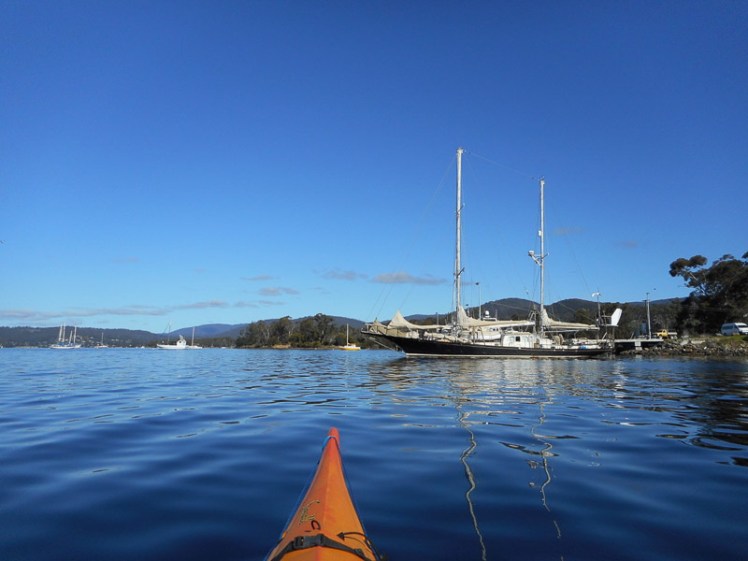
I was now nearing the moorings and a man, knee deep in the water, had one hand on his tender, and was about to head out to his yacht. He greeted me, and that was the start of a long, interesting boating conversation. It turned out we belonged to the same sailing club and that we both had Catalinas. It turned out that unlike my local, small scale adventuring, he had just returned from cruising the Pacific. We talked about yachts and our boats’ pointing capabilities. We talked about the bay and the midweek races and then I kayaked away towards the next cove. ‘Perhaps I’m getting close to Stinkpot Bay,’ I was thinking, when I was actually right in the middle of it, wondering where I was, and looking up at a house I should have recognised instantly. It just goes to show how different a place can seem when you approach it from the water… and when you are thinking about what it would be like to cruise the Pacific yourself.
Stinkpot Bay
Stinkpot is a bay with character and its shared by three houses. A small rivulet flows into it and the beach seems to be uncertain as to whether it wants to by sandy or muddy. This makes it popular with crabs, who walk it on quietly clicking legs, but difficult for humans to avoid squashing the inhabitants in their underground bunkers.
Stinkpot on a low tide
There’s a short walk from the road to Stinkpot Point. It’s all of 5-10 minutes, but once you’ve sat on the rocks at their furthest extent, it’s easy to become transfixed for a long, long time. The sandstone cliffs show off their beauty here too and the view of the moorings, the bay and the surrounding hills is pretty idyllic. As for how it got it’s name, Placenames Tasmania records it to be ‘from the smell of rotting seaweed.’ But Stinkpot is also a term of endearment and an alternative name for the Southern giant-petrel, and as it’s definitely a stinkpot if you’ve grown up here and that lovely bird is having a hard time of it when it comes to long-line fishing and the ingesting of plastics, I prefer a combination of both these alternative facts when it comes to this particular Stinkpot’s nomenclature.
The geo, the dogs and I had come here a few months earlier. It had been late in the afternoon, the bay pensive, the tide low enough for us to wander out across the rock platforms, stopping often to contemplate the sandstone cliffs.
Wingara: rock platformThe tiny pockets in the rocks provide protection for the periwinkles, who, along with other hard accumulated matter, weather the rock into these patterns in first place, with the assistance of water
I had seen some beautiful sandstone during my walks, but these cliffs were pretty impressive. Stratified sandstone with swirls of colour reminiscent of the Painted Cliffs on Maria Island. There is honeycomb weathering and some of the features almost look like petroglyphs. There are eroding, unconsolidated soils beneath higher, firmer layers.
We’d walked slowly. It is the kind of place that draws your attention to small details.
This slideshow requires JavaScript.
In the cold remains of the day, we’d had a cup of tea. It allowed time to absorb the landscape.
Still bay with cup of tea
Now, the geo called across the water to me in my kayak, to tell me I was taking an awfully long time. It was true. I was moving across the water like a chameleon along a branch. Along with pausing to look at cliffs and coves, I’d watched tree martins hunt the air above me, and I’d been trailing a grey heron who’d finally met up with a partner in a cove that had a thin beach covered in red seaweed. They’d hung around together for a while, then one flew south and the other had flown north ahead of me. Four plovers had shrieked warnings, two seagulls had glided by on the breeze, I’d seen a lonely oyster catcher and a couple of cormorants near the jetty. That’s not much birdlife, all things considered. I was hoping to see more as I continued up the bay.
As a kookaburra’s voice rang out from one of the trees, I set off again, bound for Dru Point.
What my kayak and I discovered in Ranggoeradde [North West Bay]
The Tortoise and the Elephant
Cliffs passed as I entered Ranggoeradde
And so I left vibrant Tinderbox Marine Reserve behind me and turned into Ranggoeradde, better known as North West Bay. Calling it by a name so redolent in history restores something of its original character, despite the fact that it has been stripped of its myths and stories and the people who told them aren’t really recognised anymore.
Fallen giant
A lot may have been lost in translation. It’s easy to withhold, mislead, confuse or misunderstand when it comes to words and their meanings, particularly when the relationship between the teller and the person with the quill is untrusting, or uncertain at best. Ranggoeradde may not have been properly translated at all.
It’s a low energy embayment of about 2,000 ha. and it now lay spread out before me. It’s eastern shore is also the western shore of the Tinderbox Peninsula and it’s easy to forget this as you wander about this area. There’s a long winding road that feels its way down that particular edge of the bay, past a number of Howden houses set in big blocks of land, a couple of small bays (somewhat muddy) and a bus shelter that doubles as a local book exchange or perhaps a community library. It’s a good road to cycle but it’s still on my ‘to do’ list. It’s a good area to walk too, and on this eastern side there are three spots of interest: Wingara, Stinkpot Bay and the Peter Murrell Reserve, and I was heading to Wingara to catch up with the patient geo.
The further I went into the bay, the more I noticed that diversity beneath my kayak was diminishing, and I realised that this bay is like a tortoise trying to support an elephant on its stoic little back. It carries the suburb of Howden, the country towns of Margate, Electrona and Snug, as well as Conningham, where shacks along a short series of sandy beaches now make up something of a commuter suburb.
The North West River plummets down the southern slope of kunanyi (Mt Wellington) and when it happens to be dry its bed gleams with large, pale boulders and when it’s in flood it’s strength is so awesome your breath catches. It enters Ranggoerrade, and so does the lovely Snug Rivulet, hugging its secrets to itself in a dreamy sort of way, a perfectly beautiful miniature estuary. They, along with various rivulets entering the bay, carry local litter, grey water, toxins and the like. That’s more than enough, but there’s a fish farm here that ups the nutrient load, a bit of light industry (pre-cast concrete and glazing), a seafood factory and a marina, moorings and a boat yard as well as a sewage works. (Jordan et al. 2002) as cited here.
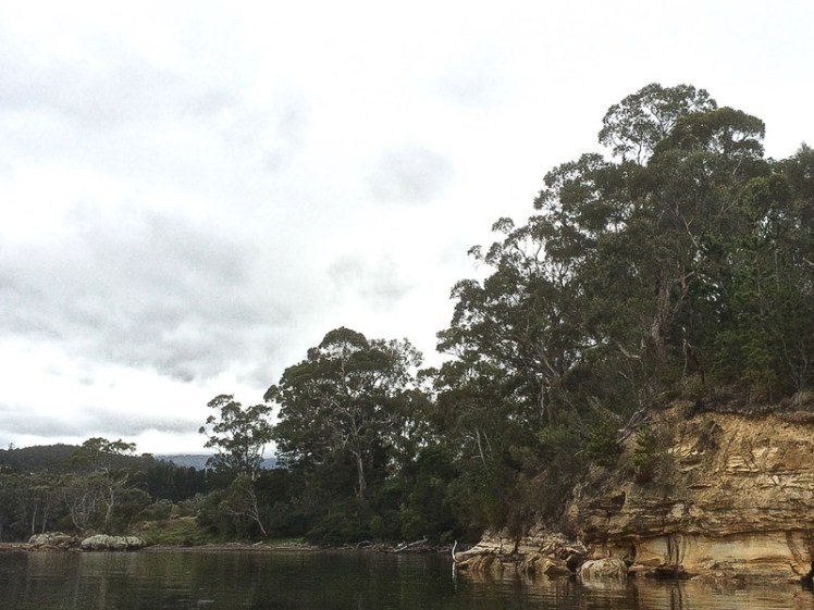
It wouldn’t take me long to reach Wingara, I figured, but then I saw the sandstone cliffs and my speed slackened off again. They were stunning and I got snap happy. Never high, they sloped downwards, eucalypts and grasslands above, and gave way to a cobbled shoreline.
Weathering artistically – when geology morphs into art form
Andrew Short (2006) doesn’t mention beaches on this side of the bay in his inventory of Tasmanian beaches, and I had flipped my strategy for exploring beaches. Instead of high tide, for the D’Entrecasteaux and kayaking I wanted high tides, expecting mostly muddy shores. That’s why, on this trip, I sometimes floated above beaches drowned by the tide and gazed at ancient ones laid down in the sandstone’s stratigraphy. I came to a cove with a private beach and tried that lifestyles on for size.
The quietude of private beachesOnly rec fishers! For a moment I thought they were fish farm workers out to bust me for straying into fish farm watersThe bay spread before me but below the water it wasn’t so uplifting anymore
It was as I paddled along the shoreline beside the fish farm that I really noticed the decline in seagrasses and seaweed. From the fish farm and that first house on the shore, it became less interesting beneath the water but the cliffs were awesome. Sometimes I had to go out a little wider to avoid the ‘bommies’. Occasional the kayak scratched as I went over them in too shallow water. I was constantly lifting my rudder.
I negotiated the fish farm and the Wingara jetty, passing cormorants holding their wings out to dry. The geo was standing on the rocky platform staring at the cliffs. So far, it had been an absorbing paddle, but I thought how westerners accuse some of the cultures amongst whom they’ve settled their flagpoles of not planning for tomorrow. We haven’t necessarily recognised that actually, we are the ones that haven’t planned for tomorrow in the most significant of ways. We’ve used up ecosystems like their isn’t going to be one. We’re the destruction and destruction doesn’t give a damn. That’s why all around us there are tortoises balancing elephants.
~~~~~~~~~~~~~~~~~~~~~~
A little more about this tortoise and that elephant:
The State of the D’Entrecasteaux Channel and the lower Huon Estuary report (Parsons, 2012) states the following about North WestBay:
At risk from nutrient loading due to high terrestrial inputs of nutrients and reduced flushing times
Experiences turbidity values far in excess of the upper national guideline value during high flows of the North WestBayRiver
Dissolved oxygen (DO) levels in North WestBay are variable and have dipped as low as 58% saturation in bottom waters during summer, reflecting poor environmental health
Occasional elevated values of contamination highlight the vulnerability of some beaches and other recreational sites to short‐term spikes in bacterial loads. Primary areas of concern in recent years include Margate and Snug
Evidence of environmental legacy issues at the former heavy industrial site at Electrona, although measures have been implemented to mitigate impacts on the Channel
Heavy metals are also elevated in sediments in deep, silty areas of North WestBay
Kayaking towards North West Bay along the Tinderbox Beach reef
I don’t like cold water and so I’ve yet to dive at Tinderbox Marine Reserve, but early one morning, after driving through the sleeping suburbs, I slipped into my kayak at Tinderbox Beach, while Tassie hens ran erratically amongst vocal sheep on the hillside, and made my way over glassy water and through the moorings, which had trapped a humpback in 2014, until I could almost touch the rocky shoreline.
Kayaking through the moorings
I’d already kayaked the start of it, as it begins at Lucas Point on the Tinderbox Peninsula, but that water was deep and choppy. It was intoxicating to know that beneath me seadragons, pipe fish, senator fish and the like were enjoying small sea caves and a wild proliferation of over thirty seaweeds. There is a multiplicity of invertebrates down there – bryozoans, sponges, and anemones – all supported by a sandstone reef and a soft sandy channel bottom, perched atop eons of earlier landforms, neatly stratified according to the roar of time.
To the east, behind me, the Channel opened into the Derwent River and Storm Bay, but I was heading for North West Bay, aiming to do a circumnavigation. When the geo had asked me how long I’d be, I’d answered vaguely. It wasn’t far to the bay from Tinderbox Beach, nor around it, I supposed. I’d walked quite a lot of this route on various earlier occasions so I had a fair idea, but what I soon discovered was that it was so visually stunning that I had to remind myself to paddle. Tinderbox is not a marine reserve for nothing. I’d float over great boulders covered in oysters and a plethora of other lifeforms. I’d stare down at gardens of seaweed interspersed with red waratahs.
Underwater diversity
‘Oh my God,’ I repeatedly recorded, ‘This is just so beautiful.’ And although they are not coral bommies, I started calling these underwater boulders by that term anyway, because it was the word that came closest to describing their coral-like magnificence. Sometimes merely a skin of water lay between me and the boulders I was gazing down at and my kayak was notching up it’s experience in scratch marks.
Tinderbox Reef seaweeds
What was particularly satisfying was that hugging the shore I could still see the little periwinkles and the striations in the rocks and the cliff on land, just as I had when I’d walked along here. In fact, it felt a whole lot more enriching being on the water at high tide because I could see beneath so far down and observe that transition from below the non-existent waves to land – the littoral zone of rocky shorelines.
Bottom and top
For forty slow, rapturous minutes I floated along the Tinderbox Beach reef, and then I turned into North West Bay, once called RANG.GOE.RAD.DE orRANG.YOE.RAO.OE, according to Plomley. I was already way behind schedule.


")