Skinny String of Beaches

Coningham’s string of pocket beaches, notable for their boat sheds, are skinny, sandy and eroding. Where my kayak and I were carried ashore by a small, crashing wave I found a stormwater outlet and around it, supporting the slope and trying to buy it a little more time, sandbags piled on top of each other.

Coningham is one of Hobart’s small, outlying beach communities where weekend shacks have given way to full time homes for people willing to commute about forty minutes into the city. Because the beaches are largely backed by reserve and cliffs they aren’t that obvious from down on the sand, but higher up the slopes of Shepherds Hill there are long views across the bay to the Tinderbox Peninsula, the D’Entrecasteaux Channel and Bruny Island. Further off to the north kunanyi dominates the skyline.

Little penguins have a tiny presence here, their numbers much reduced now that this area is more built up, the beaches less quiet. Once, two years ago as we sailed down the Channel just off Ranggoerrade (an Aboriginal name for North West Bay), we encountered a group of about two hundred penguins. It’s not uncommon to see or hear a couple out on the water but a flock that big was exhilarating.
Where the beaches are backed by, or separated from each other by cliffs, they’re mostly composed of hard Triassic fluvial sandstones as well as some Permian marine siltstones (Sharples, 2014). I discovered, when I read this report, that Old Station Road leading in to Coningham is on reclaimed land, and that a small area of low-lying ground on the northern tip of Hurst Point ‘is the artificially lowered floor of a disused coastal sandstone quarry these days fringed by several boatsheds on the shoreline.’
During my first summer of sailing, a group of us once dropped anchor off Coningham Beach to while away some time in the sun. There were beach umbrellas and swimmers in the water and on the boat music and great company. The day felt perfect.
Then, a couple of months after my kayaking trip across Ranggoerrade from Dru Point to these beaches, I came back with a friend and we walked the Coningham Clifftop Track. This peaceful walk takes you from Legacy Beach up behind the cliffs and along the steep shoreline out to Snug Point through dry sclerophyll forest. It’s used by several endangered species, including the forty spotted pardalote and the swift parrot. There are blue gums and sheoaks, heath bent grass, gentle rush and tailed spider orchids. It’s beautifully serene until you reach the point. There’s a turning circle up there. It’s possible to peer down over the cliffs. There directly beneath is an ugly fish farm, that one that always seems to be in the way whenever we want to tack.
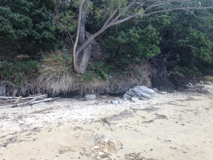
Andrew Short (2006) points out that Coningham’s beaches are reflective. He means that of all those beaches thrashed by waves, reflective beaches receive those waves with the least energy. The surf zone is narrow, as are the beaches, and their sand is coarse.
Here’s a quick list of the beaches using Andrew Short’s numbering system:
2. T479 (Little Coningham Beach) with its boat sheds. It’s in the next little embayment and is a bit longer than Clarke’s.
3. T480 (Coningham Beach) is on the eastern side of Hurst Point. It’s longer than the first two (about 500m), also has boat sheds and there are houses on the slope behind it.
4. T481 (Legacy Beach) 500m west of Snug Point, backed by forested slopes. It has cliffs and rocky platforms.
Sources:
