Hobart was smashing a March heat record with a sweltering 38°C and choppers plied the sky trying to dampen the wildfires. We were up on the island’s northern coastline where the temperature was more mellow because the hot, thuggish northerly winds cool as they travel across Bass Strait from the Australian mainland to Tasmania, then heat up again when rushing south across the island.
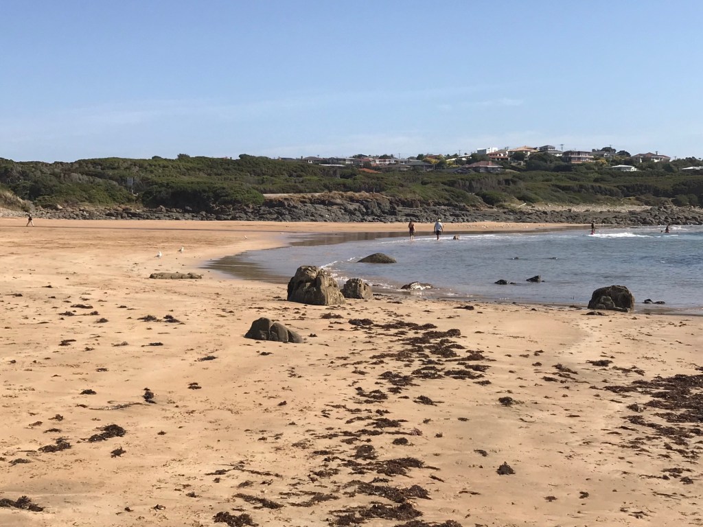
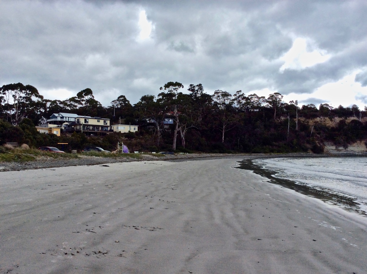
We were in Devonport because we were taking the ferry over to Melbourne the next day and as the dogs were going to have to endure a long day in the car while we relaxed on the upper decks, we treated them to the dog beach.
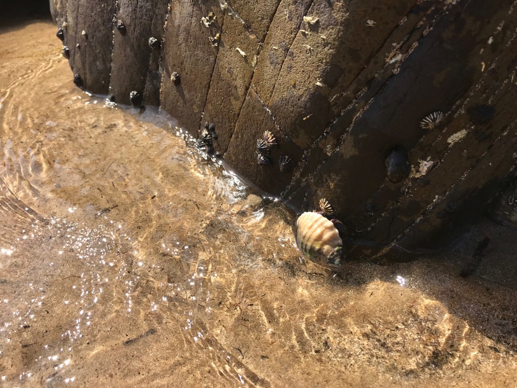
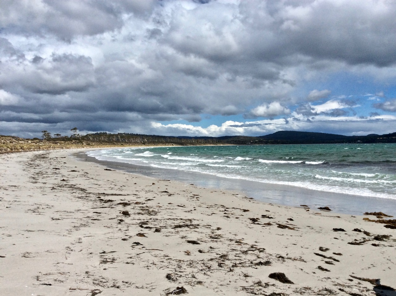
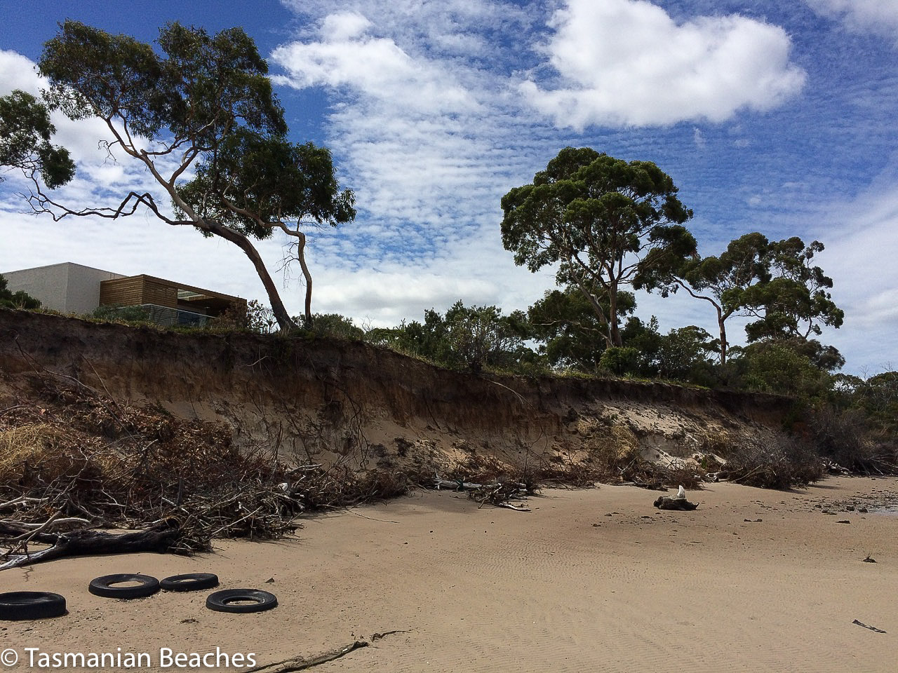
The beach is short and that day with the tide out the sand was a broad expanse, with a rivulet making a shallow entrance to the sea right down the centre. Seeking shade, we made for the eastern side where amongst the rock pools we found (all within a tiny area) litter that we gathered up. Tinnies, mostly, and pieces of plastic and I thought about the irony – humans offended by biodegradable animal scats and dog poop but fine with leaving long enduring plastic lying around that kills and maims other species. It’s a simple cognitive dissonance it really shouldn’t be that difficult for us to overcome. We are the filthiest of species.
Tethya
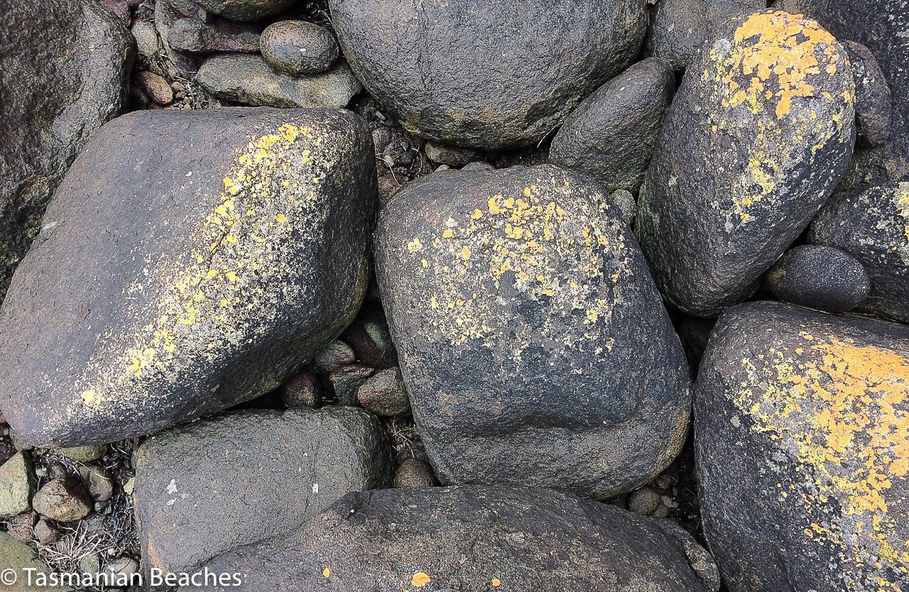
The dark basalt rock was laced with tubeworms, limpets, brown seaweeds and neptune’s necklace. The barnacles and mussels were small. I found cockles and something new entirely – a small, round thing, soft but not squishy, living quietly beneath a rock. It is tethya,aka a golf ball or ball sponge. Another sponge close by looked like an old brown brain.
Tethya (golf ball sponge)
It can be particularly difficult to identify rock hugging life forms that manifest as coatings in rock pools. It can take long periods of quiet observation of a rock surface to even see the diversity of everything that’s there. Hunting on the web later, I discovered that almost 1/3 of the world’s tethya are found in Australia. It’s possible that some arrived unnoticed as migrants and interesting to consider that as convicts stepped ashore in Van Diemens Land, fellow travellers on the ship’s hull may have broken away and taken root along the coastline.
A sponge is a close knit community of tiny individuals and when you’re looking at that diversity of coatings on the rocks you can usually tell a sponge because it is thick and tough and perforated with tiny pores ‘that look like miniature volcanic craters’ (Zell). These communities can be smooth, matt or shiny, but they are still sponges. They reproduce sexually and / or asexually – and this handy capability and their simple water filtering lifestyle is probably two reasons why they’ve been around for over 500 million years and counting.
Cuttlefish
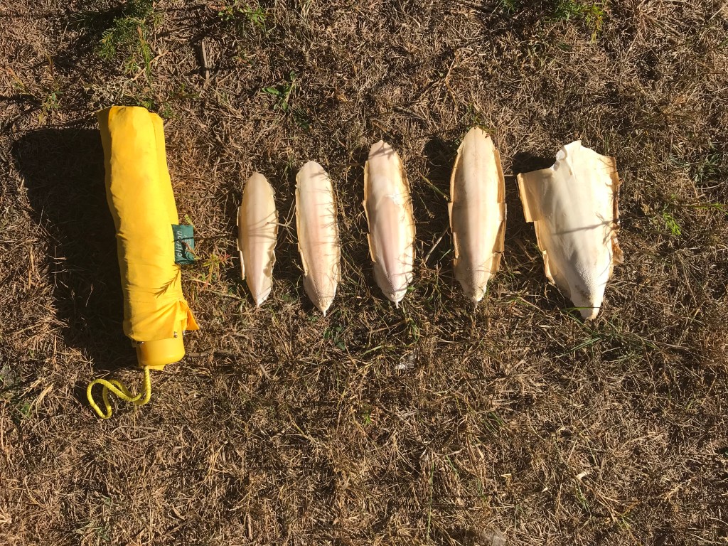
Up on the wrackline I found cuttlebones, faintly pink, like the others I’ve discovered from Eaglehawk Bay on the Tasman Peninsula and the Bay of Fires in the north east. These are possibly Sepia novaehollandiae, the New Holland Cuttlefish.
Rivulet meeting the strait
Mainland Ashes
That day, lazily spent rock pool exploring, was a peaceful interlude bracketed by those fires in southern Tasmania and fires in Victoria. Driving through Gippsland several days later, sunlight was snuffed out, day eerily turned midnight black and it was a relief at Lakes Entrance to come into the light again, despite the smoky air.
I wasn’t thinking about the tethya by then, but it was surely still there, adding beauty to the world, filtering water, being bumped by old tin cans and pieces of plastic, and although I’m no gambler I’ll bet you anything that sponges around the world, having endured climate changes before, will inhabit the planet long after we have gone, leaving our pollution and plastic mess behind us on the rising, acidic seas.
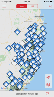
This trip was in March. It’s December now and fires are burning all along the NSW coast. Just over the mountains the country is desiccated, a drought worse than many can remember. Towns are losing their water supplies. I have bought an air purifier and downloaded the Plume, AirVisual and AirRater apps, none of these items I ever thought I’d be interested in. This is an illustration of today’s fire situation
Fires still burning in NSW, 11 Dec 2019 as viewed via the NSW Rural Fire Service app, Fires Near Me.
In fact, there have been fires burning since September. Not even rainforests have been immune. The situation is unprecedented and we have become used to smoke haze putting exercise, if not our lives on hold and burnt offerings on the waves, with fragments of forests transforming into tide lines on the beaches of the North Coast.
This, more than any other year, has been one of reflection about climate change, the biospheric, physical and psychic injury it causes and the abdication of political morality and leadership with regard to this issue. In many ways that unpresidential, cheating and ignorant trump is a most unflattering mirror of our own materialistic and uncultivated shortcomings. Here’s hoping for a successful impeachment and that whoever comes next in the USA is clear eyed about the human impact on the air we breathe, the water we drink, the wildlife we cherish and the sea water and temperature rising.
December 2019
For more information on Back Beach see Beachsafe’s summary. This, and the number T1135 for Back Beach is from: Short, A.D. 2006. Beaches of the Tasmanian coast and islands. Sydney University Press, Sydney.
Zell, L. (2014). Wild discovery guides – Australian seashores. Wild Discovery, [n.p.]
Tasman Peninsula and the beaches of Frederick Henry Bay: Sloping Main in Stinking Bay (T340)
A Fabulist Disappears
Once, in Africa, we met a charismatic man we thought might be a fabulist. Over drinks, as we watched wildlife grazing the plains from the comfort of a lodge, he told us mesmerising stories about his role in the Entebbe raid and other incredible boy’s own adventures in wild and dangerous places, where, risking his life time and again he escaped miraculously.
Mostly we were awed, but when one of us expressed scepticism he told us, ‘every few years I change my job and that way I change my life. That’s how I’ve done so much living’. And afterwards, asking each other, could any of it be true one of the locals said, ‘all these things – they all happened far away.’
I was reminded of the enjoyable time spent in the company of this man when I researched Sloping (aka Slopen) Main and discovered that one day a fabulist trailing many names but not much else, had arrived there and made himself comfortable in an old convict hut on a farm behind the beach.
Old Habitations
On Sloping Main Marsh, before the Port Arthur penitentiary was built to accommodate the convicts petty and otherwise off the streets of Britain, settlers built a farm. It was the 1820s and these weatherboard buildings are the oldest on the Tasman Peninsula. A short drive away there’s the Surgeon’s cottage (red brick) and a house associated with the semaphore system, but I walked this beach not thinking about history, and I walked in ignorance of a tale of secret liaisons, disappearance and assumed murder that happened here in the Saltwater – Slopen Main area of the peninsula back in the 1980s.
Walking Sloping Main
Rain hides kunanyi from view
The beach is a 3.5 km long crescent that faces west with Cape Deslacs and Cremorne visible in the distance. It’s bounded by Black Jack Point below Gwandalan (southern end) and Lobster Point to the north, with Sloping Island just offshore in Stinking Bay.
The transience of ripple lines below Gwandalan
It was raining over the mountain and the sky was dramatic with clouds, shafts of sunshine and drifts of rainfall. A bevy of clouds was being driven across Storm Bay by the South Westerly heading in our direction. Behind us Gwandalan, a small community of seaside cottages and shacks, perched on the lower edge of Mount Wilmot, just above the point. In front of us a stunning sweep of white sand purled off into the distance and behind the dunes on the forlorn and muddy flat, the land said nothing of dark events.
The wrack line lay along the base of the small incipient dune and was no more than a delicate wavering line of seaweed. Marram grass had taken hold, threatening the gradual gradient of a back dune. There were eucalypts poking out of the dunes, both the living and the dead and there were gutting tables every so often and sometimes a bench. It’s a low energy beach but the waves that day were hectic and the tide was low, the white sand lined with cusps.
We passed a dead cormorant and two dead fish. We passed kelp glistening on the swash. We walked through a light shower and the temperature dropped – it was summer but snow was forecast. After a bit more than an hour we reached the Cardwell Cliffs and stood below the headland contemplating the start of Lime Bay National Park above our heads. A quick scramble up and we’d have found a walking track. Whalebone Beach is on the other side.
Slopen Island is just north of Cardwell Ridge
Because of the wind we hoped to find a track behind the dunes, which had widened here, but there was nothing. We found ourselves standing on the bed of a dry rivulet, a crust of white over the mud beneath. Burdens Marsh, partly drained, was dry but there was a fence and then farmland and so we turned back. Twelve oyster catchers walked ahead of us, flying occasionally to maintain a safe space. A seagull foraged for sand mussels. High on the cliffs the small community of Gandwanan looked tiny in the vast landscape of sea, islands, peninsulas and distant shores. That day, because of the moody sea, the landscape seemed gothic and ominous. Even the names seemed gothic. I did not yet know about The Disappearance.
Burdens Marsh
Man of Mystery
The fabulist, a man of no fixed name or address, was invited to stay in that simple hut by the farming couple who owned the land. He and his wife knew him as Reuben. Other friends concurrently knew him by different names entirely. Later, piecing together the story, the coroner concluded that he was Tony Zachary Harras, sometimes Harris, born in the UK in 1934. Some of his aliases were Judah Zachariah Reuben Wolfe Mattathyahu, Karl Wolfe, Carl Wolf, Reuben Wolfe, Zac Mattathyahu, Reuben Mattathyahu, Carl Mattathyahu and also Karl Mattathyahu.
Beaches acquire different names through no actions of their own and Sloping Main and the island just offshore also have a slippery identity.I couldn’t find their Aboriginal names, but the explorer, D’Entrecasteaux, christened it Frederic Henri / St Aigen when he sailed by in 1792, according to Tasmanian Nomenclature. In 1798 Flinders, circumnavigating Van Diemen’s Land in the Norfolk, called it Sloping Island and that’s officially what it is today, but it’s just as commonly called Slopen and occasionally Storring. The Slopen might come from a whaling captain, a farmer or a lazy corruption. The beach and the island share that same identity. (Here’s a bit more about that history.)
Unlike the beach and the island the fabulist actively chose a whole series of names. Why does a man need that many names unless he has profound identity issues, fears for his life or is up to no good? At any rate, I’m calling him Tony – just because it’s authentic when so little else about this story seems to be.
He began his working life in primary industry and moved on to the British Armed Forces before arriving in Australia at about the age of 24. The period he spent in the forces seems to have influenced him quite profoundly. Regardless, he was in Australia from 1958 to 1960, then travelled to New Zealand before returning to the UK. He changed his name to Tony Zackary Harras but he could not settle. He was soon back in Australia and then he was marrying in the UK. A son was born. On the birth certificate Tony is Zachary Anthony Harras, vermin controller.
In 1971/1972 he was working as a gardener at the Botanical Gardens in Adelaide and then threw that in to become a bushman near Maydena, Tasmania. His marriage was over and he told friends he’d spent time in Israel but in 2014 when the cold case into his disappearance was reopened, the coroner expressed scepticism about that.
At first, in Tasmania, he called himself Judah Zachariah Reuben Wolfe Mattathyahu but he referred to himself by random versions of that name so that various friends knew him by his pseudynyms concurrently.
This aura of mystery was enhanced by the incredible stories he told about himself. He put it about that after getting interested in Judaism he’d fought for Israel in the Six Day War. He said his wife and his two children died in a war but when and in which war remained vague as does that family. He told friends he’d gone to Africa with seven others to destabilise a government and was the only one that got out alive. He’d followed through on orders to kill seven men and then he’d escaped by chopper. He said he was mixed up in the Entebbe air raid, that the only person shot was his cousin but when that was investigated no proof was found. He also said he’d been a Nazi hunter. Assassin, mercenary… imagination or fact? These were events that happened far away and could not be verified, not even by the coroner.
Fact: He was logging on a property on the Tasman Peninsula, at Slopen Main Beach and at the invitation of John and Anne Hull, the owners, who knew him as Reuben, he moved into a little convict built building on their land. Anne, on this farm, that at times must have felt remote, must have fallen for the stories. Soon she and Rueben were deep into an affair, her family oblivious.
After the fabulist disappeared and the police came calling, she said there’d never been an affair, but this story didn’t hold up in court. It emerged that he’d phone and say he needed his shirt washed. This was the code they used. She’d dress up, at his request, in her black coat and boots and go over to the little convict building. His shirt needed washing often; sometimes three times a day. There was passion unfolding in that building and Tony, aka Rueben Mattathyahu aka whoever didn’t exactly keep quiet about it.
A friend in Hobart let him have the use of a room in the same building as his shop, a well known shop at the time, that sold outdoor gear. It became the scene of secret trysts. He showed friends photographs, explicit ones, of what they got up to in that room and so the affair was impossible for Anne to deny. Faced with proof and under further questioning her story changed. The relationship was nothing much, they seldom met, she had no time.
All this took place in the early 80’s. John Hull said he only found out about it when police arrived at the property in 2012 investigating this old, cold case but the coroner found that at the very least he knew in March 1984 when detectives showed him photographs of Anne and Rueben in the Hobart room. What had happened to Tony, they wanted to know. The police quizzed Anne too. She said John had been fishing up at the lakes the weekend Tony disappeared and she said that when she’d finally told John about the affair and offered to leave, they never spoke of it again. John, in 1984, declared he’d been at the lakes shooting, but at the coronial enquiry in 2014 he said he was in the killing shed slaughtering sheep after dark when Tony’s friend arrived to find out where the fabulist was. (The coroner didn’t believe he was in either of these places. The killing shed seems to me to be an ironic place to be at night shortly after a murder.)
The Hulls agreed that in the final weeks before the fabulist went missing he wanted to be alone. His employer at the time described him as “fearful” and “agitated”, another friend said that he was looking for other work, anxious to leave Sloping Main. Another said he thought he’d received a call from Tony, possibly after the Saturday in November that he was supposed to have gone missing. The coroner was sceptical that the date he gave was correct.
When the Hull’s son Alan was interviewed about those final weeks and that eventful night, he told the coroner he’d seen a terrible altercation and that he had “a sneaky suspicion” that ‘there was only one other time I seen him after that’.
He said his father had rung him up and said not to come home because Rueben was ‘behaving really badly, he’s about to go’ but Alan said, ‘I’m not real good at doing as I’m told. So I toddles home.’
That night, he said, he didn’t drive in as usual but parked in the bush and as he walked along the fence line where he could stay hidden he saw a ‘flash looking car’ he didn’t recognise and a rowdy fight taking place with ‘a bit of noise and clonking and banging you could hear and squealing…’ and these men he didn’t recognise had Tony by the feet as they came out the door. The fight went on, he said, but finally the fabulist got the upper hand and sent the men packing in their car.
That story, said the coroner, was untruthful and inconsistent because he could not adequately explain why he’d not called the police at the time, even though there was a phone at the main residence. Neither did he mention this to the police when they were investigating in 1984. In fact, the Hulls never did tell anyone Rueben had disappeared. It was March 1984, four months after he’d disappeared, before the friend involved that night told the police that his itinerant friend had vanished. That’s a long and puzzling gap. Long enough for any trail to grow cold.
Anne said in 2012 that the police interrogation she’d endured in 1984 was so traumatising it still gave her nightmares. Her memory was vague and inconsistent about the facts though. She’d said her husband was away deer hunting but when interviewed the next day he said he was away fishing at the lakes. (Although actually, up at the lakes, you can do a bit of both if you are so inclined, but John was pretty clear he’d only ever gone fishing there twice before).
Anne said Tony (only she called him Reuben) often left the property, mostly for employment purposes and at times up to three or four months. ‘During these times he was away.,’ she said, ‘I would have a forwarding address to which I wrote to but Reuben never replied. The last time I saw Reuben was with John at Black Jack Hill gathering sheep. Reuben did not say where he was going when he left in November and I have no idea of his whereabouts. John, Rueben and myself parted on good terms.’ (Years later, though, it emerged that he’d left a letter in the hut for them, asking them to ‘look after the things I love’ until he returned. It’s odd they didn’t tender this at the time. It’s also odd that if he feared John he would turn to him to look after his possessions.)
One Dark Night
A witness the coroner did find convincing was a friend who said Tony (only he knew him as Mattathyahu) had no car and relied on others for transport and had asked him the day before he disappeared to pass on a message to this friend’s cousin for a lift from Slopen Main to Hobart. The arrangement was for this cousin, who was Tony’s friend, to pick him up. The arrangement was that he’d return with him to Glen Huon. Tony would spend the night with him there and then the next day this same man would drive him into Hobart.
That’s some favour to ask for and some favour to give. The distance one way is 153 km or 2 hrs 18 minutes, excluding the trip into Hobart the next day, which would have been another 90 min return trip for the friend, and these distances and times are based on better road conditions than existed back then. It was a night time journey on a Saturday. That’s great generosity. The friend connected with the flat in Hobart where the liaisons took place, said Tony (only he knew him as Karl Wolfe) had told him he’d be coming by the next day to fetch some stuff and that he’d had ‘enough down there and had to get out’. But he never turned up and he never heard from him again.
The night he was expecting his lift out of Sloping Main to Glen Huon south of Hobart, the fabulist phoned the intermediary at 8.30 p.m. to confirm his lift was arriving. He was assured it would be arriving in about half an hour. This seems to have been Mattathyahu’s last contact with anyone, anywhere and it’s not clear from the coronial report where he made that phone call from, because he doesn’t seem to have had a phone at the hut.
The friend providing the lift (who the coroner also found to be a reliable witness) was the person who finally reported the November 1983 disappearance in March 1984. He’d visited Mattathyahu at the Sloping Main farm several times and he’d responded to the request for a lift, even though it involved this lengthy four hour plus return drive at night. He arrived at 9.30 pm to find lights on, doors open, and the two dogs in the yard. When the friend went into the empty hut the luggage was ready to go, so after a wait of about 15 mins, he went to the Hulls, a 10 minute drive away at Saltwater River.
He asked Anne if she’d seen Tony, and she said she hadn’t and so this friend, the reliable witness, went back to Mattathyahu’s dwelling. He said he checked his friend’s belongings – the sleeping bag, a couple of trunks, a toolbox, spade, axe and wooden club, the bags standing at the door.
He waited, but the fabulist did not arrive and so then he drove to the shop at Premaydena, a 20 minute drive away, passed Saltwater River again, to phone his cousin who’d given him the message, then returned to his friend’s place and waited again until midnight, and this I have to say seems incredibly kind hearted or downright concerned after that long drive from the Huon Valley, especially as he’d only got the message around 4 pm that afternoon, a Saturday and especially if it crossed his mind even just for a moment that his friend was simply standing him up or that there was some confusion.
At the 2014 cold case coronial enquiry, Anne also said that this friend came to their door but she described him as “scared stiff”. It was “darkish” and she told him she didn’t know where Reuben was. She didn’t know what date it was either but “there would have been family” at her place because ‘our place always seemed to be full of people and I can’t remember who they were. All I know is I’d look sometimes and there they’d be sitting around like little birds waiting to be fed.’
But she said when he was leaving she looked through a window and thought she saw Reuben in his car. So why, the coroner asked, was he asking for Reuben if Reuben was in the car (something the friend denied, as well as denying having company for the trip down, putting paid, as far as the coroner was concerned, to the notion of Alan Hull’s suggestion there’d been a violent altercation). And why was he so scared stiff? She said that would be because he’d seen Reuben, but she had no plausible response for why she hadn’t told the police this at the time, saying only that ‘he came and gone – he came and went as he so chose.’
Alan Hull said that despite his mother not remembering, he was at home on the evening of 12 November 1983 and overheard the conversation with the friend, who was a man he recognised. He, too, saw Reuben in the car and remembered thinking, ‘I wonder when I’ll see him again.’ But the coroner said this was a story designed to protect his parents, the main suspects.
The last witness was John Hull. In his 23 March 1984 statement he’d described how the fabulist began living on the property at Sloping Main, how he got to know him “reasonably well” and how they became friendly and saw each other twice a week.
He thought the last time he saw Tony was about Tuesday 8 November 1983 at his place about 5 pm. He’d seemed his normal self and had not said anything about leaving, although he knew he was looking for a job. Neither did he take much notice of the fact that he’d gone, but ‘now I am aware of the arrangements he made, I find it strange that he didn’t keep them, as he was a meticulous person.’
The night of the disappearance, when the friend had arrived at their house, he was in the killing sheds, slaughtering sheep, he told the coroner. Previously he’d said he was up at the lakes (Central Plateau). The coroner didn’t think he was in either of these locations and I can’t help wondering whether it is usual for farmers to slaughter their sheep at night.
He said on Sunday 13th he’d gone to Reuben’s camp to get his dogs and returned on several occasions to get tools and guns that belonged to him.
He also mentioned a telephone call he’d received ‘last Monday night 19 March 84’ from an acquaintance who’d seen the notice in the paper about Reuben and had told him he’d had a call from Tony around Christmas enquiring about a job. He said he’d asked Tony (only he called him Reuben) if he was out of money and he said he wasn’t.”
The coroner, after listening to the Hull’s stories found Anne to be ‘grossly exaggerating’ while too reticent about known facts. He said, ‘Those members of the Hull family who gave evidence were in my view at pains to present as a reason for Mattathyahu’s agitation and his intention to leave the idea in some way that his colourful past as a mercenary and Nazi hunter was catching up with him. The much more likely explanation in my view for any agitation and his making arrangements to leave, in something of a hurry, is that his affair with Anne Hull had been discovered by someone and he was anxious to get away from the locality.’
He found that Tony’s disappearance was homicide but could not establish the how and that ‘Mr Mattathyahu died on or about the 12 November 1983 at or near Slopen Main, Tasmania’.
Tony was a man clearly fascinated by war, not averse to killing ‘vermin’ or trees, or, according to the tales he told (truth or lies) killing people too. He is known to have had guns, spears and knives and a wooden club (Ford, 2019). It’s an open possibility, one can imagine, that he had enemies who no doubt knew him by some other name.
Out there, there is someone who either knew or knows the truth but isn’t telling.
‘You can walk to Susan Bay from here, only you can’t.’ That was the verdict of the two local men working on their boat at a shed on the rocks at Connelly’s Bay a tiny rural community (pop. 40, according to the 2016 census) about 50 km east of Hobart, tucked beneath Thornes Hills and Quarry Hill on the dirt road to Dunalley. We’d taken them by surprise, appearing suddenly from around the back of the shed. Midweek, this small community of seaside shacks seemed deserted. They were the only people we’d seen.
Connellys Bay
They hemmed and hawed about how far you could walk west along the rocks. There was a track, they finally admitted, but it was on private property. You had to climb through the fence.
And so, rugged up against a considerable chill factor and beneath a constantly changing sky, we headed off along the boulders until the terrain pushed us upwards and we found the going easier along track and through grass. It made for brisk and easy walking and as we neared Susan Bay we shared the path with a woman and her dog. I don’t like trespassing but if she was the owner she didn’t mind our presence and if she wasn’t she allowed me to feel that perhaps it was okay to be walking where we found ourselves. Perhaps, in fact, we weren’t trespassing at all.
Looking back at Connellys BayShack on the rocksThe coastline between Susan Bay and Connellys Bay
After the barriers of one sort or another that we’d experienced along this stretch of Frederick Henry coastline, it was an exhilarating walk, and a pleasure to reach Susan Bay beach again.
Again some birdlife, again that sense of being miles away from anywhere. And then, after a bit of idle strolling along the tide line looking at the shells that had washed up here, after enjoying the sense of arrival and goal attained, we turned around and made our way to back to that tiny community where eucalpt covered hills meet the sea.
The wilder eastern end of Susan Bay
If getting started on this walk had taken some initial searching for a plausible route, then completing it proved harder still. No signs had warned us we’d been trespassing on the walk out, but here at the end it was clear that the farmer was protective about his land. We wanted to get off it, back on to the rocks where we belonged and were relieved when we finally escaped and made our way back to the edge of the shore.
Home built shack at Connellys BayConnellys Bay
Like Susan Bay, Connellys Bay (in the area known as Connellys Marsh), is an anchorage used by local sailors because it provides refuge from winds blowing in from the NW and NE and it has a nice sandy bottom that provides easy anchoring behind the moorings at the northern end of the bay.
Source: Cruising Yacht Club of Tasmania. 2014. Cruising Southern Tasmania: a guide to the waterways and anchorages of South Eastern Tasmania from Wineglass Bay to South East Cape. TASMAP, 2014
When we came back to the Primrose Sands area to find our way to the cobbled beach we’d spied as we’d peered over the rocks on our previous visit, a trim of houses along the shore hid the track from view. Signposting just isn’t that great around here, which means that unless you approach by boat, these coastal spots tend to remain local secrets or the haunts of sailors.
On Primrose Point
Instead we set off along the eastern shore of Gypsy Bay, stopping to chat to a man fishing for flathead, skirting boat houses and spending a long time enjoying the rock platforms. It was a crisp day. A big blue stillness had settled over the water and from the point we had a magnificent view out over Frederick Henry Bay to the Tasman Peninsula.
View from the end of the point
Always Take the Scenic Route
These two bays – Gypsy and Susan – are rather overlooked spots, only stumbled across if you ignore the highway and instead take the scenic route between Hobart and Dunally. We idled at Gypsy Bay enjoying the boat sheds near the boat ramp and the eccentricities that make it appealing.
Upcycled dinghy at Gypsy BayGypsy Bay: the view to the east
Susan Bay
Susan Bay
It proved impossible that day to walk around the shore of Susan Bay but on a spring low it’s possibly a cinch. Disappointed, our moods rose when we stumbled on a path between houses and followed it down to the bottom of the cliffs where we discovered a beach, rather curved, rather dark and rather thin and therefore easy prey for the ocean that nibbles away at the cliff, felling eucalypts out of the failing banks.
Whisker thin though the beach was on the tide that day, it had an appealing sense of moody seclusion, and we wandered along it in no rush whatsoever, enjoying the birdlife and stopping to chat to a local who spoke at length about this bay and with the most enormous affection. He’d bought two properties along the shore and hoped Hobartians never woke up to this small bay’s particular loveliness. As we followed him back up the path, looking back at those lovely views of the Tasman Peninsula, he told us exactly how to find our way on to Carlton Bluff, which meant that at this point we ended up heading west again, putting eastward exploring on hold.
Susan Bay and its mooringsSusan Bay: safe anchorage when the NW or NE winds are blowing
Sundra and I had decided to walk from Lewisham to Dunally and for these walks her best friend, Matisse, invariably came too. Despite his venerable age he always kept up with us and chose to stick with whoever might be lagging, although sometimes he’d set off alone to find a different way around an obstacle. And ever polite, he accepted us picking him up and passing him over hazards he couldn’t manage alone. He’d pick up his dignity and continue lightly finding his way.
Rest in peace, gentle Matisse.
Dodges Ferry and Lewisham: Sharing a Magnificent Landscape
Long ago I met a writer who lived at Dodges Ferry. It was considered an odd choice by my friends, all better acquainted with Hobart than I was at that time, but walking this area I realised the writer was prescient. Its proximity to vast Pitt Water Lagoon, quiet coves, a string of sheltered beaches, a magnificent headland, beautiful surf beaches and a photogenic river give it an enviable natural richness.
Lewisham consists of a thin string of houses that extend along the eastern shore of the inner entrance to Pitt Water Lagoon just north of Dodges Ferry and so it isn’t physically on Frederick Henry Bay although its watery landscape is intimately connected to the bay. It strikes me as an under rated place, perched as it is above the water with access to some lovely beaches via a rambling path.
Dodges Ferry and Lewisham probably don’t want their natural wealth proclaimed to the world less the financially obese rush in and take over. For the moment laid back Dodges in particular still has enough shacks and rutted roads to keep it feeling like an authentic holiday village.
It’s about a 35 minute drive from Hobart to Lewisham and Dodges Ferry and it’s rich with water views if you choose to take the Lewisham Scenic Drive turn off. It’s my firm belief that one should always take the scenic route and for this series of walks it was such a no brainer that without fail we did.
Walking the Lewisham Reef
There’s a boat ramp at Lewisham and moorings offshore, and the spit that is Five Mile Beach with its bright white dunes backed by pine forest forms the opposite shore. Water flows in and out of the lagoon to Tiger Head Bay and larger Frederick Henry Bay through a narrow channel at Sandy Point on the Five Mile side and Dodges on the northern, and responds to the lay of the land by swirling and rippling in interesting ways.
After considerable discussion we began our walk at the boat ramp and chose to go boulder hopping in preference to taking the path a sailing friend had told me hugged the shore. Sundra’s miniature poodle, Matisse, hopped from one lichened rock to the next with a grace and dexterity that belied his venerable twenty something years.
Along the reef at Lewisham: Sundra and Matisse
The lichens, in various hues, indicated the highest reach of the tide.
As well, there was dolerite weathering in interesting ways.
Quietitude along the reef
Boat Houses
Eventually we climbed up to the path and discovered that one of the particularly enjoyable aspects of this walk is the number of boat houses tucked into the cliff, each quite idiosyncratic. Boats lie about on the shore, silently emanating the richness of their mysterious lives, and jetties are also stop-and-enjoy features along this varied track. Just like on the Derwent and the D’Entrecasteaux, casuarinas (she oaks) fringe the shore, providing light shade and there are three or four ‘covelets’ depending on how you want to define stretches and pockets of sand divided by man-made features or natural indentations. Where these exist, so do the boat houses, which in many cases look to be tiny weekend beach shacks.
The tide was not yet out when we reached this vantage point
After the jetty we came across this cove.
Lewisham Beach & Okines Beach (T396)
The path led us to a beach that a passer by told us was called Lewisham Beach. Sundra was struggling to pronounce the word ‘Lewisham’ and so we agreed that we’d call it the Hamlet of Lewis, which made the place feel pleasantly foreign. I’d thought this particular beach was called Okines but one thing I have discovered about walking beaches is that both they and their names can be transient and confusing. Sorell Council refers to a Lewisham and an Okines Beach and they should know. Short (2006) doesn’t reference a Lewisham Beach. I expect they simply segue into each other and did so without us noticing.
As the tide receded the landscape transformed into vast stretches of sand interleaved with shallow fingers of water, leaving a deep channel over on the Five Mile Beach side of what a little earlier had been a single stretch of water. A few groups with fishing rods had strolled over there and tiny clicking noises emanated from the entrances of a million tiny tunnels as the more permanent inhabitants of this sweep of fabulousness, the soldier crabs, began popping up everywhere and marching off together across the watery stretches of sand like endless pink ribbons. It was hard to find any vacant land on which to place our Gulliver-like feet.
Cloud street over Lewisham beach
Transcient Landscapes
We looked at the ripple marks in the sand, practising our reading of tide and current. There were other clues to the life of the beach. Groins indicated local concern about beach loss and the wrack line showed that this was valid. It was right up against the base of the dunes and we wondered whether the marram grass and the houses themselves had affected beach replenishment. Sundra exchanged pleasantries with a landowner industriously chucking branches down to the base of the dune to join the others strewn there in an effort at holding back the weight and determination of water.
We met some walkers who told us they’d seen a large fish head with a protruding tongue and odd curls on its face and although they told us where to find it we never encountered it, just a hoard of jellyfish patiently waiting for wind and water to carry them back out to sea.
Sometimes the weather and a beach are so compelling that it pays to dawdle and lose yourself in the interesting lives of crustaceans, invertebrates, boulders and curly faced strangers from the watery depths. We idled and we lingered until at last we reached the rivulet. We had taken hours, but Dodges Ferry and Spectacle Head were still simply a distant view. and so we agreed we’d come back on the next good low tide.
There’s a natural spring and a wetland behind the beach, which would have once been handy for the Moomairemener who had been pushed out of their country by the time Ralph Dodge, born on Norfolk Island (and one of the group of settlers who came to Van Diemen’s Land in 1807/1808) was granted this land in 1864. He and his wife Charlotte called it Lagoon Farm and in time it passed to their youngest son, Robert, who with his wife Harriet raised nine children here, before selling the farm to the Crown for the new Soldier Resettlement Grants Scheme that was set up for the soldiers back from World War I.
Ernest Okines was the lucky recipient and as with many beaches the foreshore’s name became linked to the owner. Today the Dodges Ferry Primary School stands on this land – the old homestead was demolished in the 1990s.
When a new friend said she felt like an all day walk I translated that into somewhere easy, somewhere short and somewhere straightforward because I had no time to plan and I had a leg that had become the arena for lightning bolts of pain. I figured we were sure to find a track that met these criteria on the Tasman Peninsula somewhere.
The peninsula was green and resplendent after rain and we were lured down the road to Lime Bay. I’d camped there once, years ago, and expecting to see no one there we were amazed by all the tents, activity and music at the campground.
Sundra was immediately hungry and while she ate an early lunch I read the sign that described the route to Lagoon Beach, then returned to the car to photograph the relevant pages of my guidebook. Soon we were heading off along the hot track to Lagoon Beach through coastal scrub and beneath a shady canopy. We were talking enthusiastically and were inattentive to our surroundings. We paid little heed to the dry lagoon at the base of the palaeodune we clambered up, but I did recall it from last time. We did not look back to register our surroundings or to note the way we’d arrived on the beach, because coming over the top of the dunes we were enthralled by the view of the sea and the fingers of land all about us. We should have brought bathers.
Lagoon Beach
Except for three couples sun baking and a yacht anchored in the lee of the southern headland the beach was empty and so, with no regard to the pages I’d photographed we walked south, thinking that a track might possibly take us over the southern headland. There, beneath the cliffs we found a wooden seat and a sand castle, and after eating a second lunch and admiring a couple of pied oystercatchers, our cursory search produced no evidence of a track, although I later discovered there is one. And so we meandered slowly back up the beach, enjoying walking barefoot in the water. And that, I felt, was enough of a walk for my grouchy leg. Sundra, energetic and adventurous, felt the day had barely got started.
The couples were gone. The marker she’d had the foresight to place in the sand where we’d entered the beach had been kidnapped by the rising tide. For well over an hour we wandered up and down the dunes, trying to trace footsteps – anybody’s footsteps – that would return us to the track. How weird to be lost on a beach, I thought, squinting at the pages I’d photographed to my phone. I was pretty sure the best plan was to head directly back to camp and that if we headed for the trees we’d surely find the path, but our memories didn’t coincide. Meandering about on the dunes we had by now utterly confused ourselves, creating patterns of circuitous footsteps that now overlaid anything that had been there before.
When everything starts looking the same
But at least there was wifi. ‘Lost,’ I texted back home.
The pages I’d photographed were no help, especially when read with an increasingly distracted mind. I did a Google search and found a helpful blog that talked about exiting the beach at the northern headland with a picture helpfully included. There was red tape up there. If you followed it, it would take you across the headland (Green Head, apparently) to another smaller beach. This blogger had then turned back. Noting the sun’s position in the western sky I was all for turning back too. I was still reasonably confident that if we returned to the forest behind the dry lake we’d easily reach the campground again. A nightmare I’d had of being lost on the peninsula began to haunt me.
We returned to the northern headland we’d previously rejected as a possibility and scrambled up the steep slope that definitely did not look like it led to a path and after a bit of searching we found some red tape dangling from a branch. We walked a little further and found just enough tape to keep taking us forwards. We went down to explore the beach referred to in the blog (Lagoon Beach North) and then went back up on the cliff again and followed the red tape until in the middle of nowhere no more tape was to be found. From here the bays and inlets and fingers of land still confused me. I had no idea what we were looking across the water at and thought that late in the day though it was, we were still better retreating than trusting to the traces of path that might be ahead. Little did I know that the cliff tops here are shallow overhangs and considered dangerous (Leaman, 1999).
Sundra impressed me with her relaxed ‘ever onwards’ attitude. When the red tape ceased again we ended up walking in different circles in search of the oh so faint trail that often looked animal made. It seemed that the trees our red bread crumbs had been attached to had relinquished their hold during storms of long ago or the tape had simply blown away in gales.
View from the cliff top
Keeping in visual contact with the shore while Sundra’s voice receded further away I tried to figure out our position on Memory Maps and Navionics and every other app I had available but nothing gave me the precise, localised information we needed – a clear track back to camp – a Lime Bay for Dummies kind of instruction. I cursed myself for leaving the relevant map at home.
‘Still no idea where we are,’ I texted home, to the concerned enquiries. No idea where Sundra was either.
The afternoon was softening into evening. I suspected we would be sleeping out. From somewhere far away Sundra called out. Tramping around energetically, she’d found a tiny remnant of red tape, enough to lead us forward a little further but in what to me looked like an inauspicious direction.
Each tag seemed to take longer to find but we held on to a blind faith that we would arrive somewhere sometime. On two or three more occasions we lost the little red tapes seemingly forever and it was with some trepidation that we cut away from the cliffs to enter a thicker section of forest. We walked downhill away from the coast and with a hefty sense of relief found at the bottom (incredibly, disbelievingly) the track we’d walked out along hours earlier.
There was the coastline we’d passed on our way to Lagoon Beach, one or two children still swimming in the water. We had never been that far away we now realised. I thought admiringly of sailors who navigate themselves across oceans. I clearly couldn’t navigate myself across a pyrex bowl. And I’m obviously imminently capable of getting lost in a backyard copse of trees.
Dadirri is an Aboriginal word for deep listening to others and to the landscape. It’s used in both the Ngan’gikurunggurr and Ngen’giwumirri, languages from the Daly River region a couple of hundred kilometres south of Darwin. Feeling lost in the bush, that still, quiet awareness was hard to come by that day. Sundra had long ago finished her water and we were sharing the little I had left. We had no GPS and the battery on my phone was getting low.
Instead, as we travelled home after what had ended up being a six hour walk, we laughed as we reviewed the day and agreed that there was scope to do more walks together, perhaps with a bit more preparation.
But then again, without a map you really feel like you are more properly exploring! (I am not recommending this though!)
If, one day, lost on Lagoon Beach, this is the blog you discover then be aware that the densely vegetated headland to the south is called Lobster Point and Sloping (Slopen) Main beach lies some distance away on the other side. The 1.6 km stretch of sand that is Lagoon Beach lies in the lee of Sloping Island and it’s wise not go tramping about on the 15m high foredunes and their blowouts, particularly for their sakes. Take careful note of Sloping Lagoon which links the beach to the rear end of western Lime Bay beach. There’s also a smaller lagoon at the northern end of the beach.
And perhaps, rather than following the disused and apparently closed track we were on – we did this walk in 2016 so this may have changed – take your bike and go cycling around Lagoon Beach using these comprehensive notes on cycling in this area from Tassie Trails.
If geology is your thing there’s a dyke on Lobster Point and apparently on Green Head we were walking over all sorts of interesting volcanic and sedimentary geology which that day we were blind to. Those dunes we came over – they’re interesting too. Grab a copy of Walk into History in Southern Tasmania by David Leaman and he’ll illuminate the geological wonders for you. And go on the low tide – that way you can walk around the base of Green Head staying safer and not getting lost.
Back at the cottage after kayaking Sloop Lagoon, I was flipping through Marianne Robertson’s book From Petal Point to Cockle Cove over a well deserved cup of tea, and discovered a beach that I hadn’t been aware of before. Tucked away behind the big boulders at the south end of Taylor’s Beach was apparently another small cove called Sloop Reef Cove, also known as South Taylor’s Beach.
It was time to go searching – and so we went immediately.
But we couldn’t find a path. Instead, we four, two of us canines on leads, scrambled up enormous boulders and searched around when we got to the top. Faint trails sometimes led to dead ends but we finally found a vague track that led on to a better formed path through the casuarinas and finally dropped us down to a secluded campsite where two men with a van were stoking a fire. Down on the tiny north facing beach four people were enjoying a picnic while the surf pounded in. It’s an intimate cove; we felt we were invading and so we sat only momentarily on the rocks discussing the undercut dune behind the beach. The cove sloped; the surf that day rolled in and and streamed out, deflecting around the corner. We saw the back of the waves as they raced onwards to east facing Taylors. There is a permanent rip here. Swimming in the cove or the southern part of Taylor’s beach looks pretty dodgy because of the criss cross waves you get here. It was a most unsettled sea.
The boulders of Sloop Reef Cove
To Sloop Point
We knew Sloop Point well, or so we thought, but yet again, finding a trail from Sloop Reef Cove that would lead us there took a bit of effort. We considered giving up – and considered this several times more during the course of this walk – but eventually the trail we found joined a well made contour path, which I later discovered was an old tramway track.
But why would you have a tram way here? What sort of tram? What was the purpose?
The walking was soft; layers of casuarina curls lay on the ground. We passed beautiful boulders near a point with a sign that read Sloop Rock Jetty and stopped here, contemplating the dreamtime stories that would once have been associated with these powerful formations.
The path came out at the parking place for Sloop Point. Four of us, plus the two canines, had come here on a warm April day and meandered down the path to the massive sheets of lichened granite that make up the point . It has a fantastic rockpool, deep and clear and private, suspended above the ocean and claimed that day by a travelling couple in their twenties. This is the sort of place that’s probably seen a lot of people rip free off their clothes to skinny dip and enjoy the sun au naturale. It’s a highly risky business as others coming after can be as surprised as those caught cavorting in this spectacular rock pool above the sea.
Offshore were the Sloop Rocks, the bay’s most fascinating feature and visible over a vast distance. I call the most spectacular the Sitting Buddha but it probably has many names. I have a friend who calls it the Witch’s Hat.
Rock pool at Sloop Point
Sloop Rocks
T 82 Seaton Cove
No amount of searching in the bracken revealed an onward path and so we took the dirt road down to Seaton Cove, another spot we’ve overlooked on our many visits to Bay of Fires. It was astonishing to come to a tiny, rather suburban looking enclave in the coastal forest after wandering through the bush, sometimes on paths and sometimes not. A camper van had settled in here (there is a little bit of camping space) but he was close by a short row of about five houses that looked like they’d lost their way to Launceston. Like Sloop Reef Cove, this is tiny and the boat drawn up on the sand, with only one motor, must rely heavily on good weather, particularly for its return trips, because there isn’t much room for error. It’s rocky here, both above and below the waterline and what beach there is has coarse granite sand and much kelp strewn about. I found some sea glass and a beautiful quartz pebble well polished by the sea.
But a well defined path led on past the bottom of the gardens, following the fence line, and back into the peaceful casuarina forest. Again the path grew uncertain. We’d lose the trail then find it again. Finally we found ourselves in a patch of sand surrounded by boulders and apparently isolated from the sea. Even here, so close to the sea, frogs serenaded near the small soaks in the rocks.
We had been walking along the top of these massive sloping granite platforms and boulders for some 500 m but they were getting to look familiar. Sure enough, we soon saw people on top of the huge boulders we know well – we’d made it to Cosy Corner.
We lingered here, feeling triumphant and wondering whether to head for the main road. It was getting on for 4 pm. This seemed an unadventurous option and so we turned around and walked back across boulders and through the bush to Seaton Cove. I was surprised on this visit to notice the beach was longer than I’d thought before, rocks dividing the cove into a north (hidden from the road in) and south side.
Looking south over north Seaton beach.
Again we debated resorting to the road we’d walked down before but there was a clear path we could see now, heading around the northern side of the cove at quite a height above the shoreline. We followed it, but it let us down and we got lost in bracken and fallen trees, just pleased it wasn’t snake weather. We could see the tree line along Sloop Point and so we clambered down on to the boulders then bushbashed up the other side when a gulch seemed impassable. Our trusty path finder took the lead. She invariably chose a route better than the ones we selected but she’s getting on and occasionally needed a helping hand over the trickier fallen logs.
This time our choice was clear – buoyed by our progress, we took the beautiful contour path we’d walked before. We reached a dirt road descending to Sloop Reef Cove but noticed the path continued across the road, above a few houses nestled in the southern corner of Taylors Beach. Orchids grew along here, pale purple and unassuming. It wasn’t long before we met the Gardens Road just above Taylors Beach and Sloop Lagoon.
This is the kind of walk I find the most exhilarating – a walk where the way is unknown and sometimes hides itself, demanding a degree of perseverance to continue, but offering up surprises – like another of those branch shelters that we’ve seen at Tinderbox, Dora Point and a few places elsewhere.
Beneath the Lucas Point Sewage Plant there’s a bay and in that bay there’s a thin cobbled beach divided by boulders from another stretch of tide constricted beach. (Possibly Andrew Short’s beaches T469 & T470, but I could well be wrong.)
We’d started the day with brunch at MONA, Hobart’s incredible Museum of Old and New Art, way upriver and I only mention this because I’d spent an inordinately long time at the Marina Abramovic exhibition, engrossed in watching her meditatively regard a donkey and the donkey’s long considered response to her. The immaculate stillness of it all; the way the observer is absorbed into the dynamic of the interaction and how, in paying attention, new details about the donkey, or Marina, or even the pared down environment emerge into focus long after you think you’ve observed everything there is to see alerts you to the fact that perception is fickle and attention is a skill that needs honing.
It made me wonder how long I should spend regarding a beach and how you express gratitude to such a multi-diminsional part of this planet.
Later we packed a rucksack and headed down to the Tinderbox Peninsula. The off the leash exercise area behind the Lucas Point Sewage station was vibrant with canine energy but we detoured up Flowerpot Hill’s southern slope. A blue sky, and a light sea breeze …we reached the place I’d stopped before and paused to consider the various blossoms in flower along the edge of the cliff line.
This beautiful eucalyptus is not indigenous to this area.
I quizzed each local I met about beaches. I was particularly after information about a beach called Fisherman’s Haul but no one could enlighten me.
We snooped around the sewage plant and debated taking a tangled path then elected instead to descend to the shore via another steep path that followed the edge of the short deep gorge carved by the rivulet that inhabits this valley. There’s no sign to identify it but it reaches the Derwent via a cobbled beach and there, that day, it stopped behind the pebbles heaped up on the steeply sloping little beach that was being pounded by business minded waves. Occasionally we’d hear the sound of those cobbles making music as the waves retreated.
The tide was high and I had to calculate the time between waves in order to reach a spot at the northern end from where I could peer over boulders into the Lucas Point Sewage Plant’s beach (if indeed it really was a separate beach).
Lucas Point Sewage Plant’s beach just north of the Flowerpot Coastal Reserve beach.
The tide had left only one small, dry patch at the southern end and so I didn’t think it was wise to gamble with the waves. There was graffiti on its cliffs and above that I could see the sewage plant. Both detracted from its original beauty, one of austere rock and wild water. I could see Soldiers Rocks and just this side of them a lone man fishing. It seemed somewhat too close to the sewage plant to be a palatable past time.
Meanwhile, the geo had brewed the tea given to us by a friend who’d departed in his yacht to sail home to NZ. We sat back and contemplated the beach and the little rivulet, the cliffs to our south and the kayaker who surfed one of the breaking waves before heading on north with no break to his momentum.
Lone kayaking along a rugged shore ~ Soldiers Rocks in the distance
In that beautiful setting the tea tasted divine and lent a meditative quality to the attention I was lavishing on the shoreline. Then I performed a tea ceremony to honour the beach. A little liquid connection. A means of feeling my way towards how one says thank you to a beach for its existence.
Gratitude to all things beach and water
Afterwards I walked the small bushland path beyond the dog exercise ground by myself, wondering where it would take me. Like a lot of my coastal explorations, I ended up walking a circle. What beach we’d found I did not know but I did find out it wasn’t Fishermans Haul – the map said no. So for want of knowing the local name, I’m calling it Flowerpot Coastal Reserve beach and if you’re idling in this area it’s worth seeking it out. Because it exists, and it’s hidden away, and it’s very Tinderbox.
Leaning into the Vertical along the Tinderbox Shoreline
This Tinderbox shoreline is another where the cartographers have pretty much mooched on by, leaving others to fill in the blanks. But it would seem that many locals, spending their time on the clifftops only, are ignorant of the particular beauty of zawns and arête, cobbled beaches, sea caves and the communities living below the water.
Down on the reefs it’s a multicultural world. There are green and snakeskin chitons, common beaked and flea mussels, tall-ribbed and scaly limpets, chequered, ribbed and tessellated top-shells, common shelf-limpets, banded austral winks, lined whelks and common cartrut-shells… and there are the refugees that jumped ship and found a rock to cling to, escaping the polluted bilge water of their vessel of choice – the mediterranean mussel and pacific oyster may have arrived this way. (Grove, de Little).
These fantastical names and molluscs could arguably be equaled by the climbers who have transported a love of a particular sort of coastal climbing (deep water soloing) from the Cornwall and Devon coastlines to Tasmania and who have applied colourful names to the vertical routes that they alone can see and cling to. Pinnacle zawn has climbs called Fatman’s Splash and Fatboy’s Swim, Walking on Sunshine and Danni’s Pants. Climbers’ fingers and toes have found cracks in the chimneys and buttresses, they know the arête and sea caves and they’ve swum or kayaked across gulches to reach their next challenge.
Lacking this intimate geography of place, no boulders known to me, I checked my chart, I peered at my maps, took a spin on Google Earth, then set off in search of hidden beaches. Top of my list was Fishermans Haul or Fisho’s and I thought I knew exactly where I could find it.


")


