South Arm Peninsula: Goat Bluff, a fundamental question and a couple of secrets

Goats Bluff and Betsey from Calverts (1 of 1).jpg
Goats Bluff and Betsey Island from Calverts Beach

… what is beauty? This is one of the most fundamental questions, it is not superficial, so don’t brush it aside. To understand what beauty is, to have that sense of goodness which comes when the mind and heart are in communion with something lovely without any hindrance so that one feels completely at ease – surely, this has great significance in life; and until we know this response to beauty our lives will be very shallow. One may be surrounded by great beauty, by mountains and fields and rivers, but unless one is alive to it all one might just as well be dead.

~ J. Krishnamurti

img_3984-2
A Google Earth image of  Goats Bluff to the north of Betsey Island. Calverts Lagoon behind Calverts Beach (right) was largely dry when this image was taken.

On Being a Goat

It may seem strange that I’ve included Krishnamurti’s quote at this point in my blog, because the bluff is unassuming, easy to hurtle by without noticing, and yet it has a certain sense of poise gifted by its location in the landscape between two capes so that, had Krishnamurti, a great nature writer, found his way here, I’m sure he would have taken his seat and looked out at ‘all the marvellous earth’, the hills and the valleys interleaving themselves, and perhaps, while contemplating this magnificent coastline he might also have reflected on human nature – how we are so often goats, with at times, a certain poise, when we make the effort.

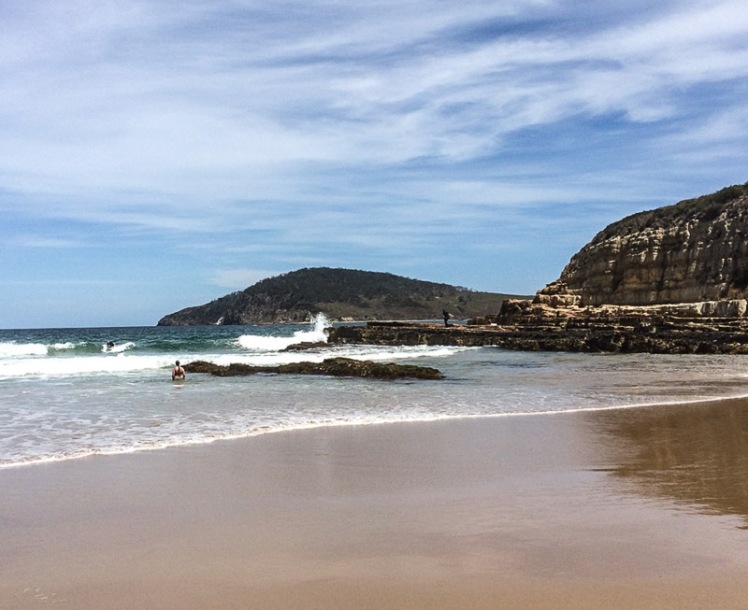
Those who appreciate beauty come here at night to star gaze and to wonder at the auroras.  In daylight hours, as the sky’s moods play out over the landscape, colours shift transferring the mood of the sky.  At this  junction of ocean, land and lagoons the biota is rich, the birds are various, the native coastal vegetation still reasonably intact. Surfers carve the breakers; below the cliff to the east is a break called Rebounds. Goats and Wedge are breaks to the west.  And from these 30 m high sandstone cliffs you can walk west along Hope Beach (aka Roaring Beach) to Cape Direction or you can go east down Goat Bluff’s flank to Calverts Beach for the walk to Cape Contrairety, or angle slightly inland to circumambulate Calverts Lagoon, binoculars around your neck, field guides in your rucksack.
Goats Bluff cliffs (1 of 1).jpg
The bluff’s ramparts with Betsey in the distance

The bluff also provides access to the north. Just cross the road and go west along the isthmus – but think seriously about this – the birds love this thin strip of beach beside the bitumen so it’s unkind to intrude.  Perhaps rather choose the meandering track (far more rewarding) along its eastern shore.

Or simply play it like Krishnamurti and  make your mind like the sky by lingering on the bluff with its sense of poise drawn mostly from the fact that it is the divide between the Arm End beaches and the sweep of coastline to the east.

In other words, don’t think for one moment that Goat (also known as Goats) is an isolated bluff simply there as a carpark, or a dislocated remnant scrap of reserved native vegetation. The road behind assumes more importance than is warranted. Instead, imagine that you are Nuenonne, that slash of bitumen not there yet and see instead Colin Springs Hill descending gracefully down to the bluff’s sandstone rampart, uninterrupted.  Before you there’s a valley, drowned by the ocean that extends down from that rampart and out to Betsey Island, with a dune trapped lake to your right behind Hope Beach, the drowned valley that is Ralphs Bay behind you to the north, a pooling of water in Calverts Lagoon and Pipe Clay Lagoon at Cremorne behind you to your left.

Goats Bluff.  A small band of Nuenonne.  Shearwaters wheeling on the night sky, and then the aurora.

Goat’s Secret, Hope’s Secret and Betsey’s Secret

Goat Bluff has two secrets.  

The first is a beach (T412 (Short, 2006)).

Short describes it as ‘a 60 m long pocket of rocks and sand set in a gap in the centre of the bluffs and immediately below the lookout. The beach consists of high tide cobbles and boulders against the base of the cliffs, then a sandy 100 m wide bar with rock outcrops that fill the gap. Waves are lowered to 1 m at the bluff owing to sheltering by the island and rocks and break across the bar with a weak rip usually flowing out against the western rocks.’

He says there is no safe access to this beach. To try would be dangerous.  So please don’t.

I was surprised to discover another secret on the On the Convict Trail blog: ‘Nearby [to Piersons Point] Goat Bluff was also the location of further underground tunnel systems [associated with the Derwent’s system of battery defence].  But Goat Bluff isn’t near Piersons Point, which is on the western side of the Derwent’s mouth (although distance is relative, I guess) and so I was sceptical until I saw this fact repeated on the South Arm History site.  The Fort Direction page by Maurice Potter states ‘at Goat Bluff there are still the remains of underground trenches that were built at that time’ [WWII] and I also discovered on this page that ‘as many will remember, most of the beaches and the hillsides of South Arm were covered with barbwire entanglement and this remained so for some years after the end of war.’ (Potter, n.d.)

Betsey’s Secret

Sitting on the bluff contemplating the landscape you might naturally suppose that Betsey Island is made off the same stuff as the bluff, but you would be wrong.  Black Jack Reef and Goat Bluff are sandstone / siltstone but Betsey declares its difference by being Jurassic dolerite (Leaman, 1999).  It shares another secret with Hope.

Hope has even more compelling secrets

And as Goat Bluff overlooks Hope here they are.

The first is the precise whereabouts of the wrecked ship, the Hope, that gives the beach its name (Leaman, 1999).

The next secret really belongs to the general vicinity near Hope because between Betsey and the Derwent Light mysterious compass deviations first noted by Mathew Flinders are now assumed to be caused by volcanic necks on the sea floor – and according to Leaman (1999) may possibly have caused the Hope to wreck in the first place.

But here’s the best secret.  Eons ago the complicated Derwent entered Storm Bay through the South Arm isthmus, which now blocks it.  The best part of this secret is that it seems to have done so through ‘a gorge [now] filled with more than 200 metres of clay, sandy clay, sand and gravel [that] lies hidden from our view…’ (Leaman, 1999).

Hope Beach from Goat's Bluff.jpg


A mountain.  A river. A bluff.  They may seem so enduring, but I think all nouns are simply verbs in disguise and everything a process.

IMG_3932

Sources:

Leaman, David. 1999. Walk into history in Southern Tasmania. Lehman Geophysics, Hobart

Short, A.D. 2006. Beaches of the Tasmanian coast and islands. Sydney University Press, Sydney.

South Arm Beaches: Hope Beach

HOPE BEACH (T413)

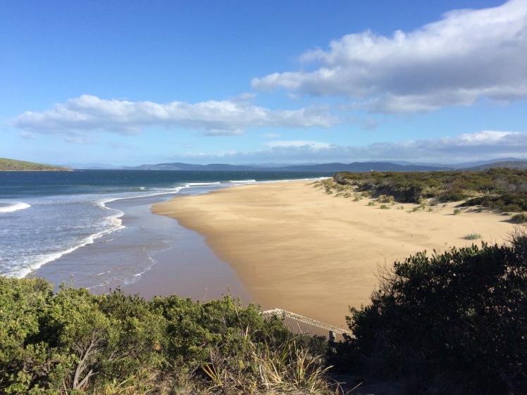
Hope Beach from Goat's Bluff
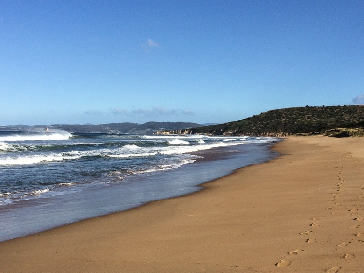
The eastern end of Hope Beach

Hope Beach spreads itself from Cape Direction in the west to Goats Bluff in the east, a distance of about 5 km.  It is backed by dunes that are quite large by Tasmanian standards. The beach forms the southern shoreline of the South Arm isthmus.  Ralphs Bay is contained behind the dunes and this large embayment of the Derwent River provides a sheltered habitat for shorebirds.  

Betsey Island lies offshore and between the island and the beach lies Black Jack Reef, notorious for snaffling the boats of the unwary.

Although we had come to Hope (driving through farmland then walking in along the dune top path)  we weren’t sure we were done with Cape Direction. I stood beneath the cyprus pines that grow on the dunes  in this western corner of the beach and contemplated its shaggy slope. Cathy energetically sought  a path and  although it was  possible a way existed, the dense scrub made it uninviting.  So we  decided to tackle the rocks instead.

The reef at the base of the cape was an equally unlikely route around  to Pot Bay but we gave it a go, timing breakers.  It defeated us within metres but presented us with a great view westwards towards the Iron Pot Reef.

3 Iron Pot from the Cape Direction Rocks
The Iron Pot from the Cape Direction rocks, western end of Hope Beach

As we set off along the sand  a lone surfer stood on the dunes assessing the surf. A pied and sooty oystercatcher were chilling together, and later we spotted six more of the pied variety, along with a dozen hooded plovers – a great sight, given they are endangered.

5 Looking back along Hope Beach.jpg
Looking back along Hope Beach

It was only when we’d reached the eastern end (where the beach unexpectedly curves and broadens) and had climbed up Goats Bluff  that we saw that those sand dunes, a bulwark against the ocean, were being sand mined.

Dune trapped lake or mining pit
Dune trapped lake behind Hope Beach with Cape Direction in the distance.

We could make out Black Jack  Reef where one of the Incat ferries, Condor 11, ground to a halt on a trial run in 2011.   But it is only the most recent shipwreck in this area.  The best known one gave the beach its name.

The Loss of the Hope

The Hobart Colonial Times May 1827 

We have the painful duty to report the loss of the barque Hope, which vessel was wrecked on Sunday morning last, on the long Sandy Beach, between Betsy and Iron-pot Islands. It appears she was on her way from Sydney hither, with about 100 tons of freight, and the following passengers: Ensign Barcley, 40th Regiment; Mrs. Bisbee and Mr. Bisbee (wife and brother of Mr. Bisbee of Hobart Town who came as passengers in the ship Elizabeth from England to Sydney); also Mrs. Westbrook mother of Dr. Westbrook. Of this place, another passenger per the Elizabeth, and three others, among whom is Mr. Edmund Johnson, nephew of Mr. Joseph Johnson of the Green Ponds.

The Hope made the Heads on Saturday afternoon; and took on board, off Cape Raoul, the pilot, Mr. Mansfield, the same evening, shortly before dusk. The Hope at this time was being towed in by two of the ship’s boats; but the pilot having taken charge of the vessel, told Captain Cunningham, that he could safely bring her up the river, without the assistance of the boats; from which, in consequence, she parted.

The Captain, however, wished the vessel might be towed in; but the Pilot observed, that his long experience in the river Derwent would enable him to bring her up in safety otherwise. The Captain was perfectly aware of sufficient room being afforded in the Derwent for any vessel to be brought up with almost any wind, and therefore acquiesced with the Pilot’s wishes; and, leaving the charge of the vessel in his hands, retired to rest, where he remained until awakened by the vessel running on shore.

The wind light and variable, and the vessel proceeded up the river but slowly. The night was rather dark and rainy; and about 4 o’clock on the morning of Sunday; about two hours before day break, she, by some means, we can scarcely conceive how, ran ashore, on the long sandy beach, in Shoal Bay, as above stated.

Although the night was rather dark, the wind was not violent, but the surf was running tremendously high. On the lead line being thrown, she was discovered to be in seven feet of water, while her proper draught was fifteen. The moment she struck, the consternation and terror became general; and the scene is described as truly terrific.

The Captain raving at the pilot like a man distracted, the latter standing in mute dismay— females just left their beds— sailors not knowing which way to turn, to relieve the creaking vessel, which was expected to go to pieces every moment, as she already leaked like a sieve— the heavy surf rolling over her, adding horror to the scene— while the dismal half hour guns of distress seemed to signal the death knell of all on board. Daylight at length appeared and discovered to the sufferers their truly perilous situation.

About 10 o’clock of the Sunday morning, two whale-boats, of Mr. Lucus’s fishing party, which had been laying off Bruny Island, came up to the wreck. They had heard the proceeding evening the signal-gun nfor the Pilot, which drew their attention and induced them to bend their steps thitherward.

They immediately lent their aid, with the ship’s jolly boat, in getting out the ship’s bower and kedge anchors; but the attempt proved fruitless, for one of the whaleboats (the property of Mr. Kelly), was stove, having her head absolutely dashed off, and the crew narrowly escaped with their lives. Captain Cunningham then jumped into the jolly boat alone, which parted from the other boat, and nearly fell a sacrifice to his eager promptitude, to save the vessel. Finding every other hope lost, to all the lives they could became their chief object.

The venerable Mrs. Westbrook and Mrs. Bisbee were safely conveyed on shore, after a state of most dreadful suspense for four hours. All this time, the rolling of the vessel almost precluded anyone from keeping their feet, while the state of the two females was most dreadful; overcome with weakness and terror, and fatigue, they could not stand without support, which was kindly afforded by a Mr. John Elliot and some other Gentlemen passengers. With the Ladies, Mr. Clarkson, charterer  of the Hope, came up to Hobart Town  by the whale-boat in the course of Sunday, bringing the fatal news to Town, leaving the other persons on board. Immediately on learning the fate of the Hope, the Agent (Mr. Behune), dispatched the sloop Recovery, a small craft, in order to bring away a portion of her cargo, in which she succeeded, having returned the following evening with as many tons of goods as could be thrown on board from the wreck.

But to return to the ship. On Sunday night, between 11 and 12 o’clock, the rudder gave way, and the upper part of her stern was driven in. At this critical hour of the night, it was every moment feared that the stern post would give way or be driven in also; in which case the vessel must soon afterwards have foundered, and every soul on board perished as the surf was still running mountains high. The other passengers who did not come up on Sunday safely arrived in Town on Tuesday – till which period all hands were employed at the pumps, in imminent peril, every moment in danger of being washed overboard. When some Gentlemen who left the wreck on Tuesday, who had visited it on Monday, the sea was gaining on the vessel every hour, her main mast had been cut away, and all hopes of saving her were given up. Some casks of spirits, which were on board, were ascertained to have been damaged by the salt water; and the tea and sugar, which also formed part of her cargo, must inevitably be destroyed. We understand, that among the persons who had merchandise on board is Mr. James Lord, owner of  the Marquis of Lausdown.—- We are not aware whether the vessel is insured or not.

The government brig Prince Leopold, in coming from Maria Island with the remainder of the wreck of the Apollo, saw the Hope off the Heads on Saturday, and safely arrived in the Harbour the same evening. Monday she discharged her lading, and on Tuesday was immediately sent to the relief of the wrecked Hope.

There were rumours that £30,000 in silver coin had been buried on the beach by two soldiers.  Captain John Laughton purchased the wreck at an auction, but in another nasty twist of fate he drowned while inspecting it (Shipwrecks of Tasmania).

More

Hope Beach walked on Friday 13th May 2016.


Derwent River: South Arm Beaches – A two cape walk

Looking for Deliverance, Direction and Hope

Calverts Beach
Source: The List

No Place Safe Enough

South Arm is Calvert country. The name is everywhere and at the eastern entrance to the river the Calverts once had fruit orchards on a farm called Pleasant View.  In  September 1939 they sold it to the army and in 1944 the army built Fort Direction.  The military base extends across both Cape Deliverance  and Cape Direction.

Even down  at the bottom of the world, the idea of falling to the enemy made people jumpy.  That’s why, from 1804, shortly after the colony was established and on into   WWII, a network of batteries and bunkers was built down both shores of the Derwent to where in Storm Bay the river merges with the Southern Ocean.  Standing right at the river’s mouth, Fort Direction and the Pierson’s Point battery were the first line of defence against enemies arriving by way of the Southern Ocean (Tasmanian Times, 25 Feb 2011).

Seacroft Bay and Fort Beach

On one of summer’s more perfect days, Cathy and I set off on a walk along Fort Beach, Seacroft Bay’s only beach.  It was low tide and our ambition was to walk across both capes and on to Hope Beach.  But the army had not responded to my request for permission to traverse military land and we anticipated that our walk would be a brief one that would end abruptly where the beach gave way to military land.

The low dunes backing the beach are infested with marram grass and the river had been nibbling away at them.  Blessington Street runs behind them and the houses here enjoy superb views over the estuary. We chose to walk along the swash, stopping to consider an outcrop of rock emerging from the sand and remarking to each other that we had finally reached the last beach on the Derwent River’s eastern shore.

There was a woman with a dog quite a distance ahead of us.   Beyond her a man took a path up from the beach and disappeared into the bush on to what had to be military land.  If he’d gone that way then so would we.

The dog owner had stripped down to her bathers and was about to plunge into the perfectly transparent water by the time we reached her. We got chatting and she told us it was possible to continue on via the rocks, or alternatively by way of the path the man had taken.   We quickly decided that the rocks would be more adventurous and walked on, undeterred by the sign we saw on the beach.

There be toxic matters here.jpg

Passing four pied oyster catchers, I wondered about the impact of toxic waste on the birds who call by and unwittingly spread toxicity further afield and on those birds who make their summer residence here and possibly bury into it.

Cape Deliverance

The rocky platform at the base of Cape Deliverance was beautiful, the pools rich with kelp and seaweed. It was tessellated in places and there were dropstones and small formations that the geo later suggested were probably remnants of an earlier rock platform.

Soon we came to the kind of risky gulch that has you wishing you’d remembered to bring a first aid kit along, just in case.  A little later we walked around a point and were elated to see the Iron Pot lighthouse right ahead of us, at the end of the low lying reef.

Remnant from earlier times and the light.jpg
The Iron Pot light and the possible remnant from an earlier rock platform now weathered away

Pot Bay

This was not the only surprise.  In Pot Bay, tucked between the two capes, there was another beach.  While Fort Beach gives every impression of being the last beach, this secret beach appeared to hold that honour.  Obviously I hadn’t been too observant when sailing passed this area, perhaps because it’s not possible to sail between the capes and the Iron Pot.  There’s that dodgy reef and sometimes there are cray pots off it, so it pays to have ample sea room.

Marram grass hadn’t made as much of an inroad on this beach’s dunes. Native vegetation still owned them. Cathy pointed out that we were not the first to have visited that day. There were footprints: human, dog and bird.

Tucked away beside the dunes we found a structure made from driftwood and plastic debris and after enjoying it  we carried on walking along this largely litter free beach.

POT BAY
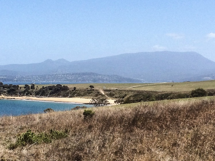
Pots Bay and its beach.  The Derwent, Hobart and kunanyi in the background.

Pot Bay hideaway.jpg

The Last Beach on the Derwent

Beyond Pots Beach we found another, even smaller beach (T 414, Short 2006).  Although little more than a 80 m cove below Cape Direction, it is the beach that actually has the honour of being the last beach on either side of the river.

The last beach on the eastern shore.jpg
The last beach

Tackling Cape Direction

That small beach was so protected we couldn’t get all the way around the rocks because of a fairly dramatic drop off and so we decided to do like mountain goats and scramble up the cliff. I was still picking my path upwards when Cathy disappeared from view. Although I was sure I’d have heard her if she’d fallen over the edge, I tried peering over the edge to make sure she wasn’t spreadeagled on the rocks below. I called her once and then I called her again, this time a whole lot louder.

She appeared above me and said she’d found a path. Trusting that no snakes were sunbaking in this vicinity, we made our way through tall grass and scrub to a path that led around the headland, taking cover when we noticed a Toyota 4×4 heading towards us.   Behind us, and way up on Fort Hill, there are Defence Dept buildings and houses. The Toyota must have seen us but as no one accosted us we continued on our way.

Ahead we could see signs and a small concrete building. Later I read that:

‘The naval command [lived] on the hill at Fort Direction. These men had to carry out watch over the entrance to the harbour. A small weather board building of four rooms was constructed on the top of the hill with the adjacent flag pole for the raising of signal flags. A watch was maintained 24 hours a day from 1940 – 1945.  As many as fifteen naval personnel lived in quarters just below the top of the hill.’ (Potter, RSL website)

The signs warned about asbestos in this vicinity but beyond them there were cliff top views to die for, so as a vague protection I held my phone in front of my nose. The sea breeze hadn’t yet roused itself and we figured any asbestos left on the surface was dormant today and must surely have been blown far and wide by now, or was beneath ground lining shearwater burrows. It was easier to simply not think about the other nasty chemicals we might be exposing ourselves too but instead to focus on the quite dramatic views of the Iron Pot and Bruny Island from this high vantage point. They were heady, and so we lingered.

As we searched around for an onward path we discovered that there were middens up and a steeply plunging cliff face on the north eastern side with a pebbled cove beneath it. We could now see all the way along the cliff line to Hope Beach.  Hope looked so close yet so unattainable.

Headlands are tricky for walkers because the way can be barred by private land, but being military land we didn’t want to find ourselves in the middle of an explosives test.  There were fences and box thorn and no doubt moon bird burrows, and although it was conceivable we might find a way, we decided on balance that we would turn back.  I wondered about kayaking the capes and then I remembered one particular time I’d sailed them.

Cape Direction cove east.jpg
Midden in foreground.  Beneath the cliff the cobbled cove.  Hope Beach in the distance


The Capes by Sea

The fleet stretched out ahead of us one balmy Saturday on the return leg of a long distance race around Betsey Island.  We were towards the back of the fleet, the conditions favouring lighter yachts and we were sailing excitingly close to the surf break off Hope Beach.

We were off Cape Direction when we observed that the boats out ahead of us had heeled dramatically.  The big blue Beneteau liked rough weather.  When lighter yachts heeled, she’d barely lean, but this southwesterly was intent on causing havoc.  Much earlier in the day the frustration had been a long period becalmed  while the rest of the fleet sailed a sneaky breeze.

We hadn’t even considered reefing before the wind whammed into us and the yacht heeled like I’d never experienced her heel before.  Suddenly the cliffs and the Iron Pot, on what was now a lee shore, seemed exceedingly close and the normally laid back crew leapt into action with alacrity.  There was a cacophony of yells to ‘down traveller!’ ‘main out!’ and  ‘reef!’  And where there were usually one pair of hands on a line there was now the urgency of many, some at cross-purposes.

As we made it around both capes and the Iron Pot with sufficient sea room to keep us safe, the wind swung behind us, the crew grew animated with unanticipated hope and the yacht, now sailing in far more favourable conditions, began to power up steadily through the fleet.

Iron Pot the reef and Bruny Island 2 (1).jpg
The Iron Pot, the reef and Bruny Island in the distance. Beach T414 below.


Making Like a Ghost

Cathy and I  turned back (but If you’re planning to walk further than us  then see below for a couple of tips.)

This time we took the path that ran along the cliff top passed the shearwater colonies and in so doing bypassed the Lone Pine Memorial where a dawn service is held each  ANZAC Day. At various points we tried short cuts but we didn’t want to damage burrows and the hollows behind the dunes roared ‘Snakes!’ at us and so we kept out.

There was something quite old time about taking the neat path we found over a fully mown hill as though we were on a clear road to somewhere, like walkers between villages in the olden days. The sweep up Fort Hill was devoid of people until we crested a rise and saw not very far away from us the same white Toyoto we’d seen earlier. Three people were bent over, working silently at some incomprehensible task, apparently just as eager to ignore us, while we, trying to avoid them, searched again (but more frantically) for a short cut off military land and on to the beach.

They were only about 10 metres away from us anyway, and we were beginning to feeling foolish.  Tired of feeling like ghosts we called out, ‘are you conservation volunteers?’

‘Army,’ they said, avoiding eye contact, and turned back to fencing a tiny tree (a lone pine?) behind a small monument while we stood about a metre away photographing the little memorial in front of the tree with its engraving of the Dardenelles. Then, feeling as though we had transformed into ghosts again, we carried on down the path back on to Pot Bay Beach.

Au revoir, timtumili minanya

We had stood at the mouth of the Derwent (known before settlement as timtumili minanya to at least some of those living along its banks).  Ocean beaches and headlands stretched out to the east.  Our walk had included two capes and and had taken us from the river to the meeting place on the eastern shore of the Derwent River, Frederick Henry Bay and Storm Bay with three of the Betsey Island group of islands – Betsey, Little Betsey (hidden from our vantage points) and the Iron Pot just off shore. From this point on we’d be walking ocean beaches all the way to the mouth of Pittwater Lagoon, but we thought we might just have a go at seeing if we could walk Cape Direction from the Hope Beach side.

~~~

Tips:  If you don’t want to sail or  kayak the capes, you can  actually walk all the way around to Hope Beach.  According to Greg Faull’s blog post it’s possible.  The Pandani Walking Club website also discusses this option but indicates that it can be precarious:

‘Thu 17 Aug South Arm to Cape Direction Grade: Easy Map reference: Blackmans Bay 1:25k Book by: 8:00pm Wed 16 Aug Start at: 10:45am at car park opposite South Arm War Memorial Group limit: 20 Bring: The usual daywalk gear This is an easy walk from South Arm to Cape Direction opposite the Iron Pot Lighthouse along a newly made track and the fore shore. We will do it `out and back` rather than as a circuit, avoiding the steep box thorn and mutton bird burrow ridden climb up from the western end of Hope Beach and precarious cliff top walk to the cape. It is an easy 4 hour walk with time for coffee at `The Sand Bar` on the way home. There are magnificent panoramic views, especially from the cape.’

* This is an Aboriginal name for the Derwent River, found in the Tasmanian Aboriginal gallery at the Tasmanian Museum and Art Gallery.  Interestingly, the spelling for the people living along the western shore is given as Muwinina, which is different to the spelling I’ve found in other sources.

Walking Cape Direction