Derwent River: South Arm Beaches: Opossum and Half Moon Bays

Mitchells Beach the view of kunanyi south end
View of kunanyi from Mitchells Beach

Clarence Beaches: The South Arm Peninsula

Lauderdale, an outer suburb about a forty minute drive east from central Hobart, is situated on the isthmus where the South Arm peninsula officially begins.  Carry on through it and there are two routes you can take to reach the Arm End beaches that are on the far side of a second more southerly isthmus.  Of the two options, I like taking  Rifle Range Road.  It wanders along the western slope of Mount Augustus and continues onto Collins Springs Hill.  There are tracts of dry sclerophyll forest, views west across Ralphs Bay to kunanyi, views east over Calverts Beach and lagoon and finally a spectacular view of the Iron Pot and Betsy Island.


.

IMG_2370
Source: Tasmap. 2007. Tasmanian map book: south region, Hobart. (Scale: 1:50,000)

Opossum Bay Beaches

Opossum Bay stretches its 1.5 km length west to southwest.  It harbours three beaches,  although, if you’re not a local, its easy to make the mistake of thinking that there is one beach only. Opossum Bay beach is easy to find while the other two are easy to overlook, unless you are  paying close attention to the landscape.

I pretty much started this blog here, with my first walk around Gellibrand Point, accessible from this point.  Now I was back here with my friend Cathy.  We’d set ourselves the goal of walking the coastline to the end of Seven Mile Beach and we’d planned to do it on low tide days over the coming months.

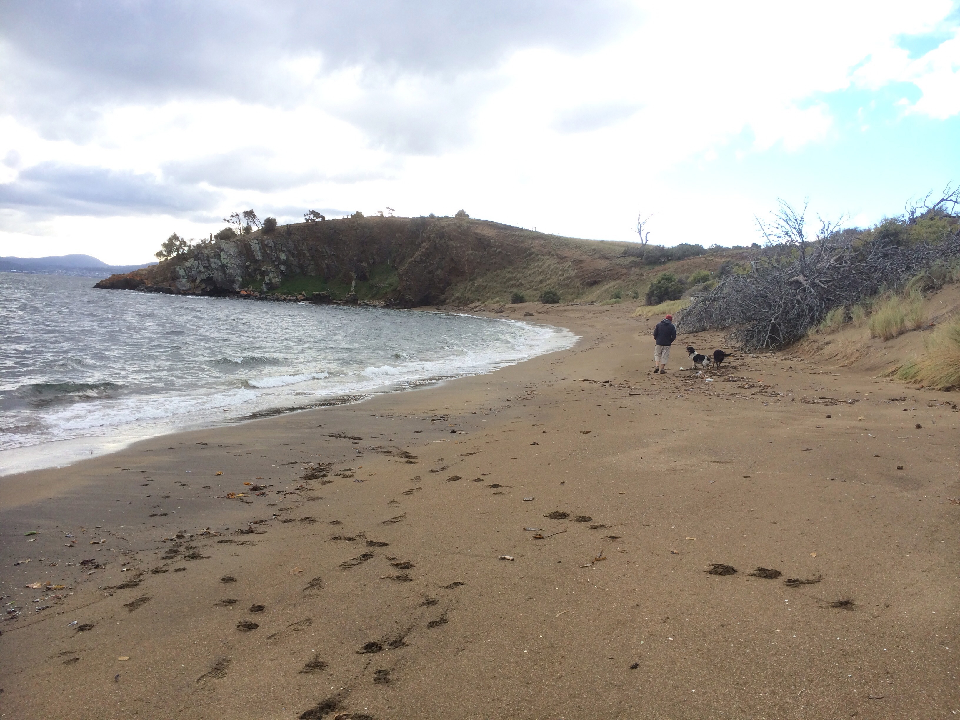
T 422 Mitchells Beach: in the shadow of its middle sibling

Mitchells Beach the view behind
Looking north along Mitchells Beach

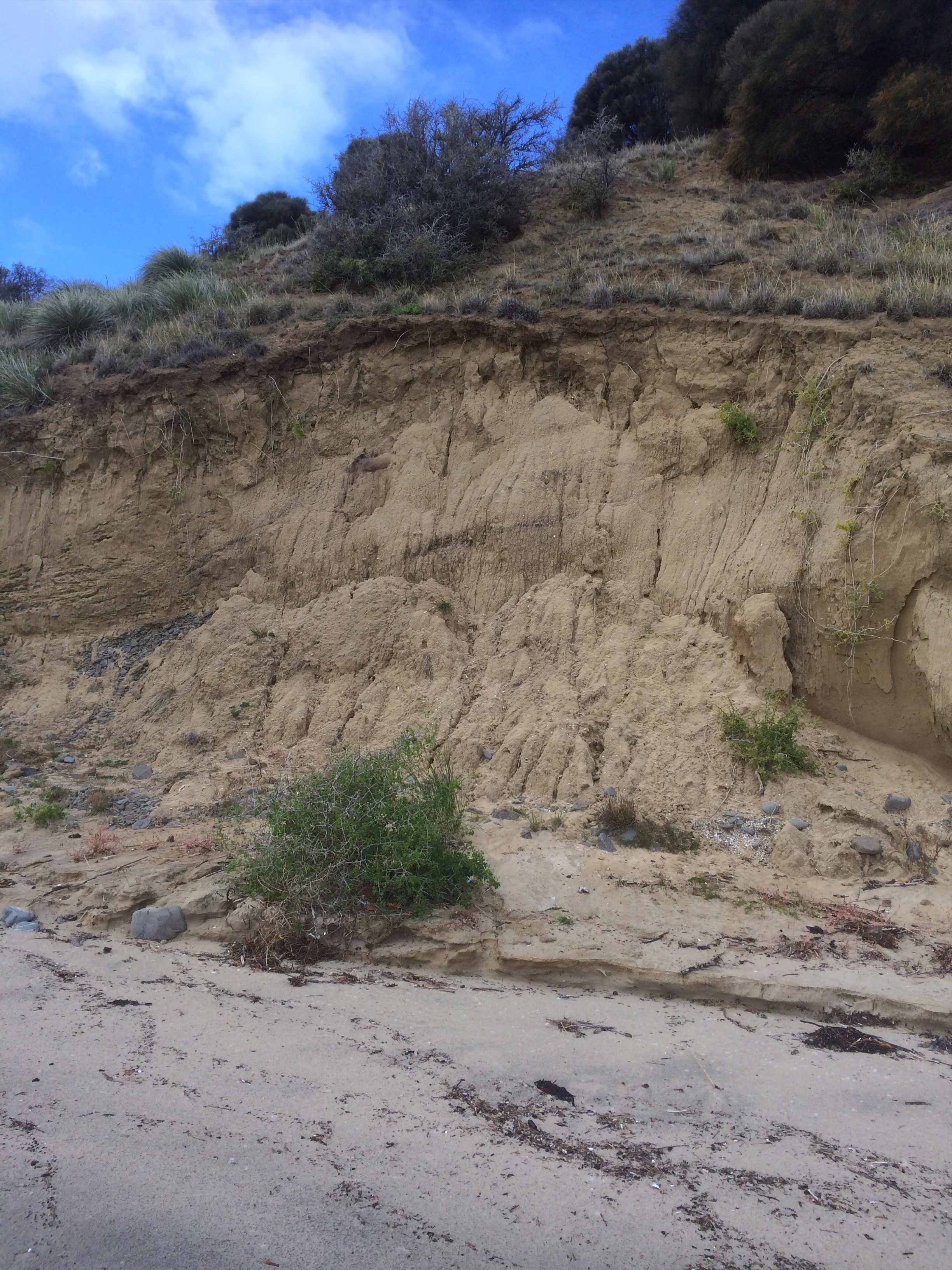
The tide was out on Mitchells Beach and it seemed lighter and more gracious than when I had been here last.  On that day a  band of cobbles barely separated the winter sea from the eroding slope at the western end of Opossum Bay and the stone percussion in the roll of the swell had been audible to us some distance above it. But the day Cathy and I had chosen had begun with a big frost.  Now the sky was blue  and on the far side of the river there was snow on kunanyi.

We turned our backs to the mountain and walked east along the pale terrace of sand the low tide had exposed, in the long gone footsteps of family bands of the Moomairemener, believed to be members of the Paredarerme (Oyster Bay tribe).  They called the land along the eastern shore of the Derwent River Nannyelebata and they were people of both the coast, the river and the lagoons that are to be found on this diverse peninsula, a peninsula  largely in kunanyi’s rain shadow with few hills.  As there are no real makers of rivers around here (save Den Hill, Jim’s Hill and Blatherwick Rise – all rather too lowly to whip up a creek) their water sources were springs and the freshwater that collected in the dunes, as well as their freedom to follow the seasons further up the river and to cross it in places.

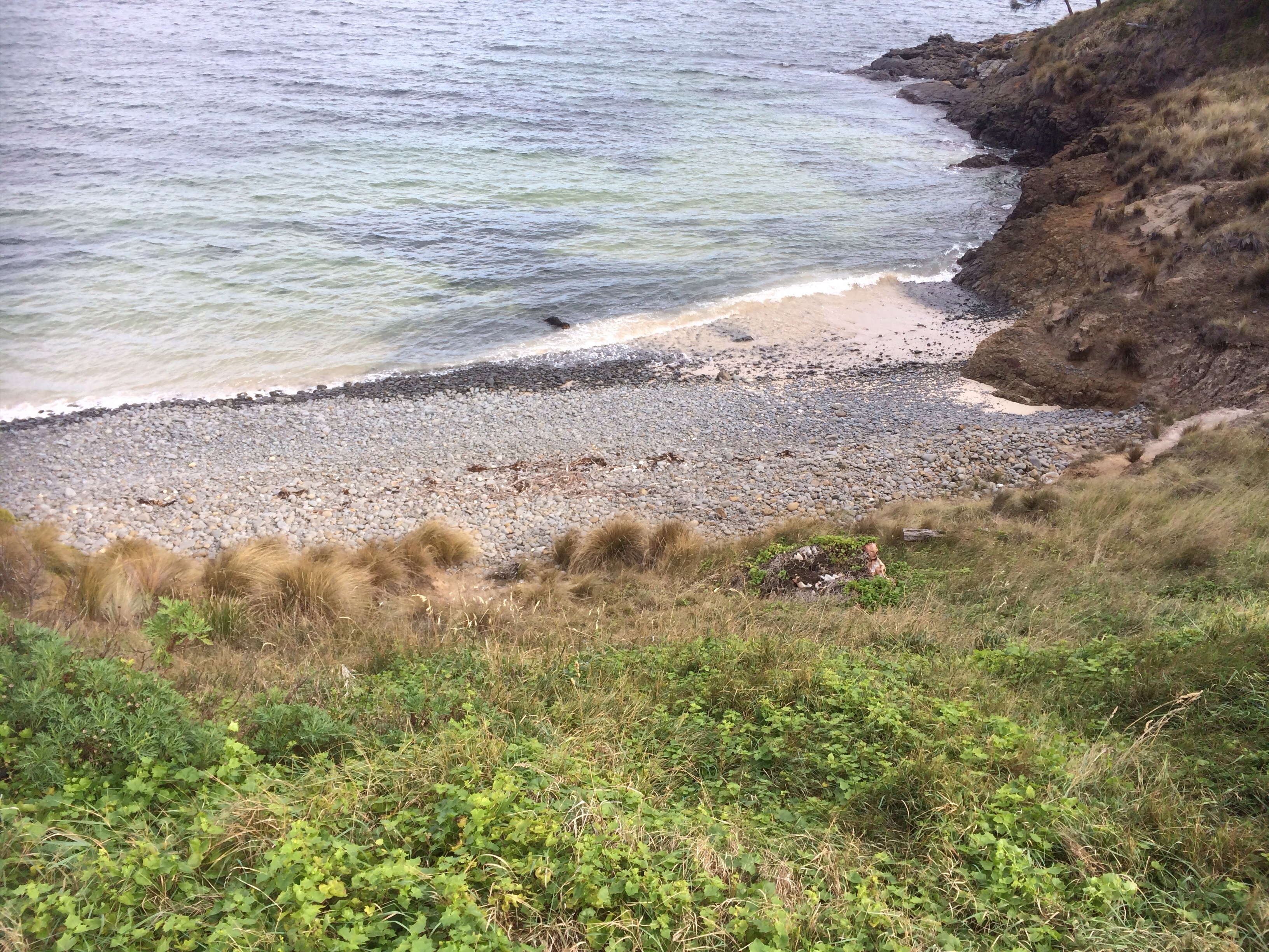
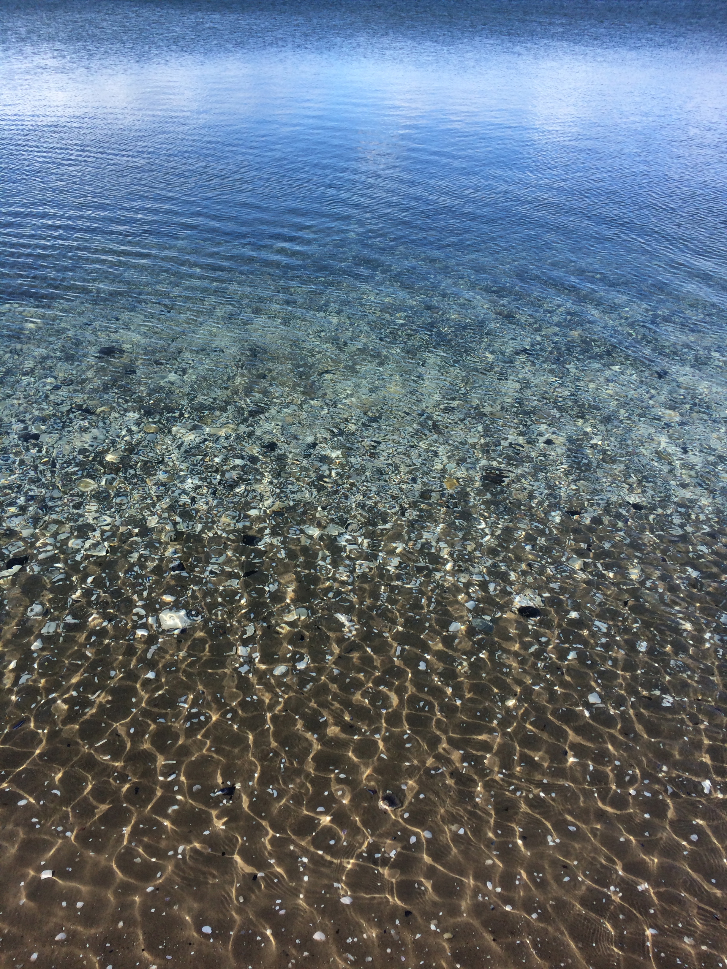
Mitchells is a reflective beach of about 850m, the longest in this bay, and stormy weather can invigorate the waves that are eating away at the weed infested slope. We stopped for a moment because I wanted to try to understand what the stratigraphy was saying about this beach’s past.

Still catching up on each other’s news, we reached the rocky platform and headland  that separate this beach from Opossum Bay Beach, embraced with so much enthusiasm by the locals that houses literally perch on the wrack line.

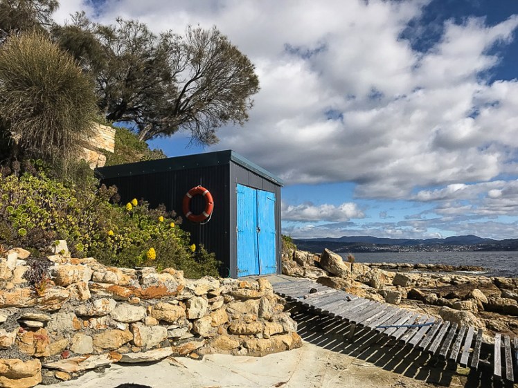
T 421 Opossum Bay Beach: houses as rampart

Opossum Bay Beach.jpg
Opossum Bay Beach: looking south

We walked along sharing the memories it has given us. Cathy knows it far better than me and she mentioned that we had the option of a footpath between here and South Arm.  I’ve viewed its houses, boatsheds and slender sweep of sand on windy days from heeling yachts and also when, becalmed,  there’s been ample time to absorb the view more fully.  The beach houses and shacks on their bluff are the rampart the rising river meets and the views are of the estuary widening.

There’s a difference between walking and exploring, and concluding that today at least we fitted in the latter category, we shunned the pathways on the headland above us at the eastern end in favour of the shoreline and clambered around the headland with its jetty by way of the rocks.

Opossum Bay Beach jetty.jpg
Southern end of Opossum Bay Beach

T 420 Glenvar Beach: The Secret Beach

We crossed a boat ramp and walked into the more hidden part of the bay.  Too often I’ve been that sort of beach walker who stops at the end of a stroll along the sand without testing its boundaries.  That’s why I’d never found Glenvar Beach.   Recently a friend had told me that she’d rented a beach house at a Gellibrand Beach.  She described where it was and spoke about the lovely way the swells sometimes swept into the bay from three different directions.


Glenvar Beach.jpg
Glenvar Beach

Glenvar is definitely the smallest and most crescent shaped beach in the bay.  Here, the houses also show an inclination to cosy up to the water, but held more tightly between two headlands, the feeling is more intimate.  I figured this had to be my friend’s ‘Gellibrand Beach’.  Cathy and I lingered on the rocks before beginning our walk out of it, admiring all the things large and minuscule about it – the nautical things like boat sheds, the sea walls in places, the features in the siltstone – fossils included – a feather or two along with shells and the vibrant seaweeds of the reef.


Glenvar beach boatshed.jpg
Glenvar boat shed

I came back here the other day after a storm.  Kelp lay washed up on the beach.  This time I walked the lanes between the houses on on the headland seeking out a path to the beach.  That’s the way to arrive on Glenvar.  Not by directions but by following the lean of the land until you arrive on the sand.
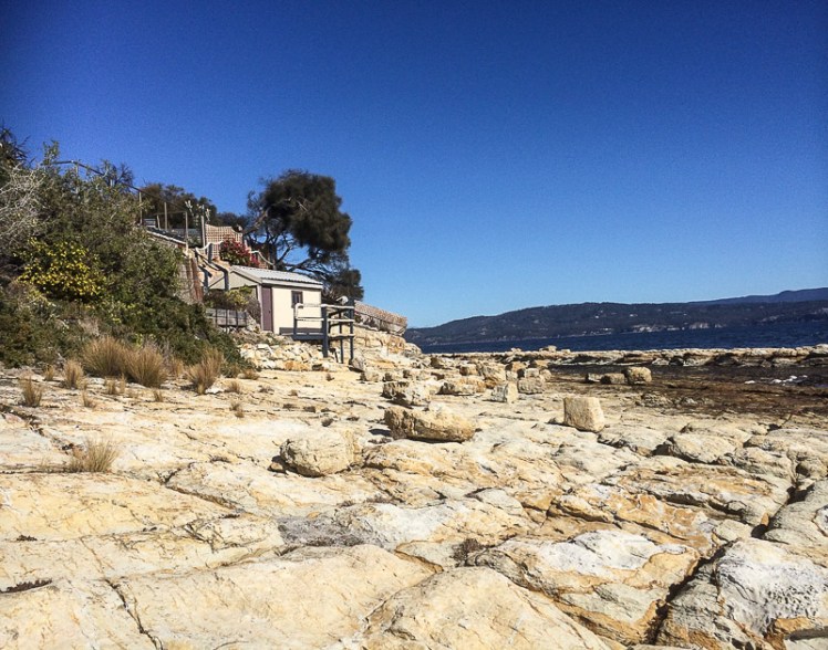
Glenvar Beach heading around to Pigeon Holes.jpg
Rock platform at the southern end of Glenvar Beach

Pigeon Holes

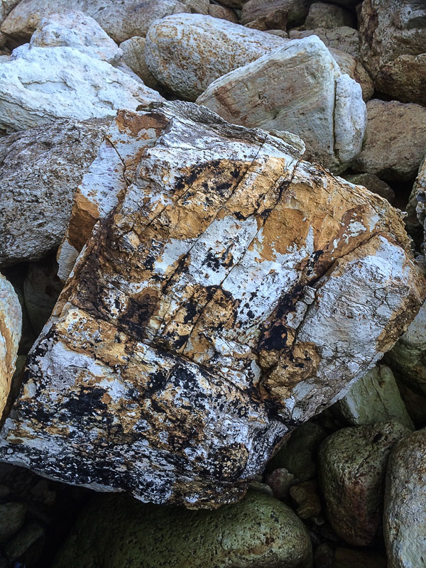
Blatherwick Rise* stops Glenvar Beach. We set off along the rock platform at its base.  The siltstone here has been sculpted by the winds and rain so that its stippled with   hollows.  I was pretty thrilled to have reached this spot because once, crewing on the big blue Beneteau in a long distance race, a buoy was placed off here and we’d had to check the chart, none of us precisely certain about where the mysterious Pigeons Holes were to be found.

It’s a favourite spot with the cormorants, perhaps because there’s quite a variety of fish here.  I counted twenty one of the birds taking in the long view and apart from a gull or two, they were the only members of the avian nations that we saw on this walk.  We also discovered the remnants of a battered metal boat lodged on the rocks.

Rock white and orange dropstoneRock white and orange

Seaweeds and rockpool.jpg

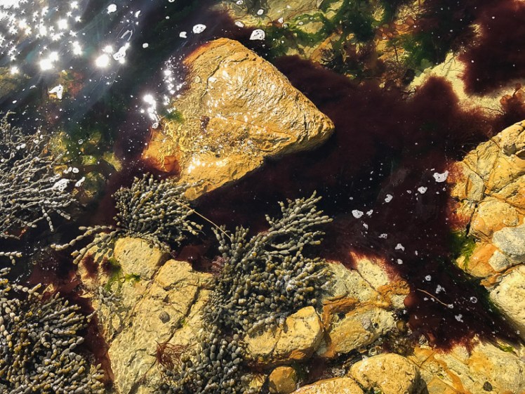
Our rock hopping had warmed us.  We took off our jackets and explored the platform with its  mollusc rich rock pools fringed with red and green seaweeds. Beneath the water where the rocks give way to sand the stingrays and the flathead lie camaflaged  and all these are reasons why divers like this spot.

We walked the shoreline, sometimes scrambling, wondering where above us the  house owned by Brian Ritchie (Violent Femmes) happened to be.  According to the website for the tv series Sandcastles that featured it, he left the Big Apple seeking the serenity of The Apple Isle and bought this land from Peter Garrett (Midnight Oil and ex Labor MP).

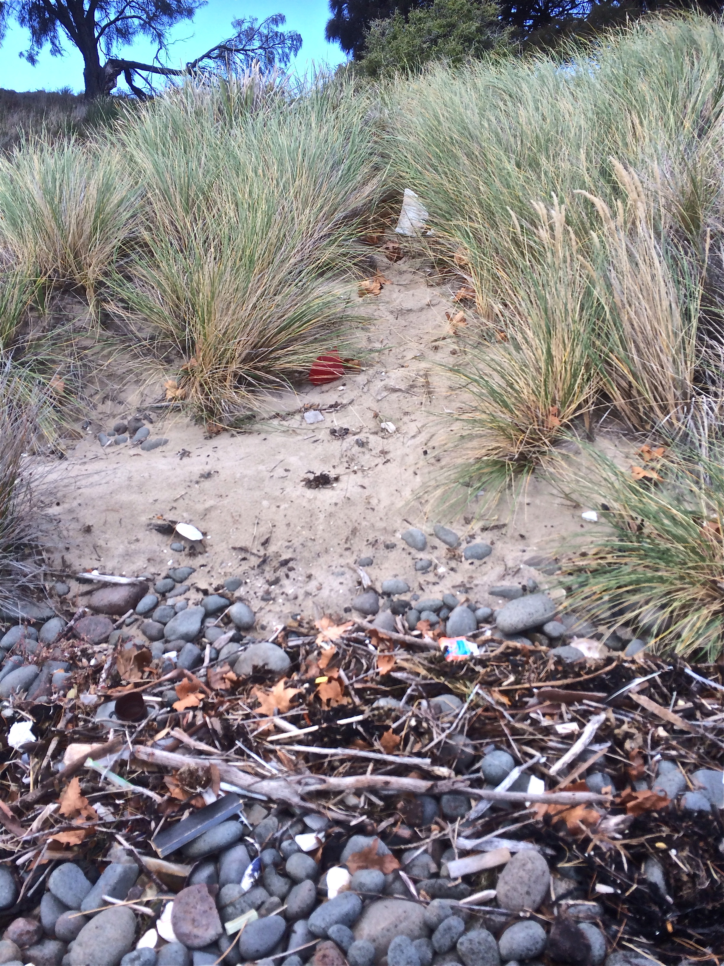
At one point we found a narrow path beneath casuarinas and sauntering along this cliff top path we heard voices below us.   The water seemed unusually blue just there.  Two heavily tattoed men on a motorboat, oblivious to our presence, were getting ready to dive. We regarded them silently  before continuing on, coming to a small beach neither of us expected to encounter.  Its beauty was marred by the litter it was assiduously collecting.  (Later I checked Short’s inventory but it isn’t noted there.)

We filled our bags with plastic bottles and styrofoam and then clambered over more rocks and down on to another  beach in the next bay along.


Half Moon Bay

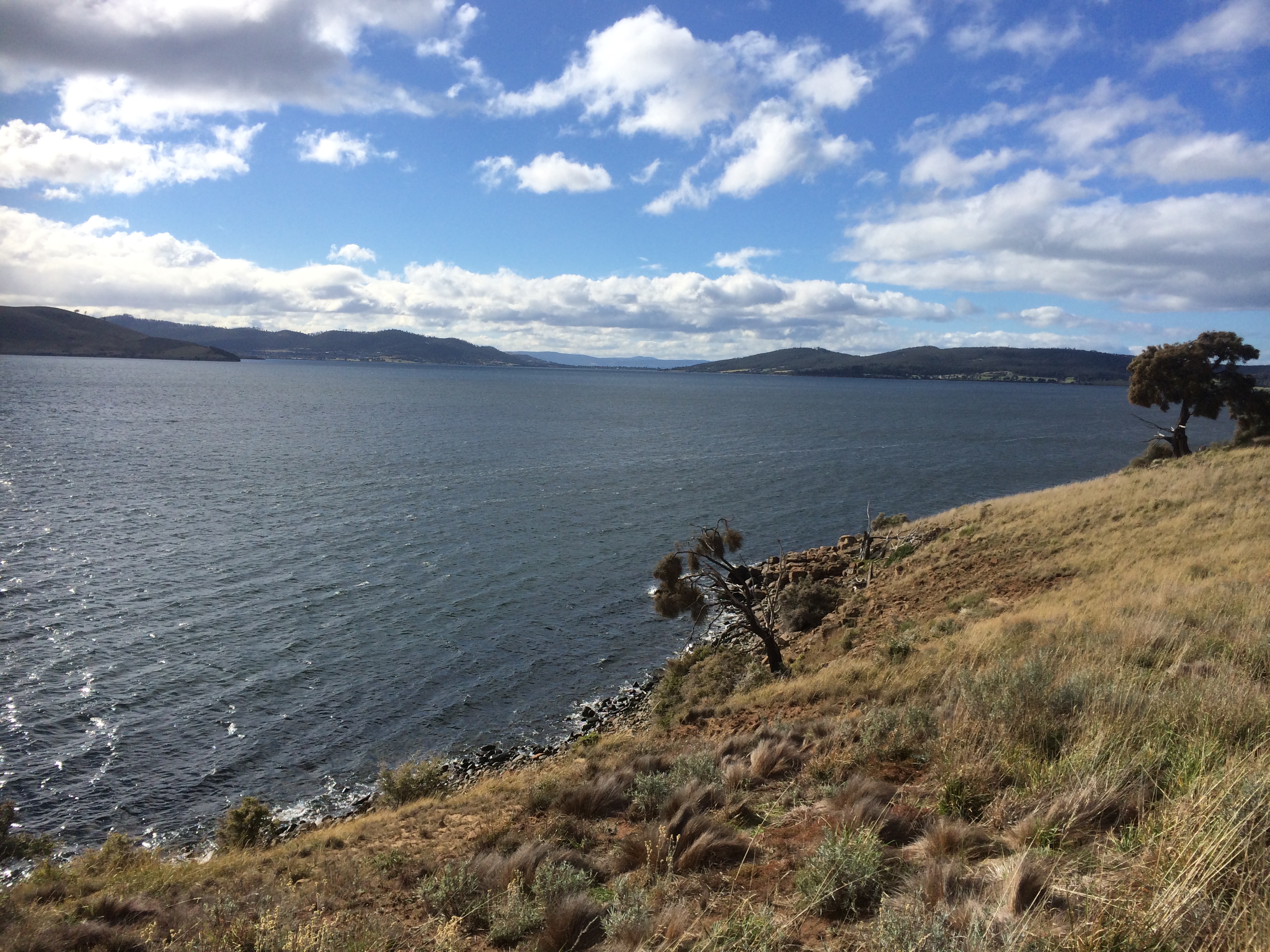
Like Opossum Bay, Half Moon Bay  has three beaches within its 3 km extent and it also faces west across the Derwent’s estuary, which  is vast here, the swells and waves from Storm Bay flow directly into the river, merging with the water from the D’Entrecasteaux on the other shore.  Humans may demarcate the boundary with a mark (the Iron Pot in this case) but the moon and the weather determine where and how the waters mingle.

Pigeon Holes cliffs.jpg
Rock formations at Pigeon Holes.  Note the jointing in the rocks – there are some beautiful examples here.

T 419 Half Moon Bay Beach and its smaller sibling

This beach (T419) we found ourselves on was known to Cathy but not to me.  Robertson (2008) calls it Half Moon Beach and Short (2006) calls it Pigeon Holes Beach .  It’s about 150m long and  on a summer’s day it would be a lovely place to come to with a beach umbrella and a good book.  But if you were a bird, that’s what you’d be dreading.  Your eye would be on making a nest here and beach umbrellas play havoc with that.

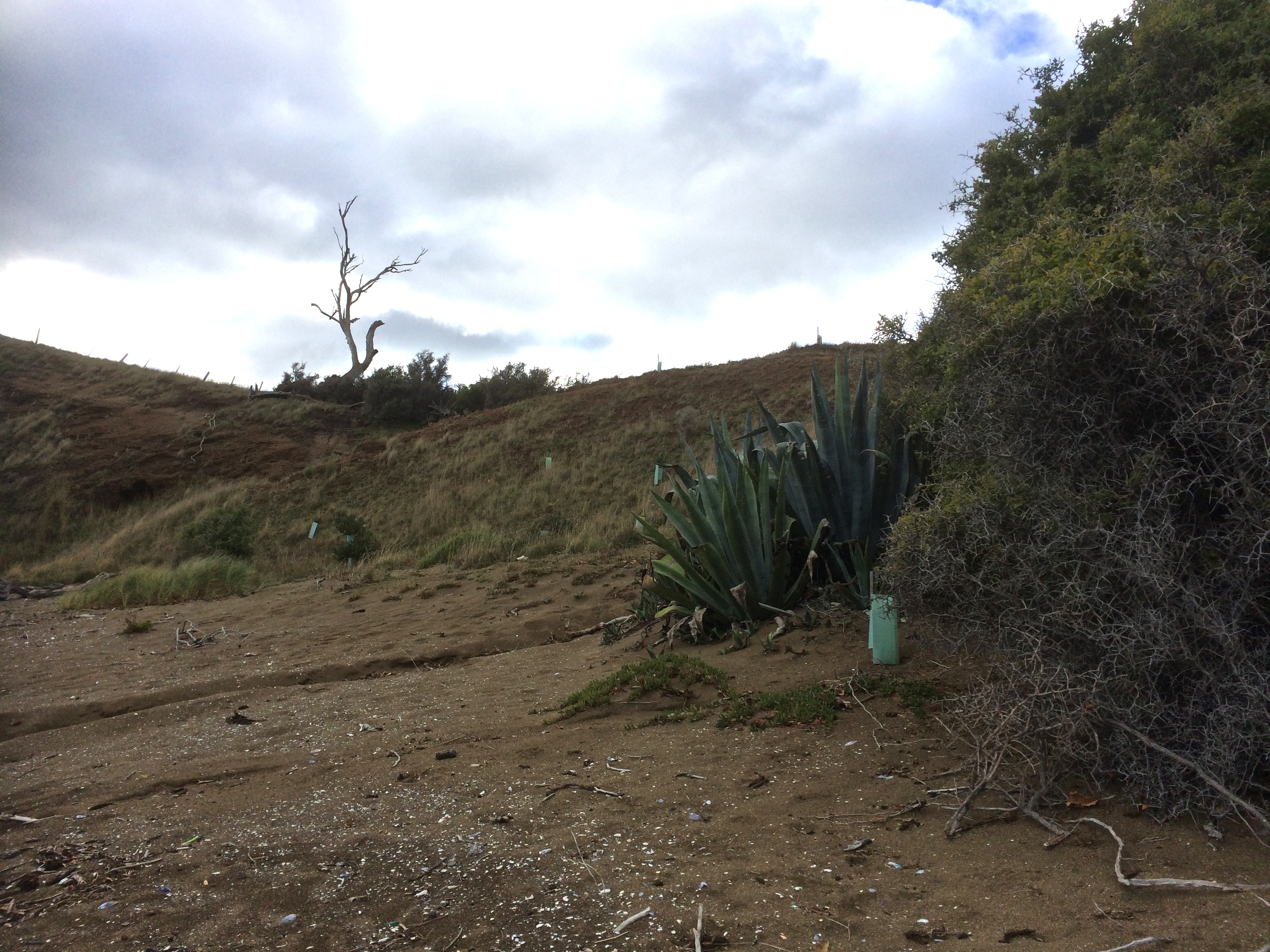
The smaller beach we’d stopped to spring clean is in effect a little  companion tucked into the long headland that is Blatherwick Rise, so seemed to me to be not quite Opossum Bay and not quite Half Moon either.  Unrecognised, it’s without a Beachsafe number (unless my beach interpretation is shaky here and I’m suffering from beach confusion).

Pigeon Holes beach.jpg
The little west facing beach beneath Blatherwick Rise.
View from Half Moon Beach.jpg

The view from Half Moon Beach: straight down the D’Entrecasteaux on the other side.

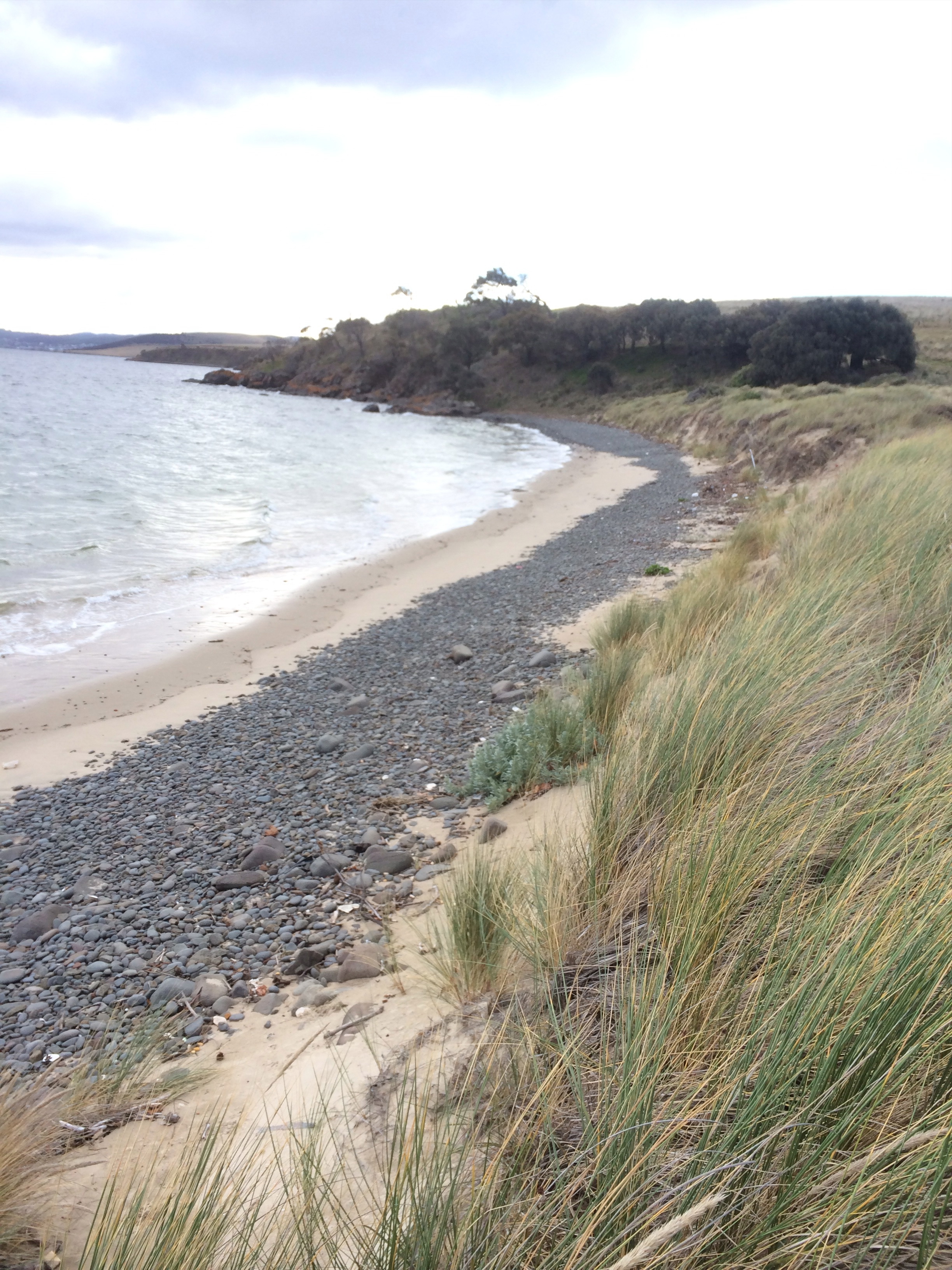
T 418 South Arm Beach

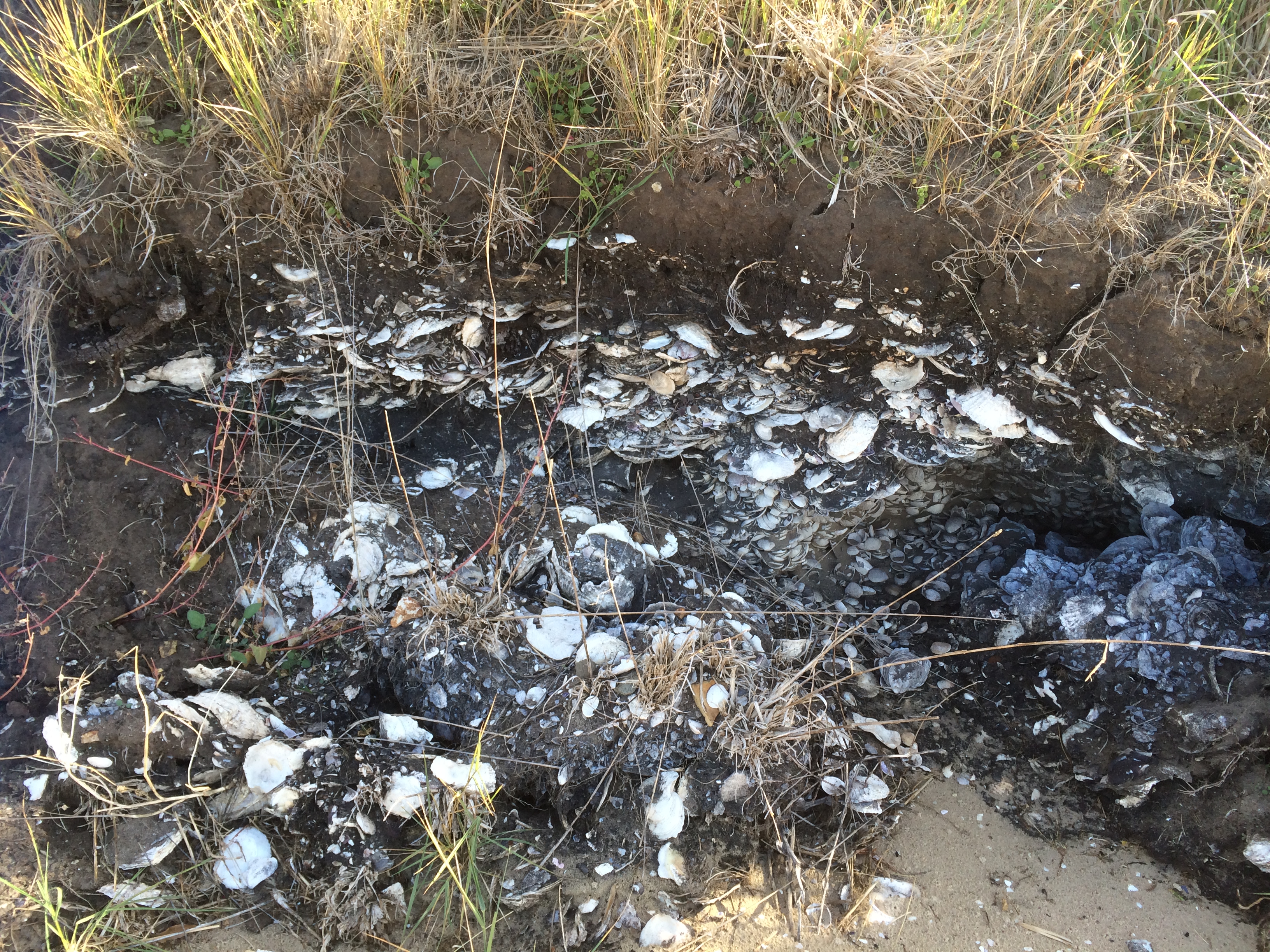
A quick clamber over the next lot of rocks and we were on South Arm Beach, the long, generous curve of sand backed by dunes.  We increased our pace because we were fast running out of time.  Sometimes we walked below houses.  We exchanged waves with a couple on a sundeck toasting their mountain view with glasses of wine.  I found an enigmatic layer of shell in the dunes.   It could have been a midden, but one of Ralphs Bay’s most intriguing features are the dense layers of shell.  This lovely embayment lies held in the crook of the peninsula’s skinny arm and I thought I might be seeing an exposed part of that layer.

We walked passed boat sheds.  We passed the conifers.  We reached South Arm (no more than a village or a far-flung Hobart suburb, take your pick) and as we turned to walk over the headland by way of the roads, we eyed out the rocks below  Johns Point. We’d hoped to walk around and complete Half Moon Bay but we had run out of time.

If we’d taken the South Arm to Opossum Bay trail that runs close to the road,  we’d have done that 4.5 km walk in less than two hours, but we had chosen to scramble over rocks instead and we had dallied  on beaches. The school bell chimes at 3 p.m. though, and one of us could not be late.  That last Half Moon beach would have to wait until next time.

View from Half Moon Beach of South Arm.jpg
The sweep of South Arm Beach in the distance  and the village at the far end.

* According to Place Names Tasmania, this name was ‘advised by Mr G. Calvert and Mrs B. Gellibrand; family by this name lived for many years in old days at top of rise on South Arm Road.’  Locals also call it Blatherwick Hill.

** They also record this information about (The) Pigeon Holes: “Pigeons as we know, favour ledges for nesting and roosting. Mr Cramp recalls that pigeons used to nest on a cliff face at Opossum Bay, South Arm. There was a considerable number of them, and the ledges were—“.


Walked on 24 August 2015


Derwent River: South Arm Peninsula Walk: Arm End Walk

10 May 2015

Mr Gellibrand’s Temporary Tenure

Conditions: SW wind about 15-20 knots, tide going out.

Clarence Map
The walk we did is in the area that is red on the map

After our impulsive breakfast decision to head out to South Arm Peninsula (see previous entry), we gathered up the dogs and set off knowing only that there was a walk at the end of the peninsula but not much more about it.  We supposed it would take a mere 30 minutes to walk that stretch of coastline.

The peninsula forms the southern end  of the Derwent River’s eastern shore, on the far side of the low lying isthmus at Lauderdale, a suburb at the eastern end of Ralphs Bay.  Somewhat uncertainly, and without consulting a map, I’d thought this might be where I’d choose to start my coastal walks from.

There are no real suburbs on the peninsula, just a couple of communities, farmland and conservation areas.  South Arm Peninsula has many varied beaches – some coastal, some on the Derwent Estuary and quieter ones in Ralphs Bay.  If this was a day  in the last interglacial (about 125 million years ago) we’d be climbing in a boat and heading out to a series of islands and as there is evidence of current sea level rise this will eventually be the case again.

We crossed the isthmus and then we were on to the peninsula and turning right for Opossum Bay.  There’s a small collection of homes and beach shacks here, many with their foundations right on the diminishing strip of beach itself.  There’s a corner store and not much more.  It’s quaint, it’s quiet and from this part of the peninsula looking north there are the most riveting views across the Derwent River back towards Hobart and the mountain. Looking south you can see the western shore receding south to Storm Bay and Bruny Island.

We crossed the equally low lying but skinnier isthmus called South Arm Neck and continued through Opossum Bay and on to what was once pastoral land but is now, south of the recreation reserve, giving way to a subdivision of new homes and that’s where we parked our car.  A sign right there announced the start of the  Arm End walk.

South Arm sign
The walk begins

We were rugged up against the cold and across the river the mountain loomed, snow still on its peak from the big dump the previous week.  These were some of the observations we made to each other as we walked along the track above the coastline:

~ There are an awful lot of different weeds invading this landscape.

~ This is a fantastic walk to do with dogs.

~ This walk is going to take us more than 30 minutes.

~ Are we doing this right? (This was me.  I was beginning to realise that a plan written on a finger nail was no plan at all.  I now saw that many compromises might.  For instance, we were enjoying following the path that made its way over grassy paleo dunes, but the actual shoreline was hidden beneath us.  I wanted to walk along the edge.

We thought that, if you put to one side the knowledge that you were not going to stumble upon a village, strike a lane or happen across a pub the walk felt a bit like rambling through the countryside in England.

SettingOffAlongTheGellibrandTrack
Beginning of the path

The path reached the cliff edge. Peering over I saw that the option of rock hopping the shoreline in between sauntering beaches was clearly not realistic.  And when we came to our first beach, a dark, cobbled and fairly short one (I discovered later that this was the western end of Mitchells Beach), I failed my first test.  I wanted to go down and put my feet on its sand but the slope looked friable and what might have been a slithery exercise for me was potentially ruinous for the slope.

NinOnMitchells
Mitchells Beach

’Do that one on the way back,’ the geologist suggested and on we walked.  My first beach – opportunity missed!  But from this view another beach to the east (further back along our path) was also evident, possibly separate, possibly the eastern end of Mitchells. We came to a radio transmitter station at White Rock Point and this view up the Derwent River (see below).

DerwentAsLake

There are some perspectives from this area where the river looks like a gigantic lake with small settlements, the city and single households spread across the hills, a known geography strangely altered.  I sail along this coastline, but now, looking down at the river from a new vantage point, and seeing this lovely sailing ground spread out all about me, it felt good to be enjoying the water from a different perspective.

AnotherViewNorth
Looking north to the entrance to Ralphs Bay

We hopped through compromised vegetation (weeds and litter) and down the eroding dunes, marram pelted, on to the beach at Mary Ann Bay.This is a bay that’s a popular day anchorage and it can get  crowded with yachts.  It’s where I once let myself down by reversing far to fast on someone else’s boat while we were anchoring.  Now I could see (at least with the tide we had) that it’s a slender beach, quite enigmatic, darkened by dolerite, and there’s a lot of litter among the belt of cobbles that lie at the base of the cliff.  We realised most of it would be swept this way from the city when the wind is blowing from the north west and the tide is running out. (I made a mental note to include rubbish bags as part of my beach walking equiment from now on.) Although I know the winch handle that we accidentally dropped overboard last summer would most likely have ended up on Bellerive Beach, I scrutinised the debris on the off chance it had circumnavigated the Derwent.  I didn’t find our winch handle but I did find a small yellow super ball and claimed it to save a bird from swallowing it.  So here’s a shout out.  Mary Ann needs friends! She’s being strangled by Hobart’s litter.

LitterOnMaryann
Mary Ann asphyxiating under litter

.

MaryAnnCobbledstrip
Mary Ann: Looking north
CliffProfileMaryAnn
Mary Ann Bay: Eroding semi-consolidated cliffs

We walked along Mary Ann and at the end scrambled up the cliff to where the caesurinas grow.

GellibrandwalkOnTheCliffs
Caesurinas, cliffs and rocky shores above Mary Ann

I also discovered a small reef, clear and precise amongst the white caps off Mary Ann.  I think it’s the two tiny black dots that are noted on the nautical chart but are very easy to overlook or to miss altogether on a higher tide when you’re sailing along chatting with friends and not paying sufficient attention.

GellibrandLookingNorth
Looking north along Mary Ann under variable skies

The next beach along the route is still Mary Ann, I think, but I was fast discovering that beach identification is a bit of an art.  There was a sign that said Gellibrand Vault on the map I found later online (see link at top) but at the time we walked along it I assumed it was the northern part of Mary Ann.  We discovered the vault itself and climbed up the slope to take a peek.  Mr Gellibrand was the first land owner in this area.  I later read he loved to sit in this spot to enjoy the view.  The words testify to his good nature and it does have a fabulous view but it’s likely that in the fullness of time the dune in which his body rests may slide inadvertently into the river.

GellibrandVault
Mr Gellibrand’s Vault
WalkingMaryAnn
Walking Mary Ann

This beach does in fact have friends.  There are new plants in green plastic casings.  They are trying to stabilise the dunes.  Like Mary Ann, it’s beauty is also marred by litter.  It’s narrow too, and at the end, where a cliff barricades the way, someone had placed a vertical series of small round cobbles along a ridge of rock.  It made me pay attention.  I enjoyed a moment contemplating my surroundings.  I looked across the river, trying to imagine what it was like to be Moomairremener because this was their domain and I have no doubt the land would be happier if that was still the case – just ask Mary Ann.  I imagined the suburbs gone and the forests on kunanyi’s foothills still pristine, the smoke rising from the fires made by the Mouheneener tribe on the western shore, their known world ending and another about to assume its place, the first omens the ships, the second their settlement at Risdon Cove.

LandcareEfforts
Landcare trying to stem the damage
MaryAnn
On the Gellibrand Vault part of the beach, looking south
LookingAcrosstoMtWellington
Looking across the river to kunanyi / Mt Wellington
Looking south back the way we’d come

It was an easy walk the rest of the way to Gellibrand Point but we were definitely taking more than 30 minutes.  When we got there, and stood looking back the way we’d come, across the water westward to the mountain, north to Droughty Point and even further upriver where rain was falling north of the bridge, we had a decision to make: continue the circuit or backtrack along our route, visiting the beach(es) we’d missed.  On the off chance that somewhere we could cut across and do a figure of eight I agreed to continue and I’m glad we did although we didn’t cross back over and Mitchells has been put aside until another time.

AnotherViewNorth
Looking north to Ralphs Bay under darkening skies
Gellibrand view north
The view from Gellibrand Point into Ralphs Bay

There was long grass on either side of the track and periodically the sudden dark blur of a mouse, perhaps native antechinus, disappearing into the undergrowth,  and flocks of birds on the slender spit extending into Ralph Bay’s still waters.  Far away to the south I could just make out a catamaran against a background of  trees.

Gellibrand_TheSpit
Small wetland and The Spit: tranquility in the lee of the peninsula

We saw the radio transmitter on the far side of the point and then it was lost again behind a low hill in the centre of the nature reserve and shortly afterwards we reached a corral we guessed was designed with sheep in mind.  We descended down to the boggy edge of Shelly Beach.

TowardstheStockYardsShellyBeach
Towards the stockyards
NativePlantsShellyBeach
Native flora (epacris impressa?)

It was so sheltered and so shallow and the bottom glistened with white shells.  We paused to consider a surprising discovery – a  dense layer of shell sandwiched between layers of dark soil in the bank behind the beach, meandering delicately the extent of the bank.

‘I’ve been here before,’ said the geologist.  It had been a field trip with an archaeologist we know, to consider whether this was a vast kitchen midden or a natural deposit eons ago.  They’d decided it was too extensive to be a midden and there was not enough evidence of fire in the layer with the shells.

The shallows (Shelly Beach)
ShellyBeach
Shelly Beach

Stratigraphy at Shelly Beach

As we began to see people again – a lone walker, a jogger with her dog, a family group – I was reflecting that I had to be better prepared – things like consulting maps, doing research, checking the tides and the moon, the weather forecast and distance to be walked. It struck me that there was a stark difference between looking from the water, where all I’d only ever noticed about Mary Ann was her unprepossessing cliff face, whereas walking her slender length, the cliff becomes intriguing, you notice the dark sand and the  wind and wave working dynamically to reshape her.  Windswept, and beneath an overcast sky, the beach had been sombre but beaches are many faced and on a sunny day with a low tide Mary Ann might be more light hearted.

Shelly, on the other hand, was quiet and reflective, openly spilling secrets, providing a long view into history.  I imagined a sunny day, a beach umbrella and a book, toddlers splashing in the shallows.  Personally, I was tantalised but the curve of sand I had not walked, that curled like a thin white line all the way around to the other side of Ralphs Bay.  I wanted to return, both on foot and by kayak.

It was a great kick off to walking the rest of the South Arm coastline and the beaches – Mary Ann, the most sombre and littered beach, so different from others I’ve encountered in Tasmania and Shelly with its clear water and amazing soil profile, so different in character – had given me a lot to think about.

Gift from Mary Ann, litter from Hobart