Derwent River: Blinking Billy to Hinsby Beach: Part 8

Naming it up

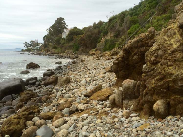
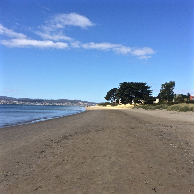
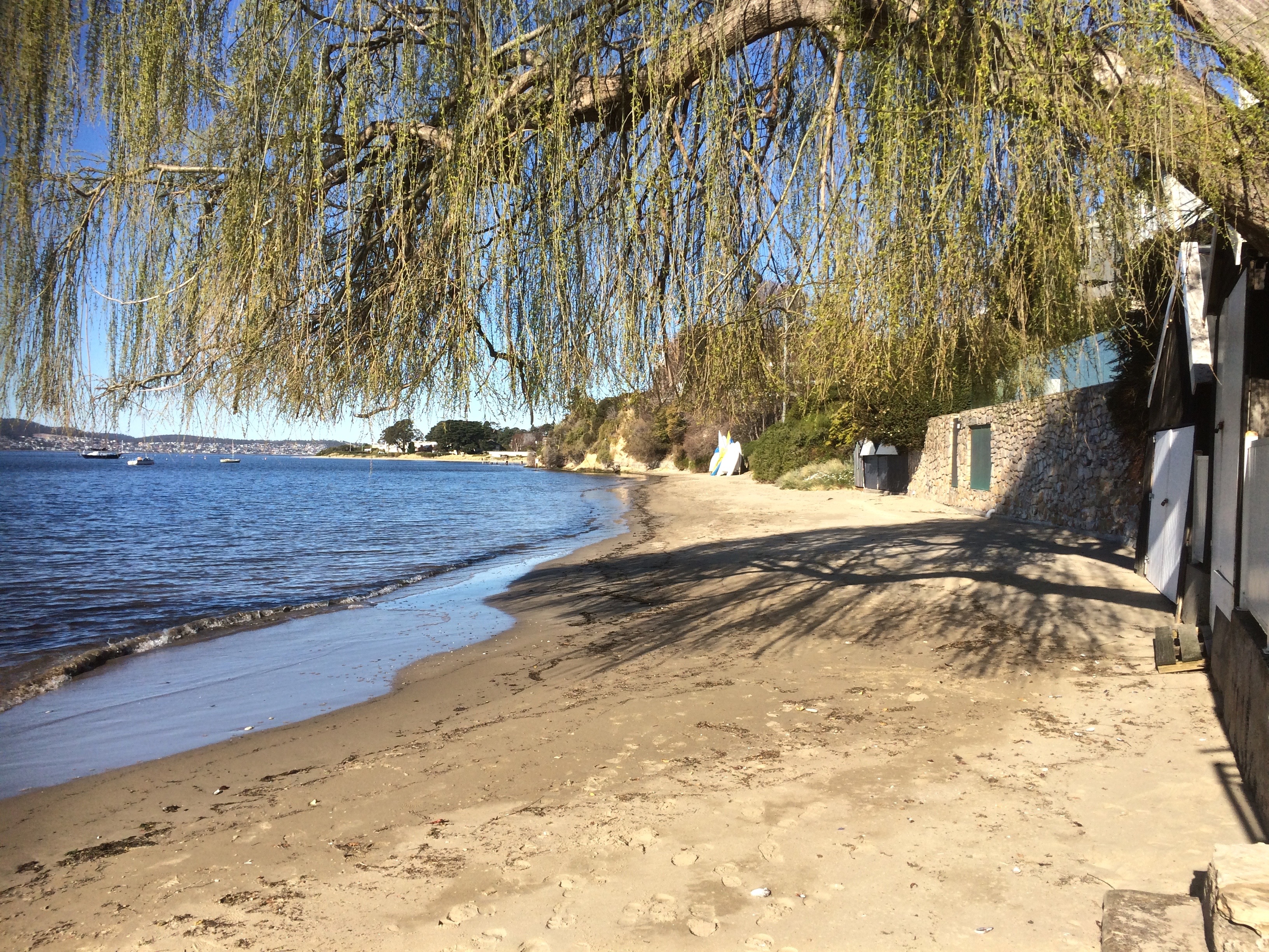
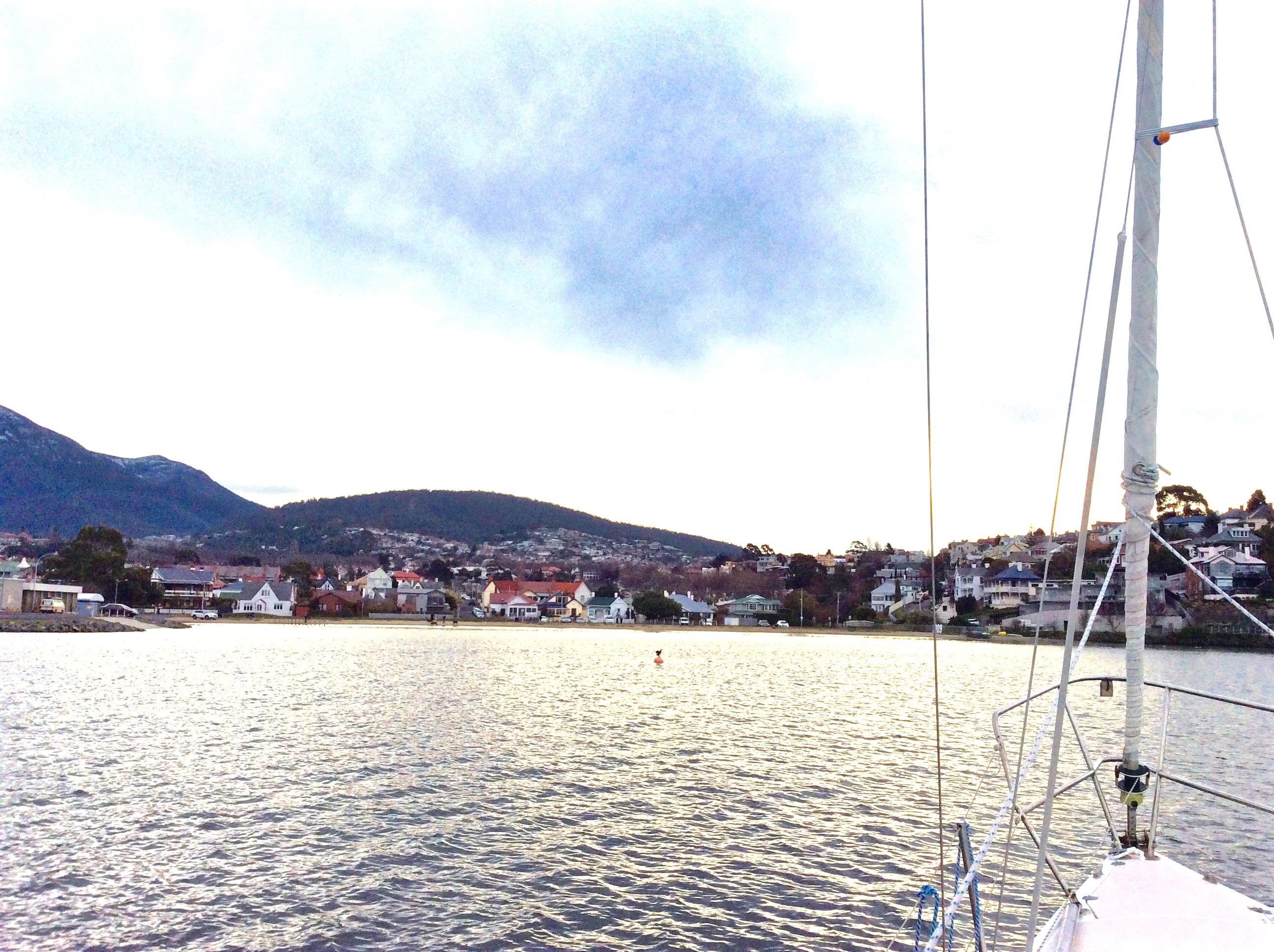
The places I’ve identified have given me the slip so I’m mentally doing circles around High School Point and  the beach some call Beck’s, some call Melinga and some call nothing at all to have a little think about the local expression of the human mind.

This is because in misleading myself when it comes to naming, I’m sure I’ve misled you.  Perhaps the cartographers, surveyors and the Nomenclature Board have not chatted enough over tea breaks or scheduled sufficient meetings, given that for many years they’ve been part of the same division in the same government agency.  This occurred to me because more research this past week indicated one of two things:  1.  I’ve misinterpreted local writers’ beach identification or 2.  The locals simply cannot agree, are occasionally geographically challenged and at other times are simply not precise enough to help confused readers out.  A case in point, Karringal Court is not south of High School Point as one of the authors I read would have it.  Whatever, the maps themselves have so very little to say!

Nomenclature, generally, is further complicated because where no formal name exists the Aboriginal community have naming rights.  But they are made up of several communities and they don’t all know a place by a single name.  Take the Derwent River itself.  It has more than one Palawa name.  According to a member of the Channel community, their name for the river is unlikely to be formally recognised.  I was given this name on a small piece of paper I can no longer find, which is a shame.  The name is beautiful.

The second point of difficulty is in negotiating on names with government.  I had a chat to someone from the Aboriginal Community when I was at Risdon Cove.  They said the government drags its feet.  I spoke to someone in government.  They said it’s hard to get representatives of the Aboriginal community to the table.

I revisited the foreshore and was pleased to encounter a local who told me he’d been walking these beaches since 1948.  An expert, surely!

’Becks, Dixons and Retreat,’ I asked. ‘Can you confirm I’ve got them in the right order?’  He looked at me blankly.

‘I’ve never heard of them,’ he said.  ‘The one you’re calling Beck’s I know as Melinga Place Beach.  Why would it be called Beck’s anyway?’

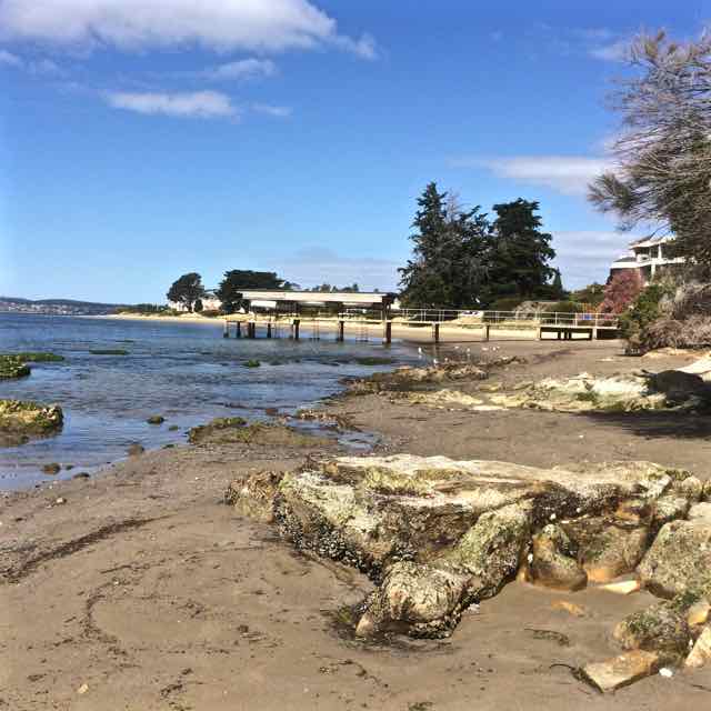
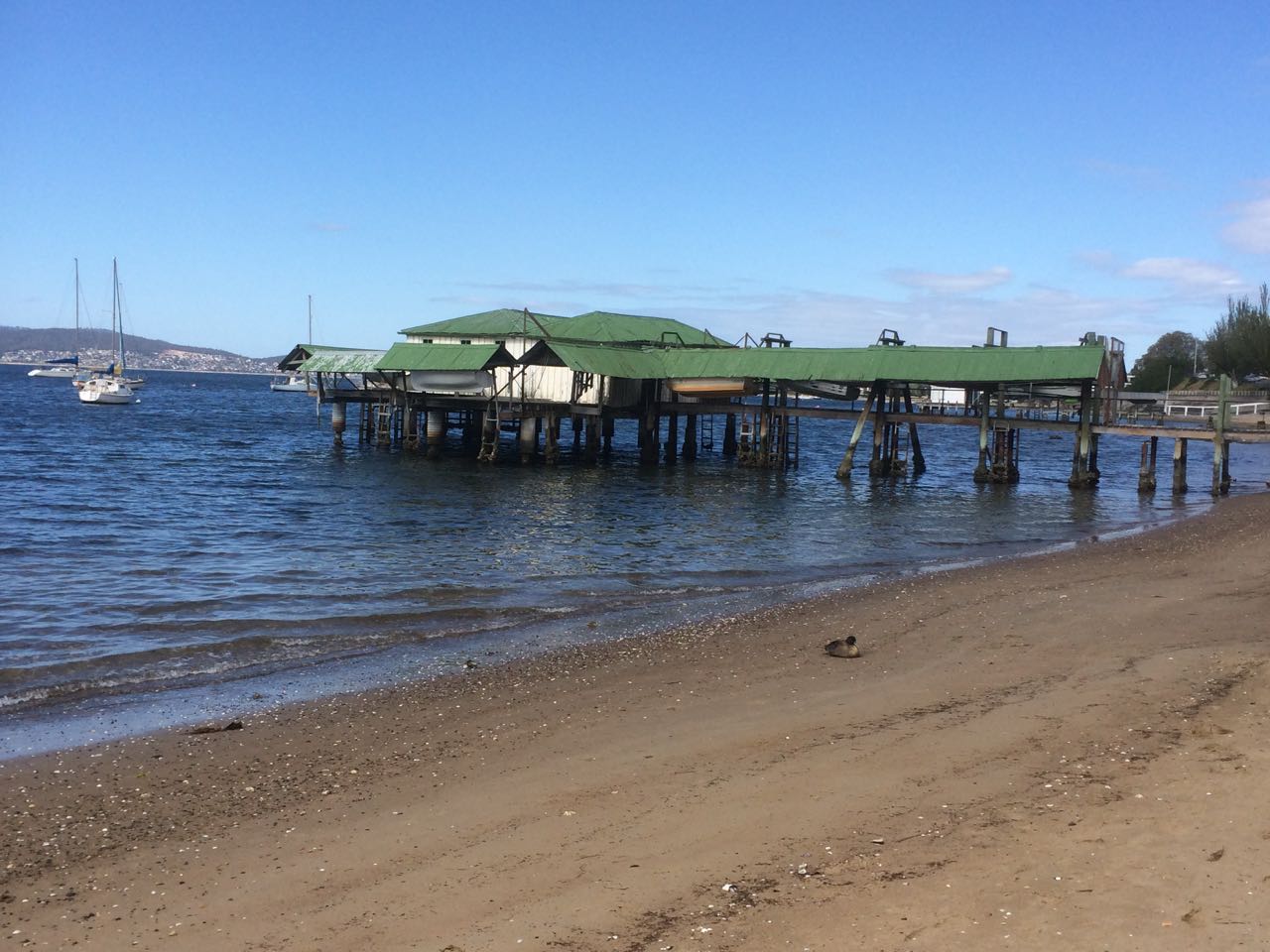
I went home.  I reopened my books and I clicked through web pages.  I rediscovered an article by Reg Escott on the Taroona Book Digitised website, who in his article on Taroona’s  boat sheds explains that Taroona has five beaches.  Starting at Grange Point, they are:

Retreat Beach [my impression was that he means the whole long strip starting from Grange Beach (not named) and ending at Retreat Cove, the northern beach on ‘High School Point’]

Retreat Cove [the one I thought was Dixons, on the northern section of ‘High School Point’]

Dixons Beach [in front of the high school, south of ‘High School Point’]

Beck’s Beach [Melinga Place beach]

Taroona Crescent Beach [Taroona Beach]

Hinsby Beach.

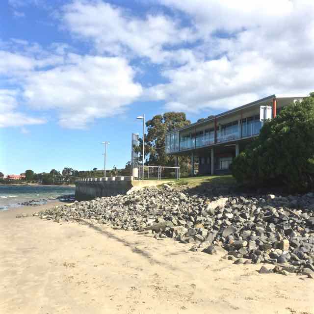
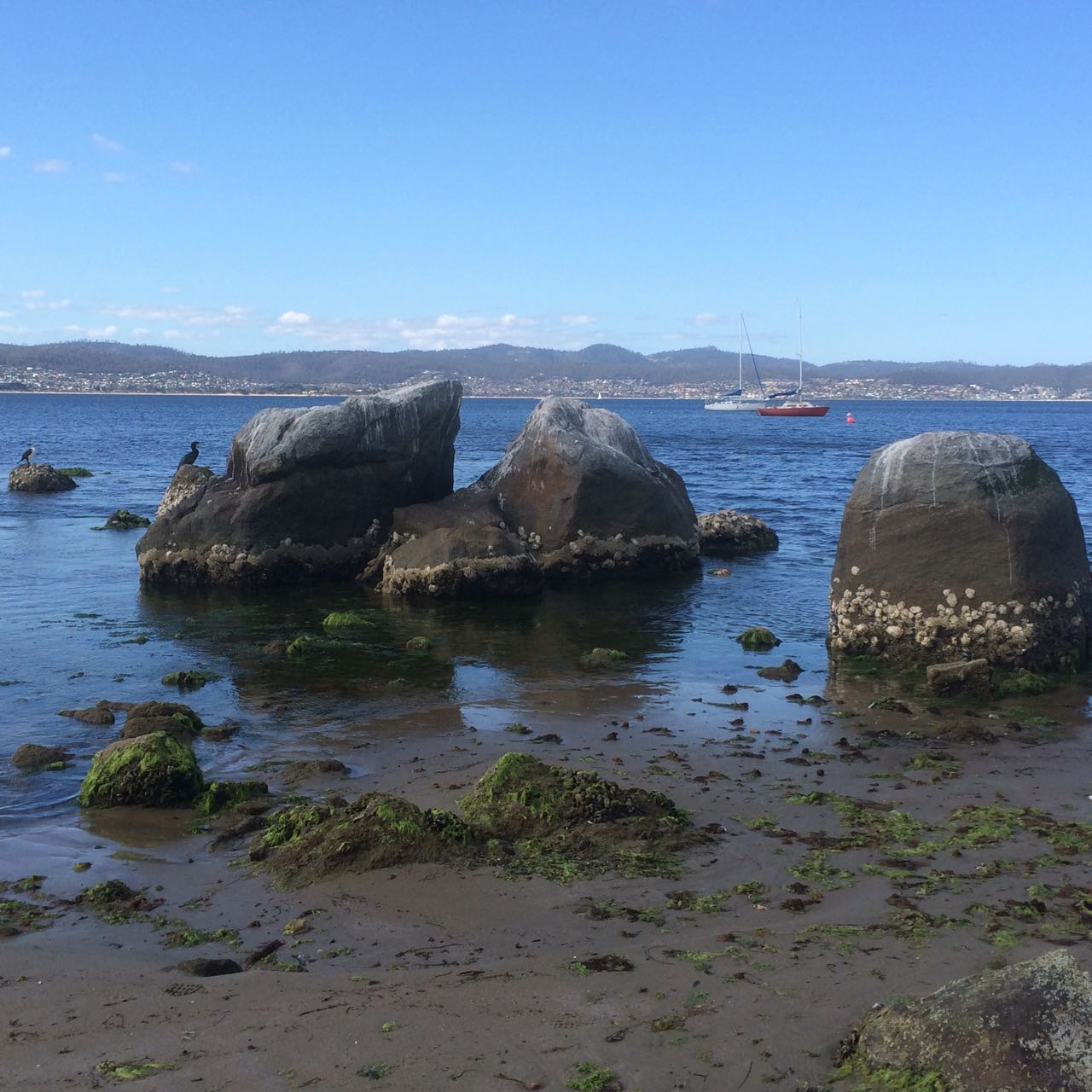
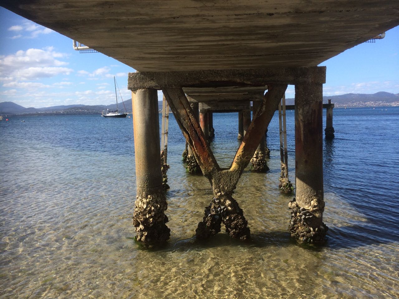
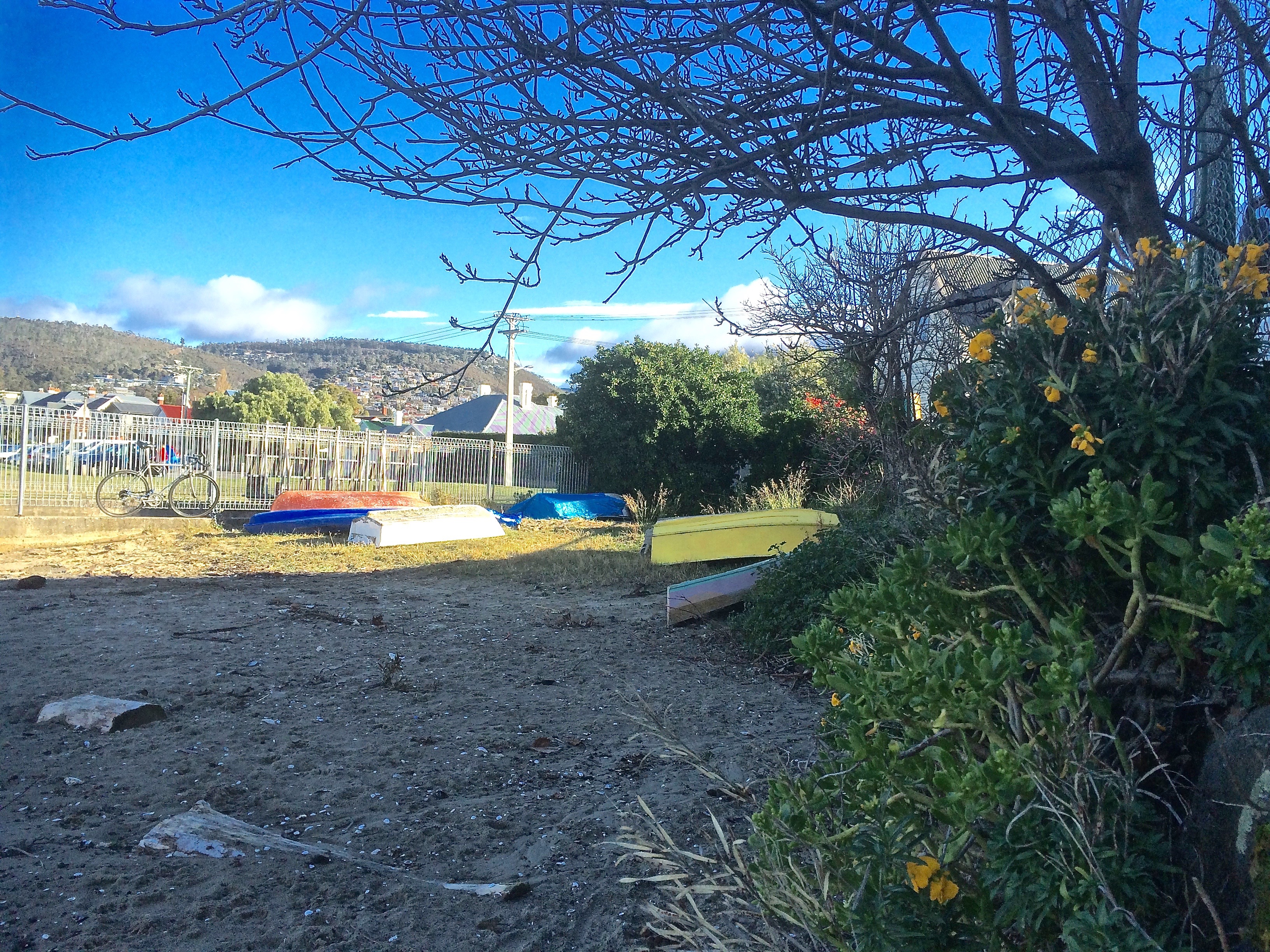
Have a look for yourself.  It’s an interesting read if you’d like to know more about boat sheds (of which there were many more in the past) – or are keen to stumble across a clue or two as to the interesting placement and formations of boulders / rocks around these beaches.  They have been moved, post invasion/settlement.

I came to two conclusions.

  1. Beach identity is (always) in a state of flux along this shoreline.  For eg, Beck’s is named for a land owner (and perhaps before that was called Mitchells after an earlier owner bearing that name) but now it’s transitioning to being named for a street.  Dixon had a farm somewhere in Taroona.
  2. We keep messing with the landscape.  Had the road not been built down to the shoreline, Beck’s and Dixons (if I’m identifying these correctly) would be one beach.

But, guess what?  I probably still don’t have the order right.  This morning I revisited the Taroona 1:25 000 map (no 5224) and this is the nomenclature that’s listed, north to south:

The Grange Picnic Area (at Cartwright Point!  Go figure.)

Cartwright Creek

Cartwright Point

Dixons Reef (in the region of Karringal Court)

Dixons Beach (which I’d figured was Retreat Cove – see above)

High School – the site indicated but the point not named

Crayfish Point

Taroona Beach

Alum Cliffs

That’s pretty meagre and laxadaisical, if you ask me, given this map is supposed to be authoritative.  What’s more, The Listmap, supposedly the most current source, given that it’s online, has even less information!  And so I’m giving up.  Here, in this city of 250,000 people more or less, we know and care so little about the coastline we haven’t named it up.  The alternative view is that the coastline rejects our spurious naming methodology, if it can even be called that.  Why name something so grand and long enduring after unexceptional land owners?  Why name it’s spots but not it’s freckles?

I like the view of the coastline slipping free of its transient names, even though names would be so helpful when you want to text your lift your whereabouts.  May it stay wild and secret in the city forever.  And perhaps Andrew Short who numbers the beaches, and my friend, who is fine with degrees of latitude and longitude but not with names have a point because if we’re not in a relationship with the coast, and we don’t value it, then it’s nothing but a nameless stranger to us after all.


Moon over Grange compressed
The moon rising over the boulder at Grange Beach

Apart from the links above, see the Place Names Tasmania database.  Here’s the official document on the rules with regard to assigning Tasmanian  place names.

Derwent River: Blinking Billy to Hinsby Beach – Part 5: Cartwright Point

Blind to the Landscape:  Cartwright out of Order

Our story is in the land … it is written in those sacred places … My children will look after those places, That’s the law.

Bill Neidjie , Kakadu elder.

In quite quick succession, with the cliffs far lower now, I was passing large houses and small boat sheds and from the Mouheenener Sentinel (see part 3), where the view of Taroona began to open up, I was particularly preoccupied with the lack of birds, the non-stick nomenclature and the dimensions of the shoreline – what was a beach and what a separating reef, had totally befuddled me because I could not get them to accord with my memory of what I had read of this section in Andrew Short’s vast inventory of beaches.

First sighting of Cartwright Point
Taroona in my sights

This estuary is expansive and should be rich with life.  Not so far away the Derwent merges with the waters of  Storm Bay and the D’Entrecasteaux Channel and yet it struck me with some force that birds had not been a presence on my walks – a handful of gulls, a cormorant, an oyster catcher of two, a heron, period. This shoreline seemed as good a place as any to encounter great avian flocks but this was far from being the case.  I was thinking about how the early explorers recorded the migratory short tailed shearwaters darkening the skies as their huge flocks passed overhead for days on end, and their descriptions of the river alive with whales and fish so that there must also have been huge numbers of gannets, gulls and cormorants diving.  There were also a great number of land birds, some now extinct (eg the Tasmanian emu), available for hunting through the she-oaks and the eucalypts when the colony began so that it can seem, reading the literature, that the Reverend Knopwood’s gun was only silent when he was enjoying convivial drinks in town or sermonising from his pulpit. But it’s winter, I reasoned.  Maybe that’s part of the problem.  Perhaps the remnants of those great flocks are still sizeable and are occupying themselves elsewhere.

Even as I approached the Sandy Bay-Taroona boundary which I assumed was the bend in the road near the Truganini Reserve, I was still pretty clueless as to my precise whereabouts but I did know I was about to leave Sandy Bay, and so, to illustrate the difference between the rivulets of the past and the present, a final quote:

‘By the 1830s, despite still having the reputation of a smuggler’s resort, Sandy Bay began attracting enterprising, law-abiding free settlers.  One of the greatest advantages of the river-side suburb was the clean water from its many little streams.  The Hobart Town Rivulet was already a miasma of rotting carcasses and filth, spreading disease and death, and the merchants in Hobart Town saw the advantages in moving their families out of the township.’ (Goc, p. 87)

I  came to a stretch of eroding yellow cliff and there again was a rivulet stifled by a tangle of exotic weeds and creepers, forming a dirty pool from which a mere trickle emerged and entered the river.  It was only afterwards, when I was researching that I learned that this, for sure, was Cartwright Creek and that the pretty little cove just a short stroll south, sheltering in the elbow between this strip of shore and the sloping point, was the start of Cartwright Point.  I had thought Cartwright Point was at Taroona High School and so, when I did the walk, I could not place this rivulet or the cove.

A little path descended beside it and I walked a short way up it and looked about – and came face to face, yet again, with my blindness to landscape. There was a park up there.  And this modest rivulet had clearly enjoyed making itself a deep bed.  This was precisely where the road curved and Taroona began.

Cartwright Rivulet
Cartwright Rivulet

I have driven along Sandy Bay Road a zillion times, thinking about a zillion different things but never about the green space on the downward slope of that bend in the road.  The Truganini Reserve is on the other side – and in fact, it’s where Mount Nelson slopes down to the river at a fairly steep gradient because of the gully carved along its side by the rivulet.  Had you asked me, I could not have told you that this park is the Pierce Reserve or that it follows the banks of Cartwright Creek, a rivulet that has its source on Mount Nelson, enjoys sunlight and moonshine all the way, except for where it passes under the span of the road.  It would once have contributed delicacies from the mountain top to the river it was merging with. These days it’s shabby and sick.  If it was our pet, we’d be up for animal cruelty charges.  If it was our god,  bad luck would rain down on us…

I made a note to self:  find out more about this rivulet – and when I did, I was to discover that Mr George Cartwright, who along with his brother owned several farms on this shoreline and was ‘father of the Tasmanian bar’ was himself sometimes  out of order, in front of it for striking fear into the hearts of his neighbours.


Birds yacht from Crawfords
The view from the Cartwright Point area.  This yacht had kept pace with me for much of my walk.

Although I felt chastened by my ignorance,  I also had a sense of anticipation because I thought I knew what lay around the corner of the point, but I was in no rush to get there.  Cartwright Point is pretty and has the feeling of a private beach.  It was nice to linger.  I could not have been happier.

Cartwright Point
Looking back at the cove at Cartwright Point

I scrambled over boulders and requested right of way from a fallen eucalypt that lay across my path, and then I was on another beach, known but not known, grappling with another name, perhaps because Andrew Short and I viewed the beaches years apart and on different tides, perhaps because he numbers the beaches but doesn’t always mention them by name, perhaps because beaches can be tricksters… or maybe just because beaches are a human construct anyway.


Source:

Goc, N. 1997. Sandy Bay: a social history. Gentrx Publishing, Hobart.

Short, A.D. 2006.  Beaches of the Tasmanian coast and islands.  Sydney University Press, Sydney.


Meet Me in Tokyo

When someone you love says ‘Meet me in Tokyo,’ the temptation is just too great. I put my blog aside, abandoned social media and headed out into the world on a small adventure that involved food safaris, onsin challenges and meditative pilgrimages to shrines, both Shinto and Buddhist.  In Kyoto the leaves were turning.

Sky tree golden flame river.png
Sky Tree, the Asahi Flame and Sumida River

We took up residence for a while in Asakusa, an old part of Tokyo, where the Sky Tree towers over an already tall city and the Asahi flame, such as it is, lies heavily on its side beneath it. We were close to shrines, big and small, that honour the Bodhisattva Kannon who is intimately linked to the Sumida River.  The story goes that back in 628 AD when the area was a delta, three fishermen hauled a statue of this particular Bodhisattva out of the river.  The first shrine was made of straw.  Now there’s a complex of wonderful shrines, including Tokyo’s biggest and most visited.

IMG_6153

The gift of the Sumida River hasn’t saved it from all sorts of atrocities.  It may know daylight but it has concrete hips. There’s minimal habitat for river species. The Derwent in comparison is a wild eyed hippie, a moody and creative artist with a flare for change.

I didn’t notice anyone fishing in the Sumida and barely a bird apart from a lone cormorant and a tiny flock of seagulls that flew into sight beneath a bridge. In fact, with a bridge literally every kilometre along its length there’s not much river traffic either because the bridges are so low.

Derwent from the Mountain (1).png

Flying back into Hobart is a beautiful experience – that first riveting sighting of the mountain and that most magnificent of rivers, always so spectacularly stunning from the air, is riveting.

Once my feet were on the mountain and my eyes on the river, I felt reconnected to home, ready to curl my hand around the tiller, jump on my bike, lug my kayak down to the water or take another stroll along the coastline somewhere.

Derwent River: Long Beach (aka Sandy Bay Beach)

From Summer Camp to Solstice Swim

Long Beach: the view from the south

I was puzzled why anyone bothered with this popular beach when I first visited it one hot summer’s day during my first year in Hobart.  There were a lot of uncertain people sitting in their bathers on the sea wall but swimming wasn’t an attractive proposition because the water came all the way up to the steps and slapped against the concrete in a discontented manner.  I sympathise with the river now.  It was trying to build a beach and this seawall, built without understanding, impeded it.

Yet this has always been a popular beach, even when, in the 1980s, it was barely there at all.  An artificial dune was cultivated in the corner bound unnaturally with marram grass. This once magnificent beach had become a desultory shadow of its previous self and I think that those who still came here were in love with a memory.  (It’s still a lovely spot when the sun is shining on it but it was overcast yesterday when I returned to take some more photos, earlier ones being lost in the uncatalogued innards of iPhoto.)

Long Beach from northern end

Before the convict ships arrived to set up camp Long Beach was called Kreewer and the Mouheenener had a summer camp in this sheltered spot.  In those days the beach was wide and backed by small dunes.  Picture a bark kayak, exquisitely woven dilly bags full of the jewels of the sea, children playing on the sand.  The land was flat and shaded behind the beach, a great spot for huts as well as some easy hunting, and there was a handy stream.

Although the rivulets that flow sporadically down the slopes of Mount Nelson are not well known, Wayne Rivulet has a slightly higher profile because it still enjoys daylight along some of its course, beautifying the grounds of Fahan School before entering the river at Long Beach / Little Sandy Bay.  It brings with it eroded dolerite from the heights, creating a delta of clay  over which the once dense sand of the beach now sits as a thin sheen.

Having already succumbed to epidemics, the distress and fear that took hold at Kreewer is outside the comprehension of anyone who hasn’t faced the end of their world and all  they hold sacred.  The forests they tended, the trees that were their totems, were knocked down to make way for an alien landscape of farmland, divided up between fences that ran all the way down into the river.   The Mouheenener, in a state of deep existential crisis, retreated and the beach became a popular destination for Hobartians in their strange clothing, who no doubt moved stiffly in the landscape not seeing the visual detail, not taking direction from the fragrance of the bush or hearing in the calls of birds the rhythm and events of the day.   Shooting expeditions from town, well recorded by the Rev Robert Knopwood, had rendered the emu extinct and chased the frightened animals that still survived further away from European settlements.  At that point the odd little handfish that moves about on its fins and inhabits the lower bays of the Derwent, still enjoyed an easy life in this beautiful bay.

The beach was so accommodatingly wide and so beautiful (see links to early photos below), that it served as a place to promenade, socialise and relax, and to enjoy the regatta that finally found a home here, or the start of a horse race.  Enjoyment was yet again marred by disputes over right of way to the beach that reached a climax around 1910.  There were petitions.  There were meetings.  The government was persuaded, buying up  land to create the park, and a long jetty was built on the beach so that people could arrive by boat as the Tramway Company wouldn’t extend the line along Sandy Bay Road.

Francis Cotton, in 1880, noticed that the sea level was rising on Long Beach.  He asserted it was the building works happening at Sullivans Cove and Norfolk Island settlers, including Maning and Fisher, considered that the sea had risen by about 50 feet in less than three decades.

There’s a more recent, curved seawall now, over which, in great storms, the sea breaks and which causes a significant wave to reflect back off it during high tides but there is a bit more beach than there used to be in the days of the old sea wall.  This area is often a gourmet adventure because there are cafes, making it, in summer, a great place for an evening pizza or a day time coffee, or a place to come on a Friday evening to enjoy the summer market.  From here you can walk north around Sandy Bay Point or south around Blinking Billy Point, the two sentinels of Little Sandy Bay and while the water in the bay is usually calm (unless the sea breeze is filling in from the south east), out beyond these two points gales frequently whip up raging white caps.

Sundown Park behind the beach was  described in the 1800s as ‘the Hyde Park of Hobart’ and it’s occasionally vivid with small flashes of colour when eastern rosellas and swift parrots  swoop between trees.  There’s a  crocquet club and a petanque piste, a playground and the playing fields.  There’s a platform just offshore that swimmers can lay claim to and that is alternatively occupied by cormorants drying their wings. Kayakers launch from here and seek refuge as well when conditions on the river turn wild.

Playground
Playground

In the heart of winter, when snow lay deep on the mountain’s summit and gardens were white with frost, the most adventurous Hobartians rose from their beds in the black pre-dawn and found their way down to Long Beach for the Dark Mofo Festival Solstice Swim.  They took off all their clothes and plunged en masse into the freezing water of the Derwent just on sunrise.

I’m sure it took their breath away.

When I arrived at the beach a good two hours after this, apart from footprints in the sand, there were no clues that this midwinter event had taken place.

I looked.  I contemplated.  I imagined the Mouheenener regarding this activity  from the ghostly forest and the sharp gasp of the Rev Knopwood.  Then I went home to a hot coffee and a warm bowl of porridge.  The frost still lingered but my kitchen was snug with the wood fire roaring.

Other people’s photographs:

Large wave striking the seawall (Sept 2009) Long Beach | Large wave, Long Beach

Historical

The closest to its natural state (post 1870)

The esplanade taking shape

Regatta at Long Beach & another (some time after 1921)

Showing the old sea wall

Before the sea wall  |  Taken from Sandy Bay Road

Jetty and sea wall, Long Beach

Sculpture, Long Beach
Blue gum tree - favourite hang out of the swift parrots
Blue gum tree – favourite hang out of the swift parrots
Beneath the blue gum tree

Further information:

Goc, N. 1997. Sandy Bay: a social history. Gentrx Publishing, Hobart

Leaman, D. 1999. Walk into history in Southern Tasmania.  Lehman Geophysics, Hobart

Derwent River: Sandy Bay Point

Thomas on Fire!

Nutgrove north to south
Nutgrove Beach with Sandy Bay Point at the far end.

Two beaches radiate from unassuming Sandy Bay Point: Nutgrove to the north and Long Beach to the south, with green and leafy Sandown Park fanning out behind the point.  The Sandy Bay Sailing Club is prominent above the dunes.  It, along with its parking area inhabit the dunes and the area behind them.  Last summer a creative French traveller parked his colourful van here and settled in, just one of the travellers passing through in their camper vans, their tenures normally much briefer affairs.

French van

The day I walked from Lords Beach to Sandy Bay Point I had Hobart’s early regattas and yacht races in mind along with that first horse race (see post on Nutgrove).  In the early years of the colony  Nutgrove was a wider beach and on this particular day I got a clue as to what it had once been like because as I walked around the Red Chapel cliffs and found the little cove the birds have been gifted I saw that everything about the beach was different. It was wider than I think I’ve ever seen it before and at  Sandy Bay Point, where beach access at high tide is often not possible except over the fragile dunes, there was a surprisingly generous sweep of sand.  I was so deeply absorbed in the past that it was almost unsettling that no horses hurtled around that corner as they did back in the early 1800s when local accents were different, dresses were long and riotous parties were a part of the regatta and racing celebrations – to the point that Sir John Franklin (of North West Passage fame and, locally, as the Governor) put a stop to the regattas below Government House because there was too much unruliness and litter.  James Kelly, chair of the Regatta committee (who’d circumnavigated Van Diemen’s Land and discovered Port Davey), moved it to Chaffey’s Point (today’s Wrest Point). Mr Chaffey made a killing at his pub – and  Sandy Bay Point featured more strongly in the races.

Wide enough to race horses

Sandy Point, back in the 1800s, had smuggling coves to the right of it and smuggling coves to the left. The little rivulets – Waimea, Maning and Lamberts, for example, provided access routes for getting smuggled grog up into the bush but the inns along the coastline were conveniently located for receiving rum and other spirits from the ships anchored offshore too.

One of these ships was the Thomas.   One dark night in 1833 Captain Hanley anchored off Sandy Bay. He’d cut deals with the smugglers, so his pockets were full and likewise the longboats were all weighed down as the smugglers rowed back into the coves.

Later that night the Thomas went up in flames and the fire raging on the river lit up the sky, mesmerising those awake on shore and  ‘looking almost splendid’ according to an onlooker. Hanley and three other crew members were the only ones on board at the time.  They jumped into a longboat and set off for the shore but because the fire seemed contained to the stern they returned for another look, while two boats, the Mary and the Stakesby came slowly to their  rescue.  As they stood near the poop the fire reached the magazine and their was a massive explosion. In the little farm houses along the coast people asleep in their beds shot upright and got to experience an unanticipated fireworks night.  Somehow the sailors escaped with their lives.

‘At eight o’ clock on the Sunday morning the dying Thomas was towed burning to nearby Sandy Bay Point where she grounded in about five feet of water and continued burning through the Sabbath with crowds flocking to Long Beach to view the spectacle. (Goc, 1997).

Suspicion over who’d started the fire swirled through the community and over the ensuing days what was left – casks of rum and casks of salt floated on the water, easy pickings for the opportunistic.

The Thomas stamped its presence on the point, predating the ‘boat park’ with its pirate ship in Sandown Park.  In fact, in 1880 ‘H’ wrote ‘…anyone walking now along the beach at high water past Murdoch’s fence would hardly believe that the ship Thomas which was wilfully burnt about 1831, and was beached at Sandy Bay Point, was available to ramblers at low watermark. Many a time I have with my young companions mounted the ribs of the old ship, which stood on the sands, a place which to get at now would be in 20ft water.’

It’s a whodunnit without an answer.  The fire may have been caused by a smuggler dissatisfied with his deal, a mutinous crew member or, for all we know, the captain himself.

Source: Goc, N. 1997. Sandy Bay: a social history. Gentrx Publishing, Hobart.


Sandy Bay Point


Sandy Bay Sailing Club
Sandy Bay Point
Rounding Sandy Bay Point

Approaching Sandy Bay Point: the path over the eroding dunes

Prossers
Prossers Restaurant: a prime position on Sandy Bay Point. Rocks shoring up the eroding beach, usually below water
Path down to Sandy Bay Point
The Sandy Bay Point walkway to the beach

Derwent River: Maning Reef: A Beach Where the Rocks Used to Be

Unveiled beaches and doppelgängers

Saluting the Governor

The sailing season officially opened last Saturday, the 10th October and Hobart’s recreational sailing fleet turned out in good numbers for the annual sail by  the Governor’s vessel Egeria, moored in Sullivan’s Cove.  Some boats adorned themselves in nautical finery.  We forgot to take off our fenders but by the time we realised this we were relaxing at the rendevouz off Nutgrove Beach and having imbibed a wine or two were feeling too mellow to care that we had not kept up appearances.

The geologist and I had invited three friends along, one an able seaman of the four legged variety, our sole adornment in his coat of yellow.  The sky was blue, the sun shone and there was a breeze strong enough to fill sails.  As this was the first time I was skippering on an opening day we stayed on the edge of the fleet, detouring under the bridge, confusing ourselves over the instructions until order was established in the fleet. We snuck in towards the rear, trying our best to keep ahead of the  Beneteau and MONA cat bearing down on us as we headed into the tight conditions in Sullivans Cove, more alarming last year on a larger boat.

IMG_5795

We dropped our anchor at the back of the fleet, by now mostly rafted up together off the beach, and I lined us up with a group of large boulders off Maning Reef, clearly much loved by cormorants. The tide was low and the coastline had a surprise for me. Lords Bay had spread itself out. It wasn’t a little beach at all but a long, thin sandy beach running along the back of Maning Reef all the way to Red Chapel Beach, validating my belief that in earlier days this coastline was one long stretch of sand, at least between Short and Long Beaches, if not beyond. As we drank wine and picnicked and the talk turned to rugby, I discussed its changed appearance with E who knew this stretch in all its variations better than me.

Later I quizzed a friend who lives above this beach for a bit more information, and then, when the tide was low yesterday afternoon I went walking, hoping to find bouquets of sea tulips waiting for me on the jetty pilings.

And here’s the thing. I didn’t find a single one, but I did find numerous other little squirts who looked remarkably like pyura Doppelgangera and squirted just to show me how it’s done.

IMG_5769
Oysters and sea squirts on a jetty piling.

Despite their name they hadn’t contrived to look anything like the elegant sea tulip I was beginning to believe I’d conjured up. They’re squat, rotund, pustular and a mucky colour, probably impeccably beautiful for blending into their surroundings but a challenge for the human eye to appreciate aesthetically.  A Tasmanian native, it’s well travelled, having hitchhiked on boats since ships first came here, making a pest of itself in New Zealand and the mainland.

I walked on, from stormwater drain to jetty piling to rocky outcrop musing about what it really was I’d seen on the hull. Had it really had a stalk? Had it even been red? Chances are it wasn’t a tulip at all but one of these doppelgängers given they are particularly captivated by artificial structures, according to the literature.

IMG_5767
A green tongued stormwater drain.

While thinking about how dramatically we have changed the ocean and the locations of its denizens,  I located Maning Rivulet (I think) which gave me a small thrill.  As I reached the little cove I’d seen from Samos when sailing with my friend the sky filled with tiny floating seeds like small white butterflies.  They made drifts on the sand and  laced  the rock pools, and the next day, around in New Town, the same phenomenon took place beside New Town Rivulet and I saw that they came from tall graceful trees whose name I still need to find out.

IMG_5859

Here are some more photos of the Maning Reef section of the walk that I took with my trusty iphone 5s.

They’re in no particular order.

IMG_5766

IMG_5784

One of two stormwaters very close to each other that are probably both linked to Maning Rivulet

IMG_5848

Jetty and the Casino
Looking back at the jetty and Casino
Ducks drinking from a stormwater
The consequences of our filth
Reaching the cove at Red Chapel Beach

Derwent River: Nutgrove Beach

Those racing days

Kelp on Nutgrove Beach

Nutgrove Beach is my wonderful ‘go to’ beach, one I mostly associate with pale sand, sunshine and activity, but because I’ve been walking through winter these photos show its moodier, more introspective personality.

I  come here to think, to catch up with friends, to watch yachts racing, to enjoy the best of the day and to be walked by the dogs. The water quality is dubious but canines aren’t discouraged by that.  There can be snow on the sand and they’ll still take the plunge. and some dogs, entranced by ducks bobbing on the water, and the more sight impaired by a bobbing buoy, head off in futile pursuit. Their owners cheery commands for them to return grow ever more plaintive as small crowds gather and their dogs recede into the distance. The dogs don’t stand a chance but avian business is always disrupted when people, with or without dogs come down to the beach.

Nutgrove  is north/south facing, a 700 m long stretch of sand that starts at the rocky platform below the cliffs, south of Red Chapel beach.  It swings slightly east and broadens out a little as it approaches Sandy Point at its southern extent. There are substantial houses – one the size of a small hotel – barricaded by pathetically small sand dunes, no more than the slightest of slopes really and at a certain spot there are no dunes at all. This beach suffered along with Short Beach because early settlers removed a large amount of sand from here too.

It’s a beach with a surprisingly fragile sense of identity. I’ve read about it and heard people refer to it as Sandy Bay Beach. In some earlier documents it also seems to have been known as Long Beach. It is longer than today’s Long Beach to its south and in earlier times when both beaches were far broader their identities were probably more fused than today. Further adding to the confusion, the Derwent Estuary Program, in a map locating monitoring sites, divides it into Nutgrove East and Nutgrove West but perhaps this is only for the purposes of checking water quality. Whatever, it can do your head in.

The Sandy Bay beaches aren’t named on the nautical chart for the Derwent River but it is identified on the Taroona 1:25,000 series. Its current name comes from a small orchard of walnut trees that used to be attached to Nutgrove House on the land behind it. The house, built in the 1880s, still exists today.

I vaguely knew the beach was there when I first came to Hobart because you can see it at certain points along Sandy Bay Road but I largely ignored it in favour of the ocean beaches. I was also understandably confused about what it was called until a friend set me straight when suggesting a group of us meet there. It was a sunny morning and the river glittered. The children paddled while we talked. For a beach of its dimensions, it was  surprisingly empty that glorious day. I began to make it a regular haunt, arriving on it usually via the right of way off Sandy Bay Road, a pathway between homes that you’re unlikely to discover unless someone tells you about it – or you’re an observant walker, or you’ve parked there, perhaps to buy something delicious from Lipscombe Larder and you’ve wondered why dogs are leading their owners up or down what looks like a private driveway.

The pink historic house with the Iceberg roses, the driveway with the wooden carport, transport me to France every time and the dogs are always full of anticipation, which is catching. You walk past various flowering plants in summer and then turn to take the steps where the nasturtium grows, and there is the jetty, the splendiferous river and the moored yachts. There are the conifers we sometimes use to help us find the Nutgrove buoy when racing, and there is the beach spread out to the south. At times you feel part of a communal passagiata but it’s also possible to have the beach entirely to yourself.  And you have to marvel:  the land sweeps up to become the hill that is Mount Nelson, carrying the weight of Sandy Bay’s large houses, and despite suburbia that beach stretches out and you have it to yourself.

You need the tide on your side walking Nutgrove Beach. When it’s really high there’s not much space between water and dunes and you end up treading a soggy path. This is sobering.   When Hobart started hankering for a race course, they decided this would be it –  that it would begin south of Sandy Point and end at Nutgrove’s northern end. In 1816 that first race was run.  A crowd gathered on Long Beach to watch the start but most would not have seen the horses galloping up Nutgrove. There’s no doubt many people raced in pursuit of the horses to enjoy the celebrations at the finishing line below the Beach Tavern – that very same pink building with the right of way down to the beach.

Nutgrove Beach
Nutgrove Beach

Later, as boundary fences were built and jetties split the beach up, access across private land wasn’t guaranteed and caused a lot of community friction. Fierce debate began appearing in the newspapers with various observations of increased sea level rise being used to explain the descent of fences into the river. Some writers had a fine sense of coastal processes, noting shifts in currents and the carriage of sand because of the changes being wrought in Sullivans Cove – wharfs and buildings, redirected rivulets, for instance.  This was just the start of debates about private and public rights to beach access. Tasmanian Traveller has encountered this problem walking the upper reaches of the Derwent. It remains an issue in many places around Tasmania today, Battery Point being a prime example.

If you come to Nutgrove Beach from Red Chapel beach to the north there’s a smidgen of beach tucked between the rocks and the jetty-with-character (the only one remaining.  This is  the spot where Lipscombe Rivulet emerges encapsulated in its stormwater drain, and this ‘beachlet’ (Thanks, No Visible Means) has a sign to inform dogs that this is just for seabirds. Once, after a massive storm a few years ago, I was astonished to discover an unkempt yacht bearded with seaweed and weighed down with barnacles, sea squirts, jellyfish polyps, mussels… the whole caboodle, washed up here, a sorry sight.

Winter on Nutgrove, down by the jetties
Winter on Nutgrove, down by the jetty

Down the south end of the beach Sandy Bay Sailing Club has its clubhouse and so the beach is often full of Optimists, and an optimist you have to be to allow tiny children loose on the river in dinghies not much bigger than walnut shells. The rescue boat is always hovering. Invariably someone capsizes, a character building experience and perhaps the reason why some fine sailors have emerged from the club.

The yellow Nutgrove buoy, just off the beach, is usually the southern extent of keelboat twilight races down the western shore, so when the sea breeze is in it’s lovely to watch the fleet gybe and run wing on wing back up the river. The beach’s other nautical connection is the orange structure half way along it. This is a light that ships use to help line up their passage under the bridge.

Winter on Nutgrove
Winter on Nutgrove

Historical photo:  View from Battery Point of Wrest Point and Sandy Point and the beaches in between.  

Sources:

Derwent Estuary Program 2004. A model stormwater management plan for Hobart Regional Councils – a focus on the New Town Rivulet Catchment. Derwent Estuary Program, DPIWE, Tasmania.

Goc, N. 1997. Sandy Bay: a social history. Gentrx Publishing, Hobart.

Robertson, M. 2008. From Petal Point to Cockle Creek: a beach explorer’s guide to the East Coast of Tasmania. Regal Printing.

Short, A.D. 2006.  Beaches of the Tasmanian coast and islands.  Sydney University Press, Sydney.

Derwent River: Red Chapel Beach (T 453)

 Just Fishing

RC a long view

It’s night time on Red Chapel Beach and the birds are loud. There’s a crescent moon rising and out near the middle of the river the foreign vessel at anchor is barely visible.  James Moodie and a mate or two are in his boat closer to the shore.  They’re waiting for a fish to bite but that’s not all they’re waiting for.  The conversation in the boat is quiet; sound carries over water.  They have one eye on the ship. Up above the beach there’s a light shining from his cottage window.

A long boat leaves the ship and heads towards them.  They raft up but from the shore you’d be hard pressed to know that business is being transacted.  All done, Moodie rows ashore.  The oars creak, there’s the small splash of water.  The birds fall silent.

The boat, carried onto the shore by the quiet water, takes clearer form.  It’s a heavy duty wooden rowboat.  And those men are taking out boxes.  There’s the sound of ceramic and glass.  They push that boat right up the sand.  Their accents are strong.  There’s both glee and caution in their voices.  The birds are on alert and the hillside is still and dark.  The men are discussing how they’re going to get the sly grog up the  hill.  They know where they’re going to hide it.  They’ve planned what they’re going to do with their share of the takings and Moodie is reckoning on a good profit selling it from his cottage to the passers by on the Sandy Bay Road.

James Moodie, back in England, was a highwayman who’d been jailed for robbing on the King’s Highway and for assaulting a Constable Jelly.  For these crimes he was separated from his wife and children and deported after first spending two years in the misery of Guildford prison and more time amidst the filth and vermin of the prison hulk, Retribution out on the Thames.  Lightfingered in NSW, he ended up in Van Diemen’s Land, where light fingered again, he nicked some rope.  Illiterate but smart, he amassed sufficient wealth through money lending (at 12 %), hard work and dodgy deals to buy the land above the handy beach now known as Red Chapel.

At 55 he married Ann Barnes (27), had five children and began to gain respect as a carpenter and a farmer.  He had a thing for rope because he learned how to spin native hemp and New Zealand flax together to make a high quality product he could sell, and he acquired further respectability with the building of St Stephen’s Church which would have been a place of community connection for the Norfolk Island convicts living in this area.  It stood out as a landmark, his apparently pious act clearly evident for all to see.

When Ann died, his eldest daughter, Mary, 12, took on her mother’s household and parental role, but she married at fourteen, a dubious marriage that was not in her best interests.  The tale deteriorates into one of financial and sexual abuse.

St Stephens Church holds summer memories for me.  Occasionally I’d go down to this beach to absorb some of its serenity while music carried from the piano in the hall and little girls thumped the floorboards yearning for the day they’d dance on points.

I came back to this beach in August, many years after those tranquil afternoons.  I stood in the small park and looked down at the moored yachts just offshore.  The gate with its Parks and Wildlife sign had been left open by a careless visitor.  There was the willow tree and the boat sheds.  There were dinghies neatly stacked.  There was no one else on this small, intimate city beach except me and a few ducks.  When I looked up, there were the mansions but there was no sign of life behind the windows.

I walked along the northern rocks where they curve out around a garden wall.  There’s a small sandy cove around there that looks to have been isolated by this garden.  To reach the sand you have to scramble across the jetty of another boat shed.  To the south the beach continues a little way below the headland.  It’s been isolated from Nutgrove Beach, the next beach along, by sea level rise but once they would have been a continuous strip.

I came back again on my yacht.  My friend had the tiller as we motored close to the moorings and I took photos and regarded the bay.  From this perspective it’s clear that Red Chapel shares Sandy Bay (as in the actual bay) with Lords Beach to the north.  In effect, they’re the same beach tied to each other by the stretch of rocks, the visible part of Manning Reef, below the seawall.  The Mannings, also convicts from Norfolk Island, had land here once, and Manning Rivulet enters the river here.  You would not know it existed.  Its trapped in a stormwater drain.  From the water you can look at the shore and imagine a different Sandy Bay – a more kindlier planned one where the rivulets run free and linear parks retain and support native fauna and flora.

‘How much water do you like beneath the keel?’ my friend asked.

‘About four.’

‘Bit less than one now.  We’re over the reef.’

‘Out we go then,’ I said.

Again I returned, talking on the phone to the little girl I’d waited for on the beach all those summers ago.  She’s grown now and was in Sydney, in transit home from the UK.  We reminisced.  I told her there was, unusually, someone else on the beach.  I said that three ducks sitting together observing the river were preventing me from walking around to the cove.  I told her there were plovers nesting, that while one circled high above the other was dive bombing me then veering in a circle and flying hard and fast straight at my face.

I left the three ducks to their ruminating and respected the plovers wishes.  The young boy on the beach had left the gate open again, only this time it was completely off its hinges.

Further information: Goc, N. 1997. Sandy Bay: a social history. Gentrx Publishing, Hobart.

Photographs from Tasmanian Archives

  1.  St Stephens Church and the stretch of beach below the cliff
  2. St Stephens Church and the beach from the foreshore

RC boats

Looking north

ngRed Chapel 1 Looking north RC a long view RC boats Red Chapel 1 Sunny day Red Chapel

Derwent River: Short Beach

Beginnings

I thought I knew Short Beach well but actually I knew little of its past and so I went there intent on peeling back the suburb.  Beneath the brief skin of grass, marinas, streets and houses who was this beach really?

It turns out that for thousands of years behind the beach there was forest kept open enough for hunting by firestick farming.  There was abundant wildlife, including forester kangaroos and the Tasmanian emu.  Birdlife was rich and varied, bronzewing pigeons prolific.  Short Beach had a pure mountain stream at each end and the Mouheneener living along the shore fed themselves from the reefs and the forest, leaving the river to the whales, seals, fish and seabirds. There is believed to have been a taboo, perhaps founded in myth, about the taking of fish.  When they went out on the water they used bark canoes to navigate the currents.

Before settlement in 1803 (Risdon Cove on the eastern shore) and 1804 (Sullivans Cove, north over the headland from Short Beach) this was a free ranging coastline but no sooner had the ships moored than the land, rivulets and beaches became subject to massive and rapid change.  The Mouheneener drew back from this part of their territory and the Reverand Knopwood and his friends moved in, enjoying hunting through here in those early days of settlement, shooting without thought of limitation, bagging pigeons, swans, wattle birds, emus, kangaroos, wallabies and the like. The forest that once supported the Mouheneener with ease was cleared for farming, and in 1804 Captain William Sladden and George Prideaux Harris were farming alongside the rivulet, the land cleared of casurinas and eucalypts by convict labour.  Harris built his home pretty much where Ashford (an historic homestead) is today.

I went looking for maps and pictures but recognising the beach isn’t easy. Perspectives and distances in early paintings make parts of the coastline hard to identify and there was considerable reclamation happening right from settlement’s start.   In 1840 this article appeared in the Colonial Times:

‘Mr Fredk Bell has erected some splendid baths at an immense expense on the Beach at his estate in Sandy Bay.  He has also run a Jetty out a considerable distance into the river at the end of which he is about to erect bathing-rooms, we are fearful it will not pay; but the public will be much indebted to Mr Bell for his spirited conduct in affording such accommodation (nay, luxuries) as the Hot and Cold Bath in a climate where both are so desirable  The Beach in front, as well the Sandy Bay Road, have become a fashionable promenade and drive.’

The Victorian Bathing Establishment was divided into Ladies’ and Gentlemen’s baths and there were two refreshment rooms.  In 1908 there were complaints about peep-holes between the two sections.

I discovered that many people (including some of the Norfolk Island settlers) had their own yachts and sailing races were held off Sandy Bay from the early years of settlement.  The Royal Yacht Club (then called the Derwent Sailing Boat Club) was founded way back in 1859 and the Derwent Sailing Squadron in 1906.  The DSS held their first meeting in an old whaling vessel, the Derwent Hunter, berthed off the Domain and in 1955, many years after the whaling vessel had burned down, they got their clubhouse at Cheverton’s Jetty on Marieville Esplanade.

The jetty, the baths, reclamation and pollution from the despoiled rivulet, all messed with the beach, which  also has a gothic side to its character.  It was once a notorious smuggling hotspot, was where, in the nineteenth century three young girls found a buried baby, where at least one nineteenth century suicide took place, and more recently there was a murder on a yacht moored just offshore.

In 1879 there was public comment that sea level had risen here and that where once it had been 3 ft deep it was now 10 ft deep.  By 1834, a commentator mentioned he had once ‘rambled on the Sandy Bay beach near the present Blanchwater and Ashfield beaches, and I can declare that the sea lies greatly encroached there.  Where water is now 8 ft deep, I have with my children rambled and got shells… the Sandy Bay beach had been greatly encroached upon by the sea.’  Nevertheless, for many years the beach suffered from the removal of sand by Council decree.

Short Beach then was apparently known by the name of the estate but I’m not sure if Blanchwater was also along Marieville Esplanade.  I’m sure more research would clarify what the beach looked like then as well, but I think it was either a long curve stretching from the rivulet to the smaller point where Wrest Point is today or that it had a stretch of cobbles or rock where the park begins, then returned to sand.  In the picture below (1855) it presents as a narrow beach with what looks like a line of cobbles, and this is quite common along some parts of the Derwent depending on the season.

Short Beach is part of the Errol Flynn reserve now, established to celebrate that Hobart to Hollywood success story – he swam here as a child – but the beach ends with the rowing sheds, built on the point where the jetty and public baths once stood.  There’s a children’s playground, public amenities, a green space and then the two yacht clubs:  the Royal Yacht Club of Tasmania and just south of it (but right next door) the Derwent Sailing Squadron, at present extending their marina.  Concealed beneath all this there used to be a strip of beach but you would never know.

I asked a friend if he could remember what the esplanade looked like when he was young.  He said he recalled a rivulet that entered Marieville Esplanade where the DSS is.  I went looking, and he was right.  Just in the corner where Wrest Point begins and the DSS ends there is a great big stormwater outlet.  I’d sailed passed it many time and never noticed it.  It creates the channel boats use to get in and out of that marina.  There’s a big shallow sandbank here that sets off depth alarms.

When we first moved to Hobart we lived in Sandy Bay not far from Marieville Esplanade.  On windy nights we could hear the clatter of rigging and a couple of times a day we’d take our dog, used to the fenceless expanses of a tree savannah, down to the beach to unleash his canine energy.  These days I go to Short Beach to walk the dogs after working on my boat.  There is sometimes a group of dog owners in conversation, you can hop over the rivulet onto the tiny, pitcturesque cove of sand at the base of Battery Point.  Short Beach is heavily used and is a bit dishevelled and subdued, its dunes long gone, maybe trammelled into the ground or flattened in a reclamation exercise, or never there in the first place.  I’m not expert in this matter but I can testify to the fact that although they have good views of the beach and the river, the houses have nothing to protect them from potential inundation.

Short Beach – perhaps Shortened Beach would be a better name –  is notable because the Sandy Bay rivulet enters the Derwent below Battery Point, and it is also the first of a string of Sandy Bay Beaches.  Before sailing became such a big part of my life I used to like launching my kayak here.  Over the last six or seven years I’ve spend a lot of my time at the clubs, sailing out of them, discovering the river’s geography.  And while boatyards are not good for the river’s health they have a strong allure, and the combined clubs and the races they hold have added to Hobart’s appeal as a nautical city on a magnificent waterway.

Note: Further information welcomed!  Photos below.

Sources:

Centre for Historical Studies (UTas). The Companion to Tasmanian History [website].

Goc, N.  A history of Sandy Bay

Approaching Short Beach

Short Beach from the water

Marieville

Looking towards the RYCT and the Wrest Point Casino

CITE: Sandy Bay from near Bath Street, Battery Point 1885. In: Allport album II No. 6, publ Hobart : s.n., [ca. 1886]. / AUTAS001126183078

Sandy Bay from near Bath Street, Battery Point 1885. In: Allport album II No. 6, publ Hobart : s.n., [ca. 1886]. / AUTAS001126183078.  State Library of Tasmania
Short Beach modern version

Taken from approximately the same place, 2015.

Short Beach 1

The small cove on the north end of Short Beach.

The DSS
The Derwent Sailing Squadron marina