Derwent River: Kayaking the Tinderbox Peninsula
Smacking Down Fear with a Paddle
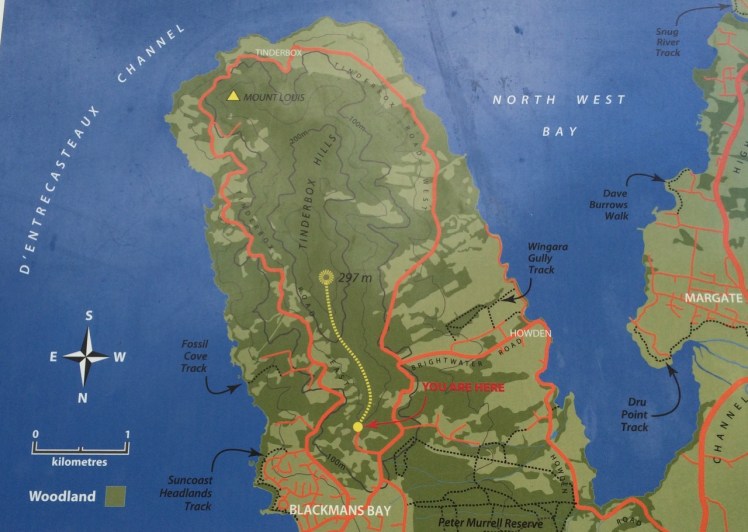
It’s a little known fact but upstream of Dennes Point, just across the water from Pierson’s Point, there’s a shark refuge and the men in grey suits and the freezing water in which they undertake business were on my mind as I climbed into my kayak to paddle the Tinderbox coastline. I would have liked company but I had no takers and so I’d decided to go alone.
On a fine day.
With the water like a mirror.
And on a low tide.
‘We’ve kayaked it before,’ the geo had said. ‘You don’t need to do it again.’
I could not remember kayaking the whole length of Tinderbox, and if we had done so it was back when I thought of Tinderbox as one long stretch of formidable coastline with no discerning features other than cliff face and rocks. Now I knew better and had reached the conclusion that the best way to get to know the peninsula was by kayak, right up close to the rocks, in part because I didn’t want to be that kayaker who made the headlines through being snaffled in the Derwent. After all, Hobart is full of sea kayakers who paddle this stretch and think nothing of it.
But I wasn’t one of them. I simply had a little goal to achieve and a mystery to solve: where was the door to the underground tunnel behind the cliffs?
‘Sailing is all about anticipation,’ my friend M, used to remind me and it’s perhaps more so with kayaking. I checked the Bureau of Meteorology site and chose my day – swell beneath 0.5 m and north westerly winds below 10 knots turning variable later in the day. It sounded perfect.
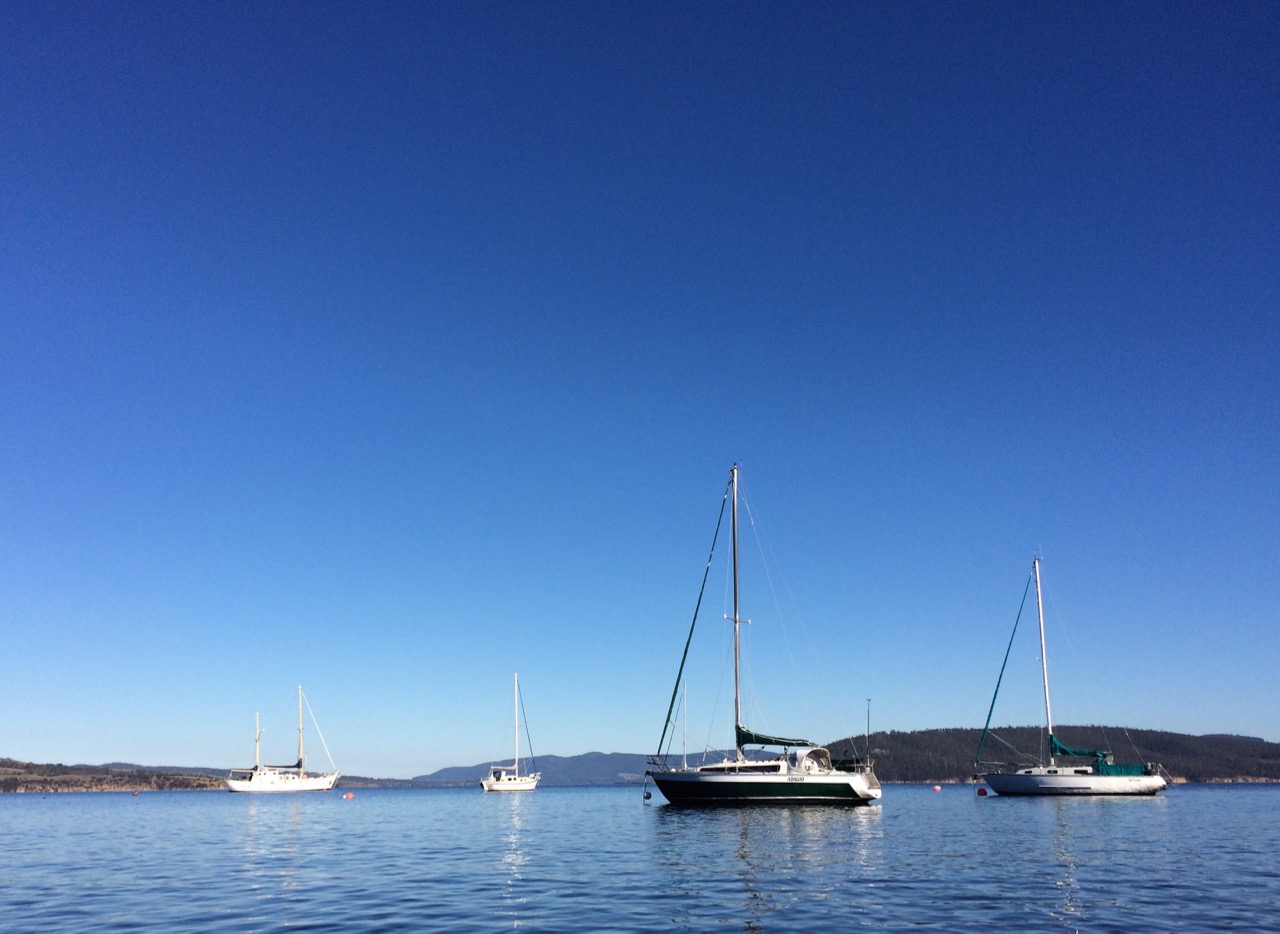
A small wave splashed over my map as the geo pushed me off and even before I’d made it out to Flowerpot Point, kayaking through the moored yachts in the southern corner of Blackmans Bay, I could tell the river was intent on being a trickster. Because the water was in fact lumpy, and so another fear assailed me. If I fell out, it would be mere moments before I died of the cold and much as I love the river I did not want its bed to be my last one. As I rounded Flowerpot Point I felt threatened by swell coming at me from all directions, no doubt lingering from previous bad weather. The surf breaking on Soldier’s Rocks a couple of hundred metres away looked downright intimidating.
I stopped. ‘Too rough… poor visibility,’ I advised myself and I wobbled into the little cobbled bay (T468) that I thought I had befriended on one of my earlier walks only to find it fractious and lumpy, the water disconcertingly black. I began to reach for my mobile (geo, come back!) but I didn’t feel steady enough to use it.
‘You miserable little coward,’ admonished the chorus in my head. I could already see Passage Point and North Bruny Island and they didn’t actually look that far away. We’d figured it would take me three hours (based on my dawdling on previous paddles) and certainly sailing along here sometimes takes a goodly length of time. And so I pointed my kayak south again, put my head down and paddled briskly towards my first waypoint, Soldiers Rocks, adrenalin ratcheting up my heartbeats. My seat wasn’t properly adjusted; my legs were already going numb. This was affecting my balance. No ways was I going to reach for my camera.
I burned passed Soldiers Rocks, keeping a distance between us because of the toothy break and reflective swell, and my compromised ability to use the pedals I could no longer feel. The Lucas Point Sewage Plant now seemed more friend than foe. I could see how in this little bay the beaches from the water seemed a single beach rather than two or three, but I was not game to reach for my iPhone.
There was no going back now.
Because of the slop I couldn’t get near the shoreline and so I had to put a big fat cross through the image I’d had of myself, drifting along a feet or two from the cliffs, trailing my hand along rocks from time to time (hello, rocks! hey, sea anemone!) imprinting the geography in my head, scrutinising the cliffs for the hidden doorway.
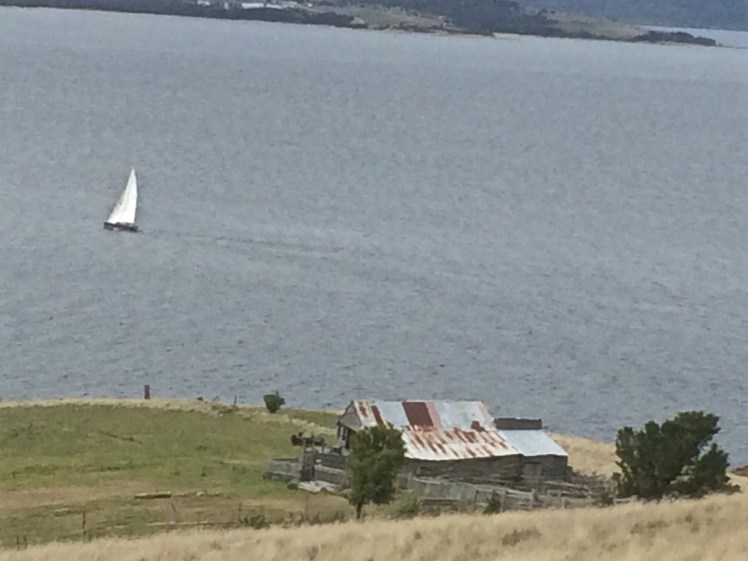
My next waypoint was Fossil Cove and I could see the arch ahead of me. The geo and the dogs were going to walk through it to the part of the beach on the northern side and I’d said I might see them here but little did I know, they were way behind me. (And little did they know I was ahead. They waited here a long, long time.) Ahead, closer to the eastern shore, was a ship at anchor. There is often a ship at anchor, presumably waiting to proceed upriver but they are like ghost ships. Sailing past, you never see crew. Back when Sandy Bay was barely populated, the ships at anchor often had clandestine grog on board that was collected by smugglers under cover of darkness.
A smaller ship came around the Bruny Island coastline and headed down the D’Entrecasteaux just as a boat came roaring out of it, headed my way. Fishers, I thought, but no. They began to reverse their boat into an extremely narrow gulch on the southern side of Fossil Cove. Neat! And what a clue! They’d been invited to lunch!
To keep my mind off sharks I contemplated the cliff top with its magnificent view, far more alluring IMHO, than an underground dining room but I guess diversity is the spice of life.
Lucas Point came and went. Before I knew it I was past Passage Point where, in the wind shadow, the water lay down. The tide was more resistant here but I was quickly through the gap between Dennes Point on North Bruny and Piersons Point on the Tasmanian mainland and in the channel flat water with a quiet lattice of ripples welcomed me. Beneath me, arrow squid, australian salmon, barracuda, pike, flathead, whiting and silver trivially glided, but I was unaware of them. Beneath the cliffs a seal lolled in the water, one flipper up. I paddled past the two little cobbled beaches, the tiny gulches and the sea cave and made it on to the beach before the geo and dogs arrived to give me a lift home. I hadn’t managed to explore the beaches but, chased ever onwards by imaginary sharks snapping at my stern, I did do this leg in 1 hour flat!