Fishy Business
I was back on the little Margate beach just south of Dru Point ready to start on my second expedition in North West Bay. The beach was kayak friendly on the high tide, and I put in there while the ducks looked on and the cormorants held out their wings, enjoying the sun.
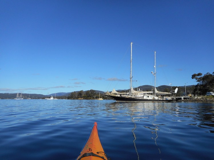
The water was clear and shallow. Sunlight made silver waves along the bay’s floor. I paddled over seagrass and a variety of red seaweeds, then through the moorings below the Esplanade (a narrow waterside road backed by a few houses) and within minutes I was at the Margate jetty.
There are two large jetties on this point and they both had fishing boats alongside. I slipped by them and found myself in a small, sombre bay where the aquatic flora looked unhappy. They were competing with a hazy looking algae that seemed to be a stranger amongst them and in the middle of the bay there was an accidental fountain around which a number of bemused seagulls were bobbing. It seemed to be caused by a pipe linked to one of the aquaculture businesses here.
Where there are boats there is diesel and bilge water, the possibility of sewage and waste water and other contaminants from anti-fouling and the like and I figured this might be the reason for the bay’s poor appearance. However this little bay was about to give me a far bigger education about pollution, profits and so-called pristine environments.
Behind the Jetty: Where Fortunes Are Quietly Made
From my kayak I’d never have noticed that in this modest, rather bushy area there’s a place called North West Bay Maritime Park where fortunes are being amassed, but I came here one day in a light drizzle to look around on foot and discovered that behind the jetties there are a couple of thought provoking buildings.
One belongs to Tassal. They own that fish farm off Wingara and the northern jetty seemed to be linked to their operation. Their neighbour is a business linked to one of Tasmania’s wealthiest men, Allen G Hansen. He started the Tasmanian Seafood Company back in 1969, arriving from Wisconsin with a colourful history and $16,000 in his pocket. Those dollars had expanded into a fortune of $211 million by 2008 thanks to his abalone, sea cucumber and whiting business, and for a while he was amongst Australia’s richest two hundred individuals. That southern jetty looked to be the one his company would use.
OH&S, Environmental Destruction and Overfishing
Tassal receives community flack for habitat destruction and, as this ABC News article (2015) indicates, abalone divers also point to salmon farming as a significant cause of environmental destruction impacting on their livelihoods.
The Tasmanian Seafood Co keeps its head down and on its website it gives little away about how it operates, but the death of a diver in 2007 brought the company’s poor OH&S practices at sea to the attention of the coroner (SMH 16 Jan, 2010) and according to this article the company did not believe it held any responsibility because of the sub-contracting arrangement it had with divers. The Code of Practice on the Worksafe Tasmania website is dated 2002 and does not directly address the issue of overloading boats.
On 3rd May 2016 an ABC News headline read:
‘Tasmania’s abalone industry overfished and heading for collapse, veteran divers warn’
Yet on 7 Jan 2017 The Examiner reported:
‘Tasmanian abalone exports to China double in 2016′
Locally, the Dept of Primary Industries, Water and the Environment regulates the abalone fishery. and they provide access to the IMAS Abalone Stock Assessments reports.. The agency is clearly concerned about the decline in stocks because they have closed some areas. But is it enough? Tasmania’s economy relies on abalone export and salmon farming creating a conflict of interest for the government, who is also the regulator, and there’s a history here of overfishing and its associated environmental consequences. The monitoring is improving, but it’s got to be dire if abalone divers are alarmed.
Giving and Taking
Alan Hansen contributes to sports clubs around his rural home town of Smithton in the North West of the state, and he’s received a citizenship award for this, but I wondered how much this company does to demonstrate gratitude to the marine environment that has extended generosity to the point of exhaustion in enabling him to amass his personal fortune? The website doesn’t mention any reciprocity extending back in this direction. There’s no mention about sustainability either.
Collapsing Fisheries in Pristine Environments
This bay, where these seafood companies have a home, is certainly not pristine although the waters where Tasmanian Seafood gets its abalone from apparently are. Their website states:
But that’s not true. Plastics, often attributed to fish farms (including Tassal), wash up on the shores off which abalone are taken and nanoplastics are part of the food cycle now. The latest 2017 Institute of Marine and Antarctic Studies report on the fishery as at 2015 provides a history of the industry, indicates an overall decline of abalone in Tasmanian waters and comments on the impact of climate change.
I explored up a dirt road close by. Behind a high wire fence an alsatian guard dog went crazy and I backed off. It was intent on protecting what looked to be Tony Garth’s Seafood Company. It specialises in rock lobster and scallops and they come from the ‘pristine waters of Tasmania’ too. They’re another company with the briefest of websites, but they have a more open presence on Facebook and they sell both locally and internationally, whereas, until recently, Tasmania’s commercial abalone landed up on foreign plates.
A fourth company drew my attention. It’s Hai Loong Seafood Export Pty. Ltd. and it arranges freight transportation for abalone and lobster. It claims an annual sales volume of $1.6 million, has a tiny staff of four (the director is also the secretary) and its revenue per employee is $400,032 or ‘86% more revenue per employee than the average company in Australia …’.
My perspective of North West Bay had changed significantly. I now knew a whole lot more about abalone. Out of interest, the take of recreational divers is less than 2%.

The Dave Burrows Reserve
The Dave Burrows track starts just east of Tramway Creek (although there’s a link to Beach Road if you want a longer walk and, in fact, you can begin this track from various spots around Barretta, the area between Margate and Electrona).
The track meanders through remnant bushland following the edge of the water and where that fountain was spurting skywards was in the same bay that Tramway Creek flows into. There’s a little bridge that crosses that damaged creek with its infestation of crack willow.
Companies Despoiling Their Local Environment
That’s where a couple of black pipes are horribly visible in this reserve, sloping down the hillside beside the creek and crossing the creek in an anti-social fashion. It was hard to figure our who owned them. They look like in-take and out-take pipes, but I can only speculate, and as I tried to figure it all out it occurred to me that if water is taken out of this bay, what’s it being used for? Signage would help the public to understand. It’s surely not for use on shellfish or fish taken from ‘pristine’ environments, because that bay is dirty and it would further muddy the concept. All I know for sure is that it was visually unpleasing and if those pipes broke they’d make an even bigger mess of that hillside than it currently is, despite the good efforts of the Derwent Avenue Landcare group that tends the reserve.
These pipes may been the cause of the fountain in the bay. The closest company appeared to me to be Tony Garth’s Seafood, but I wasn’t risking the alsatian to find out for sure.
Boats and Bays
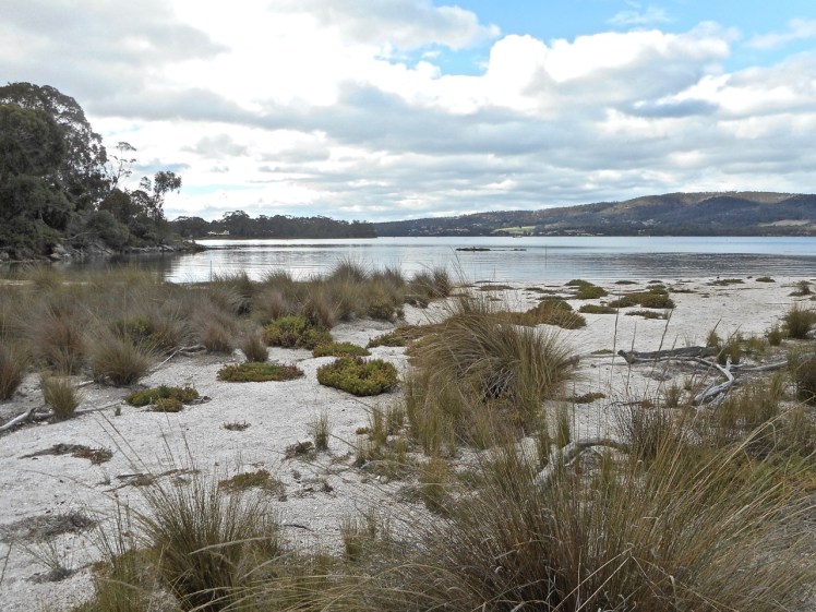
As for the beach, it looks south east. It’s skinny and its sand is dark but it has cliffs and still manages to look quite pretty. There was a low point on the southern edge of this bay where a couple of dinghies had been hauled up on the slope. Then the shore curves around and runs a little further along the base of some cliffs composed of soft tertiary sediments* that are prone to slumping. After that the path ran behind a thin cobbled beach to another point.

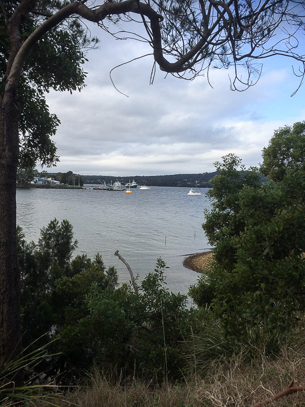
I crossed a tiny rivulet and then noticed houses behind a sandy beach, with the Margate marina visible in the distance.


This walk took all of 40 mins but it meandered through pleasant coastal woodlands, with traces of middens. That day four seagulls and a crow represented the avian nations at Baretta Bay, but plovers and magpies inhabit the suburban streets behind it and botanical discoveries made up for the empty skies.

Barretta by Boat
That was the sum of my exploring on foot, but sitting there in my kayak. I left the bemused seagulls to contemplate the fountain and paddled out of that quiet, degraded bay, hoping that beneath the water Spotted handfish might still be quietly living their benthic lives, hunting for crustaceans and worms while walking on their ‘hands’. Locals comment that you could once stand in knee deep water at Barretta and see pipefish and seahorses, but that’s no longer the case.
At the time I did this kayak trip I had no notion of the geography of this area and though I searched for names on maps there were few to help me. From this point to the Margate Marina (which isn’t really in Margate) I’m filling in the blank on the map by simply calling it Barretta Bay – but I’m happy to be corrected.
The water was reasonably calm but a south easterly breeze was producing the odd white cap as I proceeded along the shoreline. I was keeping an eye out for birds, but yet again I wasn’t seeing anything.
A 2011 study (Mount & Otera) showed that seagrass habitat in North West Bay had declined over a period of sixty years, with big changes happening in the mid-1980s. Barretta was singled out for attention.
The State of the D’Entrecasteaux Channel and the lower Huon Estuary report (Parsons, 2012) considers North West Bay ‘at risk from nutrient loading due to high terrestrial inputs of nutrients and reduced flushing times.’ It also states that it ‘experiences turbidity values far in excess of the upper national guideline value during high flows of the North West Bay River’ and that ‘dissolved oxygen (DO) levels in North West Bay are variable and have dipped as low as 58% saturation in bottom waters during summer, reflecting poor environmental health.’
The report goes on to say that ‘occasional elevated values of contamination highlight the vulnerability of some beaches … due to short‐term spikes in bacterial loads’ and ‘heavy metals are also elevated in sediments in deep, silty areas of North West Bay.’
So probably not the best place to farm fish, I was thinking, as I paddled along a Baretta beach and saw ahead of me another stretch of sand that I figured was possibly accessible on foot. This was good to know because there was a strong current keen to push me ashore and given that the swell seemed to be increasing by the minute, I was keen to nip around the next headland and arrive safely on Snug Beach.

Not Snug Enough
I reached the marina. There’s a tiny north facing beach here where I found a multitude of what I think are New Zealand screw shells. They’re pretty but a pest. This small beach is isolated from the rather lovely beach south of the marina although once they would have been a single beach.
Now, as well as the marina and boatyard, Tassal has a building here too and so does an engineering outfit. I walked south to the boatyard to work out the geography. There were swans off that lovely southern beach, several pairs, with reeds behind them and some large houses on the hillside. Where I was standing in the boatyard the water was clear but awfully stinky and there was a lovely view of the bay from another new perspective.
My geography had let me down. Those houses were the beginning of Electrona, not the country town of Snug at all, and when I rounded the headland I found myself back in the middle of aquaculture activity – two fish farm pens were just off the beach, opposite a stormwater drain, and close to the slipway, so presumably they were empty. There was a large somewhat industrial looking building and a whole lot of parked cars on the hillside. I figured that if it was public access I might be able to walk down to that small beach below the slope some other day – but when I did eventually go looking my way was barred by a locked gate. It was another Tassal site.
** See Sharples, C and Donaldson, P, A first pass coastal hazard assessment for Kingborough Local Government Area, Tasmania, Kingborough Council, Tasmania (2014) [Contract Report] for information about the geology.
