
Tiptoeing Along a Cliff Edge
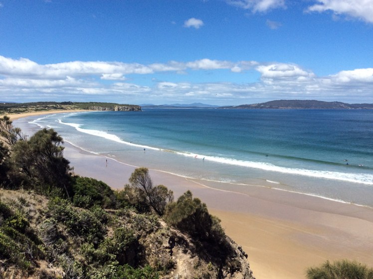
Zooming in with Google Earth I thought I spied a couple of small beaches north of Smugglers Cove and the light tracing of a path through what looked to be a nature reserve. It was enough to convince us that it was worth trying to tackle the cape from Clifton Beach on the northern side and so on a sunny day at low tide, while people swam between the flags and surfers lolled on their boards beyond the break Cathy and I scrutinised the dunes and the cliffs at the southern end of the beach and found a path that led up a steep gully. With an eye out for snakes, we scrambled up it, trusting our weight to the branches of a couple of conveniently located bushes.
There was a narrow strip at the top between the ‘keep out’ barbed wire fencing and casurinas rimming the high cliffs, some of which had fallen away. Peering over the edge we could see their broken pieces tumbled down against the sea.
We found a path, but it looked wallaby made and we meandered on and off it making a difficult passage over and under vegetation, sometimes trusting to the generosity of land owners by slipping over the fenceline to where the walking was easier. In one memorable spot, we had pretty well a foot wide space of sky we needed to cross. I avoided looking down. The drop was horrible, but Cathy skipped over it oblivious to Death’s outstretched hands.

Our tardy progress was made even slower because the views were compelling and so we’d stop, point out landmarks we were confident about and speculate about those we weren’t.
We finally found ourselves on the far end of the casurina copse, gazing down a long slope of golden grass and up the slope on the other side. There was no clear path and it had the look of large expanses of private land. With a couple of households dotting the cape, we decided to avoid rebuke and reluctantly turned back, walking single file. Cathy quietly observed the tail of a snake disappearing down a hole between us, so we were pretty pleased to reach the beach unbitten, and as the day was still young and the beach glorious, we decided to take an amble to the cliffs below Cape Deslacs.

Not much has been written about this cape, but on Placenames Tasmania I discovered that D’Entrecasteaux had noted this name on his voyages of discovery and that it had another as well – Watsons Bluff. Watson was definitely no lady because it’s my observation that places get named after men, rarely women. No doubt he was merely an earlier landowner whose name buried earlier ones tangled with mythology,
I dug about on Trove as well and discovered a 2000 fisheries arrangement between the Commonwealth and Tasmania that referred to a shark nursery in the ‘area known as Frederick Henry Bay and Norfolk Bay being all waters within an imaginary straight line between North-West Head and Cape Contrariety’ and in an article on geology in the Sanford area, Green (1961) mentions dolerite intrusions into mudstone as well as landslips in the cape’s basalt soil. As he also mentions lavas here, this little cape has some complexity but keeps a low profile in the island’s literature.
