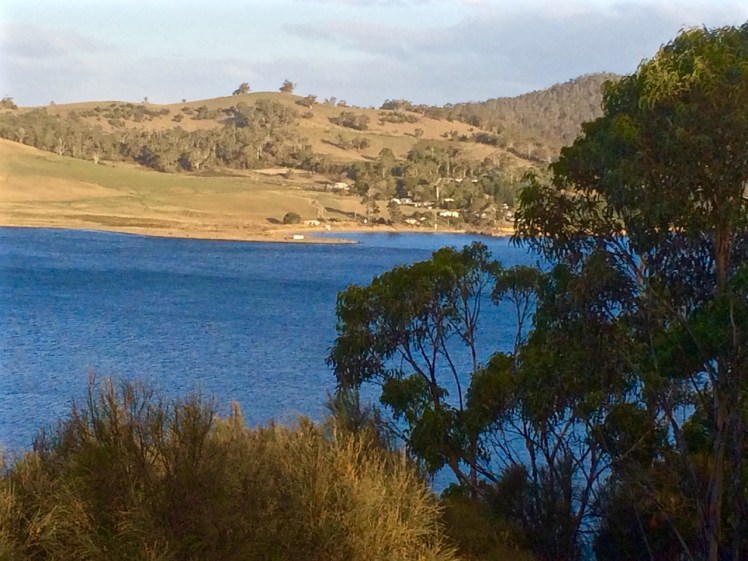
Kayaking towards North West Bay along the Tinderbox Beach reef
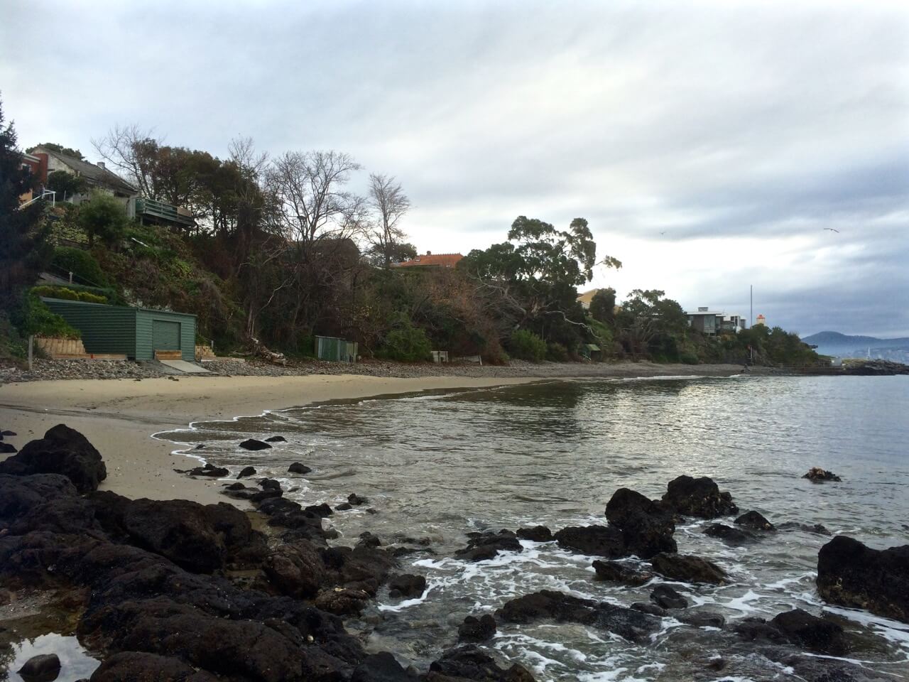
I don’t like cold water and so I’ve yet to dive at Tinderbox Marine Reserve, but early one morning, after driving through the sleeping suburbs, I slipped into my kayak at Tinderbox Beach, while Tassie hens ran erratically amongst vocal sheep on the hillside, and made my way over glassy water and through the moorings, which had trapped a humpback in 2014, until I could almost touch the rocky shoreline.
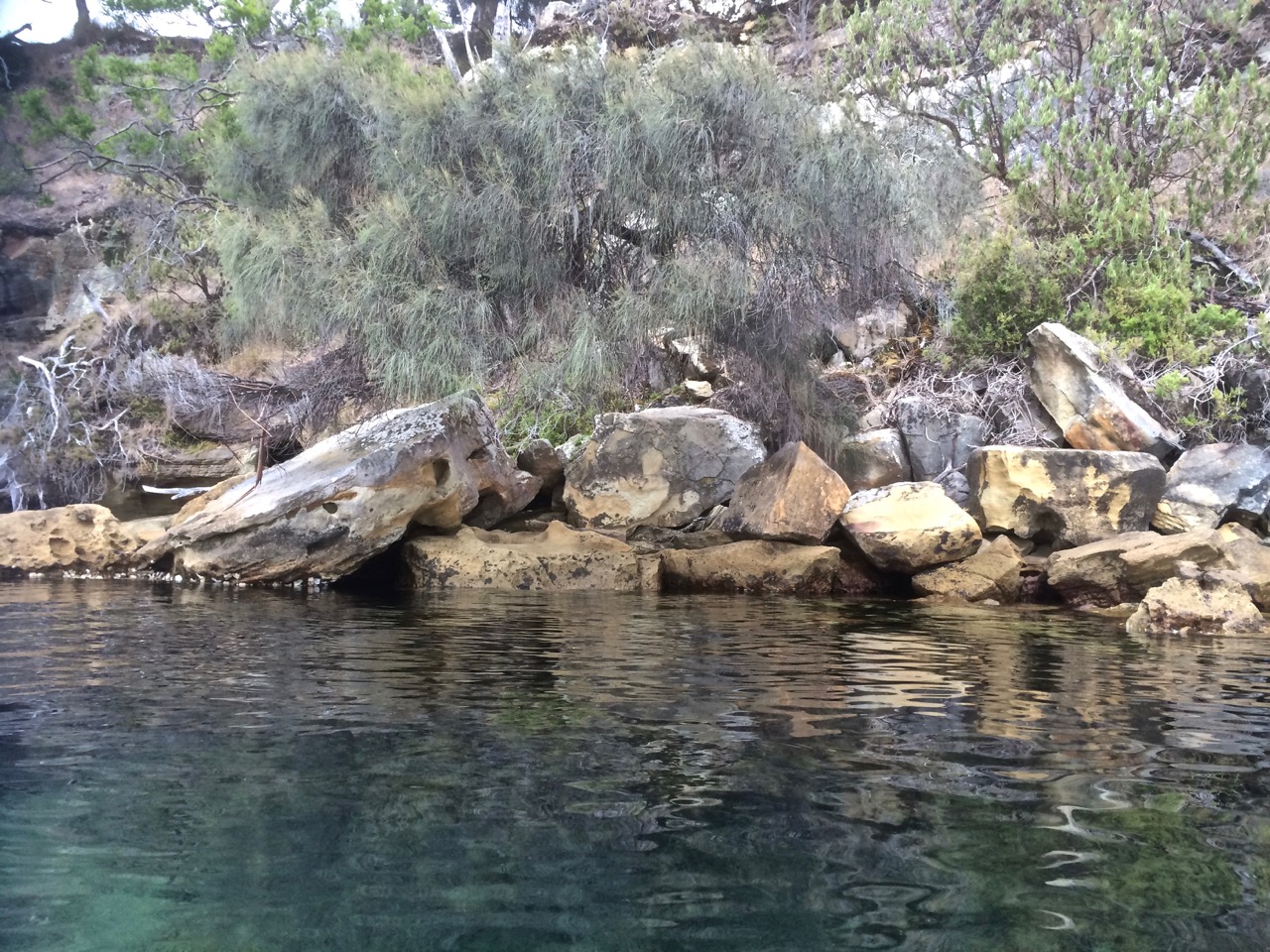
Kayaking through the moorings
I’d already kayaked the start of it, as it begins at Lucas Point on the Tinderbox Peninsula, but that water was deep and choppy. It was intoxicating to know that beneath me seadragons, pipe fish, senator fish and the like were enjoying small sea caves and a wild proliferation of over thirty seaweeds. There is a multiplicity of invertebrates down there – bryozoans, sponges, and anemones – all supported by a sandstone reef and a soft sandy channel bottom, perched atop eons of earlier landforms, neatly stratified according to the roar of time.
To the east, behind me, the Channel opened into the Derwent River and Storm Bay, but I was heading for North West Bay, aiming to do a circumnavigation. When the geo had asked me how long I’d be, I’d answered vaguely. It wasn’t far to the bay from Tinderbox Beach, nor around it, I supposed. I’d walked quite a lot of this route on various earlier occasions so I had a fair idea, but what I soon discovered was that it was so visually stunning that I had to remind myself to paddle. Tinderbox is not a marine reserve for nothing. I’d float over great boulders covered in oysters and a plethora of other lifeforms. I’d stare down at gardens of seaweed interspersed with red waratahs.
Underwater diversity
‘Oh my God,’ I repeatedly recorded, ‘This is just so beautiful.’ And although they are not coral bommies, I started calling these underwater boulders by that term anyway, because it was the word that came closest to describing their coral-like magnificence. Sometimes merely a skin of water lay between me and the boulders I was gazing down at and my kayak was notching up it’s experience in scratch marks.
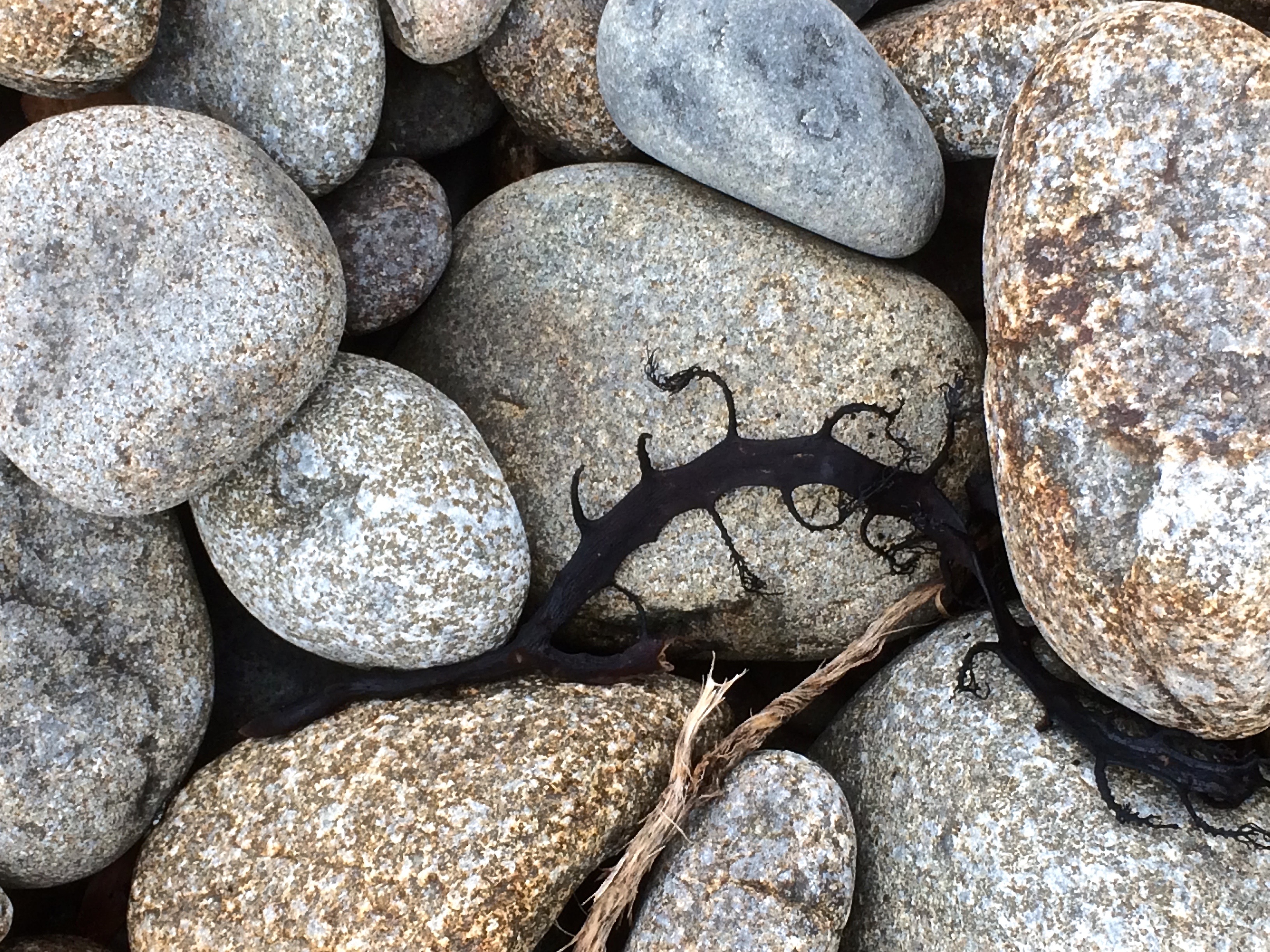
Tinderbox Reef seaweeds
What was particularly satisfying was that hugging the shore I could still see the little periwinkles and the striations in the rocks and the cliff on land, just as I had when I’d walked along here. In fact, it felt a whole lot more enriching being on the water at high tide because I could see beneath so far down and observe that transition from below the non-existent waves to land – the littoral zone of rocky shorelines.
Bottom and top
For forty slow, rapturous minutes I floated along the Tinderbox Beach reef, and then I turned into North West Bay, once called RANG.GOE.RAD.DE orRANG.YOE.RAO.OE, according to Plomley. I was already way behind schedule.
Walking the Western Shore of the Derwent River: Taroona to Taronga
(This is a continuation from an earlier post)
‘There’s a new bit of track on the Derwent River,’ a friend told me earlier this week. ‘It hasn’t been open long at all and the council hasn’t advertised it yet.’
I realized that the trail she was talking about was the much needed link between Hinsby Beach and Taronga Road and so as soon as I had a moment, I went to see for myself. And it was true. The track now leaves Hinsby Beach, involves a short walk along Wandella Avenue, then ducks down into a stretch of forest before emerging at the Shot Tower, where the vegetation is compromised by weeds but the path enlivened by river views across to South Arm. This is a stretch I’d chosen to cycle because walking on major thoroughfares at a distance from the river is an unrewarding experience.
The Shot Tower, Taroona
A steep stretch of downhill comes next, and then an equally steep stretch of uphill. It’s actually not too much of a slog at all and I sat at the table at the top with the geo, enjoying the views before walking along the cliffs, then turning back and doing it all again from the other direction.
The steep section of the track
There’s a clue to why this short piece of track may have taken so long to come into being and my guess is that landowners needed encouragement. ‘Private Property – Keep out’ signs – even one ‘Bloody Keep Out’ sign, line the fences on either side, a small sadness really, when contrasted with the UK and some other European countries where rights of way across private land are well established, well accepted and enrich communities… and I speak as someone with a right of way across our land – it’s never been an issue.
Until you reach the bottom of Taronga Road where this track links in with the Alum Cliffs walk, it feels rather disconnected from the water. But it does provide continuity with other paths and coastal strips and so it is fantastic that someone with initiative on the council has managed to work with the community to create this short but pleasant path.
The path crosses two rivulets, but these participators in the making of this landscape had vacated their beds. The shapes of tiny waterfalls were visible on one, and the rivulet it flows into was napping in a few residual pools.
A stroll in the forest between Wandella Avenue and the Shot Tower
I’d planned to limit myself to the Tassie mainland on this blog, but if you have feet, a bicycle, a kayak or a yacht, Bruny Island’s beauty exerts so strong an allure that it’s impossible not to acquiesce to it. And so, just as I’ve allowed myself to be distracted from the coastline by rivulets, the Derwent River and its beaches, I’ve done it again. Bruny, a substantial part of the D’Entrecasteaux Channel, as its name implies, just has to be included.
Of Waterways and Islands
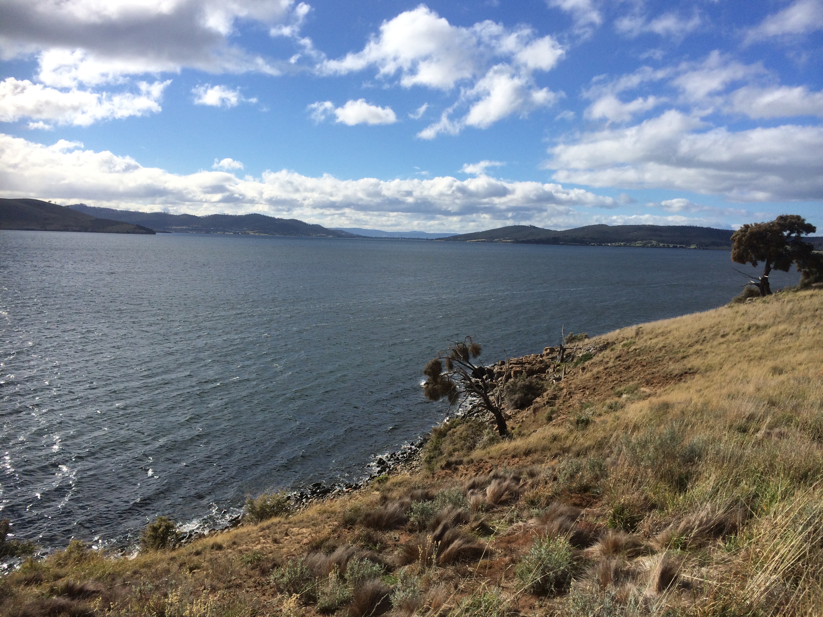
The D’Entrecasteaux Channel, or ‘The Channel’ for short, is a magnificent but fickle waterway – just ask any sailor. It feeds into the Derwent River and is separated from Storm Bay and the Tasman Sea by long, thin Bruny Island, making it a sheltered waterway, a definition it is keen to dispute, because stormy weather can make sailing it an adrenaline pumping experience on dark, wind fuelled nights when it whips up waves and gales gather strength as they hurtle through the tunnel formed by the island and the Tasmanian mainland. On calm, sunny days, it’s a completely different experience. Light breezes might arrive from unexpected directions and you may be rewarded by visits from penguins or dolphins as you enjoy the views, all sails up.
Bruny Island
The island’s original name is Lunawanna-allonah, named by the Nuenonne, who over thousands of years came to know this island intimately. Its name is so musical and redolent with eons of past history that I wish we’d restore it. Instead, it was given a pseudonym; named again after Bruni d’Entrecasteaux, who visited in 1793 and made some judicious observations about the coastline.
This island off an island off an island, apart from being much loved because it’s so undeveloped, ensures you never go hungry. As you cycle along you can stop for coffees, buy local cheese and wine, make a meal out of the oysters farmed offshore or fill your pannier bags with local fudge and cherries. The population on Bruny is small and seems smaller still because so many properties are tucked away behind hills and forests. What you particularly notice if you are sailing, is that Bruni D’Entrecasteaux was right; there are stunning anchorages, and these are often bays within bays.
There are also coves and headlands and although on the D’Entrecasteaux side of the island the beaches are low energy, on the ocean coastline the surf gets up. On the channel side it’s adorned with islands (Satellite and Partridge) and on the outside it has The Friars, part of the Actaeon Island Group, a popular haul out for seals. It also has a beautiful peninsula with a fabulous name – the Labillardiere Peninsula, which lies within the South Bruny National Park.
Satellite Island off Bruny Island, D’Entrecasteaux Channel
North Bruny Island
It takes the best part of a day to cycle around North Bruny and longer for the south. The ride takes you past quiet bays (like the Duckpond and North Simmonds), Dennes Point with its jetty and Nevada beach, which has beautiful cliffs at the southern end, and then, if you choose the ocean route, it’s up a climb from where you can look out over Bull Bay and across Storm Bay to the Iron Pot lighthouse in the Derwent, to Betsy Island and Frederick Henry Bay, and further to the east, Norfolk Bay and the Tasman Peninsula. It’s a long time since I did this ride, but it was unforgettable and these days there are bicycles for hire, which makes it that much more accessible to cyclists.
More recently we sailed into Bull Bay, then explored the coastline a little way south, getting a feel for Samos’s liking for a big ocean swell. Getting the view from water level as opposed to high up a hillside felt a privilege because you need a boat to enjoy this otherwise hidden perspective.
Dennes Point, North Bruny Island from Pierson’s Point on the Tinderbox Peninsula
The Neck
North and South Bruny, 362 sq km in all, are tied together by an isthmus (the ‘Neck’), home to penguins and shearwaters, and sitting out on the dunes beneath the moon and stars, watching them return home is exhilarating. The ocean beach is lengthy; I’m looking forward to walking it. The channel beach is quiet with vast stretches of sand exposed at low tide and limitless shallows on the high, making it popular with waders of the avian variety. The road across is a narrow strip at the base of the dunes and there’s not height separating it from the beach itself.
It’s definitely worth stopping to climb to the viewing platform because the sight of the isthmus and the coastline beyond is mesmerising.
South Bruny Island
From the ferry, it’s a longer cycle around South Bruny Island and as you head down North Bruny towards the isthmus it’s worth taking a break at Great Bay to sample the oysters and cheese before you reach the isthmus.
South Bruny is the larger end of the island and if you keep heading south down the quiet road, your bike ride will take you to a T-junction. Cycle to the left and you’ll reach Adventure Bay with its rich exploration and whaling history. It’s a picturesque choice. There’s a lovely beach walk to be had, the opportunity to take a boat trip to The Friars (I did this as an annual pilgrimage before getting my own boat) and there’s another lovely walk out along the headland with its whaling history and the opportunity to encounter a white wallaby or two. Bruny is rich in wildlife. At night it’s a kindness to travel as slowly as you would in a national park – 40 km, IMHO.
Cycle to the right and more vistas will open up as you ride through a number of tiny communities, like Lunawanna and Alonnah. It’s a steep ride up to the lighthouse with its fantastic views. I haven’t actually ridden up there, but the views are definitely worth the uphill haul. Alternatively, there’s Cloudy Lagoon and vast, wild Cloudy Beach, and the Labillardiare Peninsula. Or hoist a tent at Lighthouse Jetty beach with its more protected waters.
It’s a lovely but brief kayak trip from Tinderbox on the mainland to Nevada Beach at Dennes Point, but you can kayak across from any point on the mainland side of the Channel, depending on the type of distance and conditions you’re up for. If you possess courage, stamina and kayaking expertise, you could consider kayaking the Bruny coastline in a day – or go the whole hog and kayak the entire coastline of Tasmania like these kayakers did.
At The Quarries, Great Taylor Bay, South Bruny Island
I visit the island mostly by yacht these days, with a kayak on board. It’s a great way to explore stretches of coastline that would otherwise be inaccessible.
In the company of a plank, meant to provide a way across the gulch so that I could wander the cobble beaches, I returned to Tinderbox on what was supposed to be a low tide.
It wasn’t. That tide had firm tenure on the rocky platforms. It was in fact so high the shore was sometimes unrecognisable and I could not even find the sea cave. I did reach a cobbled beach and later, from the top of Pierson’s Point, I walked through bush to the cliff tops, seeking a path down to another cobbled shoreline but my bushbashing was entirely unsuccessful.
Actually, it transpired that I was 365 days late for that low tide. I had consulted the 2015 tide table by mistake. Still, it’s not every day you walk out with a plank. Strange to say, it’s quite companionable and will lie down on slippery seaweed if you need it to.
II.
‘Everything that arises is an invitation…’*
When I learned that Susan Murphy was leading a retreat on kunanyi I thought that I would take this invitation to escape my cocoon of fatigue (jetlag & flu) and find my way back into a practice that includes the fine honing of awareness and attunement to the natural world.
I had been on the river for a few days in a row, servicing winches, cleaning the bilge, sorting out engine problems and flat batteries. Still, we’d managed a little break in all of this and had packed a picnic and gone up river in Samos, enjoying the quietude of sunshine on water in Shag Bay and exploring hidden beaches on the other side of the river, just north of Cornelian Bay.
Then I became mountain focussed, walking to the retreat along forest trails, through leaf litter and peels of eucalypt tangled on the mossy slopes.
Eucalypt bark
For three days I absorbed the soundscape of the mountain. The kurrawongs are building nests; their conversation carried across the canopy. The frogs are seeking mates. In the pools outside the window they sang serenades. The wattle bird punctuated the silence from a eucalypt nearby, the rosellas called to each other as they flew between kunanyi and Chimney Pot Hill and the wrens held intimate conversations in the garden’s undergrowth. All this beneath a sky by turns cobalt and domed with cumulus transforming, and one turned grey, the raindrops falling quietly into the pools, repatterning the reflections of the trees all about.
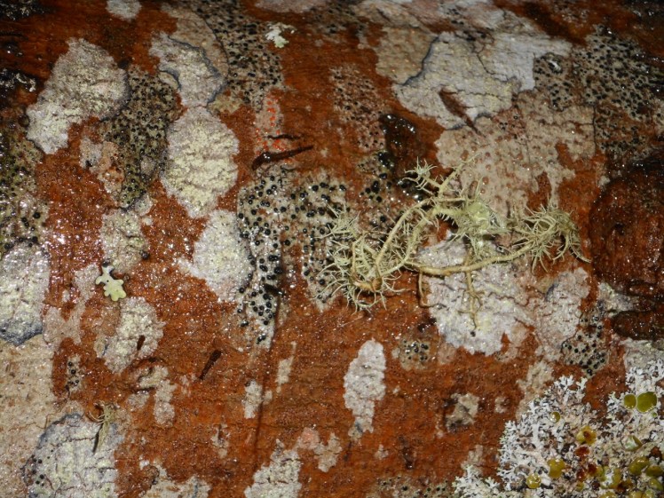
During a break I sat down on a lichened rock in a part of the forest where I sometimes walk, enfolded in its deep and friendly silence, noticing the beauty of random scatterings of leaves, twigs and impressions in the earth, and the slightly anxious flight of a bumble bee. I must have sat for about ten minutes when a gentle trilling began to rise through the forest. This insectivorous chorus was one I had never heard before, and so neither had I experienced the way the forest seemed to attend to this shimmering music.
Many make one: communities living on a blanket bush (Bedford salicina), kunanyi
It evoked that perpetual question, that one too big to have an answer: what is the secret life of the forest, what the mysteries of the river and the sea? What happens when we are not there to witness it?
Krishnamurti (2000), in All the Marvelous Earth asks
‘…what is beauty? This is one of the most fundamental questions, it is not superficial, so don’t brush it aside. To understand what beauty is, to have that sense of goodness which comes when the mind and heart are in communion with something lovely without any hindrance so that one feels completely at ease – surely, this has great significance in life; and until we know this response to beauty our lives will be very shallow.’
It’s a closed loop
And,
it’s an open invitation, because ‘medicine and sickness heal each other. The whole world is medicine. Where do you find your self?’ (Yunmen, 9th C China).
In effect, the extensive damage we have done grants to us an opportunity to develop a symbiotic ease in our relationship with the earth and bring about the healing change so urgently needed right now.
Robert Hass puts it beautifully: ‘We are the only protectors, and we are the thing that needs to be protected, and we are what it needs to be protected from.’**
A Different Sort of Tasmanian Beach: Hard, hidden and hostile
Tinderbox Hills Trail: signage delineating the peninsula
The Tinderbox Peninsula, approximately 5.5 km long, points south east and rises steeply from the water. It’s forested with eucalypts that make their living on hungry soil and its cliffs make the Alum Cliffs look positively inviting. What’s more, they shoulder into at least three bodies of water: the Derwent, the D’Entrecasteaux Channel and North West Bay. I think it’s reasonable to add a fourth because water pays no heed to lines in the sand. Storm Bay is supposed to come to a halt a tiny bit south at Dennes Point, North Bruny Island but I think it exercises free will in this regard. Tinderbox is not outside its orbit.
If you take the lovely walk along the Tinderbox Hills Trail (see sign above), following the backbone of the peninsula the views of all this water – all the same water really – are pretty spectacular.
Looking across the Derwent, South Arm Peninsula and Ralphs Bay to Frederick Henry Bay from the Tinderbox HillsThe south west view to Tasman Peninsula from the Tinderbox Hills
South Africa (once my homeland) has one vast and magnificent peninsula, the Cape Peninsula, which is justly famous. There, mountains plummet into the sea. But Tasmania is an island of water bodies, peninsulas, isthmuses, mountains, lakes and islands. And there is quite a lot that is special about this particularly scenic peninsula. The white gums and blue gums that push their roots deep into the usually dry ground provide a livelihood for the forty spotted pardalottes, green rosellas and swift parrots. These trees are an endangered habitat and it makes for endangered birds.
This is a coastline I’ve mostly sailed along, both in calms and in gales. When you’re sailing along these Tasmanian beaches and the wind is from the west you can find yourself in a wind shadow along here. Conversely if it’s whipping across from the east beware this lee shore. One wintery night stands out. We’d been becalmed and then, passing Blackmans Bay a sinister, warm wind flowed over the beach and curled around the corner, a portent that as a rookie with a pretty sketchy knowledge of winds and landforms I noted with unease. We were becalmed again off Tinderbox, left far behind by the rest of the fleet, but what, two of us had been wondering, might be awaiting us in the D’Entrecasteaux Channel when we emerged from the shelter of the cliffs beside us? It had to be, and it was, total pandemonium.
Birngana off Passage Point, Tinderbox Peninsula
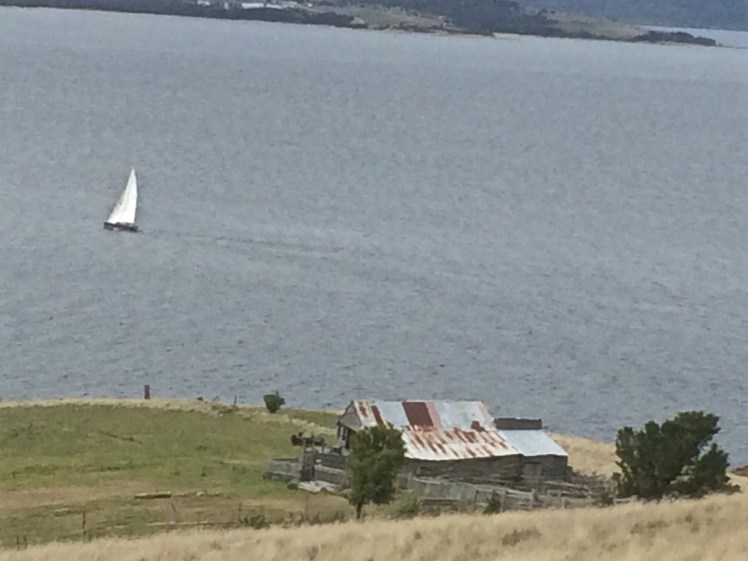
Conversely, on the day this photo was taken I wasn’t on Birngana, the boat I was crewing on some time later. I was at Boat Sales, finalising the purchase of Samos, but after that was done I drove along the Peninsula to see how the long distance race was panning out. Birngana was in the vicinity of Passage Point, heading for home and an easy win. We were well positioned to win the whole series but a week or two later disaster struck and there would be no more racing.
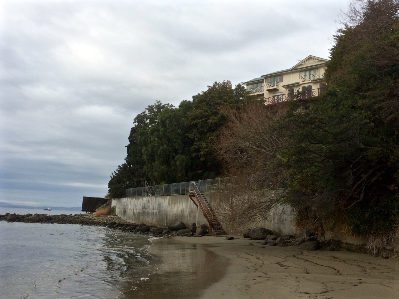
On board they could see the cliffs and the beaches, which from the road aren’t visible at all. They could see the cliff top houses in their spacious grounds – although, focussed on victory perhaps they were not looking. And there was one building that would certainly pass unnoticed, no matter how hard they looked for it.
Some people build themselves castles (even in Tasmania) but a South African millionaire decided to build himself ‘a boozy bunker’ – a tunnel and a cave worth millions, behind the cliffs – as you do. A place to party, to drink and to feast. There’s a door (disguised by a veneer of sandstone) that opens on to a rocky platform. You’d never know it was there.
And here’s another thing. For a long time it was supposed that the waters of the Derwent feed the D’Entrecasteaux Channel but actually, it’s mostly the other way around – channel waters predominantly feed the Derwent. (This is something Christine Coughenowr, Manager of the Derwent Estuary Program) explained to members of the Cruising Yacht Club of Tasmania at a meeting recently.)
Another observation from sailing this shoreline – as you enter the relatively small opening to the channel between Tinderbox and North Bruny Island, the depth decreases quite dramatically, just briefly. Imagine a different geography, with Tinderbox and the island connected. During the last Ice Age you could have strolled across to Bruny Island, rather than paddling your canoe. Bruny would have been a long, ‘isthmused’ extension of the Tinderbox Peninsula.
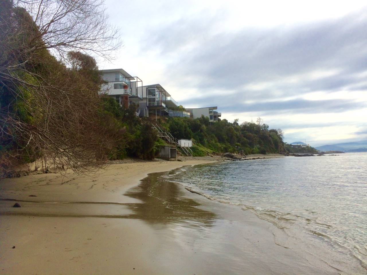
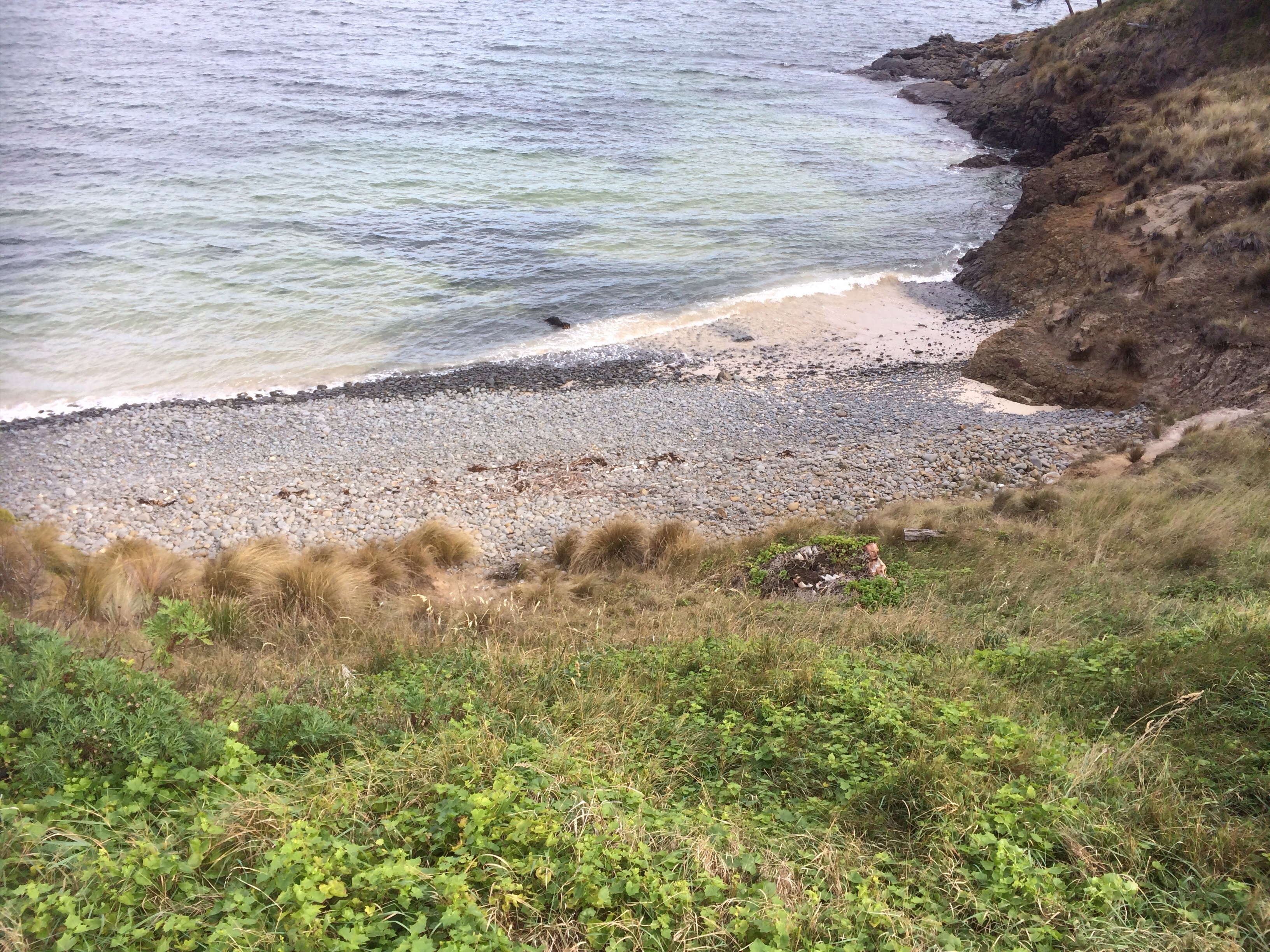
Along the Derwent River side of the peninsula the Tinderbox beaches are mostly inaccessible, mostly cobbled. They are my kind of beach – the type you have to go searching for.
I woke with a huge sense of anticipation about this next walk, keen to get going, but the aroma of coffee filled the kitchen, scrambled eggs were on offer and the woodheater warmed the house. The flame robin in the garden seemed an auspicious omen and so I breakfasted at home in preference to stopping by a Long Beach cafe.
I saw yachts sailing before a light northerly breeze as I approached my starting point. The sky was a milky dome of cloud and the landscape was quiet and dreamy. It stayed that way all day and the mountain was hidden from view except for occasional glimpses of forested flank through small gaps in the clouds.
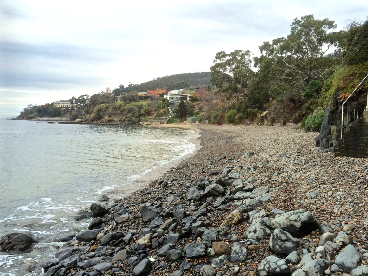
There were plovers on the beach and a lone cormorant fishing as I set off down the path from Long Beach and soon I was swinging around Blinking Billy Point into Geography Bay, the old lighthouse on my right pressed up against the houses, past the old search light and the Charles Darwin Cliffs and down on to Blinking Billy Beach, the small waves breaking on the pebbles and little sand evident because the winter river had drowned the beach.
I had not always known this was the case. I thought it’s disappearance indicated climate change, but the Salty Seadog had once told me it went submarine in winter. On rough, wintry days the beach makes music, the cobbles rolling in the waves. The Salty Seadog writes music and plays music so I guess it’s her kind of beach.
Blinking Billy Beach 1: the view from the north
I’d walked this coastline by the time I discovered Lena Lencek’s book The Beach: The History of Paradise on Earth (2009) as an audio recording on Scribd, my new favourite app. She’d spent her childhood in Trieste, enjoying the Adriatic coast and then her family moved to the USA and she got to know vastly different kinds of beaches. Listening to this book at night, speakers in my ears, I learned about pocket beaches, and the landscape I was walking fell into place.
A pocket beach is normally a fairly thin, crescent shaped beach nestled between rocky headlands. It’s possible to find strings of them along coastlines – beach, headland, beach – and although they are sedimentary (the sand, shell and pebbles laid down in beautiful layers by water) the headlands, and the rocky platforms at their feet, isolate the beaches from each other, and that means they can be subjected to different types of beach making and breaking processes, like the angle of waves and higher tides in winter which often cause them to disappear. (And if, like me, you’d forgotten that tides are higher in winter, it’s because the sun, like the moon, has an influence on tides and in winter we’re tilted further away from the sun and so it’s gravitational pull is much slacker and the tides aren’t drawn back quite as much.)
I was so excited by this concept of pocket beaches that I just had to enlighten the geologist. ‘I’m sure Blinking Billy is a pocket beach,’ I enthused.
He looked at me bemused. ‘We’re surrounded by pocket beaches,’ he said. ‘There are heaps of pocket beaches along the Derwent. Name any one. Chances are it’s a pocket beach.’ And thus began a second lesson in all things pocket beach and Derwent River. I listened, but at the same time I was hatching a plan to subvert the concept – each beach in my pocket. I ordered vials off Etsi and began to gather each beach’s signature, it’s fingerprint in these tiny bottles. Because this is the thing – the sand on each beach is different and after all, one day these beaches will really drown.
It’s a short walk from one end of the first Blinking Billy beach to the other but a little longer when the sand is submerged and you’re walking on cobbles. At the far end I made a voice memo: ‘I’m about to go where I have never been before’. That was because I’ve always been here with dogs, and I’ve always stopped obediently at the sign commanding no dogs to go any further because of seabird habitat.
Blinking Billy Beach 1: view from the south
I may never have been here but I knew that Darwin had. He’d sailed into Hobart on the Beagle in 1836 and been pretty unimpressed with the town initially but this changed as walked about. He headed up the mountain, guided by the Sandy Bay Rivulet (my first recorded walk), he walked along the river’s eastern shore where I’m currently spending a bit of time and he walked this coastline too. I felt he was a suitable companion in spirit because he had the observant eye I lack and was able to make sense of the Derwent’s complex geology in a way I could not. He’d named kunanyi/Mt Wellington Table Mountain, after another mountain I have lived beneath and his grandfather Erasmus and my sister both made Lichfield their home. If he was up for a little idle chatter, conversation should flow. And there were moments on this walk when the landscape felt so timeless I felt I could well have encountered him contemplating pebbles and stones on some of the wilder sections.
Such was his observant eye that on his fifth day here he found volcanic rocks near Blinking Billy Point on his walk from Battery Point to Sandy Bay and realized that the cliff revealed two lava flows and that volcanic rocks lay strewn about. ‘Hah!’ was his reaction (or something like this). ‘I’m standing in the eroded heart of an ancient volcano!’ He figured this out way back then yet many locals are unaware of this even today.
I’d stumbled into the heart of the volcano often and unknowingly, oblivious to the story the Charles Darwin cliffs were telling, more concerned about the smelly water that seems to be deposited straight onto the concrete path from a house above the cliffs and so the fact that Hobart is situated on the remnants of a volcano was news to me when, after this walk, I tried to make sense of it all. The reef extending out to the John Garrow Light is an old lava flow and fault lines abound through this area.
I rounded the point at the end of the beach. There, before my eyes, was another beach – Blinking Billy Beach 2, according to Short or Half Moon Bay, according to Leaman (1999). In the distance, a man in a red jumper was throwing sticks for his dog. I navigated a bit more reef and cobbles then stepped on to the sand.
The reef between Blinking Billy Beaches 1 & 2 (aka Half Moon Bay)
A cockatoo flew overhead, yelling for its mob. And then again more pebbles and then another sandy stretch and another six private stairways down onto the beach. I noticed a rivulet. This is poor little Folder Rivulet, according to Andrew Short, emerging out of its drain into sunlight, unloved and disregarded, too tiny to matter. (I watched this little rivulet being bulldozed unceremoniously into its drain, back in the day. It looked so wrong it hurt. And recently I returned to its valley to try to discover how much of it can still be seen above ground. Not much.) We communed, the rivulet and I, and then I took photos of beautiful conglomerate rocks and and made another voice memo:
I’m on another sandy cove with some interesting old beach structures. It’s quite a long sandy cove with a rocky reef in the centre of it. As I walked along the second stretch of sand a white speed boat came up river and the yacht I’d thought was leading the race (they rounded the buoy at Nutgrove all bunched up) has proceeded on down the river with its spinnaker up… this is such a lovely walk.’
Blinking Billy Beach 2 from the north
And it was true; I felt elated, thrown back into childhood recollections of The Famous Five and their explorations which we tried to mimic on holidays on South Africa’s eastern seaboard. I felt invigorated by a sense of adventure and discovery and on this beach there were so many new discoveries – new perspectives of the river and tiny, exquisite details.
Here’s the southern end of the beach, and the man and the dog had already disappeared around the corner.
Southern end of Blinking Billy beach 2
Blinking Billy Beach 2 from the south
The reef at this end of the beach held my attention for quite some time. The rocks were interesting, human debris, although depressing, also managed to look artistic and I began to do a little bit of amateur geological sleuthing perplexed by rocks that didn’t always seem to belong together – sedimentary, conglomerate and igneous, worn red bricks, smashed and violently weathered rock, unconsolidated slopes, conglomerates of modern material – and delicate combinations of life forms were represented here or lay ahead of me.
Found on Blinking Billy Beach 2Beach detail.
When I reached the next point there was a yellow unconsolidated cliff, a wall someone had built beneath it, and a rosy coloured boulder near an intrusion.
I was seriously losing track of where I was in relation to Blinking Billy beach numbers as devised by Andrew Short (see The Book Shelf) and I hadn’t got very far at all. I was lost in thoughts to do with defining beaches – how much sand do you need before you have a cove? How much before you have a beach? Were the long stretches of boulders and pebbles actually beaches at all or just the bits in between?
And did it even matter where beaches began and ended scientifically, subjectively or according to the whimsy of the tides when I was engrossed in the landscape, entranced by the huge views and fabulous details – utterly blown away by the wild grandeur so totally divorced, below the cliffs from the houses in some other more banal, irrelevant world up top?
This coastline is divine but also tragic because it’s along here that the mouheenener once walked with confidence, and after their lands had been taken that traumatised families would have retreated.
To be continued…
Sources:
Leaman, David. 1999. Walk into history in Southern Tasmania. Lehman Geophysics, Hobart
Royal Society of Tasmania, Charles Darwin in Hobart Town, edited by Margaret Davies, Hobart, Royal Society of Tasmania, 2009.
A story has no beginning or end: arbitrarily one chooses that moment of experience from which to look back or from which to look ahead.
― Graham Greene, The End of the Affair
As soon as we got home from the Arm End walk I grabbed a coffee and began to research the Tasmanian coastline. Someone must have written up their beach walks around Tasmania! My sleuthing uncovered someone Walking the Derwent River, a group walking the beaches in Clarence, and Andrew Short, who has recorded all of Tasmania’s beaches as well as the entire coastline of Australia. As soon as I saw the title of his report I realised I’d seen it before – and so I rang the geologist and suggested he visit the library. (There is nothing like a library – the next day I had it!)
The State Library of Tasmania holds tantalising titles too, and I’m conscious at the same time that although I had to dive deep into the internet to uncover sunken treasure it’s many fathoms deep and oceans vast, and there could well be further riches down there in someone’s lost, forgotten blog.
I flipped through Short’s illuminating report. Mary Ann wasn’t one long beach. She did have a companion, the one apparently nameless that I’m going to personally call (serious nomenclature being one for the state) Gellibrand Vault Beach. Down at The Spit there were two other beaches I’d either not noticed sufficiently or had failed to record. I’m pretty sure locals must call them North and South Spit beaches.
He’d also numbered the beaches along the Derwent Estuary. I’m often on them. How could I not include these old favourites? I looked at my chart of the Derwent, I consulted maps. I thought about the mountain and how it conjures up weather and serves up magic or sorcery for yachties, how when you’re out there sailing, you have to keep your eye on it so you know what might be brewing. The river is inextricably bound to the mountain, not just through the wind but because rivulets carrying altitudinal memories and stories flow down into it, bringing their own unique chemistries to the Derwent.
The mountain’s personal space extends some way out to sea – you feel its moods, it’s muscle flexing. How could I not take all that into account? I looked again at Andrew Short’s incredible number, 1,067, and quickly remembered that in all things, small is beautiful. Perhaps 100 beaches was a more suitable goal. Perhaps I should focus on a particular locale. I decided to make my mistakes close to home and start with the beaches of the Derwent and the South Arm Peninsula, possibly even the D’entrecasteau Channel, but I didn’t dare count them.
I had walked several beaches before I realised the beginning was merely symbolic. Exploring the beaches, laying down memories about them, began on my first visit to Tasmania many years ago.
Still, I felt that before I began on the beaches not that far from my front door, I needed to know more about that beautiful thing, the river, its currents and waves, which along with the wind shapes the shoreline, and the small but powerful rivulets that merge and become one with it.
This project was proving to be as shapeshifting as the beaches themselves.
Conditions: SW wind about 15-20 knots, tide going out.
The walk we did is in the area that is red on the map
After our impulsive breakfast decision to head out to South Arm Peninsula (see previous entry), we gathered up the dogs and set off knowing only that there was a walk at the end of the peninsula but not much more about it. We supposed it would take a mere 30 minutes to walk that stretch of coastline.
The peninsula forms the southern end of the Derwent River’s eastern shore, on the far side of the low lying isthmus at Lauderdale, a suburb at the eastern end of Ralphs Bay. Somewhat uncertainly, and without consulting a map, I’d thought this might be where I’d choose to start my coastal walks from.
There are no real suburbs on the peninsula, just a couple of communities, farmland and conservation areas. South Arm Peninsula has many varied beaches – some coastal, some on the Derwent Estuary and quieter ones in Ralphs Bay. If this was a day in the last interglacial (about 125 million years ago) we’d be climbing in a boat and heading out to a series of islands and as there is evidence of current sea level rise this will eventually be the case again.
We crossed the isthmus and then we were on to the peninsula and turning right for Opossum Bay. There’s a small collection of homes and beach shacks here, many with their foundations right on the diminishing strip of beach itself. There’s a corner store and not much more. It’s quaint, it’s quiet and from this part of the peninsula looking north there are the most riveting views across the Derwent River back towards Hobart and the mountain. Looking south you can see the western shore receding south to Storm Bay and Bruny Island.
We crossed the equally low lying but skinnier isthmus called South Arm Neck and continued through Opossum Bay and on to what was once pastoral land but is now, south of the recreation reserve, giving way to a subdivision of new homes and that’s where we parked our car. A sign right there announced the start of the Arm End walk.
The walk begins
We were rugged up against the cold and across the river the mountain loomed, snow still on its peak from the big dump the previous week. These were some of the observations we made to each other as we walked along the track above the coastline:
~ There are an awful lot of different weeds invading this landscape.
~ This is a fantastic walk to do with dogs.
~ This walk is going to take us more than 30 minutes.
~ Are we doing this right? (This was me. I was beginning to realise that a plan written on a finger nail was no plan at all. I now saw that many compromises might. For instance, we were enjoying following the path that made its way over grassy paleo dunes, but the actual shoreline was hidden beneath us. I wanted to walk along the edge.
We thought that, if you put to one side the knowledge that you were not going to stumble upon a village, strike a lane or happen across a pub the walk felt a bit like rambling through the countryside in England.
Beginning of the path
The path reached the cliff edge. Peering over I saw that the option of rock hopping the shoreline in between sauntering beaches was clearly not realistic. And when we came to our first beach, a dark, cobbled and fairly short one (I discovered later that this was the western end of Mitchells Beach), I failed my first test. I wanted to go down and put my feet on its sand but the slope looked friable and what might have been a slithery exercise for me was potentially ruinous for the slope.
Mitchells Beach
’Do that one on the way back,’ the geologist suggested and on we walked. My first beach – opportunity missed! But from this view another beach to the east (further back along our path) was also evident, possibly separate, possibly the eastern end of Mitchells. We came to a radio transmitter station at White Rock Point and this view up the Derwent River (see below).
There are some perspectives from this area where the river looks like a gigantic lake with small settlements, the city and single households spread across the hills, a known geography strangely altered. I sail along this coastline, but now, looking down at the river from a new vantage point, and seeing this lovely sailing ground spread out all about me, it felt good to be enjoying the water from a different perspective.
Looking north to the entrance to Ralphs Bay
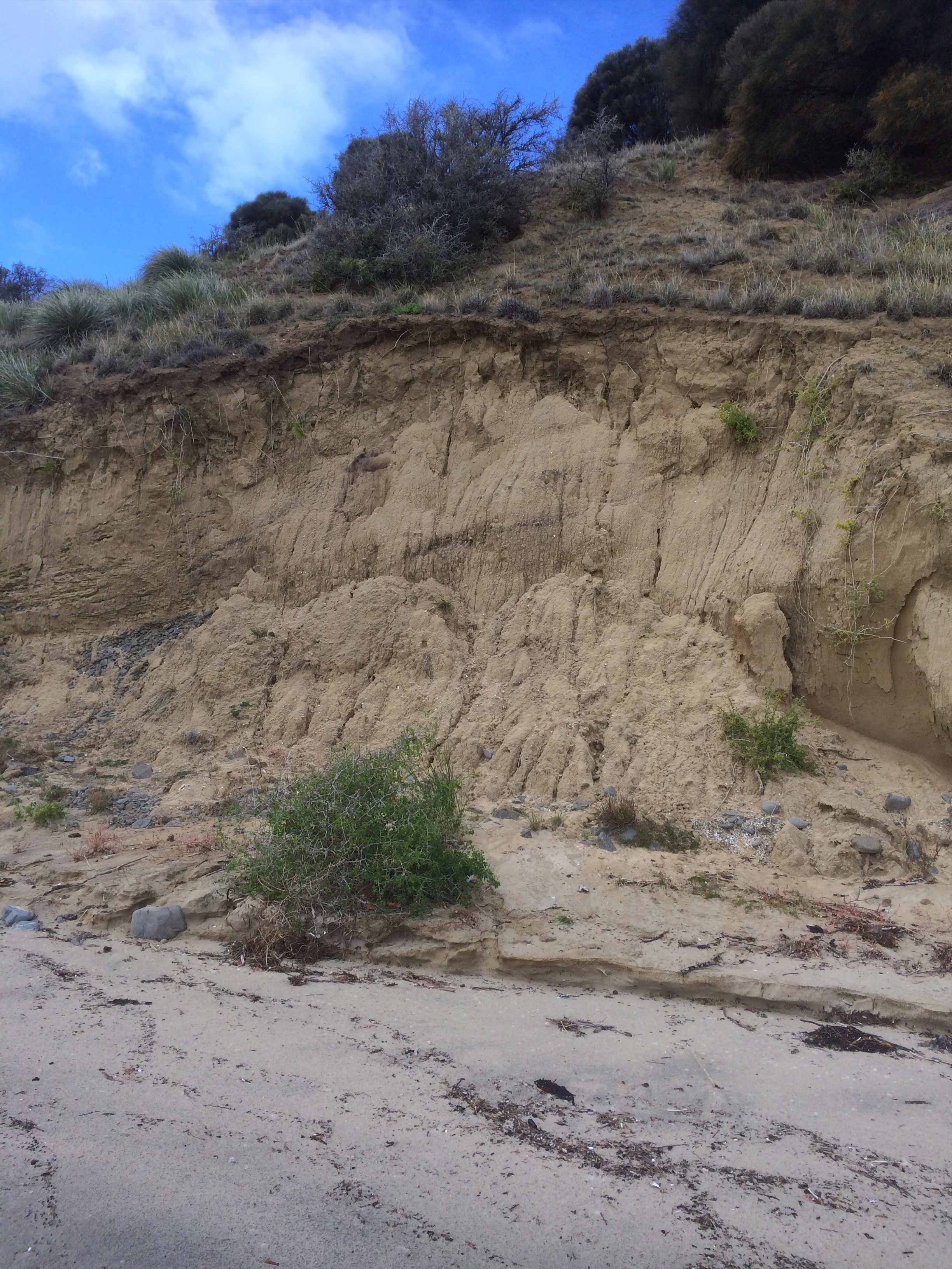
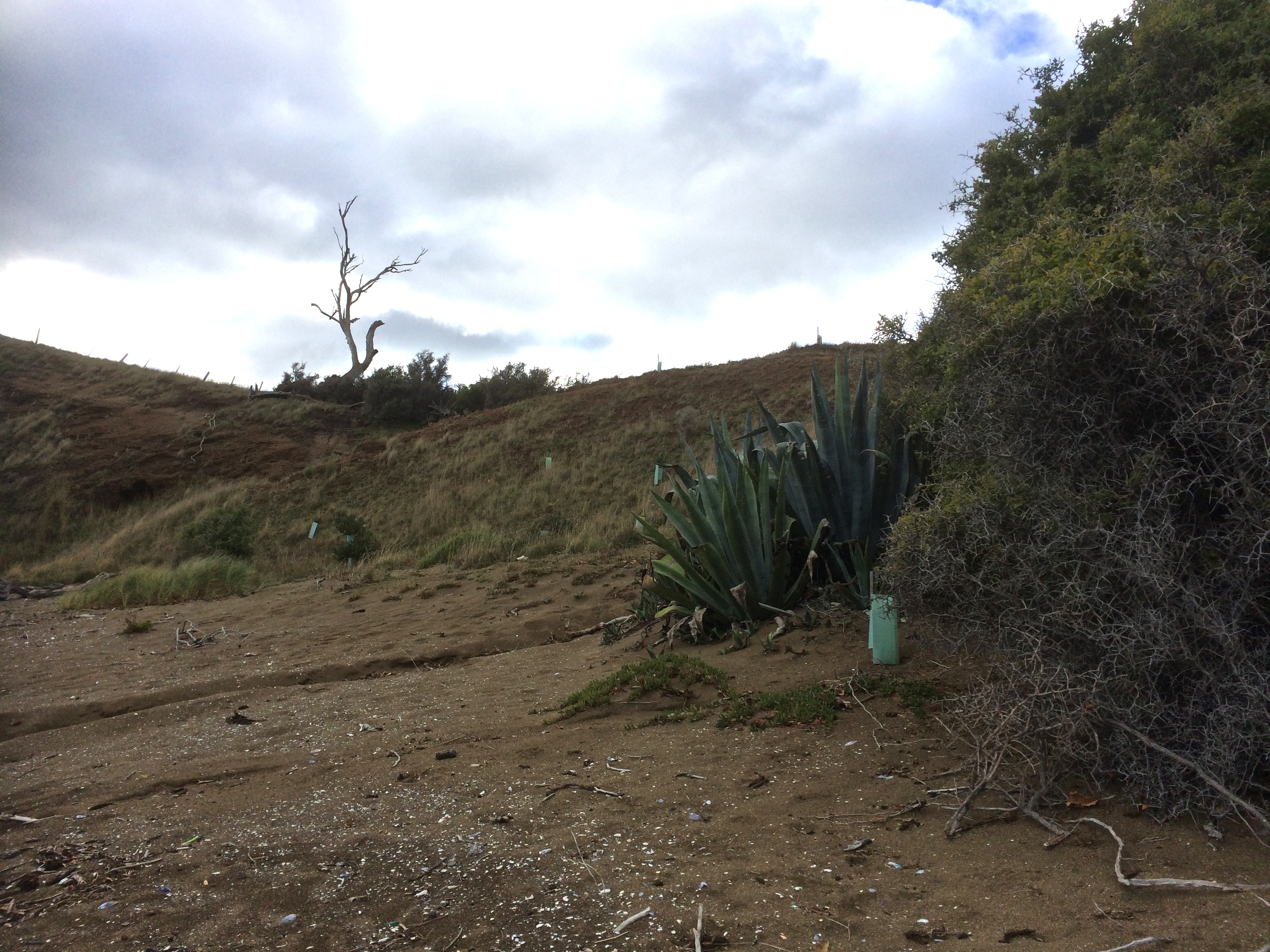
We hopped through compromised vegetation (weeds and litter) and down the eroding dunes, marram pelted, on to the beach at Mary Ann Bay.This is a bay that’s a popular day anchorage and it can get crowded with yachts. It’s where I once let myself down by reversing far to fast on someone else’s boat while we were anchoring. Now I could see (at least with the tide we had) that it’s a slender beach, quite enigmatic, darkened by dolerite, and there’s a lot of litter among the belt of cobbles that lie at the base of the cliff. We realised most of it would be swept this way from the city when the wind is blowing from the north west and the tide is running out. (I made a mental note to include rubbish bags as part of my beach walking equiment from now on.) Although I know the winch handle that we accidentally dropped overboard last summer would most likely have ended up on Bellerive Beach, I scrutinised the debris on the off chance it had circumnavigated the Derwent. I didn’t find our winch handle but I did find a small yellow super ball and claimed it to save a bird from swallowing it. So here’s a shout out. Mary Ann needs friends! She’s being strangled by Hobart’s litter.
Mary Ann asphyxiating under litter
.
Mary Ann: Looking northMary Ann Bay: Eroding semi-consolidated cliffs
We walked along Mary Ann and at the end scrambled up the cliff to where the caesurinas grow.
Caesurinas, cliffs and rocky shores above Mary Ann
I also discovered a small reef, clear and precise amongst the white caps off Mary Ann. I think it’s the two tiny black dots that are noted on the nautical chart but are very easy to overlook or to miss altogether on a higher tide when you’re sailing along chatting with friends and not paying sufficient attention.
Looking north along Mary Ann under variable skies
The next beach along the route is still Mary Ann, I think, but I was fast discovering that beach identification is a bit of an art. There was a sign that said Gellibrand Vault on the map I found later online (see link at top) but at the time we walked along it I assumed it was the northern part of Mary Ann. We discovered the vault itself and climbed up the slope to take a peek. Mr Gellibrand was the first land owner in this area. I later read he loved to sit in this spot to enjoy the view. The words testify to his good nature and it does have a fabulous view but it’s likely that in the fullness of time the dune in which his body rests may slide inadvertently into the river.
Mr Gellibrand’s VaultWalking Mary Ann
This beach does in fact have friends. There are new plants in green plastic casings. They are trying to stabilise the dunes. Like Mary Ann, it’s beauty is also marred by litter. It’s narrow too, and at the end, where a cliff barricades the way, someone had placed a vertical series of small round cobbles along a ridge of rock. It made me pay attention. I enjoyed a moment contemplating my surroundings. I looked across the river, trying to imagine what it was like to be Moomairremener because this was their domain and I have no doubt the land would be happier if that was still the case – just ask Mary Ann. I imagined the suburbs gone and the forests on kunanyi’s foothills still pristine, the smoke rising from the fires made by the Mouheneener tribe on the western shore, their known world ending and another about to assume its place, the first omens the ships, the second their settlement at Risdon Cove.
Landcare trying to stem the damageOn the Gellibrand Vault part of the beach, looking southLooking across the river to kunanyi / Mt WellingtonLooking south back the way we’d come
It was an easy walk the rest of the way to Gellibrand Point but we were definitely taking more than 30 minutes. When we got there, and stood looking back the way we’d come, across the water westward to the mountain, north to Droughty Point and even further upriver where rain was falling north of the bridge, we had a decision to make: continue the circuit or backtrack along our route, visiting the beach(es) we’d missed. On the off chance that somewhere we could cut across and do a figure of eight I agreed to continue and I’m glad we did although we didn’t cross back over and Mitchells has been put aside until another time.
Looking north to Ralphs Bay under darkening skiesThe view from Gellibrand Point into Ralphs Bay
There was long grass on either side of the track and periodically the sudden dark blur of a mouse, perhaps native antechinus, disappearing into the undergrowth, and flocks of birds on the slender spit extending into Ralph Bay’s still waters. Far away to the south I could just make out a catamaran against a background of trees.
Small wetland and The Spit: tranquility in the lee of the peninsula
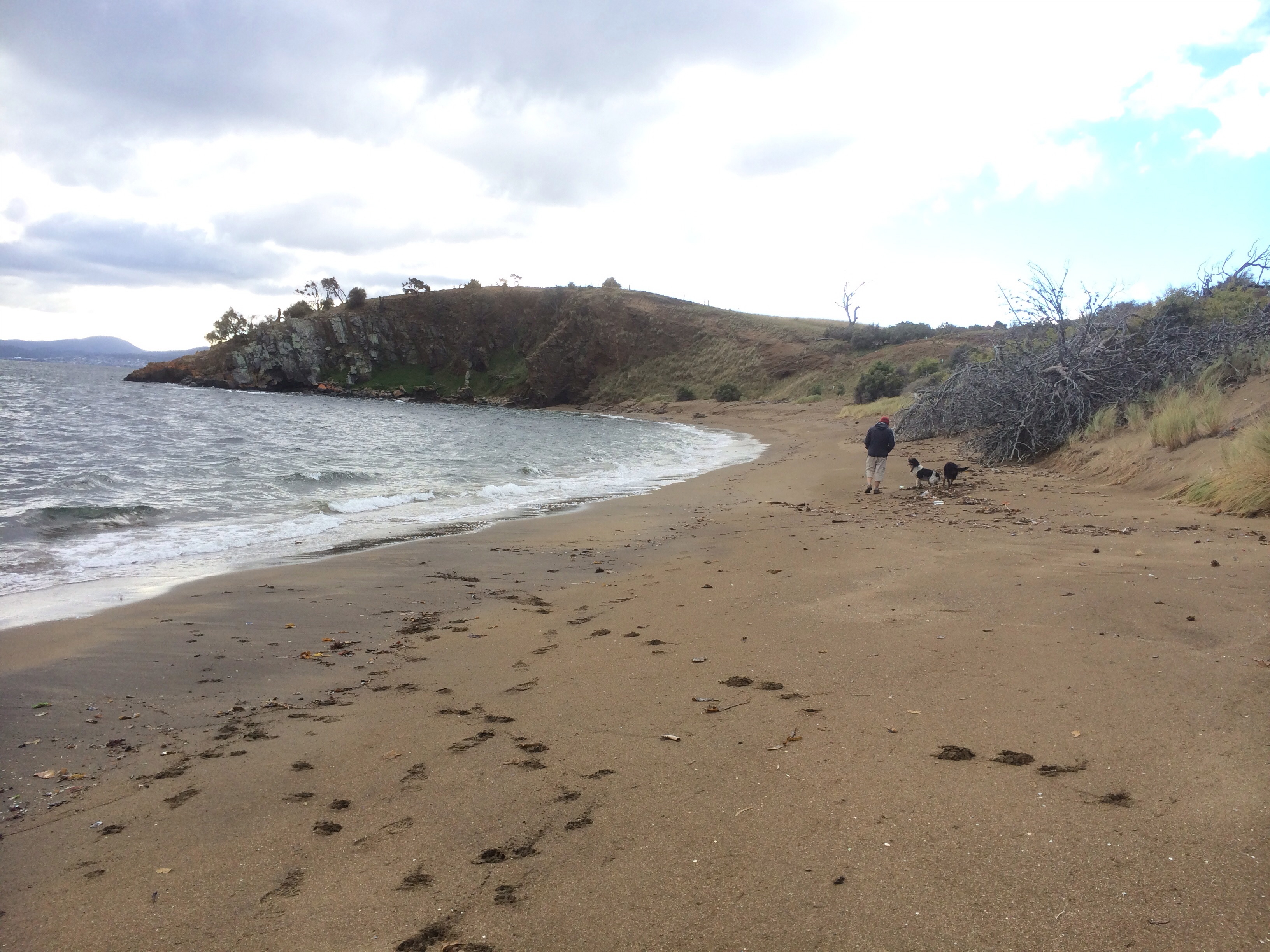
We saw the radio transmitter on the far side of the point and then it was lost again behind a low hill in the centre of the nature reserve and shortly afterwards we reached a corral we guessed was designed with sheep in mind. We descended down to the boggy edge of Shelly Beach.
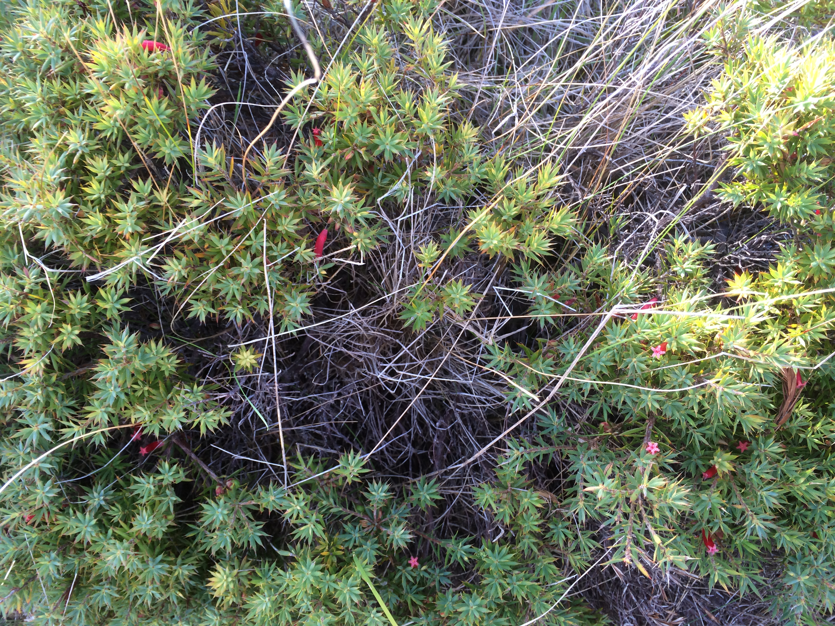
Towards the stockyardsNative flora (epacris impressa?)
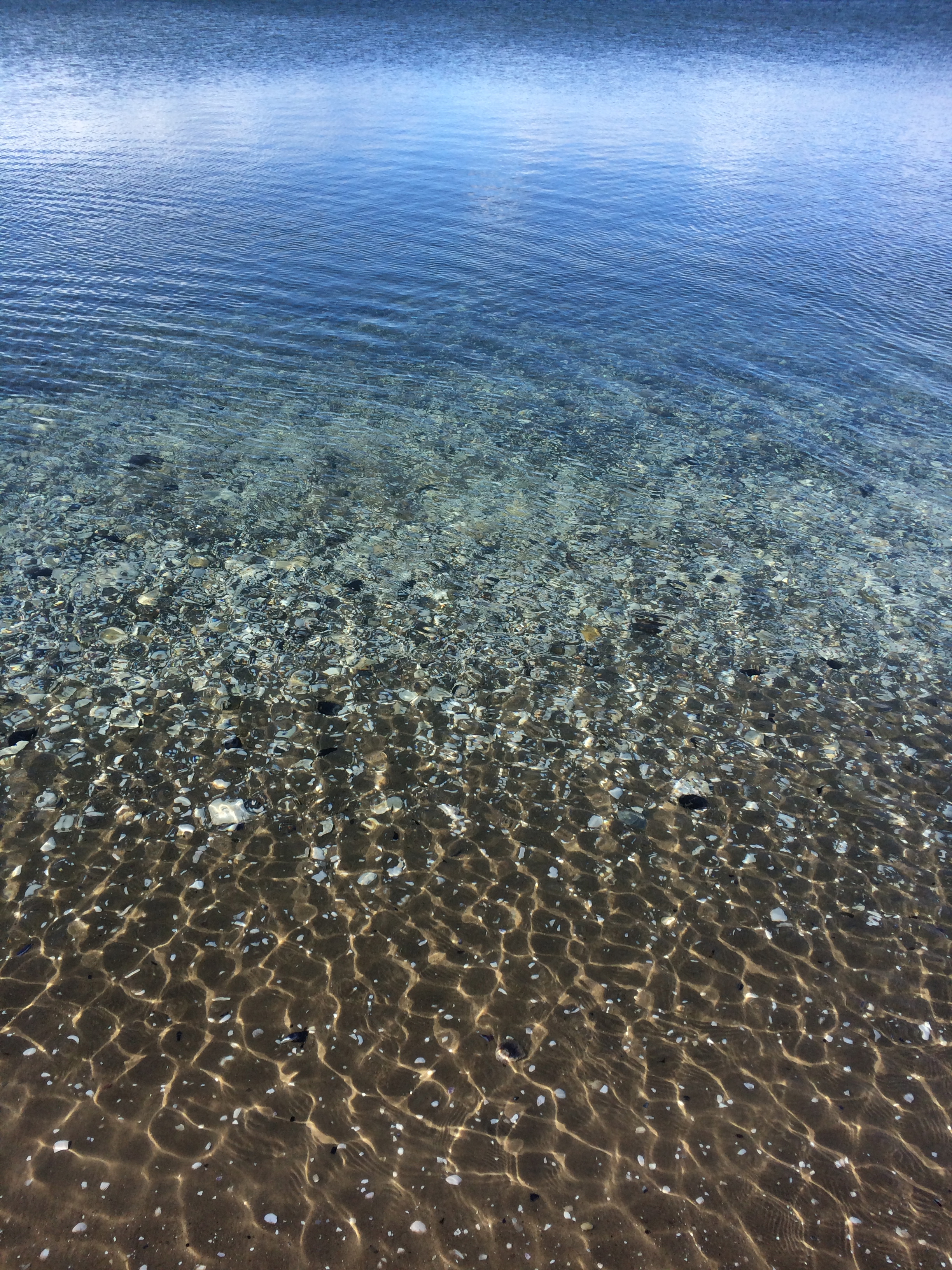
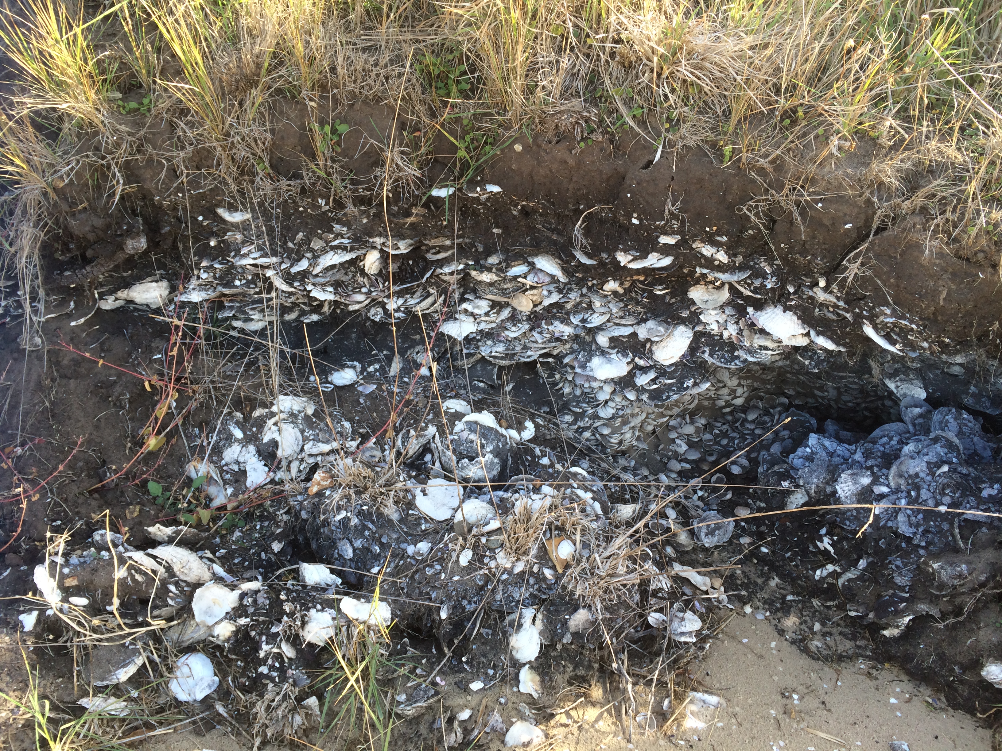
It was so sheltered and so shallow and the bottom glistened with white shells. We paused to consider a surprising discovery – a dense layer of shell sandwiched between layers of dark soil in the bank behind the beach, meandering delicately the extent of the bank.
‘I’ve been here before,’ said the geologist. It had been a field trip with an archaeologist we know, to consider whether this was a vast kitchen midden or a natural deposit eons ago. They’d decided it was too extensive to be a midden and there was not enough evidence of fire in the layer with the shells.
The shallows (Shelly Beach)Shelly Beach
As we began to see people again – a lone walker, a jogger with her dog, a family group – I was reflecting that I had to be better prepared – things like consulting maps, doing research, checking the tides and the moon, the weather forecast and distance to be walked. It struck me that there was a stark difference between looking from the water, where all I’d only ever noticed about Mary Ann was her unprepossessing cliff face, whereas walking her slender length, the cliff becomes intriguing, you notice the dark sand and the wind and wave working dynamically to reshape her. Windswept, and beneath an overcast sky, the beach had been sombre but beaches are many faced and on a sunny day with a low tide Mary Ann might be more light hearted.
Shelly, on the other hand, was quiet and reflective, openly spilling secrets, providing a long view into history. I imagined a sunny day, a beach umbrella and a book, toddlers splashing in the shallows. Personally, I was tantalised but the curve of sand I had not walked, that curled like a thin white line all the way around to the other side of Ralphs Bay. I wanted to return, both on foot and by kayak.
It was a great kick off to walking the rest of the South Arm coastline and the beaches – Mary Ann, the most sombre and littered beach, so different from others I’ve encountered in Tasmania and Shelly with its clear water and amazing soil profile, so different in character – had given me a lot to think about.


")