Bays of Dismay 3: East Coast Tasmania: Okehampton Bay

Before the Poop Soup Cometh

Okehampton Trip - boat on a mooring.jpg
Quiet day at Triabunna in Spring Bay.  The Tasmanian Seafoods buildings and the wood chip mill are visible in the distance.

I’m writing in defence of the ocean and the shore, not something I’d anticipated when I first set out to explore the coastline. Back then, the idea was to log the diversity and beauty of all that I saw, but in the 21st century it’s not so simple.

That’s why this blog is a Tasmanian take on that ubiquitous tale of industry and the powers that be colluding to rob the public of their common wealth while holding out jobs as a carrot and blindsiding the environment that sustains us.

But carrots are quickly nibbled away and environments don’t always recover.

It may be uncool in the strange climate we inhabit these days, but I would go so far as to frame this story as one of elder abuse. That elder is Mother Earth who nourishes billions of people (and all those other species we largely couldn’t give a rat’s arse about). The irony, of course, is that each time she’s bashed we’re bashed too except so many of us have become  anaesthetised to what’s happening.  We forget that

we are the protectors,

We are the thing it needs protection from

We are that which needs protecting

(Quoted in Murphy, 2012)

***

Okehampton Bay: Big Fish Snaffles up the Lure of Profit and Expansion

The desire to get bigger, to generate more profit and to be the best has Tassal, a Tasmanian salmon producer, angling to put 28 pens in Okehampton Bay on the East Coast. There will be 800,000 fish at full capacity. That’s a whopping amount of poop, streaks ahead of that expelled by the whole of Triabunna (the closest town) after endless nights of food poisoning and infinite days of giardia.* I’m sure you can easily visualise the soup of nutrients that will combine with the currents and the tides flowing into Okehampton Bay and along Mercury Passage of which it is a part.

Okehampton Trip - fishing boat on Mercury Passage.jpg
The view from the lease: Maria Island, the mountain is Bishop and Clerk.

Whales migrate through here, dolphins and seals regard it as their hunting grounds and habitat and divers collect abalone from these ostensibly  pristine waters  for the export market.

Tasmania benefits from its clean and green brand, but Tassal has recently been trashing it for themselves and for others. The company has acquired  a reputation for being a heavy users of antibiotics, for overstocking, for damaging the sea floor in Macquarie Harbour at a distance further than anticipated out from their pens.  They’re also responsible for a significant amount of debris that washes up on the shorelines.  And this is a shame.  Tasmania needs clean and green.  It needs sustainable industry.  It needs long term, permanent jobs.  I’d like to be honouring them for their contribution to the economy but the cost to the environment is just too high.

Their lease in Okehampton Bay is 80 hectares and stretches to within 530m off Lords Bluff, it’s northern headland.  So close, and not much room left for boating.

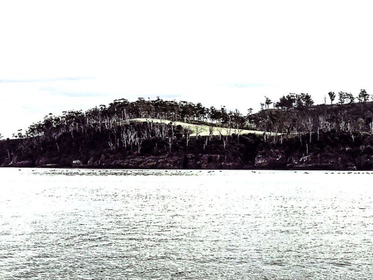
It’s 700m from the shore at the other extreme.  And it’s 7 km from the Maria Island Marine Reserve, which is seriously ouch.   The island is a much loved national park. There’s a marine reserve there too, and it’s one of Tasmania’s most iconic views, visible from different points along the east coast south of Freycinet Peninsula.

Understandably, Tasmanians who have warm memories of blissful days on this vehicle free island rich in wildlife and 360 degrees of scenic beauty, are dismayed. For some of the sailors I’ve discussed this with, it makes for a waterway ruined. Tassal says it isn’t fish farming in Mercury Passage (Tassal Sustainability report 2016) and here’s the actual quote:

When investigating potential sites for expansion of farming, Tassal will examine various sites, some which may be suitable from an environmental and social perspective, and some that are not. Mercury Passage, located adjacent to Okehampton Bay, is one such example. We will not farm in Mercury Passage. A rigorous stakeholder engagement process is undertaken to ensure our social licence to operate.’

But this is downright sneaky. Mercury Passage includes bays and embayments, of which Okehampton is one. It’s part of the passage’s shoreline after all!  That statement, plus a temperature graph without a key in Sustainability report 2016, the debacle in  Macquarie Harbour with no apparent contingency plan beyond charming the regulator were enough to make me particularly curious about this fishy business, the focus of local debate and protest.

Actually, one other thing.  The local council  claims that the last time Okehampton was pristine was ‘when Aboriginal people fished there in canoes’ (The Mercury, 23 Nov 2016), so here’s what it was like when the French explorer Peron visited in 1802:  “The marine animals were very abundant on these shores, and we saw huge troops of dolphins, cetaceans and innumerable legions of seals” he wrote ( Plomley, 1983:72).  But hey – isn’t that how we want the oceans to be?

A similar abundance of seals was seen around Ile des Phoques [Island of the Seals] in 1987. (Ranson & Brown, 1987). And the Maria Island National Park and the Ile  des Phoques Nature Reserve Management Plan 1998 states that around Maria Island there is still a rich marine flora and fauna representative of a variety of Tasmanian east coast habitats (Edgar 1981). That’s why a stretch of coastal water  around the north western shore was added as a marine extension to the Park.  And it’s also considered the most significant representation of the Maugean biogeographic province reserved in Tasmania (Kriwoken, 1991).

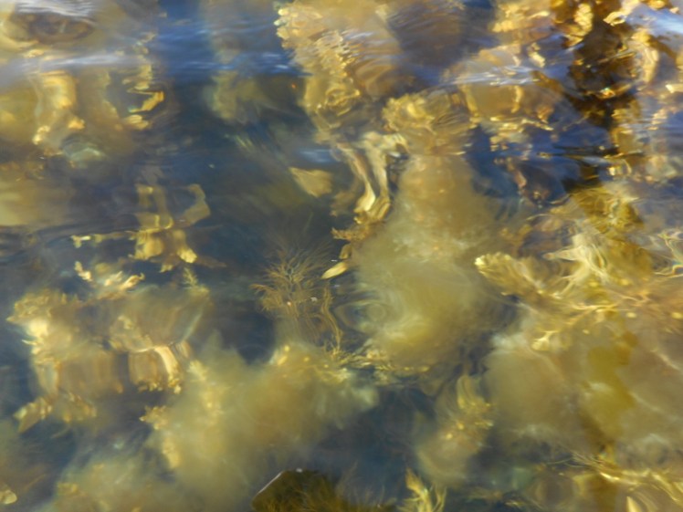
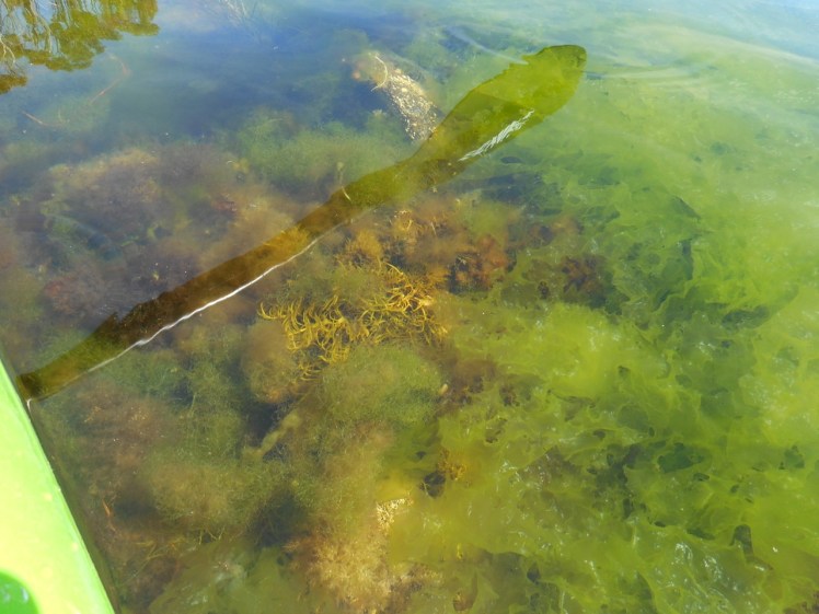
The plan notes extensive seagrass beds which act as fish nursery areas.  According to locals, sharks breed here too. Tassal, heedless of the precautionary principle and disrespecting the possibility of damage, are shrugging off known unknowns, have experiments up their sleeve and will  ‘monitor’ what happens to this environment.

So, regardless of their poor record in Macquarie Harbour (and IMHO the D’Entrecasteaux) they’re telling us they respect the environment (only not as much as profit) and are asking us to trust them   I really, really want to.  But I think Mother Earth is up for another bashing.

***

Seeing It for Myself

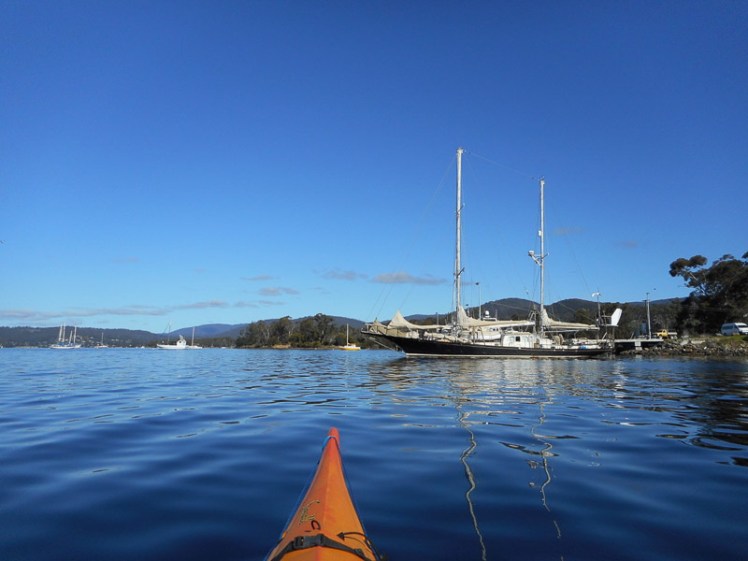
I’d Google Earthed Okehampton Bay, checked it on maps, viewed the Tassal lease on paper, read reports (see below) until I could no longer see straight, but as I’m not particularly familiar with Triabunna and Spring Bay (although they once provided the yacht I was on safe harbour from a storm) I thought it would be insightful to go and actually see the lease so I knew what I was writing about.

Just as the kayak was going up on the roof rack, a friend who is also concerned about Tassal’s expansion plans rang to say he’d arranged for me to go out on a yacht to  view the lease. ‘You’ll see much more of it this way,’ he said.

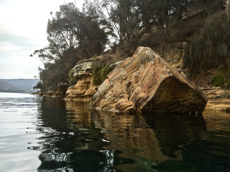
So on one of those stunning winter days when there is no breeze and the sky is impeccably blue, the geo, the dogs and I stepped onto one of those ‘I wish it was mine’ sort of yachts and, with its equally concerned owners, motored out passed Bricky Point and Horseshoe Shoal, Sappho Spit, Windlass Bay and Point Home.  Once around that headland  we were into Okehampton Bay.

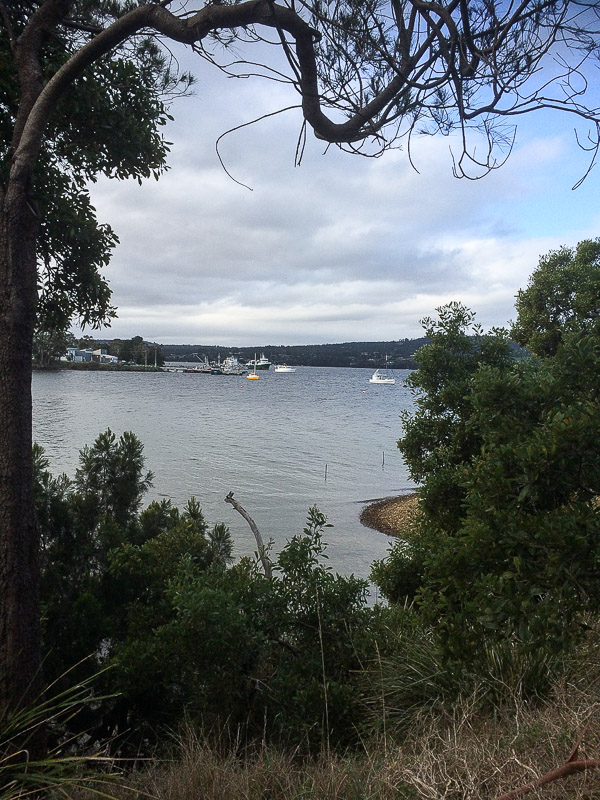
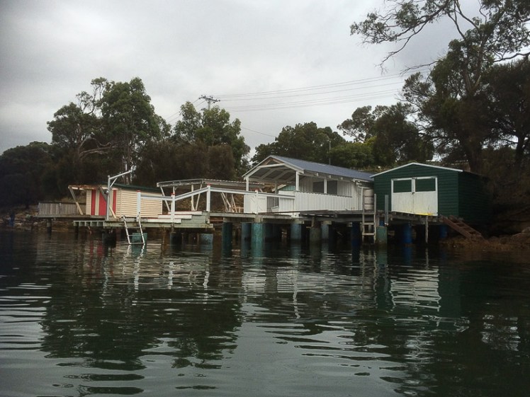
But as we crossed Spring Bay we passed by the shed that had once housed fishmeal, causing a stink, literally. We passed the Tasmanian Seafoods building and the jetty where the super trawler would have been based if community outrage had not put a halt to this massive fishing trawler’s plans to operate in Tasmanian waters.  The concern then was overfishing.  The new concern is overstocking.

Tassal have planned a long jetty here and a start has been made. It means the local yachties need to roll over because one of the racing buoys has been a fixture here, so the jetty means a course change. This may not seem important if you don’t sail, but it does demand that one community gives up the rights it has enjoyed for a company project destined to use the common wealth for its own profit.  Racing here is a pleasurable activity, avoiding large boats is not.  What offset is Tassal offering, I wonder?

Just a hop across the bay’s entrance there’s still the old wood chip infrastructure.  It used to provide employment for Triabunna.   A tourism venture is  planned here but if Tassal is given the go ahead then noise, lights and visual impact could be problematic.

Okehampton Trip - woodchip mill.jpg
Triabunna wood chip mill.  A tourist venture is planned for this site

All the Profligate Beauty

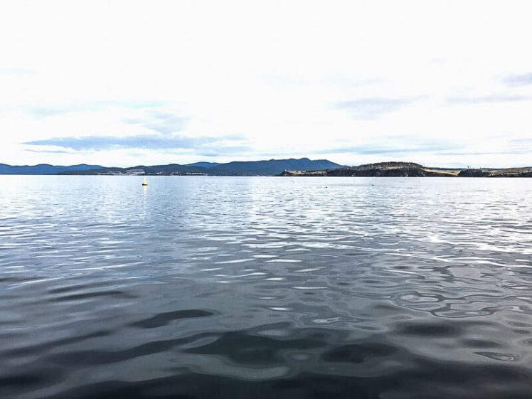
On this perfect winter afternoon Mercury Passage shimmered blue and silver and Bishop and Clerk stood tall against the sky while the dogs snoozed on deck and we all chatted.  No aquaculture wins beauty points. Spring Bay Seafoods, Tassal’s new partner, farms in this vicinity too but it has struggled because warmer waters  have caused algal blooms and DST [Diarrhetic Shellfish Toxin] disease.

Tassal is not concerned. They are taking over an existing salmon lease never farmed because the original owner did the monitoring and concluded that for a cold water species the water would be too warm. Tassal reckon that they’ve monitored the area and the water here is as cool as the waters in some of their other leases. This is a surprising and convenient discovery, as East Coast waters are considered warmer than those down south  and this last summer many tropical fish found there way down here, inadvertently stuck in the East Australian current, which is nosing its way further south than it has been inclined to travel before.

As we rounded the headland and Okehampton Bay came into view I was thinking about how salmon producers state that the ocean’s resources are fast running out, and they are therefore  providing a community benefit. But as the oceans succumb to acidification, microplastics and warming, so will salmon. Also, it’s beginning to seem that fish farming with its explosive expulsion of nutrients locally accelerates the ocean’s distress.  It seems to me it would be better by far better for us as a species with our habits of overconsumption and waste, to focus our attention on ocean health and behaviour modification so that the ecosystems we depend on continue to sustain us. And their argument is all a bit of a furphy really, because when it comes to salmon farming wild fish still end up down the gullets of farmed salmon by innocently swimming into pens or ending up  ground into food pellets.

Okehampton Trip - endangered panorama.jpg
Okehampton Bay: endangered panorama


Tassal, we could see, that beautiful afternoon, is leaping enthusiastically into developing this lease. The lease marker buoys are in, pens are being developed and we were gobsmacked by how huge this lease is in the landscape. It  stretches out across the entrance to the bay and deep into it, appearing to shrink the dimensions of the coastline.  Truly, it’s scary vast!

Okehampton Trip - the buoy _.jpg
Lease marker.  That’s Home Point in the distance and the Okehampton shoreline extends out to the right. The lease extends in toward the shore.

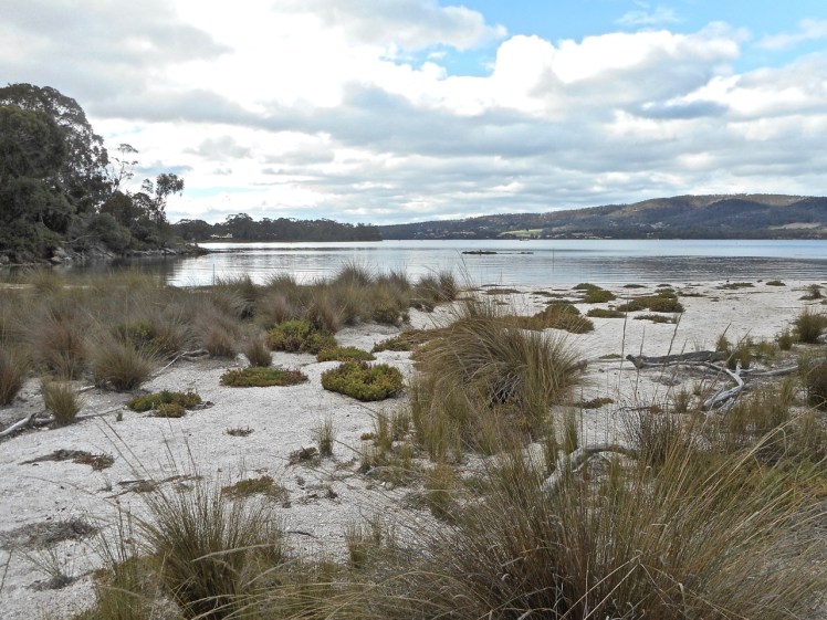
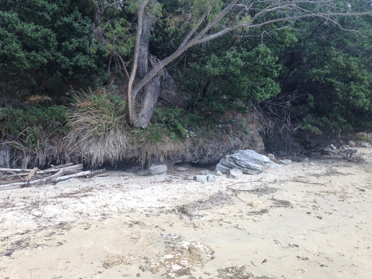
The skipper put the boat in neutral and we gazed sombrely at the loveliness of the mainland and the Maria Island coasts.  We watched the ripples of baitfish on the water, seagulls so full they look laboured taking off.  Okehampton’s beach is enjoyed by locals in summer, our companions said.   I turned to look at Maria Island.  It looks so close here; you can see Darlington. No worries, according to Tassal. Tourists love to visit fish farms. (Who are these peculiar people, I had to wonder.  It’s like paying to visit a battery hen farm, is it not?) And I’m not disputing that people are keen to visit big black pens, but is that not truly bizarre?

Okehampton Trip - Maria thin blue line.jpg
Lords Bluff (left) and Maria Island


Okehampton Trip - the pens _.jpg
Pens in progress. (I had to adjust this photo to make them apparent.)

Tassal say that 5 independent studies (2006-2009) suggest that nutrients  can occur out to 500m from the source.  I don’t believe in a fluid environment that nutrients screech to a halt at the 500m mark. Look at the way litter finds its way independently across oceans -airoplane wings, for heaven’s sake – and how nutrients consumed are transported to other reefs inside avian and piscean bellies.  Tassal’s big dump may well contain antibiotics, if they don’t get their act on and stop this bad behaviour.  Good luck whales.  Good luck dolphins, seals and birds, in avoiding entanglements and antibiotics.  Good luck all you other species we don’t really give a rat’s ho hum about either but are destined to encounter poop soup.

To counter watery rises in temperature, Tassal are breeding heat tolerant salmon and will experiment with integrative farming, growing seaweeds, urchins (both feral and native) and mussels beside the pens to sop up nutrients and help out the reefs. Who knows, perhaps they’ll introduce their brand new but not adequately tested waste management system, developed belatedly and in a hurry (reactively, in other words) when nutrients from their pens in Macquarie Harbour spilled past the scientific estimates of the impact zone.   It’s success is still questionable. And again, if only all this were possible without an unsustainable impact.

But Tassal, it’s not!

I hope like hell that this farm doesn’t go ahead.  Worse case scenario, I hope like hell that integrative farming is the success Tassal expects it to be.  But it’s got to be a definite yes before many Tasmanians accept the notion.  At the moment it seems more like fingers crossed.

When I talked about this issue with friends, I discovered a growing distrust about decisions made behind closed doors. The fact that DPIPWE and Tassal share a building in the city centre leads to a perception of a snug relationship, the kind of relationship that at least one of its competitors seems concerned gives them preferential treatment.  Huon Aquaculture are taking the regulator to court for not heeding scientific advice and mismanaging stocking limits in Macquarie Harbour with devastating consequences for the environment.  Tassal have jumped in to support the regulator.

***

Around Spring Bay

On our return trip we headed across Spring Bay towards the Eastcoaster Resort. Close by a proposed 350 mm water pipe will enter the bay, heading out and around to Okehampton Bay and if you’re wondering why a water pipe, fresh water is needed to wash down salmon in order to prevent disease. But the East Coast is drought prone. To support Tassal (as well as a golf course and potentially some farmers), the Glamorgan Spring Bay Council is planning to build dam. The dam will be on the property of two council staff, a lucrative arrangement. But Tassal will have a long wait to get this water and let’s hope the rains fall.  Let’s hope the promise of additional water to the community holds good and it’s not the community sacrificing water to Tassal, kind of easy to imagine.

And for what? This company turns over a huge profit already. It’s an industry roughly thirty years old.   They don’t yet know their full impact on the environment. Far better for them to perfect their techniques rather than expecting the planet to accept getting whacked while they work things out.

For a start they could take their fish farms out of bays and out of sheltered waters and leave the East Coast alone.  They could work towards minimising  their oceanic footprint with real integrity so that they stop impacting on the disappearing species all about us.

Socially, this farm has split the community. Jobs are needed here, no one disputes this, and with a park on their doorstep and  tourism on the rise, Triabunna could enhance its appeal as a choice destination. That’s one of the reasons those opposed to the fish farm believe the site is inappropriate, that the environmental impacts will be significant and that this is salmon farming on the edge.

This from the EPA’s own website:


The Tasmanian salmon industry is one of Australia’s largest and most valuable aquaculture industries. Increased sea surface temperatures may present challenges for the production of this cool-water farmed species as they are currently farmed near the upper thermal limits of their optimal growing temperature. A temperature rise of 3°C may result in severe stress to Tasmanian salmon. Warmer temperatures are also likely to increase outbreaks of disease in aquaculture operations and changes to rainfall and changes in salinity, nutrients and sediments may also have a negative impact. (EPA, 2017)

Let’s Grow Tasmania’s social media and television campaign from LGTF (see video) began in late December 2016 depicting a fisherman defecating over the side of a boat, claiming “farming 800,000 salmon in Okehampton Bay is about the same as 10,000 people taking a dump in the bay every day”.

That’s a hell of a lot of poop soup.

Mother Earth is drowning in our waste. We’re throttling her.

So hand’s off Okehampton Bay.


Some further reading:

For the planning documents relating to Okehampton Bay, check this DPIPWE page.

Salmon Farming Operations Okehampton Bay: report of the Marine Farming Planning Review Panel.

Report for Glamorgan Spring Bay Council: Prosser Plains Raw Water Scheme

Tea Tree Rivulet Dam.

(A Google search on Prosser Plains raw water will produce several reports)

Woodruff, R. 2016.  Glamorgan Spring Bay Council’s very secret business. Tasmanian Times 22 Dec 2016

Rea, W. 2017 Social licence? Doesn’t look like it. Tasmanian Times 24 April 2017

Kelly, L. 2017. Tassal’s contempt for due process. Tasmanian Times. 20 May 2017

The Four Corners program that kicked off significant community concern is also worth watching.

Bays of Dismay 2: D’Entrecasteaux Channel: Mickeys Bay (Great Taylor Bay)

BAY OF DISMAY 2

Great Taylor Bay map.jpg
Great Taylors Bay map (Tasmap. 2007. Tasmanian map book: southern region.)

Once, in Alaska, poking about a waterway, we watched the first salmon return to breed. Their life cycle begins in the gravels of the home river where they are born. They leave it for the ocean but return to it to breed, recognizing it by its scent, along with other cues. The icy chill, the glacier, the clear stream and the salmon (now more ruby than silver) made for a moment of mystery and magnificence.

Those were sockeye salmon, but the Atlantic salmon farmed in Tasmania are not native here and these days there’s a lot of conversation – protest even – about the environmental impact fish farms are having. Resistance has been growing against their planned expansion in Tasmanian waters.

That luscious pink steak on a plate had grown extremely popular because it was regarded as a gourmet choice – healthy, sophisticated and quick to prepare. Ethical, even, with many believing that farmed fish take pressure off wild piscean populations. That’s turned out not to be true (although the ratio of wild stock in feed has diminished somewhat) and farmed salmon are not naturally pink fleshed, people have learned. It has also become more commonly known that controlling disease outbreaks in pens is a difficult management issue that sometimes involves the use of anti-biotics. Seals still die seeking salmon in the farms, although not as many as in the early days but search through the relevant agency’s right to information index indicates that relocations are still frequent. Hundreds of birds get entangled each year. It’s a young industry leveraging off being clean and green but environmental sustainability, especially in a time of climate change, is tightly constrained by environmental factors, such as warming oceans, and the perception many have is that they have betrayed public trust about their practices and could do a whole lot better. They say they’re trying and the three companies have chosen different ways of improving but the chorus is growing that fish farms do not belong in bays.

Sailing, the sight of pens in an otherwise beautiful location that would normally elevate one’s spirits has quite the opposite effect. They can be noisy, spoiling the serenity of otherwise quiet anchorages. There is a particular one that is always in the way when I want to tack. Debris can mess with propellers and cause injury and it’s not always apparent when there’s a tow underway. These are situations that can be dangerous. Fatal, even. On the other hand, they have brought much needed employment to Tasmania and generate considerable wealth for the state.

***

GREAT TAYLOR BAY

Great Taylor Bay.jpg

Great Taylor Bay is off South Bruny Island with Partridge Island protecting its north western entrance. There’s a popular anchorage off the island.  We ducked in here to escape bad weather on our way down to Recherche Bay this last summer. South Bruny National Park is at the southern end. Jetty Beach, also down south, is probably the best known beach in this bay because of easy public access. Too easy maybe.  When we were last here there were five vehicles spread along the beach and this in a national park.  There are anchorages along Great Taylor Bay’s eastern flank at North Tinpot Bay, Tinpot Bay and Mickeys Bay.

Great Taylor Bay, like all the D’Entrecasteaux bays, is really beautiful – the moody water, the forests, beaches and the islands. It can feel wild and remote, approaching by boat, so long as you ignore the dark farm with its caged salmon secured near the entrance of the bay. Tassal has a 30 year lease here and there were seven or eight pens that I counted as we sailed passed making for Mickeys Bay.

MICKEYS BAY

Mickeys Bay panorama.jpg

Mickeys Bay, an embayment off Great Taylor, can’t be accessed by road. It’s surrounded by hills and forest, has a lovely serenity and offered good protection from the prevailing wind one day in February (2017) when we decided to anchor here. It has a fairly narrow entrance, guarded on each side by the other two islands in the Partridge Island Group – Seagull Rock, a tiny islet, and Curlew Island, somewhat bigger. There are a few properties around the edge of the bay, although they are set well back and are relatively unobtrusive.

There was a yacht already there and by the time the stars were out we were nine overnight.

The next day, once all but two other yachts had sailed away, the geo decided to do a spot of fishing from the tender. Flathead were plentiful in 2005 when the Lady Nelson overnighted here, I later discovered, and he was hoping to catch us dinner. Another couple had also decided to put fish on the menu. They’d spread a gill net between Curlew Island and the shore. Just putting it out there, but in my humble opinion these should have been banned decades ago. Along with a fish for the plate, there’s the by-catch factor that can include seabirds of which Curlew Island has a few.

I decided to circumnavigate Mickeys Bay from Seagull Rock around to Curlew Island. It was sunny, the water was still and clear. There’d been a full moon the night before and the tide was way out. The conditions were perfect.

I kayaked over to Seagull Rock and began to work my way back along the bay, kayaking over and beside a fringe of seaweed, mostly those beautiful strappy canopy forming brown macroalgae, like kelp. I was expecting to lose myself to the beauty, but beauty wasn’t what I got. They lacked the variety and robustness of the ones I’d seen in the Tinderbox Marine Reserve. That’s not surprising in a quiet bay like this one, but their vivacity was frequently lost within the dirty brown miasma of a brown filamentous species, similar if not the same as one I recollected seeing at Baretta.  It looked to have attached itself into the thallus of the seaweed like a parasite and seemed to be successfully suffocating everything it encountered. On the few occasions that I found something still vibrantly alive, the brown miasma was right up beside it, rocking and rolling with the movement of the water, just waiting to pounce. Or so it seemed to me, a novice in the world of seaweeds.

Mickeys Bay seaweed 1.jpg
Not the prettiest of sites: kayaking the reefs in Mickeys Bay

I was doodling along but often I stopped and floated, trying to figure out what I was seeing. I wondered if my perception was skewered somehow, if maybe Tasmania just happened to have some dead ugly reefs. If maybe a species as dominant as this ugly miasma could be normal. But what kept coming vividly to mind was my favourite Eastern Cape (RSA) river, the Kwelera, and how over the course of one summer we watched grey water from an ablution block turn a happy rocky shore into a soapy, slimy one where nothing grew.

Each time I reached one of the beaches around the bay I walked, collecting plastic and other litter. I was disappointed at just how much of it there was. Some was fish farm debris, the lines entangled in old washed up branches or caught up on the wrackline, which, I noticed, on the longest, sandiest beach, had spilled over the low bank, with plastic sometimes caught up in a tussock or lying in a thin line on the grass.

Two seaweeds from Mickey's Bay.jpg
The encroaching miasma and plastic litter.

The day I had thought would be wonderfully spent on the water was turning out to be a dispiriting experience but I expected that on the deeper, eastern side of the bay,  in shadow cast by the forest that afternoon, the seaweed would be healthier.

It wasn’t.

I walked this pebbled northern shore.  I floated above the seaweed.   It seemed to me it was an opportunistic seaweed invading the space where others should grow.

In the distance I could hear the rumble which we’d earlier concluded must be coming from the fish farm.  I thought about its possible impact – the faeces, the unswallowed food, the way the debris accumulates beneath the pens before it is picked up by the currents and tide and I wondered if anyone knew how those currents might move around Great Taylor Bay. It seemed to me entirely feasible that if fish farm debris was washing into Mickeys Bay, then nutrients were making it in here too and given its shape they might be having a hard time flushing back out.

The brown fuzz.jpg
The miasma was everywhere

Observing this bay of dismay I wondered if what I was seeing was the result of a seasonal trigger, climate change, the impact of habitation or the passing parade of yachts that might have poor waste management strategies.

Or all of these things combined.

I hadn’t noticed anything amiss when I’d first paddled from the yacht to the shore. The water was clear. I’d seen ripple marks in the sand and down beneath me what I took to be seagrass standing upright, all at a distance from each other. But later, when I studied the photos I had taken, I noticed that in the little hollows small clouds of that miasmic seaweed seemed to be resting like brown cotton wool.    Studying my photos later I couldn’t decide if the seagrass was healthy or not. Searching the web I struggled to identify this filamentous alga.

Mickeys Bay seagrass and sand.jpg
My amateur interpretation: ‘The miasma’ encroaching on  seagrass

Mickeys Bay seaweed 2.jpg

CURLEW ISLAND: BIRDS AT RISK

Curlew Island is 0.415 hectares of non-allocated Crown Land, and at least in 2001 was home to Pacific and Kelp Gulls, Sooty and Pied Oystercatchers as well as Caspian Terns who have (and possibly still do) use it as a breeding site, along with Black-faced Cormorants, Little Black Cormorants, Great Cormorants and Silver Gulls (Brothers et al, 2001).

On the point near Curlew Island there were a whole lot of pipes and what looked like a fish farm pen in the process of being built. The land just there had a most unpleasant vibe because of the mess lying about in what had seemed at first glance to be a lovely wooded area. I looked at that island and noticed some birds. I considered that net. I thought about that fish farm, about 5 km away, and how, when you sail by, you often see birds hanging about the pens. No place for a net, I thought. And I didn’t like the idea that birds from Curlew Island might get entangled in fish farm netting.

Until I’d noticed the mute trouble the bay is in it had seemed stunning. I’d paddled around it, drifted, communed with it. I’d walked it. I’d seen two  tiny groups of minuscule silver fish (less than a dozen in each) and I’d seen a ray.

‘Good paddle?’ the geo asked when I got back.  I told him about the trouble I’d seen.

‘How was the fishing?’

‘Two little flathead too small to eat.’

***

But now, months later, I wonder if I was entirely wrong about what I saw.

The more I read the more it seemed that studied opportunistic species associated with fish farms are green, like Ulva and Chaetomorpha and they weren’t on my radar as I kayaked. On the web I finally located a look alike species to the ‘miasma’ called Ectocarpus, found in New Zealand and elsewhere in Australia. There are two varieties in Tasmania (one also found at Eaglehawk Neck) and they are migrants from the UK that have grown resistant to anti-foul and heavy metals like copper. This species hasn’t been studied much from what I can see and although to me, a rank amateur, it looks opportunistic, I haven’t noticed it linked to fish farms.

Which begs the question – why is it so abundant in this bay?  If my identification is correct, then is it thriving on heavy metal contamination here?

Variety.jpg
The green seaweeds of Mickeys Bay.

Tassal’s baseline environmental monitoring program doesn’t cover Mickeys Bay but they do have a monitoring spot in the middle of Great Taylor Bay, M8, that has indicated higher than average chlorophyl readings and Oh’s thesis also notes increases in opportunistic * green algal species in Great Taylor Bay.  She monitored just outside Mickeys Bay.

I would really like to see Tassal include Mickeys Bay in its broadscale environmental monitoring program (BEMP) because both boats and fish farms use anti foul, although fish farms are apparently trying to phase it out.  Tassal is farming a waterway they do not own, a waterway in which the public, marine mammals, birds and other species have a vested interest and it would be a way of returning the favour that both the community and the environment are extending to them were they to increase their monitoring stations.

In 2014 the Aquaculture Stewardship Council auditing team identified  areas where Tassal could do better. Principle 2 (Conserve natural habitat, local biodiversity and ecosystem function) related to feed testing and making lethal incidents publically available within 30 days. Principle 3 was about protecting the health and genetic integrity of wild populations through the development of an area based management plan (my italics) and Principle 4 (Using resources in an environmentally efficient and responsible manner) related to the feed ingredients used at the farming sites. Tassal also has to abide by Principle 5 (Manage disease and parasites in an environmentally responsible manner) and was also advised it could do better in relation to Principle 7 (Be a good neighbour and conscientious citizen).

Tassal holds Best Aquaculture Practices (BAP) salmon certificates for the Tin Pot Point and Partridge Island farm sites, according to WWF’s the Aquatic Stewardship Council scheme, but there is concern about bias in this regard.

Changes in the Channel have been noted by many, including abalone divers and recreational fishers. The fact is, that since the first species let go their grip on the hulls of the boats of the first explorers from Europe, the D’Entrecasteaux has been disrupted by a multiplicity of different activities, visitors and the like. It’s just been growing ever more intense, to the point where it’s health is of growing public concern.

The more I read the more interested I became in fish farms, concluding that they do not belong in bays at all.  But I also began to consider the impact of my own sailing on the environment and the things I  could personally do to reduce this.  If there are heavy metals in Mickeys Bay then less damaging anti-foul needs to be considered.

  • See Macleod (2016) noted below.

Some Reading:

Brothers, Nigel (2001). “Tasmania’s offshore islands : seabirds and other natural features”. Tasmanian Museum and Art Gallery, Hobart

Tasmania’s salmon trade casts deadly net. Australian, 22 June 2013

Dangerous dinners. Is salmon farming ruining Tasmania The Australian 22 Dec 2016

Flora SA. (database) Ectocarpus fasciculatus

D’Entrecsteaux and Huon Collaboration. (2016). D’Entrecasteaux and Huon report card 2015 NRM South, Hobart. (see pg 14 for deaths and entanglements).

Fisheries Research and Development Corporation (2016) Understanding broad scale impacts of salmonid farming on rocky reef communities FRDC Project No 2014/042 2016

Report for Tassal Operations Pty Ltd: Huon Region – MF 185 Tin Pot Point and MF 203 Partridge Island : Full Assessment Against Aquaculture Stewardship Council (ASC) Salmon Standard V1.0 Tassal Operations Pty Ltd

Macleod et al (2016). Clarifiying the relationship between salmon farm nutrient loads and changes in macroalgal communities FRDC report

This report notes:  ‘Opportunistic species should not always be considered bad, they are a natural part of an the functional ecology of an estuary and serve a very useful role in “mopping up” excess nutrients. Consequently their presence can actually help ameliorate/ remediate the effects of nutrient fertilization. It is when they actually alter the structure and function of communities that they should be considered undesirable.’


D’Entrecasteaux Channel: North West Bay: Coningham

Skinny String of Beaches

Coningham Clarks Beach.jpg
Clarke’s Beach, Coningham

Coningham’s string of pocket beaches, notable for their boat sheds, are skinny, sandy and eroding. Where my kayak and I were carried ashore by a small, crashing wave I found a stormwater outlet and around it, supporting the slope and trying to buy it a little more time, sandbags piled on top of each other.

Coningham beach erosion (2017).jpg
Beach erosion, Coningham (2017)

Coningham boatsheds.jpg

Coningham is one of Hobart’s small, outlying beach communities where weekend shacks have given way to full time homes for people willing to commute about forty minutes into the city. Because the beaches are largely backed by reserve and cliffs they aren’t that obvious from down on the sand, but higher up the slopes of Shepherds Hill there are long  views across the bay to the Tinderbox Peninsula, the D’Entrecasteaux Channel and Bruny Island. Further off to the north kunanyi dominates the skyline.

NW Bay from Coningham
kunanyi from Coningham

Little penguins have a tiny presence here, their numbers much reduced now that    this area is more built up, the beaches less quiet.  Once, two years ago as we sailed down the Channel just off Ranggoerrade (an Aboriginal name for North West Bay), we encountered a group of about two hundred penguins. It’s not uncommon to see or hear a couple out on the water but a flock that big was exhilarating.

Where the beaches are backed by, or separated from each other by cliffs, they’re mostly composed of  hard Triassic fluvial sandstones as well as some Permian marine siltstones (Sharples, 2014).  I discovered, when I read this report, that Old Station Road leading in to Coningham is on reclaimed land, and that a small area of low-lying ground on the northern tip of Hurst Point ‘is the artificially lowered floor of a disused coastal sandstone quarry these days fringed by several boatsheds on the shoreline.’

During my first summer of sailing, a group of us once dropped anchor off Coningham Beach to while away some time in the sun.  There were beach umbrellas and swimmers in the water and on the boat music and great company.  The day felt perfect.

Then, a couple of months after my kayaking trip across Ranggoerrade from Dru Point to these beaches, I came back with a friend and we walked the Coningham Clifftop Track.  This peaceful walk takes you from Legacy Beach up behind the cliffs and along the steep shoreline out to Snug Point through dry sclerophyll forest.  It’s used by several endangered species, including the forty spotted pardalote and the swift parrot.  There are blue gums and sheoaks, heath bent grass, gentle rush and tailed spider orchids.  It’s beautifully serene until you reach the point.  There’s a turning circle up there.  It’s possible to peer down over the cliffs.  There directly beneath is an ugly fish farm, that one that always seems to be in the way whenever we want to tack.

Andrew Short (2006) points out that Coningham’s beaches are reflective.  He means that of all those beaches thrashed by waves, reflective beaches receive those waves with the least energy.   The surf zone is narrow, as are the beaches, and their sand is coarse.

 Here’s a quick list of the beaches using Andrew Short’s numbering system:

 1.  T478, (Clarks Beach, aka The Dog Beach) 150 m of north facing sand with some rock flats between two sandstone points.

2.  T479 (Little Coningham Beach) with its boat sheds. It’s in the next little embayment and is a bit longer than Clarke’s.

3.  T480 (Coningham Beach) is on the eastern side of Hurst Point.  It’s longer than the first two (about 500m), also has boat sheds and there are houses on the slope behind it.

4.  T481 (Legacy Beach) 500m west of Snug Point, backed by forested slopes.  It has cliffs and rocky platforms.

Sources:


D’Entrecasteaux Channel: North West Bay: Snug Beach and Rivulet by kayak and on foot

Not Snug Enough for a Landing

Snug-3
Snug River enters North West Bay

As I kayaked towards the next headland I couldn’t see a thing beneath the water because of the sea state and I was trying to angle the kayak against the uppity swell. Walking, a path may take you away from the shore. In a kayak, the sea state can keep you at a distance from it too. I was having to focus harder and unlike when I’d kayaked the Tinderbox Peninsula’s eastern shore with numb legs, this time I’d adjusted my pedals too far forward, so the only purchase I was getting was with the tips of my toes. Meanwhile, the fetch was increasing, the water was darker and deeper and the white crests were getting more numerous.  There was a small beach, only accessible by boat, on the northern side of the headland.  Waves were breaking on it.  I’d come back and explore it another day, I decided, because I did not want to risk capsizing.

Snug’s Coastline on Foot

Snug is another place on the Channel Highway that I’ve habitually driven through en route to other destinations, except for once, when we’d walked up to Snug Falls in the forest behind the town one wintery day.  Not once when driving did I bother to imagine what it was like when this area was the domain of the South East Tribe or what impressions D’Entrecasteaux, Bass, Flinders and their crews formed on those early expeditions as they made the acquaintance of this part of the bay, comfortably secluded beneath the Snug Tiers and fed by the streams running down from them.  Not for a moment had I stopped to imagine a fishing fleet operating out of Snug or small freight ships visiting in the early 1800s.  In fact, I had never even connected Snug with the coastline.

In the 1820s  timber cutters did business here and farmers took up land. A tiny settlement began to grow, but bushfires destroyed it in 1854, and returned again on 7 February 1967 to repeat the performance.  There’s a monument in remembrance of those who lost their lives.

It was only more recently, with my attention increasingly focussed on Tasmania’s coastline, that I decided on a whim one day to turn south off the highway to see if I could reach the shore of North West Bay.  I didn’t notice that the road was, in fact, called Beach Road.

Snug-4
Footbridge across Snug River

It took me to the Esplanade and I found a caravan park, a footy field, a beautiful beach and and a peaceful little river.  I was immediately won over by the way it curved around some lovely cliffs and quietly nosed its way into the bay between beach and headland.  A little footbridge crossed it, providing access to the headland and so, without hesitating, the dogs (on their leads) and I bounded up it.  There was  a light drizzle.  I soaked up the beautiful views. With Bruny Island at the opposite end of the bay it looked like an enclosed lake. There were a couple of yachts on moorings, the water was somnolent and a small motor boat puttered across it.

Snug Beach (T477)

Landcare have been doing careful work here and the beach was almost (but not totally) devoid of litter. It’s a lean beach and I think of it as green hued because of the green river and the thin strip of overlapping vegetation separating it from the road.  There are no dunes, so to compensate there are neatly laid sandbags suggesting to the sea that it keeps back.   Blackwoods grow right down to the beach. Of course, as the sea is swelling, there is coastal erosion because Snug is on a soft sediment plain cupped by sandstone slopes and there are rockfalls on the beach’s southern headland (Sharples & Donaldson, 2014)

Snug beach viewed from the south Y
Snug Beach: the view north
Blackwoods indicate erosion

Evidence of coastal erosion: trees losing their foothold

Walking Snug Rivulet

It was a foul day. Snow had fallen and then settled overnight, but been washed away by rain in the early morning, and apart from being bitterly cold the waterladen sky sagged. Grey misery pervaded the landscape.

‘I think this is a great day to go to Recherche Bay,’ said the geologist.

My preference was to sit by the fire with a book, but I was also curious to revisit rivulets, now in flood.   As we visited previously dormant streams now grown powerful and active,  I recalled the Snug River. This was the perfect day to walk its banks.

Snug-5
Snug River’s estuary
Snug-2
The river broadens

We started at the coast and walked upstream around a leisurely bend.  The tannin water, the reeds, and the river widening peacefully further upstream made for a pleasant stroll.  There is a little wetland area with native grasses and reeds and a  white faced heron and a large egret were enjoying the mudflats.  We counted 22 hooded plovers there too and there was pink epacris in blossom, prickly moses, leptospermum lerigium, acacia dielbata, banksia marginata, eucalyptus amygdalina and sag. The multiplicity was greater than my botanical knowledge.

We passed two black pipes, side by side entering the river close to where I was now picking up litter – a dummy, plastic bottles and a cardboard drink container.

Snug.jpg
Rapids on the Snug River

Where the river narrowed there were rapids and somewhere along here the path left the wetland and we had to walk along the side of a road.  There were signs about dog control – dogs on the loose have been destructive.  The river is in close proximity to houses and it isn’t fenced.  It’s not just dogs, it’s people too.  The litter up here was disappointing.

A native hen  swam the river, making use of more rapids further upstream, and  as we walked along the bridge on the Channel Highway I saw two tiny black ducklings in the reeds below but could not see their mother. There was a track on the other side of the bridge that followed alongside the  opposite bank and then meandered up a hill.  It was the old main road, we figured, closed off now to vehicles.  We were high above the river flats with a filtered view through eucalypt forest but still we were picking up litter – more and more plastic, more and more styrofoam, all  heading incrementally down to the waterway and on out into North West Bay.

At the top there was nowhere to go.  We didn’t realise we were in the area allocated to the Electrona Industrial Park.  There were houses and a path in the forest nearby had broken bridges.  Old car parts were strewn through the undergrowth giving it an abandoned, somewhat hostile appearance. There was no incentive to explore; we returned the same way and when we got back to the beach we crossed the footbridge and did the headland walk the dogs and I had done before, only this time we carried on walking alongside a seafood factory, wondering exactly what it was.   We came to its entrance.  A notice proclaimed ‘Ralphs’  [Tasmanian Seafood Pty Ltd].  There were piles of abalone shells, a bad smell and a lot of litter.

Another astute business man and this time an Italian migrant success story (if you’re the human and not the piscean abalone predators) because this company had its beginnings when Ralph Caccavo, a prominent Tasmanian businessman, began exporting live abalone to China in 1996. It is now the world’s largest supplier of live abalone caught in the wild, exporting more than 500 tonnes per year out of a total Tasmanian catch of approximately 2,600 tonnes. Ralph’s also owns government-issued abalone catch quotas in Tasmania’  (Company website).

We strolled up to the factory again more recently.  The abalone shells were all neatly bagged up and there wasn’t quite as much litter lying about the hillside.

Abalone fisheries are in decline and several areas have been closed this year.  In the D’Entrecasteaux, there’s a belief that at least some of the reason is because of fish farms.  If a generous proportion of those  2,600 tonnes were still in situ, I wondered, would there be more birds?  Would the ecosystems be more intact?  One of those self-evident questions, really.

Surfing a Following Sea

I rounded Snug Beach’s southern point and turned into the next bay, rather muddy looking and quite triangular, with Snug Creek entering at its northern end.  Out of the corner of my eye I saw a concrete post looking like a monument in the water, but actually just part of a substantial jetty that was now a ruin and maybe a reminder of the days when fishing was more active here.  This was another area I wanted to return to because, also out of the corner of my eye, I saw an appealing boatshed on a thin muddy shore.  But the swell pushed me, this time from right behind, and I was surfing down a following sea, the kayak’s prow burying itself in the wave ahead.  It was getting to be far too full on for my liking and so I turned to face these swells rolling in from the D’Entrecasteaux because at least that way I could keep my eye on them and there was less chance of them knocking me over.

Coningham was now not far away.


D’Entrecasteaux Channel: North West Bay: Electrona and Peggy’s Beach (T476)

Electrona, the Great Lake and Broken Dreams

I did not expect much of Electrona, my next waypoint, because I remembered the community objection to the Pioneer Silicon smelter that was built here in the late 1980’s.  The company actually only lasted three years.  Profit eluded them and those industrial dreams crumbled.

The smelter had risen like a phoenix from the ruins of the Electrona Carbide Works with its  strong link to the Great Lake up on the Central Plateau.  This company, owned by  James Gillies, who dreamed big and clearly had energy, was a motivating factor for the construction of Tasmania’s  Hydroelectric Power Scheme. He needed power for his  zinc smelting process and  calcium carbide factory (built in 1917) and so he made it all happen.

He called his enterprise Electrona because of the electricity and electrodes used for smelting, but after the 1967 bush fires howled through and destroyed it, and demand for carbide kept falling, the company became insolvent  and 250 people found themselves reshaping dreams of the good life and looking for work elsewhere.

I wasn’t thinking about wrecked dreams, huge ambition or  job anxiety as I paddled passed.  I wasn’t even thinking about the beach north of the marina – the one the swans had paddled out from.  I wasn’t paying the shore much attention at all because I was tilting with white capped swells and that demanded most of my attention.

On Peggys Beach

To look more closely at what I’d missed, I came back on foot a couple of times and discovered that Electrona now consists of two areas, a residential community called Peggy’s Beach where most of the houses are reasonably new and a small industrial sector.

Where once there were workers’ cottages  it’s now a quiet, middle class suburb with some particularly large houses up the northern end.  But although it doesn’t look anything like an industrial suburb anymore, it still rubs shoulders with industry because up on the headland dividing the Peggy’s Beach community from Snug,  the Electrona Industrial Park has a quite commanding presence on the skyline, and up there, on the road leading into the park, some of the more modest homes remain.

Peggy's Beach
Peggy’s Beach (North)

There are two beaches on either side of the community’s northern headland and on the advice of some small boys with fishing rods coming towards us along a track, we took a path through bushland down to the beach on the northern side. It’s about 250 m long and faces east across the bay, and it’s a varied beach, in some places narrow, rocky and undercut, and in others lightly coved, then spreading out to create, at low tide, a lovely sandy zone much loved by soldier crabs.  There are reeds and a wetland of sorts and it has a beautiful serenity on a warm day.  Even though it’s not that long, we poked around for quite a while here, chatting to the mother of at least one of the boys with rods.  They were heading out in a dinghy to fish for flathead but she lingered on the beach and shared some local information.

Peggy's Beach-2
Peggy’s Beach (N)

What I liked in particular was the way the coastline weaved an irregular line and  it was a great place  to cast your mind back across the Holocene, because there are artefact scatters and traces of midden and we also found the silcrete quarry that it’s likely the Mouheneenner and / or  Nuenonne used back in the day.  Now it’s protected by the Aboriginal Relics Act 1975, so we looked and contemplated the quarry in particular, then walked gently on the beach, not wanting to crush the armies of crustaceans clicking their way across the sand.  This beach extends northwards until it reaches the Margate Marina and it’s a shame that this marrs the view a little, as this marina is more of a working boat yard.

Peggy's Beach-3
Peggy’s Beach (N): Margate Marina visible in the distance

A walk around the headland in a southerly direction leads you to Peggy’s Beach (S), or beach T476, in accordance with Short (2006).  I accessed it once via the track around  the headland and on a different day by taking a path between houses. It’s short with a slight curve, backed by a rather weed infested hill that is crested by houses. It’s constrained by the headland to the north and to the south by a point that has been industrialised by Tassal. They’ve got two fish pens about opposite a stormwater, it seemed to me.  Depending on where you’re standing (or kayaking) these pens don’t look that far off the beach and although they’ve been there each time I’ve visited, perhaps they are in fact empty.   Still, the beauty of the beach is compromised by its proximity to aquaculture.

Electrona Beach
A deep strandline of seaweed on Peggy’s Beach (S).
View from the beach south of Peggy's
Fish farm activity off the beach with Coningham in the distance
Shady Peggys
Peggy’s Beach (S) on a still day.
The view north from Barretta
The view north from above Peggy’s Beach (S)
Driving along the Channel Highway in this vicinity, I’d seen a sign that said Sunshine Industries and it’s supported by some text that is possibly in Mandarin.  I couldn’t see where this company was actually located and so I searched the web and discovered that in 2005 five acres of land had been bought on the bay by a Lendlease Project Manager, Jeff Hunt, who had turned it into a company called Coastal Waters Seafoods.  On his Linked In page he says he was  ‘the sole Director & Secretary, CEO, Contract Administrator and tank Room Manager and built the company from Nothing to a $35m turnover per annum’ – and that he became Tasmania’s second largest exporter of abalone and lobster – ‘by 2012 [he was] exporting over 200 tonne of abalone and 100 tonne of southern rock lobster to Shanghai, Guangzhou, Shenzhen, Taiwan, Japan and Dubai’ (LinkedIn).   In 2013 he sold it to a Chinese company and it’s now known as Sunshine Industries.

The southern headland is also better explored on foot but on the day I kayaked  this stretch of coastline I was relieved to find that on rounding it I had at last reached Snug and that Coningham, my final destination, looked a whole lot closer.

Note: Like other parts of the coastline I’ve walked and kayaked, there’s a lack of certainty about the nomenclature.  Getting conflicting advice about which beach was the actual Peggy’s Beach, I’ve referred to them as North and South, but the northern beach is in Barretta Bay and prior to construction along this shoreline may have been part of one beach around the embayment.  (It’s confusing!)

D’Entrecasteaux Channel: North West Bay: Barretta – Who knew?

Fishy Business

Dru Point to Snug-1
Heading towards the Margate Jetty

I was back on the little Margate beach just south of Dru Point  ready to start on my second expedition in North West Bay.  The beach was kayak friendly on the high tide, and I put in there while the ducks looked on and the cormorants held out their wings, enjoying the sun.

The water was clear and shallow. Sunlight made silver waves along the bay’s floor. I paddled over seagrass and a variety of red seaweeds, then through the moorings below the Esplanade (a narrow waterside road backed by a few houses) and within minutes I was at the Margate jetty.

There are two large jetties on this point and they  both had fishing boats alongside.  I slipped by them and found myself in a small, sombre bay where the aquatic flora looked unhappy. They were competing with a hazy looking algae that seemed to be a stranger amongst them and in the middle of the bay there was an accidental fountain  around which a number of bemused seagulls were bobbing.  It seemed to be caused by a pipe linked to one of the aquaculture businesses here.

Where there are boats there is diesel and bilge water, the possibility of sewage and waste water and other contaminants from anti-fouling and the like and I figured this might be the reason for the bay’s poor appearance. However this little bay was about to give me a far bigger education about pollution, profits and so-called pristine environments.

Behind the Jetty: Where Fortunes Are Quietly Made

Margate and David Burrows Reserve-2.jpg
View of the Margate Jetty from the Dave Burrows Reserve

From my kayak I’d never have noticed that in this modest, rather bushy area there’s a place called North West Bay Maritime Park where fortunes are being amassed, but I came  here one day in a light drizzle to look around on foot and discovered that behind the jetties there are a couple of thought provoking buildings.

One belongs to Tassal.  They own that fish farm off Wingara and the northern jetty seemed to be linked to their operation.  Their neighbour is a business linked to one of Tasmania’s wealthiest men, Allen G Hansen.  He started the  Tasmanian Seafood Company back in 1969, arriving from Wisconsin with a colourful history and $16,000 in his pocket.  Those dollars had expanded into a fortune of $211 million by 2008 thanks to his abalone, sea cucumber and whiting business, and for a while he was amongst Australia’s richest two hundred individuals.  That southern jetty looked to be the one his company would use.

OH&S, Environmental Destruction and Overfishing

Tassal receives community flack  for habitat destruction and, as this ABC News article (2015) indicates, abalone divers also point to salmon farming as a significant cause of environmental destruction impacting on their livelihoods.

The Tasmanian Seafood Co keeps its head down and on its website it gives little away about how it operates, but the death of a diver in 2007 brought the company’s poor OH&S practices  at sea to the attention of the coroner (SMH 16 Jan, 2010) and according to this article the company did not believe it held any responsibility because of the sub-contracting arrangement it had with divers.  The Code of Practice on the Worksafe Tasmania website is dated 2002 and does not directly address the issue of overloading boats.

On 3rd May 2016 an ABC News headline read:

‘Tasmania’s abalone industry overfished and heading for collapse, veteran divers warn’

Yet on 7 Jan 2017 The Examiner reported:

Tasmanian abalone exports to China double in 2016′

Locally, the Dept of Primary Industries, Water and the Environment regulates the abalone fishery. and they provide access to  the IMAS Abalone Stock Assessments reports..   The agency is  clearly concerned about the decline in stocks because they have closed some areas.  But is it enough? Tasmania’s economy relies on abalone export and salmon farming creating a conflict of interest for the government, who is also the regulator, and there’s a history here of overfishing and its associated environmental consequences.  The monitoring is improving, but it’s got to be dire if abalone divers are alarmed.

Giving and Taking

Alan Hansen contributes to sports clubs around his rural home town of Smithton in the North West of the state, and he’s received a citizenship award for this,  but I wondered how much this company does to demonstrate gratitude to the marine environment that has extended generosity to the point of exhaustion in enabling him to amass his personal fortune?  The website doesn’t mention any reciprocity extending back in this direction.  There’s no mention about sustainability either.

 Collapsing Fisheries in Pristine Environments

This bay, where these seafood companies have a home, is certainly not pristine although the waters where Tasmanian Seafood gets its abalone from apparently are.  Their website states:

‘Cool pristine waters, wild seclusion and an environment untouched by development allow us to hand harvest only the purest sea produce for you.’

But that’s not true.  Plastics, often attributed to fish farms (including Tassal), wash up on the shores off which abalone are taken and nanoplastics are part of the food cycle now.  The latest 2017 Institute of Marine and Antarctic Studies report on the fishery as at 2015  provides a history of the industry, indicates an overall decline of abalone in Tasmanian waters and comments on the impact of climate change.

I explored up a dirt road close by.  Behind a high wire fence an alsatian guard dog went crazy and I backed off.  It was intent on protecting what looked to be Tony Garth’s Seafood Company.  It specialises in rock lobster and scallops and they come from the ‘pristine waters of Tasmania’ too.  They’re another company with the briefest of  websites, but they have a more open presence on Facebook and they sell both locally and internationally, whereas, until recently, Tasmania’s commercial abalone landed up on foreign plates.

A fourth company drew my attention.  It’s  Hai Loong Seafood Export Pty. Ltd. and it arranges freight transportation for abalone and lobster.   It claims an annual sales volume of $1.6 million, has a tiny staff of four (the director is also the secretary) and its revenue per employee is $400,032 or ‘86% more revenue per employee than the average company in Australia …’.

My perspective of North West Bay had changed significantly.   I now knew a whole lot more about abalone.  Out of interest, the take of recreational divers is less than 2%.

Margate and David Burrows Reserve.jpg
Industrial pipes crossing Tramway Creek

The Dave Burrows Reserve

The Dave Burrows track starts just east of Tramway Creek (although there’s a link to Beach Road if you want a longer walk and, in fact, you can begin this track from various spots around Barretta, the area between Margate and Electrona).

The track meanders through remnant bushland following the edge of the water and where that fountain was spurting skywards was in the same bay that Tramway Creek flows into.  There’s a little bridge that crosses that damaged creek with its infestation of crack willow.

Companies Despoiling Their Local Environment

That’s where a couple of black pipes are horribly visible in this reserve, sloping down the hillside beside the creek and crossing the creek  in an anti-social fashion.  It was hard to figure our who owned them.  They look like in-take and out-take pipes, but I can only speculate, and as I tried to figure it all out it occurred to me that if water is taken out of this bay, what’s it being used for? Signage would help the public to understand.  It’s surely not for use on shellfish or fish taken from ‘pristine’ environments, because that bay is dirty and it would further muddy the concept.  All I know for sure is that it was visually unpleasing and if those pipes broke they’d make an even bigger mess of that hillside than it currently is, despite the good efforts of the Derwent Avenue Landcare group that tends the reserve.

These pipes may been the cause of the fountain in the bay.  The closest company appeared to me to be  Tony Garth’s Seafood, but I wasn’t risking the alsatian to find out for sure.

Boats and Bays

As for the beach, it looks south east. It’s skinny and its sand is dark but it has cliffs and still manages to look quite pretty.  There was a low point on the southern edge of this bay where a couple of dinghies had been hauled up on the slope.  Then the shore curves around and runs a little further along the base of some cliffs composed of soft tertiary sediments* that are prone to slumping.   After that the path ran behind a thin cobbled beach to another point.

Margate and David Burrows Reserve-3
Coastal erosion and cobble beach detail*

 I crossed a tiny rivulet and then noticed houses behind a  sandy beach, with the Margate marina visible in the distance.

Margate and David Burrows Reserve-2.jpg
Barretta Bay dinghies
Margate and David Burrows Reserve-4
Rivulet enters the next bay along.  Margate Marina to the south.

This walk took all of 40 mins but it meandered through pleasant coastal woodlands, with traces of middens.  That day four seagulls and a crow represented the avian nations at Baretta Bay, but plovers and magpies inhabit the suburban streets behind it and botanical discoveries made up for the empty skies.

Margate and David Burrows Reserve-5
Funghi & Eucalypt

Barretta by Boat

That was the sum of my exploring on foot, but sitting there in my kayak. I left the bemused seagulls to contemplate the fountain and paddled out of that quiet, degraded bay, hoping that beneath the water Spotted handfish  might still be quietly living their benthic lives, hunting for crustaceans and worms while walking on their ‘hands’.  Locals comment that you could once stand in knee deep water at Barretta and see pipefish and seahorses, but that’s no longer the case.

At the time I did this kayak trip I had no notion of the geography of this area and though I searched for names on maps there were few to help me.  From this point to the Margate Marina (which isn’t really in Margate) I’m filling in the blank on the map by simply calling it Barretta Bay – but I’m happy to be corrected.

The water was reasonably calm but a south easterly breeze was producing the odd white cap as I proceeded along the shoreline.  I was keeping an eye out for birds, but yet again I wasn’t seeing anything.

A 2011 study (Mount & Otera) showed that seagrass habitat in North West Bay had declined over a period of sixty years, with big changes happening in the mid-1980s.  Barretta was singled out for attention.

The State of the D’Entrecasteaux Channel and the lower Huon Estuary report (Parsons, 2012) considers North West Bay ‘at risk from nutrient loading due to high terrestrial inputs of nutrients and reduced flushing times.’   It also states that it ‘experiences turbidity values far in excess of the upper national guideline value during high flows of the North West Bay River’ and that ‘dissolved oxygen (DO) levels in North West Bay are variable and have dipped as low as 58% saturation in bottom waters during summer, reflecting poor environmental health.’

The report goes on to say that ‘occasional elevated values of contamination highlight the vulnerability of some beaches … due to short‐term spikes in bacterial loads’ and ‘heavy metals are also elevated in sediments in deep, silty areas of North West Bay.’

So probably not the best place to farm fish, I was thinking, as I paddled along a Baretta beach and saw ahead of me another stretch of sand that I figured was possibly accessible on foot. This was good to know because there was a strong current keen to push me ashore and  given that  the swell seemed to be increasing by the minute, I was keen to nip around the next headland and arrive safely on Snug Beach.

Margate and David Burrows Reserve-4.jpg
The Baretta beach north of the Margate Marina (a facility on the southern end of Barretta).

Not Snug Enough

I reached the marina.  There’s a tiny north facing beach here where I found a multitude of what I think are New Zealand screw shells.   They’re pretty but a pest.  This small beach is isolated from the rather lovely beach south of the marina although once they would have been a single beach.

Now, as well as the marina and boatyard, Tassal has a building here too and so does an engineering outfit.  I walked south to the boatyard to work out the geography.  There were swans off that lovely southern beach, several pairs, with reeds behind them and some large houses on the hillside. Where I was standing in the boatyard the water was clear but awfully stinky and there was a lovely view of the bay from another new perspective.

My geography had let me down.  Those houses were the beginning of Electrona, not the country town of Snug at all, and when I rounded the headland I found myself back in the  middle of aquaculture activity – two fish farm pens were just off the beach, opposite a stormwater drain, and close to the slipway, so presumably they were empty. There was a large somewhat industrial looking building and a whole lot of parked cars on the hillside. I figured that if it was public access I might be able to walk down to that small beach below the slope some other day – but when I did eventually go looking my way was barred by a locked gate.  It was another Tassal site.

Marina beach.jpg
Beach on the northern side of Margate Marina

** See Sharples, C and Donaldson, P, A first pass coastal hazard assessment for Kingborough Local Government Area, Tasmania, Kingborough Council, Tasmania (2014) [Contract Report] for information about the geology.

D’Entrecasteaux Channel: North West Bay: the NE reaches

Continuing the Journey Around Ranggoerrade: Heading for Dru Point

North of Stinkpot-5
Cliffs north of Stinkpot Bay

Dangerous Encounters with Gulls

I drifted out of Stinkpot Bay and paddled north.  As I approached a corrugated metal boat shed the ‘owner’, a seagull, flew above me, screaming  warnings, while using a novel approach to keep me at bay.  Not wanting to take a direct hit, its missiles hitting the water beside my kayak, I paddled  around the point, somewhat aghast, aware that the alarm had now been taken up by two plovers, who joined in the shrieking then quickly shot off, careful not to fly beneath the heavily loaded gull.

North of Stinkpot-3
Beware seagulls on military missions

Birds of the North East Corner

The bay shallows out up here and I found myself  in just a few inches of water . When the tide is out, I figured, this would be an expansive stretch of muddy sand but it was tricky to determine whether it really constituted a beach.   I floated past Villa Howden, just visible between trees. Three pied oyster catchers were hanging out on a rock, and I was kayaking like a handfish, my paddle useless now because it was so shallow.   If I’d had to get out I’d have sunk into the unforgiving mud.

North of Stinkpot-6
Approaching the north eastern reaches of the bay

Then I was back along cliffs, different layers of rocks sandwiched on top of each other, a little unconsolidated, and the water a little deeper now so that I could go closer in. Three pied oyster catchers, presumably the three from earlier,  were now lazing companionably on a slipway and a cormorant was snoozing on a buoy close by. One of them emitted cautious alarm calls about my arrival* for the cormorant’s benefit and I watched her rouse herself and start looking around frantically as I floated  by, not conscious of my presence.  Still unable to determine the danger, she departed in a rush anyway, but the oyster catchers, calculating my progress,  followed in a more leisurely fashion a while later.

I was ready to turn west.  The beautiful serenity dissipated because I was close to the Channel Highway.  There were paddocks and then Margate itself, but the shape of the watery world was entrancing, full of rushy islets separated by shallow channels and in them the water was still.

North of Stinkpot-2
Walking in the vicinity of North West River

I took a punt on the third channel, heading along with my rudder up and spotted the North West River entering the bay.  I’d walked to about this point in the virtual company of my sister  several days earlier, and from her different continent she’d enthusiastically told me discomforting stories of misadventure that had me looking over my shoulder as I navigated the lonely muddy shoreline beneath the park’s deserted cliffs.

On that day that I walked with my sister’s voice in my hand, I’d passed the playground, walking along a tendril of beach sand and then along dark cobbles with oysters glued to their sides and then along stretches of succulent salt marsh.

North of Stinkpot-1

I’d negotiated exposed rocks in dark mud and heard a chorus of tiny noises that I think came from the invertebrates living down muddy tunnels, and I’d seen a grey heron, no doubt one of the two I’d been watching on this kayaking trip.

I’d expected to see a vibrant range of birds from my kayak but even in the less well frequented parts of the bay this was  not the case.  Seagulls were the most prolific; I saw twelve, but no sign of the penguins that hopefully still inhabit the bay.

The water beyond the river mouth was glassy and a whole lot deeper in these tussocky channels.  I encountered three pairs of black swan and two pelicans (probably the same ones I’d met on my walk) and then I turned south west to head  around Dru Point. A lone pied oyster catcher watched me go by.

The heron reappeared while I was kayaking briskly over more oyster laden reefs.  There were people near the jetty and the boat slip and the sea breeze had just begun arriving.  I made a dash through the moorings  and raced along to my arrival point, the most western beach along the Dru Point road, a muddy little thing frequented by ducks.

North of Stinkpot-1-2.jpg
Approaching Dru Point

Although I was stoked and keen to continue the geo had the final say: ‘Enough,’ he said. ‘You can kayak the rest another day. ‘  It seemed a reasonable request.  The trip had been sublime. It had taken four hours, but had felt like only one. I just wasn’t sure when I’d get another chance to come paddling on Ranggoeradde.

*I try to adhere to ethical birdwatching guidelines.

D’Entrecasteaux Channel: North West Bay: Stinkpot Bay, the small coves and boat houses of Ranggoeradde

Terms of Endearment

I left Wingana behind me and drifted on down the bay, feeling elated.  I was discovering coves that weren’t evident from the road.  Their beaches were private affairs, apparently enjoyed only by the people living in the houses directly above them and given that the tide was high, they were merely thin lines of sand, often covered in the red seaweed I’d seen earlier and sometimes there was no beach at all, except that I’d be floating over expanses of sand that on the low tide were probably exposed.  In one small cove a pair of horses stood staring at me. I passed a green shack and glided over its beach. I paused beneath a house on a cliff to inspect the rocky shoreline.  There was a party happening up there and they had no idea I was drifting along savouring their bay.  In the water  tiny fish were jumping and the grey heron that had been leading me down Ranggoerrade flew off again as I drew closer.

I loved discovering boat sheds along the edge of the bay.  I hadn’t realised there were quite so many.

Boatshed and jetty and boats.jpg

NW BAY S of Stinkpot-1

Around 10.30 am I came to a change in the cliffs. They looked, to my ignorant eye, to be a dolerite intrusion and I discovered a picturesque grouping of boat sheds close by.

NW BAY S of Stinkpot-3.jpg

I was now nearing the moorings and a man, knee deep in the water, had one hand on his tender, and was about to head out to his yacht.  He greeted me, and that was the start of a long, interesting boating conversation.  It turned out we belonged to the same sailing club and that we both had Catalinas. It turned out that unlike my local, small scale adventuring, he had just returned from cruising the Pacific. We talked about yachts and our boats’ pointing capabilities.  We talked about the bay and the midweek races and then I kayaked away towards the next cove.  ‘Perhaps I’m getting close to Stinkpot Bay,’ I was thinking, when I was actually right in the middle of it, wondering where I was, and looking up at a house I should have recognised instantly.  It just goes to show how different a place can seem when you approach it from the water… and when you are thinking about what it would be like to cruise the Pacific yourself.

Stinkpot fave.jpg
Stinkpot Bay

Stinkpot is a bay with character and its shared by three houses.  A small rivulet flows into it and the beach seems to be uncertain as to whether it wants to by sandy or muddy.  This makes it popular with crabs, who walk it on quietly clicking legs,  but difficult for humans to avoid squashing the inhabitants in their underground bunkers.

Stinkpot Bay (1).jpg
Stinkpot on a low tide

There’s a short walk from the road to Stinkpot Point.  It’s all of 5-10 minutes, but once you’ve sat on the rocks at their furthest extent, it’s easy to become transfixed for a long, long time.  The sandstone cliffs show off their beauty here too and the view of the moorings, the bay and the surrounding hills is pretty idyllic.  As for how it got it’s name, Placenames Tasmania records it to be ‘from the smell of rotting seaweed.’  But Stinkpot is also a term of endearment and an alternative name for the Southern giant-petrel, and as it’s definitely a stinkpot if you’ve grown up here and that lovely bird is having a hard time of it when it comes to long-line fishing and the ingesting of plastics, I prefer a combination of both these alternative facts when it comes to this particular Stinkpot’s nomenclature.

D’Entrecasteaux Channel: North West Bay – Wingara

Tea at Wingara

The geo, the dogs and I had come here a few months earlier.  It had been late in the afternoon, the bay pensive, the tide low enough for us to wander out across the rock platforms, stopping often to contemplate  the sandstone cliffs.

WINGARA LR-1-2
Wingara: rock platform
WINGARA LR-6
The tiny pockets in the rocks provide protection for the periwinkles, who, along with other hard accumulated matter, weather the rock into these patterns in first place, with the assistance of water

I had seen some beautiful sandstone during my walks, but these cliffs were pretty  impressive.  Stratified sandstone with swirls of colour reminiscent of the Painted Cliffs on Maria Island.  There is honeycomb weathering and some of the features almost look like petroglyphs.  There are eroding, unconsolidated soils beneath higher, firmer layers.

We’d walked slowly.  It is the kind of place that draws your attention to small details.

This slideshow requires JavaScript.

In the cold remains of the day, we’d had a cup of tea. It allowed time to absorb the landscape.

WINGARA LR-12
Still bay with cup of tea

Now, the geo called across the water to me in my kayak, to tell me I was taking an awfully long time.  It was true.  I was moving across the water like a chameleon along a branch. Along with pausing to look at cliffs and coves, I’d watched tree martins hunt the air above me, and I’d been trailing a grey heron who’d finally met up with a partner in a cove that had a thin beach covered in red seaweed.  They’d hung around together for a while, then one flew south and the other had flown north ahead of me.  Four plovers had shrieked warnings, two seagulls had glided by on the breeze, I’d seen a lonely oyster catcher and a couple of cormorants near the jetty.   That’s not much birdlife, all things considered.  I was hoping to see more as I continued up the bay.

As a kookaburra’s voice rang out from one of the trees, I set off again, bound for Dru Point.

D’Entrecasteaux Channel: North West Bay by kayak

What my kayak and I discovered in Ranggoeradde [North West Bay]

The Tortoise and the Elephant

NW BAY SECTION 1-1-2.jpg
Cliffs passed as I entered  Ranggoeradde

And so I left vibrant Tinderbox Marine Reserve behind me and turned into Ranggoeradde,  better known as North West Bay. Calling it by a name so redolent in history restores something of its original character, despite the fact that it has been stripped of its myths and stories and the people who told them aren’t really recognised anymore.

NW BAY SECTION 1-1-3.jpg
Fallen giant

A lot may have been lost in  translation.  It’s easy to withhold, mislead, confuse or misunderstand when it comes to words and their meanings, particularly when the relationship between the teller and the person with the quill is untrusting, or uncertain at best.  Ranggoeradde may not have been properly translated at all.

It’s a low energy embayment of about 2,000 ha. and it now  lay spread out before me.  It’s eastern shore is also the western shore of the Tinderbox Peninsula and it’s easy to forget this as you wander about this area.  There’s a long winding road that feels its way down that particular edge of the bay, past a number of Howden houses set in big blocks of land, a couple of small bays (somewhat muddy) and a bus shelter that doubles as a local book exchange or perhaps a community library.  It’s a good road to cycle but it’s still on my ‘to do’ list.  It’s a good area to walk too, and on this eastern side there are three spots of interest:  Wingara, Stinkpot Bay and the Peter Murrell Reserve, and I was heading to Wingara to catch up with the patient geo.

NW BAY SECTION 1-1

The further I went into the bay, the more I noticed that diversity beneath my kayak  was diminishing, and I realised that this bay is like a tortoise trying to support an elephant on its stoic little back.  It carries the suburb of Howden, the country towns of Margate, Electrona and Snug, as well as Conningham, where shacks along a short series of sandy beaches now make up something of a commuter suburb.

The North West River plummets down the southern slope of kunanyi (Mt Wellington) and when it happens to be dry its bed gleams with large, pale boulders and when it’s in flood it’s strength is so awesome your breath catches.  It enters Ranggoerrade, and so does the lovely Snug Rivulet, hugging its secrets to itself in a dreamy sort of way, a perfectly beautiful miniature estuary.  They, along with various rivulets entering the bay, carry local litter, grey water, toxins and the like.  That’s more than enough,  but there’s a fish farm here that ups the nutrient load, a bit of light industry (pre-cast concrete and glazing), a seafood factory and a marina, moorings and a boat yard as well as a sewage works. (Jordan et al. 2002) as cited here.

It wouldn’t take me long to reach Wingara, I figured, but then I saw the sandstone cliffs and my speed slackened off again.  They were stunning and I got snap happy.  Never high, they sloped downwards, eucalypts and grasslands above, and gave way to a cobbled shoreline.

NW BAY SECTION 1-2
Weathering artistically – when geology morphs into art form

Andrew Short (2006) doesn’t mention beaches on this side of the bay in his inventory of Tasmanian beaches, and I had flipped my strategy for exploring beaches.  Instead of high tide, for the D’Entrecasteaux and kayaking I wanted high tides, expecting mostly muddy shores.  That’s why, on this trip, I sometimes floated above beaches drowned by the tide and gazed at ancient ones laid down in the sandstone’s stratigraphy.  I came to a cove with  a private beach and tried that lifestyles on for size.

NW BAY SECTION 1-5
The quietude of private beaches
NW BAY SECTION 1-4
Only rec fishers! For a moment I thought they were  fish farm workers out to bust me for straying into fish farm waters
NW BAY SECTION 1-7
The bay spread before me but below the water it wasn’t so uplifting anymore

It was as I paddled along the shoreline beside the fish farm that I really noticed the decline in seagrasses and seaweed. From the fish farm and that first house on the shore, it became less interesting beneath the water but the cliffs were awesome. Sometimes I had to go out a little wider to avoid the ‘bommies’. Occasional the kayak scratched as I went over them in too shallow water. I was constantly lifting my rudder.

I negotiated the fish farm and the Wingara jetty, passing cormorants holding their wings out to dry.  The geo was standing on the rocky platform staring at the cliffs.  So far, it had been an absorbing paddle, but I thought how westerners accuse some of the cultures amongst whom they’ve settled their flagpoles of not planning for tomorrow. We haven’t necessarily recognised that actually, we are the ones that haven’t planned for tomorrow in the most significant of ways.  We’ve used up ecosystems like their isn’t going to be one.  We’re the destruction and destruction doesn’t give a damn.  That’s why all around us there are tortoises balancing elephants.

~~~~~~~~~~~~~~~~~~~~~~

A little more about this tortoise and that elephant:

The State of the D’Entrecasteaux Channel and the lower Huon Estuary report (Parsons, 2012) states the following about North WestBay:

  • At risk from nutrient loading due to high terrestrial inputs of nutrients and reduced flushing times
  • Experiences turbidity values far in excess of the upper national guideline value during high flows of the North WestBayRiver
  • Dissolved oxygen (DO) levels in North WestBay are variable and have dipped as low as 58% saturation in bottom waters during summer, reflecting poor environmental health
  • Occasional elevated values of contamination highlight the vulnerability of some beaches and other recreational sites to short‐term spikes in bacterial loads. Primary areas of concern in recent years include Margate and Snug
  • Evidence of environmental legacy issues at the former heavy industrial site at Electrona, although measures have been implemented to mitigate impacts on the Channel
  • Heavy metals are also elevated in sediments in deep, silty areas of North WestBay

Source:  Kingborough Council. North West Bay