A Physical Oxymoron: the Cuttlefish

cuttlefish-800340_640
Cuttlefish (species unknown) – Courtesy of the Creative Commons (Adobe Stock)Winter Beachcombing: a richness of cuttlefish shells

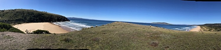
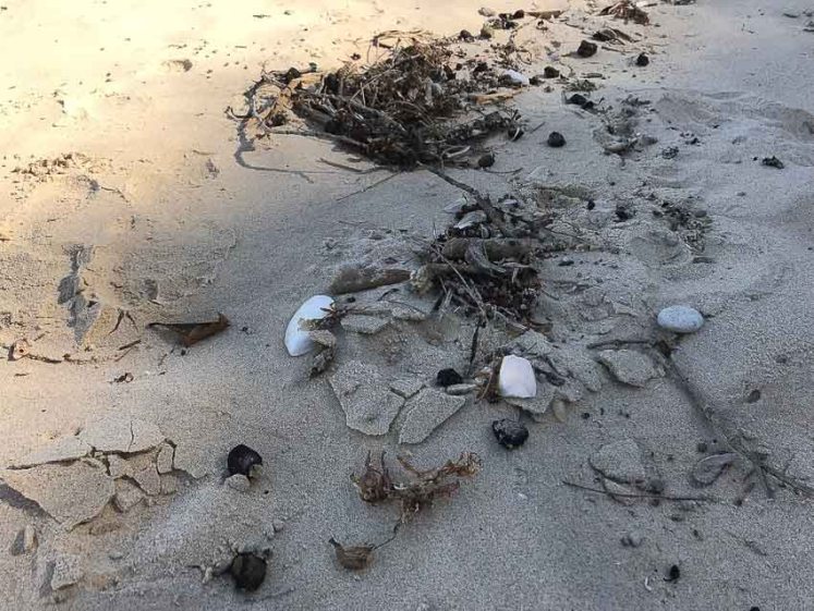
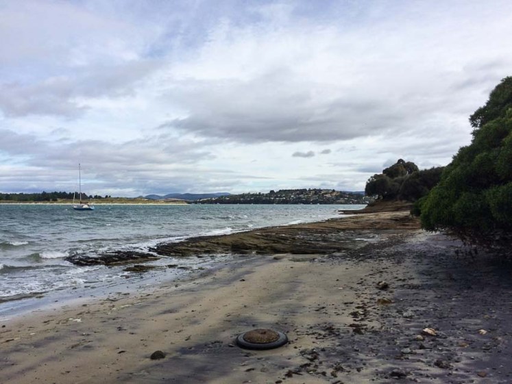
In the lightest of my summer clothes I explore the winter rock pools beneath the two headlands that hold the cuttlefish beach tight. A fine trail of their shells lie in a tangle with little pumice stones, mangrove pods, seaweed and the occasional bright piece of tiny plastic that together have invariably traced the sea’s overnight reach up the beach on these southern winter and spring days.

Beachcombing
Cuttlefish, mangrove pods, seaweed and pumice (Photo: Tasmanian Beaches)

Out in the bay whales may breach and the dolphins surf, but my curiosity is usually focussed on the tiny and the ordinary, although nothing – absolutely nothing– is ordinary about a beach when you start to look at it closely.

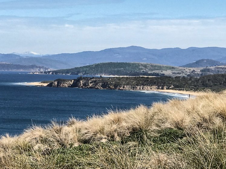
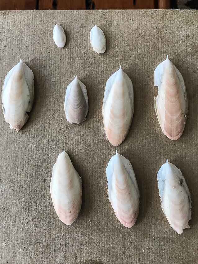
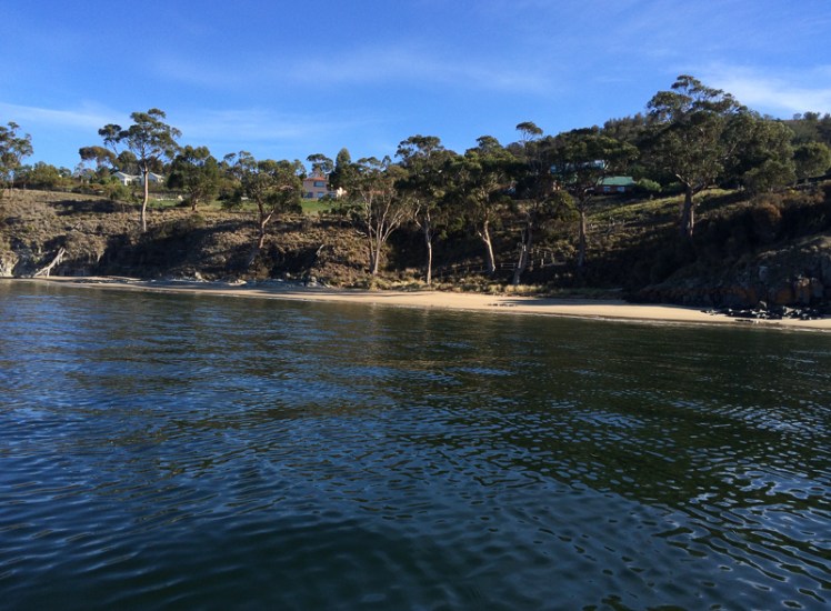
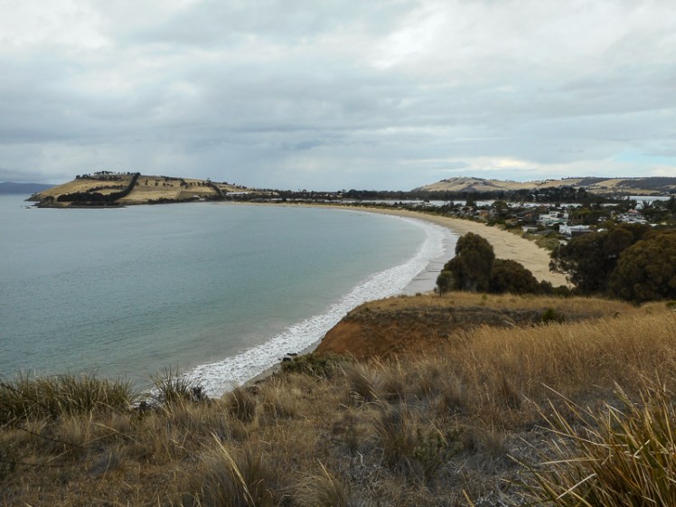
This beach is in northern NSW.  It’s a short stroll from the long beach that fronts this tiny seaside community, but few people find their way around here, to where the cuttlefish wash up in all their diversity – the large and the small, the bitten and the untouched, the wide and the skinny. It’s not uncommon to find them on Tasmanian beaches too. In fact, they are sometimes the same species, just a bit more tolerant of those cooler waters.

Why so many are washing up on this beach I do not know. Perhaps, hanging around in the same vicinity they are hounded down by predators on the prowl. Perhaps they drift here on the current from exotic vicinities far away.    Most likely it’s to do with mating and the high price that extols and most likely they are locals.

Cuttlefish
Cuttlefish shells (Photo: Tasmanian Beaches)

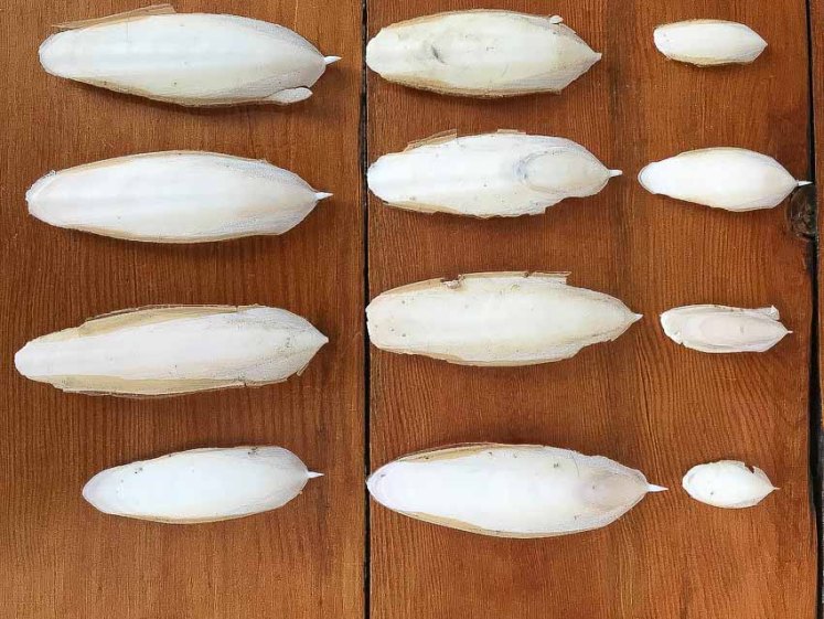
I’ve picked up huge pieces of cuttlebone, quite weighty, broken and scoured by a predator’s teeth.  I’ve picked up the tiny, perfectly formed shells of newborns (unless there is a teeny tiny species out there) and longer shells, oval, with a pink blush and a tiny cusp.  I’ve picked up the ones shaped like a plump leaf, with thin black lines sometimes etched on the anterior side.

I’ve picked all these up thinking they were the same but in sorting them I discovered a lot about my ignorance and a lot about their differences.  I seem to have collected four distinct species, possibly more.

Cuttlefish  Travel Across Time and Language

Cuttlefish
Cuttlefish (NSW)  Photo: Tasmanian Beaches

These exotic cephalapods are so well adapted that their trajectory extends forwards from the Cretaceaous period ‘which lasted approximately 79 million years, from the minor extinction event that closed the Jurassic Period about 145.5million years ago to the Cretaceous-Paleogene (K-Pg) extinction event dated at 65.5 million years ago,’ according to  LiveScience.  That’s pretty damn amazing.  Humans are untested newcomers in comparison, given we’ve been around in this modern format only during the last 300,000 years (Wikipedia).

Cuttlefish  grace the oceans in temperate and tropical locations worldwide, but curiously, they’re not in the Americas and  the author of their Wikipedia entry suggests that  one theory is that Gondwana had broken up by then and the North Atlantic had become too cold and deep for them to cross. I wonder about the cold bit, given that they’re comfortable in Tasmanian waters.

On the whole they seek out shallow water and are particularly partial to reefs, estuaries and seagrass meadows along the coast although amongst the many different species of cuttlefish, some do like their water deep.

The Greeks and Romans, keen on harvesting cuttlefish not only for their flesh but for their ink called the mollusc sepia.

‘Cuttle’ comes from the Old English  name for the species, cudele, which may be connected to the Old Norse word koddi (cushion) as well as Middle Low German’s Kudel  (Wikipedia).

Cuttlefish Magic: Embodying the bizarre

Cuttlefish
Cuttlefish shells (Northern NSW)  Photo: Tasmanian Beaches

Cuttlefish are believed to prefer midnight feasts of shrimp and tiny fish to breakfasts and lunches but some species are out and about during daylight hours. They use two of their ten suckered tentacles with consummate skill, whipping these flexible ‘chopsticks’ out swiftly to pluck unwary fish and crustaceans into their beaky little mouths.  It takes significant brain power to manage limbs, tentacles, defence mechanisms and their various mobility features.  Its cousin, the octopus, uses nine brains to perform its daily rituals but a cuttlefish has one of the largest brain to body size ratios in the animal world and  is known to be a fast learner.

I love the way they hold their tentacles in front of their faces when they swim. It makes them look like they have a long grooved snout.  Perhaps this intimidates others while streamlining their motion, but that’s just an uneducated guess.

I’m sorry to make you think twice about that cuttlefish on your predatorial menu but they are unutterably beautiful and if you look them up on Youtube (see links below), you can’t help but feel somewhat mesmerised by the way they sashay about in a frilly sort of way.  Think flamenco and think belly dancing for the way they ripple the soft fins along the sides of their body comporting themselves in a languorous or seductive manner.

Yet, no sooner have you thought this than you’re thinking  zebras, toads and chameleons  because although they are often striped they can change colour, skin texture and shape swiftly, blending into the background by making like they’re seaweed or a rock, or alternatively showing off with a bit of fluorescence or splashes of dazzling disco skin colour (Australian Museum). They use their skin to ‘speak’ or express their feelings, flashing messages via dynamic spots and colourful pulses. For instance, they might colour up one side of their body to bedazzle a potential partner while shading the other side to emphasise  a ‘piss off’ to a contender (The Animal Communication Project).

They are physical oxymorons, edible but venomous.  Their muscles contain a toxic compound with some suggestion that they are as lethal as blue-ringed octopus.  (MarineBio, 2016)  Their skin is a canvas and they wield colour like an artist – and yet  they are colour blind.

That shell encountered on the beach is actually a phenomenal piece of engineering.  We see shell and wonder about gifting it to our budgies or those artistically inclined might sculpt it like a piece of scrimshaw, and those who are frugal might pound it to add to a homemade toothpaste, or to a polish, but a cuttlefish uses this aragonite shell in lieu of a backbone, a shell that does double duty as a nifty buoyancy device because by pumping liquid in and out of the lattice of the minuscule chambers that make up the shell they are able to adjust the internal gas to liquid ratio, and this allows them to migrate  up and down the water column, making like an elevator.

There’s a muscular mantle attached to that cuttlebone.  It forms a sort of cavity, open at the front and it is also a mobility device. When the mantle muscle contracts, a whoosh of water whips through this siphon, strong enough to propel this magician of the seas at rapid speed.  This is the same way it conjures up a cloak of black ink to confuse the enemy – the original “India Ink’ we used in fountain pens once upon a time and the sepia of the Greeks and Romans.

There are many other interesting things about a cuttlefish’s internal geography (for instance, they have three hearts) but for me those eyes have it. There is something soulful about those deep dark, W shaped ancient eyes in a body full of frills and artifice, those colour blind eyes of a master of colour and disguise. Those eyes have an underwater knowingness, but their lifespan is a mere two years.  They come together in a big festive crowd to spawn and then, completely spent, they die.  A popular place to see Giant Cuttlefish migrate for this molluscan orgy is off Whyalla in the Spencer Gulf, South Australia.  (Here is some fantastic youtube footage by Pink Tank Scuba (2015).)

Maternal Cuttlefish Behaviour

Cuttlefish eggs?
Found beneath a rockpool ledge in mid-October.  I think these may be cuttlefish eggs because they look similar to others on Google images, but I’m too novice to be sure.  

The mother may not be around to care for her offspring but she lavishes care on her eggs, carefully hiding and tending them on the under side of rocks, jetties and other shady overhangs.  There are sometimes about 30 to 50 eggs in a cluster and they’re not all from the same mother.

Once I read about this I immediately went looking.  It was a fine October day and I did actually find eggs in a cluster on the under side of a rock, hanging there like glistening white raindrops, but I couldn’t identify them with 100% certainty and the ease of this find seemed too good to be true given that there’s a lot of diversity in those rock pool worlds.

Cuttlefish as Predator and Prey

Quite a lot of the cuttlefish I’ve collected have smallish teeth marks scouring the shell or making frills along the edges. The literature suggests it’s usually dolphins or sea lions but they’re also preyed on by sharks and larger cuttlefish.  Perusing the research it appears cuttlefish numbers have dropped dramatically but are now rising.  Some scientists think that overfishing and climate change might, at least for now, be working in their favour.

The Cuttlefish Who’s Who

Cuttlefish are molluscs and belong to the gastropod family.  The giant cuttlefish (Sepia apama)  is easy to identify by its size.  Wild seas over the last few days have brought by the wind sailors, portuguese man ‘o wars in their droves, violet snails and cuttlefish onto the beach in droves.  I found two almost perfect giant cuttlefish shells that had been floating around in the oceans for a pretty long time.  You could tell; they were encrusted with goose barnacles, most small, but one in particular was large and curious, coming out of its shell to question where the water had disappeared to, I assume.

Next time you find a cuttlefish and you want to figure out whether it’s the Knifebone cuttlefish (Sepia cultrate), the slender Braggs cuttlefish (Sepia Braggi Verco), the oval yellow ridged Smith’s cuttlefish  (Sepia smithi Hoyle), one of the various species, one out of place or one yet to be discovered, head over to this guide for the lowdown or visit the cephalopod section on the Australian Museum’s molluscs page. It’s pretty obvious when you’ve found a Giant cuttlefish Cuttlefish/Giant Cuttle – Sepia apama, as it’s all of 80 cm- 1m when fully grown.:  Although they haven’t been studied all that much, they are apparently quite common and are fished – and so yep, we better add ourselves to that list of predators.

About my Research

Cuttlefish collection 1

I started off curious about the different shapes of cuttlefish shell I was finding on the beach but as well as finding out about these cephalopods, these molluscs, these gastropods, losing time to youtube videos about them, I also wandered down related trails and found out some interesting info about people who have studied them, like the interesting Mr Bragg, and stumbled upon some engrossing blogs, like Susan Scott’s. She’s a sailor and marine biologist and I quickly downloaded her book.  Here’s her post on cuttlefish.

But I’m still not sure about those eggs and I’m not entirely confident I know the species I’ve found, so if you can help me identify them please leave a comment :).

More sources:

Guide to cuttlefish species in Australia. Monceaux, D. 2015

Cuttlefish Camouflage: New York Times interview on Youtube with Dr Roger Hanlon of Woods Hole, MA

Giant Australian cuttlefish (Sepia apama) mating behaviours, 2012. Dr Roger Hanlon.  Youtube.

Cuttlefish laying eggs. National Marine Aquarium, 2017.  Youtube video.

Cuttlefish eggs.  The Nature Box, 2017.  Youtube video

Tasman Peninsula: Lime Bay – Losing the Plot on Lagoon Beach

Lagoon Beach (T 343)

When a new friend said she felt like an all day walk I translated that into somewhere easy, somewhere short and somewhere straightforward because I had no time to plan  and I had a leg that had become the arena for lightning bolts of pain.  I figured we were sure to find a track that met these criteria on the Tasman Peninsula somewhere.

The peninsula was green and resplendent after rain and we were lured down the road to Lime Bay.  I’d camped there once, years ago, and expecting to see no one there we were amazed by all the tents, activity and music at the campground.

Sundra was immediately hungry and while she ate an early lunch I read the sign that described the route to Lagoon Beach, then returned to the  car to photograph the relevant pages of my guidebook.  Soon we were heading off along the hot track to Lagoon Beach through coastal scrub and beneath a shady canopy.  We were talking enthusiastically and were inattentive to our surroundings.  We paid little heed to the dry lagoon at the base of the palaeodune  we clambered up, but I did recall it from last time.  We did not look back to register our surroundings or to note the way we’d arrived on the beach, because coming over the top of the dunes we were enthralled by the view of the  sea and the  fingers of land all about us.  We should have brought bathers.

First view of Lagoon Beach
Lagoon Beach

Except for three couples sun baking and a yacht anchored in the lee of the southern headland the beach was empty and so, with no regard to the pages I’d photographed we walked south, thinking that a track might possibly take us over the southern headland. There, beneath the cliffs we found a wooden seat and a sand castle, and after eating a second lunch and admiring a couple of pied oystercatchers, our cursory search produced no evidence of a track, although I later discovered there is one.  And so we meandered slowly back up the beach, enjoying walking barefoot in the water.  And that, I felt, was enough of a walk for my grouchy leg.  Sundra, energetic and adventurous, felt the day had barely got started.

The couples were gone.  The marker she’d had the foresight to place in the sand where we’d entered the beach had been kidnapped by the rising tide.  For well over an hour we wandered up and down the dunes, trying to trace footsteps – anybody’s footsteps – that would return us to the track.  How weird to be lost on a beach, I thought, squinting at the pages I’d photographed to my phone.  I was pretty sure the best plan was to head directly back to camp and that if we headed for the trees we’d surely find the path, but our memories didn’t coincide.  Meandering about on the dunes we  had by now utterly confused ourselves, creating patterns of circuitous footsteps that now overlaid anything that had been there before.

Lagoon Beach
When everything starts looking the same

But at least there was wifi. ‘Lost,’ I texted back  home.

The pages I’d photographed were no help, especially when read with an increasingly distracted mind.  I did a Google search and found a helpful blog that talked about exiting the beach at the northern headland  with a picture helpfully included.  There was red tape up there.  If you followed it, it would take you across the headland (Green Head, apparently) to another smaller beach.  This blogger had then turned back.  Noting the sun’s position in the western sky I was all for turning back too.  I was still reasonably confident that if we returned to the forest behind the dry lake we’d easily reach the campground again.  A nightmare I’d had of being lost on the peninsula began to haunt me.

We returned to the northern headland we’d previously rejected as a possibility and scrambled up the steep slope that definitely did not look like it led to a path and after a bit of searching we found some red tape dangling from a branch.  We walked a little further and found just enough tape to keep taking us forwards.  We went down to explore the  beach referred to in the blog (Lagoon Beach North) and then went back up on the cliff again and followed the red tape until in the middle of nowhere no more tape was to be found.  From here the bays and inlets and fingers of land still confused me.  I had no idea what we were looking across the water at and thought that late in the day though it was, we were still better retreating than trusting to the traces of path that might be ahead.  Little did I know that the cliff tops here are shallow overhangs and considered dangerous (Leaman, 1999).

Sundra impressed me with her relaxed ‘ever onwards’ attitude.  When the red tape ceased again we ended up walking in different circles in search of  the oh so faint trail that often looked animal made.  It seemed that the trees our red bread crumbs had been attached to had relinquished their hold during storms of long ago or the tape had simply blown away in gales.

Lagoon Beach Walk.jpg
View from the cliff top

Keeping in visual contact with the shore while Sundra’s voice receded further away I tried to figure out our position on Memory Maps and Navionics and every other app I had available but nothing gave me the precise, localised information we needed – a clear track back to camp – a Lime Bay for Dummies kind of instruction.  I cursed myself for leaving the relevant map at home.

‘Still no idea where we are,’ I texted home, to the concerned enquiries.  No idea where Sundra was either.

The afternoon was softening into evening.  I suspected we would be sleeping out.  From somewhere far away Sundra called out.  Tramping around energetically, she’d found a tiny remnant of red tape, enough to lead us forward a little further but in what to me looked like an inauspicious direction.

Each tag seemed to take longer to find but we held on to a blind faith that we would arrive somewhere sometime.  On two or three more occasions we lost the  little red tapes seemingly forever and it was with some trepidation that we cut away from the cliffs to enter a thicker section of forest.  We walked downhill away from the coast and with a hefty sense of relief found at the bottom (incredibly, disbelievingly) the track we’d walked out along hours earlier.

There was the coastline we’d passed on our way to Lagoon Beach, one or two children still swimming in the water.  We had never been that far away we now realised.   I thought admiringly of sailors who navigate themselves across oceans.  I clearly couldn’t navigate myself across a pyrex bowl.  And I’m obviously imminently capable of getting lost in a backyard copse of trees.

Dadirri is an Aboriginal word for deep listening to others and to the landscape.  It’s used in both the Ngan’gikurunggurr and Ngen’giwumirri, languages from the Daly River region a couple of hundred kilometres south of Darwin.  Feeling lost in the bush, that still, quiet awareness was hard to come by that day.  Sundra had long ago finished her water and we were sharing the little I had left.     We had no GPS and the battery on my phone was getting low.

Dadirri  also refers to the awareness of ‘where you’ve come from, why you are here, where are you going now and where you belong.’ We’d done a lot of talking that day about just those topics.  I thought that night was likely to teach us about “the quiet stillness and the waiting” aspect of dadirri (Ungunmerr-Baumann)  and provide us with long hours to pick apart our mistakes.

Instead, as we travelled home after what had ended up being a six hour walk, we laughed as we reviewed the day and agreed that there was scope to do more walks together, perhaps with a bit more preparation.

But then again, without a map you really feel like you are more properly exploring!  (I am not recommending this though!)

If, one day, lost on Lagoon Beach, this is the blog you discover then be aware that the densely vegetated headland to the south is called Lobster Point and Sloping (Slopen) Main beach lies some distance away on the other side. The 1.6 km stretch of sand  that is Lagoon Beach lies in the lee of Sloping Island and it’s wise not go tramping about on the 15m high foredunes and their blowouts, particularly for their sakes. Take careful note of Sloping Lagoon which links the beach to the rear end of western Lime Bay beach.  There’s also a smaller lagoon at the northern end of the beach.

And perhaps, rather than following the disused and apparently closed track we were on – we did this walk in 2016 so this may have changed –  take your bike and go cycling around Lagoon Beach using these comprehensive notes on cycling in this area from Tassie Trails.

If geology is your thing there’s a dyke on Lobster Point and apparently on Green Head we were walking over all sorts of interesting volcanic and sedimentary geology which that day we were blind to.  Those dunes we came over – they’re interesting too. Grab a copy of Walk into History in Southern Tasmania by David Leaman and he’ll illuminate the geological wonders for you.  And go on the low tide – that way you can walk around the base of Green Head staying safer and not getting lost.


Frederick Henry Bay: Seven Mile and Five Mile Beaches

Most of the sand on the world’s beaches consists of two minerals, feldspar and quartz.   They are particularly stable and that makes them especially durable.  Take a peek at sand through a microscope and you’ll see that the grains look like tiny pebbles bigger than silt, smaller than gravel, many hued, transparent quartz, weathered smooth, pulverised and polished over the millenia.  They form the unique, mobile fingerprint of the beach, created by the swish and swash of waves, tides and seafloor shape, gradient and cover.  They may wash more or less straight up on to the beach or away from it, or be carried there by longshore drift, arriving at an angle, a part of the shifting sediment carried along by the coast-shaping sea.  

***

Seven Mile Beach (T397) 

Seven-Mile-Beach-and-Acton-Creek-1.jpg
Acton Creek meets Seven Mile Beach

Seven Mile Beach, mostly southeast facing, is 15 km from Hobart and is pretty much the closest surf beach to the city.  The waves aren’t usually much more than a metre here, but they’ve travelled across about 20 km of Frederick Henry Bay to break on this seven mile long beach backed by homes at the western end and a beach reserve further east.  There’s a road behind the dunes and the reserve.  It’s dirt up the eastern end, bitumen down west.

One of the most obvious features of this beach is the unhappy pine plantation that extends behind it and encroaches on the dunes but if you’re standing on the beach it’s the great sweep of sand and the views across Frederick Henry Bay that are the most compelling.

What’s not so obvious when you’re on the beach itself is that it is a massive ‘sand spit that traverses the axis of the eroded Coal River Valley rift’ (Leaman, 1999), where once back in time there were twenty active volcanoes.  In this valley early settlers found skinny seams of coal, enough to inspire hope that quickly collapsed into disappointment.

We’ve come to this beach when the tide has been so high it’s been right up to the marram infested, undercut dunes and there’s been insufficent beach for a walk.  We’ve come on extreme lows when the beach’s width and a sunny sky has made it particularly inviting and horses, dogs, swimmers and beach umbrellas have given it a festive air. You don’t want for space here.  This beach allows everyone to disperse along its generous length.  Some people seem to make use of the dunes to disperse with clothing altogether, but in Tasmania the sun has a sharp edge and can end up being a painful experience for delicate extremeties.

This is a go to beach for cycling at low tide when the sand is hard and you can fly along its length all the way out to Sandy Point where Pitt Water, a 3,500 ha barrier estuary spills into the bay and Seven Mile Beach and Five Mile Beach meet.  This beach system they’re both a part of has actually built out 1 to 2 km seaward, according to Short (2006), ‘as a series of more than 50 low foredune ridges which have subsequently been transgressed by dune activity that increases to the east.’  It’s on this barrier land feature that the pines were planted and Hobart’s airport built, so a particular Seven Mile Beach experience is planes landing and taking off low overhead.  Pitt Water-Orielton Lagoon is one of Tasmania’s ten Ramsar wetlands and provides refuge for threatened species, both avian and botanical.

Sandy Point and Five and Seven Mile Beaches
Looking across Pitt Water to Sandy Point where Seven Mile and Five Mile Beaches meet.  Photo taken on  Tiger Head Beach, Dodges Ferry

From Sandy Point you can see Lewisham on Pitt Water’s eastern shore, a skinny community of houses that traces the shoreline of this estuarine lagoon with the community of Dodges Ferry at the mouth. Looking west to the far end of Seven Mile Beach where the walk around Single Hill ended is actually the best known part of the beach.  The hill, the houses and Acton Creek give it an intimacy the rest of the beach lacks.  The thin western finger of the small township broadens out eastwards and the houses start extending inland across that ancient but shallow barrier dune system.

Seven Mile beach from the Sandy Point or eastern end
Ripple marks on Seven Mile Beach.  The darker lines are caused by heavier minerals or organic matter trapped in the shallow troughs

Five Mile Beach

This is no beach for a bike.  As a Ramsar site it’s the domain of shorebirds.   I came here with the geo on a spring low tide that hadn’t receded as much as we’d have liked. There’s a track behind the beach that meanders through pine forest, then turns to follow the Pitt Water coast.  True forests uplift and Tasmania has magnificent ones that provide this kind of experience, but plantations cast a desolate atmosphere both sad and disturbing.

In his book The hidden lives of trees: what they feel, how they communicate – discoveries from a secret world, forester Peter Wohlleben  discusses the various ways trees suffer in plantations. Communicating via electrical impulses and chemical messages with various fungi as support networks the lives of trees is worth getting to know about.  A monoculture isn’t healthy and doesn’t make for happy, healthy trees.

Five Mile Beach on Pittwater Lagoon, looking towards Sandy Point

We didn’t complete this walk.  I hadn’t read this book yet, but the atmosphere was so unedifying that it stilled conversation and dampened our mood.  At a certain point we stopped and reluctantly agreed that we found the damaged dunes and miserable trees (upended in places, and ravaged by the sirex wasp)  too disheartening, particularly when we imagined what the dune system was like before human interference.

We found a way on to the beach via a pathway through the eroded dunes and because the tide had receded further out by then we could walk along the shallows enjoying the occasional presence of a few shorebirds.  Crabs beginning to emerge from their burrows and apart from the sad sight of  trees that had fallen with the collapsing dunes the view of Pitt Water was a whole lot better.

A combined Seven Mile and Five Mile Walk: CCC brochure

Tip:  If you’re planning on walking Five Mile Beach, wait for a spring low tide.

Frederick Henry Bay: Lauderdale’s May’s Point to Seven Mile Beach along Roches Beach and Single Hill

Roches With Gritted Teeth

We couldn’t have chosen a worst day for our walk.  It was snowing on the mountain, raining in town and the best the temperature could manage was a measely 7 degrees centigrade.

Cathy reminded me that we had stoic Scottish blood coursing our veins; I kept secret my preference for a sauna.  Our hardiness extended only so far and we agreed to leave one car at Seven Mile Beach.  That done we sought out a Lauderdale cafe to psych ourselves up for the miserable walk ahead.

Our cafe on the western side of the suburb had a view across Ralphs Bay on the Derwent River  to the city and the mountain and from the table we’d chosen beside the wood heater we looked out at water chaotic with white caps.  Kunanyi, normally dominating the western horizon, had vanished,  the wind was loud and I was pretty damned glad I wasn’t sailing.

‘We had hardy ancestors,’ said Cathy firmly.

‘There might not be much beach to walk on,’ I suggested in a faint voice.  It looked to me like the conditions had whipped up a higher than usual tide.

Lauderdale is a largely low lying suburb that takes in the isthmus where the South Arm Peninsula begins and straddles Frederick Henry Bay in the east and the Derwent River in the west. Back in the early 1900s there had been enthusiasm for a canal that would reduce the distance to Hobart for the shipping of farm produce, much like the Dunally canal further north saves yachts the trip around the Tasman Peninsula today.  But work was hampered by the First World War  and when they got down to business in 1924 storms made it apparent breakwaters would be needed on Roches Beach to prevent silting.  Too expensive, the decision makers concluded and the project was abandoned, leaving a 1 km canal that doesn’t quite reach the beach and is hardly visible at the Ralphs Bay end (Alexander). Later I discovered that the layer of sand in this area is skimpy.  It covers over two hundred metres of clay, sandy clay and boulder beds that filled in the ‘eroded, ancient rift valley landscape as sea level rose.’ (Leaman, 1999).

The two most significant bumps in its landscape are Richardson’s Hill with May’s Point below it at the southern end of Roches Beach and Single Hill to its north.  Our walk was to begin below the first and take us around the second – but the weather was so truly terrible that we prevaricated by driving slowly up Richardsons Hill and then slowly back down to Roches Beach, slowly parking the car close to May’s Point and slowly donning extra thermals and wet weather gear before braving the lashing rain.

We began walking down the beach in a most unhardy manner.  The tide was indeed high, the work of the stormy south westerly, but at least the wind was at our backs. Slowly our Scottish blood began exerting itself and snug in all our layers we got our stride up and congratulated ourselves for defying the weather.

Lauderdale takes its name from Ann and Robert Mather’s Ralphs Bay farm, Lauderdale Park.  They were early settlers and their inspiration was Lauder, Robert’s birthplace near Berwick-upon-Tweed in Scotland. When it comes to hardiness Ann totally put us to shame, ‘raising her children and managing an unwilling convict workforce’ on this isolated farm (Clarence City Council).  By the 1950s settler hardiness had given way to hedonism and holiday shacks began filling in the landscape.  These days it’s suburban homes fronting up to the dunes along this 3.5 km section of the beach, their gardens spilling out into the public reserve.

Shells on Roches
Beach assemblage both human and natural

The narrow beach sloped steeply that day and the waves were slapping at the dunes in some places, undercutting them and threatening to saturate our ankles, so we decided to see if we could find a track behind the beach and for a while picked our way through undergrowth and escapee plants. This high sea also had us discussing Lauderdale’s vulnerability to storm surges and sea level rise, much like its southern neighbour, Cremorne.  The isthmus isn’t much above sea level and the small dunes along Roches are already compromised by human impacts.  We also spent considerable time discussing whether we were walking one beach or several and what, if anything they were called. Later I referred to the guru, Andrew Short, who in his inventory referred to Roches Beach as a 5 km stretch of increasingly wider beaches lying between Mays Point and Single Hill, although actually 3 and 4 narrow again, we found. For the record, he called them Roches Beach and then Roches Beach North 1, 2, 3 and 4 but the locals probably have different names for them.

IMG_4500.jpg
The beach makes another curve at Bambra Reef and begins to broaden

We passed Bambra Point and its reef as the weather began clearing and reached the part of the beach that Cathy most loves because it holds memories of regular visits with her children when they were little.  She pointed out the shelter provided by the trees and Epping Park Reserve behind the dunes and took me up there to take a peek at Lauderdale Yacht Club, the base for catamaran sailing in Hobart.  Later, reading David Leaman’s Walk into History (1999) I learned that there are some brilliant examples of Permian rocks in this area.  Also, right at this point on a low tide you can see the irregular roof of the main Jurassic dolerite intrusion.  (If you want to know why the dolerite in this area is great for giving you an idea of the gigantic intrusions dominating central and eastern Tasmania  pick up a copy of this book and take a stroll here – it’s definitely worth it.)

IMG_4655
Not just any old rock.

Single Hill and North Roches Beach (T 398)

We passed the sailing club and the boat ramp and took the path leading up Single Hill, that singular landmark as you fly into Hobart. Initially we walked below big houses I hadn’t known existed and at the base of the hill Roaches Beach (N3) aka Short’s T399, a narrow 50m ribbon of sand and rock, that is a continuation of Roches Beach N2 aka T400 was being bashed by waves.

View from Single Hill.jpg
On Single Hill with Richardson’s Hill, Cremorne and Cape Deslacs in the distance and the Tasman Peninsula in the distance

We were walking amongst eucalypts and she-oaks following  what is really pretty much a contour path with a lovely sandstone bridge.

IMG_4510.jpg
Walking Single Hill

Cathy pointed out the most northern beach below us (T398). There were steep steps leading down to it but we continued on around the hill, stopping every now and then to take in the sweeping views of Frederick Henry Bay and the Tasman Peninsula.   But if you’re keen on geology this little beach is definitely worth a visit because according to Leaman the Permian rich siltstone here is rich in fossils.  Far away over the bay we saw enormous waves breaking on a point we struggled to identify. Eventually the path turned towards Seven Mile Beach and we gradually descended on to the sand.

T 397 Seven Mile Beach (southern corner)

There are shacks clustered in the corner beneath the hill south of where picturesque Acton River enters the beach.  A small flock of ducks were enjoying it as we crossed the wooden bridge.

The walk had taken roughly 3 hours but I was enthralled by it and so the next Saturday I was back with my friend Rosemary White, who had sore knees and wanted an easy walk.  This time, with an impeccable blue sky and far kinder weather we walked it the other way around, from Seven Mile to Launderdale.

Again, the beautiful creek at Seven Mile, and again the expectant flock of ducks.  Walking this way there were points where it seemed we were trailing the edge of a great bay with a relatively small opening.  Identifying landmarks was difficult but our geographic guesses were confirmed by a local we encountered, walking alone with his radio tuned in to the racing.

Reaching Roches we turned and walked Roches N3, pausing to examine the small butterfly shaped shells that had washed up everywhere on the sand.

Kayaking Single Hill

Still not done with this area  I brought others to walk it and keen to explore Roches N4 I paddled around Single Hill from Seven Mile Beach to Lauderdale.  It’s a short paddle but (small confession) when the wind came up my enthusiasm for paddling to May’s evaporated and I pulled in early.

Kayaking Single Hill.jpg
Calm moments off Single Hill and Roches Beach N4


Frederick Henry Bay: Cremorne Beach to Lauderdale

Walking Swathes of Yellow

There are homes on the low dunes backing Cremorne beach and behind them the small community stretches across the flat land in the elbow between the beach and Pipeclay Lagoon.  These reaches of Moomairemener land were first reshaped into farmland by the McCauley family who arrived in 1804 and ran cattle and sheep.  They also grew potatoes, barley and beans.  These days it’s a small community of permanent residents and holidaymakers; a place unspoilt by the inappropriate development that marrs so many other beachside villages although there is currently a developer who would really like to try.  I for one hope this community holds out against greed.

Cremorne Beach looking south
Cremorne Beach with Pipeclay Lagoon in the distance

Pipeclay Lagoon

Cremorne benefits from Pipeclay Lagoon, an enclosed, tidal body of water  that separates it from Clifton to the south.  I discovered, when I kayaked it, that it is shallow and that I’d chosen the perfect way to enjoy its serenity. There are oyster farms here and along its margins there are 45 ha of saltmarsh wetlands, protected to some extent by coastal reserve and the attentions of the Wildcare Deslacs Group, but also threatened by changes in tidal flows, habitat disturbance, unmanaged tracks and roads, ditches and litter.

One of the first farms on the banks of the lagoon was Waterloo Farm, owned by Captain Busby and his wife Mary.  When John Morrisby bought it from Mary he developed orchards of apples, pears, apricots and cherries and grew peas and root crops between the rows, enriching the alluvial soils with seaweed.  There’s a rare eucalypt (Eucalyptus Morrisbyi) that grows in this area and it takes its name from this farming family, who eventually sold, the subdivided land along the waterfront and lagoon giving way to weekenders.

Today, on the Cremorne side of the lagoon there is a narrow road squeezed between backyard fences and the shore.  It runs down to a tapering of beach beside the lagoon’s channel to the sea.  Four dolphins came through this channel earlier this year and stranded but for walkers it’s a good place to begin exploring the short, narrow beach.

Cremorne Beach (T405)

The beach has a domesticated feel because of the houses on the low dunes, but this is deceptive. When there are storm surges such as there were in 2010 and 2011, the waves have been known to undercut sections of the dunes and there have been a number of dramas at sea off this coastline.

Cathy and I came to Cremorne hoping to find a track we thought might exist at the northern end of the beach. It was a cold day, the tide was out and rain threatened but quite quickly we had walked the kilometer or so along the sand. Ahead of us was the steepish, yellowish slope of Calverts Hill, much of which was owned in the early days of the colony by Elias Grimsey, whose neighbour for a while was the  Rev Knopwood’s adopted daughter, Elizabeth.

Calverts Hill and Cremorne North (Beach T404)

We quickly found the track and walked quite easily across hillsides of tall yellow grass, coming across a small cove  about ten minutes into the walk. Beach T 404 is a short 50m pocket beach that looked to be mainly cobbles  trapped by the cliffs that are some 30m high.  It’s also only accessible from the sea and apparently at times sand fills it to form a low tide made terrace.

Most of Calverts Hill is reserve, perhaps to protect the endangered Eucalyptus morrisbyi which  is in decline, but fortunately there are people who care.

Cremorne walk with Cathy.jpg
On Calverts Hill

For a while we followed a fence line and then we descended down to the rocks and most of our walk ended up taking place just above the waterline as the path curved around one undulating hillside after another.   We idled along, discussing the rock formations we encountered.  The sea was quiet and rain was visible in the distance.  There were good views over Sloping Island to the Tasman Peninsula.

We passed five pied oyster catchers standing quietly on the rocks. We passed a couple of pacific gulls and then a shag standing very still on a pole, imbuing the mood of the day. It was hard to gauge how far we still had to walk.

Mays Beach (T403)

I was keen to reach Mays Beach because I had only ever seen it from the top of Richardson’s (aka Nobs) Hill and from there it seemed unattainable down at the bottom of the steep slope, separated from the road by private land, but as we rounded Calverts Hill on our walk the land flattened out and there before us was the beach, occupied just then by a flock of about twenty plovers.

We were fascinated to discover a small number of houses in the bush behind us, but they’re so tucked away that we couldn’t easily discern any driveways or even a road and as we crossed the beach we puzzled over their means of access – down Richardson’s Hill or from somewhere to the south?

This walk had taken about 2.5 hours and we were yearning for lunch and racing the approaching rain. Still, while Cathy explored the hillside looking for the path, I walked along the kilometre long curve of beach, crossing a spine of rock that divided it into two sections to its conclusion at Mays Point, where there is a right hand break.

MAY'S BEACH FROM THE POINT.jpg
Mays Beach viewed from the point at the northern end

Richardson’s Hill

The hill is 79 m high but the good news is that the track is well made and links the beach to the top of the hill where the private road begins behind a gate.  We literally ran up it to reach the car we’d had the foresight to park at the top.  We had finished just in time – the temperature was dropping and the rain slammed down on us just as we got there.

One of us was digging about frantically in pockets but to no avail.  The car and its  keys were separated by the distance of our walk.  All thoughts of lunch in a cosy café faded.  Wildly we surveyed the landscape beneath us for a shortcut back to Cremorne but faced with what looked like a lot of private land we didn’t like our chances and so we set off back down the hill at a trot, laughing over our misadventure.

Cremorne walk with Cathy - Lauderdale.jpg
The view from the top of Richardson’s Hill

Listen to the locals tell you what they love about Cremorne and help support them in their fight against Inappropriate Development.

Further reading:  The Cremorne community website 

Frederick Henry Bay: South Arm Peninsula: Cape Deslacs

A Different Sense of Direction:  the intimacy of Sea and Soil

Clifton Beach LOOKING TO CAPE DESLACS-2
Clifton Beach and Cape Deslacs

It seems so long ago now, but during summer, shortly after friends told me they’d seen thousands of shearwaters from their yacht as they were crossing Frederick Henry Bay, we came to Cape Deslacs one evening to watch the shearwaters return to their burrows.

It seemed to me that this, really is the best way to experience the cape – as a  refuge for these well travelled birds and so rather than wander its tracks or follow  its roads, we sought out the viewing platform.

I’d once seen  large flocks of Short-tailed Shearwaters (Puffinus tenuirostris)  rafting in Port Davey and I’d seen the very first of them return one year from their long migration down the latitudes to Fisher Island, a tiny granite island in the Great Dog Island Group between Flinders and Cape Barren Islands. Those Fisher Island birds have been the subject of a longitudinal monitoring program extending back to the 1950s and because they return literally to the day, we were there when the leaders arrived.  A scratching in the soil the next morning gave their presence away.

Although I’d read that they could be seen rafting off Taroona I’d rarely seen any on the Derwent River but when returning from Recherche Bay on Samos we saw for the first time in the D’Entrecasteaux a flock of perhaps two hundred winging their way down the Channel.  I’ve been unlucky because these long winged birds are Australia’s most numerous seabirds and while there are no longer flocks of many millions, as the explorer, Matthew Flinders  in 1798 asserted he’d seen, the flocks are large enough still to create awe when you see them.

The track to the platform led through native bushland.  The day was already darkening and gradually the stars came out.  In total there were  four of us stargazing on the platform, our sense of self miniaturised by the Milky Way and the looming sky.  All around Tasmania and especially around the Bass Strait islands great flocks of shearwaters were on their way home to their burrows but when the first dark shadows flitted overhead we thought at first that they might have been bats.

Aborigines believed they wintered behind the moon.  That’s apparently how they got the name ‘moon bird’.  They make a good meal and taste like sheep and so they’re more commonly called  ‘mutton birds’. They might migrate almost the length of the globe on those metre long wings and swim proficiently with those webbed feet, and for a bird have a keen sense of smell, but they are so inelegant at landing that you swear they must sustain bruises.  They are renowned for their  excellent time management and for their magnificent sense of direction.  They set off at the end of each Northern summer from the waters off Japan, Siberia and Alaska, barely, if ever making landfall, honing in on their tiny burrow at the far ends of the earth.

They partner  for life (mostly), lay their single egg at the end of the November  and watch it crack open in January. Then they take turns minding their one and only, feeding it up until it’s double their size. Come April they fly north without it and abandoned, wandering about and testing their wings, the chicks don’t eat.  They tone down, feather up and intuitively follow their parents north a few weeks later in May.

Shearwaters are predators at sea and on land they are prey.  The snakes that inhabit some Bass Strait islands rely almost wholly on the  chicks for sustenance.  It’s a physically close and terrible relationship.  They are also commercially harvested for feathers, oil and meat and the traditional mutton bird harvesting practised by Aboriginal Australians continues.  Modern life has thrown in further difficulties.  Think gill nets and plastic, habitat loss and feral predators like cats.

That night on the cape the sky was soon awash with birds cascading down through the air.  It was awesome.  It was impossible to count them.  There was a profound sense of a community returning, of lives lived with purpose and capability, of birds bringing their oceanic experience back with them and deep down into their burrows within the earthy skin of the cape.

***

There is a circuit walk you can do on the cape.

For more on Short-tailed Shearwaters and pictures of these unassuming but talented birds see:

Birdlife

Tasmania.  Parks and Wildlife Service.  Short-tailed Shearwater, Puffinus tenuirostris

Frederick Henry Bay: Clifton Beach (T408)

Cape Contrariety to Cape Deslacs


Clifton Beach LOOKING TO CAPE DESLACS
Clifton Beach

After slithering down off Cape Contrariety we took off our shoes, Cathy and I, and walked barefoot along the swash, quickly leaving behind the small groups of swimmers and surfers taking advantage of sunny weather. Soon we had the whole beach to ourselves and forgot completely about the existence of the low lying houses between the beach and Pipe Clay Lagoon, except for when we paused to study the sand dunes, their shape steeply altered by marram grass, their mass being gnawed away at by the sea. The dunes extend about 300m inland and reach a height of about 20 m (Short, 2006) and amongst the native bush growing on their backs is Acacia longifolia and the threatened species Cynoglossum australe.  These Cape Deslacs/Clifton Beach dune fields are a geoconservation site of state significance, and Clifton’s Frederick Henry Bay beach alignment is also considered significant.

Especially along some parts of Bicheno Street the houses here are regarded as being at early risk from sea level rise (Sharples, 2009) and sea level rise will of course impact coastal values too and destroy the dune habitat the Clifton Beach community is currently working to preserve.

We studied the ripple marks and read the southerly swell, counting numerous rips and we observed that apart from a lone juvenile Pacific Gull studying our progress this popular beach, facing south- southeast into Frederick Henry and towards Storm Bay was  that day devoid of birds.

When we reached the end we lingered and with a little assistance from Memory Maps pointed out to each other the landmarks we were observing to the south and then we turned our attention to the cliffs at the base of  Cape Deslacs taking stabs in the dark about the pale rock, before guessing at sandstone.  Later I read that there have been numerous drownings at this northern area of the beach, so it’s a wise swimmer who stays within the flags down the southern end.

Our efforts at amateur geology ending in uncertainty, we walked back down the beach contemplating a stroll around the lagoon on a future low tide and pondering the difficulties Cape Deslacs might pose for our exploring.


Further Reading:

Sharples, C.  2009. Climate change impacts on Clarence coastal areas.  Clarence City Council, Clarence.

Short, Andrew. 2006.  Beaches of the Tasmanian coast & islands: a guide to their nature, characteristics, surf and safety.  Sydney University Press, Sydney.


Tasflora. 2012.  Clifton Beach Coastal Reserve: reserve activity plan 2012-2016, draft  (revision 3): advice prepared by Tasflora for Clarence City Council. Unpublished report.

Frederick Henry Bay: Cape Contrariety

Clifton Beach FRAMED
Clifton Beach and Pipe Clay Lagoon viewed from Cape Contrierity

Tiptoeing Along a Cliff Edge

Zooming in with Google Earth I thought I spied a couple of small beaches north of Smugglers Cove and the light tracing of a path through what looked to be a nature reserve. It was enough to convince us that it was worth trying to tackle the cape from Clifton Beach on the northern side and so on a sunny day at low tide, while people swam  between the flags and surfers lolled on their boards beyond the break Cathy and I scrutinised the dunes and the cliffs at the southern end of the beach and found a path that led up a steep gully.  With an eye out for snakes, we scrambled up it, trusting our weight to the branches of a couple of conveniently located bushes.

There was a narrow strip at the top between  the ‘keep out’ barbed wire fencing and casurinas rimming the high cliffs, some of which had fallen away. Peering over the edge we could see their broken pieces tumbled down against the sea.

We found a path, but it looked wallaby made and we meandered on and off it making a difficult passage over and under vegetation, sometimes trusting to the generosity of land owners by slipping over the fenceline to where the walking was easier. In one memorable spot, we had pretty well a foot wide space of sky we needed to cross. I avoided looking down. The drop was horrible, but Cathy skipped over it oblivious to Death’s outstretched hands.

Clifton Beach.jpg

Our tardy progress was made even slower because the views were compelling and so we’d stop, point out landmarks we were confident about and speculate about those we weren’t.

Clifton Beach LOOKING TO CAPE DESLACS.jpg
Clifton Beach and Cape Deslacs.  Tasman Peninsula is visible across Frederick Henry Bay

We finally found ourselves on the far end of the casurina copse, gazing down a long slope of golden grass and up the slope on the other side. There was no clear path and it had the look of large expanses of private land.  With a couple of households dotting the cape, we decided to avoid rebuke and reluctantly turned back, walking single file.   Cathy quietly observed  the tail of a snake disappearing down a hole between us, so we were pretty pleased to reach the beach unbitten, and as the day was still young and the beach glorious, we decided to take an amble to the cliffs below Cape Deslacs.

Clifton Beach and the golden grass.jpg
The interplay of land and water made the walk worthwhile

Not much has been written about this cape, but on Placenames Tasmania I discovered that D’Entrecasteaux had noted this name on his voyages of discovery and that it had another as well – Watsons Bluff.  Watson was definitely no lady because  it’s my observation that places get named after men, rarely women.  No doubt he was merely an earlier landowner whose name buried earlier ones tangled with mythology,

I dug about on Trove as well and discovered a 2000 fisheries arrangement between the Commonwealth and Tasmania that referred to a shark nursery in the ‘area known as Frederick Henry Bay and Norfolk Bay being all waters within an imaginary straight line between North-West Head and Cape Contrariety’ and in an article on geology in the Sanford area, Green (1961) mentions dolerite intrusions into mudstone as well as landslips in the cape’s basalt soil.  As he also mentions lavas here,  this little cape has some complexity but keeps a low profile in the island’s literature.

Green, D.C.  1961.  The geology of the South Arm-Sanford area, Tasmania.  Papers and Proceedings of The Royal Society of Tasmania, Vol 95.


Frederick Henry Bay: Goat Bluff to Cape Contrariety – Calverts Beach

CALVERTS BEACH (T411)

The moon had given us a low tide and with a slender window between cold fronts Cathy and I whipped on our walking gear to continue our saunter along the coastline.

We paused on Goats Bluff to look across the long expanse of Hope Beach before making our way down the narrow path through native bush to the beach. The last time I’d come here it had been 25 degrees and people, heavily tattooed, were lounging under umbrellas beside the sedimentary cliffs.  Today was crisp but sunny. Ever since the geo and I had driven off the ferry after a couple of weeks spent in shorts and t shirts on the mainland, Tassie had been lashed by a bout of wild, wintery weather, so this was a brilliant reprieve.

FEATURE BENEATH GOAT BLUFF.jpg
This feature in the cliffs below Goat Bluff may be linked to its history (see previous blog post)

Calverts had been our ‘go to beach’ when we first came to Tasmania.  Every time I walk it I remember a tiny kelpie x border collie puppy from the Stirling Ranges in Western Australia. Along with two of his siblings he’d been bundled into a box and on to a plane in Perth. Several hours later I plucked him out of that box at Kununurra Airport in the Kimberly region of WA and for the next two years he enjoyed field camp living with us. The creek, the waterholes, the fishing expeditions and the parties in the annex, the walks down to the chopper to meet the guys returning from another blisteringly hot day doing mag anomalies. Two years in a caravan in boab country, living small. Two years in a tiny field camp in all that wild, vast inaccessible space. We were lucky though, because sometimes, in the chopper, we got to explore caves rich with rock art and canyons with verdant microenvironments that felt way off the map, far from roads or even a track, that you wouldn’t know were there unless you could spot them from the air.

This puppy, born of working stock, climbed trees (sort of). His acrobatics intrigued children. His speed was astonishing and Calverts was a beach he raced along, trying unsuccessfully to round up seagulls. He drove around Australia, squeezed on top of a mattress that was wedged on top of a motorbike, that weighed down the already sagging boot of our Holden station wagon.

Cathy and I walking along discussing economic conundrums, saw a spout of water off Betsey Island, just as two birds lifted into the air close by.  Further down the beach a lone man stood on the sand dunes assessing the swell on this rip-prone beach. Behind him, the dunes sloped down to Calverts Lagoon, a change in the vegetation and a quieter sort of environment.

We reached the opposite headland. This is where the geo and I have always turned back, but had occasionally noticed people making their way down it and had puzzled over where they were coming from. Cathy was the person who let me in on that secret, but before we set off up that path we explored the rock platform that slants upwards around its base because another beachwalking friend had told me that if you climbed to the end of it and peered around the corner you could see a little cobbled beach. But what we saw when we reached the end was the narrow shape of a gulch that at low tide probably did leave cobbles and rocks exposed. While I stood there musing, Cathy bounded up the daunting cliff face and when I looked up I could see her standing on the headland enjoying the view.

I followed slowly up that steep side. There was only marram grass to grab hold and it looked rather puny. Besides, it’s hostile and I wasn’t wearing gloves. I surveyed the big drop beneath me and the hard faced rocks. Those I was clambering up were damp and my shoes lacked grip. One up to Cathy, I decided, and slithered slowly down to a more welcoming ledge before seeking out the little path further back along the headland.

From the top we could see Calverts Lagoon, fingers of land and stretches of sea. The best was yet to come, because on the other side of the bluff lies a hidden beach, outstandingly beautiful. I’d been here once before, pretty much as soon as Cathy had told me about it. It had been a hot day and our party had disturbed a lover’s tryst. ‘Beware the snake,’ the man had yelled at us, jumping up to shoo us away. We had clearly destroyed their moment because it wasn’t too long before they were trailing us back along Calverts.


Smugglers Cove and Calverts Beach agn-1
Smugglers Cove and Calverts Beach


Smugglers Cove (Beach T 410)

We descended through soft sand, stepping over dead birds and a dead sheep to reach Smugglers Cove. It’s seriously lovely and is cupped by the steep headlands of Cape Contrariety. It’s also seriously private and intimate even though it’s spacious enough to accommodate several parties of beach goers. Two eagles wheeled above us and a pied oyster catcher stood on the rocks regarding us.

After a while we followed a fence line up the bluff on the other side, keen to reach the other end of the Cape. I’d tried hunting down the owner of the private land without any luck, so we didn’t like our chances. There were mutton bird burrows. There were sheep, happily alive. We followed their tracks until we reached a fence that crossed our path.

This was as far as we figured we could go. From there we could see the spot we’d reached on an earlier expedition, when we’d attempted to cross the Cape from the Clifton side (see next blog post), so that long slope separating us from that point near the top was frustrating. We knew there was a nature reserve along the tip of the cape and that another beach (T409) was down there too.

On the Beachsafe site its described as ‘a 150 m long high tide cobble beach located along the western end of the cove, with a sand and rock low tide terrace. Waves averaging about 1 m break across the 50 m wide bar and surge up the cobbles, with the steep slopes right behind. The 4 ha tip of the cape is a private wildlife sanctuary.’

Cape Contrarity Calverts side.jpg
Walking Cape Contrierty

We’d been defeated but the walk back was uplifting. A yacht was crossing Norfolk Bay, a north easterly filling its sails. That whale breached and blew again. We saw Little Betsey Island tucked away behind Betsey Island, Black Jack Reef and the great sweep of Hope Beach beyond Goats Bluff.  We saw the Iron Pot at the entrance to the Derwent and snow on kunanyi and the Snowy Range.   And as we clambered back down the path to Calverts there were seven surfers in the swell beneath us, where originally there had been only one. You’ve got to have ichor coursing through your veins to take  on Tasmania’s winter ocean. I lack even a single drop and just the sight of them had me zipping up my down jacket.

Cape Contrarity Calverts side - snow.jpg
Calverts and Hope, with snow in the background


This walk: 1 September 2017. If you’ve walked this cape or know the contact details of the farmer, please let me know so we can try again.


D’Entrecasteaux Channel: Kettering and Little Oyster Cove

Back in the Land of the Nuenonne

When we were preparing the house for sale earlier this year, we moved on board Samos, thinking we’d be at Kettering in Little Oyster Cove for several months. We planned to spend that time cruising the D’Entrecasteaux and Norfolk Bay but within a matter of days our lovely mountain home had found itself new owners and we barely had time to tackle our list of boat tasks before we were home again packing boxes.

Travelling in a small van as we did last year and cruising in a small yacht proves that truism of life being richer as possessions get exfoliated and waste gets reduced. But moving house is not good for the environment. You may give the Red Cross Shop your library and St Vinnies the clothes off your back, but the recycling and refuse bins fill exponentially and zero waste targets shatter alarmingly.

We went down to the marina on a sunny day and stepping on board Samos I noticed a swirling black ring beneath the water, just behind the yacht’s transom, and an overlapping circle of silver, moving that little bit quicker. A cormorant was hunting a school of bait fish that panicked into a leaping confusion as the bird downed its catch while rising to the surface.

Relaxing beneath the boom tent with a g&t on a blue day before summer’s lease expired, we watched a puffer fish slowly inspecting the seaweed attached to the floating marina and each time the black swans came visiting the dogs were transfixed.

When the cygnets were young

Life in the marina spools out slowly. Those of us working on our boats shared tools, suggestions, advice and meals while in the background yachts slipped quietly through the marina, the Bruny Island ferries came and went where once the Nuenonne paddled their bark canoes, where Bruni D’Entrecasteaux sailed – sealers and whalers too – and the constant sound on the boat, in the quieter moments and most noticeably in the silence of the night, was the idle clicking of tiny beings feasting on the hull.

Ferry to Bruny (1).jpg
The additional summer ferry crossing to Bruny Island from Kettering

The super blue blood moon rose over Bruny Island, the Channel and the yachts while the dark hills slept and we looked up at the moon and also down at its reflection, snagged in the riggings of yachts impressed by its light on the water.

Super blue blood moon

There have been other times at the marina when nature has gifted us a surprise or two. We’ve been astonished by flocks of about 200 black cockatoos swirling around the pine trees. We’ve stopped to watch the parade of crabs along the marina shallows. Kayaking this cove I once followed a ray as it made its way around the north east corner. I like rays. The ones I have encountered all seem capable and full of purpose.

We were at the marina long enough to enjoy several coffees and breakfasts at the café beside the ferry terminal with its views of Bruny Island and to enjoy the pub up the hill. Really, the marina is for me the heart of Kettering and Kettering the link between mainland Tasmania and Bruny Island. For a small place it’s pretty amazing that along with the pub it has three cafes as well as artistic credentials and links, some believe to planets elsewhere. This extra terrestrial history inspired the Kettering Incident.

We walked the short track through coastal woodland around to Trial Bay, lazed at Kettering Point and in the evening took the short walking track below the cricket oval on the northern side of the cove.  There are houses on the hills which were once entirely forested, that therefore drew timber cutters in Kettering’s early days, and tucked away in the valleys behind the village are farms producing organic produce for which Tasmania is rightly famous.

Marinas can be tough on the watery world but this one has achieved some recognition for its environmental efforts and living on board proved so enjoyable that we agreed that while small is beautiful if we want to live on board all summer long then a yacht a little bigger would be more comfortable.  And so our lovely yacht Samos is on the market and a new adventure is about to begin.