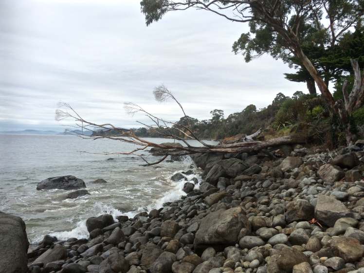
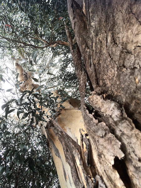
I had to boulder hop around Cartwright’s point because between cliff and river the rocks grow larger (I wondered why) and for a moment I was stopped by (and confused by) a fallen eucalypt, aged and bleached, that I had to navigate. These are boulders seabirds retire to when they want to simply relax and stare out across the river. I saw two or three, but it was clear from the guano on their favourite boulders that this area is a regular haunt.
The waves reclaim: Unsupported by the cliffs, great trees fall
There was one more enormous boulder I had to walk around, a boulder that protects its secret from the northerly winds – and then I was there, in the tiny cove that I remembered.
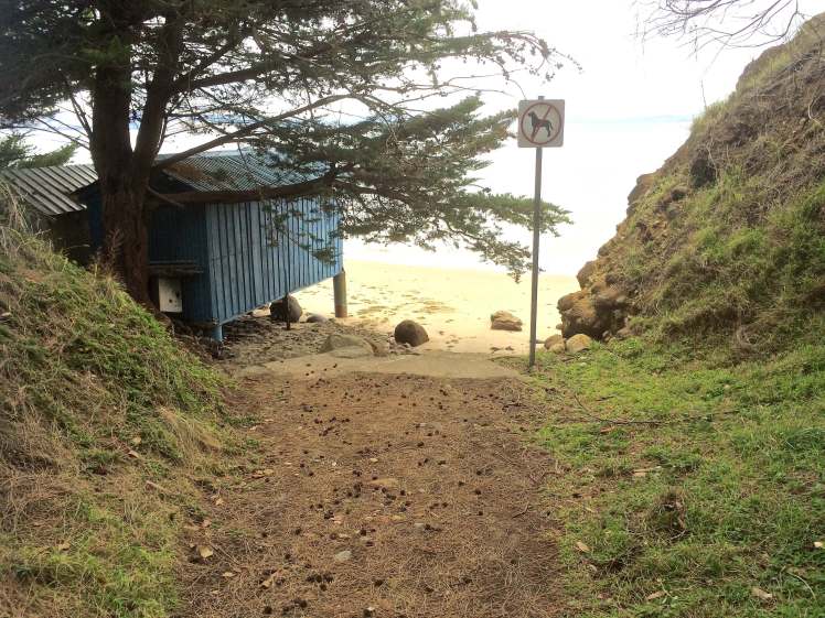
You would have no idea that at the bottom of leafy Grange Avenue below the Channel Highway (down past Mary’s Grange retirement village and just past the little grassy island in the road between the two cul de sacs) there is a path to a beach – except that a sign, seemingly disconnected to anything around it, says No Dogs. That’s when you notice that what you assumed was a garden path actually provides access to a beach.
The northern way
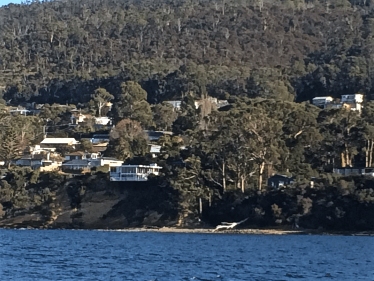
For most Hobartians there’s no real reason to wander down this road and the locals seem to keep the presence of the beach a secret. I hadn’t heard of it before but it had been an exhilarating discovery the previous week when I was sniffing around the streets of Taroona looking for access points to the shoreline.
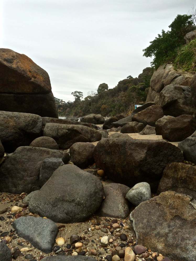
That day I had walked a little tentatively down that path that leads to a numbered garden gate and was relieved to discover that another path diverged to the right. It was picturesque and I was taking photos of its loveliness and the surprise of being surrounded by garden when my iPhone died. I could hear the crash of waves but they were hidden by a hedge as I walked down the short, steep steps and I was literally on the beach before I could see what I thought was the cove’s full extent. The northern view was hidden behind huge boulders but to the south about midway along the ribbon of pebbles between the water and the bush I could make out a waypoint, also a recent discovery, further to the south.
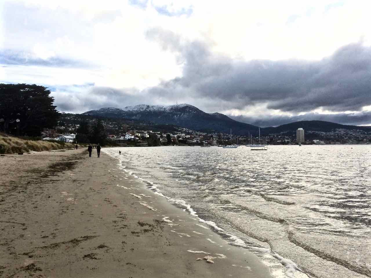
Looking north up Grange Beach
The waves that day had been surprisingly large and vigorous. I had stood on the sand and laughed. How amazing! Another beach discovered, perfect for a beach umbrella and a good book in the summertime, within 20 minutes of home.
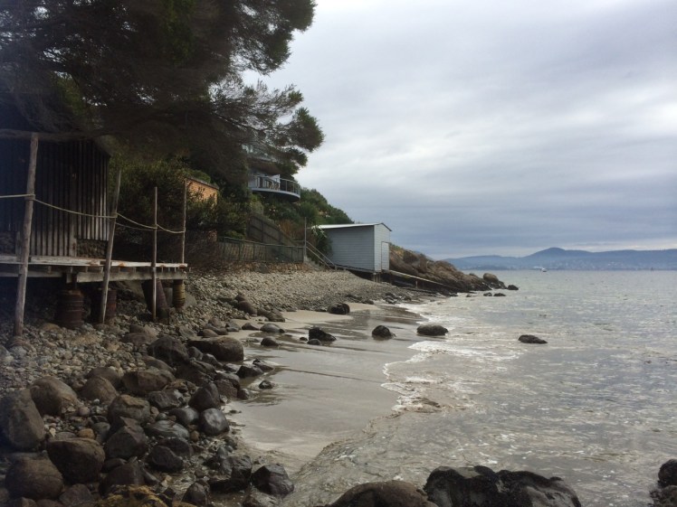
Arriving on the beach again I saw that it had changed with the tide and was a little longer than I’d originally taken it to be because it extended south to two boatsheds I hadn’t taken much notice of on my previous visit. I walked the small beach and paused to regard them. A rivulet, no doubt called Grange Rivulet, entered the beach beside them and I walked up it a little way to clarify my location. I was at the bottom of the southern cul de sac off Grange Road and I saw that a path diverted up to the top of the cliffs behind the beach. I would be coming back!
It’s a short distance from the source to the river but the rivulet wears a concrete corsetThe southern way: the path over Grange Rivulet, down to the beach
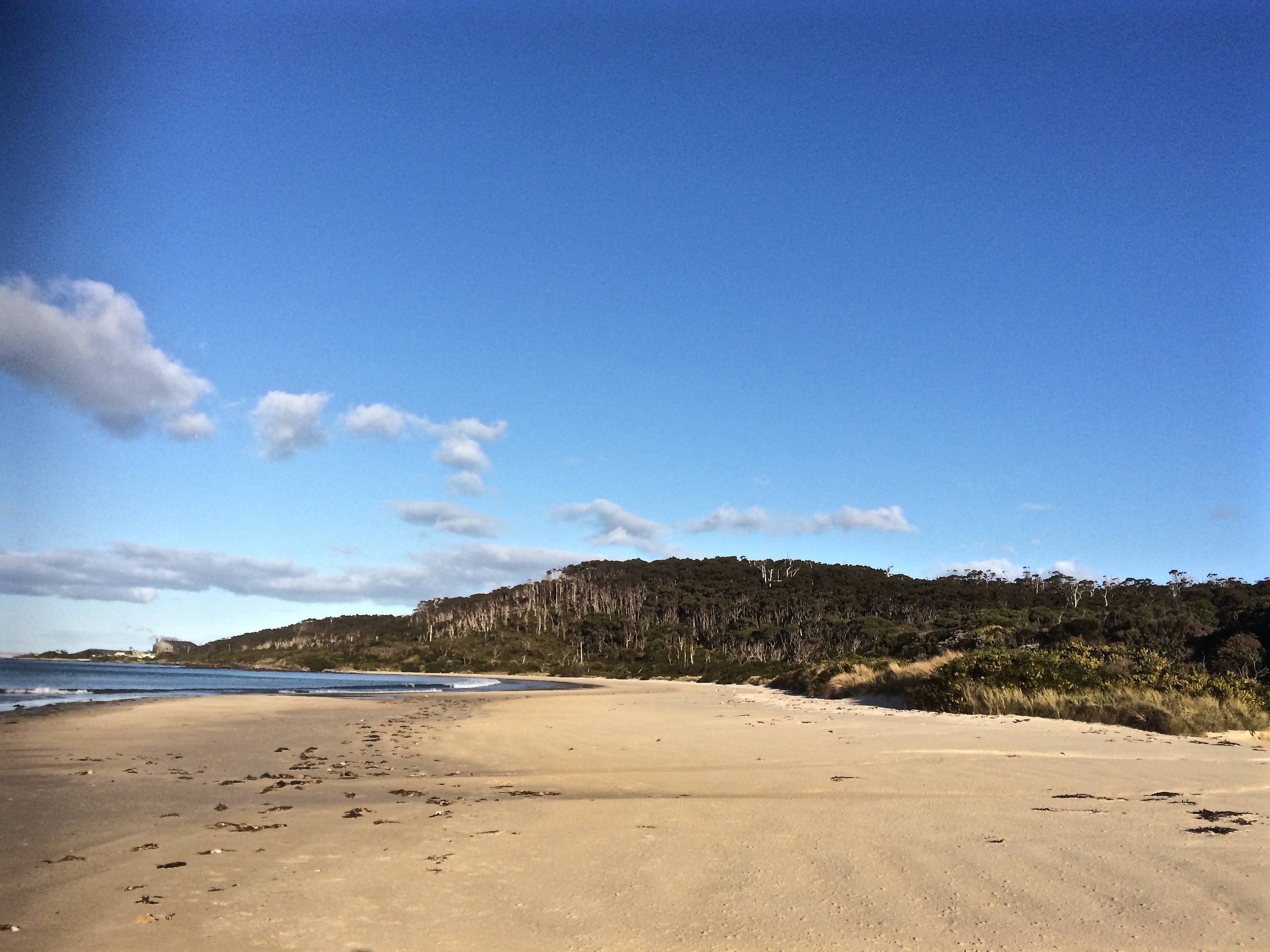
In front of me was another long, narrow pebble strip. I could see two men a little further along and at the far end I had a clear view of Taroona High School and so I set off again wondering what my next surprise would be but also quite disappointed that I was nearing the end of my route – I had arranged to be picked up at the High School.
The long view south
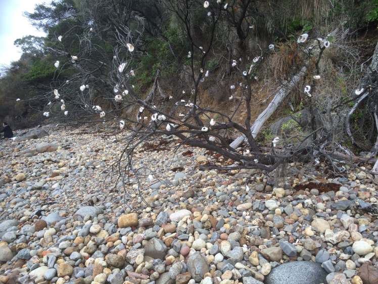
The two men on the rock turned out to be fishers. From their accents I could tell that they were new arrivals to the country, perhaps refugees. The fishing was not good, but they said they came here quite often to fish, and just a little further on I was surprised to see their family group – the mothers and the children, sitting and playing on the rocks. Perhaps they are the people who have so beautifully decorated an old dead tree with bleached shells.
Tree of ShellsFriable cliff face near Grange Beach
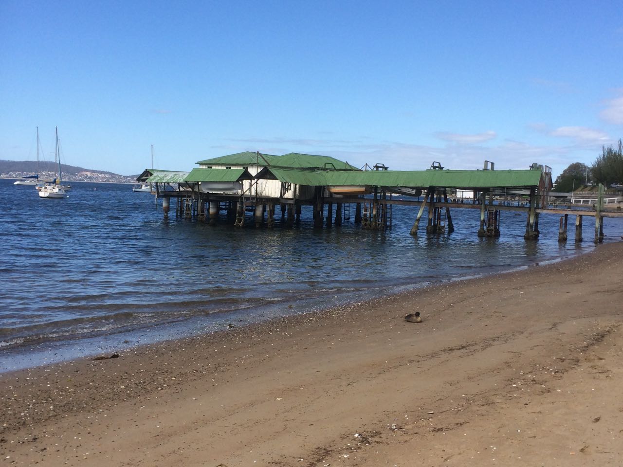
At the end of the beach I had to hop onto rocks and make my way between the river and a concrete wall. Around the corner a wooden boatshed looked as though it might end my walk but I found a way around it and although my walk felt seamless this is where I regard the Blinking Billy Beach 3 section as beginning. Just look at this picture. Who’d think there was a city here?
As you turn the corner at the point at the southern end of Blinking Billy Beach 2 (aka Half Moon Bay) you see this structure.
The same subjects preoccupied me as I walked along – the geology, the history, the structures – and, specifically, locating myself on this piece of shoreline. I kept changing my mind as to where I was in relation to the road above me but I wanted to do this walk without the help of Google Maps so that I had a real sense of (urban) adventuring into the unknown.
As you turn the corner at the point at the southern end of Blinking Billy Beach 2 (aka Half Moon Bay) you see this structure.
In wild weather this would be a windswept stretch of rocky coastline with views north to town, south into Storm Bay and across the river to more loveliness along the southern section of the eastern shore. On the day of my walk these lonely stretches felt pensive, secret and self-contained, and I felt myself more likely to encounter a nineteenth century smuggler along here than back at Red Chapel Beach or Blinking Billy Point. At the same time I felt as though the shoreline was as aware of me as I was of it.
I figured I was out of Geography Bay and this new perspective of the river renewed my feeling of exhilaration in the landscape and perplexity about ourselves – that we Westerners have been here since the beginning of the 1800s and yet, so close to the city centre, the nomenclature is still so sparse as to be mostly non-existent and so slippery where it is there at all. Many of us know more about London, Paris and places overseas than we do the intimate nooks and crannies of the river, the mountain and the great rifted catchment.
A few months after this walk I had a debate with a friend over just this issue. He’s a man that does real adventuring and exploring – the further off the beaten tracks of this world and out of communication the better. He is against nomenclature. He wants the earth’s places (mountains, rivers) left untainted by names but is prepared to compromise on a latitude/longitude co-ordinate.
I feel differently. As I walked along this stretch of coast wondering about the original aboriginal names for the places and features I was passing – names that over 30,000 years just have to have been rich, dense and redolent with mythology – it struck me like an epiphany, the extremely serious and overlooked disconnection we have with the earth. A shrieking Disconnection. A Disconnection so profound we’re trashing the planet beyond redemption and losing ourselves. No names – no recognition. No relationship. No honouring. No sense of gratitude. I looked at the magnificent, powerful river that I love so much, as much a goddess as the Ganges, and wished ‘sacred’ had not become a disparaged word because if anything felt sacred it was the animation I perceived in this river and its shoreline, so dynamic and timeless despite our culture turned beautiful parasite glued to its side. At the most profound level this existential disconnection is manifesting in more damaged psyches as each generation becomes less connected to the earth because how do you honour yourself if you can’t relate to and stand in awe of the greater entity you’re part of? As I wandered along the rocks, pausing to ponder their origins, diversity and beauty, I felt so utterly enthralled at the profligate beauty about me and a real grief that so many other compelling distractions have made it difficult for us to immerse ourselves in a landscape unfettered by human notions of time as was the case before our cultural evolution careered us away from hunting and gathering.
I had begun to pay more attention to my thoughts and less to the landscape when a sloping and strangely familiar boulder blocked my route.
Hello, Boulder.
About two feet of estuary rose and fell about its base. I didn’t want to take off my shoes and wade, the river’s temperature making it somewhat untouchable. On the other hand, my first strategy for climbing up the boulder’s side was hampered by the fact that a few weeks before I had dislocated and fractured my little finger while working on the boat with our mechanic, who I think of as being to engines what Leonard Cohen is to music.
I put my hands on the sloping rock. ‘I know you, Boulder.’ We had not met for a Very Long Time. Looking up I noticed a huge house with enormous windows. Now that was new to me.
When we were a whole lot younger we had come to look at a house – a beach shack really – at the bottom of Mitah Crescent. The owners walked us through their cacti and succulent garden down to a large boulder. The river lapped around its base but they assured us there was sand when the tide went out. We desired that boulder and that river access but knew that once we had paid for the property we would not be able to afford renovations for a while to come and so we sadly and stupidly decided not to make an offer.
I leaned my back against the boulder for a while, thinking that on this walk I’d barely noticed the Eastern Shore – I was so busy ‘paying attention’ (my current mantra) to the rocks about my feet and the all enveloping personality of the shore. My iPhone was losing power rapidly because of happy snapping and jubilant voice memos. I looked back along the way I’d come. I tested my finger’s capacity to help draw my weight up the side of the boulder. Not looking good.
Looking back at Blinking Billy Beach 3 from Mitah Crescent
My options were limited – I could fall, climbing that boulder. But if so, there was reason to hope that I’d be spotted sooner rather than later by the big windowed houses above me because at this point of the walk they had drawn closer and lower to the shore and so I took my chances, shifted my weight from disabled finger to used-to-being-bruised knee. Trying to be discrete, because I could not definitely recall whether the boulder was a right of way, I crept across it, slithered down over the boat shed’s jetty and found myself in an intimate and beautiful sandy cove. If the tide had been out when we’d viewed that house, we would both have lost our heads and hearts.
Looking back at Mitah Crescent cove
More rocks, more pebbles, the occasional rivulet and astonishing discoveries. I sometimes thought that paying too much attention to where I was about to place my feet I was missing out on rivulets, but in fact the way you find a Hobart rivulet is to use your nose. As they emerge dishevelled and emaciated from their concrete prisons they bring with them a distinct smell: stale old detergent. Yep. The cleaner we are, the dirtier we make the environment.
Then I encountered another boulder and, with an awkward gap, a double set of rails leading from boat sheds to the water. I slithered down to the base of the boulder and timed my scramble for a gap in the waves – and made it under the structure.
Double boat shed
I was about to leave Sandy Bay and enter the suburb of Taroona. but a little way around the next corner I found some more appealing structures and to my surprise, a sphinx like rock gazing out to sea. It’s waypoints like this that would undoubtedly have carried names earlier in the Holocene and I paused, feeling the loss of the language that once sung this landscape into being, the loss of a way of being in the landscape and interpreting the subtle nuances our less sophisticated gaze misses. I work with people who have dementia. In a more holistic way I think we have robbed the landscape of its earlier identity and a significant part of its memory.
As you turn the corner at the point at the southern end of Blinking Billy Beach 3 you see this structure. In the absence of official nomenclature, my personal name for it is The Mouheenener Sentinal
And it was along this stretch of shore that I nagging awareness came to the fore – one huge river, but only a handful of avian wanderers.
Where the hell were the birds?
Next blog entry: Photographs – Blinking Billy to the Sandy Bay border
I’ve had lots of opportunities to observe the coastline between Blinking Billy Point and the Alum Cliffs. It’s a scenic kayak trip from Short Beach to Kingston and when there’s barely a ripple on the water it’s lovely to idle in time and on tide and simply float a while, mind empty, just lost in the beauty of the estuary and its shoreline. A cormorant dives, a fish jumps and occasionally a beetle on its back, its legs flailing disconsolately, might require rescuing.
The breeze is my friend if I’m sailing but I’m less keen on it when I’m bashing into white caps when kayaking – although surfing waves with a following wind (always more gentle) is a lot of fun. The Derwent’s water is cold and I know my limitations; it would snap freeze me if I fell in and hopping back into a sea kayak after a capsize is not easy at all. When the wind strengthens I’m ready to head for the closest beach. My focus contracts to the wind and the waves and the shoreline barely gets a second glance.
The landmarks I pick as waypoints when I’m sailing or kayaking are known features and this is what I was remarking on to my friend as we sailed home one day after a weekend down the channel. The skipper wasn’t calling for a sail change. The mains’l didn’t need tweaking and so we were chatting about the Taroona-Sandy Bay coastline we were sailing past. There were the cliffs topped by houses. There was an occasional set of steps, a sundeck or a boatshed but mostly it was sombre rock and remnant forest higher up and I couldn’t have named any spots along there. My friend didn’t exactly agree with me about the shoreline’s inaccessibility though.
‘It’s not really,’ she said. ‘If the tide is right you can walk it. In fact, you should. It’s worth it.’
‘You should, it’s worth it,’ I was to discover, was an enormous understatement but for a long time I did nothing with this information. It was only once I’d decided to write this blog and to include the river that I acted.
I went to Taroona and I explored the roads closest to the shore looking for access points to the river. I’d like to say I studied the chart and the maps but I didn’t. I looked at them in the most cursory fashion and they never made it into my backpack. But one Friday night before going to bed I did pick up the tide table. I wanted the moon and sun to be in alignment for a very low tide – ideally a Proxigean spring tide. There would be supermoons in August and September but this was June and I didn’t want to wait that long. Hobart doesn’t have a big tidal range – the maximum is 1.32m but on a narrow, rocky coastline that’s still significant.
To see what the tides might be on any particular day I’ve always done it the easy way – just clicked on the tide app on my phone and so I wasn’t too sure I was interpreting the paper tide table across the year correctly, particularly as it seemed to me that the next day looked like it would be pretty damned good regardless of the lack of a spring tide. It was June and actually, it was quite close to the winter solstice. If I’d known more about beaches at the time I would have known that winter isn’t actually the best time to find the beaches all stretched out but at that point I hadn’t encountered Lena Lencek and she had a few things to tell me that the geologist had not.
And so I set the alarm for Very Early, pretty excited about this walk. It was either going to be stunning or it was going to end with me against a cliff, the dark water rising.
Sometimes you just don’t see what’s in front of your eyes.
The cardboard sign at the start of the track gave me pause for thought ‘Snake Spotted Lying on the Path’ someone had written, and so instead of exploring new territory I headed down to the marina to do a bit of work on Samos. The dogs lay and watched me. It’s currently the summer solstice, the day was hot, the moon a waxing gibbous and the tide low but oblivious to all this I was tending the engine and talking to my neighbour.
At a certain point I looked past the yachts and ducks to the houses that occupy the foreshore.
There at their base were remnants of beach. Rather sorry looking remnants but large enough patches of polluted sand to provide private coves for those lucky enough to live in those houses. Not that long ago it was a longer stretch of cleaner sand and boats swung at their moorings in the lee of Wrest Point. Now the marina’s been extended and there are new floating berths.
This view has become so familiar to me but in failing to question it I hadn’t seen it for what it really was: a beach still present enough to make a statement: well may I go unnoticed but I’ll be back in one guise or another long after the marina and these activities are gone.
Had I been more attuned to the landscape, I might have immediately realized that this city was criss-crossed with rivulets but it was only after leafing through a report about Wayne Rivulet back in 2003 that I began to observe the landscape more carefully (or so I thought) and recognised that if we valued natural landscapes more highly Hobart could have been an even more beautiful city.
One rainy Saturday that year, the report in my hand, three of us went in search of Wayne. We drove through Sandy Bay paying attention to the dips and hollows where rivulets once might have flowed and we went to Long Beach to seek Wayne’s mouth because I’d read that according to Wooraddy – or so George Robinson said in his journal – there used to be a large Aboriginal village there. And if this was true then a rivulet would be a most necessary resource. I discussed the possibility of a village with an archaeologist I knew and he wasn’t too sure he trusted Robinson on this issue and let’s face it, a language barrier can lead to a lot of misinformation. Elsewhere in the literature it’s considered to have been a camping site.
In 2003 the beach was disappearing so fast that efforts were being made to shore it up. We stood on this little remnant of beach and figured out that the rivulet emerged where new works were happening at the southern end, and then I noticed that we’d actually parked right above the stormwater drain, which is now the mouth of Wayne Creek.
After a little exploring around the area we found the rivulet again higher up the slope at Fahan School. A sign testified to their care of the rivulet and how they used it for educative purposes but it looked crestfallen that day and damaged by diversion. It flowed over watercress and then into a more established looking bed below the willow trees and under a little wooden bridge. Its bed grew deeper and cut around the edge of a small shed, ran under the road, emerged again just briefly then disappeared completely until it reached the end of the pipe at Long Beach.
A scientist friend who knew about Wayne said it was corroding the diesel tank under the BP petrol station (now United) and so that spot is on the contaminated sites register. I asked a Fahan student if she knew where Wayne Rivulet was and she said she’d never heard of it. When I told here where she could find it, she said, ‘we just call it ‘the creek’ but after our conversation she went looking and told me about the signs in the playground. ‘So I probably did know,’ she reasoned.
We climbed up behind the school and tried to track Wayne to its source higher up Mount Nelson. We figured it had to be near a large purple house on the upper slopes but in fact, although two tributaries are said to flow into Wayne, we had no luck finding any trace of any rivulet above Churchill Avenue. There were new houses encroaching into the bush up there and they impeded our search.
It’s now 2015 and Wayne Rivulet remains largely unknown to Hobartians, but that’s also true of the other disregarded rivulets, most being unassuming, sporadic and unknown. Today I went back to take a peek at Wayne and I was disappointed to see that it looked as crestfallen as ever.
Wayne Rivulet 2015
Not that long ago a friend and I did a walk from the mouth of Lambert Rivulet at the Derwent Sailing Squadron, up the shady gulley to the top of Mount Nelson and down through the Truganini Reserve to Cartwright Creek in Taroona. Lambert enjoys a lot of daylight and makes its way through a densely foliaged linear reserve. It’s the lucky one, along with a tiny handful of others.
A natural stretch along the Hobart Rivulet: how our creeks should look
Chatting as we walked, we wandered across the catchments of the other Sandy Bay Rivulets that these days are sealed up tight until they get to the river, but there was so little evidence of their presence that lost in conversation and good company I did not pay attention to the landscape and forgot to pay my regards to those neglected rivulets.
When someone you love says ‘Meet me in Tokyo,’ the temptation is just too great. I put my blog aside, abandoned social media and headed out into the world on a small adventure that involved food safaris, onsin challenges and meditative pilgrimages to shrines, both Shinto and Buddhist. In Kyoto the leaves were turning.
Sky Tree, the Asahi Flame and Sumida River
We took up residence for a while in Asakusa, an old part of Tokyo, where the Sky Tree towers over an already tall city and the Asahi flame, such as it is, lies heavily on its side beneath it. We were close to shrines, big and small, that honour the Bodhisattva Kannon who is intimately linked to the Sumida River. The story goes that back in 628 AD when the area was a delta, three fishermen hauled a statue of this particular Bodhisattva out of the river. The first shrine was made of straw. Now there’s a complex of wonderful shrines, including Tokyo’s biggest and most visited.
The gift of the Sumida River hasn’t saved it from all sorts of atrocities. It may know daylight but it has concrete hips. There’s minimal habitat for river species. The Derwent in comparison is a wild eyed hippie, a moody and creative artist with a flare for change.
I didn’t notice anyone fishing in the Sumida and barely a bird apart from a lone cormorant and a tiny flock of seagulls that flew into sight beneath a bridge. In fact, with a bridge literally every kilometre along its length there’s not much river traffic either because the bridges are so low.
Flying back into Hobart is a beautiful experience – that first riveting sighting of the mountain and that most magnificent of rivers, always so spectacularly stunning from the air, is riveting.
Once my feet were on the mountain and my eyes on the river, I felt reconnected to home, ready to curl my hand around the tiller, jump on my bike, lug my kayak down to the water or take another stroll along the coastline somewhere.
I was puzzled why anyone bothered with this popular beach when I first visited it one hot summer’s day during my first year in Hobart. There were a lot of uncertain people sitting in their bathers on the sea wall but swimming wasn’t an attractive proposition because the water came all the way up to the steps and slapped against the concrete in a discontented manner. I sympathise with the river now. It was trying to build a beach and this seawall, built without understanding, impeded it.
Yet this has always been a popular beach, even when, in the 1980s, it was barely there at all. An artificial dune was cultivated in the corner bound unnaturally with marram grass. This once magnificent beach had become a desultory shadow of its previous self and I think that those who still came here were in love with a memory. (It’s still a lovely spot when the sun is shining on it but it was overcast yesterday when I returned to take some more photos, earlier ones being lost in the uncatalogued innards of iPhoto.)
Before the convict ships arrived to set up camp Long Beach was called Kreewer and the Mouheenener had a summer camp in this sheltered spot. In those days the beach was wide and backed by small dunes. Picture a bark kayak, exquisitely woven dilly bags full of the jewels of the sea, children playing on the sand. The land was flat and shaded behind the beach, a great spot for huts as well as some easy hunting, and there was a handy stream.
Although the rivulets that flow sporadically down the slopes of Mount Nelson are not well known, Wayne Rivulet has a slightly higher profile because it still enjoys daylight along some of its course, beautifying the grounds of Fahan School before entering the river at Long Beach / Little Sandy Bay. It brings with it eroded dolerite from the heights, creating a delta of clay over which the once dense sand of the beach now sits as a thin sheen.
Having already succumbed to epidemics, the distress and fear that took hold at Kreewer is outside the comprehension of anyone who hasn’t faced the end of their world and all they hold sacred. The forests they tended, the trees that were their totems, were knocked down to make way for an alien landscape of farmland, divided up between fences that ran all the way down into the river. The Mouheenener, in a state of deep existential crisis, retreated and the beach became a popular destination for Hobartians in their strange clothing, who no doubt moved stiffly in the landscape not seeing the visual detail, not taking direction from the fragrance of the bush or hearing in the calls of birds the rhythm and events of the day. Shooting expeditions from town, well recorded by the Rev Robert Knopwood, had rendered the emu extinct and chased the frightened animals that still survived further away from European settlements. At that point the odd little handfish that moves about on its fins and inhabits the lower bays of the Derwent, still enjoyed an easy life in this beautiful bay.
The beach was so accommodatingly wide and so beautiful (see links to early photos below), that it served as a place to promenade, socialise and relax, and to enjoy the regatta that finally found a home here, or the start of a horse race. Enjoyment was yet again marred by disputes over right of way to the beach that reached a climax around 1910. There were petitions. There were meetings. The government was persuaded, buying up land to create the park, and a long jetty was built on the beach so that people could arrive by boat as the Tramway Company wouldn’t extend the line along Sandy Bay Road.
Francis Cotton, in 1880, noticed that the sea level was rising on Long Beach. He asserted it was the building works happening at Sullivans Cove and Norfolk Island settlers, including Maning and Fisher, considered that the sea had risen by about 50 feet in less than three decades.
There’s a more recent, curved seawall now, over which, in great storms, the sea breaks and which causes a significant wave to reflect back off it during high tides but there is a bit more beach than there used to be in the days of the old sea wall. This area is often a gourmet adventure because there are cafes, making it, in summer, a great place for an evening pizza or a day time coffee, or a place to come on a Friday evening to enjoy the summer market. From here you can walk north around Sandy Bay Point or south around Blinking Billy Point, the two sentinels of Little Sandy Bay and while the water in the bay is usually calm (unless the sea breeze is filling in from the south east), out beyond these two points gales frequently whip up raging white caps.
Sundown Park behind the beach was described in the 1800s as ‘the Hyde Park of Hobart’ and it’s occasionally vivid with small flashes of colour when eastern rosellas and swift parrots swoop between trees. There’s a crocquet club and a petanque piste, a playground and the playing fields. There’s a platform just offshore that swimmers can lay claim to and that is alternatively occupied by cormorants drying their wings. Kayakers launch from here and seek refuge as well when conditions on the river turn wild.
Playground
In the heart of winter, when snow lay deep on the mountain’s summit and gardens were white with frost, the most adventurous Hobartians rose from their beds in the black pre-dawn and found their way down to Long Beach for the Dark Mofo Festival Solstice Swim. They took off all their clothes and plunged en masse into the freezing water of the Derwent just on sunrise.
I’m sure it took their breath away.
When I arrived at the beach a good two hours after this, apart from footprints in the sand, there were no clues that this midwinter event had taken place.
I looked. I contemplated. I imagined the Mouheenener regarding this activity from the ghostly forest and the sharp gasp of the Rev Knopwood. Then I went home to a hot coffee and a warm bowl of porridge. The frost still lingered but my kitchen was snug with the wood fire roaring.
The sailing season officially opened last Saturday, the 10th October and Hobart’s recreational sailing fleet turned out in good numbers for the annual sail by the Governor’s vessel Egeria, moored in Sullivan’s Cove. Some boats adorned themselves in nautical finery. We forgot to take off our fenders but by the time we realised this we were relaxing at the rendevouz off Nutgrove Beach and having imbibed a wine or two were feeling too mellow to care that we had not kept up appearances.
The geologist and I had invited three friends along, one an able seaman of the four legged variety, our sole adornment in his coat of yellow. The sky was blue, the sun shone and there was a breeze strong enough to fill sails. As this was the first time I was skippering on an opening day we stayed on the edge of the fleet, detouring under the bridge, confusing ourselves over the instructions until order was established in the fleet. We snuck in towards the rear, trying our best to keep ahead of the Beneteau and MONA cat bearing down on us as we headed into the tight conditions in Sullivans Cove, more alarming last year on a larger boat.
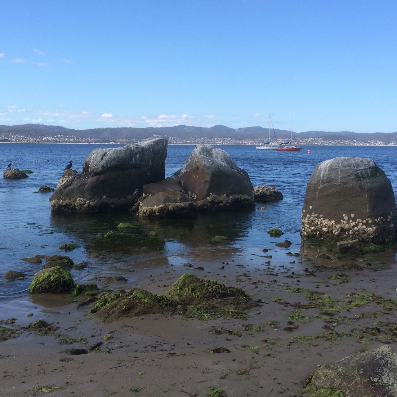
We dropped our anchor at the back of the fleet, by now mostly rafted up together off the beach, and I lined us up with a group of large boulders off Maning Reef, clearly much loved by cormorants. The tide was low and the coastline had a surprise for me. Lords Bay had spread itself out. It wasn’t a little beach at all but a long, thin sandy beach running along the back of Maning Reef all the way to Red Chapel Beach, validating my belief that in earlier days this coastline was one long stretch of sand, at least between Short and Long Beaches, if not beyond. As we drank wine and picnicked and the talk turned to rugby, I discussed its changed appearance with E who knew this stretch in all its variations better than me.
Later I quizzed a friend who lives above this beach for a bit more information, and then, when the tide was low yesterday afternoon I went walking, hoping to find bouquets of sea tulips waiting for me on the jetty pilings.
And here’s the thing. I didn’t find a single one, but I did find numerous other little squirts who looked remarkably like pyura Doppelgangera and squirted just to show me how it’s done.
Oysters and sea squirts on a jetty piling.
Despite their name they hadn’t contrived to look anything like the elegant sea tulip I was beginning to believe I’d conjured up. They’re squat, rotund, pustular and a mucky colour, probably impeccably beautiful for blending into their surroundings but a challenge for the human eye to appreciate aesthetically. A Tasmanian native, it’s well travelled, having hitchhiked on boats since ships first came here, making a pest of itself in New Zealand and the mainland.
I walked on, from stormwater drain to jetty piling to rocky outcrop musing about what it really was I’d seen on the hull. Had it really had a stalk? Had it even been red? Chances are it wasn’t a tulip at all but one of these doppelgängers given they are particularly captivated by artificial structures, according to the literature.
A green tongued stormwater drain.
While thinking about how dramatically we have changed the ocean and the locations of its denizens, I located Maning Rivulet (I think) which gave me a small thrill. As I reached the little cove I’d seen from Samos when sailing with my friend the sky filled with tiny floating seeds like small white butterflies. They made drifts on the sand and laced the rock pools, and the next day, around in New Town, the same phenomenon took place beside New Town Rivulet and I saw that they came from tall graceful trees whose name I still need to find out.
Here are some more photos of the Maning Reef section of the walk that I took with my trusty iphone 5s.
They’re in no particular order.
One of two stormwaters very close to each other that are probably both linked to Maning Rivulet
Looking back at the jetty and CasinoThe consequences of our filthReaching the cove at Red Chapel Beach
Nutgrove Beach is my wonderful ‘go to’ beach, one I mostly associate with pale sand, sunshine and activity, but because I’ve been walking through winter these photos show its moodier, more introspective personality.
I come here to think, to catch up with friends, to watch yachts racing, to enjoy the best of the day and to be walked by the dogs. The water quality is dubious but canines aren’t discouraged by that. There can be snow on the sand and they’ll still take the plunge. and some dogs, entranced by ducks bobbing on the water, and the more sight impaired by a bobbing buoy, head off in futile pursuit. Their owners cheery commands for them to return grow ever more plaintive as small crowds gather and their dogs recede into the distance. The dogs don’t stand a chance but avian business is always disrupted when people, with or without dogs come down to the beach.
Nutgrove is north/south facing, a 700 m long stretch of sand that starts at the rocky platform below the cliffs, south of Red Chapel beach. It swings slightly east and broadens out a little as it approaches Sandy Point at its southern extent. There are substantial houses – one the size of a small hotel – barricaded by pathetically small sand dunes, no more than the slightest of slopes really and at a certain spot there are no dunes at all. This beach suffered along with Short Beach because early settlers removed a large amount of sand from here too.
It’s a beach with a surprisingly fragile sense of identity. I’ve read about it and heard people refer to it as Sandy Bay Beach. In some earlier documents it also seems to have been known as Long Beach. It is longer than today’s Long Beach to its south and in earlier times when both beaches were far broader their identities were probably more fused than today. Further adding to the confusion, the Derwent Estuary Program, in a map locating monitoring sites, divides it into Nutgrove East and Nutgrove West but perhaps this is only for the purposes of checking water quality. Whatever, it can do your head in.
The Sandy Bay beaches aren’t named on the nautical chart for the Derwent River but it is identified on the Taroona 1:25,000 series. Its current name comes from a small orchard of walnut trees that used to be attached to Nutgrove House on the land behind it. The house, built in the 1880s, still exists today.
I vaguely knew the beach was there when I first came to Hobart because you can see it at certain points along Sandy Bay Road but I largely ignored it in favour of the ocean beaches. I was also understandably confused about what it was called until a friend set me straight when suggesting a group of us meet there. It was a sunny morning and the river glittered. The children paddled while we talked. For a beach of its dimensions, it was surprisingly empty that glorious day. I began to make it a regular haunt, arriving on it usually via the right of way off Sandy Bay Road, a pathway between homes that you’re unlikely to discover unless someone tells you about it – or you’re an observant walker, or you’ve parked there, perhaps to buy something delicious from Lipscombe Larder and you’ve wondered why dogs are leading their owners up or down what looks like a private driveway.
The pink historic house with the Iceberg roses, the driveway with the wooden carport, transport me to France every time and the dogs are always full of anticipation, which is catching. You walk past various flowering plants in summer and then turn to take the steps where the nasturtium grows, and there is the jetty, the splendiferous river and the moored yachts. There are the conifers we sometimes use to help us find the Nutgrove buoy when racing, and there is the beach spread out to the south. At times you feel part of a communal passagiata but it’s also possible to have the beach entirely to yourself. And you have to marvel: the land sweeps up to become the hill that is Mount Nelson, carrying the weight of Sandy Bay’s large houses, and despite suburbia that beach stretches out and you have it to yourself.
You need the tide on your side walking Nutgrove Beach. When it’s really high there’s not much space between water and dunes and you end up treading a soggy path. This is sobering. When Hobart started hankering for a race course, they decided this would be it – that it would begin south of Sandy Point and end at Nutgrove’s northern end. In 1816 that first race was run. A crowd gathered on Long Beach to watch the start but most would not have seen the horses galloping up Nutgrove. There’s no doubt many people raced in pursuit of the horses to enjoy the celebrations at the finishing line below the Beach Tavern – that very same pink building with the right of way down to the beach.
Nutgrove Beach
Later, as boundary fences were built and jetties split the beach up, access across private land wasn’t guaranteed and caused a lot of community friction. Fierce debate began appearing in the newspapers with various observations of increased sea level rise being used to explain the descent of fences into the river. Some writers had a fine sense of coastal processes, noting shifts in currents and the carriage of sand because of the changes being wrought in Sullivans Cove – wharfs and buildings, redirected rivulets, for instance. This was just the start of debates about private and public rights to beach access. Tasmanian Traveller has encountered this problem walking the upper reaches of the Derwent. It remains an issue in many places around Tasmania today, Battery Point being a prime example.
If you come to Nutgrove Beach from Red Chapel beach to the north there’s a smidgen of beach tucked between the rocks and the jetty-with-character (the only one remaining. This is the spot where Lipscombe Rivulet emerges encapsulated in its stormwater drain, and this ‘beachlet’ (Thanks, No Visible Means) has a sign to inform dogs that this is just for seabirds. Once, after a massive storm a few years ago, I was astonished to discover an unkempt yacht bearded with seaweed and weighed down with barnacles, sea squirts, jellyfish polyps, mussels… the whole caboodle, washed up here, a sorry sight.
Winter on Nutgrove, down by the jetty
Down the south end of the beach Sandy Bay Sailing Club has its clubhouse and so the beach is often full of Optimists, and an optimist you have to be to allow tiny children loose on the river in dinghies not much bigger than walnut shells. The rescue boat is always hovering. Invariably someone capsizes, a character building experience and perhaps the reason why some fine sailors have emerged from the club.
The yellow Nutgrove buoy, just off the beach, is usually the southern extent of keelboat twilight races down the western shore, so when the sea breeze is in it’s lovely to watch the fleet gybe and run wing on wing back up the river. The beach’s other nautical connection is the orange structure half way along it. This is a light that ships use to help line up their passage under the bridge.
Derwent Estuary Program 2004. A model stormwater management plan for Hobart Regional Councils – a focus on the New Town Rivulet Catchment. Derwent Estuary Program, DPIWE, Tasmania.
Goc, N. 1997. Sandy Bay: a social history. Gentrx Publishing, Hobart.
Robertson, M. 2008. From Petal Point to Cockle Creek: a beach explorer’s guide to the East Coast of Tasmania. Regal Printing.
Short, A.D. 2006. Beaches of the Tasmanian coast and islands. Sydney University Press, Sydney.
There’s been a delay in posting because of visitors, learning about beekeeping and preparing a beehive, travel about the state and trying to get my first issue of a local newsletter to the printer on time. But while it may seem I’m making my way excruciatingly slowly down the Western shore of the Derwent Estuary, I did in fact reach Piersons Point much earlier this year and so I’m playing catch up on this blog.
While writing, I’ve walked some beaches down the D’Entrecasteaux Channel and on the South Arm Peninsula.
I can also report that from Cockle Creek to Couta Rocks the boobiala has been in brilliant yellow blossom. Epacrids and cyathodes have also been adding colour to the coastal landscape. There are a diverse range of sponges washing up on the Cowrie Point beaches and while the sand at Robbins Passage seems pale at first glance, a little digging reveals black sand lies just beneath those beautiful ripple marks the outgoing tide leaves far behind. The surf was big at Marrawah and at Mt Cameron West, a place I’ve long wanted to visit, we acquisced to aboriginal requests not to take dogs in, and we turned back.
This month I also got to know the sandhoppers at Sarah Ann Rocks (West Coast) far more intimately than I’d ever anticipated. If any beach was aptly named its Sarah Ann. That sand is rocking and hopping beneath your feet and unless you go digging you would probably never know.
The plover that gave me an in the face warning that I was not welcome on Red Chapel beach (see my last post) also gave me reason to pause and think a little. I phoned the Parks and Wildlife Service to report the broken gate but more than that, as a person who has long bewailed the dog apartheid on many of Tasmania’s beaches my walking has led me to the conclusion that during the prime breeding months in spring, we should all be avoiding the beaches, ceding tenure to the birds, so that they can enjoy their parenting without abandoning nests or succumbing to anxiety and alarm. After all, it’s we, not our dogs who are the most menacing of species and with the dunes eroding on many beaches, it’s a hard call for nesting birds to simply find a spot to lay an egg.
This is why over the next few months I’m exchanging my walking shoes for my bicycle. I’m hopping in my kayak and I’m hoisting my sails. Walking, developing an intimacy with landscape, paying attention to it and asking questions of it has been exhilarating and has expanded my thinking but now I’m curious to experience small adventures out on the water.


")


