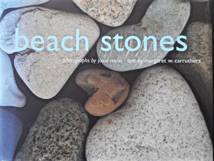
‘What compels us to walk along the beach, our gaze fixed upon the sand? We can’t resist the smooth, surf-polished stones that have been tossed this way and that by the waves. Their intriguingly varied colors, patterns, and shapes draw us to the hunt, and soon our hands and pockets are full. Something about beach stones is comforting. They don’t age, die, or fade away. We perceive them as paragons of permanence and immutability.
But in fact the timelessness of stones is merely an illusion born of our own fleeting presence on Earth. Their features are a testament to impermanence, a witness to change. Every spot, stripe, fault, and fold that tempts us to pick up a pebble holds a garment of Earth’s four-and-a-half billion-year history.
A beach is a strip of loose material at the water’s edge, a collection of sand and stones assembled, disassembled, and reassembled by the sea. On the geology time scale, its ephemeral. And for most stones, the beach is just the latest stop on a journey that began eons ago…’
~ Iselin, J. & M.W. Carruthers 2006. Beach stones. Abrams, New York.
In the company of a plank, meant to provide a way across the gulch so that I could wander the cobble beaches, I returned to Tinderbox on what was supposed to be a low tide.
It wasn’t. That tide had firm tenure on the rocky platforms. It was in fact so high the shore was sometimes unrecognisable and I could not even find the sea cave. I did reach a cobbled beach and later, from the top of Pierson’s Point, I walked through bush to the cliff tops, seeking a path down to another cobbled shoreline but my bushbashing was entirely unsuccessful.
Actually, it transpired that I was 365 days late for that low tide. I had consulted the 2015 tide table by mistake. Still, it’s not every day you walk out with a plank. Strange to say, it’s quite companionable and will lie down on slippery seaweed if you need it to.
II.
‘Everything that arises is an invitation…’*
When I learned that Susan Murphy was leading a retreat on kunanyi I thought that I would take this invitation to escape my cocoon of fatigue (jetlag & flu) and find my way back into a practice that includes the fine honing of awareness and attunement to the natural world.
I had been on the river for a few days in a row, servicing winches, cleaning the bilge, sorting out engine problems and flat batteries. Still, we’d managed a little break in all of this and had packed a picnic and gone up river in Samos, enjoying the quietude of sunshine on water in Shag Bay and exploring hidden beaches on the other side of the river, just north of Cornelian Bay.
Then I became mountain focussed, walking to the retreat along forest trails, through leaf litter and peels of eucalypt tangled on the mossy slopes.
Eucalypt bark
For three days I absorbed the soundscape of the mountain. The kurrawongs are building nests; their conversation carried across the canopy. The frogs are seeking mates. In the pools outside the window they sang serenades. The wattle bird punctuated the silence from a eucalypt nearby, the rosellas called to each other as they flew between kunanyi and Chimney Pot Hill and the wrens held intimate conversations in the garden’s undergrowth. All this beneath a sky by turns cobalt and domed with cumulus transforming, and one turned grey, the raindrops falling quietly into the pools, repatterning the reflections of the trees all about.
During a break I sat down on a lichened rock in a part of the forest where I sometimes walk, enfolded in its deep and friendly silence, noticing the beauty of random scatterings of leaves, twigs and impressions in the earth, and the slightly anxious flight of a bumble bee. I must have sat for about ten minutes when a gentle trilling began to rise through the forest. This insectivorous chorus was one I had never heard before, and so neither had I experienced the way the forest seemed to attend to this shimmering music.
Many make one: communities living on a blanket bush (Bedford salicina), kunanyi
It evoked that perpetual question, that one too big to have an answer: what is the secret life of the forest, what the mysteries of the river and the sea? What happens when we are not there to witness it?
Krishnamurti (2000), in All the Marvelous Earth asks
‘…what is beauty? This is one of the most fundamental questions, it is not superficial, so don’t brush it aside. To understand what beauty is, to have that sense of goodness which comes when the mind and heart are in communion with something lovely without any hindrance so that one feels completely at ease – surely, this has great significance in life; and until we know this response to beauty our lives will be very shallow.’
It’s a closed loop
And,
it’s an open invitation, because ‘medicine and sickness heal each other. The whole world is medicine. Where do you find your self?’ (Yunmen, 9th C China).
In effect, the extensive damage we have done grants to us an opportunity to develop a symbiotic ease in our relationship with the earth and bring about the healing change so urgently needed right now.
Robert Hass puts it beautifully: ‘We are the only protectors, and we are the thing that needs to be protected, and we are what it needs to be protected from.’**
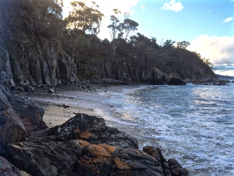
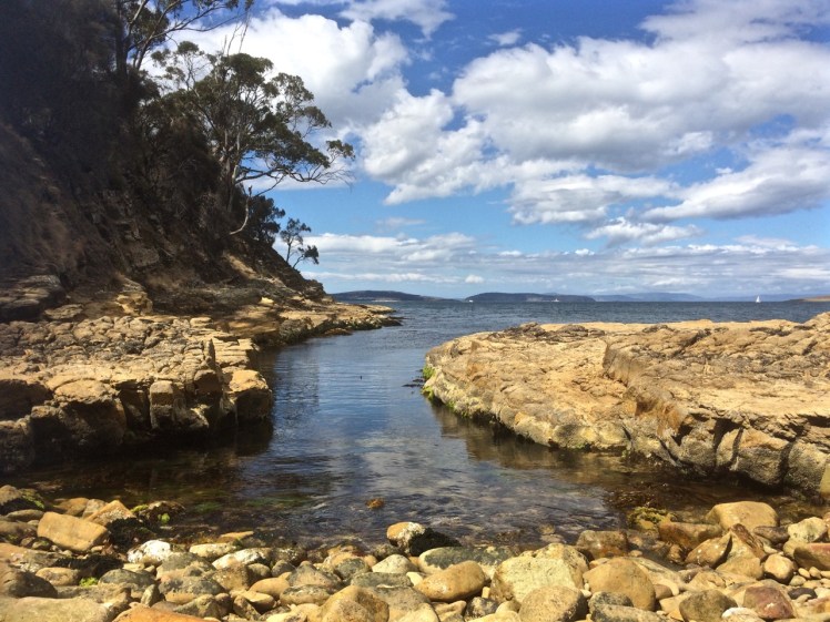
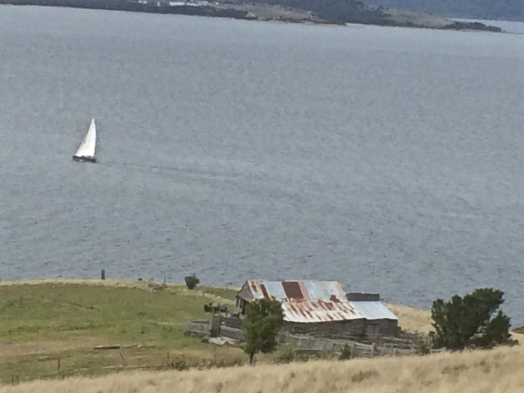
Tinderbox Beach with jetty & Bruny Island across the D’Entrecasteaux Channel
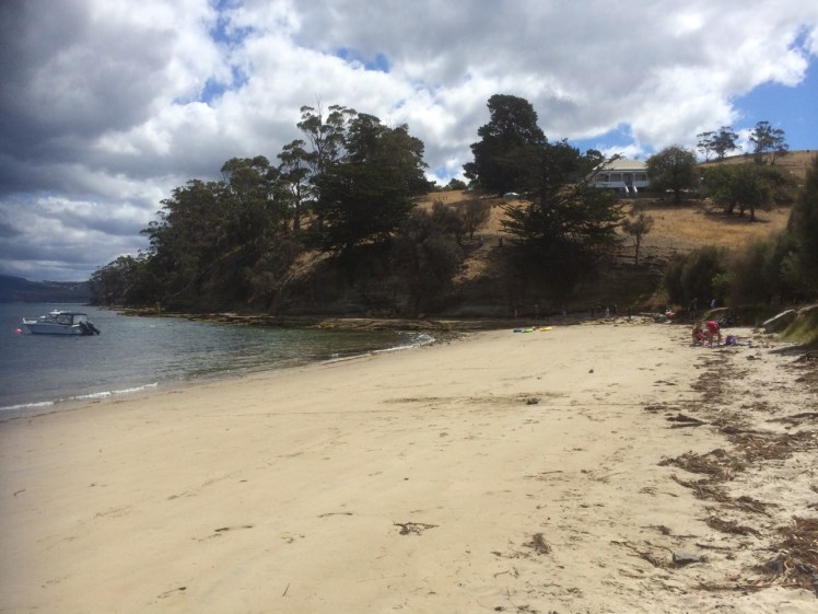
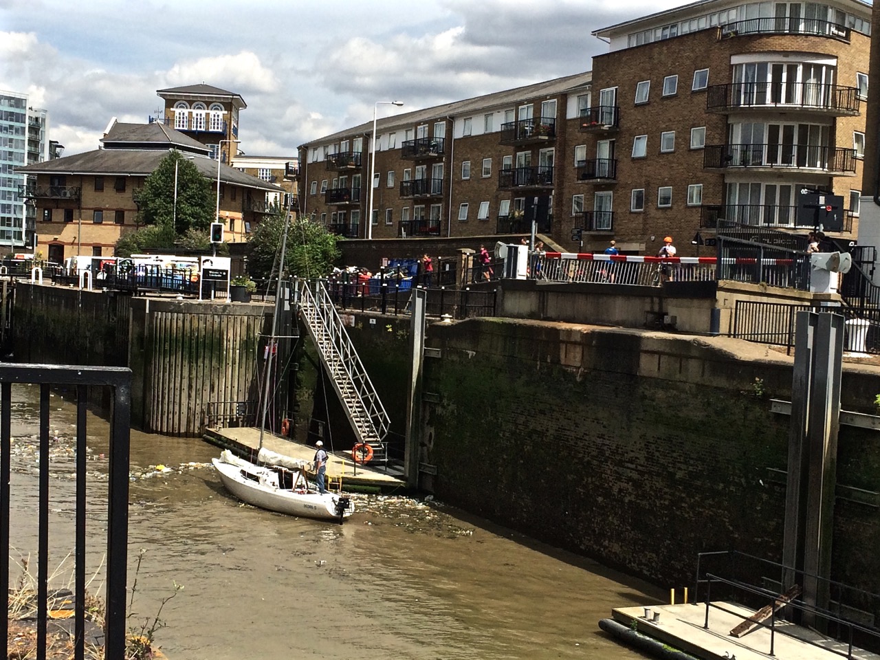
The headsail was torn, the furler broken and so on that fine day last summer I found myself down on Tinderbox Beach as the seabreeze swooped in and the tide ran out.
This beach is small and beautiful, with a jetty, yacht moorings and the great bulk of Bruny Island protecting it from the worst of the Southern Ocean’s temper tantrums.
I walked east, past children playing on the sand and adults relaxing and on to the rocks, heading for the small cobbled beach below Pierson’s Point. I hadn’t gone very far when a man stopped me.
‘What’s over there?’ he said, sweeping his hand across the northern extent of Bruny Island. ‘More of the same?’
‘Not at all!’ I said and passionately described the unique qualities of Bruny Island. ‘Not to be missed,’ I concluded.
‘More of the same,’ he said morosely. ‘I think I’ll just climb in the back of my ute and have a sleep with my little mate.’
He was well set up. He and his travel worn blue heeler had driven down from Queensland rather quickly, then crossed to Tasmania on the overnight ferry which makes port on Tasmania’s north coast. They’d then hurtled down the extent of the island to this beach at the southern end, all in one day.
Walking on beneath the cliffs, I found some beautiful rock platforms that were (at least to my untrained eye) tessellated. There are well known ones at Eaglehawk Neck but on my walks I was finding them in many more places. Soon I noticed a couple who had set themselves up in a small, sheltered corner and I stopped to ask how far it was possible to continue walking in this easterly direction.
‘Not far,’ they told me. ‘You come to a gulch that’s just too wide to jump. We’ve often thought we should bring along a plank to get over it.’
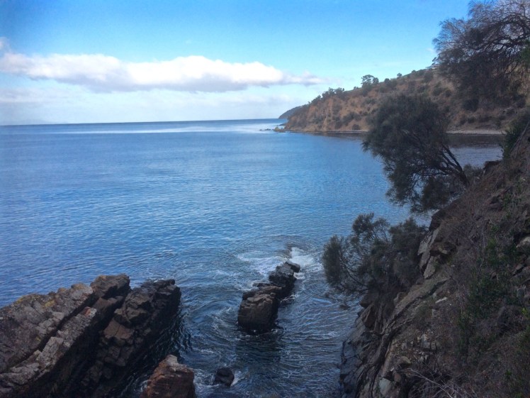
From the rocks at Tinderbox looking north into the Derwent River
It wasn’t long before I came to that gulch. I had paused at many rock pools along the way – amongst the most beautiful I could recall seeing in Tasmania – but this gulch was exceptionally dense with beauty – kelp and a variety of other bright seaweeds. I regretted leaving my rocky shore guidebook at home because quite clearly a person should never visit a marine reserve without one.
The gulch was just too wide for me to jump. The pebble beach beneath Pierson’s Point was simply unattainable, at least today.
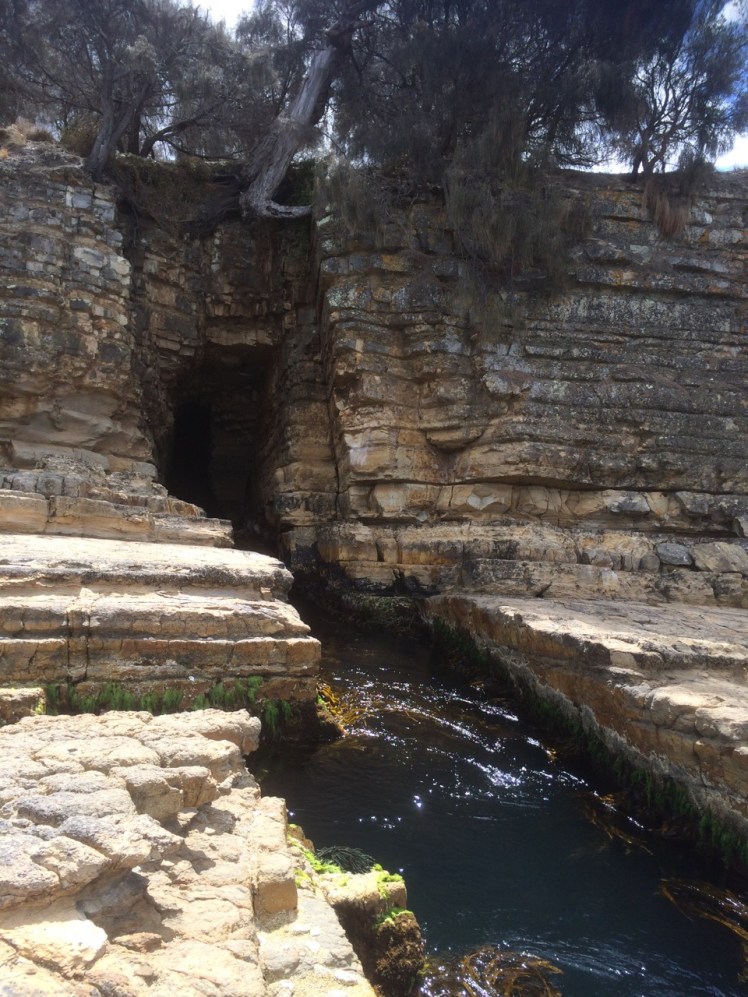
The other exquisite thing about the gulch was that it led into a small sedimentary sea cave. The rocks at its base and under the water had a shimmery pink glow. Right at the end of its deep resounding depths, small cobbles had been pushed up in a pile by the water, which was just deep enough to deter me and so I took a seat at the entrance of the cave and listened meditatively to what it had to say; and taped its voice.
The sea cave
I could have sat there all afternoon, listening to that gurgling water resonate in the cave but eventually I roused myself and walked back, climbing the cliff and finding that it ended up in someone’s garden. The man who had given me directions was now alone. We discovered we had mutual friends and I told him about the places I’d been and what I’d seen along the coastline and how puzzling the paucity of nomenclature was. We were standing on Mouheener land – they’d once enjoyed the bounty of the Derwent’s western shore, the Channel and Bruny Island. He thought the Aboriginal tribes probably named significant spots on the landscape for people in much the same we so frequently name them but I shared my different perspective, that places are named in accordance with long held myths, that the landscape is redolent with story but has lost its voice and then I walked back along the rocks, wishing I’d brought a plank with me.
The blue heeler was not asleep although his big mate was. We acknowledged each other and then I crossed the beach and walked westward, bound for North West Bay.
Swimmers told me the temperature was not too bad and in fact, that summer, the waters around Tasmania experienced heatstroke, their highest temperatures ever, the East Australian current extending further south than usual and bringing with it fish from warmer climes.
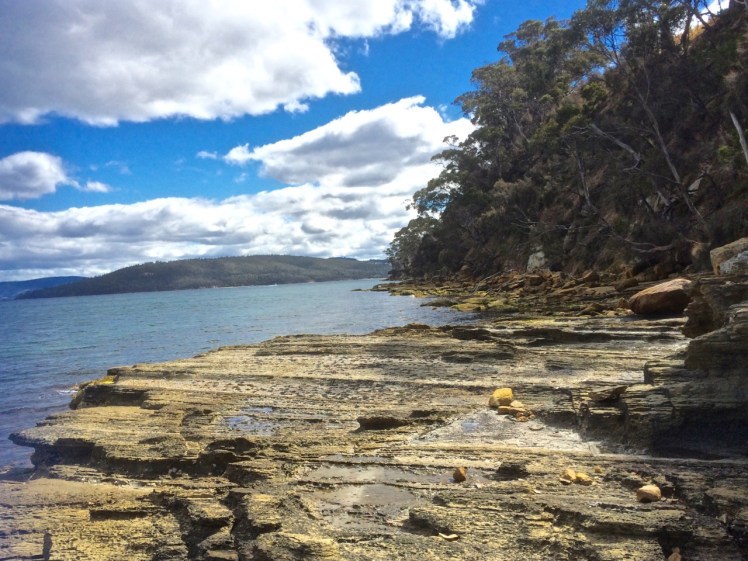
Rocky platform west of Tinderbox Beach. Looking into North West Bay (right)
I had the rocks to myself. The sandstone cliffs were photogenic. I was able to walk almost to the point where North West Bay begins – but not quite. Still, I was satisfied to have discovered that kayaking along here was likely to be rewarding, and so after studying the ripple marks of ancient beaches etched in the surface of ancient sandstone I followed the sea breeze back into Hobart, feeling exultant.
Historic photograph of this view is at https://stors.tas.gov.au/AUTAS001124067968w800 – View of Tinder Box Bay, the northern part of D’Entrecasteaux Channel Residence of Joshua Fergusson Esq. Walter Synnot.
The owl is calling in the garden. The river is quiet, the mountain is alive with night life of a different kind… the wallabies, bandicoots, sugar gliders, frogmouths and the moths. This is home but sometimes it’s nice to go away and expose yourself to the joys and sorrows of a greater world.
The Trans Siberian Express, and Then Some
I had thought that by focussing my attention on the local coastline I’d subdue the travel bug but that’s a hard call when someone you love wants you to visit them in London.
Of course you say yes.
But to tread more lightly on the earth we decided to take the train from Hong Kong to London – a cruise overland, country and cultures slowly revealing themselves. Sailors who have spent days at sea get this but most people I told were bemused. ‘That’s a long time on a train,’ they said.
In fact, the days flew.
I’d do it all over again in a heartbeat even though you see the damage as well as the beauty.
Silent Summer
Whenever he emerged from the vodka soaked conviviality he was enjoying with the Russians in the next compartment, the American would say, ‘Why has China got no bugs?’ And I would reply, ‘Why are we not seeing any birds?’
It seemed a silent summer.
Between Hong Kong and Beijing we saw a horse, a cow and a few tiny flocks of sheep but no birds. We saw new cities of derelict buildings and a countryside devoid of life. As we walked seven stages of the Great Wall one hot and humid afternoon we encountered two red bottomed bumble bees (name unknown) and although about half the bumble bee species known to the world occur in China, I see heaps more in my garden on any sunny summer’s day.
Siberia does have insects. We met our first big winged thing at the border. Siberia also has a multitude of mosquitoes, but across it’s whole extent we barely saw a bird, let alone a flock, despite passing wetlands, Lake Baikel and rivers.
‘There’s plenty of wildlife in Russia,’ said one of the Russians. ‘I’m going hunting as soon as I’ve unpacked my bags.’ And after giving the matter some more thought, he said the train probably scared the birds away.
Slicing through country in a train is no way to monitor wildlife but in trying to find out why the emptiness I found my concerns are shared by Pakistan – they’ve noticed a drop in migratory birds from Siberia.
Personally, I’m sad the birds were foraging elsewhere because Siberian birdlife is magnificent and migrating flocks, though smaller, are also apparently returning home earlier than usual each year.
We saw two storks in Poland, the odd bird in Germany and a small flock of waterfowl in Holland. In the UK the skies were busier but we were on foot and bicycles there and that might have been the difference.
Plastics Rule
Walking through history and past longboats along the lovely Regents Canal in London, birds were nesting amongst the plastic drifting on its surface (see below – that mound in the water is a nest).
We rode along the Thames to Greenwich, looking at the little beaches where in the nineteenth century mudlarks (the human variety) searched for pickings. A small yacht negotiating the lock from the Thames into the Limehouse Marina was surrounded by plastic litter, a bit like that nest.
No Tasmanian Coastline, This
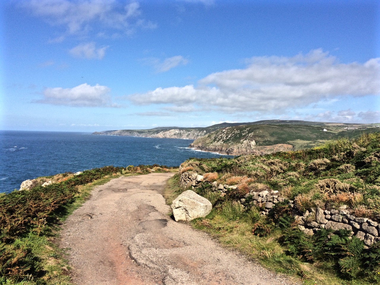
We cycled from St Michael’s Mount to Mousehole in Cornwall and walked from St Ives to Zennor.
It was summer; it was magical. The weather was warm, the leaves full of sap, the wild flowers in blossom and the breeze was fragrant.
It was tough returning to winter.
Storms had pummelled the island while we were away. The Hobart Rivulet, imprisoned beneath the city streets had flooded and damaged buildings. It had been an expensive and inconvenient pest, apparently, but I felt empathy for its bid for freedom.
It just wanted to do what rivers do best: shape and nourish landscapes.
And me: I’m just dancing in the rain because hey, it’s still a vibrant, abundant world with far more joys than sorrows, and there’s an owl calling in the garden.
It’s a little known fact but upstream of Dennes Point, just across the water from Pierson’s Point, there’s a shark refuge and the men in grey suits and the freezing water in which they undertake business were on my mind as I climbed into my kayak to paddle the Tinderbox coastline. I would have liked company but I had no takers and so I’d decided to go alone.
On a fine day.
With the water like a mirror.
And on a low tide.
‘We’ve kayaked it before,’ the geo had said. ‘You don’t need to do it again.’
I could not remember kayaking the whole length of Tinderbox, and if we had done so it was back when I thought of Tinderbox as one long stretch of formidable coastline with no discerning features other than cliff face and rocks. Now I knew better and had reached the conclusion that the best way to get to know the peninsula was by kayak, right up close to the rocks, in part because I didn’t want to be that kayaker who made the headlines through being snaffled in the Derwent. After all, Hobart is full of sea kayakers who paddle this stretch and think nothing of it.
But I wasn’t one of them. I simply had a little goal to achieve and a mystery to solve: where was the door to the underground tunnel behind the cliffs?
‘Sailing is all about anticipation,’ my friend M, used to remind me and it’s perhaps more so with kayaking. I checked the Bureau of Meteorology site and chose my day – swell beneath 0.5 m and north westerly winds below 10 knots turning variable later in the day. It sounded perfect.
A small wave splashed over my map as the geo pushed me off and even before I’d made it out to Flowerpot Point, kayaking through the moored yachts in the southern corner of Blackmans Bay, I could tell the river was intent on being a trickster. Because the water was in fact lumpy, and so another fear assailed me. If I fell out, it would be mere moments before I died of the cold and much as I love the river I did not want its bed to be my last one. As I rounded Flowerpot Point I felt threatened by swell coming at me from all directions, no doubt lingering from previous bad weather. The surf breaking on Soldier’s Rocks a couple of hundred metres away looked downright intimidating.
I stopped. ‘Too rough… poor visibility,’ I advised myself and I wobbled into the little cobbled bay (T468) that I thought I had befriended on one of my earlier walks only to find it fractious and lumpy, the water disconcertingly black. I began to reach for my mobile (geo, come back!) but I didn’t feel steady enough to use it.
‘You miserable little coward,’ admonished the chorus in my head. I could already see Passage Point and North Bruny Island and they didn’t actually look that far away. We’d figured it would take me three hours (based on my dawdling on previous paddles) and certainly sailing along here sometimes takes a goodly length of time. And so I pointed my kayak south again, put my head down and paddled briskly towards my first waypoint, Soldiers Rocks, adrenalin ratcheting up my heartbeats. My seat wasn’t properly adjusted; my legs were already going numb. This was affecting my balance. No ways was I going to reach for my camera.
I burned passed Soldiers Rocks, keeping a distance between us because of the toothy break and reflective swell, and my compromised ability to use the pedals I could no longer feel. The Lucas Point Sewage Plant now seemed more friend than foe. I could see how in this little bay the beaches from the water seemed a single beach rather than two or three, but I was not game to reach for my iPhone.
There was no going back now.
Because of the slop I couldn’t get near the shoreline and so I had to put a big fat cross through the image I’d had of myself, drifting along a feet or two from the cliffs, trailing my hand along rocks from time to time (hello, rocks! hey, sea anemone!) imprinting the geography in my head, scrutinising the cliffs for the hidden doorway.
My next waypoint was Fossil Cove and I could see the arch ahead of me. The geo and the dogs were going to walk through it to the part of the beach on the northern side and I’d said I might see them here but little did I know, they were way behind me. (And little did they know I was ahead. They waited here a long, long time.) Ahead, closer to the eastern shore, was a ship at anchor. There is often a ship at anchor, presumably waiting to proceed upriver but they are like ghost ships. Sailing past, you never see crew. Back when Sandy Bay was barely populated, the ships at anchor often had clandestine grog on board that was collected by smugglers under cover of darkness.
A smaller ship came around the Bruny Island coastline and headed down the D’Entrecasteaux just as a boat came roaring out of it, headed my way. Fishers, I thought, but no. They began to reverse their boat into an extremely narrow gulch on the southern side of Fossil Cove. Neat! And what a clue! They’d been invited to lunch!
To keep my mind off sharks I contemplated the cliff top with its magnificent view, far more alluring IMHO, than an underground dining room but I guess diversity is the spice of life.
Lucas Point came and went. Before I knew it I was past Passage Point where, in the wind shadow, the water lay down. The tide was more resistant here but I was quickly through the gap between Dennes Point on North Bruny and Piersons Point on the Tasmanian mainland and in the channel flat water with a quiet lattice of ripples welcomed me. Beneath me, arrow squid, australian salmon, barracuda, pike, flathead, whiting and silver trivially glided, but I was unaware of them. Beneath the cliffs a seal lolled in the water, one flipper up. I paddled past the two little cobbled beaches, the tiny gulches and the sea cave and made it on to the beach before the geo and dogs arrived to give me a lift home. I hadn’t managed to explore the beaches but, chased ever onwards by imaginary sharks snapping at my stern, I did do this leg in 1 hour flat!
Cobbled beach, Pierson’s Point and quieter water
Cliffs at the start of the D’Entrecasteaux Channel
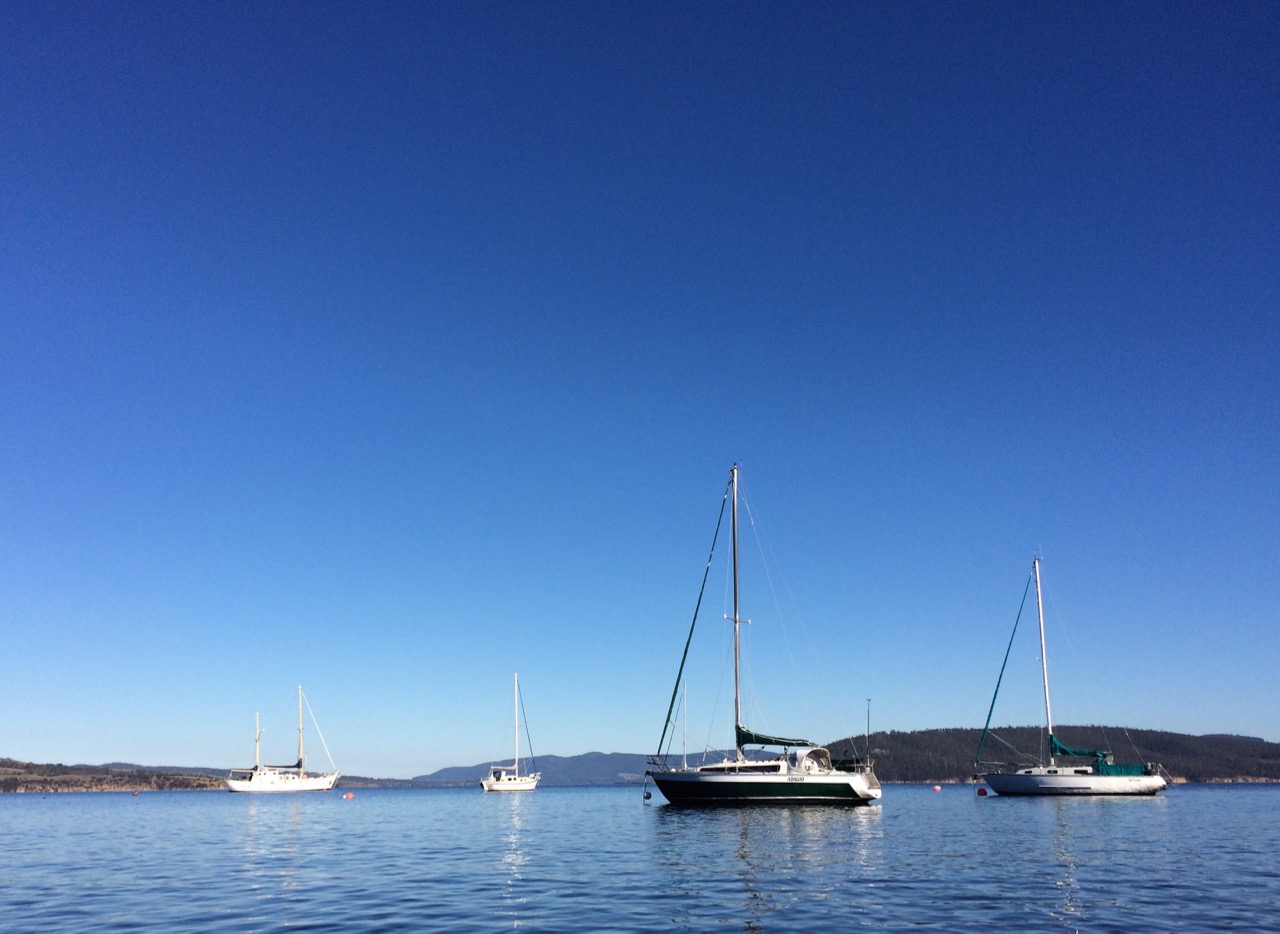
Moorings off Tinderbox Beach. Bruny Island (left).
With a Dark and Stormy in one Hand and a Pencil in the Other
PASSAGE POINT
Passage Point is a notable promontary at the mouth of the Derwent Estuary and is both lovely from the water and green and pleasant from the road – a rolling hillside, a rustic shed, an abrupt cliff line carved by the waters of the Derwent, the D’Entrecasteaux and Storm Bay.
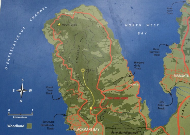
Map from the Kingborough Council Signage at the start of the Tinderbox Hills track: nomenclature is thinly used. Passage Point, Piersons Point and Tinderbox Beach, all important landmarks, are not noted. (Passage Point is to the left of Mount Louis.)
Having finally decided that ‘not the real Fishermans Haul’ was in fact the real Fishermans Haul (see last blog post), we went to Passage Point to see if there was some way we could access the little cobbled beach I’d noticed. There wasn’t. We had to make do with expansive views but as these were superlative and so vast in scope we could hardly complain. Mount Louis, Tinderbox’s highest point and forested in eucalypts rose behind us.
Birngana off Passage Point
My guess on how Passage Point got its name was all tied up with waypoints, landmarks and the ocean because if you’re heading off in your yacht on a trip of any distance, it pays to sit down and plan your passage. With a ‘dark and stormy’* in one hand, and a pencil in the other, take a careful note of the tides, currents and potential hazards. Become familiar with the landmarks you’ll pass, navigational signs you’ll encounter, channels or reefs you may need to negotiate and choose your waypoints. Make Meteye your new best friend and despite being in love with your chartplotter, tuck the paper version into your nav table too because it’s less likely to let you down. Departing the Derwent at this point to head out across Storm Bay is always a bit of a passage into the unknown because the bay is notorious for conjuring tempests up out of the most benign conditions.
Because this familiar promontary is just there where the waters of Storm Bay, the Derwent and the D’Entrecasteaux merge, it’s symbolic of passages about to begin and passages almost completed. So it goes without saying that this is how it got its name, right?
Wrong.
I checked Placenames Tasmania and found some unverified information. A boat called the Fancy was one of ‘the few remaining trading boats called passage boats.’ Back in slower more leisurely days these boats used to ply the Derwent and the Channel. In doing so, they had to round Passage Point and in so doing, they gave the point its name.
This information in the database comes from a boating article in the Saturday Mercury, Jan 2002 where it’s also noted that ‘most features on coasts were named by mariners and seeking reasons for names means looking at it [sic] from a mariner’s point of view. Thus Passage Point was a marker for south-bound boats of the entrance of ‘the passage’ or the Channel.’
Exploring the sweep of shoreline from Sandy Bay to Tinderbox had triggered my curiosity about the way places were named but I had not considered that mariners had a big hand in the names of the places I was exploring. This was an unforgiveable oversight because it’s obvious that many major features first got their names from the early voyages of discovery. My impression of the western shoreline of the Derwent was that places were usually named after the early landowner’s or overlooked in the naming process altogether but I could see that in a tiny colony at the end of the world there’d be a sense of familiarity and homeliness for locals who plied these waterways in naming the places they were passing by the names of the people they knew. On dark and stormy nights in particular, the ability to recognise familiar landmarks and tick off waypoints is comforting and engenders hope when you’re toughing out rugged conditions.
We paused here to savour the view. Passage Point felt extremely evocative for me: I had walked out one wintery morning and followed the Sandy Bay Rivulet down to its mouth. I had turned right and wandered the shoreline from there to here, a distance of some 35 kilometres, give or take a few and although I had done this as an urban explorer, little bit by little bit, it had been fun, it had changed the way I related to the coast as well as dramatically expanding my knowledge of the city I live in.
Beaches T 471 (Fisherman’s Haul) & T472 Fisherman’s Haul South
Having scrutinised more maps I began to doubt that the Lucas Point Sewage Plant was actually at Lucas Point. It’s the landmark that helps identify Fisherman’s Haul and as conversations with locals had helped me fix it in my mind that it lay just south of Flowerpot Hill I started to think that the problem was one of language – ‘just’ is a stretchy kind of word for a start, and may not have been used by anyone I’d spoken to. It may simply have been a supposition I’d made from what had been said to me.
Our modus operandi was to drive along the Tinderbox road slowly (not difficult – there were quite a few cyclists out and about) and check for detours down the slope. The geo noticed a sizeable piece of green land with car tracks on it, somewhat sheltered from the road by a partial row of caesurinas. We did a u-turn and went back to investigate.
Close by a man was burning off. He ambled over to talk to me and I asked him if this was Lucas Point.
‘Some people think it is, but it isn’t really.’
‘Is it back where the sewerage plant is?’
‘Nope. Some people think that’s Lucas Point too, but it isn’t really.’
‘So where is the real Lucas Point?’
He pointed vaguely over his shoulder. ‘Back there a bit.’
‘Okay… And so I’m wondering, if Lucas Point is back there, then is this Fishermans Haul?’
‘Some people say it is but it isn’t really the real Fishermans Haul.’
‘Is there a beach down there?’
‘Nope.’
‘Is there a path down?’
‘Maybe. You should be okay if you’ve got your balancing shoes on.’
‘Well, thanks, I might go and explore.’
The geo was down at the bottom of the slope reading a sign. It stated ‘Lucas Point’. A thin band of caesurinas lined the vertical cliff top so we put the dogs on leads and slithered down a very steep path of sorts beside a short deep gully carved by another youthful rivulet, at that time dwelling soley in a few remnant pools. An old rusty cable lay beside the track but we couldn’t identify a use for it unless haulage came into it. It didn’t take at all long before we came to the end of the path. It stopped for me at a rather cracked and fragile looking rock arch left over from a previous coastline. It might have been fine to walk over it onto the high rocky platform but I didn’t like the look of the cracks in the unconsolidated cliff face to which it was attached. The geo and the dogs stopped a bit further back because it really wasn’t a place for the dogs to be at all – it was all rather precipitous.
The rocks at the real Lucas Point; climbers’ secret
It goes without saying that the long views were superlative. Down this end of the river we were getting closer views of the Iron Pot, the lighthouse at the entry to the Derwent River and in the southern curve of Lucas Point (the cliff I was presumably standing on) was a very beautiful and quiet cobbled beach and just to the north of where I was standing was another cobbled beach. Looking directly south at the cliffs that work around to Passage Point I saw a third. And looking directly down was a tiny narrow gulch.
Fisherman’s HaulLooking south from Lucas Point, the beach below Passage Point just visible.
Andrew Short notes a Fishermans Haul (S) and a Fishermans Haul. Here’s his description of Fisherman’s Haul:
‘Fishermans Haul is a small curving cobble beach (T 471) located to the lee of 40 m high Lucas Point. Steep vegetated bluffs rise to 50 m behind the small beach, which is partly sheltered by the point and rock reefs resulting in low waves at the shore. The road runs along the top of the bluff 100 m west of the beach with access via a steep descent. ‘(Short, 2006)
And here’s his description of Fishermans Haul South:
‘Beach T 472 commences 100 m south of the Haul, and is a 200 m long east- to northeast-facing narrow high tide cobble beach located at the base of 50 m high cliffs, with a steep gully descending to the centre of the beach.’ (Short, 2006)
New discoveries! Seen so often from the water but not really properly seen at all. I was happy to believe the sign and this time, added to the slippery geography I’ve been doing battle with, was that local’s wicked sense of humour and the entertainment he got from causing confusion.
This coastline may seem impossible to access on foot but later I discovered that it’s loved for being a climbing area rich in deepwater solos, that method of climbing that evolved in SW England.Nick Hancock makes it clear that for this you need a kayak you can tie up while you climb up dolerite boulders or columns at this point and you need to be confident that the water is deep and safe enough to splash down into. Don’t even think about trying this unless you have plenty of experience, not just about deepwater solos but weather conditions and the sea state too because Tinderbox is unforgiving. And if you think the name makes it promising for fishing, pack your tackle and take your rod further afield. Too many fish have been hauled and this area is now protected within the bounds of the Tinderbox Marine Reserve – no fishing allowed.
View across the river to South Arm from the real Lucas Point. The Iron Pot is that tiny dot to the right.
When it came to Tinderbox, it was deja vu. Like Sandy Bay and Taroona, when I scrutinised the maps and the nautical chart we keep aboard Samos I couldn’t quite place where I’d been. This was the downside, yet again, of exploring spontaneously then trying to superimpose where I’d been over paper. For example, if you have a sewage plant called the Lucas Point Sewage Plant then logically it’s at the spot named Lucas Point on the map.
Or is it?
When I looked at the map something still seemed awry.
Fossil Cove was a cinch though. The geo knew it well but I had never been there. And so, after a morning spent on boat maintenance we decided to see if it was dog friendly, and it was.
It’s a short walk from the bottom of a cul de sac at the top of the cliffs but it makes you work for your rewards. We stepped into a beautiful dry sclerophyll forest (white gums on starved soil) with epacris impressa in tiny pink blossom down near our ankles. Our dogs were in high spirits, intoxicated by a vibrant palette of smells, but taking dogs down the long steep steps and declines on a lead was tricky – it’s uncomfortable being dragged. The trail makes use of the gorge carved out by the little rivulet which was was hidden beneath dead blackberries, only shyly flashing a small pool every now and then. There are ferns and other water loving species with wet roots and an umbrella of shady foliage (eucalyptus regnans, I think) overhead.
Small rivulet crafts a beautiful thing
And then I emerged with a sense of astonishment into a beautiful pebbled cove, all sedimentary pinks and ochres with intrusions of darker dolerite, and allowed myself to indulge in a sense of wonderment at the very big – the beautiful sea arch you can walk through on to another strip of beach at low tide (only there was water swirling through when we were there) and then the vastness wrapped up in the very small.
The arch at Fossil Cove with Soldiers Rocks visible to the north
Here’s some advice: come on a low tide with a magnifying glass in your pocket. An unrushed state of mind is imperative. Within moments you’ll find hours, minutes and seconds evaporate and that timeless feeling that’s such a quality of scuba diving expands about you. Beneath your feet and in touch with your hand, you’re part of the Permian and that’s when this area was a cold and shallow sea and icebergs and glaciers abounded.
Parents with small children obsessed with dinosaurs – this may be nirvana! I found no dinosaurs but the cove is dense with fossils and once everyone is through with imagining past environments draw their attention to the fresh piece of plumber’s downpipe just visible in a small space behind the cliff’s facade. How did it get there and what is it for? It’s lodged in tight. It can’t be moved. If looks like it has been bored down from the top to provide a wastewater outlet and it could not be more incongruous or jarring. It must surely contravene the local planning scheme because this is a site of geological significance.
Apart from that niggle – or maybe because of it – it’s the sort of cove that would have had Enid Blyton reaching for her pen, or Mr Garth and his cronies scheming and because it feels so very secret it was a surprise when a couple arrived and set a camera up on a tripod. We got talking. He said he came here frequently, especially early in the morning, obsessed with trying to capture the spirit of the cove through images.
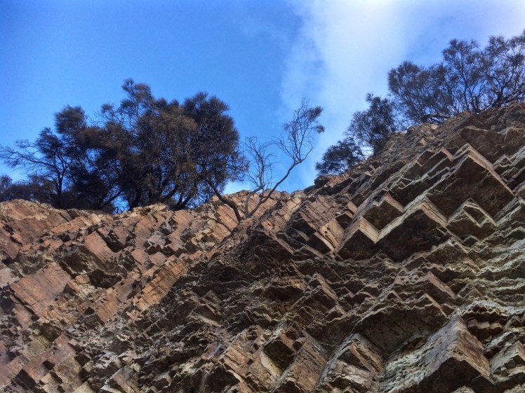
We stood a while longer on the raised bed of cobbles (how deep is it, I wondered) looking through the arch up the coastline to Blackmans Bay and beyond, and also out across to the Iron Pot harbour light and the ship anchored over near the eastern shore. It is all about the rock here, I thought, the fossils, the many coloured pebbles and the beautiful layers of tilted stratigraphy with an intrusion running through it, and the square jointing, some broken up, perhaps by brittleness in the rock. I could not stop looking. I could not stop wondering. I could not stop taking photographs.
The wave cut platforms and the water swirling and sweeping over the kelp and the reef offshore, clear and as intoxicating as gin, are just as compelling. They’re tessellated and layered and as information stacked as the pages of a book. It’s the same when you look up.
Looking up through the eons at Fossil Cove
As we left I paused to acknowledge the rivulet, locked from the sea by the pebbles at its mouth. It has not reached beyond youth; it has no flood plain but its story is surely wrapped up with the Derwent – not just a drowned river valley but a rift valley too, many of these small rivulets in their steep gorges evidence of the ripping that happens as a rift widens in the earth’s skin and the western and the eastern shores of the river move further apart… and also the way water likes to inhabit the depths and seeks out soft spots in which to make its bed as it pursues its descent.
Beneath the Lucas Point Sewage Plant there’s a bay and in that bay there’s a thin cobbled beach divided by boulders from another stretch of tide constricted beach. (Possibly Andrew Short’s beaches T469 & T470, but I could well be wrong.)
We’d started the day with brunch at MONA, Hobart’s incredible Museum of Old and New Art, way upriver and I only mention this because I’d spent an inordinately long time at the Marina Abramovic exhibition, engrossed in watching her meditatively regard a donkey and the donkey’s long considered response to her. The immaculate stillness of it all; the way the observer is absorbed into the dynamic of the interaction and how, in paying attention, new details about the donkey, or Marina, or even the pared down environment emerge into focus long after you think you’ve observed everything there is to see alerts you to the fact that perception is fickle and attention is a skill that needs honing.
It made me wonder how long I should spend regarding a beach and how you express gratitude to such a multi-diminsional part of this planet.
Later we packed a rucksack and headed down to the Tinderbox Peninsula. The off the leash exercise area behind the Lucas Point Sewage station was vibrant with canine energy but we detoured up Flowerpot Hill’s southern slope. A blue sky, and a light sea breeze …we reached the place I’d stopped before and paused to consider the various blossoms in flower along the edge of the cliff line.
This beautiful eucalyptus is not indigenous to this area.
I quizzed each local I met about beaches. I was particularly after information about a beach called Fisherman’s Haul but no one could enlighten me.
We snooped around the sewage plant and debated taking a tangled path then elected instead to descend to the shore via another steep path that followed the edge of the short deep gorge carved by the rivulet that inhabits this valley. There’s no sign to identify it but it reaches the Derwent via a cobbled beach and there, that day, it stopped behind the pebbles heaped up on the steeply sloping little beach that was being pounded by business minded waves. Occasionally we’d hear the sound of those cobbles making music as the waves retreated.
The tide was high and I had to calculate the time between waves in order to reach a spot at the northern end from where I could peer over boulders into the Lucas Point Sewage Plant’s beach (if indeed it really was a separate beach).
Lucas Point Sewage Plant’s beach just north of the Flowerpot Coastal Reserve beach.
The tide had left only one small, dry patch at the southern end and so I didn’t think it was wise to gamble with the waves. There was graffiti on its cliffs and above that I could see the sewage plant. Both detracted from its original beauty, one of austere rock and wild water. I could see Soldiers Rocks and just this side of them a lone man fishing. It seemed somewhat too close to the sewage plant to be a palatable past time.
Meanwhile, the geo had brewed the tea given to us by a friend who’d departed in his yacht to sail home to NZ. We sat back and contemplated the beach and the little rivulet, the cliffs to our south and the kayaker who surfed one of the breaking waves before heading on north with no break to his momentum.
Lone kayaking along a rugged shore ~ Soldiers Rocks in the distance
In that beautiful setting the tea tasted divine and lent a meditative quality to the attention I was lavishing on the shoreline. Then I performed a tea ceremony to honour the beach. A little liquid connection. A means of feeling my way towards how one says thank you to a beach for its existence.
Gratitude to all things beach and water
Afterwards I walked the small bushland path beyond the dog exercise ground by myself, wondering where it would take me. Like a lot of my coastal explorations, I ended up walking a circle. What beach we’d found I did not know but I did find out it wasn’t Fishermans Haul – the map said no. So for want of knowing the local name, I’m calling it Flowerpot Coastal Reserve beach and if you’re idling in this area it’s worth seeking it out. Because it exists, and it’s hidden away, and it’s very Tinderbox.
Leaning into the Vertical along the Tinderbox Shoreline
This Tinderbox shoreline is another where the cartographers have pretty much mooched on by, leaving others to fill in the blanks. But it would seem that many locals, spending their time on the clifftops only, are ignorant of the particular beauty of zawns and arête, cobbled beaches, sea caves and the communities living below the water.
Down on the reefs it’s a multicultural world. There are green and snakeskin chitons, common beaked and flea mussels, tall-ribbed and scaly limpets, chequered, ribbed and tessellated top-shells, common shelf-limpets, banded austral winks, lined whelks and common cartrut-shells… and there are the refugees that jumped ship and found a rock to cling to, escaping the polluted bilge water of their vessel of choice – the mediterranean mussel and pacific oyster may have arrived this way. (Grove, de Little).
These fantastical names and molluscs could arguably be equaled by the climbers who have transported a love of a particular sort of coastal climbing (deep water soloing) from the Cornwall and Devon coastlines to Tasmania and who have applied colourful names to the vertical routes that they alone can see and cling to. Pinnacle zawn has climbs called Fatman’s Splash and Fatboy’s Swim, Walking on Sunshine and Danni’s Pants. Climbers’ fingers and toes have found cracks in the chimneys and buttresses, they know the arête and sea caves and they’ve swum or kayaked across gulches to reach their next challenge.
Lacking this intimate geography of place, no boulders known to me, I checked my chart, I peered at my maps, took a spin on Google Earth, then set off in search of hidden beaches. Top of my list was Fishermans Haul or Fisho’s and I thought I knew exactly where I could find it.


")


")