Derwent River: Long Beach (aka Sandy Bay Beach)

From Summer Camp to Solstice Swim

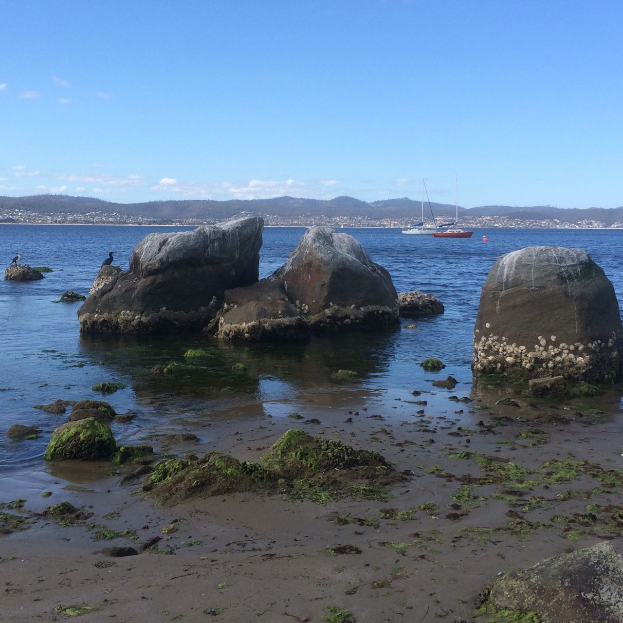
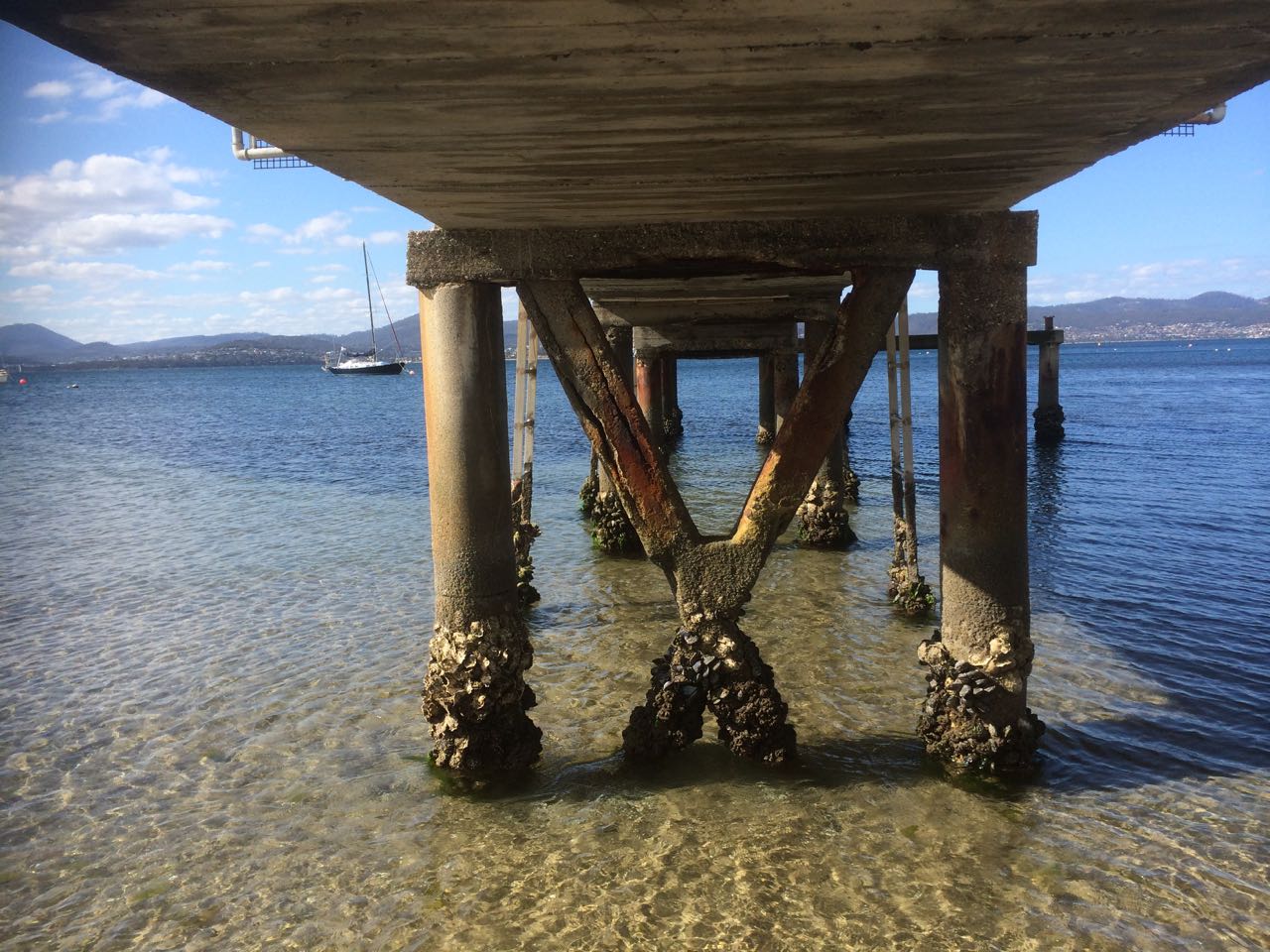
Long Beach: the view from the south

I was puzzled why anyone bothered with this popular beach when I first visited it one hot summer’s day during my first year in Hobart.  There were a lot of uncertain people sitting in their bathers on the sea wall but swimming wasn’t an attractive proposition because the water came all the way up to the steps and slapped against the concrete in a discontented manner.  I sympathise with the river now.  It was trying to build a beach and this seawall, built without understanding, impeded it.

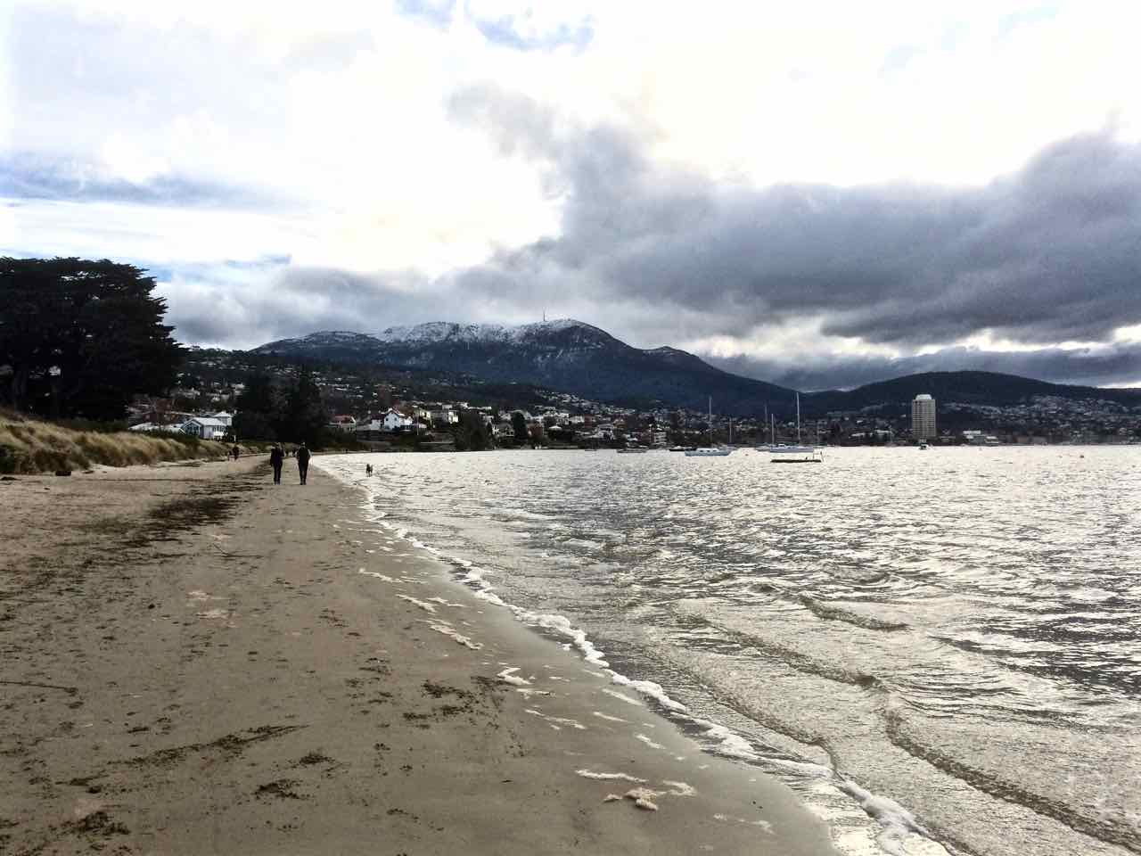
Yet this has always been a popular beach, even when, in the 1980s, it was barely there at all.  An artificial dune was cultivated in the corner bound unnaturally with marram grass. This once magnificent beach had become a desultory shadow of its previous self and I think that those who still came here were in love with a memory.  (It’s still a lovely spot when the sun is shining on it but it was overcast yesterday when I returned to take some more photos, earlier ones being lost in the uncatalogued innards of iPhoto.)

Long Beach from northern end

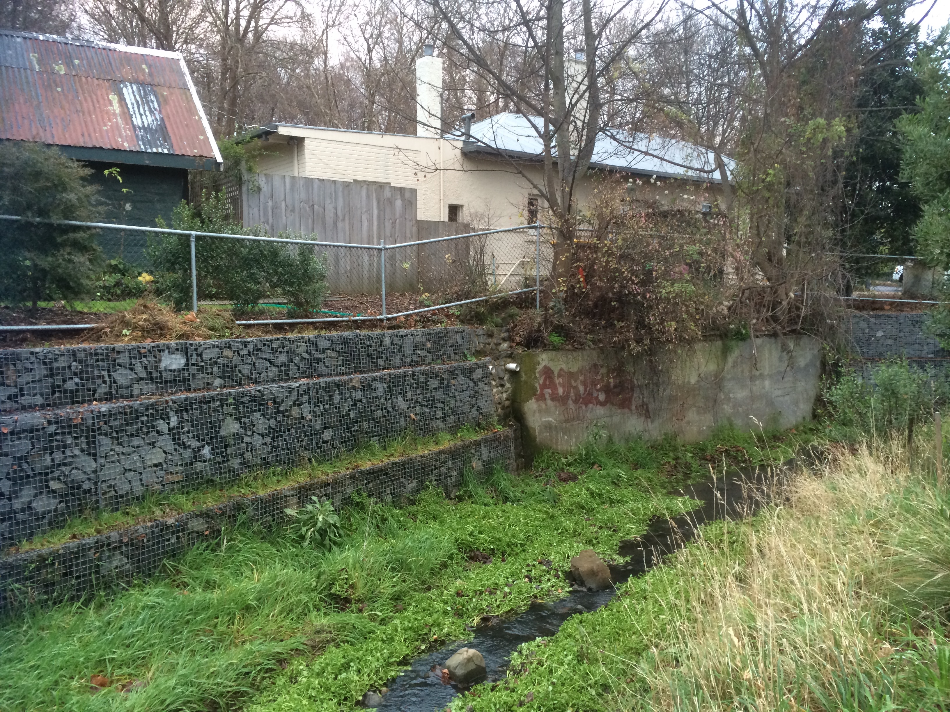
Before the convict ships arrived to set up camp Long Beach was called Kreewer and the Mouheenener had a summer camp in this sheltered spot.  In those days the beach was wide and backed by small dunes.  Picture a bark kayak, exquisitely woven dilly bags full of the jewels of the sea, children playing on the sand.  The land was flat and shaded behind the beach, a great spot for huts as well as some easy hunting, and there was a handy stream.

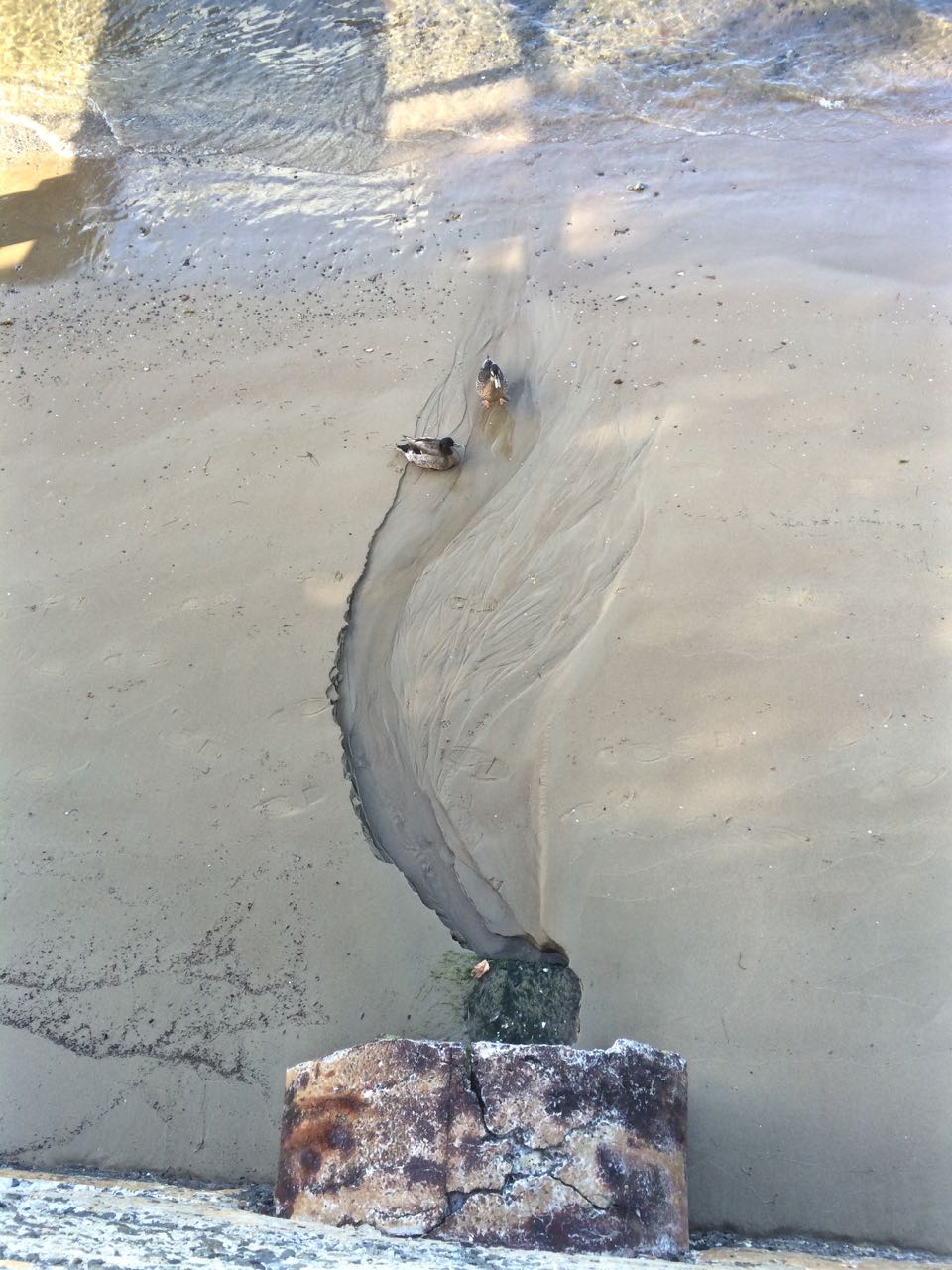
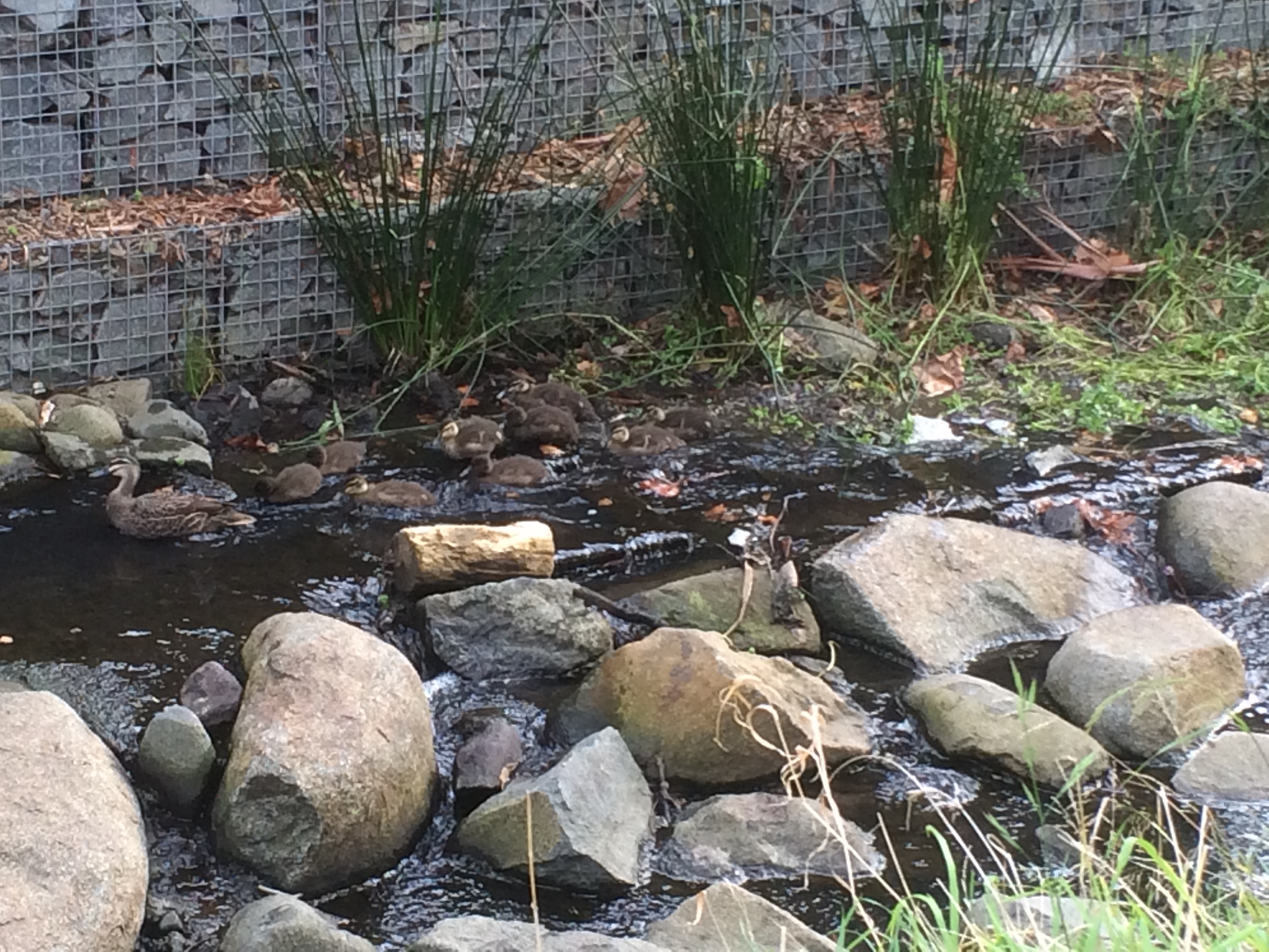
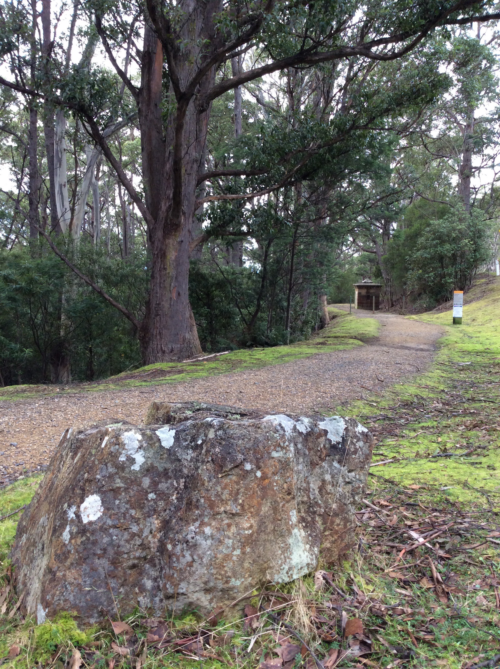
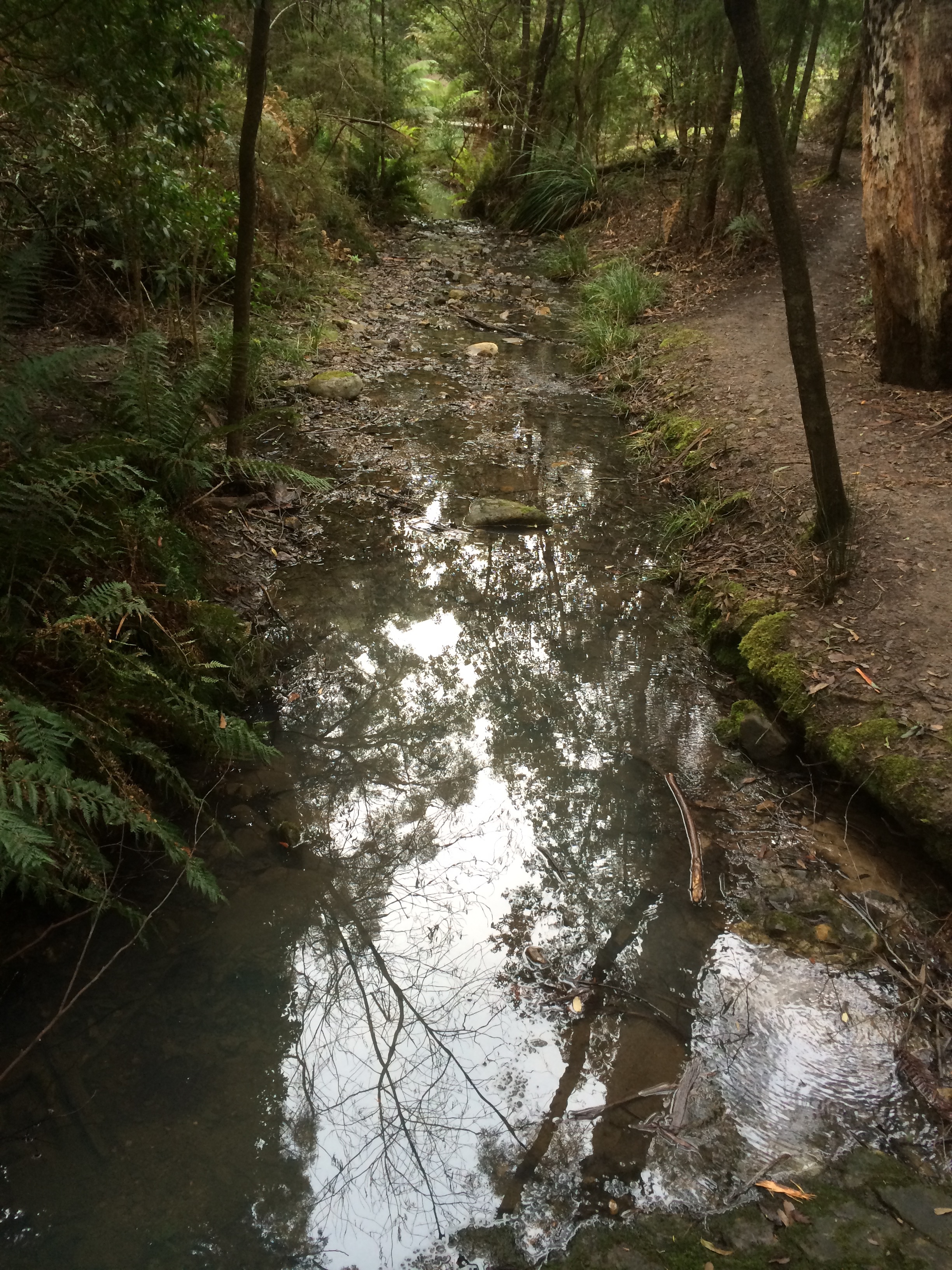
Although the rivulets that flow sporadically down the slopes of Mount Nelson are not well known, Wayne Rivulet has a slightly higher profile because it still enjoys daylight along some of its course, beautifying the grounds of Fahan School before entering the river at Long Beach / Little Sandy Bay.  It brings with it eroded dolerite from the heights, creating a delta of clay  over which the once dense sand of the beach now sits as a thin sheen.

Having already succumbed to epidemics, the distress and fear that took hold at Kreewer is outside the comprehension of anyone who hasn’t faced the end of their world and all  they hold sacred.  The forests they tended, the trees that were their totems, were knocked down to make way for an alien landscape of farmland, divided up between fences that ran all the way down into the river.   The Mouheenener, in a state of deep existential crisis, retreated and the beach became a popular destination for Hobartians in their strange clothing, who no doubt moved stiffly in the landscape not seeing the visual detail, not taking direction from the fragrance of the bush or hearing in the calls of birds the rhythm and events of the day.   Shooting expeditions from town, well recorded by the Rev Robert Knopwood, had rendered the emu extinct and chased the frightened animals that still survived further away from European settlements.  At that point the odd little handfish that moves about on its fins and inhabits the lower bays of the Derwent, still enjoyed an easy life in this beautiful bay.

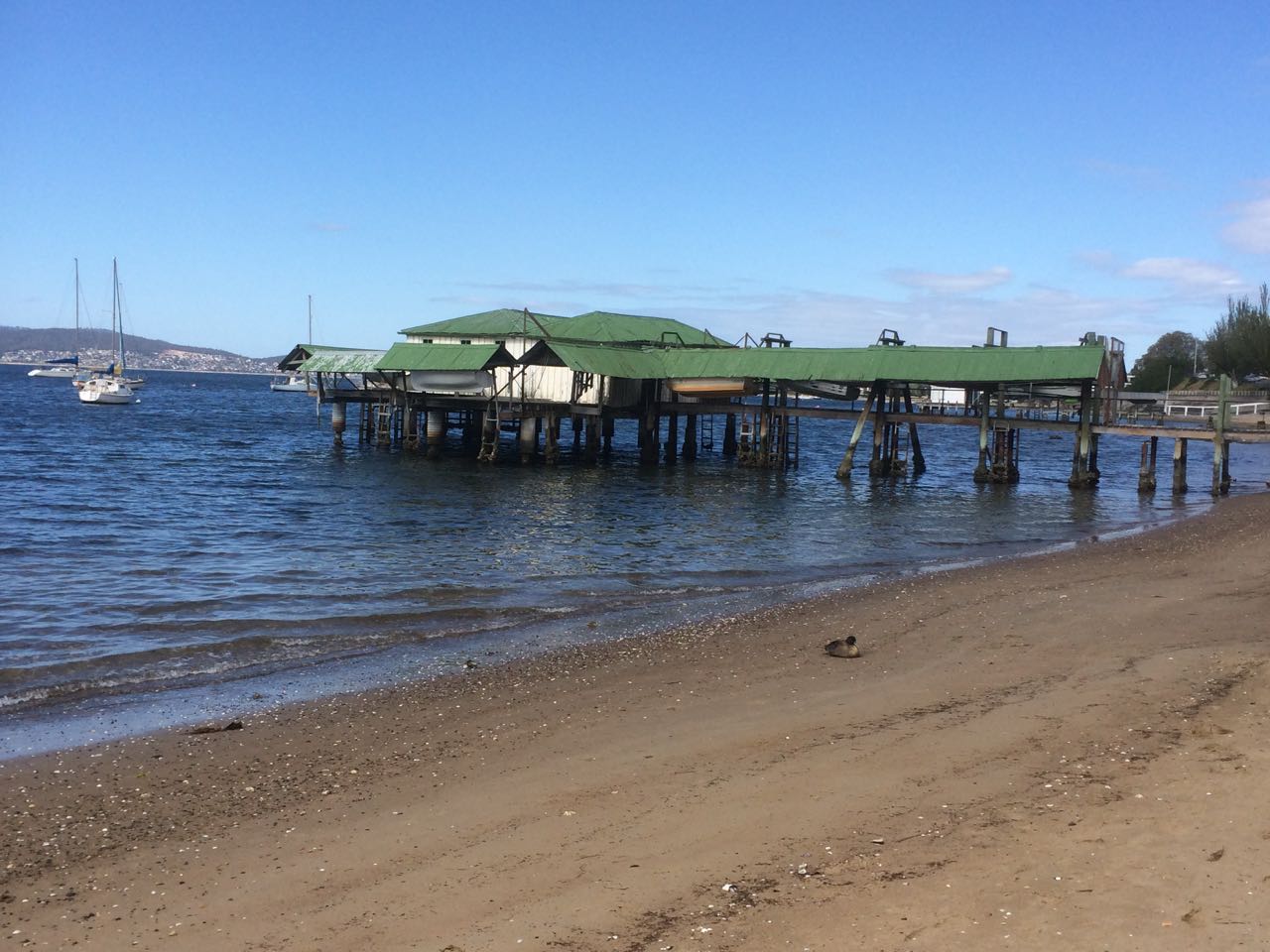
The beach was so accommodatingly wide and so beautiful (see links to early photos below), that it served as a place to promenade, socialise and relax, and to enjoy the regatta that finally found a home here, or the start of a horse race.  Enjoyment was yet again marred by disputes over right of way to the beach that reached a climax around 1910.  There were petitions.  There were meetings.  The government was persuaded, buying up  land to create the park, and a long jetty was built on the beach so that people could arrive by boat as the Tramway Company wouldn’t extend the line along Sandy Bay Road.

Francis Cotton, in 1880, noticed that the sea level was rising on Long Beach.  He asserted it was the building works happening at Sullivans Cove and Norfolk Island settlers, including Maning and Fisher, considered that the sea had risen by about 50 feet in less than three decades.

There’s a more recent, curved seawall now, over which, in great storms, the sea breaks and which causes a significant wave to reflect back off it during high tides but there is a bit more beach than there used to be in the days of the old sea wall.  This area is often a gourmet adventure because there are cafes, making it, in summer, a great place for an evening pizza or a day time coffee, or a place to come on a Friday evening to enjoy the summer market.  From here you can walk north around Sandy Bay Point or south around Blinking Billy Point, the two sentinels of Little Sandy Bay and while the water in the bay is usually calm (unless the sea breeze is filling in from the south east), out beyond these two points gales frequently whip up raging white caps.

Sundown Park behind the beach was  described in the 1800s as ‘the Hyde Park of Hobart’ and it’s occasionally vivid with small flashes of colour when eastern rosellas and swift parrots  swoop between trees.  There’s a  crocquet club and a petanque piste, a playground and the playing fields.  There’s a platform just offshore that swimmers can lay claim to and that is alternatively occupied by cormorants drying their wings. Kayakers launch from here and seek refuge as well when conditions on the river turn wild.

Playground
Playground

In the heart of winter, when snow lay deep on the mountain’s summit and gardens were white with frost, the most adventurous Hobartians rose from their beds in the black pre-dawn and found their way down to Long Beach for the Dark Mofo Festival Solstice Swim.  They took off all their clothes and plunged en masse into the freezing water of the Derwent just on sunrise.

I’m sure it took their breath away.

When I arrived at the beach a good two hours after this, apart from footprints in the sand, there were no clues that this midwinter event had taken place.

I looked.  I contemplated.  I imagined the Mouheenener regarding this activity  from the ghostly forest and the sharp gasp of the Rev Knopwood.  Then I went home to a hot coffee and a warm bowl of porridge.  The frost still lingered but my kitchen was snug with the wood fire roaring.

Other people’s photographs:

Large wave striking the seawall (Sept 2009) Long Beach | Large wave, Long Beach

Historical

The closest to its natural state (post 1870)

The esplanade taking shape

Regatta at Long Beach & another (some time after 1921)

Showing the old sea wall

Before the sea wall  |  Taken from Sandy Bay Road

Jetty and sea wall, Long Beach

Sculpture, Long Beach
Blue gum tree - favourite hang out of the swift parrots
Blue gum tree – favourite hang out of the swift parrots
Beneath the blue gum tree

Further information:

Goc, N. 1997. Sandy Bay: a social history. Gentrx Publishing, Hobart

Leaman, D. 1999. Walk into history in Southern Tasmania.  Lehman Geophysics, Hobart

Derwent River: Maning Reef: A Beach Where the Rocks Used to Be

Unveiled beaches and doppelgängers

Saluting the Governor

The sailing season officially opened last Saturday, the 10th October and Hobart’s recreational sailing fleet turned out in good numbers for the annual sail by  the Governor’s vessel Egeria, moored in Sullivan’s Cove.  Some boats adorned themselves in nautical finery.  We forgot to take off our fenders but by the time we realised this we were relaxing at the rendevouz off Nutgrove Beach and having imbibed a wine or two were feeling too mellow to care that we had not kept up appearances.

The geologist and I had invited three friends along, one an able seaman of the four legged variety, our sole adornment in his coat of yellow.  The sky was blue, the sun shone and there was a breeze strong enough to fill sails.  As this was the first time I was skippering on an opening day we stayed on the edge of the fleet, detouring under the bridge, confusing ourselves over the instructions until order was established in the fleet. We snuck in towards the rear, trying our best to keep ahead of the  Beneteau and MONA cat bearing down on us as we headed into the tight conditions in Sullivans Cove, more alarming last year on a larger boat.

IMG_5795

We dropped our anchor at the back of the fleet, by now mostly rafted up together off the beach, and I lined us up with a group of large boulders off Maning Reef, clearly much loved by cormorants. The tide was low and the coastline had a surprise for me. Lords Bay had spread itself out. It wasn’t a little beach at all but a long, thin sandy beach running along the back of Maning Reef all the way to Red Chapel Beach, validating my belief that in earlier days this coastline was one long stretch of sand, at least between Short and Long Beaches, if not beyond. As we drank wine and picnicked and the talk turned to rugby, I discussed its changed appearance with E who knew this stretch in all its variations better than me.

Later I quizzed a friend who lives above this beach for a bit more information, and then, when the tide was low yesterday afternoon I went walking, hoping to find bouquets of sea tulips waiting for me on the jetty pilings.

And here’s the thing. I didn’t find a single one, but I did find numerous other little squirts who looked remarkably like pyura Doppelgangera and squirted just to show me how it’s done.

IMG_5769
Oysters and sea squirts on a jetty piling.

Despite their name they hadn’t contrived to look anything like the elegant sea tulip I was beginning to believe I’d conjured up. They’re squat, rotund, pustular and a mucky colour, probably impeccably beautiful for blending into their surroundings but a challenge for the human eye to appreciate aesthetically.  A Tasmanian native, it’s well travelled, having hitchhiked on boats since ships first came here, making a pest of itself in New Zealand and the mainland.

I walked on, from stormwater drain to jetty piling to rocky outcrop musing about what it really was I’d seen on the hull. Had it really had a stalk? Had it even been red? Chances are it wasn’t a tulip at all but one of these doppelgängers given they are particularly captivated by artificial structures, according to the literature.

IMG_5767
A green tongued stormwater drain.

While thinking about how dramatically we have changed the ocean and the locations of its denizens,  I located Maning Rivulet (I think) which gave me a small thrill.  As I reached the little cove I’d seen from Samos when sailing with my friend the sky filled with tiny floating seeds like small white butterflies.  They made drifts on the sand and  laced  the rock pools, and the next day, around in New Town, the same phenomenon took place beside New Town Rivulet and I saw that they came from tall graceful trees whose name I still need to find out.

IMG_5859

Here are some more photos of the Maning Reef section of the walk that I took with my trusty iphone 5s.

They’re in no particular order.

IMG_5766

IMG_5784

One of two stormwaters very close to each other that are probably both linked to Maning Rivulet

IMG_5848

Jetty and the Casino
Looking back at the jetty and Casino
Ducks drinking from a stormwater
The consequences of our filth
Reaching the cove at Red Chapel Beach

Derwent River: Nutgrove Beach

Those racing days

Kelp on Nutgrove Beach

Nutgrove Beach is my wonderful ‘go to’ beach, one I mostly associate with pale sand, sunshine and activity, but because I’ve been walking through winter these photos show its moodier, more introspective personality.

I  come here to think, to catch up with friends, to watch yachts racing, to enjoy the best of the day and to be walked by the dogs. The water quality is dubious but canines aren’t discouraged by that.  There can be snow on the sand and they’ll still take the plunge. and some dogs, entranced by ducks bobbing on the water, and the more sight impaired by a bobbing buoy, head off in futile pursuit. Their owners cheery commands for them to return grow ever more plaintive as small crowds gather and their dogs recede into the distance. The dogs don’t stand a chance but avian business is always disrupted when people, with or without dogs come down to the beach.

Nutgrove  is north/south facing, a 700 m long stretch of sand that starts at the rocky platform below the cliffs, south of Red Chapel beach.  It swings slightly east and broadens out a little as it approaches Sandy Point at its southern extent. There are substantial houses – one the size of a small hotel – barricaded by pathetically small sand dunes, no more than the slightest of slopes really and at a certain spot there are no dunes at all. This beach suffered along with Short Beach because early settlers removed a large amount of sand from here too.

It’s a beach with a surprisingly fragile sense of identity. I’ve read about it and heard people refer to it as Sandy Bay Beach. In some earlier documents it also seems to have been known as Long Beach. It is longer than today’s Long Beach to its south and in earlier times when both beaches were far broader their identities were probably more fused than today. Further adding to the confusion, the Derwent Estuary Program, in a map locating monitoring sites, divides it into Nutgrove East and Nutgrove West but perhaps this is only for the purposes of checking water quality. Whatever, it can do your head in.

The Sandy Bay beaches aren’t named on the nautical chart for the Derwent River but it is identified on the Taroona 1:25,000 series. Its current name comes from a small orchard of walnut trees that used to be attached to Nutgrove House on the land behind it. The house, built in the 1880s, still exists today.

I vaguely knew the beach was there when I first came to Hobart because you can see it at certain points along Sandy Bay Road but I largely ignored it in favour of the ocean beaches. I was also understandably confused about what it was called until a friend set me straight when suggesting a group of us meet there. It was a sunny morning and the river glittered. The children paddled while we talked. For a beach of its dimensions, it was  surprisingly empty that glorious day. I began to make it a regular haunt, arriving on it usually via the right of way off Sandy Bay Road, a pathway between homes that you’re unlikely to discover unless someone tells you about it – or you’re an observant walker, or you’ve parked there, perhaps to buy something delicious from Lipscombe Larder and you’ve wondered why dogs are leading their owners up or down what looks like a private driveway.

The pink historic house with the Iceberg roses, the driveway with the wooden carport, transport me to France every time and the dogs are always full of anticipation, which is catching. You walk past various flowering plants in summer and then turn to take the steps where the nasturtium grows, and there is the jetty, the splendiferous river and the moored yachts. There are the conifers we sometimes use to help us find the Nutgrove buoy when racing, and there is the beach spread out to the south. At times you feel part of a communal passagiata but it’s also possible to have the beach entirely to yourself.  And you have to marvel:  the land sweeps up to become the hill that is Mount Nelson, carrying the weight of Sandy Bay’s large houses, and despite suburbia that beach stretches out and you have it to yourself.

You need the tide on your side walking Nutgrove Beach. When it’s really high there’s not much space between water and dunes and you end up treading a soggy path. This is sobering.   When Hobart started hankering for a race course, they decided this would be it –  that it would begin south of Sandy Point and end at Nutgrove’s northern end. In 1816 that first race was run.  A crowd gathered on Long Beach to watch the start but most would not have seen the horses galloping up Nutgrove. There’s no doubt many people raced in pursuit of the horses to enjoy the celebrations at the finishing line below the Beach Tavern – that very same pink building with the right of way down to the beach.

Nutgrove Beach
Nutgrove Beach

Later, as boundary fences were built and jetties split the beach up, access across private land wasn’t guaranteed and caused a lot of community friction. Fierce debate began appearing in the newspapers with various observations of increased sea level rise being used to explain the descent of fences into the river. Some writers had a fine sense of coastal processes, noting shifts in currents and the carriage of sand because of the changes being wrought in Sullivans Cove – wharfs and buildings, redirected rivulets, for instance.  This was just the start of debates about private and public rights to beach access. Tasmanian Traveller has encountered this problem walking the upper reaches of the Derwent. It remains an issue in many places around Tasmania today, Battery Point being a prime example.

If you come to Nutgrove Beach from Red Chapel beach to the north there’s a smidgen of beach tucked between the rocks and the jetty-with-character (the only one remaining.  This is  the spot where Lipscombe Rivulet emerges encapsulated in its stormwater drain, and this ‘beachlet’ (Thanks, No Visible Means) has a sign to inform dogs that this is just for seabirds. Once, after a massive storm a few years ago, I was astonished to discover an unkempt yacht bearded with seaweed and weighed down with barnacles, sea squirts, jellyfish polyps, mussels… the whole caboodle, washed up here, a sorry sight.

Winter on Nutgrove, down by the jetties
Winter on Nutgrove, down by the jetty

Down the south end of the beach Sandy Bay Sailing Club has its clubhouse and so the beach is often full of Optimists, and an optimist you have to be to allow tiny children loose on the river in dinghies not much bigger than walnut shells. The rescue boat is always hovering. Invariably someone capsizes, a character building experience and perhaps the reason why some fine sailors have emerged from the club.

The yellow Nutgrove buoy, just off the beach, is usually the southern extent of keelboat twilight races down the western shore, so when the sea breeze is in it’s lovely to watch the fleet gybe and run wing on wing back up the river. The beach’s other nautical connection is the orange structure half way along it. This is a light that ships use to help line up their passage under the bridge.

Winter on Nutgrove
Winter on Nutgrove

Historical photo:  View from Battery Point of Wrest Point and Sandy Point and the beaches in between.  

Sources:

Derwent Estuary Program 2004. A model stormwater management plan for Hobart Regional Councils – a focus on the New Town Rivulet Catchment. Derwent Estuary Program, DPIWE, Tasmania.

Goc, N. 1997. Sandy Bay: a social history. Gentrx Publishing, Hobart.

Robertson, M. 2008. From Petal Point to Cockle Creek: a beach explorer’s guide to the East Coast of Tasmania. Regal Printing.

Short, A.D. 2006.  Beaches of the Tasmanian coast and islands.  Sydney University Press, Sydney.

Derwent River: A Beautiful Geology

But Where Does the Beach Start, and Where Does it End?

beach near trywork

At first I thought I’d simply visit each sandy beach, but within the first few minutes of our initial walk at South Arm I’d scrapped that plan.  Beaches are not disconnected from their rocky platforms or the coastline that surrounds them; it’s not possible to see the whole magnificent geology by looking at grains of sand even though they say a lot.

I was also immediately confronted by the question about what makes a beach.  Bedrock geology occupies about 60% of the shoreline so there’s a lot of hard rock.  The remaining 40% of the coast comprise sandy beaches; some tiny, waveless coves, some long surf beaches, each with their own sandy signature.

On walks with the geologist, we got to talking about how beaches are made.  We’re a tiny island hammered by the Roaring Forties.  Weather passes through and clearly subscribes to the view that when visiting, more than three days and you stink like a fish.  The cold fronts run hasty circles around the Southern Ocean.  I’m glad to see one go, I’m enjoying the mellowness that confirms my belief that there’s no better place on earth to live than on this island, when goddamit, that warm weather is shoved out by another cold front arriving in a temper and I have to down traveller and reef, close windows and crank up the woodstove, add another layer of thermals before heading down to the marina.  But our beaches face every which way, so for each one exposed to the prevailing wind another provides a safe anchorage or a sheltered nook be you human, seal or seabird.

A ripple becomes a wave, the moon entices then releases the ocean making a yo-yo of the tides, currents wend their way through the oceans deep and deep below the layer we’re a part of, magma schmoozes through fissures and cracks melting all opposition, adding its power to the building and destruction of coastlines.   With humankind intent on weighing in, turning tropical our polar waters and usurping the earth building roles of rivulets and the like, we’re bringing the Holocene that nurtured us to a climactic close.

I went looking for a definition of a beach.  I found long, technical ones that sounded far too complex for me so I decided a beach was where there was enough sand that the word ‘beach’ popped into my head.  Still, I would have to become attuned to where a beach began or ended and was going to learn that it was no easy matter.

That’s why I’m glad I started with the Derwent River beaches.  I’d no sooner get home than uncertainty about what I’d noticed – or, more usually, failed to notice – would assail me and back I’d go.  I’d go back often just for the pleasure of revisiting or to take a friend to see what I had found.  I’d go back because I’d begun to doubt my point of view, wanted to confirm the beach’s perspective both literally and figuratively, and because, the way I see it, neither the beach nor I are different and neither are we the same each time we meet.

Percentages sourced from Short, A.D. 2006.  Beaches of the Tasmanian coast and islands.  Sydney University Press, Sydney.

Tasmanian Beaches: Reflection 2: On Rivulets and Reciprocity

The Long Bond

SBR

Since completing my walk along the rivulet I’ve struck up a different kind of relationship with it. At night, I might see the moon or hear the owl – or, like last night – go out to see the aurora – but I‘m also conscious of the rivulet flowing down it’s almost totally urban catchment and I can visualise its whole sinuous extent.

In spare moments I’ve been seeking it out again – in Greenlands Avenue, down the Jackson’s Bend Path and on into Turnip Fields. Once I noticed a soft, earthy hole on the high side of the O’Grady’s Track into which (when its running) it disappears to travel under the path.

One very still day on that track, I stopped and looked up. The summit road wasn’t far away. Even with my poor spatial skills I could not get lost. And so I left the path and bushbashed up, through deep leafy deposits and over rotten, mossy tree trunks, perfect places for leaches to lay their eggs, dragging myself up onto the road as car tyres whooshed past quite close to my nose.

And I can say with authority that when you emerge on the summit road it is right there on the other side keeping company momentarily with the Radford Track. A cloth nappy lay in the stormwater drain that carries it beneath the road, a disposable coffee mug some distance off but otherwise, for a moment, the road was quiet and the forest fragrant.

I reflected that in the short time I’ve properly known it, the rivulet has taught me, profoundly, that small, local adventures ground you in place.  The day was a still one but just briefly, the breeze came sweeping through the canopy and elevated the moment into a happy sense of contentment.
My tiny quests had solved a mystery. One report I read said that the rivulet rose no higher than Huon Road. Another said it begins above O’Gradys at The Springs. I dispute both. Where there is a summit there is a source. You could say that it begins as that raindrop hanging from the tip of that rock on the peak. I will contend it rises in the steam from my coffee, the warmth of your breath.

I felt I owed reciprocation for the gifts I felt it had bestowed on me – perhaps go and hitch those underpants off that rock or gather up the garbage to make life that bit easier for those most tolerant of native fauna who still, astonishingly, manage to inhabit some of the rivulet, for the duck and her ducklings and for the grey heron I saw one day on its banks.

But then I found The Friends of the Sandy Bay Rivulet and took myself off to meet them. I grabbed a rubbish bag and while some people planted I yanked out sticky weed and picked up litter. Afterwards, over a cup of coffee I discovered one person had a deep knowledge of local history including beaches. Two others were yachties and so we sat in bands of sunshine and drizzle and talked about history, the rivulet, beaches and sailing and I would not have missed that morning for the world.

I’m not done with the Rivulet yet but that’s secret business between the rivulet and me.  The next posting really will be on beaches.

Postscript

About two weeks after writing this Susan Murphy came to Hobart to talk about her new book, Minding the Earth, Mending the World.  What she had to say about our disconnection from the earth really resonated with me.  I went up afterwards to have a chat.  In my copy of her book she wrote ‘luckily we can’t walk the same rivulet twice.’

Back at home I opened her book and began to read, and this is what I read on pg 1.

Perhaps the origin of any book, like the source of a river, is finally impossible to separate from all that is and will be.  For which of a dozen or more feeder springs do you choose; or earlier that that, which moss bank dripping over a rock ledge, which raindrop that fell in a catchment; and how to put a date to a raindrop which is really as old as the earth, and in fact even older, as old as the elements formed in the earliest supernovae explosions?  Or back to the start of time itself, arriving together with matter and energy some trillionth of a second after whatever unimaginable occurrence marked the birth of the ongoing revelation that we call the universe?’

Cleaning up with the Friends of the SBR

After we’d finished our work today a duck and her ducklings manoeuvred up the rivulet.  This is the habitat we’ve left for other species to struggle with. (Rushes courtesy of the Friends of the SBR.  If you live in the catchment (and even if you don’t) please consider helping out.)

~~~~~~~~~~

Literature

The literature is full of detail I’d have loved to add to these posts.  See The Book Shelf for further information.

Walking the Sandy Bay Rivulet From Source to Estuary Part 4

Roughed up in the ‘burbs.

Track to Romilly Road

South Hobart, Dynnyrne, Sandy Bay – the suburban route began with a nondescript path outside the park gates that ran downhill to the rivulet, returning in a rush to its natural bed. I explored a bit, then crossed it to reach the forest track above it through to Romilly Road.

So here’s the sobering truth.  The houses begin and the rivulet gets roughed up.  A sign of worse to come, it travels between banks entangled with blackberries and forgot me nots, lawns and paddock.  Some gardens make it their focus, others shun it.  Regardless, it sounded almost cheerful flowing thin and narrow at this interface between forest and habitation. I had a good view of the state of affairs; this path follows a higher contour just below Stony Steps, another of Hobart’s secret places.   There were cliffs; I reflected on how this rivulet, eons ago, before its landscaping capacity had been thwarted by us newbies, had carved an impressively deep valley.

I arrived at Romilly Street.  After my wanderings the concrete seemed cold, shadowed and unforgiving.  I, myself, mentally immersed in the rivulet, felt out of place as I paused to take some photos from the bridge.  I could see no way of getting to the bottom.  It was the domain of the ducks.

You barely catch a glimpse of the rivulet on the last stretch of Waterworks Road and what you see is hardly edifying. By the time it gets to Linton Avenue it looks scruffy and unkempt – and then it’s gone!  it simply disappears beneath the road.

With a sense of anticipation, I  took the little path I’d discovered at Linton Avenue on a previous sortie, full of anticipation that I would burst through into the park but my conjecture was wrong.  It led me through to an enclave of flats. Back on Linton, I peered through a wild tangle of tall, dense brambles and weeds, a sign of neglect that indicated a rivulet could well be travelling underneath.   There was nothing to see, nowhere to go and so at the Foodstore on King I turned into Overall Street, braving a soapy smelling periwinkle clad bank, down to the rivulet, where I stood over it taking photos of where it emerges from its tunnel and its route down through the park.  Then I chose to walk the road rather than that sodden weed infested bank and encountered it at Parliament Street where it travels beside the oval. I was retracing my steps from a brief exploration of this area the previous week.

That morning frost had crunched under my shoes as I walked upstream along the rivulet flowing  between gardens and park.  I’d tiptoed past a tiny tent in a hidden glade (someone sleeping rough)  and had expected to emerge on Linton Avenue but had arrived, instead, on the freeway, quickly ducking back down lest I be noticed by the morning traffic.

Again I crossed the road.  There was the place where I’d stopped to chat with a man who directed my attention to a house, once a mill, on the banks of the rivulet, and there again, down a steep descent, was the end of  Fitzroy Place and the woebegone rivulet now in a stormwater drain heading beneath Regent Street.  I sauntered down Queen Street and detoured into Lincoln Street to meet it again where the story was one of ducks and daks – ducks fossicking on the bank and old underpants caught on a rock.

I walked down Jersey Street and found the rivulet carrying a plastic bag.  I was there to greet it at Dr Syntax, where it had accumulated plastic cartons and I was there as it entered another stormwater drain (yep, we really esteem this rivulet) and was there to witness it running down its gutter behind the back gardens on Osborne Road.  Sombered, I headed down Quayle Street.

Down near the beach the rivulet gets some recognition but litter marrs the scene – spray cans, McDonalds takeaway products, trapped by a buffer – Mary Ann Bay Beach is grateful. What a terribly filthy, crass minded species we are, I was thinking, and then a welcoming tide came rolling in, and the rivulet, once fragrant, now toxic, depleted itself into the Derwent.  My dogs rushed to greet me and the geologist waited.  Short Beach was lit with slow afternoon activity and the light was mellow.  Feeling like a traveller arriving in another land, I was both buoyed by the loveliness of the walk to Romilly, the activity on the Esplanade and sobered by how quickly the rivulet had been ravaged.

We found a bench, we spread a cloth, we poured puerh tea, and sitting side by side eating chocolate and imbibing this smooth antique tea, I told the geologist of the places I’d been and the things that I’d seen.

SBR at top of Wwks Rd
Meeting forget-me-nots, top of Waterworks Rd

Waterworks

Sandy Bay Rivulet running past Pillinger Road
Sandy Bay Rivulet from Dr Syntax
Sandy Bay Rivulet mouth, Short Beach Sandy Bay
Tea time after the rivulet walk

Walking the Sandy Bay Rivulet from Source to Estuary Part 3

Part 3:  Hall’s Saddle to Waterworks: A rivulet’s point of view

Ridgeway 1 The third stage begins:  Hall’s Saddle

I was strolling a high contour,  the tiny cluster of houses at Finger Post on the far side of the valley.  Far below, the rivulet flowed beneath the forest canopy in the Turnip Fields valley and as I walked I tried to hold its presence in my mind.    Turnip Fields Turnip Fields

The houses on Huon Road hove into sight and the  Derwent River in the distance.  Gracious eucalypts beside the path had bark I had to stop and admire, she-oaks, orange banksia in blossom, and closer to my feet the tiny red flare of epacris impressa.  I was relishing my solitude, enjoying the rhythm of my stride but making slow progress – there were a lot of little water courses I kept stopping to examine.  Alone with my thoughts I faced the same question with the rivulet that I’d had when walking above Mitchells Beach on the South Arm Peninsula:  how close must you physically be to something to be actually walking  it?  And in what way can you be said to be walking something when you don’t know it’s there?  (I was thinking particularly of rivulets in the city and how, walking down a road we are most of us unaware that a rivulet might be flowing beneath us, imprisoned in a drain.)

Ridgeway 3 Near McDermotts Saddle

I reached the abandoned paddocks of McDermotts Saddle, the lumpy land that bears old traces of a building.  Superb blue wrens flitted ahead of me and a raven called lazily.  A little while later I got a view of dark water down at Waterworks. I came to the steps and descended, then lingered.  Gentle Annie Falls and a series of cliffs demanded exploration – their’s is a long quiet dreaming up here in the eucalypt forest.   Contemplation over, I followed the Circuit track, paused again at a poignant memorial seat to young life cut short, then finally arrived down at the rivulet at last, just where it emerged from the forest running small and shallow, slightly cloudy, over its dark forest bed, a stride wide, meandering around boulders.  I walked beside it companionably, stopping to capture its voice at a cliff and again where it runs over pebbles.

Rivulet The rivulet enters Waterworks

Shortly after this I had a choice of path but the rivulet had none. The rivulet is tricked as soon as it enters Waterworks,  apparently for the misdemeanour of flooding (or landscape building, depending on your perspective) in earlier days.   It is  sneakily led into a moat that runs around the reservoir to the right while the usurper, the reservoir, inhabits the bed the rivulet made like a gigantic cuckoo’s egg.

Reservoir Cuckoo’s egg: The Reservoir

I could have walked beside it, commiserating, but having been that way so many times before (the bitumen, the picnic tables), I went left and walked a forest trail.  As usual the gulls were hanging out on the water and when I crossed over between the upper and lower reservoirs  there was a raven grubbing for food, some tassie hens, ducks and plovers. Munching on an apple, I rejoined the disheartened rivulet as it moved unwillingly down its moat, squeezing itself into the very centre as though it didn’t really belong there.  I passed a bbq in action and a couple arm in arm enjoying the view.   Two ducks, flying low, winged pass me on their way up to the top reservoir and as I approached the gate I spotted the first exotic plants: an escaped agapanthus.  It was a harbinger of things to come.

MoatDisplaced rivulet: the ecosystem blanks out. No life to foster, no landscape to build

Walking the Sandy Bay Rivulet From Source to Estuary Part 1

Part One:  Being Random

Because I live in the Sandy Bay Rivulet’s catchment, it seemed symbolic that I should kick off my beach walks by strolling the Sandy Bay Rivulet from its source at The Springs (about half way up the mountain) to Short Beach where it enters the Derwent.  I looked at the spurs high up near the summit, figuring out the catchment zone.  I read reports and discovered some conflicting facts about where its source is believed to be.  I did some sleuthing, discovering it here and there as it meandered through its urban reaches.  I made an astounding discovery – or so I thought.  It’s the rivulet that flows beside my favourite forest track.

‘You’re going to walk the what?’ said my friends.  It seems that even if you live in its catchment, on the landscape it has made, the rivulet is out of sight and out of mind.

While vacuuming one day, it occurred to me that it must flow through Turnip Fields.  I cut that chore short and went to explore this little known spot.  From the road I saw new houses with names like Mystic Way, and the Derwent, like a heart-shaped lake, captured by the foothills.  I saw the reservoir at Waterworks and down on the valley floor, blocked by private property, I saw the forest it must surely run through.

The one thing I didn’t do was consult a map.

Confident I now knew its route, I told the geologist I would follow the rivulet that slips down beside ‘the leech path’ to Jackson’s Bend on Huon Road.  There’s a steep, forested valley on the lower side and I imagined I would slither down into this copse with my sailing boots in my rucksack in case I had to slosh my way down the rivulet itself.  Over drinks the geologist explained that I would need a compass, that the bush would be dense, and quite possibly impenetrable over the rivulet.  He told me it was even conceivable I could fall over a cliff and die.

I was disbelieving.  The copse is narrow but it’s true the slope is steep.  I had thought of my descent into the valley as a drop into an unknown world – old memories of the Famous Five had stirred, awakening my inner George.  ‘Forget it,’ said the geologist, and told me of his efforts to push through horizontal and the achingly slow progress he had made.  ‘Only masochists will go into that stuff.  There’s too little reward.’

I was unconvinced but I didn’t like the idea of encountering old bones (that cliff!) or trespassing and encountering a landowner bristling with weapons, as occurred to some others in a 4×4 recently.  And so I agreed to begin at The Springs and to follow a more conventional way down to the river.

From the Springs to the River: Radfords Track

Inspiration Has Many Threads (2)

It’s Written in the Literature

Version 3

I began these pages for myself, in order to think out my own particular pattern of living, my own individual balance of life, work and human relationships…  My situation had, in certain ways, more freedom than that of most people, and in certain other ways, much less.

― Anne Morrow Lindbergh, Gift from the Sea

When I was pondering the shape this blog should take, it wasn’t to other blogs that I turned but to my friends, the books.  My reading for pleasure over the past year has been almost solely confined to sailing – mostly circumnavigations by people made of different stuff:  Bernard Moitessier, Joshua Slocum and Tania Aebi to name a few.  I thought about the writer’s like Dervla Murphy, who have carried me with them on their bicycles, writers like Laurie Lee with whom I walked out one midsummer morning through England and into Franco’s Spain, while  managing to co-exist in a boiling high school classroom.

Recently I’ve been listening late at night to The Old Ways: A Journey on Foot by Robert MacFarlane. One moment we’re on an ancient pathway then I wake up to find I’m with him on a boat.  Roger Deakin (‘I went to Wales because the place was stiff with magic’) would be right at home adding the chilly Derwent to his  Waterlog but wild swimming is not entering into my plans.  I like to stay warm.  My favourite kayaking companion has always been the enigmatic  imposter, Grey Owl, back when you could truly lose yourself (and your identity) in the Canadian wilds.  And more recently I’ve also read Cheryl Strayed’s Wild, about the walk she did down the Pacific Coast Trail after her mother died.

I’m no writer, no adventurer.  I read, I holiday, I work with people whose memory and bodies are failing them.  They are losing their history, grieving the loss of themselves and everything they hold dear.  Around me there are beaches.  I have two dogs for whom a stretch of sand and a cold current represent the penultimate adventure.  I have a helpful geologist who knows his vegetation too.  I have feet, a bicycle, a kayak and a yacht.

But reading about grander adventures is inspiring.  It occurred to me that down in the depths of the oceanic web I could start a modest blog so that I can scribble a little, fiddle about on beaches, mess about in boats, think as I cycle, sense the earth beneath my feet, carry dreams on my wake and reflect on memories as I peer into rockpools.  In trying to shrug off the notion that only great adventures matter I thought again about getting to know the beaches and coastlines and in so doing discover the nature of the world we’re fast rubbing out before loss becomes our nightmare and our sorrow, and the beaches disappear insufficiently recorded.