D’Entrecasteaux Channel: Lunawanna-allonah (Bruny Island)

Tasmanian Beaches of the D’Entrecasteaux Channel

I’d planned to limit myself to the Tassie mainland on this blog, but if you have feet, a bicycle, a kayak or a yacht, Bruny Island’s beauty exerts so strong an allure that it’s impossible not to acquiesce to it. And so, just as I’ve allowed myself to be distracted from the coastline by rivulets, the Derwent River and its beaches, I’ve done it again. Bruny, a substantial part of the D’Entrecasteaux Channel, as its name implies, just has to be included.

Of Waterways and Islands

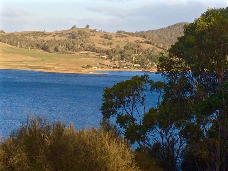
The D’Entrecasteaux Channel, or ‘The Channel’ for short, is a magnificent but fickle waterway – just ask any sailor. It feeds into the Derwent River and is separated from Storm Bay and the Tasman Sea by long, thin Bruny Island, making it a sheltered waterway, a definition it is keen to dispute, because stormy weather can make sailing it an adrenaline pumping experience on dark, wind fuelled nights when it whips up waves and gales gather strength as they hurtle through the tunnel formed by the island and the Tasmanian mainland. On calm, sunny days, it’s a completely different experience. Light breezes might arrive from unexpected directions and you may be rewarded by visits from penguins or dolphins as you enjoy the views, all sails up.

Bruny Island

The island’s original name is Lunawanna-allonah, named by the Nuenonne, who over thousands of years came to know this island intimately. Its name is so musical and redolent with eons of past history that I wish we’d restore it.   Instead, it was given a pseudonym; named again after Bruni d’Entrecasteaux, who visited in 1793 and made some judicious observations about the coastline.

This island off an island off an island, apart from being much loved because it’s so undeveloped, ensures you never go hungry. As you cycle along you can stop for coffees, buy local cheese and wine, make a meal out of the oysters farmed offshore or fill your pannier bags with local fudge and cherries. The population on Bruny is small and seems smaller still because so many properties are tucked away behind hills and forests. What you particularly notice if you are sailing, is that Bruni D’Entrecasteaux was right; there are stunning anchorages, and these are often bays within bays.

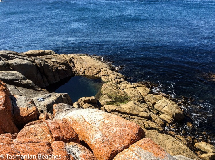
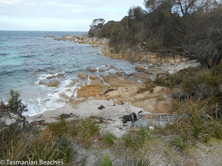
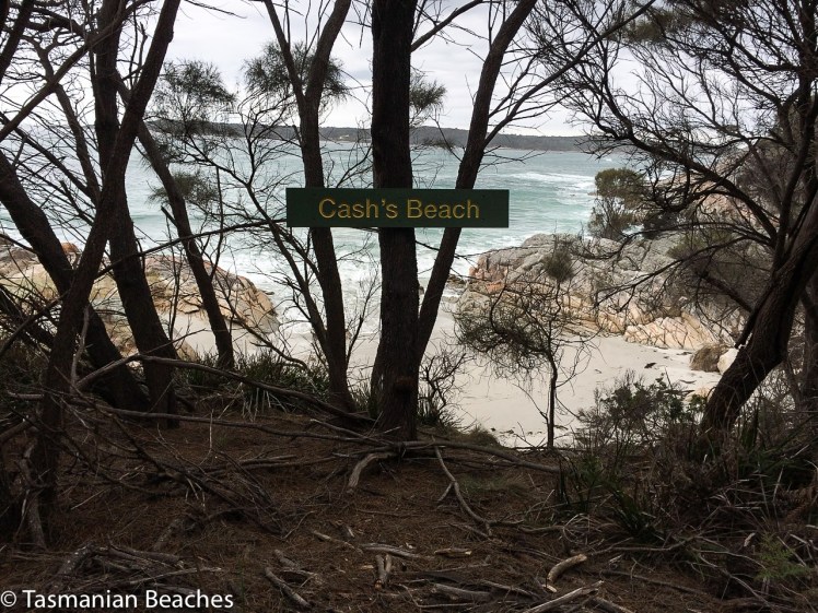
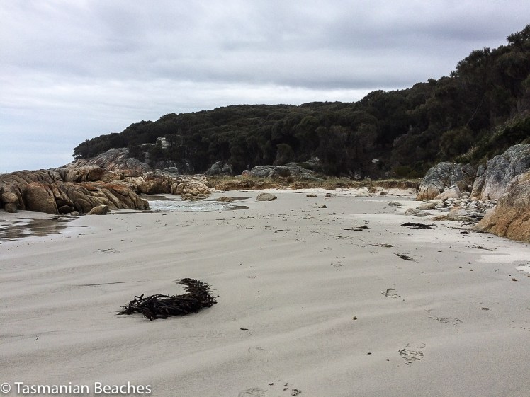
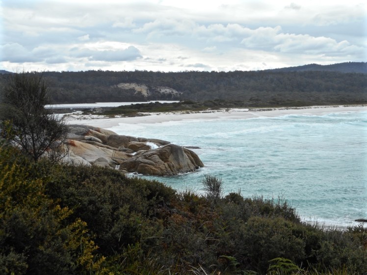
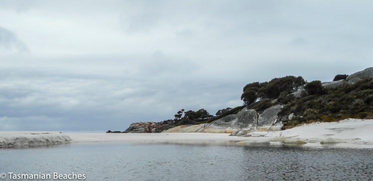
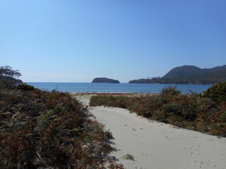
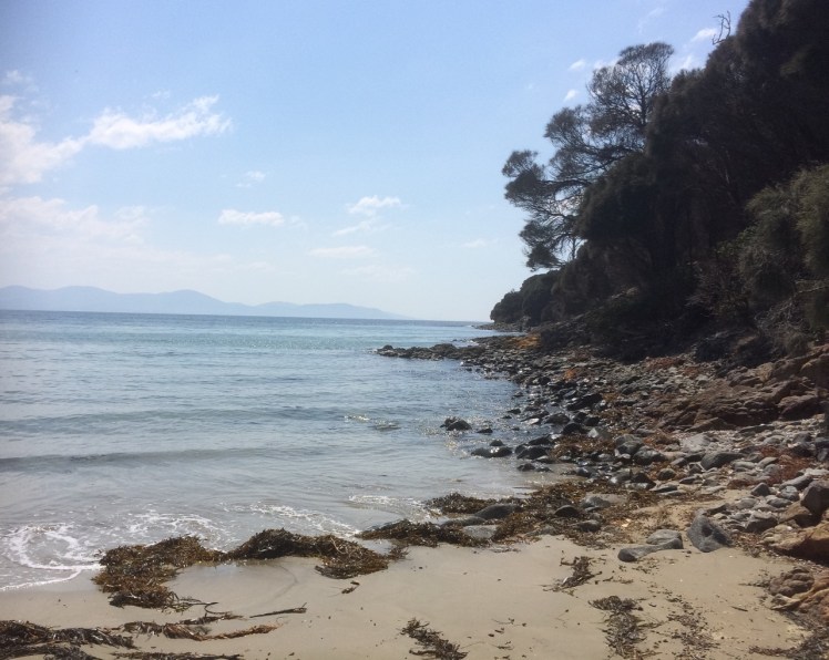
There are also coves and headlands and although on the D’Entrecasteaux side of  the island the beaches are low energy, on the ocean coastline the surf gets up. On the channel side it’s adorned with islands (Satellite and Partridge) and on the outside it has The Friars, part of the Actaeon Island Group, a popular haul out for seals. It also has a beautiful peninsula with a fabulous name – the Labillardiere Peninsula, which lies within the South Bruny National Park.

Satelite Island.jpg
Satellite Island off Bruny Island, D’Entrecasteaux Channel

North Bruny Island

It takes the best part of a day to cycle around North Bruny and longer for the south. The ride takes you past quiet bays (like the Duckpond and North Simmonds), Dennes Point with its jetty and Nevada beach, which has beautiful cliffs at the southern end, and then, if you choose the ocean route, it’s up a climb from where you can look out over Bull Bay and across Storm Bay to the Iron Pot lighthouse in the Derwent, to Betsy Island and Frederick Henry Bay, and further to the east, Norfolk Bay and the Tasman Peninsula. It’s a long time since I did this ride, but it was unforgettable and these days there are bicycles for hire, which makes it that much more accessible to cyclists.

More recently we sailed into Bull Bay, then explored the coastline a little way south, getting a feel for Samos’s liking for a big ocean swell. Getting the view from water level as opposed to high up a hillside felt a privilege because you need a boat to enjoy this otherwise hidden perspective.

Dennes point from Pierson's Point.jpg
Dennes Point, North Bruny Island from Pierson’s Point on the Tinderbox Peninsula

The Neck

North and South Bruny,  362 sq km in all, are tied together by an isthmus (the ‘Neck’), home to penguins and shearwaters, and sitting out on the dunes beneath the moon and stars, watching them return home is exhilarating. The ocean beach is lengthy; I’m looking forward to walking it. The channel beach is quiet with vast stretches of sand exposed at low tide and limitless shallows on the high, making it popular with waders of the avian variety.  The road across is a narrow strip at the base of the dunes and there’s not height separating it from the beach itself.

It’s definitely worth stopping to climb to the viewing platform because the sight of the isthmus and the coastline beyond is mesmerising.

The Neck Bruny Island.jpg

South Bruny Island

From the ferry, it’s a longer cycle around South Bruny Island and as you head down North Bruny towards the isthmus it’s worth taking a break at Great Bay to sample the oysters and cheese before you reach the isthmus.

South Bruny is the larger end of the island and if you keep heading south down the quiet road, your bike ride will take you to a T-junction. Cycle to the left and you’ll reach Adventure Bay with its rich exploration and whaling history.  It’s a picturesque choice.  There’s a lovely beach walk to be had, the opportunity to take a boat trip to The Friars (I did this as an annual pilgrimage before getting my own boat) and  there’s another lovely walk out along the headland with its whaling history and the opportunity to encounter a white wallaby or two.  Bruny is rich in wildlife.  At night it’s a kindness to travel as slowly as you would in a national park – 40 km, IMHO.

Cycle to the right and more vistas will open up as you ride through a number of tiny communities, like Lunawanna and Alonnah. It’s a steep ride up to the lighthouse with its fantastic views. I haven’t actually ridden up there, but the views are definitely worth the uphill haul. Alternatively, there’s Cloudy Lagoon and vast, wild Cloudy Beach, and the Labillardiare Peninsula. Or hoist a tent at Lighthouse Jetty beach with its more protected waters.

It’s a lovely but brief kayak trip from Tinderbox on the mainland to Nevada Beach at Dennes Point, but you can kayak across from any point on the mainland side of the Channel, depending on the type of distance and conditions you’re up for.  If you possess courage, stamina and kayaking expertise, you could consider  kayaking the Bruny coastline in a day – or go the whole hog and kayak the entire coastline of Tasmania like these kayakers did.

At the Quarries Bruny Island Mike and Samos.jpg
At The Quarries, Great Taylor Bay, South Bruny Island

I visit the island mostly by yacht these days, with a kayak on board.  It’s a great way to explore stretches of coastline that would otherwise be inaccessible.

Here’s a creation story from the Nuenonne of Lunawanna-allonah and here’s more info on Bruny Island.

Lighthouse Jetty Beach Bruny Island.jpg
Lighthouse Jetty Beach, Great Taylor Bay, South Bruny

Bay of Fires: South Taylor Beach to North Cosy Corner

Losing Our Way

T 81 Sloop Reef Cove

DSCN0638.jpg
Sloop Reef Cove, Bay of Fires

Back at the cottage after kayaking Sloop Lagoon, I was flipping through Marianne Robertson’s book From Petal Point to Cockle Cove over a well deserved cup of tea, and discovered a beach that I hadn’t been aware of before.  Tucked away behind the big boulders at the south end of Taylor’s Beach was apparently another small cove called Sloop Reef Cove, also known as South Taylor’s Beach.

It was time to go searching – and so we went immediately.

But we couldn’t find a path.  Instead, we four, two of us canines on leads, scrambled up enormous boulders and searched around when we got to the top.  Faint trails sometimes led to dead ends but we finally found a vague track that led on to a better formed path through the casuarinas and finally dropped us down to a secluded campsite where two men with a van were stoking a fire.  Down on the tiny north facing beach four people were enjoying a picnic while the surf pounded in.  It’s an intimate cove; we felt we were invading and so we sat only momentarily on the rocks discussing the undercut dune behind the beach.  The cove sloped; the surf that day rolled in and and streamed out, deflecting around the corner.  We saw the back of the waves as they raced onwards to east facing Taylors.  There is a permanent rip here.  Swimming in the cove or the southern part of Taylor’s beach looks pretty dodgy because of the criss cross waves you get here.  It was a most unsettled sea.

The boulders of Sloop Reef Cove.jpg
The boulders of Sloop Reef Cove

To Sloop Point

We knew Sloop Point well, or so we thought, but yet again, finding a trail from Sloop Reef Cove that would lead us there took a bit of effort.  We considered giving up – and considered this several times more during the course of this walk – but eventually the trail we found joined a well made contour path, which I later discovered was an old tramway track.

But why would you have a tram way here?  What sort of tram?  What was the purpose?

The walking was soft; layers of casuarina curls lay on the ground.  We passed beautiful boulders near a point with a sign that read Sloop Rock Jetty and stopped here, contemplating the dreamtime stories that would once have been associated with these powerful formations.

Granite boulder and one with indentations.jpg

The path came out at the parking place for Sloop Point.  Four of us, plus the two canines, had come here on a warm  April day and meandered down the path to the massive sheets of lichened granite that make up the point .  It has a fantastic rockpool, deep and clear and private, suspended above the ocean and claimed that day by a travelling couple in their twenties.  This is the sort of place that’s probably seen a lot of people rip free off their clothes to skinny dip and enjoy the sun au naturale.  It’s a highly risky business as others coming after can be as surprised as those caught cavorting in this spectacular rock pool  above the sea.

Offshore were the Sloop Rocks, the bay’s most fascinating feature and visible over a vast distance.  I call the most spectacular the Sitting Buddha but it probably has many names.  I have a friend who calls it the Witch’s Hat.

Rock pool at Sloop Bay.jpg
Rock pool at Sloop Point
Sloop Rock.jpg
Sloop Rocks

T 82 Seaton Cove

No amount of searching in the bracken revealed an onward path and so we took the dirt road down to Seaton Cove, another spot we’ve overlooked on our many visits to Bay of Fires.  It was astonishing to come to a tiny, rather suburban looking enclave in the coastal forest after wandering through the bush, sometimes on paths and sometimes not. A camper van had settled in here  (there is a little bit of camping space) but he was close by a short row of about five houses that looked like they’d lost their way to Launceston.   Like Sloop Reef Cove, this is tiny and the boat drawn up on the sand, with only one motor, must rely heavily on good weather, particularly for its return trips, because there isn’t much room for error.  It’s rocky here, both above and below the waterline and what beach there is has coarse granite sand and much kelp strewn about.  I found some sea glass and a beautiful quartz pebble well polished by the sea.

Seaton Cove South.jpg

But a well defined path led on past the bottom of the gardens, following the fence line, and back into the peaceful casuarina forest.  Again the path grew uncertain.  We’d lose the trail then find it again.  Finally we found ourselves in a patch of sand surrounded by boulders and apparently isolated from the sea.  Even here, so close to the sea, frogs serenaded near the small soaks in the rocks.

We had been walking along the top of these massive sloping granite platforms and boulders for some 500 m but they were getting to look familiar.  Sure enough, we soon saw people on top of the huge boulders we know well – we’d made it to Cosy Corner.

Approaching Cosy Corner (n) on the rocks.jpg

We lingered here, feeling triumphant and wondering whether to head for the main road.  It was getting on for 4 pm.  This seemed an unadventurous option and so we turned around and walked back across boulders and through the bush to Seaton Cove.  I was surprised on this visit to notice the beach was longer than I’d thought before, rocks dividing the cove into a north (hidden from the road in) and south side.

Bay of Fires Seaton Cove
Looking south over north Seaton beach.


Again we debated resorting to the road we’d walked down before but there was a clear path we could see now, heading around the northern side of the cove at quite a height above the shoreline.  We followed it, but it let us down and we got lost in bracken and fallen trees, just pleased it wasn’t snake weather.  We could see the tree line along Sloop Point and so we clambered down on to the boulders then bushbashed up the other side when a gulch seemed impassable.  Our trusty path finder took the lead.  She invariably chose a route better than the ones we selected but she’s  getting on and occasionally needed a helping hand over the trickier fallen logs.

This time our choice was clear – buoyed by our progress, we took the beautiful contour path we’d walked before.  We reached a dirt road descending to Sloop Reef Cove but noticed the path continued across the road, above a few houses nestled in the southern corner of Taylors Beach.  Orchids grew along here, pale purple and unassuming.  It wasn’t long before we met the Gardens Road just above Taylors Beach and Sloop Lagoon.

This is the kind of walk I find the most exhilarating – a walk where the way is unknown and sometimes hides itself, demanding a degree of perseverance to continue, but offering up surprises – like another of those branch shelters that we’ve seen at Tinderbox, Dora Point and a few places elsewhere.

This slideshow requires JavaScript.


North East Tasmania: Bay of Fires: Humbug Point Nature Reserve: Boat Harbour Cove to Dora Point

Puzzling Over Humbug Point

Closing in on Grants Point
Humbug Point Recreation Area.  Grants Point (left).

Map and further info about  Humbug Point Nature Reserve

The holiday homes of Binalong Bay spread up the northern slope of Humbug Hill, but behind them the original vegetation remains considerably intact, protected inside the Humbug Point Nature Recreation Area.  This reserve spreads across both Humbug and Bald Hills.  It’s mainly dry sclerophyll forest (although it has its boggy bits) with a diversity of plant, wildlife and bird species and a spectacular coastline that makes for a wonderful walk.  There are various free camping spots that have a more enclosed, bushland feel than the coastal camping sites along the road to The Gardens, north of Binalong Bay, and until our last visit, we had relied more on our car than our feet to take us exploring in this area.

I wondered how this area got it’s current name, given that in northern Australia ‘humbug’ is an Aboriginal term for placing unreasonable demands on family, but according to the Tasmanian Nomenclature Board, it’s first shown on an early diagram (1/386 Dorset) as Point Puzzle. They say it was named by a certain  J. H. Wedge, because of the frustrating difficulties experienced in running stock there. Thylacines took his sheep and lambs, apparently, so perhaps farming there was in fact humbug as far as his family was concerned.  They themselves were bigger humbug by far for those families, bands and tribes who had lived more lightly and longer  on this particular country.

The board also notes Top Bay (AMG608 x 5426), which I hadn’t spotted on any maps, as one of the small features west of Humbug Point (as advised by Jack Mallinson and Alf Barnett of Binalong Bay, January 1977).  Possibly this is the spot where we found an unexpected beach.

***

We made an impulsive decision one Monday lunch time to head north.   We threw some clothes into a bag, bundled the dogs into the car and headed up to the Bay of Fires for a couple of days of down time.  Our first walk was going to be to Dora Point and back to Binalong Bay along the Skeleton Bay Track, but in the end we did it over two walks.  One of us was sick on our first attempt and we also failed to take enough water for our canine companions.  For September, it was surprisingly hot although for most of this walk the weather was overcast, going by my photos.

Binalong Bay Coves

We lingered in the Binalong Bay coves just to the south of  Boat Harbour Cove / Binalong Gulch.  The sand was still free of footprints and it was all so idyllic. It was the kind of morning for snorkelling, for settling in comfortably with small children still excited by the prospect of sand castles, for putting up a beach umbrella and losing oneself in a book.  We observed the lichen’s low level mark – perfectly straight – and the pelicans near the boat ramp.  I imagined these coves long ago, small campfires burning, Larapuna bands hunting through the scrub and diving for shellfish in the translucent waters of the bay.  The gulches make perfect pools for those who like to keep their feet grounded.  The boulders never cease to fascinate.  You can lose yourself in the view north for hours and while there are pockets of sand in the gulches that one could kindly call ‘covelets’, there is in fact a high tide, white sand beach with lovely boulders and tidal pools, about 100m wide, according to Andrew Short (2006), who  numbers it beach T90.

Binalong the coves
Down amongst the gulches of Binalong Bay

T91 Skeleton Bay (or South and North Skeleton Coves)

Skeleton Bay.jpg

There’d been a full moon by night and all day a big swell had been flowing into the bay, with a huge surf crashing against the points visible to the north from our cottage on the hill, but the water in the coves was comparatively gentle. Eventually we left Binalong Bay, walking around the corner into wild and much smaller Skeleton Bay, the real start of the walk.  It has two coves, North and South, with small Skeleton Rivulet feeding fresh water into the sea after rain falls.   There was a ‘don’t mess with me’ surf smashing in here too; water in a hurry.  Kelp lay strewn along the wrack line, big pieces, their feet intact, testifying to the strength of a past storm, and I started to pick my way over the coarse, white sand while the geo stuck to the road above. Almost immediately I found myself walking into a cloud of the small, flying invertebrates usually attracted to rotting seaweed and the pungent treasure that contains.  I fled their avid interest by escaping through the bush back up to the road.  The walk could only get better.

We crossed the rivulet and began the walk to Skeleton Point and, just offshore,  walk- stopping Skeleton Rock. The meandering track follows the coastline with beautiful views its entire length and I had the strong sense of this being, under the thin disguise of a modern path, a Larapuna track, whole eras old. Granite underpins the vegetation, she-oaks extend behind the boulders and the path is densely covered in their curls  when walking through copses. Boobiala and kunzia were in flower.  Every so often paths lead down to places where wonderful views give way to the spectacular. That day there were two other parties of walkers enjoying the track, and we met both in the vicinity of Skeleton Point, but we seemed to be the only ones intent on walking through to Dora Point, about 4 hours return.

The day became overcast after that bright sunny start but each time sunshine burst through, we sweltered and kept a sharper look out for snakes.

Grants Point

We reached Grants Point. Offshore to the south are Grants Point Rocks.

Grants Point rocks.jpg
Grants Point Rocks: there’s surely a myth attached

In this vicinity the path is on a higher contour and after passing  boulders with big auras all gathered in an area backing the point, there’s a truly massive one with a particularly looming, mysterious presence.   This rock definitely has to have a dreamtime significance but it’s meaning and name are lost in time, unless perhaps you’re Larapuna, and if it has a modern one that’s hard to track down too.    It seemed reasonable to suppose that the day use/camping area close by might once have been a place of significance to the original inhabitants who lived in communication with this land.

Boulder at Grants Point.jpg
Base of the large boulder at Grants Point, Humbug Point Reserve

We stopped here for a while, enjoying the view and the ambience created by the boulders, then contemplated the wisdom of going on. I felt both relief and failure when we turned around.  This time I was determined to walk the full extent of Skeleton Cove but again we were assailed by insects and fled off it in a rush, through yet another band of insects, this time mosquitoes.

***


Dora Point Beaches (T92, 93, and one unidentified)

Take Two began at the other end of this walk, on Dora Point Beach (T93), just within the northern headland of Kunarra Koona (Georges Bay) and huge breakers were rolling in over the sand bar. I turned sailor, not liking what I saw, and we had a long strategising conversation as we walked to the start of the track, about bars and stormy weather, crossing sandbars at slack water and the history here of dredging and the current breakwater developments we could see taking place at the far end of the beach.  Once, when we were being hammered by a ferocious northerly gale just south of here, both yacht and crew compromised, seeking refuge in Georges Bay had been considered. I’m glad the skipper quickly dismissed this option.

This is also the kind of beach to enjoy from an aesthetic point of view and if you’re a fisher it’s a good place to cast a line, given the piscean through-traffic. But leave your bathers at home. A big body of water enters and departs through a narrowe entrance and the current isn’t to be taken lightly, although that’s how it would surely take you. This great lagoon spreads inland to St Helen’s. The sandbar gets dredged to keep the mouth open and there’s a breakwater that’s led to a  beach blossoming on the southern side of the entrance.

Dora Beach is quite a wide, curvaceous beach with soft white sand and seawater pooled that day in the hollows the outgoing tide had left behind. It’s especially beautiful as you walk north across it to the start of the track. A density of ti tree forest creates an intimate feeling in that corner of the beach, well protected from northerly winds out of both quarters, but I felt it was keeping secrets and when we reached the track we saw it hid a shelter, made from fallen branches, beneath its canopy.  These are surprisingly common on coastal bush walks.

Dora Beach.jpg
Dora Point Beach (T 93): pausing to read the ripple lines

We started on the path and rounded the headland and it was not long before we reached a beach divided by an outcrop of boulders into a northern and southern half. Someone had put a sign saying Cash’s Beach above it; a new sign.  (I think it’s T92, Dora Point North in Short’s inventory)  We wondered at its significance and later, talking to a local beach afficiando who knows this area extremely well, his bemusement was much the same as ours.

Cash's Beach.jpg

We took a relaxing stroll through casurina forest on a beautiful track, at times through  muddy puddles and ti tree groves, and over a small marsupial meadow, scats in abundance and small tunnels in the undergrowth, the boom of the surf and the serenading frogs, so tolerant of the ocean that they also sung from puddles  in the granite boulders, where, on closer inspection, we saw tadpoles and mosquito larvae.

We crossed a little meadow.  We walked through boobiala thickets.  The vegetation ranged from dry loving plants to thirsty plants. There was sometimes moss growing on the granite and lichens on branches, and it was an easy, thoroughly satisfying walk, no significant ups and downs. We passed Grants Rocks, we passed a beacon and we came again to the boulder at Grants Point, where again we sat for a while, gazing out to sea, trying to decipher the memory of the big boulders behind us that we’d past the previous day. It was a Wednesday. There was no one else on the track.

Beach2 on Dora - Grants walks.jpg
Isolated  beach, Humbug Point Reserve

Our return walk held two surprises apart from the usual one of the return walk always seeming so much shorter. The geo spotted two more beaches, small and tucked away, difficult to see from the path if you weren’t especially looking and when I checked Short I was satisfied that we had again discovered a beach that was not on the inventory.  The last one we found was Dora Point (T93), which we’d passed without noticing on our way north.  I spied a pair of pied oyster catchers on it and a white buoy that had drifted up on the tide. I carefully snuck down and claimed it for Samos, the pied oyster catchers so intent on foraging that they were none the wiser to my presence, a bit of a coup on an island where the birds are usually jittery.


Tasmania’s North East Beaches: Bay of Fires: Sloop Lagoon by Kayak

Sloop Lagoon by Kayak

Of Swans and Leaches


Sloop Lagoon seen from the rocks above Sloop Reef Cove over Taylors Beach
Sloop Lagoon viewed from above Sloop Lagoon Cove

 22 Sept 2016

It was almost impossible to squeeze into my wetsuit. It slowly dawned on me that it wasn’t mine at all but an old one belonging to my daughter. Kayaking in a teeny size 8 would feel like I’d been swallowed by a snake and so I wore it legs up only, and layered thermals  over that.

I had decided to kayak around the circumference of one of the dune trapped lagoons along The Gardens Road and decided in favour of Sloop. The morning was overcast and there was a little bit of breeze by the time we reached the lagoon, somewhat later than planned.  I felt a little mournful, as I always do, when the breeze is fooling with the surface tension, marring the glassy water I like so much when kayaking.

The geo helped me launch and our one dog followed, peeping unhappily. She’s the pack leader and path finder. She likes to keep us together and on off lead areas will always come back to collect me if I’ve lingered behind.

I was aiming for the bridge that goes beneath the Gardens Road and paddled swiftly across the tannin water, eventually dropping her. On the other side I found a narrow channel, closed off at its mouth. This lagoon was saline and sometimes black beneath the clouds.

DSCN0602.jpg

I idled here.  Frogs were being vocal in the rushes, a surprise to hear them in such a salty environment and I wondered if the many flood events this year had altered the salinity level.  The surf boomed on Taylor Beach. It was peaceful floating and listening to the soundscape.  I drifted down to where the lagoon meets the beach.

dscn0603

And then I turned around, headed back beneath the bridge and set off to circumnavigate this dune trapped lake.

DSCN0606.jpg

It’s a quiet world in amongst the boobiala, rushes and ti tree.  As I kayaked around the edge of the lagoon I spotted two swans’ nests in the reeds but there were four couples in total that came gliding out from among them at various points and moved away from me, honking small warnings.   In fact, despite my best attempts to be non-intrusive, one took off heavily in front of me, half running across the water – we had not seen each other until the last moment.

I’d last seen black swans on the Thames, near Kensington Palace.  That was a surprise too, but apparently a small number have acclimatised there.  Far better to see them in a habitat that’s natural to them.  They’re migratory, but their pattern of migrating is opportunistic and erratic and they plan their travels according to what the weather’s been serving up.  The oddest swan behaviour I ever saw was one that flew over to a bay and paddled out to sea.

Don’t believe those stories of them being loyal to one partner for life.  They’ve been found out.  Swans cheat; sneaky affairs take place in hidden corners of the rushes and so watching these partnered birds gather in the middle of the lagoon, I wondered about the layers of their relationships and whose eggs were whose in those nests in the shallows.  I didn’t check the lagoon’s depth, but swans like shallow water so that they can bottom feed without diving, one way to tell.

Down at the far end, near the quarry, I found a small stream and seeking out the glassy patches where I’d be more protected from the south easterly, I found a crane staring attentively into the water.  There were also full throated frogs around the lake from time to time, and small lunettes that doubtless hold evidence of camping and feasts from the eras before colonisation.

DSCN0616.jpg

The lagoon held one final surprise for me.  This is what we saw when we went to load the kayak – a huge leach with a foot that could have competed with kelp for grip.  A leach so huge it could suck a swan dry.

DSCN0629.jpg


North East Tasmania: Bay of Fires ~ Binalong Bay

Binalong Bay ~ To Where we Keep Returning

View of Binalong Bay from Cosy Corner
View of Binalong Bay and Humbug Hill

The Bay of Fires from Humbug Point northwards is an exhilarating stretch of Tasmanian coastline.  There’s just something about the white sand, the lichened granite boulders and the crystal clear water that combine to make it particularly awesome and peaceful at the same time.  In summer, when it’s warm, the bush camping along The Gardens Road is the loveliest we’ve found in the state and in the cooler months there are plenty of beach houses available for hire.

Binalong is a small settlement on the northern slope of Humbug Hill, backed by a great reserve and with wonderful views.  It has a tiny permanent population of about 200 people and is a mix of small shacks, large mansions and modest beach houses.  There is no shop but there is a small cafe with a good menu and expansive views.   Behind the bay  and at the foot of  the hill  lies Grants Lagoon, wonderful for birdwatching or kayaking.

The complexity of the landscape – the casuarina forests, the photogenic rock formations and the dune trapped lagoons combine with the beaches to make this area totally compelling.  Apart from cycling, swimming and kayaking, there’s a surf break at the northern end of Binalong Beach and at the southern end there are a number of beautiful coves separated from each other by massive boulders.  There’s a gulch that forms a tiny harbour of sorts and these days  an ecotour leaves from here and heads out by boat along the coastline as far north as Eddystone Lighthouse.

Harbour at Binalong Bay

This spot hasn’t always been called Binalong Bay.  It was once Boat Harbour but as there is also a Boat Harbour in the North West, it cast off name confusion and opted for something more indigenous.  The Bay of Fires was known as Larapuna by the  people these days known as the North East nation. There are believed to have been seven clans in all (Johnson & Mcfarlane, 2015) , roughly totalling about 500 people* who willingly granted seasonal access to the Ben Lomond nation, probably for reciprocal rights, enabling them to benefit from the area’s rich pickings.  It was a meeting place and as the climate was mild, it could well have been where most Tasmanians chose to live in earlier periods of the Holocene.

The current name of the Bay of Fires was provided by Tobias Furneaux, who captained the HMS Adventure (part of Cook’s Great Antarctic Expedition of 1772-1775).  He and his expeditioners noticed many campfires burning in this area at night, and aboriginal stone formations, seal traps, burial sites and middens still exist, so treading lightly and respectfully needs to go hand in hand with leisure and enjoyment when visiting this area.

After the European invasion, sheep farming, fishing, forestry and the transporting of these commodities grew in importance and on our last visit we discovered the tracks of what had once been a local railway.  It follows a contour, then ends at the gulch, where today there’s a jetty and boat ramp.

We’ve been to the Bay of Fires three times this year.  First we camped and then we brought some of our overseas family here.  The mad keen cyclist promptly headed for the Blue Tiers track while the rest of us, being of more idle dispositions, merely rode from Binalong to the The Gardens, did a bit of Humbug Point exploring and had a pleasant amble along Binalong Bay Beach, the white sand soft underfoot.

It was only when we were at the farthest end of the beach where the big boulders begin, that we realised the cyclist had taken both sets of car keys.  He was expecting us to meet him in Derby later on that particular day but his mobile had no Australian reception, so while he  waited and wondered what had happened to us, we tried to relax into the knowledge that there was nowhere to go and nothing we could do except soak up the sun and admire the sublime view from the beach house.

The geo and I came back again shortly after our Hong Kong to London train trip.  This time we focused on exploring with a little bit of kayaking thrown in for good measure.  We met a local artist and had some long chats with a new friend who is walking the beaches from the Tamar to Freycinet.

Binalong Bay beach is a  poignant beach for me.  A good friend, who loved this spot too, had a heart attack on an early morning stroll along the sand and although he recovered, did not see out the year, dying on my birthday.

Binalong the coves

*Given the fact that European invasion of Tasmania caused numbers to collapse quickly and dramatically, this number is a best guess by some of those working in the field.

References:

Johnson, M & I. McFarlane. 2015.  Van Diemen’s Land: an aboriginal history, UNSW Press, Sydney.


Frederick Henry Bay: Pittwater Nature Reserve: Penna Beach

Touching the Land of the Moomairremener Band

Map of Pittwater

Penna Beach

When you fly into Hobart’s airport, peninsulas of land and bodies of water spread out below.   One of these watery stretches is the large, relatively shallow estuary/lagoon that forms Pitt Water Nature Reserve and Orielton Lagoon (east, and just off this map).  The Coal River, Penna and Iron Creek pour freshwater into it.

This striking body of water is  crossed by McGees Bridge and the Sorell causeway, both tethered to a suburbanised headland in the middle of the lagoon called Midway Point. It enters the sea between Seven Mile Beach spit and Lewisham.

I love the view coming in to land, love crossing the causeways, the seagulls hanging in the sky, the salt spray… but it’s not an area that I’ve ever explored.  I last flew over it a few weeks ago, returning from a postponed yacht delivery in Queensland.  This time I went to the map to find out more about it.  The names of the places surrounding Pitt Water intrigued me – Shark Point Road, Penna and Frogmore Creek.  It was clearly time to go adventuring in the lands of the Oyster Bay and Big River tribes.  The Moomairremener band in particular, spent a lot of time around Pitt Water.  Their presence is there in the middens and quarries they left behind.

At Midway Point we turned right along Penna Road and quickly found ourselves in countryside with the water to our left. Then we turned left along Shark Point Road.

This road runs along the northern shore.  There’s a row of houses, some beautiful, others not, but if you don’t mind the sight of traffic crossing the causeway in the distance, then the northern shore is a secret gem.    The dirt road takes a corner and heads north, up into farmland, home to Highland cattle.

Shark Point Road, it turns out, gets its name because this estuary is much loved by sharks, including the gummy shark.  They come here to forage and to breed.  It’s the nursery for their babies and while they’re unlikely to nibble a kayak I may put on hold indefinitely my plan to paddle its perimetre.  In recognition of its importance to the sharks it was declared their refuge and no-take area in 1995.  There has to be something in this for people, right? These sharks are fished commercially.

We turned around and sought out Penna Beach on this northern shore and found that it’s in a part reserve, part dog exercise zone.  We walked down to it through tussocks and an astonishing diversity of weeds, including box thorn and boneseed.

White shells clad much of the beach and they’re there again in the soil profile behind the beach, along with a thin trail of pebbles denoting an earlier landscape.   We figured this is the same shell layer that is visible at Ralph’s Bay, that beautiful embayment on the Derwent River.  Strolling along its full, extremely skinny extent we also noticed that the rising sea had nibbled into the soils behind the beach so that only the roots of the tussocks and a depth of about about 10 cm of loam defended the land from the fluid invader gaining might millimeter by millimetre.

As we walked along we discovered some lovely  little salt marshes and wetlands behind the beach, although some had an algal infestation.  We didn’t see the little blue butterfly that forages here but we heard some brief birdsong emerging from the tussocks.  I thought the area could have provided a wonderful habitat for nesting birds but I suspect there’s far too much human disturbance for them to make a go of it. It was only later that I discovered that this area is renowned for its salt marsh diversity and rare plant species.

 With an oyster farm tucked into a corner of Pitt Water at Barilla Bay, as well as at Woody Island and Shark Point, along with other human encroachment, such as homes and causeways, water quality has taken a battering.  At least forty different types of fish, including eels, seahorses, pipefish, sharks and rays have been known to glide beneath the surface, some enjoying the seagrass once prolific in the quiet shallows.
There’s a man who, between 1975 and 1995, came to know this area, it’s plants and animals well. Geoff Prestige watched as the banded stingaree, southern conger eel, shot-headed eel, rock ling, pipefish, soldier fish, rock flathead, king barracouta, weedfish and smooth toadfish, once prolific, became rare or vanished completely.   He also observed snails and worms and molluscs, along with other invertebrates quietly vanish.

Once at least seven types of migratory birds flew here from Alaska to enjoy Tasmania’s summer.  This estuary, since 1982, has been a RAMSAR site – in fact, the southernmost site on the East Australasian Flyway but given our interconnected world and development across both hemispheres, this hasn’t stopped numbers plummeting like a distressed stockmarket.

One little known fact about Pitt Water is that it is the home of a tiny, rare  orange seastar (Parvulastra vivipara), one of very few anywhere that gives birth to live young.

People like to fish on the seaward side of McGees Bridge and they like to bird watch at Sorell Causeway and the Waterview Sanctuary.   Levees have messed with the tides that supported Pittwater although there’s a bit more flushing happening these days. Farmers have spread fertiliser on their fields, fostering algal growth in the lagoons.  Dams on the Coal River have stymied freshwater flow.  Seagrass has withered.

This area really symbolises the way we are hammering the lovely world but here’s a small plus.  On all the slender extent of Penna Beach I only found two pieces of plastic litter, and I thought that a small solace.


Sources:  Pitt Water and Orielton Lagoon Ramsar site and in particular, the NRM South Report to the Community (2012)  


Penna Beach

Penna Beach tussocks and pigface

Wetland behind the beach

Tussocks and erosion

Forestier Peninsula: Lagoon Bay and Two Mile Beach, Bangor

Map Two Mile Beach Bangor
Map: Bangor, Forestier Peninsula  (Source:  Tasmap. Tasmanian map book: southern region, 2007)

Careful With Your Feet Now

Lagoon Bay Beach (Forestier Peninsula)

As I’d walked the Geography Bay beaches it had dawned on me that I was seeing very few birds. When I shared this observation with my friends most would think a little, then remember a couple of birds they’d seen on a rock the day before, or noticed on a beach they’d visited, or comment on seagulls that had been pesky down at the wharf.

This is very different from the year 1798, when Matthew Flinders estimated that there were at least one hundred million short tailed shearwaters within a single flock sighted in Bass Strait. They’re still Australia’s most common seabird but their numbers are nothing like that these days because of habitat loss and predation – especially by snakes and humans. (This Parks and Wildlife brochure explains more about these birds and their challenges.)

My friends’ answers perplexed me. I wondered if we’d normalised the low bird numbers we were seeing. Most of us don’t notice the loss of a particular birdsong from our garden because we don’t know the calls in the first place and we’re barely aware of our disruptive presence on birds when we wander along a beach.

One day earlier this year a notification arrived in my intray. Birdlife Tasmania was going on an expedition to Bangor, a well known farm on the Forestier Peninsula. There would be a beach walk and they’d be monitoring seabirds. I decided that this was a great opportunity to see a magnificent farm with 35 km of beaches and to learn more about shorebirds from those in the know.

And so I went along.

We were a group of about thirteen that hot day. A warm  wind was blowing from the north east and then, in the afternoon (when we were at Swan Lagoon) the sea breeze filled in as is its wont from the south east, bringing a refreshing change.

Matt Dunbabin, the owner, met us and filled us in on the history and environment of the farm, telling us about the damage sustained in the bushfire two years ago and then we set off in convoy, travelling slowly over the farm tracks beside water, across Blackman Plains and through dry sclerophyll forest. We stopped regularly, safari style, to observe birds, to listen to their calls against the backdrop of silence. I felt humbled by everyone’s enthusiasm and knowledge knowing my own to be pitiful.

We came to the airstrip. On a hill behind the headland forming the southern end of Lagoon Beach there was a small wooden house and between this headland and its northerly, forested neighbour, but hidden by scrub, lay Lagoon Beach. It’s possible to camp here and people were. In fact, they’d been coming here regularly for the past 30 years.

The beach was irresistible and while the group broke up and went off to various spots to observe birds I set off to walk it. I was dismayed by the extent of the litter. ‘It’s the worst we’ve seen here,’ said the campers, stopping on their way back up the beach to talk about it. ‘No doubt those storms we had brought this mess in.’  I went back to get some bags and soon the group from WildWays, also a part of the group that day, were also picking up litter.

The campers certainly had a point. There had been storms and in fact 2016 has brought odd weather to Tasmania. When I drafted  this blog post last summer, fires were still burning in the South West World Heritage Area and water storages had fallen beneath a mind boggling 12% through drought, mismanagement and a broken undersea cable that transports hydro electric energy to the mainland.  Then, astonishingly, the north of the state was beset not once but several times by extremely damaging floods.

I saw oyster catchers, Pacific gulls and two hooded plovers as I walked along, sticking as close as possible to the water’s edge. The tide was up and the sand was mostly quite soft. The endangered hooded plover, a tiny, well camouflaged bird that makes its nest in a barely noticeable scoop of sand, breeds here and is susceptible to being wiped out by misplaced human feet, the sniff of a dog or a storm event.

Bangor Lagoon Beach
Lagoon Bay beach

The beach was different from those I’d recently been walking. It was quite wide and apart from plastic bottles with Japanese print on them and other assorted plastic debris that hinted at fishing boats being the source,  I saw an abandoned eggshell that testified to a new bird somewhere in the vicinity. There was a heap of kelp and sometimes the bones of fish, bird and possibly a marsupial. Growing over much of the beach was a prostate, four petalled plant, which I tentatively identified as  sea rocket, a plant with an interesting back story. It seemed to be beach building, shaping the sand into slight dips and hollows and it was being thoroughly serviced by the bees – a bumble bee, honey bees and a small native bee were collecting nectar from its tiny flowers with quiet assiduity.

Bangor Lagoon Beach

There is a small rivulet at the southern end of this beach, running along the bottom of the hillside. The campers had noticed discoloured water around here and a bad smell.  Standing beside it I noticed a fairly empty Hills pesticide container (5l), the potential culprit. It seemed sadly ironic that this beach that would otherwise be so pristine, cared for as it is by environmentally aware owners, suffers, because of human carelessness, in this case probably coming from boats offshore.

It was on this beach that the difficulties posed for beach walkers by private land and rugged shorelines  really hit home. TheList indicates land tenure so that bit is easy. Identifying owners is not, so private land poses an access problem for those of us keen to access hidden beaches, headlands and rocky stretches.

Bangor Lagoon Beach sea rocket.jpg

PART TWO

Two Mile Beach (Forestier Peninsula)

Two Mile Beach Bangor - first peep

‘Two Mile Beach (T 299) is a gently curving 3 km long northeast-facing sandy beach located in 3 km wide North Bay … The bay is bordered by the prominent Cape Paul Lamanon and Monument Point in the north and 138 m high Cape Frederick Hendrick to the east. The beach receives refracted waves which average about 1 m at the shore and maintain a 50 m wide low tide terrace, cut by up to 12 rips during periods of higher waves. It is backed by a continuous foredune, which has a series of blowouts along the northern and central sections, some extending 200 m inland. The dunes are backed by 200 ha Top and Swan lagoons and associated partly drained wetlands, with Swan Lagoon draining out via a small creek at the southeastern end of the beach. Farmland borders and backs the lagoon, with vehicle access to Parrot Point at the southeastern end of the beach.’

Source: https://beachsafe.org.au/beach/tas/sorell/marion-bay/two-mile-beach

I regrouped with those bird watching near the campsite and we were reminded of the importance of not going up into the dunes because of breeding birds. More soberingly, I discovered that the breeding season extends over spring and summer. Human summer holidays happen at absolutely the wrong time of the year for the birds and as for me, I mused yet again about how best to limit beach walking to autumn and winter.

If we were a kinder, less self indulgent species we would quarantine beaches, or at least a goodly number, so that birds are still capable of breeding, nesting and fledging their young. Our presence on beaches is a huge reason for breeding failure.  There are beaches completely exempt to dogs or sometimes limited to particular times of the day but we put no restraints on ourselves.

About nine of us decided to walk up through the dry sclerophyll forest and down to Two Mile Beach. I had the most uncanny sense as we walked there of having been here before, on the wide track up through the forest, and I remembered how once long ago I’d gone with a keen birdwatching friend on a university ornithological weekend. Where the zoologists had placed a mist net back then had been so similar to where we were walking  that just possibly it was in fact the same spot, given that we’d also gone to count shorebirds at Marion Bay, not that far from here.

Two Mile Beach was a vast, impeccable curve of sand – an irresistible walk. Far away it curved and ran out to a point. You could see the surf breaking on the rocks. But we didn’t walk it. We sat on the rocks, some of us in shade, some in the bright, hot sun and ate our lunches and talked, and I discovered that the youngest two members of our group originated overseas – one from Nepal and one from Canada.

A ‘tin dish’ that had been bobbing out in the bay came and anchored close to where we were sitting and the sole occupant began scuba diving along the peaceful reef.

Two Mile Beach Bangor

As we began walking down the beach we noticed a few more things. Litter had been collected, and stockpiled in the corner. Fissure Island – it has a huge fissure separating its two sides one from the other – became visible around the headland.

Looking at the beach profile I think I figured out why dunes on this beach are also building and not receding. The kelp washes up. The sea rocket is nourished by it. It, in turn, nourishes secondary species, of which on this beach there was a profusion – the dunes were healthy and although marram grass was washing up it did not seem to be taking much hold… so many dunes around Tasmania have been damaged by the deliberate planting of marram grass, considered an asset back in the twentieth century.

In single file, out of respect for the birds, we walked carefully across the dunes to Swan Lagoon, brown and brackish. There were more bird species here – black swans, for one. There were  hooded plovers on this beach, some juveniles too, and we counted and identified dead shearwaters – mostly Fluttering Shearwaters, recent arrivals from NZ, I learned, and increasing in numbers, as well as fairy prions and a little penguin. A juvenile Pacific gull with a damaged wing walked ahead of us, doing a short glide each time we got too near. On the way back, as we approached the end of the beach and it feared being cornered, it took fright and managed a longer flight out onto the water where it sank down amongst some other gulls.

It arrived and they departed and I thought it must have drowned because I did not see it leave with them and doubted its strength to do so in any case, and soon there was no evidence of any bird at all on that clear blue water. This passed without comment.  My observation of declining bird numbers was taken as a given, the reasons well known.  We discussed loss of habitat in places like China – either before or after this expedition I heard a man weep on Radio National because of the almost total loss of habitat for migrating birds along China’s Yellow Sea coastline.  I was yet to experience the literally birdless skies I saw from the train as I traversed Asia and Europe by train and yet to read a report from Pakistan about the Indus Flyway (International Migratory Bird Route Number 4).

Again we sat on the rocks while the less heat tolerant members of our group ran across the sand and into the water for a skinny-dip – it was the kind of day and the sort of place that made a swim most compelling.

Bangor has a lovely restaurant, built  after the bushfire, but we were all so engrossed  in enjoying the lovely surroundings, both in and out of the water, on the beach and in the bush, that our progress out was slow and by the time we reached it, it was closing.  I made a note to come back some other time to sample the wine and enjoy the oysters, at that particular moment in time being devastated by POMS up and down the east coast, just another unusual event down here in Tasmania and linked perhaps to the East Australian current flowing so much further south than usual.

This slideshow requires JavaScript.

Slideshow:  Two Mile Beach and Swan Lagoon.

Reflection: Where the Starfish Are Always Pointing

Reflection

Yacht on the D'Entrecasteaux Channel.jpg
Lone yacht sailing the D’Entrecasteaux  Channel

I once had a friend who died far too young of breast cancer and sailed away to where the starfish are always pointing.  Here’s to you, Vicky, the first woman I knew to buy her own yacht.  Groundbreaking is difficult work to do.

As for me,  I walked down the mountain one day last year, following the course of a small rivulet that not many Hobartians seem to know much about and wandered south down the western shore of the Derwent and around the corner into the D’Entrecasteaux Channel.  It may seem a sequential endeavour but it hasn’t been, because over this period I’ve also walked north along the river and across it and explored the eastern shore, reached Fort Direction and gone out along  the ocean beaches of South Arm Peninsula.  I’ve gone alone, with friends, family and my dogs.  I’ve spent a lot of time, thanks to my baggy old sails and the masthead fly, looking up at sky and clouds and birds, and at stars at night in quiet anchorages.   I’ve also spent a lot of time looking down from Samos at water, it’s ripples and waves and bioluminescence, from cliffs to rocky platforms, from mud and sand into the earth’s crevices, at leaves and moss and lichen and under rocks, and in the pools where the communities of starfish live, their tiny pointers creating a lattice of  directions.

I’ve strolled some North West Tasmanian beaches and responded loyally to the magnetic lure of the Bay of Fires and on the way back home I’ve reconnoitred the East Coast, pondering logistical difficulties for coastal exploring that’s still to happen.

Then just the other day  I met a man who has nearly finished walking all the beaches between the Tamar River and the Freycinet Peninsula and I’ve heard of another who has walked the entire Tasmanian coastline thinking hard about birds and their diminishing habitat.

That’s inspirational!

It seems to me an empty exercise to tick off beaches although each time I find one that hasn’t been noted by Andrew Short* I experience a small thrill.  Actually, whether it’s kayaking, sailing, walking or cycling I particularly enjoy it when it provides an opportunity to listen to the land and the water, learning to read them, losing myself in them, enjoying the whole unfolding of the coastline, the patterns that repeat, the intrusions, the formations that mystify, the dropstones, colours and hues.

Without exception I’ve returned home from every small local exploration seeking answers to a new question or mulling over a new observation.  I’ve often gone back to some part of the coastline again and again, because I felt its call, or because I wanted to clarify something, or because I was seeking replenishment.

A beach is a shapeshifter.  The beach you visit one day is never the same the next.  All you can ever be reasonably certain of is it’s location and that is sometimes shockingly transitory too.  That’s why a top 10 beaches is meaningless to me.  Ultimately each one has it’s charm but the best is the one you know the most deeply; it’s moods, the way it changes through the seasons and the years, the way the elements  combine to recreate it and the beauty that coastal wanderers leave behind them – adornments like shells patterned into something new and strange, zen cairns and the tipis made of sticks, so easy to miss inside the coastal forest.  Sometimes they’re the abandoned shell of some small being or the delicate bones and feathers of a bird.  That beach you know best is usually the beach that most changes you, and you it.

Before I record more D’Entrecasteaux meanderings I’m pausing to cover some of the other coastlines I’ve been exploring.

First to a beach on the Forestier Peninsula.

And that on account of the birds.

* Short, A.D. 2006.  Beaches of the Tasmanian coast and islands.  Sydney University Press, Sydney.


D’Entrecasteaux Channel: Tinderbox Beach History

Wrecks and Ancient Litter

A silver memento

Up on the hills, Tinderbox Peninsula is often so dry it’s pretty reasonable to assume that’s why it got this name, but the story is actually more interesting.

In the early 1800s Joshua Fergusson, who lived on the land just above the beach, saw a business opportunity and planted tobacco here with a view to supplying the local pipe smokers.

Joshua Ferguson
Land that once belonged to Joshua Ferguson – this house was once his barn, according to the interpretive panel at the beach.

One day he found a silver tinderbox inscribed in French, an indication that some thirty years before early French expeditioners, perhaps with Baudin, maybe with Bruny D’Entrecasteaux, had visited this beach and most likely made a fire, and stood around talking, perhaps exploring a little.  Maybe this tinderbox slipped out of someone’s pocket or maybe it was left on a stone and forgotten.  There’s also a chance that it had been traded or that it had washed ashore.  Regardless, it’s owner sailed home to France but the tinderbox remained in Van Diemen’s Land.

One day Joshua Ferguson came beach combing, picked it up, and thought, ‘I know – I’ll name this beach after it.’

Shipwrecks

Bruny Island may protect the channel from the vast fetch of the Southern Ocean but the wind can funnel up and down this waterway, aided and abetted by the hills and valleys, descending with rapid speed upon the unwary.

Tinderbox Beach lies close to the northern (Storm Bay) entrance and the gap between the island and Tasmania is particularly narrow and also shallower here. As a consequence, a few boats have been caught out and come to grief on its shore.

On 6 July 1822 a government vessel (name unknown) sailed from Hobart and capsized in Tinderbox Bay. Two men drowned.

On 21 May 1887 the Alice, a ketch, dragged her anchors and went ashore in Tinderbox Bay.

On 12 March 1925 the Rebecca, a ketch (but officially a ‘barge’), heading from Hobart to Strathblane, was overwhelmed off Tinderbox Point by a massive squall, blew out her mizzen sail and drifted on to the rocks. She’d been built by Thomas Inches and James McLaren further down the channel on the Huon River in 1853 and was owned by Edward Knight.

As a small group of yachts moor off just offshore, and as the channel is a popular place to sail, there have doubtless been more nautical dramas on this little beach.

Back in 1948 the Government planned a vehicular crossing between Tinderbox and Dennes Point. This made sense – it was reasonably close to Hobart and this is, after all, the narrowest point.  But again a storm came raging and this put paid to that idea* and so  this beautiful spot (along with Nevada Beach on the Bruny Island side) remains intact – in fact, more so than most others as Tinderbox Beach was declared a marine reserve in 1991.

Pilot Station

Up above the beach and a little to to east there used to be a pilot station at Pierson’s Point.  This beach would have been a great adventuring place for the children living there, and for parents to relax or mess about in boats, in much the same way as today.   For more about life at the station, see Bill Harvey’s remembrances on the  Beach Stories page.

* Tasmanian Year Book – Issue 23 – Page 228

https://books.google.com.au/books?id=m_N9AAAAIAAJ, 1992.

Wrecks: Source http://oceans1.customer.netspace.net.au/tas-wrecks.html


Reflection: Beach Pebbles

My touchstone.jpg

‘What compels us to walk along the beach, our gaze fixed upon the sand?  We can’t resist the smooth, surf-polished stones that have been tossed this way and that by the waves.  Their intriguingly varied colors, patterns, and shapes draw us to the hunt, and soon our hands and pockets are full.  Something about beach stones is comforting.   They don’t age, die, or fade away.  We perceive them as paragons of permanence and immutability.

But in fact the timelessness of stones is merely an illusion born of our own fleeting presence on Earth.  Their features are a testament to impermanence, a witness to change.  Every spot, stripe, fault, and fold that tempts us to pick up a pebble holds a garment of Earth’s four-and-a-half billion-year history.

A beach is a strip of loose material at the water’s edge, a collection of sand and stones assembled, disassembled, and reassembled by the sea.  On the geology time scale, its ephemeral.  And for most stones, the beach is just the latest stop on a journey that began eons ago…’

~ Iselin, J. & M.W. Carruthers 2006. Beach stones. Abrams, New York.

Book Beach Stones.jpg
Book cover image