Derwent River: Up Against It

The Birds And the Beaches

Last October I was at Eumarrah, Hobart’s oldest wholefoods shop, when I bumped into an acquaintance I hadn’t seen in quite a while. It so happens that we are both interested in the environment, and birds in particular have been a long and avid interest of his.

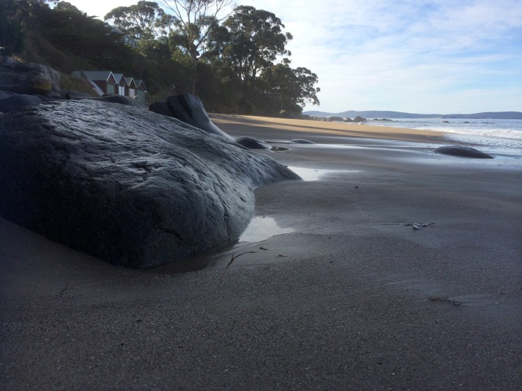
I was keen to find out his take on my observation of low bird numbers around the Derwent’s shores, be they on the western or eastern side or in Ralphs Bay, that beautiful low energy embayment near the mouth of the Derwent, these being some of my current stomping grounds. I had also walked ocean beaches with this concern uppermost in my mind and actually, it was while writing this now in my little mountain study, that it dawned on me that  there used to be a flock of seagulls that flew over our ridge en route from North West Bay (we used to assume) to the tip in South Hobart. ‘ When had this stopped?’  I asked the geo. ‘The sight and sound of them used to be part of the daily rhythm up here.’

‘I reckon they stopped flying over about two years ago,’ he said.

Two years for us to notice a pretty obvious change in our environment.  That’s sobering.  The only large flock I’ve seen since I started my walks has been at the dirty little mouth of New Town rivulet but perhaps I have not been focussing on gulls sufficiently because today, sailing Samos into Sullivans Cove just as the cold front arrived with a blast, I noticed a fair number perched on the roof of the new Institute of Marine and Antarctic Studies building and there was also a small flock at the Wrest Point casino.

It’s easy to assume that these birds, long considered the rats of the sea, are safe from our abuse of the environment… but what if something sinister is going on right under our noses that we are not aware of? And what if the seagulls are not as robust as we once thought? Of course, there could be some perfectly simple explanation. Down at the tip they might have introduced a management practice to stop scavenging seagulls from spreading toxic debris along the shorelines. Certainly, some councils have waged war on them (see links below).

Gulls and cormorants are also regarded with trepidation by those sailors who have boats on moorings. I have a couple of friends who have been most unhappy to discover a seagull after party mess on their yachts.  Some people resort to nautical scarecrows, profiles of eagles, plastic bags and webbing. Take your eye off your yacht and this is what happens.

Seagull Central
Seagull central: it’s our palace now


Seagull payback

Anyway, this man so knowledgeable about all things avian, was kind enough to let me record our talk and so here are some of the points he made during the course of our long conversation.

Shorebirds are in decline. Some natural causes include high tides washing away nests. When you think about the more volatile oceans and weather we’re getting with climate change and the way dunes are being hammered by sea level rise, this would be headline news if birds like little penguins and short tailed shearwaters produced newspapers. Native fauna like quolls prey on birds too.

I could add my own examples: go out to Chappel Island in the Furneaux Group off Tasmania’s north eastern coastline and you can barely put one careful foot in front of the other without stepping on the snakes that prey on the short tailed shearwaters that have their southern summer burrows there.

He cited more examples and based on what he had to say I suggest we all go and peer at ourselves in the mirror because the main cause is our lack of restraint in the way we behave around beaches.  Some locals  walk straight through the plastic fences that councils erect on dunes to safeguard both nesting birds and eroding dunes. People camp on beaches, dunes, or just behind them. Radios blare, kids race about on quad bikes and dirt bikes. Adults in four wheel drive vehicles mistake dunes for playthings, crush nests and mess with the role of dunes as a barricade against the sea.

‘When this sort of thing is happening on remote ocean beaches,’ he said. ‘You know there’s no haven.’ And he mentioned a researcher dissecting a bird on Lord Howe Island, (a tiny speck in the ocean 600 km off the Australian coastline) and finding it chock full of plastics.

‘ And over fishing, acidification of the oceans, the warming seas,’ I said.

‘Dogs,’ he said. ‘Horses on beaches.’

‘Seven Mile Beach,’ I said.

‘Marion Bay Narrows,’ he added.

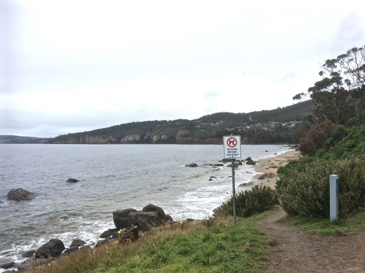
He had begun talking about birds, like oyster catchers and the endangered hooded plover that choose to nest in the tiny scrapes they make in soft sand. Instead of limiting themselves to the hard sand close to the watermark, people and their dogs trample all over the beaches. It’s possible to stamp on a nest oblivious to what you are doing. ‘You may think your dog is doing no damage, but these nests are hard to see.’ And dogs, he emphasised, run all over the beaches. ‘It’s bad enough when they’re leashed. They still scare birds away.’

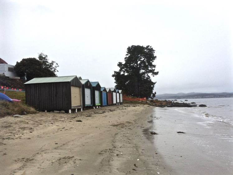
He told me about the annual gull count that is run over the June long weekend and includes the Derwent River.  On Bellerive Beach, for example, ‘there’s a veritable passeggiato of dogs and their owners and so there’s no chance for a bird to make use of it’, he said.

I began to feel uneasy.  I have two beautiful canine companions, fellow adventurers where their presence is allowed. I thought of all our lovely beach walks. It seems to me that even people walking quietly and carefully down a beach with no dog at all disturb birds and even scientists monitoring or researching bird behaviour and lifestyles have that same effect no matter how careful they try to be. Birds nestled over their eggs leave their nests, for instance, when they see that most dangerous of all mammals (us) looming, albeit with a scientific title. But mostly I was thinking about the consequences for me in raising my awareness about this issue. My dogs! The beach! Were they two incompatible loves? And what was more important? Shorebirds, or the delight of seeing my happy dogs enjoying the surf?

‘And boats too,’ I said with a heavy heart.

‘Yes,’ he said. And he told me about a particular reserve on the Derwent River, a little one, just a handful of hectares. He’d recently gone there to do a survey and he explained how its done. You spend twenty minutes on each hectare noting the birds you see and hear. ‘That’s how the atlas [Bird Atlas of Australia] was done, right across Australia. But in those twenty minutes there was a jet ski out on the river in front of me, jets from the display squadron from the RAAF – two went up the river, a helicopter going up the river, a fixed wing aircraft directly overhead at low altitude, there was big earthmoving equipment on a block just up the road from me and somebody was using a brush cutter the whole time I was there. So how am I to rely on my ears to do the survey?’

And, I wondered, how do birds communicate against so much mechanical volume.

I walked out of that shop with a lot on my mind. Shorebirds are up against our way of life. To be a migratory bird travelling the Asia-East Australian Flyway the odds are getting steeper. Will there be water in a particular wetland or will  a new housing development have put paid to that refuge?  Will weeds have covered your burrow or stifled a food source when you arrive? And let’s not even talk about hunters.

It seemed to me that if I was going to walk the birds’ beaches then I had to do it with even more care, in a way that gave more than it took.  But how?

I tried to think of communities that live with restraint. Apart from the locals of North Sentinel Island, denizens of the deep Amazon or the San still sort of clinging to a Kalahari lifestyle, I could only think of the Amish.

But on the bright side, a friend  is elated to discover that ten Little Black Cormorants have come to hang out with the Pied Cormorants living on Cormorant Rock off her home (see here).

And on a really world changing scale, Boyan Slat, a teenager from Holland, has come up with an idea, now crowdfunded, backed by the scientific community and at pilot study stage, for cleaning the oceans of plastics within a ten year period. Impossible? His Ted Talk is here.  See what you think


More About Gulls in Hobart

 Seagulls and the Sorell causeway

Tasports cull gulls

2015 winter gull count

Derwent River: Blinking Billy to Hinsby Beach – Part 10 – Conclusion

Sleuthing Around Taroona

Pebbles make a foot


‘There is much heaving related to water conditions and light structures are moved with the changes’ ~ David Leaman (1999)

I was on such a high after completing that walk that I couldn’t return to those beaches fast enough. The very next day I was back, sleuthing around behind the beaches, particularly the Grange end of Dixons Beach as well as Crayfish Point.

There, in the shade of the canopy behind the boat sheds at Grange Avenue, was the bed the rivulet had made for itself and heading south was a clifftop track.

I bumped into two locals who’ve live behind the beach (Grange, or Grange end of Dixons, take your pick) for decades. I knew the one – she’d taught my daughter. The man and I soon discovered a common connection, this being Hobart. They were happy to share their knowledge about what to expect from the nearby tracks, set me right about the location of Cartwright’s Point but could not identify Beck’s and Retreat Beaches. ‘My dear, I have not been down to the beach for years,’ she said.

The dogs and I pondered the rivulet and the bed it has made for itself then wandered along the cliff top track – and, just for the record, we’ve been back many times since then, accessing it most often from Uitekah Crescent on the southern side of the rivulet. The cliffs are unstable (which is why, for some years, it was closed to the public) and to avoid broken limbs and worse, there’s a wire fence along the edge. There’s also the option, further along the walk, of taking the steep steps down to the shore (where Dixon’s Reef lies wide and exposed on a spring tide) or continuing through a lane, along roads and through bushland down to the beaches at Taroona High School. On this section from Grange there are beautiful views of the estuary through the fringe of casurinas on the cliff edge. On the other side of the path are gardens and the sounds of the suburb.

Clifftop bridge

Sue Mount’s article on bushwalking tracks in Taroona explains that there’s been a path running along the foreshore a long time before the Apex Club upgraded it in 1972 and I like the idea that this was Mouheenener made. I haven’t found anything to suggest that it was but there’s a human tendency to take the path of least resistance and so there would have been a big attraction to following in earlier footsteps. This might seem a long way from Taroona, but in his book Lost trails of the Transvaal (1965), T.V Bulpin says the ox wagon trails of the Voortrekkers often followed already existing tribal pathways through Southern Africa.

Sue Mount also writes in such a way that makes it sound as though the track continues along the Alum Cliffs to the south. I was intrigued – did a path linked with the Taroona beaches run all the way to Kingston or did she mean that you walk along the rocks to Taronga Road and clamber uphill to join the Alum Cliffs track there? This blog heads there next. I made a note to self: find out!

The view from Taroona

I so wanted to show the geo my new discoveries but when, late one evening, I finally got him to walk the garden path with me down to the beach at Grange, malicious little waves were hammering at the steps and the cliffs.

‘It’s gone!’ I gasped, my disappointment profound. You would not have known a beach had been there. For a moment he looked unimpressed but then he turned to watch the wave action on the cliff with growing interest. ‘It’s being undercut,’ he said and we turned and walked back to the car talking beach erosion. And so, perhaps, I took him there in what were for him, ideal conditions after all, but I felt that I had lost my friend, the beach.  (Later, on more long walks, I was to realise that just like Lord’s Beach in Sandy Bay, this beach expands into long and impressive proportions along which there are many instances of beach art.)

The dogs came with me to explore Cartwright Creek too. We followed it from the base of Mount Nelson, across the road and down the grassy bank to the reef below. We visited on high tides and low tides, the expanse of reef exposed and one fine day, with my cycling friend, we walked from Lamberts Rivulet to Cartwright Creek. The creek does have friends. The Friends of Truganini group apparently attempts to make headway against the riot of weeds beneath which it is largely hidden and at this point it does not look as though they are winning the war, at all.

The Sandy Bay beaches inspired me to look into history to make sense of their current shape and appearance but Taroona, with the cone of its volcano beneath the Alexander Battery (Leaman, 1999)  and the squiggles in the roads indications of multiple repairs, lured me into burying beneath the surface to try to understand the variable geology of the beaches

zen

Going along for the ride

The land here is unstable, the soils expansive. The schools and many Taroona streets and houses are travelling on the back of a slow moving landslip down towards the river, and yes, on some cliff tops, their tenure could be precarious! Cracks in walls, roads and soils, hummocky earth and gutters, contorted trees and sudden shifts in slope angle are some of the clues as to what’s lying beneath, as are the inclinometers that track it’s incremental journey.

For those with a short attention span for matters geological, I promise  I’ll be brief!

Simon Stephens is a geologist who has focused his attention on Taroona and he writes that it is ‘a complete microcosm of the geology of the Derwent Valley’, pointing out that the geology determined the way settlement and construction happened in this area. But long before the explorer’s ships anchored, long before the Mouheenener attuned themselves to this land, and at that point in time when the Permain and Triassic rocks had laid themselves down, Tasmania was a part of Gondwanaland, and was a large basin of accumulating sediments, at other times a shallow sea or lowland flats with icebergs visible offshore. Transformed again, a slow river meandered across ‘a vast riverine plain’ (Stephens). I forget dates fast, so I’m not noting the chronological dimensions of eons here – I’m more interested in the different climates and landscapes that have taken a ride through Taroona.

Today, for instance, there are hard, older rocks on the hills and softer rocks, somewhat younger, on what Stephens refers to as the ‘coastal apron.’ The oldest rock is the Grange Mudstone (Permian) and Fern Tree mudstone also occurs here, sometimes with drop stones in it, as well as worm castings. It smells of sulphur if you strike it – but I haven’t, and I’m not going to run through all the different rock formations either, as there are lots, so instead I’ve linked to relevant resources. Also, because my little project has led to geological conversations at home, I’ll put up the geo’s take on the Derwent and D’Entrecasteaux too, I think perhaps after Pierson’s Point where the view to starboard is of the channel, the view to port the river and Storm Bay.

There are glacial scratches on some rocks that I found along this shore and those stones that have dropped into the mudstone (when it was still mud) have probably dropped out of icebergs and I think that is amazing!  It’s actually no wonder that these kaleidoscopic landscapes have led to such a confusing shoreline.

In short, according to Stephens, the climates in which the rocks were laid down varied from Northern Siberian conditions to the sweltering heat of the African Rift Valley. Taroona, (and okay, the island) has had long drawn out climactic moods.  But we’ve had our impact too.  Here’s a conglomerate of ‘anthropocite’!

Anthropocite conglomerate

Clinging to the cliff
After Blinking Billy 3

Taroona’s fault

There are many fault lines in Tasmania and Taroona has it’s very own (although Sandy Bay has more.)  It’s about 60 million years old and when the land subsided and formed the Derwent Valley this fault started opening up, quite possibly as a result of Australia breaking apart from Gondwanaland. Stephens says it runs from close to the Grange quarry (Truganini Reserve), across the Channel Highway and south to the top of Taroona Crescent where it turns and travels out to sea near the southern end of Hinsby Beach and not far from Alum Cliffs. That steep gully I thought so pretty as I came down the wooden steps on to Hinsby Beach? It’s an exposed part of this fault.

Just Past Blinking Billy beach 1
After Blinking Billy 3

Tropical Taroona

Sometimes Taroona exposes its more tropical self in the form of clay soils and fresh water sediments from when it basked beneath a torrid sun. Stephens says that in the area around Karingal Court ‘the sediments are much finer with clay layers which sometimes contain impressions of leaves and other plant matter.’   A friend of mine recently spent time in Coffs Harbour and couldn’t get over all the turtles she saw swimming around in a lagoon. If we could time travel back to when Taroona was (sub)tropical, we could sip on gin and tonics while watching the turtles, rather similar to the Murray River turtles, swimming around our feet in Taroona. It’s true; there’s evidence in those sub-tropical chapters of the rocks.


BLACK SAND AND ZIRCONS

After the last glacial period the sea rose to today’s level. Dolerite from the hill tops weathered and fell into the sea, releasing heavy minerals like magnetite. There is black sand on Taroona beach and well as magnetite you can find zircons here.

So that’s all I’ll say about reading rocks to discover Taroona’s hidden personality and life experience, but the geo has assured me of the need to look at the big picture and not just the local details and so I tasked him with scoping the Derwent River Valley and the D’Entrecasteaux.  I think Pierson’s Point is the right place to point that particular telescope starboard up the channel and port side to Storms Bay and the Derwent River valley and in the meantime there more places to go and people to see.

Bibliography

Leaman, D. (1999). Walk into history in southern Tasmania. Hobart, Tas: Leaman Geophysics.

Mount, S. ([n.d.]). More walking tracks. [Hobart], Tasmania: Dept of Sport and Recreation.

Stephens, S. (n,d,). Introduction and early history. [Hobart].

the face

Derwent River: Blinking Billy to Hinsby Beach: Part 9

The Last Leg… Or So I Thought

Before they built the High School that provides ‘an education fit for a princess,’ a nod to the fact that Mary Donaldson (also known as Princess Mary of Denmark) attended school here, an earlier school for girls existed on this spot and before that, in the 1830s, it was an inn, The Retreat, run by Harriet Baines, and reached via a rough track (now Sandy Bay Road) from town or via the water, where visitors made landfall at the Crayfish Point jetty. (There is still evidence on offshore rocks of some of the original structure and the crayfish, for which it is named, are apparently still plentiful but not for the taking).

The Retreat had a cricket pitch and a bowling green. Back then, a lot of people had their own boats but if you were one of those who didn’t, you could hire one here and go fishing, or ride a horse, or simply unpack your bags and spend the weekend relaxing in the garden, enjoying the substantial meals Harriet put on.

In the early days of the settlement the sailing races sometimes used Crayfish Point as a down river mark and so The Retreat would have been a good spot to watch the yachts gybe or tack for the homeward stretch, sails goose winged before the sea breeze.  Some people like the Reverand Knopwood came out here by boat to fish a little, sometimes with women from the Aboriginal community who were skilled divers for crayfish.

These days, given student activities, it was good to see cormorants and gulls still making use of the rocks on High School point.

After the walk along Retreat Beach, the undercut slope on my right, the tree with its roots exposed, the school grounds above, I crossed the road on to Beck’s beach, tame and civilised compared to the beaches earlier in my walk. No more than a cove, marooned from Retreat  by the road, it is known for its quaint row of boatsheds and the dinghies/kayaks that lie upside down on the grassy slope. Further back there’s a row of houses with great views out across the river. Beck’s (also known as Melinga Place Beach)  is tucked into the northern corner of Crayfish Point, but the Taroona Foreshore trail that I ambled onto behind the rocks at the beach’s southern end, meant easy walking along a well made track with a number of different points of interest – the casurina trees, the blackwoods, the Tasmanian Aquaculture and Fisheries Institute’s labs higher up above the track and, behind it, unseen, bowls and tennis grounds.

It’s also on this point that the Parks and Wildlife Service has enclosures for the Tasmanian devils that are part of its release program, a project attempting to save from extinction this unique marsupial that’s been suffering from a rare infectious cancer, Tasmanian Devil Facial Tumour Disease, in epidemic proportions.  There are also breeding aviaries here, designed to support the endangered and migratory orange bellied parrot to make a recovery from near extinction. There are really so very few of them left.

Crayfish Point is a lightly wooded hillside but it’s the water views that make it the kind of place that draws you back and the sewerage works that once tainted the air aren’t quite so repellent anymore.  But this place also has contact history: in 1805 it was one of the first places that the aborigines and the settlers made contact, exchanging kelp and crayfish for potatoes and bread .  Later, Norfolk Island settlers like the Colleys (who arrived desperate for food, their ship having been poorly provisioned) were granted land in this area (Goc, 1997).

Beck's Beach boatsheds
Becks Beach (Melinga Place Beach) looking woebegone on an overcast day – it’s usually so much prettier!
Becks and RETREAT beaches, Taroon
Boat sheds on Beck’s Beach with Retreat Beach and High School Point in the distance

According to the Derwent Estuary Program, there are approximately 3.3 square kilometres of rocky/cobble reef  in the Derwent estuary and a fair bit of this is along the Taroona shoreline.  Kelp forests grow here, thanks, no doubt,  to the  Crayfish Point Scientific Reserve in front of the TAFI labs.

I revelled in the river views. On the Eastern shore, between Trywork Point and Gellibrand Point there’s the opening to Ralphs Bay, an area a local I chatted to on Hinsby Beach did not know about – I had to point out its entrance. There’s often a ship anchored in the middle of the river avoiding port taxes and there’s an open view downriver into Storm Bay.

There were more people on this part of the walk, several couples, a mother and her children. I loped past Batchelor’s 1810 grave (one of the earliest in Tasmania), across Taroona Beach, Taroona’s most popular, where we’ve launched our kayaks from in the past, and then I walked along the track that runs below the houses to Hinsby Beach.

Not that long before this walk, down a cul de sac, I had found the long steps at its southern extent. They led down a steep, quite dramatic ravine onto the beach, just where the Alum Cliffs begin. In fact, for a small, secluded beach it has a lot of different access points, as well as boat sheds and rivulets, but it also has an interesting feeling of intimacy and wildness in comparison to Beck’s, the Alum Cliffs looming large along its southern extent.

High above I could see Taronga Road where the Alum Cliff walk begins but I promised myself that on another generous low tide I’d try to walk along the base to the rocky platform at the bottom of Taronga Road where I’d heard there were fossils.

Just for a moment I stood and considered the walk I had done and all I had seen and then I turned around and made my way back to Taroona Beach and my waiting lift. The walk had taken three hours. My phone was flat because of all the photos I’d taken and voice memos I’d made. It had been exhilarating and explorative and full of fantastic discoveries. I’d never left the city and yet I’d felt worlds away and I couldn’t have felt more inspired than I did at that moment to carry on exploring Tasmanian beaches.

Looking south from Crayfish Point
There were lots of marine buoys on this particular day a week or two ago (Feb 2016). It took a while before I realized they marked the marine reserve
Remains of an old jetty
Remains of the jetty and the big view south.  The building (right) is linked to the sewerage works).
Blackwoods on the Taroona foreshore path
The path through the blackwood grove
Taroona Beach
Taroona Beach, looking south along Alum Cliffs, with Hinsby hidden from view.
Hinsby Beach
Hinsby Beach from the southern end
Kelp and rocks
The kelp and the rocks ~ on Hinsby Beach
Hiinsby Beach
Hinsby Beach: tide out

Derwent River: Blinking Billy to Hinsby Beach: Part 8

Naming it up

The places I’ve identified have given me the slip so I’m mentally doing circles around High School Point and  the beach some call Beck’s, some call Melinga and some call nothing at all to have a little think about the local expression of the human mind.

This is because in misleading myself when it comes to naming, I’m sure I’ve misled you.  Perhaps the cartographers, surveyors and the Nomenclature Board have not chatted enough over tea breaks or scheduled sufficient meetings, given that for many years they’ve been part of the same division in the same government agency.  This occurred to me because more research this past week indicated one of two things:  1.  I’ve misinterpreted local writers’ beach identification or 2.  The locals simply cannot agree, are occasionally geographically challenged and at other times are simply not precise enough to help confused readers out.  A case in point, Karringal Court is not south of High School Point as one of the authors I read would have it.  Whatever, the maps themselves have so very little to say!

Nomenclature, generally, is further complicated because where no formal name exists the Aboriginal community have naming rights.  But they are made up of several communities and they don’t all know a place by a single name.  Take the Derwent River itself.  It has more than one Palawa name.  According to a member of the Channel community, their name for the river is unlikely to be formally recognised.  I was given this name on a small piece of paper I can no longer find, which is a shame.  The name is beautiful.

The second point of difficulty is in negotiating on names with government.  I had a chat to someone from the Aboriginal Community when I was at Risdon Cove.  They said the government drags its feet.  I spoke to someone in government.  They said it’s hard to get representatives of the Aboriginal community to the table.

I revisited the foreshore and was pleased to encounter a local who told me he’d been walking these beaches since 1948.  An expert, surely!

’Becks, Dixons and Retreat,’ I asked. ‘Can you confirm I’ve got them in the right order?’  He looked at me blankly.

‘I’ve never heard of them,’ he said.  ‘The one you’re calling Beck’s I know as Melinga Place Beach.  Why would it be called Beck’s anyway?’

I went home.  I reopened my books and I clicked through web pages.  I rediscovered an article by Reg Escott on the Taroona Book Digitised website, who in his article on Taroona’s  boat sheds explains that Taroona has five beaches.  Starting at Grange Point, they are:

Retreat Beach [my impression was that he means the whole long strip starting from Grange Beach (not named) and ending at Retreat Cove, the northern beach on ‘High School Point’]

Retreat Cove [the one I thought was Dixons, on the northern section of ‘High School Point’]

Dixons Beach [in front of the high school, south of ‘High School Point’]

Beck’s Beach [Melinga Place beach]

Taroona Crescent Beach [Taroona Beach]

Hinsby Beach.

Have a look for yourself.  It’s an interesting read if you’d like to know more about boat sheds (of which there were many more in the past) – or are keen to stumble across a clue or two as to the interesting placement and formations of boulders / rocks around these beaches.  They have been moved, post invasion/settlement.

I came to two conclusions.

  1. Beach identity is (always) in a state of flux along this shoreline.  For eg, Beck’s is named for a land owner (and perhaps before that was called Mitchells after an earlier owner bearing that name) but now it’s transitioning to being named for a street.  Dixon had a farm somewhere in Taroona.
  2. We keep messing with the landscape.  Had the road not been built down to the shoreline, Beck’s and Dixons (if I’m identifying these correctly) would be one beach.

But, guess what?  I probably still don’t have the order right.  This morning I revisited the Taroona 1:25 000 map (no 5224) and this is the nomenclature that’s listed, north to south:

The Grange Picnic Area (at Cartwright Point!  Go figure.)

Cartwright Creek

Cartwright Point

Dixons Reef (in the region of Karringal Court)

Dixons Beach (which I’d figured was Retreat Cove – see above)

High School – the site indicated but the point not named

Crayfish Point

Taroona Beach

Alum Cliffs

That’s pretty meagre and laxadaisical, if you ask me, given this map is supposed to be authoritative.  What’s more, The Listmap, supposedly the most current source, given that it’s online, has even less information!  And so I’m giving up.  Here, in this city of 250,000 people more or less, we know and care so little about the coastline we haven’t named it up.  The alternative view is that the coastline rejects our spurious naming methodology, if it can even be called that.  Why name something so grand and long enduring after unexceptional land owners?  Why name it’s spots but not it’s freckles?

I like the view of the coastline slipping free of its transient names, even though names would be so helpful when you want to text your lift your whereabouts.  May it stay wild and secret in the city forever.  And perhaps Andrew Short who numbers the beaches, and my friend, who is fine with degrees of latitude and longitude but not with names have a point because if we’re not in a relationship with the coast, and we don’t value it, then it’s nothing but a nameless stranger to us after all.


Moon over Grange compressed
The moon rising over the boulder at Grange Beach

Apart from the links above, see the Place Names Tasmania database.  Here’s the official document on the rules with regard to assigning Tasmanian  place names.

Derwent River: Blinking Billy to Hinsby Beach: Part 7: Reaching High School Point

The Name Confusion Never Ends

Detail: baby mussels and limpets on rock
A detail from this walk: mussels and limpets exposed by the tide

The eucalypt that had confused me as I approached Grange Beach a little earlier in the walk had done so because my next waypoint, already known to me, was another  bleached eucalypt lying prone across pebbles and sand, supported on the tiptoes of its branches.  But now, walking along south of Grange Beach I was still trying to clarify the coastline in my head.  Where, really, did Grange begin and end?  Why was what I was seeing not according with what I’d read in Short’s inventory?

I rounded a slight point and finally reached the eucalypt I’d encountered the previous Sunday, a day that had begun sluggishly because I’d been reading Cheryl Strange’s book Wild, about her long walk down the Pacific Crest Trail, well into into the early hours of the morning. It had made me itchy to get out and walk beaches again, especially as so much of my time had been spent on Samos, back in the water finally after a long time on the slip, but still needing new batteries and a new anchor.  Down at the boat that Sunday, ready to do some work, the geo and I  realised we could do nothing – the shipbuilder had one of our keys and we’d forgotten the other – and so, with just a short space in my day before heading off on a beekeeping course, I’d set off on my initial sortie into Taroona to identify beach access points.

I’d parked the car at the southern end of Flinders Esplanade and found a path that led down to the beach beside a double story house.  This path followed the short, steep edge of a gully that was the home of a rivulet.  At the bottom of the cliff a huge, bleached eucalypt tree stretched across the sand.  On the other (southern side of the rivulet) another path ascended.

KARINGAL COURT 2 the eucalypt
The prone eucalypt at the bottom of Karingal Court

I thought initially that I was on the beach that Short calls T458 (aka Blinking Billy Beach 3 – yep, I know; I was very confused!) because he describes that as being a narrow reflective sand and rocky beach that extends along the base of 20-30 m high bluffs for 200m. Only this wasn’t that long – or then again, maybe on a different tide it was? I also thought that it might be T459 which he describes as extending south of the sloping 20m high Cartwright Point. When I read this I still thought that Cartwright Point was actually High School Point visible in the distance, so it didn’t make sense. (He says of T459 that it’s a narrow eroding beach, is backed by vegetated bluffs that rise to 20m in the south, that there are houses on top of them and steps at the northern end. Not knowing the shoreline to the north at all that Sunday, I decided for the time being that this was the one I was on, not thinking twice about the steps at Grange Beach.

Welcome to my geographically confused world!

I hadn’t had time on that Sunday visit to walk north of the eucalypt, otherwise I’d have realised then that in the absence of a firm nomenclature there are different ways of viewing the coastline. Short, it seems, has taken a larger coastal/geomorphological perspective and identified longer strips – the three Blinking Billy Beaches with the third extending to Mitah Crescent (I think), and Dixons extending south from Grange Avenue to Taroona High School and High School Point. It was only when I revisited on a summer spring tide that I saw that on this strip Grange, Karringal and Dixons really do become one.

One long beach
Karingal Court, Grange Beach, Dixon Beach merge on a spring low tide, Jan 2016

That Sunday, I simply walked about on the shrunken sandy portion of the beach as far as I could go, which wasn’t far as the tide was quite high.  It was indeed narrow here, and as you can see, there are a lot of cobbles and sand and a reef. I found a quite astonishing square rock pool carved into a huge boulder that looked at first like a boat and then like a plane. It’s at the southern end close to the geologically interesting cliff that barred my way further south on that particular tide.

Karingal Court 1

The carved pool at Karingal

So on my long walk I sauntered along knowing that at some point I’d see the bleached and fallen eucalypt below Karringal Court and when I did the somewhat longer beach thrilled me just as much the second time, although I paused with concern to reconsider the dank little rivulet trapped behind a buildup of pebbles.

Karingal Court looking north up its beach
Revisited:  The beach below Karingal Court on the spring low tide, Jan 2016.

From here I could see past the pebble strip I was on to how the beach I assumed was Dixon’s curves to the point at the High School and that, in fact, this wasn’t all that far away.

There is a path you’re encouraged to take as your near the high school, but I’d come back after my beekeeping course was over, and walked that then, trying to shrug off a small despair that had nothing to do with the keeping of bees. That path sometimes uses streets, sometimes paths through bush and across grassy spaces, and sometimes brings you to cliff tops and as a result I was beginning to wonder about the geography behind the beach too.

Rather than choosing this path again I continued along the pebbles beneath tall yellow, unconsolidated cliffs before I stepped onto the beach that I’d identified  as the one Sue Mount refers to as Dixons, but which, on a more recent visit, some locals spread on towels told me they simply call High School beach. They did not know it had another name.

Quiet view from Karingal
High School Point from Karingal Court beach, Taroona

As I walked along Dixons I kept a closer lookout for middens but the evidence I found was frail and barely present. I stopped to try and make sense of a layout of rocks that brought fish traps to mind, but if Tasmanian aborigines did not eat fish from  3700 years ago onwards – there was a dietary transition at this point (Johnson & McFarlane, 2015) –  then why would they have built a trap, if that’s what it is?  I must be one of many who have thought about this because on that later visit one of the people I stopped to chat with on this beach had wondered the same thing and as archaeologists have visited the midden on Dixons, they must have regarded/disregarded this feature too. It doesn’t feature in Jim Stockton’s Tasmanian Naturalist article on the matter.

I rounded the point I thought was Cartwright’s, puzzled, because it was disassociated from the reserve to which it was supposed to be attached.  Instead the school grounds rise behind it.  Is there a school anywhere else in Australia that has such a fantastic setting – surrounded by two beaches and a third (Retreat) across the road really just artificially divided from the other two?

There was a small cluster of seabirds hanging out on the boulders at the point (not Cartwright’s at all, but High School Point, just to be clear).  There nearly always are seabirds here and, buoyed by this fabulous walk, I adjusted the pick up arrangements and then I carried on walking.

(Andrew Short’s report is referenced on The Bookshelf page).

Johnson, M & I McFarlane. 2015.  Van Diemen’s Land: an aboriginal history, UNSW, Sydney