Sailing: Finding Samos

Boats on the Derwent

In January last year I bumped into E at the top of the road and pretty quickly the subject turned to boats and sailing – a shared passion. I told her I was camping out on boatsales.com.au and that day the boat of my dreams was a classic S&S 36.  I wished I was in a position to buy it.

‘Don’t!’ she said. ‘Let’s buy a boat together.’ And just like that the decision was made.

You might ask, ‘why not buy with the geologist?’ But although the geologist was sure he’d like sailing he hankered not for a boat but a motorbike.

E and I began holding boat meetings, and I continued to indulge my passion for reading about long distance cruising, preferably solo, like Tania Aebi’s Maiden Voyage.   After all, if there were teenage girls adventurous enough to take on the seven seas with just their autopilot for company, then surely I was capable of sailing the D’Entrecasteaux Channel by myself, if it came to that?

We easily agreed on a small yacht we could sail on the river and in the Channel, one that would be kind to us while teaching us skills.

And then we started looking. We looked at the cheapest of boats and boats that would stretch our budget, small yachts and, because they were there and the tide was out when it came to the boat market, yachts so big they extended our criteria far away from our brief.

We learned about the secret foibles yachts don’t exactly announce to the world and crafted a checklist, and because the more we looked at boats the more a little bit of luxury appealed, the budget we allowed ourselves crept up and up – and then we’d remember ourselves and shackle ourselves more firmly to our criteria.

We looked in Launceston and Hobart and we put in an offer on a lovely Cavalier. We enquired as far afield as Melbourne and Sydney.

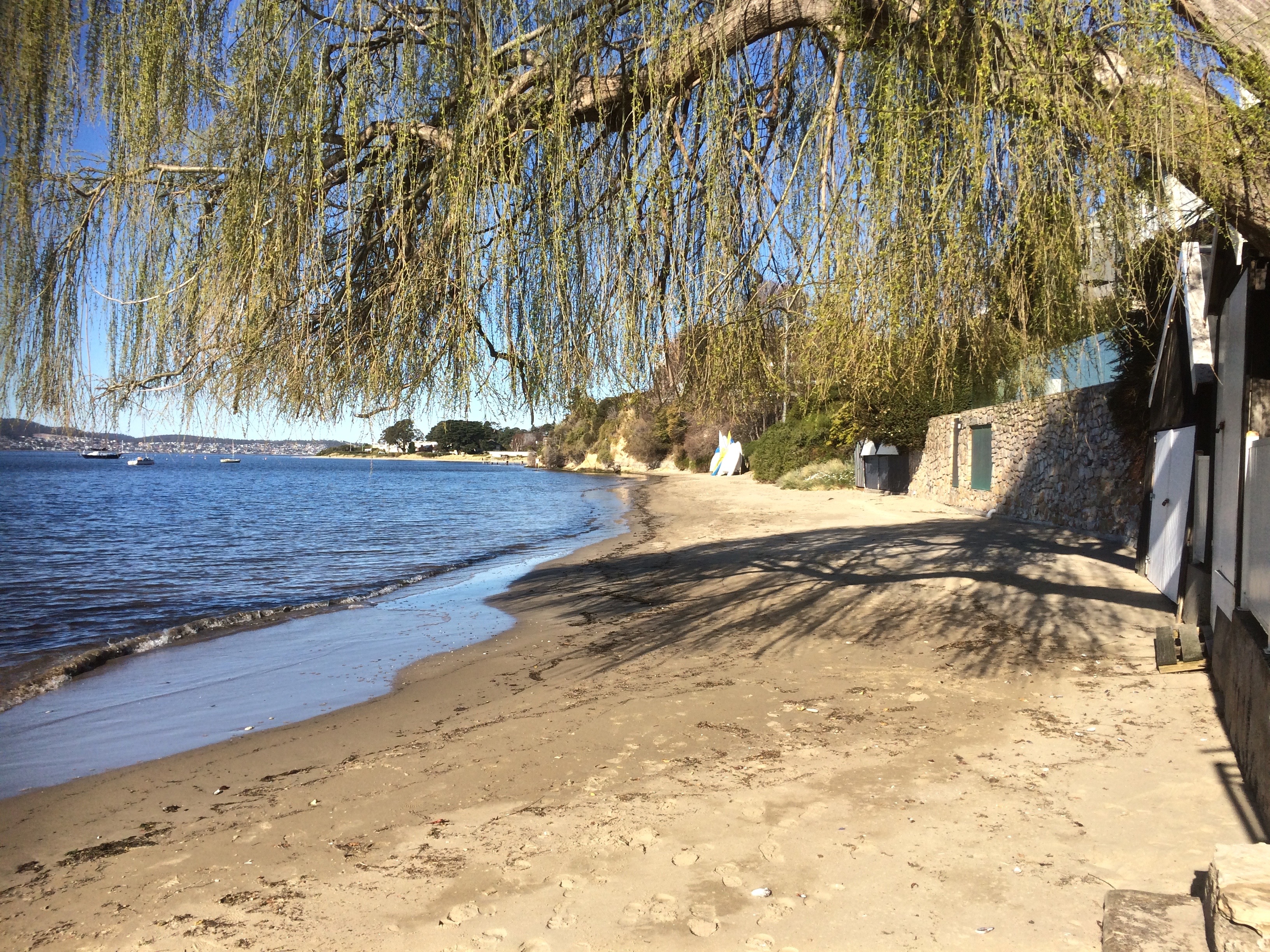
Right at the beginning of our search we’d encountered a Catalina 27 swinging on her mooring on the other side of the river. We fell for her immediately and discussed her excitedly over a cup of coffee at The Aproneers. But it was only the third boat we had seen.  We decided it was just too soon.

I was in Botswana some months later, when I learned she had come down in price and with nothing new to look at we took along our experienced friends and paid Samos a second visit.  A little bit more knowledgeable now, but still with a lot to learn, we liked her just as much the second time around.

The negotiations began. We arranged the survey and bought the boat, acquiring at last that long desired status: Poor Bloody Boat Owners.

SAMOS at the RYCT
Samos at the Royal Yacht Club of Tasmania

We enthusiastically listed and ticked off our tasks. E sailed, I sailed, we sailed together. With the exception of a little bit of coastal cruising, most of my sailing at the time we were searching for Samos, was around the buoys, racing on a beautiful Beneteau with a fabulous crew but the week before we took delivery of our yacht the  boat owner, a most gracious, kind and generous friend, died unexpectedly and that era came to an end.

My focus turned solely to boat ownership and cruising, and racing was put to one side.

ON BIRNGANA.png
My favourite Beneteau

One weekend, shortly after buying Samos, the geologist and I piled the dogs on board and set sail for Barnes Bay (Bruny Island) on our first cruise.  Trimming sails to win began not to matter quite so much.  It was a thrill of a different kind to have Samos catch the wind, to sit back and occasionally let Tania the autopilot (but aka Raeline when sailing with a different crew) strut her stuff.

Sometimes it’s enough just to sit back in the cockpit and discover new beaches and sometimes a long reach down the river, the surf flying and the boat heeling is totally exhilarating.  We coaxed her to 7.9 knots, then E got her to 8.1.  Samos is ready to go racing!

~~~

Meanwhile, this week, high above us in the night sky, another Catalina -the icy comet, Catalina – with its dusty split tail is whipping across the heavens, visible near Venus and the crescent moon.

Derwent River: Maning Reef: A Beach Where the Rocks Used to Be

Unveiled beaches and doppelgängers

Saluting the Governor

The sailing season officially opened last Saturday, the 10th October and Hobart’s recreational sailing fleet turned out in good numbers for the annual sail by  the Governor’s vessel Egeria, moored in Sullivan’s Cove.  Some boats adorned themselves in nautical finery.  We forgot to take off our fenders but by the time we realised this we were relaxing at the rendevouz off Nutgrove Beach and having imbibed a wine or two were feeling too mellow to care that we had not kept up appearances.

The geologist and I had invited three friends along, one an able seaman of the four legged variety, our sole adornment in his coat of yellow.  The sky was blue, the sun shone and there was a breeze strong enough to fill sails.  As this was the first time I was skippering on an opening day we stayed on the edge of the fleet, detouring under the bridge, confusing ourselves over the instructions until order was established in the fleet. We snuck in towards the rear, trying our best to keep ahead of the  Beneteau and MONA cat bearing down on us as we headed into the tight conditions in Sullivans Cove, more alarming last year on a larger boat.

IMG_5795

We dropped our anchor at the back of the fleet, by now mostly rafted up together off the beach, and I lined us up with a group of large boulders off Maning Reef, clearly much loved by cormorants. The tide was low and the coastline had a surprise for me. Lords Bay had spread itself out. It wasn’t a little beach at all but a long, thin sandy beach running along the back of Maning Reef all the way to Red Chapel Beach, validating my belief that in earlier days this coastline was one long stretch of sand, at least between Short and Long Beaches, if not beyond. As we drank wine and picnicked and the talk turned to rugby, I discussed its changed appearance with E who knew this stretch in all its variations better than me.

Later I quizzed a friend who lives above this beach for a bit more information, and then, when the tide was low yesterday afternoon I went walking, hoping to find bouquets of sea tulips waiting for me on the jetty pilings.

And here’s the thing. I didn’t find a single one, but I did find numerous other little squirts who looked remarkably like pyura Doppelgangera and squirted just to show me how it’s done.

IMG_5769
Oysters and sea squirts on a jetty piling.

Despite their name they hadn’t contrived to look anything like the elegant sea tulip I was beginning to believe I’d conjured up. They’re squat, rotund, pustular and a mucky colour, probably impeccably beautiful for blending into their surroundings but a challenge for the human eye to appreciate aesthetically.  A Tasmanian native, it’s well travelled, having hitchhiked on boats since ships first came here, making a pest of itself in New Zealand and the mainland.

I walked on, from stormwater drain to jetty piling to rocky outcrop musing about what it really was I’d seen on the hull. Had it really had a stalk? Had it even been red? Chances are it wasn’t a tulip at all but one of these doppelgängers given they are particularly captivated by artificial structures, according to the literature.

IMG_5767
A green tongued stormwater drain.

While thinking about how dramatically we have changed the ocean and the locations of its denizens,  I located Maning Rivulet (I think) which gave me a small thrill.  As I reached the little cove I’d seen from Samos when sailing with my friend the sky filled with tiny floating seeds like small white butterflies.  They made drifts on the sand and  laced  the rock pools, and the next day, around in New Town, the same phenomenon took place beside New Town Rivulet and I saw that they came from tall graceful trees whose name I still need to find out.

IMG_5859

Here are some more photos of the Maning Reef section of the walk that I took with my trusty iphone 5s.

They’re in no particular order.

IMG_5766

IMG_5784

One of two stormwaters very close to each other that are probably both linked to Maning Rivulet

IMG_5848

Jetty and the Casino
Looking back at the jetty and Casino
Ducks drinking from a stormwater
The consequences of our filth
Reaching the cove at Red Chapel Beach

Derwent River: Red Chapel Beach (T 453)

 Just Fishing

RC a long view

It’s night time on Red Chapel Beach and the birds are loud. There’s a crescent moon rising and out near the middle of the river the foreign vessel at anchor is barely visible.  James Moodie and a mate or two are in his boat closer to the shore.  They’re waiting for a fish to bite but that’s not all they’re waiting for.  The conversation in the boat is quiet; sound carries over water.  They have one eye on the ship. Up above the beach there’s a light shining from his cottage window.

A long boat leaves the ship and heads towards them.  They raft up but from the shore you’d be hard pressed to know that business is being transacted.  All done, Moodie rows ashore.  The oars creak, there’s the small splash of water.  The birds fall silent.

The boat, carried onto the shore by the quiet water, takes clearer form.  It’s a heavy duty wooden rowboat.  And those men are taking out boxes.  There’s the sound of ceramic and glass.  They push that boat right up the sand.  Their accents are strong.  There’s both glee and caution in their voices.  The birds are on alert and the hillside is still and dark.  The men are discussing how they’re going to get the sly grog up the  hill.  They know where they’re going to hide it.  They’ve planned what they’re going to do with their share of the takings and Moodie is reckoning on a good profit selling it from his cottage to the passers by on the Sandy Bay Road.

James Moodie, back in England, was a highwayman who’d been jailed for robbing on the King’s Highway and for assaulting a Constable Jelly.  For these crimes he was separated from his wife and children and deported after first spending two years in the misery of Guildford prison and more time amidst the filth and vermin of the prison hulk, Retribution out on the Thames.  Lightfingered in NSW, he ended up in Van Diemen’s Land, where light fingered again, he nicked some rope.  Illiterate but smart, he amassed sufficient wealth through money lending (at 12 %), hard work and dodgy deals to buy the land above the handy beach now known as Red Chapel.

At 55 he married Ann Barnes (27), had five children and began to gain respect as a carpenter and a farmer.  He had a thing for rope because he learned how to spin native hemp and New Zealand flax together to make a high quality product he could sell, and he acquired further respectability with the building of St Stephen’s Church which would have been a place of community connection for the Norfolk Island convicts living in this area.  It stood out as a landmark, his apparently pious act clearly evident for all to see.

When Ann died, his eldest daughter, Mary, 12, took on her mother’s household and parental role, but she married at fourteen, a dubious marriage that was not in her best interests.  The tale deteriorates into one of financial and sexual abuse.

St Stephens Church holds summer memories for me.  Occasionally I’d go down to this beach to absorb some of its serenity while music carried from the piano in the hall and little girls thumped the floorboards yearning for the day they’d dance on points.

I came back to this beach in August, many years after those tranquil afternoons.  I stood in the small park and looked down at the moored yachts just offshore.  The gate with its Parks and Wildlife sign had been left open by a careless visitor.  There was the willow tree and the boat sheds.  There were dinghies neatly stacked.  There was no one else on this small, intimate city beach except me and a few ducks.  When I looked up, there were the mansions but there was no sign of life behind the windows.

I walked along the northern rocks where they curve out around a garden wall.  There’s a small sandy cove around there that looks to have been isolated by this garden.  To reach the sand you have to scramble across the jetty of another boat shed.  To the south the beach continues a little way below the headland.  It’s been isolated from Nutgrove Beach, the next beach along, by sea level rise but once they would have been a continuous strip.

I came back again on my yacht.  My friend had the tiller as we motored close to the moorings and I took photos and regarded the bay.  From this perspective it’s clear that Red Chapel shares Sandy Bay (as in the actual bay) with Lords Beach to the north.  In effect, they’re the same beach tied to each other by the stretch of rocks, the visible part of Manning Reef, below the seawall.  The Mannings, also convicts from Norfolk Island, had land here once, and Manning Rivulet enters the river here.  You would not know it existed.  Its trapped in a stormwater drain.  From the water you can look at the shore and imagine a different Sandy Bay – a more kindlier planned one where the rivulets run free and linear parks retain and support native fauna and flora.

‘How much water do you like beneath the keel?’ my friend asked.

‘About four.’

‘Bit less than one now.  We’re over the reef.’

‘Out we go then,’ I said.

Again I returned, talking on the phone to the little girl I’d waited for on the beach all those summers ago.  She’s grown now and was in Sydney, in transit home from the UK.  We reminisced.  I told her there was, unusually, someone else on the beach.  I said that three ducks sitting together observing the river were preventing me from walking around to the cove.  I told her there were plovers nesting, that while one circled high above the other was dive bombing me then veering in a circle and flying hard and fast straight at my face.

I left the three ducks to their ruminating and respected the plovers wishes.  The young boy on the beach had left the gate open again, only this time it was completely off its hinges.

Further information: Goc, N. 1997. Sandy Bay: a social history. Gentrx Publishing, Hobart.

Photographs from Tasmanian Archives

  1.  St Stephens Church and the stretch of beach below the cliff
  2. St Stephens Church and the beach from the foreshore

RC boats

Looking north

ngRed Chapel 1 Looking north RC a long view RC boats Red Chapel 1 Sunny day Red Chapel

Derwent River: Lord Beach, Sandy Bay

It’s One for the Birds

Lord’s Beach, Sandy Bay.  

In the little nook on the south side of the casino there’s a small, intimate curve of sand that survives despite the development around it. Because it’s below the seawall drivers lost in their own thoughts can overlook its presence. There’s a gate with a Parks and Wildlife sign beside it. No dogs are allowed, and I think perhaps there should be no gate there at all because I’ve gates to beaches are sometimes left open by the careless, making seabirds like penguins vulnerable to attack.

According to Short (2006), this beach was continuous with Short Beach long ago, which means there was once sand around Wrest Point (hard to envisage). Given that early settlers mentioned sea level rise they’d witnessed, this may have been the case although my hunch is that there were some cobbled strips and these days at least, it’s more continuous with beaches to the south.

One day when the weather was still warm I went down to the marina to work on the boat and the dogs came with me. Afterwards we walked along Marieville Esplanade, past the casino and around the corner to Lord’s. I tied the dogs up at the fence and went on down the path. I felt I was encroaching – the owners had risen as one and moved out onto the water. There is a bench. I sat on it as unobtrusively as possible. Around me there were footprints and all of them belonged to ducks.

In the afternoon much of this part of the beach lies in the casino’s long shadow. The view up river is blocked by Wrest Point but there’s a longer view across the river and down the estuary, and in the foreground there’s the much photographed jetty with its boat house as well as a cluster of yachts on their moorings. Out a bit further, the casino buoy cleared, we often turn the yacht into the wind and hoist the sails.

There are actually a couple of buoys in this vicinity that the Derwent Sailing Squadron and the RYCT use for the combined club races. As well as the green Casino buoy just off Wrest Point, there’s the DSS permanent further offshore and the Manning Reef buoy, sometimes camouflaged by moorings.

I’ve sailed past this beach many times, and cycled above it on lazy summer rides from the Cenotaph to Hinsby Beach, Taroona but one summer a few years ago, feeling particularly free on a week day, my friend and I walked north from Long Beach further south.  The tide was low, but there were some rocks and bits of branch we had to navigate. And this is the thing – you can come to this beach and think that it’s a tiny cove. It isn’t. That little cove is like the bloom of a lily and its stem is a long slender tapering of sand and rock. Jump onto Google Earth and take a ride from the tiny deltoid mouth of Sandy Bay Rivulet south along the coast. You can see clues as to what was there before, you can deduce that older shoreline, marvel (with some concern) at the myriad changes.

Really, the only distraction on the beach is the sound of traffic coming from the road above so if you feel a real urge to come here, bring earphones and relax to music – and bring a bag for litter collection. Picking up the odd cigarette stub or plastic wrapper is a nice way to reciprocate the avian owners for tolerating your inconvenient presence.

The Lords were once the wealthiest family in Hobart, made good from a convict beginning. James, sentenced in York, arrived on the HMS Calcutta in 1804 and quickly grew rich trading in illicit grog. Goc (1997) describes him as a ‘Bobby Shaftoe’ dressed in knee breaches and silver buckles. He and his sons became large landowners in Sandy Bay and bought the Chaffey’s Land, lending their name both to the beach and to Lord Street not that far north from Wrest Point.

But that day last autumn, while my dogs stared down at me feeling cheated, I envisaged the cultivated fields of the New Norfolk settlers and like the Mouheenener children before them, the Chaffey children and others playing on the sand and exploring Manning Reef. Car traffic faded, the road was dirt once more and the Canadian political prisoners on their unsteady legs, plotting their escape, were road building, there was the foot travellers, the odd person on horseback, the sounds of farming and land clearing as well as the odd shot – which would have to be the Rev Knopwood bagging pigeons. Out on the river I imagined a tall ship, whales breaching, gannets diving, and on a light south easterly breeze, the conversation of penguins carried towards me.

Sources:

Goc, N. 1997. Sandy Bay, Gentrx Publishing, Hobart.

Short, A.D. 2006.  Beaches of the Tasmanian coast and islands.  Sydney University Press, Sydney.

Sandy Bay

Historical Photos in Tasmanian Archives

Photographic link:  Aerial view of Wrest Point , Lord’s Beach and Marieville pre the Casino and DSS.

Lords and the boatshedLords and seagull

Ducks on Lords

Walking the Sandy Bay Rivulet from Source to Estuary Part 3

Part 3:  Hall’s Saddle to Waterworks: A rivulet’s point of view

Ridgeway 1 The third stage begins:  Hall’s Saddle

I was strolling a high contour,  the tiny cluster of houses at Finger Post on the far side of the valley.  Far below, the rivulet flowed beneath the forest canopy in the Turnip Fields valley and as I walked I tried to hold its presence in my mind.    Turnip Fields Turnip Fields

The houses on Huon Road hove into sight and the  Derwent River in the distance.  Gracious eucalypts beside the path had bark I had to stop and admire, she-oaks, orange banksia in blossom, and closer to my feet the tiny red flare of epacris impressa.  I was relishing my solitude, enjoying the rhythm of my stride but making slow progress – there were a lot of little water courses I kept stopping to examine.  Alone with my thoughts I faced the same question with the rivulet that I’d had when walking above Mitchells Beach on the South Arm Peninsula:  how close must you physically be to something to be actually walking  it?  And in what way can you be said to be walking something when you don’t know it’s there?  (I was thinking particularly of rivulets in the city and how, walking down a road we are most of us unaware that a rivulet might be flowing beneath us, imprisoned in a drain.)

Ridgeway 3 Near McDermotts Saddle

I reached the abandoned paddocks of McDermotts Saddle, the lumpy land that bears old traces of a building.  Superb blue wrens flitted ahead of me and a raven called lazily.  A little while later I got a view of dark water down at Waterworks. I came to the steps and descended, then lingered.  Gentle Annie Falls and a series of cliffs demanded exploration – their’s is a long quiet dreaming up here in the eucalypt forest.   Contemplation over, I followed the Circuit track, paused again at a poignant memorial seat to young life cut short, then finally arrived down at the rivulet at last, just where it emerged from the forest running small and shallow, slightly cloudy, over its dark forest bed, a stride wide, meandering around boulders.  I walked beside it companionably, stopping to capture its voice at a cliff and again where it runs over pebbles.

Rivulet The rivulet enters Waterworks

Shortly after this I had a choice of path but the rivulet had none. The rivulet is tricked as soon as it enters Waterworks,  apparently for the misdemeanour of flooding (or landscape building, depending on your perspective) in earlier days.   It is  sneakily led into a moat that runs around the reservoir to the right while the usurper, the reservoir, inhabits the bed the rivulet made like a gigantic cuckoo’s egg.

Reservoir Cuckoo’s egg: The Reservoir

I could have walked beside it, commiserating, but having been that way so many times before (the bitumen, the picnic tables), I went left and walked a forest trail.  As usual the gulls were hanging out on the water and when I crossed over between the upper and lower reservoirs  there was a raven grubbing for food, some tassie hens, ducks and plovers. Munching on an apple, I rejoined the disheartened rivulet as it moved unwillingly down its moat, squeezing itself into the very centre as though it didn’t really belong there.  I passed a bbq in action and a couple arm in arm enjoying the view.   Two ducks, flying low, winged pass me on their way up to the top reservoir and as I approached the gate I spotted the first exotic plants: an escaped agapanthus.  It was a harbinger of things to come.

MoatDisplaced rivulet: the ecosystem blanks out. No life to foster, no landscape to build