Frederick Henry Bay: The Dodges Ferry Coastline – Spectacle Head to Carlton River
Previous Post: Tiger Bay Beach to Spectacle Head
Spectacle Head

By means of the path and the road we reached the summit of Spectacle Head. It was arguably the most perfect day of summer and we visually wallowed in the landscape about us.
We walked passed the ceramic whale that is a feature of this headland and took a track beneath the casurinas that border the houses (friendly residents, curious dogs) to another clearing. Beneath the cliffs we saw a rocky shoreline interrupted by cobbled beaches. Two 80 year olds drowned off here in the summer of 2017, caught out by rough weather while checking their craypots.
The land was fairly clear of trees on the eastern side of the point and again we lingered, enjoying looking down at the surfers and the long view out along Park and Carlton beaches, with the Carlton river entrance tiny in the distance and Carlton Bluff a heft of shoulder on the far side looking every bit an island and blocking from our view our onward passage.
The track down the cliff face looked too risky, although locals do use it and we ventured some way along it before turning back. A lone Pacific Gull perched on the sharp, narrow edge of cliff. There is no barricade and it would be easy to take a tumble but I liked that it was unfenced and up to individuals to keep themselves safe.
When we got to the bottom by way of the tamer path, the first thing we did was try to get as far around the headland as we could via the rocks. If I’m right this was dolerite, jointed and sandwiched in vertical and horizontal directions that created something of a floral pattern in some areas. That day, we didn’t get far at all.

Park and Carlton Beaches (T392)
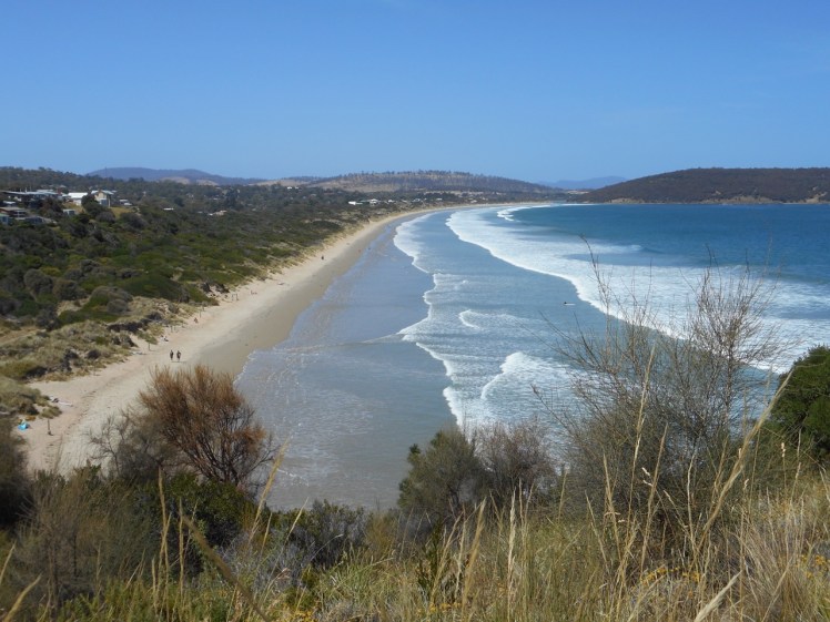
Park and Carlton, popular Hobart surf beaches, merge into each other with no natural division between them. Really, it’s a single beach approximately 3 km long IMHO, facing south and copping the southerly swell. With the tide reasonably low we wandered barefoot along the swash enjoying the light, offshore breeze and the long ripple lines left behind in the sand.
At the time I did this walk a friend was keen to buy a place behind the beach while it remained relatively undiscovered and we’d discussed beach erosion and done some Google Earth exploring. The beach is backed by a narrow strip of coastal reserve. But what looked like a single line of dunes online was broader than I’d anticipated when I set foot on the beach. Marram grass cloaked the incipient dunes in front of taller, older dunes that had been undercut by waves at some point and it was interesting to try to figure out beach processes here. Just after this walk a local told me some guinea pig refugees have made a home in these dunes. She also told me she’s given up fishing. Apparently the flathead Emmett said were bountiful are not so bountiful anymore.

Carlton River
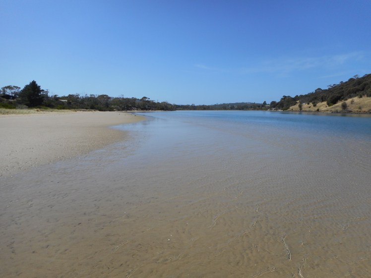
We reached the Carlton Park Surf Life Saving Club and walked on by. We rounded the bend at the river mouth where clear green water was streaming out into the bay, swirling around this year’s sandbank, and not far away there were some surfers and people on SUPS. We were nicely protected from the sea breeze now and walked along in the water with tiny fish swirling around our legs. Exploring the river mouth made me feel exultant. My only prior contact with the river had been further inland, crossing it by way of the bridge and following some of its bends along the road. The modest proportions of this river appeal to me. In size it’s much like the rivers around the town I grew up in. I was eager to return with my kayak.

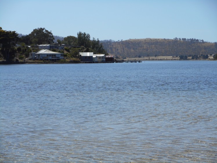
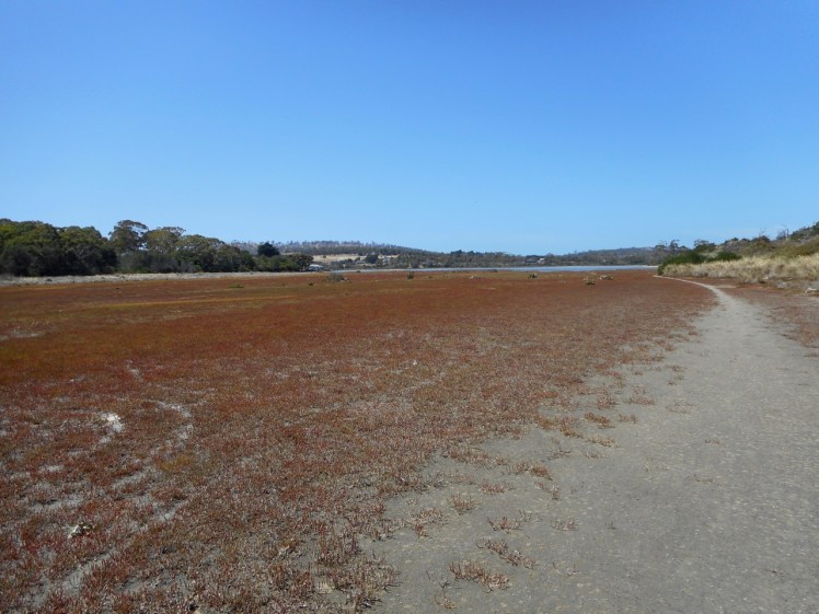
Carlton Bluff, liberally dotted with casurina’s, rises on the other side and someone was walking a path up there. Behind the dunes the river broadens to form a wetland with houses on the inland slopes.
Pied oyster catchers walked ahead of us, gulls gathered near a fallen tree and a pair of swans were off in the distance, paddling out from the wetland where they seem to like to gather. I tried to imagine what the river looked like untouched, full of the birds that should have been there but weren’t because of habitat loss – the great flocks of earlier days now reduced so dramatically the world over.
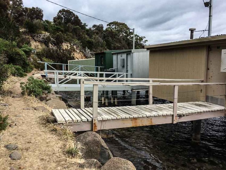
At Steele’s Island resort we again encountered friendliness and stopped for a while to chat to the owners, who were enjoying the fine day beside the river. They talked about its shapeshifting tendencies and how they become an island several times a year when the river water rises and fills the wetland and the dry river bed at their entrance. We walked a big circle around their property, enjoying the birdlife. There was a deepness of large shells beneath our feet and in the stratigraphy of the river banks.

The day after this lovely walk, the friend who was hankering after property here asked if I’d come back to explore with her and so I showed her the circuit around Steele’s Island. This time the tide was higher. A dozen swans looked at us hesitantly across the vast mudflats and so we kept well away from their territory.

Each walk along rivers and beaches throws up new delights. I studied the layers of shell in the undercut bank, the same shells we were walking over and tried to imagine the landscapes further down the stratigraphic layers that had once had their time to emblazon this world with beauty.
Feb 2017