Derwent River: Red Chapel Beach (T 453)

 Just Fishing

RC a long view

It’s night time on Red Chapel Beach and the birds are loud. There’s a crescent moon rising and out near the middle of the river the foreign vessel at anchor is barely visible.  James Moodie and a mate or two are in his boat closer to the shore.  They’re waiting for a fish to bite but that’s not all they’re waiting for.  The conversation in the boat is quiet; sound carries over water.  They have one eye on the ship. Up above the beach there’s a light shining from his cottage window.

A long boat leaves the ship and heads towards them.  They raft up but from the shore you’d be hard pressed to know that business is being transacted.  All done, Moodie rows ashore.  The oars creak, there’s the small splash of water.  The birds fall silent.

The boat, carried onto the shore by the quiet water, takes clearer form.  It’s a heavy duty wooden rowboat.  And those men are taking out boxes.  There’s the sound of ceramic and glass.  They push that boat right up the sand.  Their accents are strong.  There’s both glee and caution in their voices.  The birds are on alert and the hillside is still and dark.  The men are discussing how they’re going to get the sly grog up the  hill.  They know where they’re going to hide it.  They’ve planned what they’re going to do with their share of the takings and Moodie is reckoning on a good profit selling it from his cottage to the passers by on the Sandy Bay Road.

James Moodie, back in England, was a highwayman who’d been jailed for robbing on the King’s Highway and for assaulting a Constable Jelly.  For these crimes he was separated from his wife and children and deported after first spending two years in the misery of Guildford prison and more time amidst the filth and vermin of the prison hulk, Retribution out on the Thames.  Lightfingered in NSW, he ended up in Van Diemen’s Land, where light fingered again, he nicked some rope.  Illiterate but smart, he amassed sufficient wealth through money lending (at 12 %), hard work and dodgy deals to buy the land above the handy beach now known as Red Chapel.

At 55 he married Ann Barnes (27), had five children and began to gain respect as a carpenter and a farmer.  He had a thing for rope because he learned how to spin native hemp and New Zealand flax together to make a high quality product he could sell, and he acquired further respectability with the building of St Stephen’s Church which would have been a place of community connection for the Norfolk Island convicts living in this area.  It stood out as a landmark, his apparently pious act clearly evident for all to see.

When Ann died, his eldest daughter, Mary, 12, took on her mother’s household and parental role, but she married at fourteen, a dubious marriage that was not in her best interests.  The tale deteriorates into one of financial and sexual abuse.

St Stephens Church holds summer memories for me.  Occasionally I’d go down to this beach to absorb some of its serenity while music carried from the piano in the hall and little girls thumped the floorboards yearning for the day they’d dance on points.

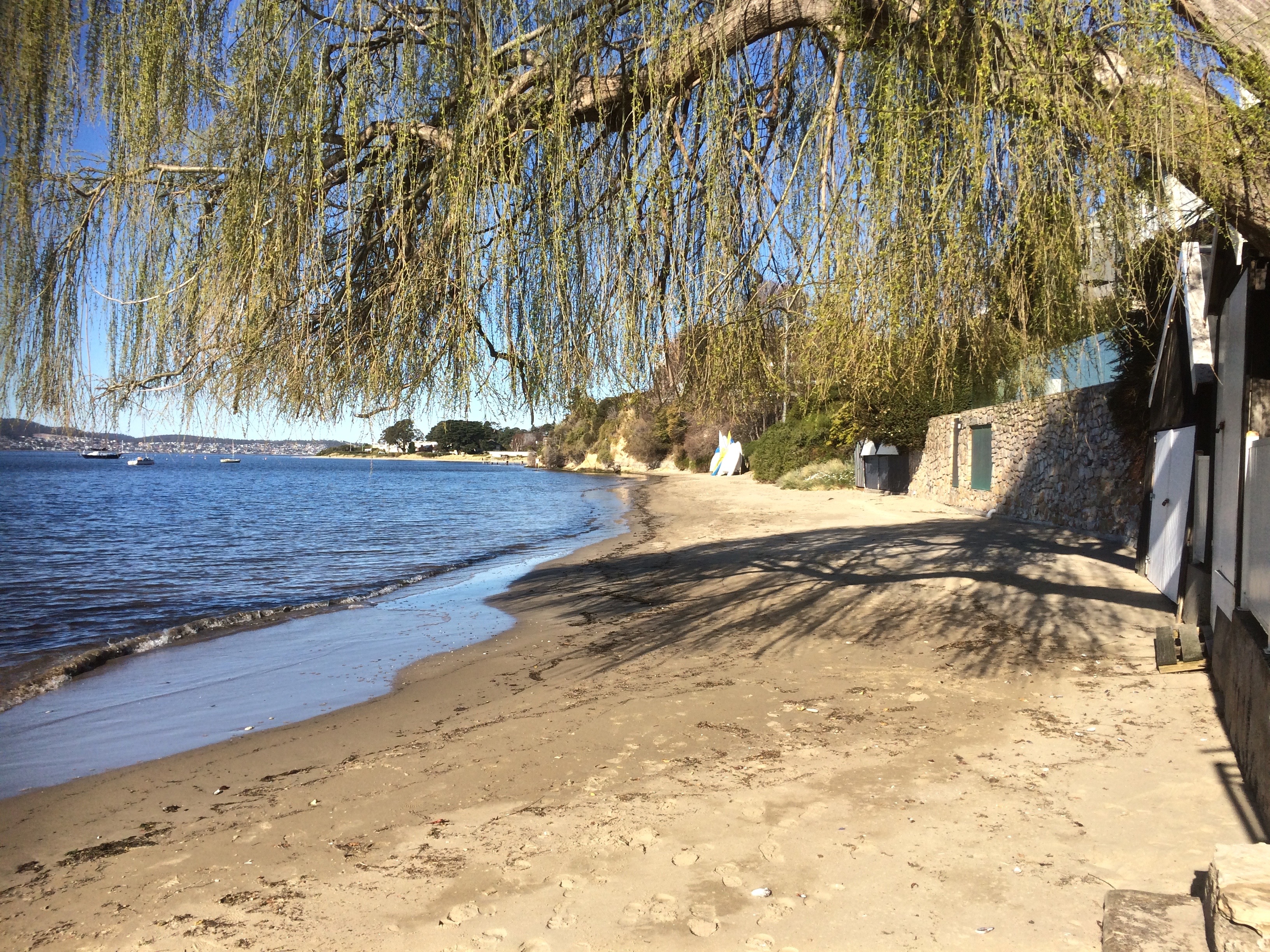
I came back to this beach in August, many years after those tranquil afternoons.  I stood in the small park and looked down at the moored yachts just offshore.  The gate with its Parks and Wildlife sign had been left open by a careless visitor.  There was the willow tree and the boat sheds.  There were dinghies neatly stacked.  There was no one else on this small, intimate city beach except me and a few ducks.  When I looked up, there were the mansions but there was no sign of life behind the windows.

I walked along the northern rocks where they curve out around a garden wall.  There’s a small sandy cove around there that looks to have been isolated by this garden.  To reach the sand you have to scramble across the jetty of another boat shed.  To the south the beach continues a little way below the headland.  It’s been isolated from Nutgrove Beach, the next beach along, by sea level rise but once they would have been a continuous strip.

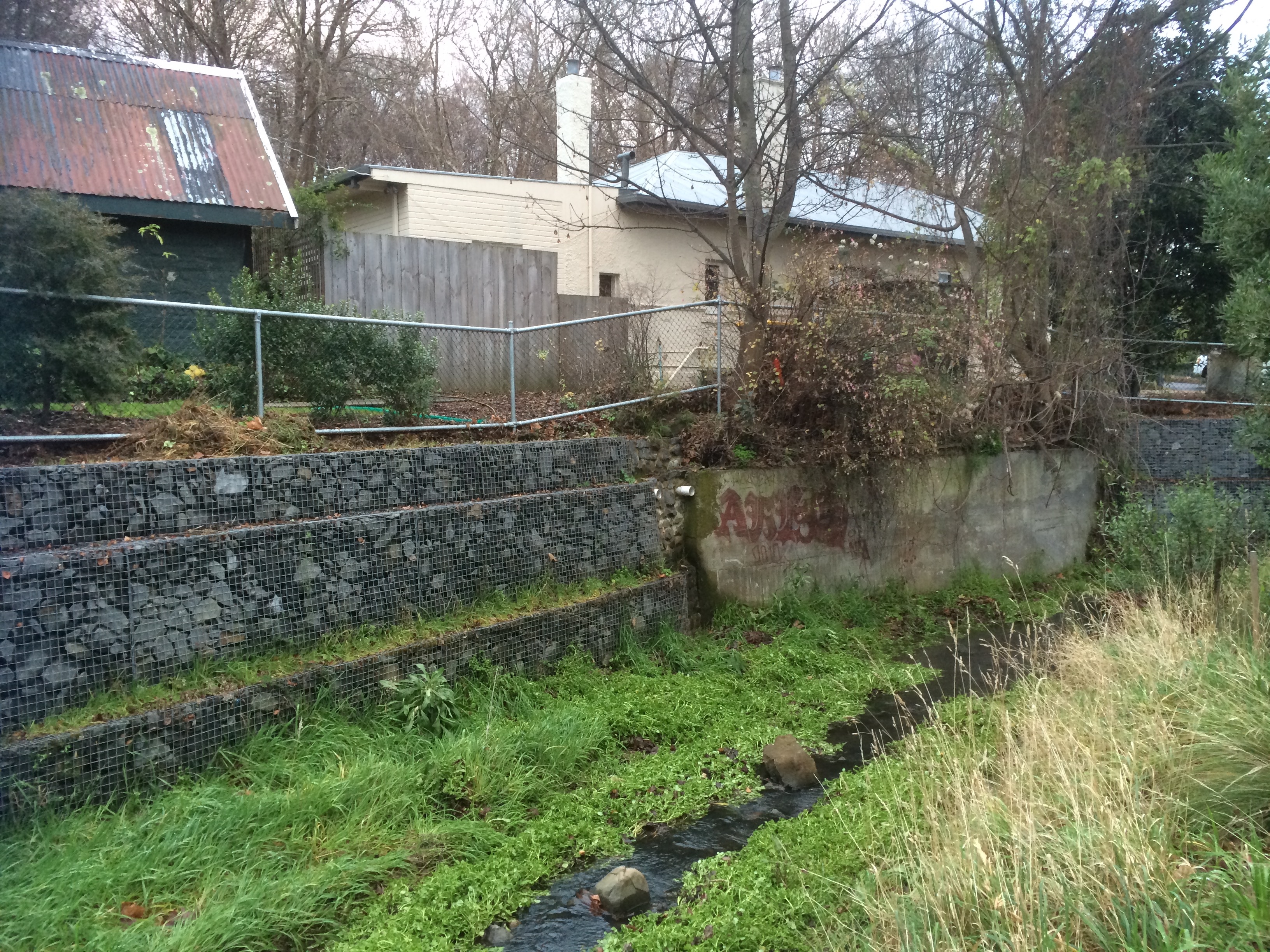
I came back again on my yacht.  My friend had the tiller as we motored close to the moorings and I took photos and regarded the bay.  From this perspective it’s clear that Red Chapel shares Sandy Bay (as in the actual bay) with Lords Beach to the north.  In effect, they’re the same beach tied to each other by the stretch of rocks, the visible part of Manning Reef, below the seawall.  The Mannings, also convicts from Norfolk Island, had land here once, and Manning Rivulet enters the river here.  You would not know it existed.  Its trapped in a stormwater drain.  From the water you can look at the shore and imagine a different Sandy Bay – a more kindlier planned one where the rivulets run free and linear parks retain and support native fauna and flora.

‘How much water do you like beneath the keel?’ my friend asked.

‘About four.’

‘Bit less than one now.  We’re over the reef.’

‘Out we go then,’ I said.

Again I returned, talking on the phone to the little girl I’d waited for on the beach all those summers ago.  She’s grown now and was in Sydney, in transit home from the UK.  We reminisced.  I told her there was, unusually, someone else on the beach.  I said that three ducks sitting together observing the river were preventing me from walking around to the cove.  I told her there were plovers nesting, that while one circled high above the other was dive bombing me then veering in a circle and flying hard and fast straight at my face.

I left the three ducks to their ruminating and respected the plovers wishes.  The young boy on the beach had left the gate open again, only this time it was completely off its hinges.

Further information: Goc, N. 1997. Sandy Bay: a social history. Gentrx Publishing, Hobart.

Photographs from Tasmanian Archives

  1.  St Stephens Church and the stretch of beach below the cliff
  2. St Stephens Church and the beach from the foreshore

RC boats

Looking north

ngRed Chapel 1 Looking north RC a long view RC boats Red Chapel 1 Sunny day Red Chapel

Derwent River: Wrest Point, Sandy Bay

Old Sorrows
IMG_3941

View of the Casino from the Royal Yacht Club of Tasmania

Puzzling over Sandy Bay’s earlier coastline I browsed books and clicked my way through  archival images and concluded that for thousands of years Wrest Point had more delicate proportions.  Before the Mouheenener were forced off their land in 1804 it would have been used as a landmark, a camping spot, a pantry and a kitchen, with Lamberts Rivulet on its northern side creating a diversity of plant and marine life – that is, if that rivulet hasn’t been diverted.  I checked the stormwater map. Drains and rivulets join up but I was reasonably confident it was entering the river in much the same spot it always had.

People were possibly born on this point of land and they certainly died here, hung for misdemeanours on Gibbet Point, as it was known in the early days of settlement, because it was far enough away from Sullivan’s Cove not to cause offence but still a visible reminder of the ultimate punishment.

These days bitumen and the casino weigh down those old sorrows and more besides, because apparently the Sandy Bay Station was in this general vicinity, the home from 1838 of a cohort of homesick Canadian political prisoners, rebels in an uprising, the Battle of Prescott. Their voyage out from Quebec on the Buffalo took a hellish four months (sickness, injury, fear and hunger) and when they arrived, swaying and staggering on their sea legs, they were, that very day, forced off to build Sandy Bay Road. The station was rough – a circle of basic huts – and their provisions were meagre. But they managed to write diaries and when the Governor, Sir John Franklin, who later died searching for the North West Passage, came visiting, one of them wrote this:

He made a very edifying speech to us, in which he was pleased to say that we were very bad men, very bad, indeed; and intimated that we all deserved to be hung. He said we had been sent there for one of the most aggravating crimes, putting much emphasis on the word ‘aggravating’, and, at the same time, as if unwilling to look us in the face, rolled his eyes up to heaven, like a dying calf, if I may be allowed to use a a comparison suggested by my former business…’ (Captain Daniel Heustis, a butcher prior to exile).

Thomas Chaffey, who owned the point, tried to help them escape.  He’d come out to the colony aged 45,  having narrowly missed being hung for robbery and having served time on Norfolk Island.  His land extended from the point up the slopes of Mount Nelson but he and his wife Maria (a Lady Juliana convict with a sentence for shoplifting) built a modest stringybark cottage on what then became known as Chaffey’s Point.  The couple and their seven children had a front row view of executions for several years and after that a foul smelling try works may have been established on the point (Goc,1997).  Thomas’s son, William, built the Traveller’s Rest hotel on Chaffey’s Point. Later, a hotel, the Wrest Point Riviera, was built there and in 1973 the Wrest Point casino took its place.

The Boardwalk at the Casino traps the sun and is built over the water. For a brief period one summer I liked to walk the local beaches then go there for a coffee, the papers and a view of the yachts. This was before we actually bought a boat and I could elevate that experience to coffee on board wherever on the river I chose to have it.  (Today it was mid river, the water quiet, the breeze minimal and five dolphin in a tight pod swimming slowly by.)

The point has been the site of much happiness and sadness and these emotions are still very much entwined  in terms of the current business of tourism and gambling. As for the land itself, it’s been beefed up, extended, and when you sail by you can see pipes entering the river beneath the casino as well.  Although  the cormorants and seagulls hang about on the rocks close by, the contamination from the hotel and the marina has to be detrimental.  It’s no place for swimming and no place to feast on the stoic molluscs that survive there but apart from all that, it’s an iconic local landmark.

Archival Images (Tasmanian Archives and Heritage)

Early Buildings on Wrest Point

Photograph – ‘Wrest Point’ House, Sandy Bay

Wrest Point Hotel

Marieville

Further reading:  Goc, N. 1997. Sandy Bay: a social history. Gentrx Publishing, Hobart.

Derwent River: A Beautiful Geology

But Where Does the Beach Start, and Where Does it End?

beach near trywork

At first I thought I’d simply visit each sandy beach, but within the first few minutes of our initial walk at South Arm I’d scrapped that plan.  Beaches are not disconnected from their rocky platforms or the coastline that surrounds them; it’s not possible to see the whole magnificent geology by looking at grains of sand even though they say a lot.

I was also immediately confronted by the question about what makes a beach.  Bedrock geology occupies about 60% of the shoreline so there’s a lot of hard rock.  The remaining 40% of the coast comprise sandy beaches; some tiny, waveless coves, some long surf beaches, each with their own sandy signature.

On walks with the geologist, we got to talking about how beaches are made.  We’re a tiny island hammered by the Roaring Forties.  Weather passes through and clearly subscribes to the view that when visiting, more than three days and you stink like a fish.  The cold fronts run hasty circles around the Southern Ocean.  I’m glad to see one go, I’m enjoying the mellowness that confirms my belief that there’s no better place on earth to live than on this island, when goddamit, that warm weather is shoved out by another cold front arriving in a temper and I have to down traveller and reef, close windows and crank up the woodstove, add another layer of thermals before heading down to the marina.  But our beaches face every which way, so for each one exposed to the prevailing wind another provides a safe anchorage or a sheltered nook be you human, seal or seabird.

A ripple becomes a wave, the moon entices then releases the ocean making a yo-yo of the tides, currents wend their way through the oceans deep and deep below the layer we’re a part of, magma schmoozes through fissures and cracks melting all opposition, adding its power to the building and destruction of coastlines.   With humankind intent on weighing in, turning tropical our polar waters and usurping the earth building roles of rivulets and the like, we’re bringing the Holocene that nurtured us to a climactic close.

I went looking for a definition of a beach.  I found long, technical ones that sounded far too complex for me so I decided a beach was where there was enough sand that the word ‘beach’ popped into my head.  Still, I would have to become attuned to where a beach began or ended and was going to learn that it was no easy matter.

That’s why I’m glad I started with the Derwent River beaches.  I’d no sooner get home than uncertainty about what I’d noticed – or, more usually, failed to notice – would assail me and back I’d go.  I’d go back often just for the pleasure of revisiting or to take a friend to see what I had found.  I’d go back because I’d begun to doubt my point of view, wanted to confirm the beach’s perspective both literally and figuratively, and because, the way I see it, neither the beach nor I are different and neither are we the same each time we meet.

Percentages sourced from Short, A.D. 2006.  Beaches of the Tasmanian coast and islands.  Sydney University Press, Sydney.

Walking the Sandy Bay Rivulet From Source to Estuary Part 4

Roughed up in the ‘burbs.

Track to Romilly Road

South Hobart, Dynnyrne, Sandy Bay – the suburban route began with a nondescript path outside the park gates that ran downhill to the rivulet, returning in a rush to its natural bed. I explored a bit, then crossed it to reach the forest track above it through to Romilly Road.

So here’s the sobering truth.  The houses begin and the rivulet gets roughed up.  A sign of worse to come, it travels between banks entangled with blackberries and forgot me nots, lawns and paddock.  Some gardens make it their focus, others shun it.  Regardless, it sounded almost cheerful flowing thin and narrow at this interface between forest and habitation. I had a good view of the state of affairs; this path follows a higher contour just below Stony Steps, another of Hobart’s secret places.   There were cliffs; I reflected on how this rivulet, eons ago, before its landscaping capacity had been thwarted by us newbies, had carved an impressively deep valley.

I arrived at Romilly Street.  After my wanderings the concrete seemed cold, shadowed and unforgiving.  I, myself, mentally immersed in the rivulet, felt out of place as I paused to take some photos from the bridge.  I could see no way of getting to the bottom.  It was the domain of the ducks.

You barely catch a glimpse of the rivulet on the last stretch of Waterworks Road and what you see is hardly edifying. By the time it gets to Linton Avenue it looks scruffy and unkempt – and then it’s gone!  it simply disappears beneath the road.

With a sense of anticipation, I  took the little path I’d discovered at Linton Avenue on a previous sortie, full of anticipation that I would burst through into the park but my conjecture was wrong.  It led me through to an enclave of flats. Back on Linton, I peered through a wild tangle of tall, dense brambles and weeds, a sign of neglect that indicated a rivulet could well be travelling underneath.   There was nothing to see, nowhere to go and so at the Foodstore on King I turned into Overall Street, braving a soapy smelling periwinkle clad bank, down to the rivulet, where I stood over it taking photos of where it emerges from its tunnel and its route down through the park.  Then I chose to walk the road rather than that sodden weed infested bank and encountered it at Parliament Street where it travels beside the oval. I was retracing my steps from a brief exploration of this area the previous week.

That morning frost had crunched under my shoes as I walked upstream along the rivulet flowing  between gardens and park.  I’d tiptoed past a tiny tent in a hidden glade (someone sleeping rough)  and had expected to emerge on Linton Avenue but had arrived, instead, on the freeway, quickly ducking back down lest I be noticed by the morning traffic.

Again I crossed the road.  There was the place where I’d stopped to chat with a man who directed my attention to a house, once a mill, on the banks of the rivulet, and there again, down a steep descent, was the end of  Fitzroy Place and the woebegone rivulet now in a stormwater drain heading beneath Regent Street.  I sauntered down Queen Street and detoured into Lincoln Street to meet it again where the story was one of ducks and daks – ducks fossicking on the bank and old underpants caught on a rock.

I walked down Jersey Street and found the rivulet carrying a plastic bag.  I was there to greet it at Dr Syntax, where it had accumulated plastic cartons and I was there as it entered another stormwater drain (yep, we really esteem this rivulet) and was there to witness it running down its gutter behind the back gardens on Osborne Road.  Sombered, I headed down Quayle Street.

Down near the beach the rivulet gets some recognition but litter marrs the scene – spray cans, McDonalds takeaway products, trapped by a buffer – Mary Ann Bay Beach is grateful. What a terribly filthy, crass minded species we are, I was thinking, and then a welcoming tide came rolling in, and the rivulet, once fragrant, now toxic, depleted itself into the Derwent.  My dogs rushed to greet me and the geologist waited.  Short Beach was lit with slow afternoon activity and the light was mellow.  Feeling like a traveller arriving in another land, I was both buoyed by the loveliness of the walk to Romilly, the activity on the Esplanade and sobered by how quickly the rivulet had been ravaged.

We found a bench, we spread a cloth, we poured puerh tea, and sitting side by side eating chocolate and imbibing this smooth antique tea, I told the geologist of the places I’d been and the things that I’d seen.

SBR at top of Wwks Rd
Meeting forget-me-nots, top of Waterworks Rd

Waterworks

Sandy Bay Rivulet running past Pillinger Road
Sandy Bay Rivulet from Dr Syntax
Sandy Bay Rivulet mouth, Short Beach Sandy Bay
Tea time after the rivulet walk

Walking the Sandy Bay Rivulet From Source to Estuary Part 1

Part One:  Being Random

Because I live in the Sandy Bay Rivulet’s catchment, it seemed symbolic that I should kick off my beach walks by strolling the Sandy Bay Rivulet from its source at The Springs (about half way up the mountain) to Short Beach where it enters the Derwent.  I looked at the spurs high up near the summit, figuring out the catchment zone.  I read reports and discovered some conflicting facts about where its source is believed to be.  I did some sleuthing, discovering it here and there as it meandered through its urban reaches.  I made an astounding discovery – or so I thought.  It’s the rivulet that flows beside my favourite forest track.

‘You’re going to walk the what?’ said my friends.  It seems that even if you live in its catchment, on the landscape it has made, the rivulet is out of sight and out of mind.

While vacuuming one day, it occurred to me that it must flow through Turnip Fields.  I cut that chore short and went to explore this little known spot.  From the road I saw new houses with names like Mystic Way, and the Derwent, like a heart-shaped lake, captured by the foothills.  I saw the reservoir at Waterworks and down on the valley floor, blocked by private property, I saw the forest it must surely run through.

The one thing I didn’t do was consult a map.

Confident I now knew its route, I told the geologist I would follow the rivulet that slips down beside ‘the leech path’ to Jackson’s Bend on Huon Road.  There’s a steep, forested valley on the lower side and I imagined I would slither down into this copse with my sailing boots in my rucksack in case I had to slosh my way down the rivulet itself.  Over drinks the geologist explained that I would need a compass, that the bush would be dense, and quite possibly impenetrable over the rivulet.  He told me it was even conceivable I could fall over a cliff and die.

I was disbelieving.  The copse is narrow but it’s true the slope is steep.  I had thought of my descent into the valley as a drop into an unknown world – old memories of the Famous Five had stirred, awakening my inner George.  ‘Forget it,’ said the geologist, and told me of his efforts to push through horizontal and the achingly slow progress he had made.  ‘Only masochists will go into that stuff.  There’s too little reward.’

I was unconvinced but I didn’t like the idea of encountering old bones (that cliff!) or trespassing and encountering a landowner bristling with weapons, as occurred to some others in a 4×4 recently.  And so I agreed to begin at The Springs and to follow a more conventional way down to the river.

From the Springs to the River: Radfords Track

Tasmanian Beaches: Reflections 1

MONDAY 11 MAY 2015

THE BEGINNING POINT

One the shores of the Derwent

A story has no beginning or end: arbitrarily one chooses that moment of experience from which to look back or from which to look ahead. 
Graham Greene, The End of the Affair

As soon as we got home from  the Arm End walk I grabbed a coffee and began to research the Tasmanian coastline.  Someone must have written up their beach walks around Tasmania!  My sleuthing uncovered someone Walking the Derwent River, a group walking the beaches in Clarence, and Andrew Short, who has recorded all of Tasmania’s beaches as well as the entire coastline of Australia.  As soon as I saw the title of his report I realised I’d seen it before – and so I rang the geologist and suggested he visit the library.  (There is nothing like a library – the next day I had it!)

The State Library of Tasmania holds tantalising titles too, and I’m conscious at the same time that although I had to dive deep into the internet to uncover sunken treasure it’s many fathoms deep and oceans vast, and there could well be further riches down there in someone’s lost, forgotten blog.

I flipped through Short’s illuminating report.  Mary Ann wasn’t one long beach.  She did have a companion, the one apparently nameless that I’m going to personally call (serious nomenclature being one for the state) Gellibrand Vault Beach.  Down at The Spit there were two other beaches I’d either not noticed sufficiently or had failed to record.  I’m pretty sure locals must call them North and South Spit beaches.

He’d also numbered the beaches along the Derwent Estuary. I’m often on them.  How could I not include these old favourites?  I looked at my chart of the Derwent, I consulted maps.   I thought about the mountain and how it conjures up weather and serves up magic or sorcery for yachties, how when you’re out there sailing, you have to keep your eye on it so you know what might be brewing.  The river is inextricably bound to the mountain, not just through the wind but because rivulets carrying altitudinal memories and stories flow down into it, bringing their own unique chemistries to the Derwent.

The mountain’s personal space extends some way out to sea – you feel its moods, it’s muscle flexing.  How could I not take all that into account?  I looked again at Andrew Short’s incredible number, 1,067, and quickly remembered that in all things, small is beautiful. Perhaps 100 beaches was a more suitable goal.  Perhaps I should focus on a particular locale.  I decided to make my mistakes close to home and start with the beaches of the Derwent and the South Arm Peninsula, possibly even the D’entrecasteau Channel, but I didn’t dare count them.

I had walked several beaches before I realised the beginning was merely symbolic.  Exploring the beaches, laying down memories about them, began on my first visit to Tasmania many years ago.

Still, I felt that before I began on the beaches not that far from my front door, I needed to know more about that beautiful thing, the river, its currents and waves, which along with the wind shapes the shoreline, and the small but powerful rivulets that merge and become one with it.

This project was proving to be as shapeshifting as the beaches themselves.

Detail, Grange Beach section