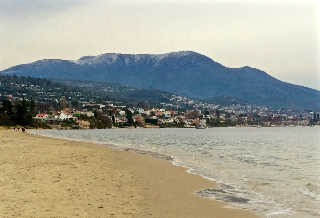
Derwent River: Lord Beach, Sandy Bay

It’s One for the Birds

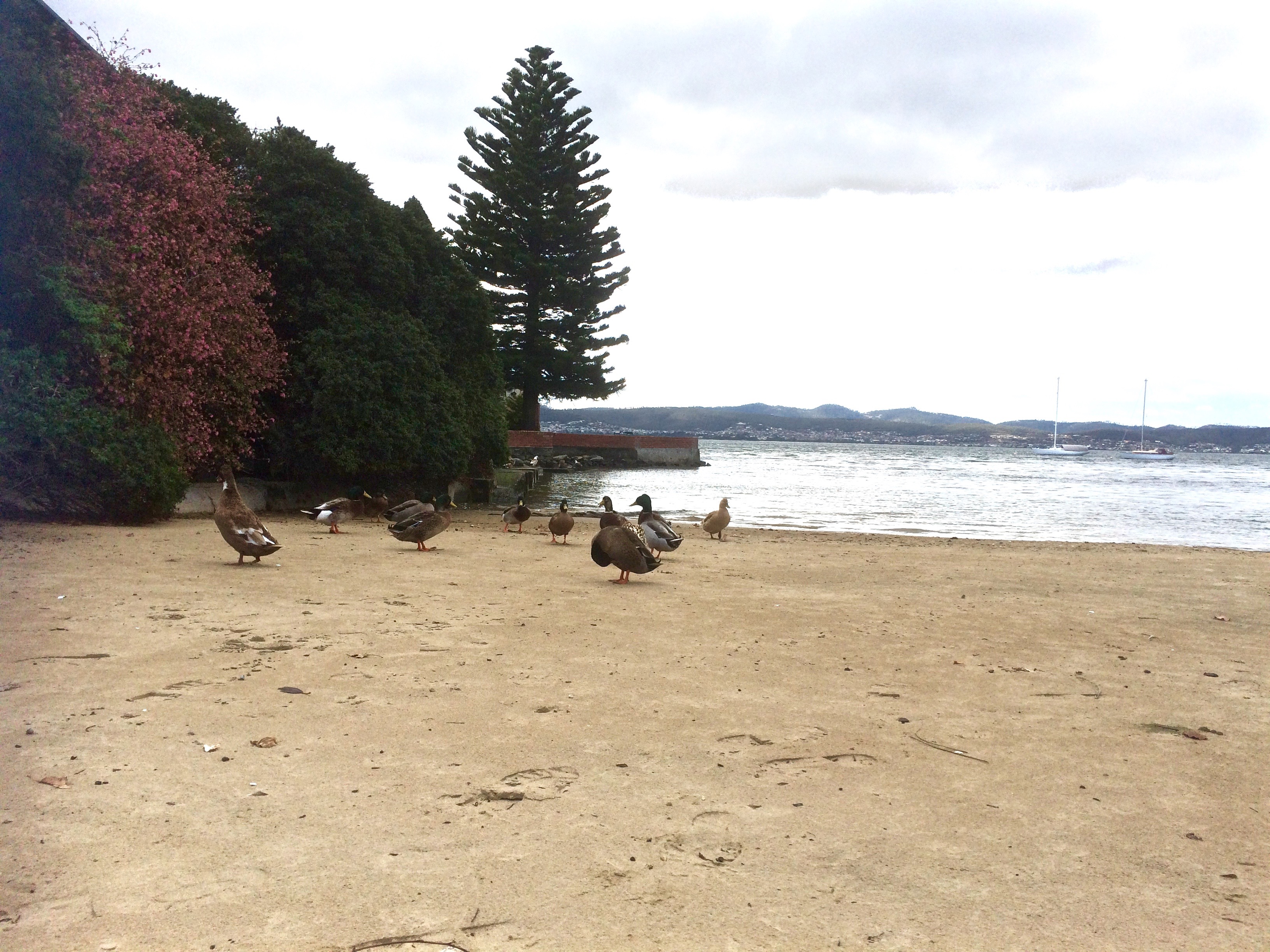
Lord’s Beach, Sandy Bay.  

In the little nook on the south side of the casino there’s a small, intimate curve of sand that survives despite the development around it. Because it’s below the seawall drivers lost in their own thoughts can overlook its presence. There’s a gate with a Parks and Wildlife sign beside it. No dogs are allowed, and I think perhaps there should be no gate there at all because I’ve gates to beaches are sometimes left open by the careless, making seabirds like penguins vulnerable to attack.

According to Short (2006), this beach was continuous with Short Beach long ago, which means there was once sand around Wrest Point (hard to envisage). Given that early settlers mentioned sea level rise they’d witnessed, this may have been the case although my hunch is that there were some cobbled strips and these days at least, it’s more continuous with beaches to the south.

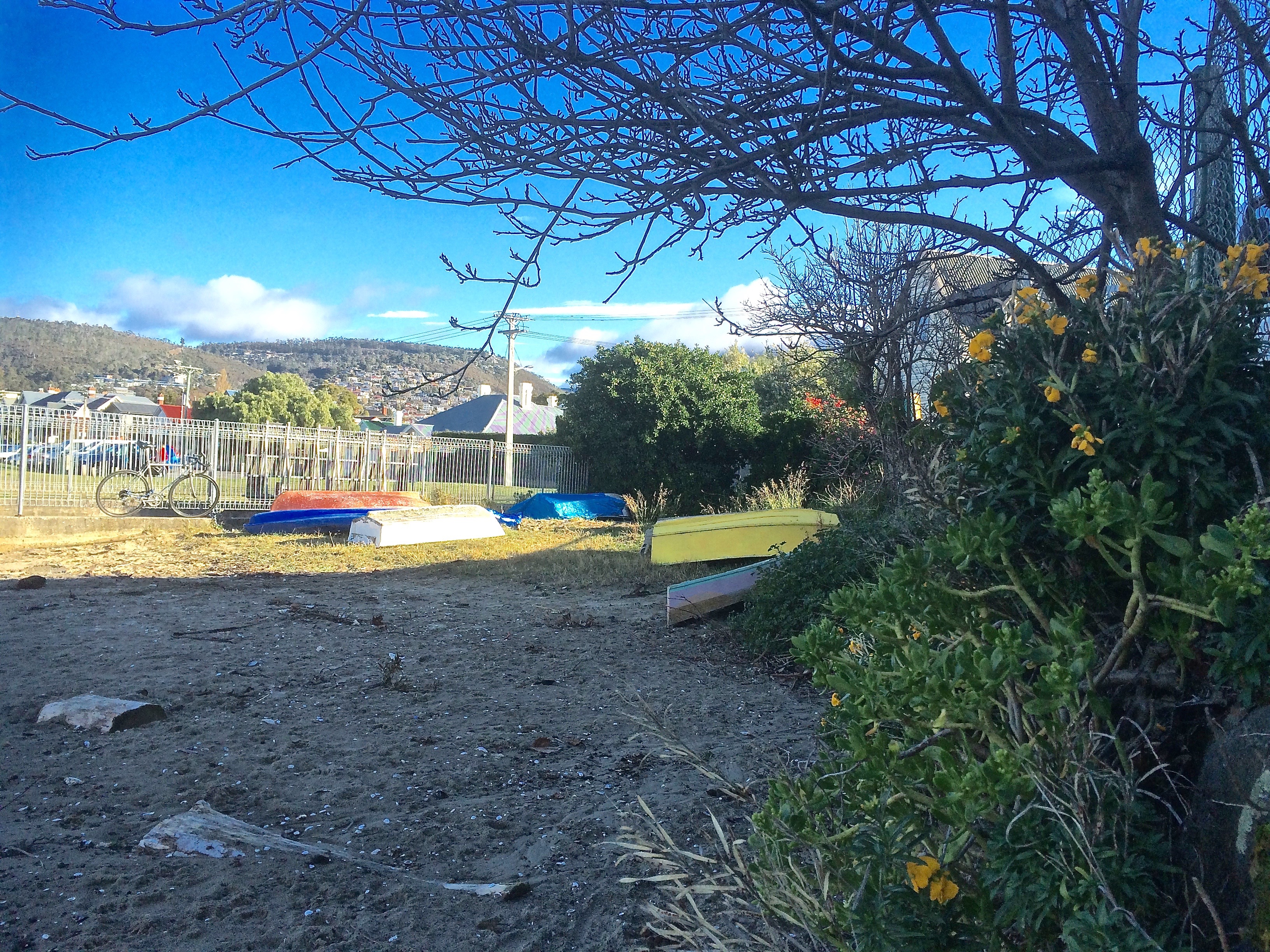
One day when the weather was still warm I went down to the marina to work on the boat and the dogs came with me. Afterwards we walked along Marieville Esplanade, past the casino and around the corner to Lord’s. I tied the dogs up at the fence and went on down the path. I felt I was encroaching – the owners had risen as one and moved out onto the water. There is a bench. I sat on it as unobtrusively as possible. Around me there were footprints and all of them belonged to ducks.

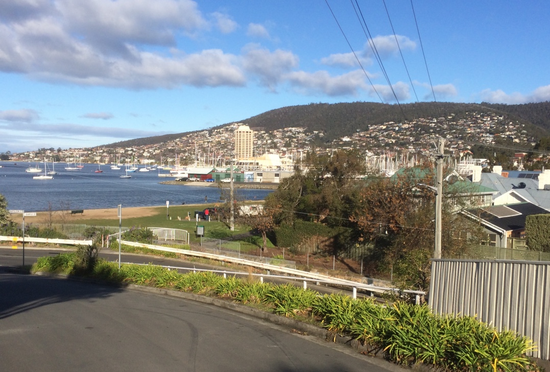
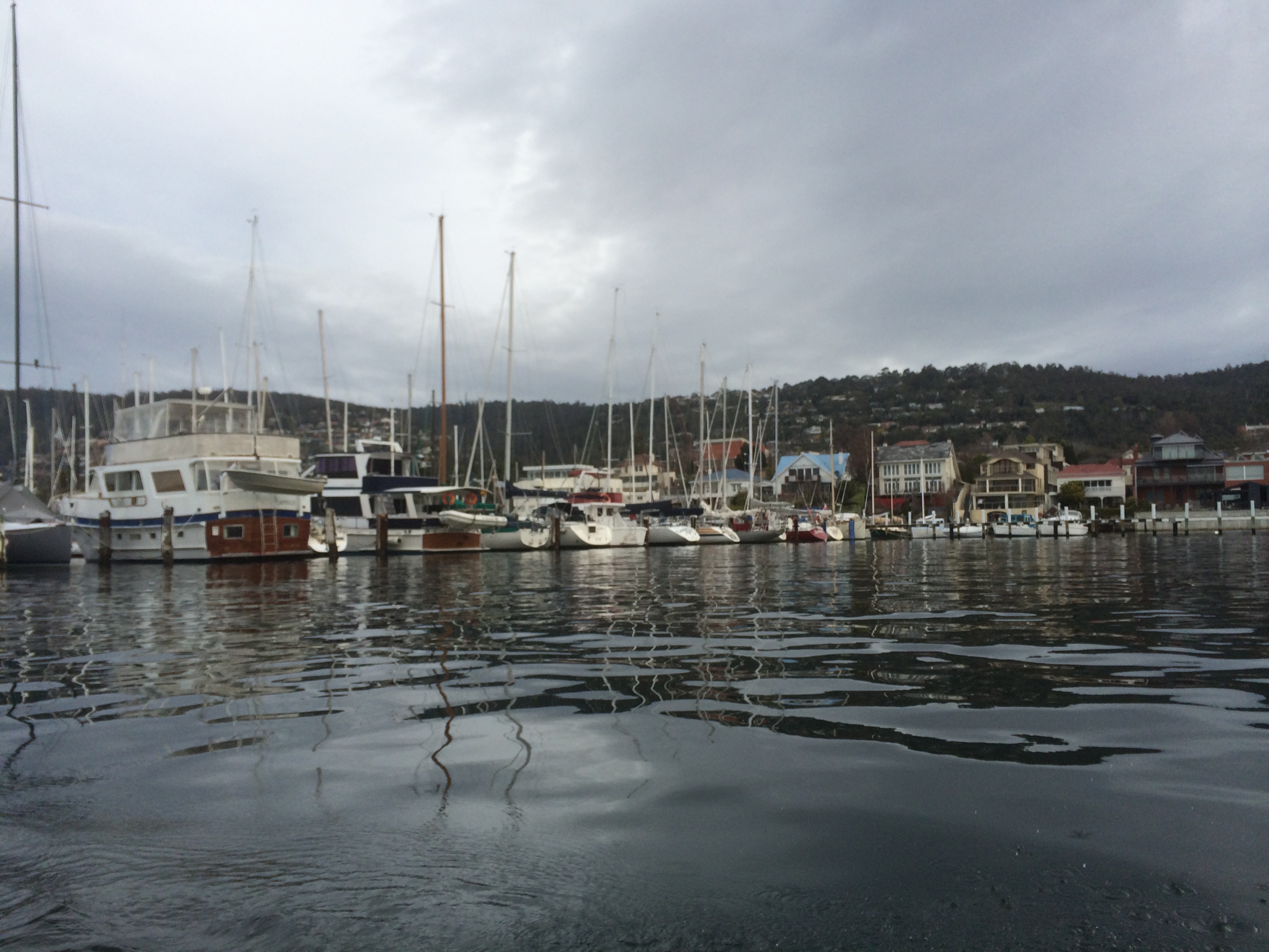
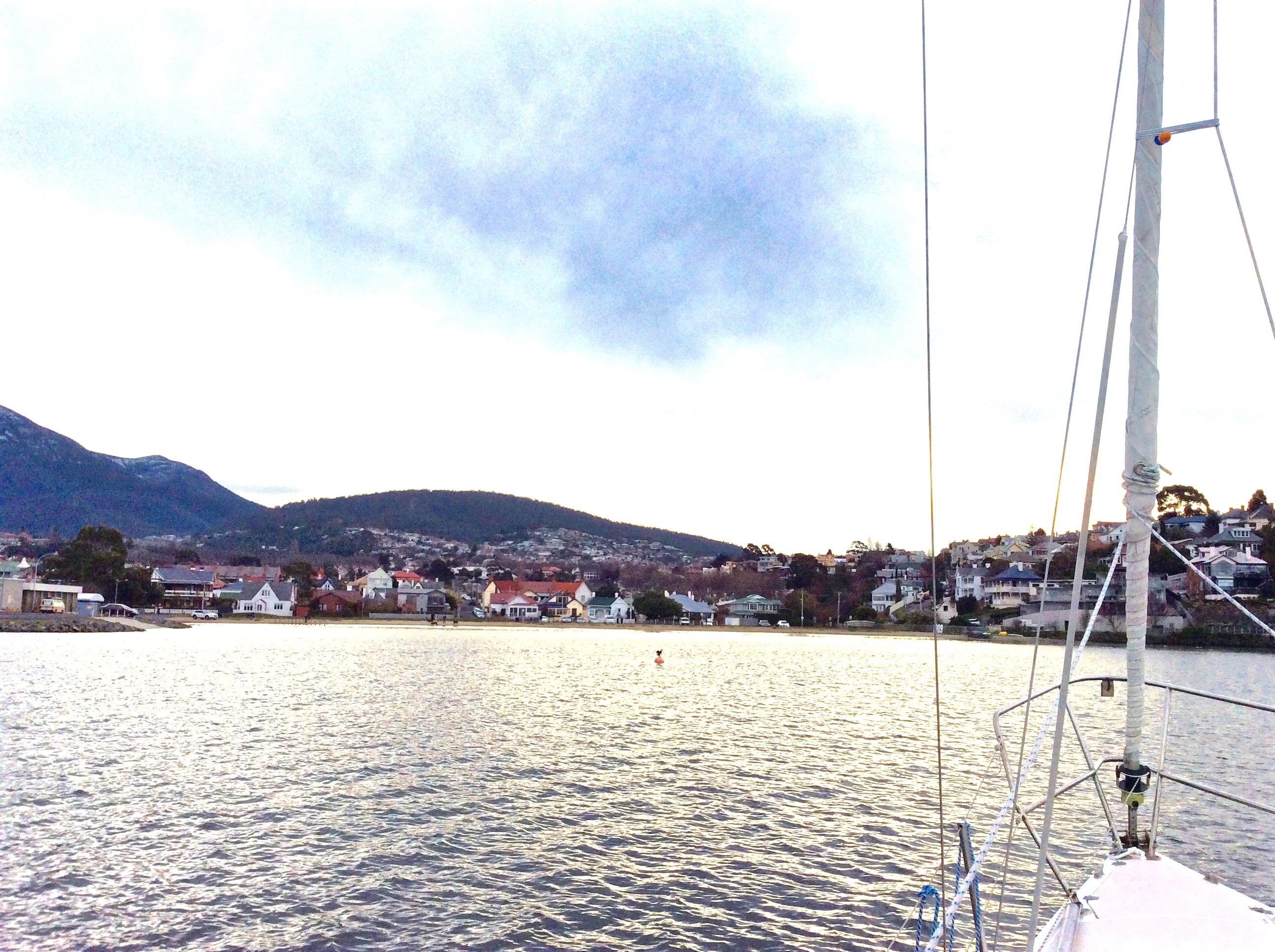
In the afternoon much of this part of the beach lies in the casino’s long shadow. The view up river is blocked by Wrest Point but there’s a longer view across the river and down the estuary, and in the foreground there’s the much photographed jetty with its boat house as well as a cluster of yachts on their moorings. Out a bit further, the casino buoy cleared, we often turn the yacht into the wind and hoist the sails.

There are actually a couple of buoys in this vicinity that the Derwent Sailing Squadron and the RYCT use for the combined club races. As well as the green Casino buoy just off Wrest Point, there’s the DSS permanent further offshore and the Manning Reef buoy, sometimes camouflaged by moorings.

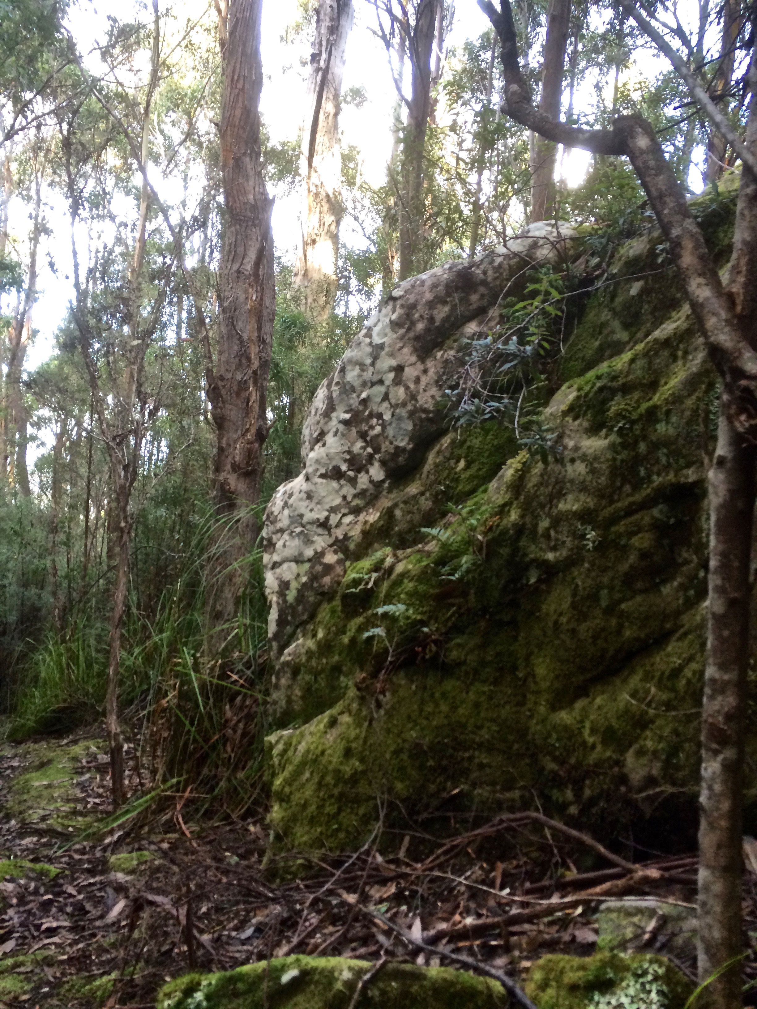
I’ve sailed past this beach many times, and cycled above it on lazy summer rides from the Cenotaph to Hinsby Beach, Taroona but one summer a few years ago, feeling particularly free on a week day, my friend and I walked north from Long Beach further south.  The tide was low, but there were some rocks and bits of branch we had to navigate. And this is the thing – you can come to this beach and think that it’s a tiny cove. It isn’t. That little cove is like the bloom of a lily and its stem is a long slender tapering of sand and rock. Jump onto Google Earth and take a ride from the tiny deltoid mouth of Sandy Bay Rivulet south along the coast. You can see clues as to what was there before, you can deduce that older shoreline, marvel (with some concern) at the myriad changes.

Really, the only distraction on the beach is the sound of traffic coming from the road above so if you feel a real urge to come here, bring earphones and relax to music – and bring a bag for litter collection. Picking up the odd cigarette stub or plastic wrapper is a nice way to reciprocate the avian owners for tolerating your inconvenient presence.

The Lords were once the wealthiest family in Hobart, made good from a convict beginning. James, sentenced in York, arrived on the HMS Calcutta in 1804 and quickly grew rich trading in illicit grog. Goc (1997) describes him as a ‘Bobby Shaftoe’ dressed in knee breaches and silver buckles. He and his sons became large landowners in Sandy Bay and bought the Chaffey’s Land, lending their name both to the beach and to Lord Street not that far north from Wrest Point.

But that day last autumn, while my dogs stared down at me feeling cheated, I envisaged the cultivated fields of the New Norfolk settlers and like the Mouheenener children before them, the Chaffey children and others playing on the sand and exploring Manning Reef. Car traffic faded, the road was dirt once more and the Canadian political prisoners on their unsteady legs, plotting their escape, were road building, there was the foot travellers, the odd person on horseback, the sounds of farming and land clearing as well as the odd shot – which would have to be the Rev Knopwood bagging pigeons. Out on the river I imagined a tall ship, whales breaching, gannets diving, and on a light south easterly breeze, the conversation of penguins carried towards me.

Sources:

Goc, N. 1997. Sandy Bay, Gentrx Publishing, Hobart.

Short, A.D. 2006.  Beaches of the Tasmanian coast and islands.  Sydney University Press, Sydney.

Sandy Bay

Historical Photos in Tasmanian Archives

Photographic link:  Aerial view of Wrest Point , Lord’s Beach and Marieville pre the Casino and DSS.

Lords and the boatshedLords and seagull

Ducks on Lords

Derwent River: Wrest Point, Sandy Bay

Old Sorrows
IMG_3941

View of the Casino from the Royal Yacht Club of Tasmania

Puzzling over Sandy Bay’s earlier coastline I browsed books and clicked my way through  archival images and concluded that for thousands of years Wrest Point had more delicate proportions.  Before the Mouheenener were forced off their land in 1804 it would have been used as a landmark, a camping spot, a pantry and a kitchen, with Lamberts Rivulet on its northern side creating a diversity of plant and marine life – that is, if that rivulet hasn’t been diverted.  I checked the stormwater map. Drains and rivulets join up but I was reasonably confident it was entering the river in much the same spot it always had.

People were possibly born on this point of land and they certainly died here, hung for misdemeanours on Gibbet Point, as it was known in the early days of settlement, because it was far enough away from Sullivan’s Cove not to cause offence but still a visible reminder of the ultimate punishment.

These days bitumen and the casino weigh down those old sorrows and more besides, because apparently the Sandy Bay Station was in this general vicinity, the home from 1838 of a cohort of homesick Canadian political prisoners, rebels in an uprising, the Battle of Prescott. Their voyage out from Quebec on the Buffalo took a hellish four months (sickness, injury, fear and hunger) and when they arrived, swaying and staggering on their sea legs, they were, that very day, forced off to build Sandy Bay Road. The station was rough – a circle of basic huts – and their provisions were meagre. But they managed to write diaries and when the Governor, Sir John Franklin, who later died searching for the North West Passage, came visiting, one of them wrote this:

He made a very edifying speech to us, in which he was pleased to say that we were very bad men, very bad, indeed; and intimated that we all deserved to be hung. He said we had been sent there for one of the most aggravating crimes, putting much emphasis on the word ‘aggravating’, and, at the same time, as if unwilling to look us in the face, rolled his eyes up to heaven, like a dying calf, if I may be allowed to use a a comparison suggested by my former business…’ (Captain Daniel Heustis, a butcher prior to exile).

Thomas Chaffey, who owned the point, tried to help them escape.  He’d come out to the colony aged 45,  having narrowly missed being hung for robbery and having served time on Norfolk Island.  His land extended from the point up the slopes of Mount Nelson but he and his wife Maria (a Lady Juliana convict with a sentence for shoplifting) built a modest stringybark cottage on what then became known as Chaffey’s Point.  The couple and their seven children had a front row view of executions for several years and after that a foul smelling try works may have been established on the point (Goc,1997).  Thomas’s son, William, built the Traveller’s Rest hotel on Chaffey’s Point. Later, a hotel, the Wrest Point Riviera, was built there and in 1973 the Wrest Point casino took its place.

The Boardwalk at the Casino traps the sun and is built over the water. For a brief period one summer I liked to walk the local beaches then go there for a coffee, the papers and a view of the yachts. This was before we actually bought a boat and I could elevate that experience to coffee on board wherever on the river I chose to have it.  (Today it was mid river, the water quiet, the breeze minimal and five dolphin in a tight pod swimming slowly by.)

The point has been the site of much happiness and sadness and these emotions are still very much entwined  in terms of the current business of tourism and gambling. As for the land itself, it’s been beefed up, extended, and when you sail by you can see pipes entering the river beneath the casino as well.  Although  the cormorants and seagulls hang about on the rocks close by, the contamination from the hotel and the marina has to be detrimental.  It’s no place for swimming and no place to feast on the stoic molluscs that survive there but apart from all that, it’s an iconic local landmark.

Archival Images (Tasmanian Archives and Heritage)

Early Buildings on Wrest Point

Photograph – ‘Wrest Point’ House, Sandy Bay

Wrest Point Hotel

Marieville

Further reading:  Goc, N. 1997. Sandy Bay: a social history. Gentrx Publishing, Hobart.

Derwent River: Short Beach

Beginnings

I thought I knew Short Beach well but actually I knew little of its past and so I went there intent on peeling back the suburb.  Beneath the brief skin of grass, marinas, streets and houses who was this beach really?

It turns out that for thousands of years behind the beach there was forest kept open enough for hunting by firestick farming.  There was abundant wildlife, including forester kangaroos and the Tasmanian emu.  Birdlife was rich and varied, bronzewing pigeons prolific.  Short Beach had a pure mountain stream at each end and the Mouheneener living along the shore fed themselves from the reefs and the forest, leaving the river to the whales, seals, fish and seabirds. There is believed to have been a taboo, perhaps founded in myth, about the taking of fish.  When they went out on the water they used bark canoes to navigate the currents.

Before settlement in 1803 (Risdon Cove on the eastern shore) and 1804 (Sullivans Cove, north over the headland from Short Beach) this was a free ranging coastline but no sooner had the ships moored than the land, rivulets and beaches became subject to massive and rapid change.  The Mouheneener drew back from this part of their territory and the Reverand Knopwood and his friends moved in, enjoying hunting through here in those early days of settlement, shooting without thought of limitation, bagging pigeons, swans, wattle birds, emus, kangaroos, wallabies and the like. The forest that once supported the Mouheneener with ease was cleared for farming, and in 1804 Captain William Sladden and George Prideaux Harris were farming alongside the rivulet, the land cleared of casurinas and eucalypts by convict labour.  Harris built his home pretty much where Ashford (an historic homestead) is today.

I went looking for maps and pictures but recognising the beach isn’t easy. Perspectives and distances in early paintings make parts of the coastline hard to identify and there was considerable reclamation happening right from settlement’s start.   In 1840 this article appeared in the Colonial Times:

‘Mr Fredk Bell has erected some splendid baths at an immense expense on the Beach at his estate in Sandy Bay.  He has also run a Jetty out a considerable distance into the river at the end of which he is about to erect bathing-rooms, we are fearful it will not pay; but the public will be much indebted to Mr Bell for his spirited conduct in affording such accommodation (nay, luxuries) as the Hot and Cold Bath in a climate where both are so desirable  The Beach in front, as well the Sandy Bay Road, have become a fashionable promenade and drive.’

The Victorian Bathing Establishment was divided into Ladies’ and Gentlemen’s baths and there were two refreshment rooms.  In 1908 there were complaints about peep-holes between the two sections.

I discovered that many people (including some of the Norfolk Island settlers) had their own yachts and sailing races were held off Sandy Bay from the early years of settlement.  The Royal Yacht Club (then called the Derwent Sailing Boat Club) was founded way back in 1859 and the Derwent Sailing Squadron in 1906.  The DSS held their first meeting in an old whaling vessel, the Derwent Hunter, berthed off the Domain and in 1955, many years after the whaling vessel had burned down, they got their clubhouse at Cheverton’s Jetty on Marieville Esplanade.

The jetty, the baths, reclamation and pollution from the despoiled rivulet, all messed with the beach, which  also has a gothic side to its character.  It was once a notorious smuggling hotspot, was where, in the nineteenth century three young girls found a buried baby, where at least one nineteenth century suicide took place, and more recently there was a murder on a yacht moored just offshore.

In 1879 there was public comment that sea level had risen here and that where once it had been 3 ft deep it was now 10 ft deep.  By 1834, a commentator mentioned he had once ‘rambled on the Sandy Bay beach near the present Blanchwater and Ashfield beaches, and I can declare that the sea lies greatly encroached there.  Where water is now 8 ft deep, I have with my children rambled and got shells… the Sandy Bay beach had been greatly encroached upon by the sea.’  Nevertheless, for many years the beach suffered from the removal of sand by Council decree.

Short Beach then was apparently known by the name of the estate but I’m not sure if Blanchwater was also along Marieville Esplanade.  I’m sure more research would clarify what the beach looked like then as well, but I think it was either a long curve stretching from the rivulet to the smaller point where Wrest Point is today or that it had a stretch of cobbles or rock where the park begins, then returned to sand.  In the picture below (1855) it presents as a narrow beach with what looks like a line of cobbles, and this is quite common along some parts of the Derwent depending on the season.

Short Beach is part of the Errol Flynn reserve now, established to celebrate that Hobart to Hollywood success story – he swam here as a child – but the beach ends with the rowing sheds, built on the point where the jetty and public baths once stood.  There’s a children’s playground, public amenities, a green space and then the two yacht clubs:  the Royal Yacht Club of Tasmania and just south of it (but right next door) the Derwent Sailing Squadron, at present extending their marina.  Concealed beneath all this there used to be a strip of beach but you would never know.

I asked a friend if he could remember what the esplanade looked like when he was young.  He said he recalled a rivulet that entered Marieville Esplanade where the DSS is.  I went looking, and he was right.  Just in the corner where Wrest Point begins and the DSS ends there is a great big stormwater outlet.  I’d sailed passed it many time and never noticed it.  It creates the channel boats use to get in and out of that marina.  There’s a big shallow sandbank here that sets off depth alarms.

When we first moved to Hobart we lived in Sandy Bay not far from Marieville Esplanade.  On windy nights we could hear the clatter of rigging and a couple of times a day we’d take our dog, used to the fenceless expanses of a tree savannah, down to the beach to unleash his canine energy.  These days I go to Short Beach to walk the dogs after working on my boat.  There is sometimes a group of dog owners in conversation, you can hop over the rivulet onto the tiny, pitcturesque cove of sand at the base of Battery Point.  Short Beach is heavily used and is a bit dishevelled and subdued, its dunes long gone, maybe trammelled into the ground or flattened in a reclamation exercise, or never there in the first place.  I’m not expert in this matter but I can testify to the fact that although they have good views of the beach and the river, the houses have nothing to protect them from potential inundation.

Short Beach – perhaps Shortened Beach would be a better name –  is notable because the Sandy Bay rivulet enters the Derwent below Battery Point, and it is also the first of a string of Sandy Bay Beaches.  Before sailing became such a big part of my life I used to like launching my kayak here.  Over the last six or seven years I’ve spend a lot of my time at the clubs, sailing out of them, discovering the river’s geography.  And while boatyards are not good for the river’s health they have a strong allure, and the combined clubs and the races they hold have added to Hobart’s appeal as a nautical city on a magnificent waterway.

Note: Further information welcomed!  Photos below.

Sources:

Centre for Historical Studies (UTas). The Companion to Tasmanian History [website].

Goc, N.  A history of Sandy Bay

Approaching Short Beach

Short Beach from the water

Marieville

Looking towards the RYCT and the Wrest Point Casino

CITE: Sandy Bay from near Bath Street, Battery Point 1885. In: Allport album II No. 6, publ Hobart : s.n., [ca. 1886]. / AUTAS001126183078

Sandy Bay from near Bath Street, Battery Point 1885. In: Allport album II No. 6, publ Hobart : s.n., [ca. 1886]. / AUTAS001126183078.  State Library of Tasmania
Short Beach modern version

Taken from approximately the same place, 2015.

Short Beach 1

The small cove on the north end of Short Beach.

The DSS
The Derwent Sailing Squadron marina

Derwent River: A Beautiful Geology

But Where Does the Beach Start, and Where Does it End?

beach near trywork

At first I thought I’d simply visit each sandy beach, but within the first few minutes of our initial walk at South Arm I’d scrapped that plan.  Beaches are not disconnected from their rocky platforms or the coastline that surrounds them; it’s not possible to see the whole magnificent geology by looking at grains of sand even though they say a lot.

I was also immediately confronted by the question about what makes a beach.  Bedrock geology occupies about 60% of the shoreline so there’s a lot of hard rock.  The remaining 40% of the coast comprise sandy beaches; some tiny, waveless coves, some long surf beaches, each with their own sandy signature.

On walks with the geologist, we got to talking about how beaches are made.  We’re a tiny island hammered by the Roaring Forties.  Weather passes through and clearly subscribes to the view that when visiting, more than three days and you stink like a fish.  The cold fronts run hasty circles around the Southern Ocean.  I’m glad to see one go, I’m enjoying the mellowness that confirms my belief that there’s no better place on earth to live than on this island, when goddamit, that warm weather is shoved out by another cold front arriving in a temper and I have to down traveller and reef, close windows and crank up the woodstove, add another layer of thermals before heading down to the marina.  But our beaches face every which way, so for each one exposed to the prevailing wind another provides a safe anchorage or a sheltered nook be you human, seal or seabird.

A ripple becomes a wave, the moon entices then releases the ocean making a yo-yo of the tides, currents wend their way through the oceans deep and deep below the layer we’re a part of, magma schmoozes through fissures and cracks melting all opposition, adding its power to the building and destruction of coastlines.   With humankind intent on weighing in, turning tropical our polar waters and usurping the earth building roles of rivulets and the like, we’re bringing the Holocene that nurtured us to a climactic close.

I went looking for a definition of a beach.  I found long, technical ones that sounded far too complex for me so I decided a beach was where there was enough sand that the word ‘beach’ popped into my head.  Still, I would have to become attuned to where a beach began or ended and was going to learn that it was no easy matter.

That’s why I’m glad I started with the Derwent River beaches.  I’d no sooner get home than uncertainty about what I’d noticed – or, more usually, failed to notice – would assail me and back I’d go.  I’d go back often just for the pleasure of revisiting or to take a friend to see what I had found.  I’d go back because I’d begun to doubt my point of view, wanted to confirm the beach’s perspective both literally and figuratively, and because, the way I see it, neither the beach nor I are different and neither are we the same each time we meet.

Percentages sourced from Short, A.D. 2006.  Beaches of the Tasmanian coast and islands.  Sydney University Press, Sydney.

Tasmanian Beaches: Reflection 2: On Rivulets and Reciprocity

The Long Bond

SBR

Since completing my walk along the rivulet I’ve struck up a different kind of relationship with it. At night, I might see the moon or hear the owl – or, like last night – go out to see the aurora – but I‘m also conscious of the rivulet flowing down it’s almost totally urban catchment and I can visualise its whole sinuous extent.

In spare moments I’ve been seeking it out again – in Greenlands Avenue, down the Jackson’s Bend Path and on into Turnip Fields. Once I noticed a soft, earthy hole on the high side of the O’Grady’s Track into which (when its running) it disappears to travel under the path.

One very still day on that track, I stopped and looked up. The summit road wasn’t far away. Even with my poor spatial skills I could not get lost. And so I left the path and bushbashed up, through deep leafy deposits and over rotten, mossy tree trunks, perfect places for leaches to lay their eggs, dragging myself up onto the road as car tyres whooshed past quite close to my nose.

And I can say with authority that when you emerge on the summit road it is right there on the other side keeping company momentarily with the Radford Track. A cloth nappy lay in the stormwater drain that carries it beneath the road, a disposable coffee mug some distance off but otherwise, for a moment, the road was quiet and the forest fragrant.

I reflected that in the short time I’ve properly known it, the rivulet has taught me, profoundly, that small, local adventures ground you in place.  The day was a still one but just briefly, the breeze came sweeping through the canopy and elevated the moment into a happy sense of contentment.
My tiny quests had solved a mystery. One report I read said that the rivulet rose no higher than Huon Road. Another said it begins above O’Gradys at The Springs. I dispute both. Where there is a summit there is a source. You could say that it begins as that raindrop hanging from the tip of that rock on the peak. I will contend it rises in the steam from my coffee, the warmth of your breath.

I felt I owed reciprocation for the gifts I felt it had bestowed on me – perhaps go and hitch those underpants off that rock or gather up the garbage to make life that bit easier for those most tolerant of native fauna who still, astonishingly, manage to inhabit some of the rivulet, for the duck and her ducklings and for the grey heron I saw one day on its banks.

But then I found The Friends of the Sandy Bay Rivulet and took myself off to meet them. I grabbed a rubbish bag and while some people planted I yanked out sticky weed and picked up litter. Afterwards, over a cup of coffee I discovered one person had a deep knowledge of local history including beaches. Two others were yachties and so we sat in bands of sunshine and drizzle and talked about history, the rivulet, beaches and sailing and I would not have missed that morning for the world.

I’m not done with the Rivulet yet but that’s secret business between the rivulet and me.  The next posting really will be on beaches.

Postscript

About two weeks after writing this Susan Murphy came to Hobart to talk about her new book, Minding the Earth, Mending the World.  What she had to say about our disconnection from the earth really resonated with me.  I went up afterwards to have a chat.  In my copy of her book she wrote ‘luckily we can’t walk the same rivulet twice.’

Back at home I opened her book and began to read, and this is what I read on pg 1.

Perhaps the origin of any book, like the source of a river, is finally impossible to separate from all that is and will be.  For which of a dozen or more feeder springs do you choose; or earlier that that, which moss bank dripping over a rock ledge, which raindrop that fell in a catchment; and how to put a date to a raindrop which is really as old as the earth, and in fact even older, as old as the elements formed in the earliest supernovae explosions?  Or back to the start of time itself, arriving together with matter and energy some trillionth of a second after whatever unimaginable occurrence marked the birth of the ongoing revelation that we call the universe?’

Cleaning up with the Friends of the SBR

After we’d finished our work today a duck and her ducklings manoeuvred up the rivulet.  This is the habitat we’ve left for other species to struggle with. (Rushes courtesy of the Friends of the SBR.  If you live in the catchment (and even if you don’t) please consider helping out.)

~~~~~~~~~~

Literature

The literature is full of detail I’d have loved to add to these posts.  See The Book Shelf for further information.

Walking the Sandy Bay Rivulet From Source to Estuary Part 4

Roughed up in the ‘burbs.

Track to Romilly Road

South Hobart, Dynnyrne, Sandy Bay – the suburban route began with a nondescript path outside the park gates that ran downhill to the rivulet, returning in a rush to its natural bed. I explored a bit, then crossed it to reach the forest track above it through to Romilly Road.

So here’s the sobering truth.  The houses begin and the rivulet gets roughed up.  A sign of worse to come, it travels between banks entangled with blackberries and forgot me nots, lawns and paddock.  Some gardens make it their focus, others shun it.  Regardless, it sounded almost cheerful flowing thin and narrow at this interface between forest and habitation. I had a good view of the state of affairs; this path follows a higher contour just below Stony Steps, another of Hobart’s secret places.   There were cliffs; I reflected on how this rivulet, eons ago, before its landscaping capacity had been thwarted by us newbies, had carved an impressively deep valley.

I arrived at Romilly Street.  After my wanderings the concrete seemed cold, shadowed and unforgiving.  I, myself, mentally immersed in the rivulet, felt out of place as I paused to take some photos from the bridge.  I could see no way of getting to the bottom.  It was the domain of the ducks.

You barely catch a glimpse of the rivulet on the last stretch of Waterworks Road and what you see is hardly edifying. By the time it gets to Linton Avenue it looks scruffy and unkempt – and then it’s gone!  it simply disappears beneath the road.

With a sense of anticipation, I  took the little path I’d discovered at Linton Avenue on a previous sortie, full of anticipation that I would burst through into the park but my conjecture was wrong.  It led me through to an enclave of flats. Back on Linton, I peered through a wild tangle of tall, dense brambles and weeds, a sign of neglect that indicated a rivulet could well be travelling underneath.   There was nothing to see, nowhere to go and so at the Foodstore on King I turned into Overall Street, braving a soapy smelling periwinkle clad bank, down to the rivulet, where I stood over it taking photos of where it emerges from its tunnel and its route down through the park.  Then I chose to walk the road rather than that sodden weed infested bank and encountered it at Parliament Street where it travels beside the oval. I was retracing my steps from a brief exploration of this area the previous week.

That morning frost had crunched under my shoes as I walked upstream along the rivulet flowing  between gardens and park.  I’d tiptoed past a tiny tent in a hidden glade (someone sleeping rough)  and had expected to emerge on Linton Avenue but had arrived, instead, on the freeway, quickly ducking back down lest I be noticed by the morning traffic.

Again I crossed the road.  There was the place where I’d stopped to chat with a man who directed my attention to a house, once a mill, on the banks of the rivulet, and there again, down a steep descent, was the end of  Fitzroy Place and the woebegone rivulet now in a stormwater drain heading beneath Regent Street.  I sauntered down Queen Street and detoured into Lincoln Street to meet it again where the story was one of ducks and daks – ducks fossicking on the bank and old underpants caught on a rock.

I walked down Jersey Street and found the rivulet carrying a plastic bag.  I was there to greet it at Dr Syntax, where it had accumulated plastic cartons and I was there as it entered another stormwater drain (yep, we really esteem this rivulet) and was there to witness it running down its gutter behind the back gardens on Osborne Road.  Sombered, I headed down Quayle Street.

Down near the beach the rivulet gets some recognition but litter marrs the scene – spray cans, McDonalds takeaway products, trapped by a buffer – Mary Ann Bay Beach is grateful. What a terribly filthy, crass minded species we are, I was thinking, and then a welcoming tide came rolling in, and the rivulet, once fragrant, now toxic, depleted itself into the Derwent.  My dogs rushed to greet me and the geologist waited.  Short Beach was lit with slow afternoon activity and the light was mellow.  Feeling like a traveller arriving in another land, I was both buoyed by the loveliness of the walk to Romilly, the activity on the Esplanade and sobered by how quickly the rivulet had been ravaged.

We found a bench, we spread a cloth, we poured puerh tea, and sitting side by side eating chocolate and imbibing this smooth antique tea, I told the geologist of the places I’d been and the things that I’d seen.

SBR at top of Wwks Rd
Meeting forget-me-nots, top of Waterworks Rd

Waterworks

Sandy Bay Rivulet running past Pillinger Road
Sandy Bay Rivulet from Dr Syntax
Sandy Bay Rivulet mouth, Short Beach Sandy Bay
Tea time after the rivulet walk

Walking the Sandy Bay Rivulet from Source to Estuary Part 3

Part 3:  Hall’s Saddle to Waterworks: A rivulet’s point of view

Ridgeway 1 The third stage begins:  Hall’s Saddle

I was strolling a high contour,  the tiny cluster of houses at Finger Post on the far side of the valley.  Far below, the rivulet flowed beneath the forest canopy in the Turnip Fields valley and as I walked I tried to hold its presence in my mind.    Turnip Fields Turnip Fields

The houses on Huon Road hove into sight and the  Derwent River in the distance.  Gracious eucalypts beside the path had bark I had to stop and admire, she-oaks, orange banksia in blossom, and closer to my feet the tiny red flare of epacris impressa.  I was relishing my solitude, enjoying the rhythm of my stride but making slow progress – there were a lot of little water courses I kept stopping to examine.  Alone with my thoughts I faced the same question with the rivulet that I’d had when walking above Mitchells Beach on the South Arm Peninsula:  how close must you physically be to something to be actually walking  it?  And in what way can you be said to be walking something when you don’t know it’s there?  (I was thinking particularly of rivulets in the city and how, walking down a road we are most of us unaware that a rivulet might be flowing beneath us, imprisoned in a drain.)

Ridgeway 3 Near McDermotts Saddle

I reached the abandoned paddocks of McDermotts Saddle, the lumpy land that bears old traces of a building.  Superb blue wrens flitted ahead of me and a raven called lazily.  A little while later I got a view of dark water down at Waterworks. I came to the steps and descended, then lingered.  Gentle Annie Falls and a series of cliffs demanded exploration – their’s is a long quiet dreaming up here in the eucalypt forest.   Contemplation over, I followed the Circuit track, paused again at a poignant memorial seat to young life cut short, then finally arrived down at the rivulet at last, just where it emerged from the forest running small and shallow, slightly cloudy, over its dark forest bed, a stride wide, meandering around boulders.  I walked beside it companionably, stopping to capture its voice at a cliff and again where it runs over pebbles.

Rivulet The rivulet enters Waterworks

Shortly after this I had a choice of path but the rivulet had none. The rivulet is tricked as soon as it enters Waterworks,  apparently for the misdemeanour of flooding (or landscape building, depending on your perspective) in earlier days.   It is  sneakily led into a moat that runs around the reservoir to the right while the usurper, the reservoir, inhabits the bed the rivulet made like a gigantic cuckoo’s egg.

Reservoir Cuckoo’s egg: The Reservoir

I could have walked beside it, commiserating, but having been that way so many times before (the bitumen, the picnic tables), I went left and walked a forest trail.  As usual the gulls were hanging out on the water and when I crossed over between the upper and lower reservoirs  there was a raven grubbing for food, some tassie hens, ducks and plovers. Munching on an apple, I rejoined the disheartened rivulet as it moved unwillingly down its moat, squeezing itself into the very centre as though it didn’t really belong there.  I passed a bbq in action and a couple arm in arm enjoying the view.   Two ducks, flying low, winged pass me on their way up to the top reservoir and as I approached the gate I spotted the first exotic plants: an escaped agapanthus.  It was a harbinger of things to come.

MoatDisplaced rivulet: the ecosystem blanks out. No life to foster, no landscape to build

Walking the Sandy Bay Rivulet from Source to Estuary Part 2

Part Two:  So You Think You Know Who I Am?

A milky sky, a pensive day. The geologist, still concerned that I would leave the path to seek the rivulet, was not impressed that I was mapless, but I was in familiar terrain and wanted to intuitively feel my way towards the rivulet, maintaining all the while an awareness of the catchment.  There were two rivulets to chose from, if my reading of the landscape was correct.  The one I feel a certain attachment to, that heads down to Turnip Fields via Jacksons Bend and the one that Radfords and Fern Glade, two of my favourite tracks, keep company with.  I chose the latter.

From The Springs I plunged down into the forest along Radford’s Track, conscious of the rivulet somewhere at the bottom of the slope to my right, and the sound I could hear, while possibly the rivulet, was really more likely to be the breeze soughing through the canopy.  It was damp, the vegetation flourishing and aromatic with minty overtones.  Occasionally there was birdsong.

From the Springs to the River: Radfords Track

I turned on to Reid’s track but ignored the turn off to Silver Falls because that’s in the Browns River catchment.  I figured I was walking along a spur dividing the two catchments from each other and so I stuck with my choice, deciding to walk the full extent of Radfords the next weekend, more closely shadowing the rivulet. (And we did, slipping and sliding, initially, in the newly fallen snow at The Springs). Further down, where the trails diverge near the concrete reservoir covered in graffiti (despoiling the forest with a reminder of urban grit) I turned down the bitumen track the council workers use, enjoying the light south easterly and the quiet calls of small birds as I went from valley edge towards the rivulet itself.

From the Springs to the River: Reids Track

REids3

A mountain biker whizzed by, a friend passed at a jog and then I stopped to chat to a woman who told me, as though it was a perfectly ordinary thing to do, that she had walked the Overland Track more than 20 times.  That’s massive! She talked about the enjoyment of taking a backpack and bushwalking alone for days at a time. I was so captivated by her self reliance that when I finally walked on, I took my more usual route and had to backtrack to the Fern Glade path beneath the high canopy with it’s dense understory of tree ferns through which the rivulet weaves, making its way beneath a series of wooden bridges.  Often on this track light falls in luminous bands through the foliage.  Despite the rain and snow we’d had, I’d walked some distance before I found the rivulet pooled in a puddle, and further down the soaked bed, a silvery trickle slipping modestly over the waterfall at the old quarry on Huon Road, a road originally carved out of the forest in the 1830s.

Fern Glade 1

Fern Glade 2

I would not know this until I finally picked up a map a few weeks later but the rivulet along the Fern Glade track is the Longhill Creek.  At its confluence in Fern Tree it travels west.  The actual Sandy Bay rivulet heads down Jacksons Bend and so I should have walked the leech track, (as I’ve done on other occasions) and defied the dangers of the copse.

HelloRivulet
Rivulet sighted on the Fern Glade track. But who is it really?

In my ignorance, I began my next descent from within the tiny heart of Fern Tree, on the Pipeline track, passing old sandstone structures associated with the early supply of water to Hobart, cheering on the trickles of water trying to create new beds for themselves, noting the swish of a cyclist above me on Huon Road, and careful not to disturb two rosellas murmuring sweet nothings to each other in a eucalypt tree above my head.  I co-own a yacht with a friend/neighbour and I co-own a copper beech with some neighbourhood rosellas.  I looked up at them looking down at me and wondered if they are a part of that small flock that make a gentle rain of husks from the swollen leaf buds in the days before the new leaves unfurl.

Pipeline

On Hall’s Saddle the path crosses the road.  I walked on into a dry sclerophyll landscape, heading for Gentle Annie Falls and the Waterworks Reserve.  Finally I really was in the Sandy Bay Rivulet’s catchment and the real walk was just beginning.

Walking the Sandy Bay Rivulet From Source to Estuary Part 1

Part One:  Being Random

Because I live in the Sandy Bay Rivulet’s catchment, it seemed symbolic that I should kick off my beach walks by strolling the Sandy Bay Rivulet from its source at The Springs (about half way up the mountain) to Short Beach where it enters the Derwent.  I looked at the spurs high up near the summit, figuring out the catchment zone.  I read reports and discovered some conflicting facts about where its source is believed to be.  I did some sleuthing, discovering it here and there as it meandered through its urban reaches.  I made an astounding discovery – or so I thought.  It’s the rivulet that flows beside my favourite forest track.

‘You’re going to walk the what?’ said my friends.  It seems that even if you live in its catchment, on the landscape it has made, the rivulet is out of sight and out of mind.

While vacuuming one day, it occurred to me that it must flow through Turnip Fields.  I cut that chore short and went to explore this little known spot.  From the road I saw new houses with names like Mystic Way, and the Derwent, like a heart-shaped lake, captured by the foothills.  I saw the reservoir at Waterworks and down on the valley floor, blocked by private property, I saw the forest it must surely run through.

The one thing I didn’t do was consult a map.

Confident I now knew its route, I told the geologist I would follow the rivulet that slips down beside ‘the leech path’ to Jackson’s Bend on Huon Road.  There’s a steep, forested valley on the lower side and I imagined I would slither down into this copse with my sailing boots in my rucksack in case I had to slosh my way down the rivulet itself.  Over drinks the geologist explained that I would need a compass, that the bush would be dense, and quite possibly impenetrable over the rivulet.  He told me it was even conceivable I could fall over a cliff and die.

I was disbelieving.  The copse is narrow but it’s true the slope is steep.  I had thought of my descent into the valley as a drop into an unknown world – old memories of the Famous Five had stirred, awakening my inner George.  ‘Forget it,’ said the geologist, and told me of his efforts to push through horizontal and the achingly slow progress he had made.  ‘Only masochists will go into that stuff.  There’s too little reward.’

I was unconvinced but I didn’t like the idea of encountering old bones (that cliff!) or trespassing and encountering a landowner bristling with weapons, as occurred to some others in a 4×4 recently.  And so I agreed to begin at The Springs and to follow a more conventional way down to the river.

From the Springs to the River: Radfords Track

Kunanyi

fern

One Christmas when I was new to Hobart, my friend and I rode up the mountain, a long slow ride that kept me at eye level with some of its passing features and wobbling as I got distracted by the silencing view beneath us.  The plants, the water dripping through the sliced soil at the road’s edge, the tall forests of eucalypts and rainforest species, the fragrant air and then in the alpine zone the sculpturally stunted snow gums and cushion plants, were hard and breathless work to get to know.

A rest at the summit, the chill, the distant view of the South West, the disorientating landscape of peninsulas and islands, most of south eastern Tasmania spread out about us, and then the exhilaration of sweeping back down its long flank on the narrow road, all the way back to the city.

The first beaches I’m exploring lie beneath the mountain, the usual term Hobartians use to name it up but when one day not so long ago I turned on to the summit road and saw the new kunanyi / Mt Wellington sign, I thought, quite simply, ‘YES!’

I’d almost forgotten Uluru was once Ayer’s Rock and frankly, for a massive mountain to be bequeathed the name of a mere mortal in a distant land, is an archaic notion. The mountain, through the Ice Ages and the Holocene and past the date of European settlement, carried many names (Unghanyahletta, Pooranetere and others), because there were different languages and dialects spoken here but in 2013, at a ceremony on its summit, the government announced its new dual naming nomenclature policy, a late acknowledgement that this land once had other more authentic and richer names than it currently carries.

Kunanyi

The mountain rises above the city like Table Mountain over Cape Town and although the foothills disguise this fact, kunanyi is actually the taller of the two. In February 1804, dissatisfied with the initial settlement at Risdon Cove, a small party landed at Sullivan’s Cove on the western shore.  In a letter that month the Governor said  there ‘there is a run of clear fresh water, proceeding from a distance and having its source in a rock in the vicinity of Table Mountain…’ (HRA 3,1 p 223 Collins to King 29 February 1804).  Clearly a similarity between the two mountains, the way cloud snags on their summits, had been noted.

We think 100 years a lengthy span.  Kunanyi took the Permian, Triassic and Jurassic ages to achieve its character.  Geologists look at it and see a horst.  For a sailor or explorer, like George Bass, who noted it in 1798, it’s a most significant landmark.  The early settlers appreciated its water but took to soiling it immediately, used as they were to the sewers and drains of cities like London.  Kunanyi had been seen as sacred, the relationship non-duelist, totemic, but Europeans put a higher value on utility and took its timber, stone, wildlife, plants and water.  Non-duelist myself, I can’t begin to imagine the pain that those clans, pushed out of their own home, felt as they watched the earth they belonged to desecrated so wantonly.  Had the new arrivals not been so Cartesian in their perspectives, words like threatened, endangered and extinct would, just maybe, not apply to Tasmania’s natural wealth like it does today.

Mountain fires, floods, landslides, eras, climates and species come and go and despite the  recreational, weather and telecommunication structures on its summit, it’s still magnificent, sometimes so solidly present, sometimes ethereal, and occasionally in humid weather, like a dreamtime serpent, a long ribbon of cloud  slithers through the valleys and wraps itself around the mountain, creating an atmosphere of mystery.

It has a secret night life, most denizens being nocturnal – the chorussing frogs, the sugar gliders, the wallabies, the boobook owl – and it has a diversity of plants, is criss crossed with paths and rivulets, studded with huts and waterfalls. In 1906 the mountain got a little more breathing space from people when it became a park.  When you go walking, its best to be prepared because like so many mountains, it’s wild and can be tempestuous and even today has the capacity to snatch up lives.

This has been a cold winter and most unusually there has been snow on the summit almost every day.  I’m looking at those snow flecked cliffs, the Organ Pipes, up at the peak.  I know that around the corner The Lost World is also under snow.  I’ve been sailing the river and walking the beaches, and making my plans to follow that rivulet whose catchment I live in, (with its tendrils starting above our home, behind it, in front of it and below it)  from its accepted source at The Springs down to the beach at Sandy Bay.

And in walking the rivulet, I’ll also be walking kunanyi.

kunanyi sunset
kunanyi viewed from the Eastern Shore